Rocksprings is a town in Edwards County, Texas, in the United States. As of the 2010 census, the town population was 1,182, down from 1,285 at the 2000 census. It is the county seat of Edwards County. The town received its name from natural springs associated with the porous limestone rocks in the area.
| Name: | Rocksprings town |
|---|---|
| LSAD Code: | 43 |
| LSAD Description: | town (suffix) |
| State: | Texas |
| County: | Edwards County |
| Elevation: | 2,402 ft (732 m) |
| Total Area: | 1.22 sq mi (3.15 km²) |
| Land Area: | 1.22 sq mi (3.15 km²) |
| Water Area: | 0.00 sq mi (0.00 km²) |
| Total Population: | 1,182 |
| Population Density: | 934.16/sq mi (360.59/km²) |
| ZIP code: | 78880 |
| Area code: | 830 |
| FIPS code: | 4862816 |
| GNISfeature ID: | 1345423 |
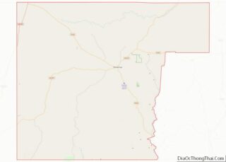
Online Interactive Map
Click on ![]() to view map in "full screen" mode.
to view map in "full screen" mode.
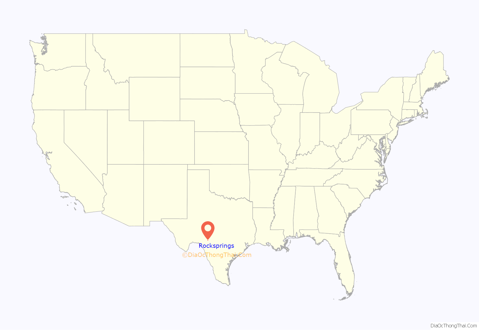
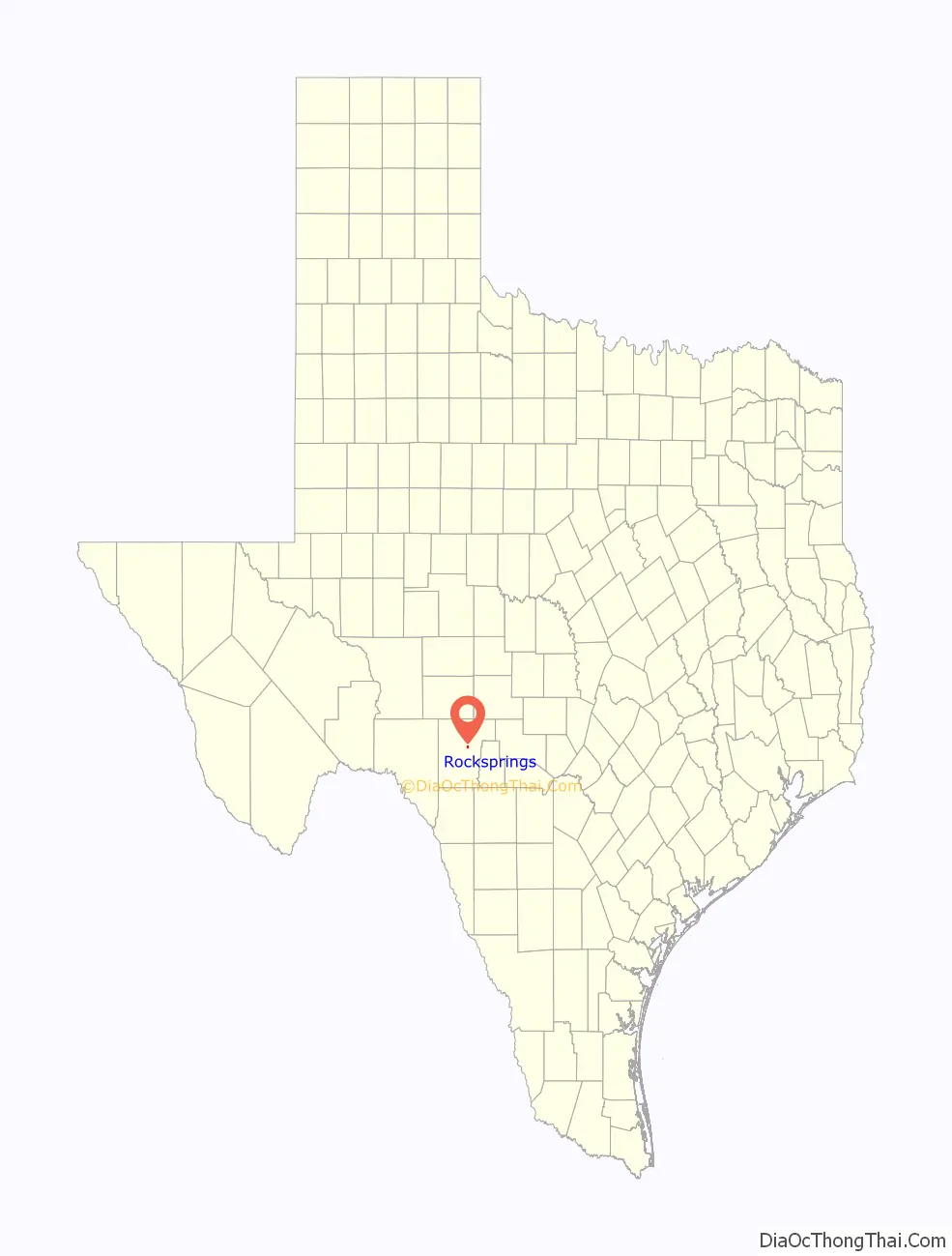
Rocksprings location map. Where is Rocksprings town?
History
J. R. Sweeten sited Rocksprings in 1891 because of the springs nearby. Also in 1891, the town acquired a post office and was made county seat. The original courthouse built in the town burned in 1897. By 1914, Rocksprings had a population around 500.
During the early 1900s, hostilities between Anglos and Mexicans along the “Brown Belt” were common. In Rocksprings, Antonio Rodriguez, a twenty-year-old Mexican, was burned at the stake by a white mob for allegedly killing a white woman, Effie Greer Henderson. This event was widely publicized and protests against the treatment of Mexicans in the U.S. erupted within the interior of Mexico, namely in Guadalajara and Mexico City. This was part of a series of racist killings known as La Matanza.
On April 12, 1927, the town was hit by an F5 tornado that destroyed 235 of the 247 buildings in the town. The tornado killed 72 townspeople and injured 205, almost a third of the population at the time.
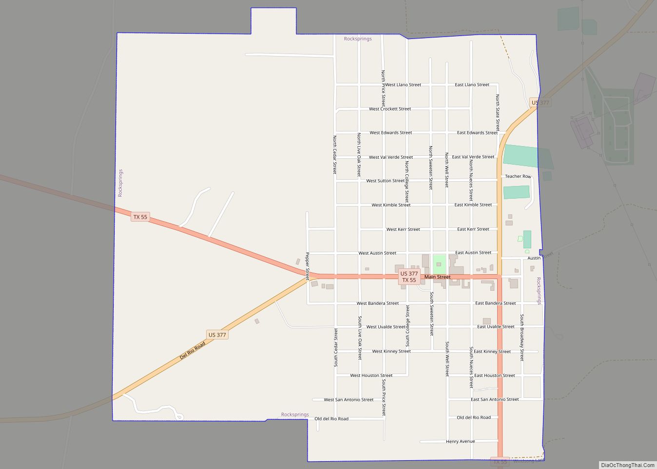
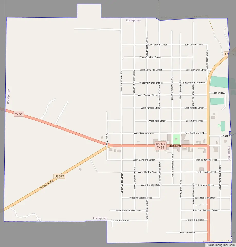
Rocksprings Road Map
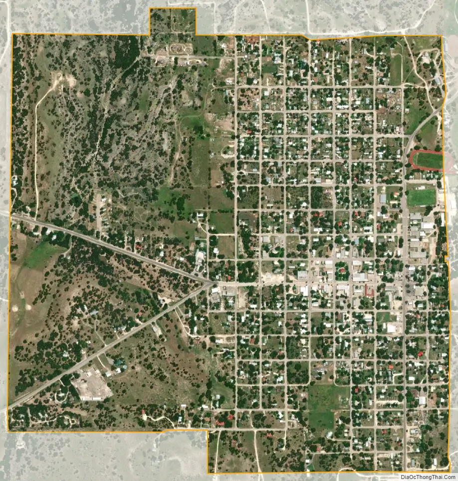
Rocksprings city Satellite Map
Geography
Rocksprings is located northeast of the center of Edwards County at 30°0′58″N 100°12′32″W / 30.01611°N 100.20889°W / 30.01611; -100.20889 (30.016161, –100.209023). Rocksprings sits on top of the Edwards Plateau. According to the United States Census Bureau, the town has a total area of 1.2 sq mi (3.1 km), all of it land.
U.S. Route 377 passes through the center of the town, leading northeast 46 miles (74 km) to Junction and southwest 76 miles (122 km) to Del Rio. Texas State Highway 55 joins US 377 as Main Street through Rocksprings, but leads northwest 55 miles (89 km) to Sonora and south 68 miles (109 km) to Uvalde.
Climate
The climate in this area is characterized by hot, humid summers and generally mild to cool winters. According to the Köppen climate classification system, Rocksprings has a humid subtropical climate, Cfa on climate maps.
See also
Map of Texas State and its subdivision:- Anderson
- Andrews
- Angelina
- Aransas
- Archer
- Armstrong
- Atascosa
- Austin
- Bailey
- Bandera
- Bastrop
- Baylor
- Bee
- Bell
- Bexar
- Blanco
- Borden
- Bosque
- Bowie
- Brazoria
- Brazos
- Brewster
- Briscoe
- Brooks
- Brown
- Burleson
- Burnet
- Caldwell
- Calhoun
- Callahan
- Cameron
- Camp
- Carson
- Cass
- Castro
- Chambers
- Cherokee
- Childress
- Clay
- Cochran
- Coke
- Coleman
- Collin
- Collingsworth
- Colorado
- Comal
- Comanche
- Concho
- Cooke
- Coryell
- Cottle
- Crane
- Crockett
- Crosby
- Culberson
- Dallam
- Dallas
- Dawson
- Deaf Smith
- Delta
- Denton
- Dewitt
- Dickens
- Dimmit
- Donley
- Duval
- Eastland
- Ector
- Edwards
- El Paso
- Ellis
- Erath
- Falls
- Fannin
- Fayette
- Fisher
- Floyd
- Foard
- Fort Bend
- Franklin
- Freestone
- Frio
- Gaines
- Galveston
- Garza
- Gillespie
- Glasscock
- Goliad
- Gonzales
- Gray
- Grayson
- Gregg
- Grimes
- Guadalupe
- Hale
- Hall
- Hamilton
- Hansford
- Hardeman
- Hardin
- Harris
- Harrison
- Hartley
- Haskell
- Hays
- Hemphill
- Henderson
- Hidalgo
- Hill
- Hockley
- Hood
- Hopkins
- Houston
- Howard
- Hudspeth
- Hunt
- Hutchinson
- Irion
- Jack
- Jackson
- Jasper
- Jeff Davis
- Jefferson
- Jim Hogg
- Jim Wells
- Johnson
- Jones
- Karnes
- Kaufman
- Kendall
- Kenedy
- Kent
- Kerr
- Kimble
- King
- Kinney
- Kleberg
- Knox
- La Salle
- Lamar
- Lamb
- Lampasas
- Lavaca
- Lee
- Leon
- Liberty
- Limestone
- Lipscomb
- Live Oak
- Llano
- Loving
- Lubbock
- Lynn
- Madison
- Marion
- Martin
- Mason
- Matagorda
- Maverick
- McCulloch
- McLennan
- McMullen
- Medina
- Menard
- Midland
- Milam
- Mills
- Mitchell
- Montague
- Montgomery
- Moore
- Morris
- Motley
- Nacogdoches
- Navarro
- Newton
- Nolan
- Nueces
- Ochiltree
- Oldham
- Orange
- Palo Pinto
- Panola
- Parker
- Parmer
- Pecos
- Polk
- Potter
- Presidio
- Rains
- Randall
- Reagan
- Real
- Red River
- Reeves
- Refugio
- Roberts
- Robertson
- Rockwall
- Runnels
- Rusk
- Sabine
- San Augustine
- San Jacinto
- San Patricio
- San Saba
- Schleicher
- Scurry
- Shackelford
- Shelby
- Sherman
- Smith
- Somervell
- Starr
- Stephens
- Sterling
- Stonewall
- Sutton
- Swisher
- Tarrant
- Taylor
- Terrell
- Terry
- Throckmorton
- Titus
- Tom Green
- Travis
- Trinity
- Tyler
- Upshur
- Upton
- Uvalde
- Val Verde
- Van Zandt
- Victoria
- Walker
- Waller
- Ward
- Washington
- Webb
- Wharton
- Wheeler
- Wichita
- Wilbarger
- Willacy
- Williamson
- Wilson
- Winkler
- Wise
- Wood
- Yoakum
- Young
- Zapata
- Zavala
- Alabama
- Alaska
- Arizona
- Arkansas
- California
- Colorado
- Connecticut
- Delaware
- District of Columbia
- Florida
- Georgia
- Hawaii
- Idaho
- Illinois
- Indiana
- Iowa
- Kansas
- Kentucky
- Louisiana
- Maine
- Maryland
- Massachusetts
- Michigan
- Minnesota
- Mississippi
- Missouri
- Montana
- Nebraska
- Nevada
- New Hampshire
- New Jersey
- New Mexico
- New York
- North Carolina
- North Dakota
- Ohio
- Oklahoma
- Oregon
- Pennsylvania
- Rhode Island
- South Carolina
- South Dakota
- Tennessee
- Texas
- Utah
- Vermont
- Virginia
- Washington
- West Virginia
- Wisconsin
- Wyoming