McKinney is a city in and the county seat of Collin County, Texas, United States. It is Collin County’s third-largest city, after Plano and Frisco. A suburb of the Dallas–Fort Worth metroplex, McKinney is about 32 miles (51 km) north of Dallas.
The U.S. Census Bureau listed McKinney as the nation’s fastest-growing city from 2000 to 2003 and again in 2006, among cities with more than 50,000 people. In 2007, it was ranked second-fastest growing among cities with more than 100,000 people and in 2008 as third-fastest. In the 2010 census, the city’s population was 131,117, making it Texas’s 19th-most populous city. The population estimate produced by the city as of 2019 was 199,177, which made it Texas’s 16th-most populous city. In 2020, its population was 195,308. As of May 2017, McKinney was the third-fastest growing city in the United States.
The Census Bureau defines an urban area of northern Dallas-area suburbs that are separated from the Dallas–Fort Worth urban area, with McKinney and Frisco as the principal cities; the McKinney–Frisco urban area had a population of 504,803 as of the 2020 census, ranked 83rd in the United States.
| Name: | McKinney city |
|---|---|
| LSAD Code: | 25 |
| LSAD Description: | city (suffix) |
| State: | Texas |
| County: | Collin County |
| Incorporated: | 1848 |
| Elevation: | 630 ft (192 m) |
| Land Area: | 66.96 sq mi (173.43 km²) |
| Water Area: | 0.74 sq mi (1.91 km²) |
| Population Density: | 2,974.43/sq mi (1,148.44/km²) |
| ZIP code: | 75069-75072 |
| Area code: | 214, 469, 945, 972 |
| FIPS code: | 4845744 |
| GNISfeature ID: | 1341241 |
| Website: | www.mckinneytexas.org |
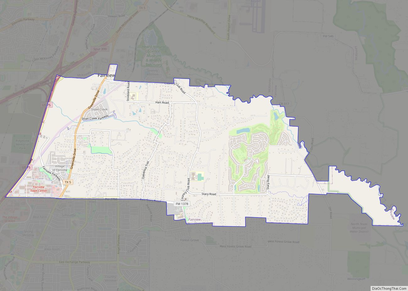
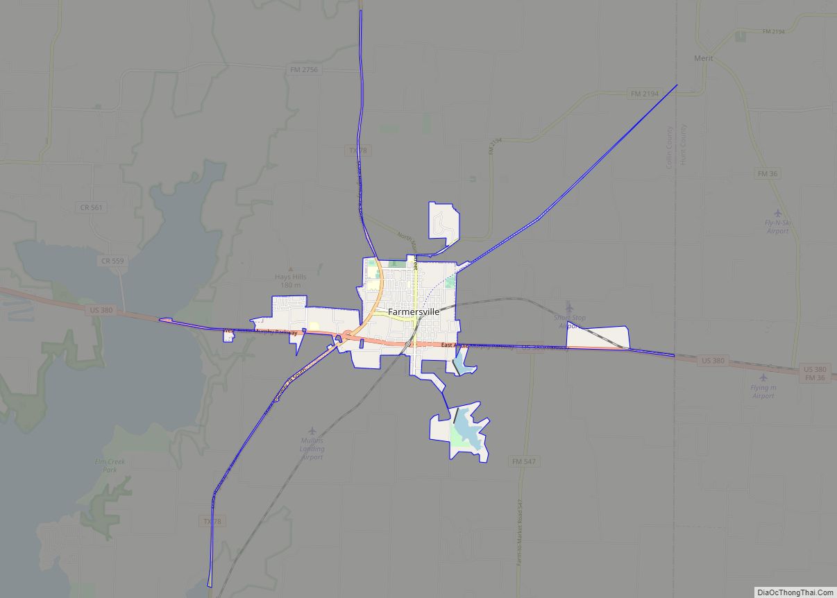
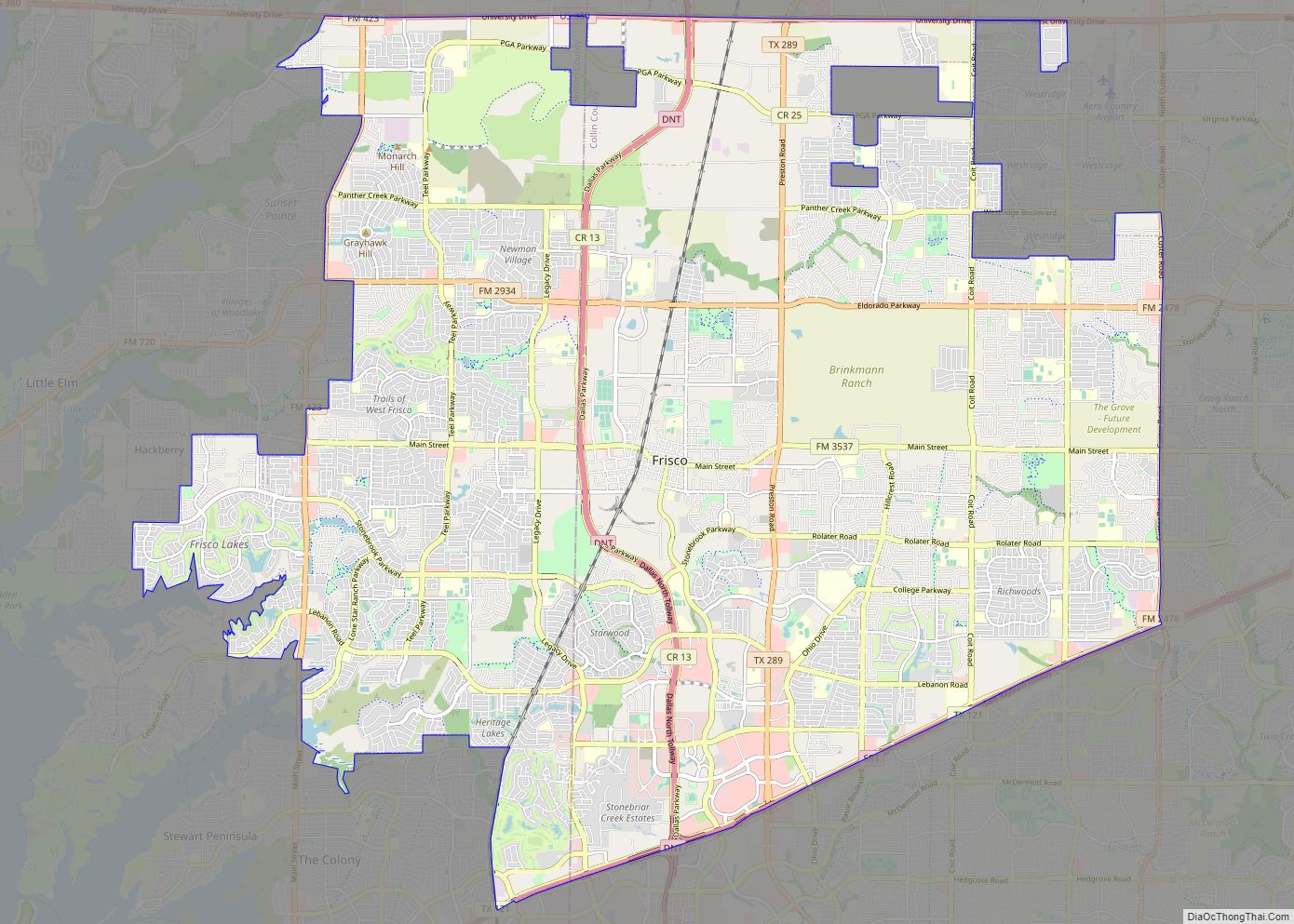
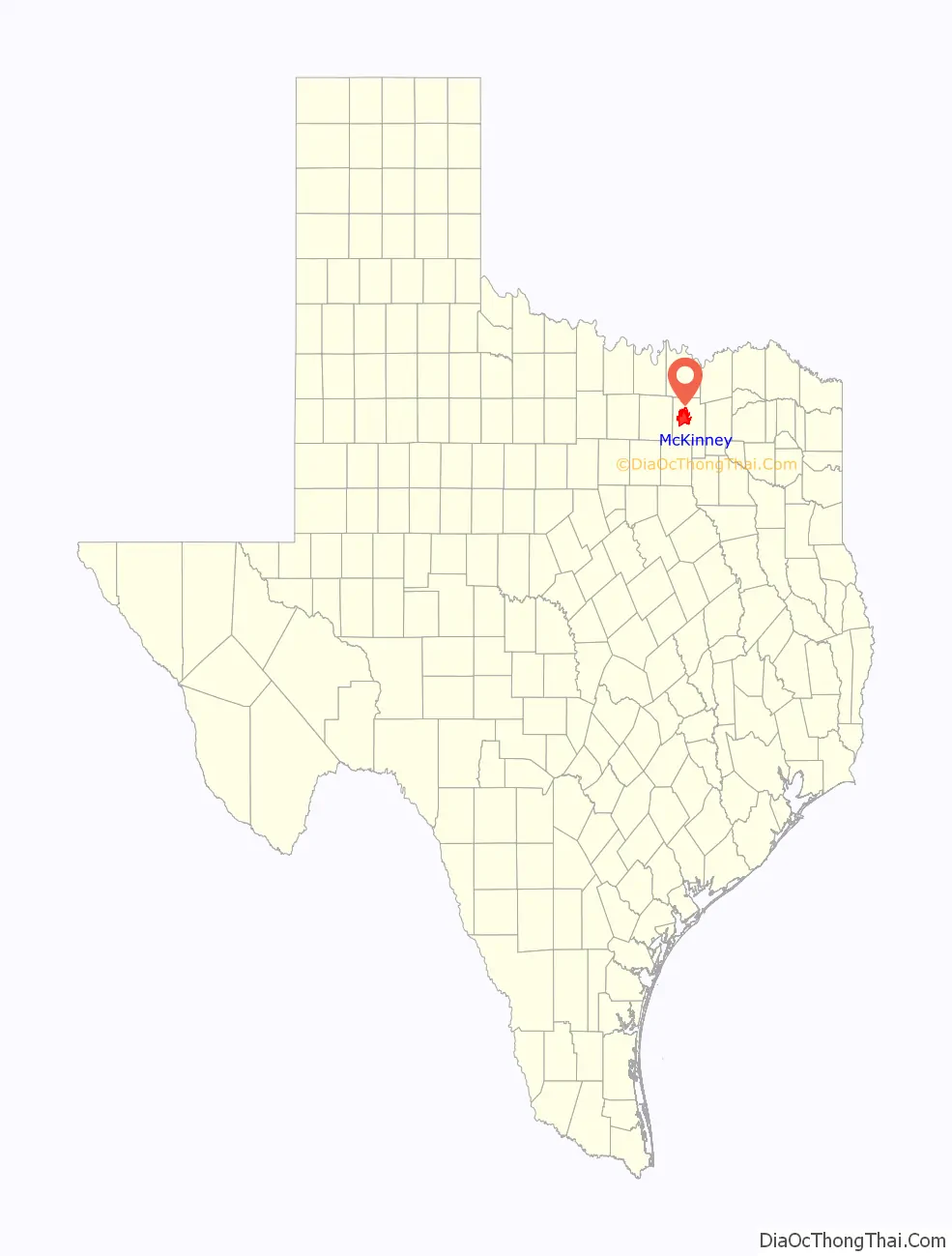
Online Interactive Map
Click on ![]() to view map in "full screen" mode.
to view map in "full screen" mode.
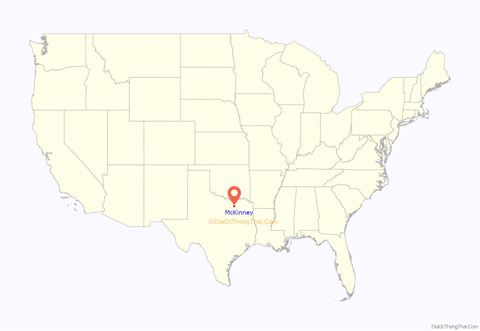
McKinney location map. Where is McKinney city?
History
On March 24, 1849, William Davis, who owned 3,000 acres (12 km) where McKinney now stands, donated 120 acres (0.49 km) for the townsite. Ten years later, McKinney incorporated, and in 1913, the town adopted the commission form of government.
For its first 125 years, McKinney served as the county’s principal commercial center. The county seat provided farmers with flour, corn, cotton mills, cotton gins, a cotton compress, and a cottonseed oil mill, as well as banks, churches, schools, newspapers, and from the 1880s, an opera house. Businesses also came to include a textile mill, an ice company, a large dairy, and a garment-manufacturing company. The population grew from 35 in 1848 to 4,714 in 1912. By 1953, McKinney had a population of more than 10,000 and 355 businesses. The town continued to serve as an agribusiness center for the county until the late 1960s.
By 1970, Plano surpassed McKinney in size. McKinney experienced moderate population growth, from 15,193 in the 1970 census to 21,283 in the 1990 census. By the mid-1980s, the town had become a commuter center for residents who worked in Plano and Dallas. In 1985, it had a population of just over 16,000 and supported 254 businesses. Since then, McKinney’s rate of increase has been much more dramatic. In the 2000 census, McKinney had grown to 54,369 with 2,005 businesses and in the 2010 census the population had more than doubled to 131,117 residents. The Census Bureau’s most recent estimated population for McKinney (July 1, 2015) is 162,898. The most recent population estimate, produced by the city as of January 1, 2019, is 187,802.
Both the city and the county were named for Collin McKinney, signer of the Texas Declaration of Independence, and a congressman for the Red River district of the Republic of Texas. He was the author of a bill establishing counties in the northern part of the state.
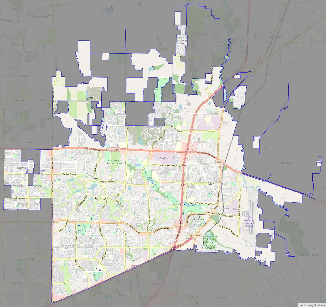
McKinney Road Map
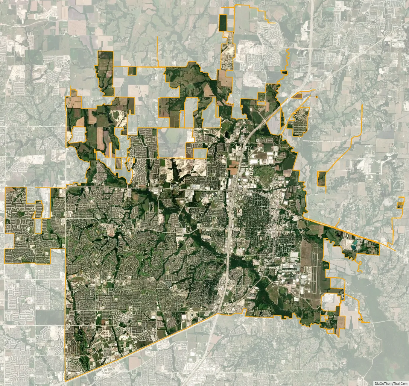
McKinney city Satellite Map
Geography
According to the United States Census Bureau, the city has an area of 62.9 square miles (162.9 km), of which 0.7 square mile (1.7 km), or 1.07%, is covered by water.
Climate
McKinney is considered part of the humid subtropical region.
- On average, the warmest month is July.
- The highest recorded temperature was 118 °F (48 °C) in 1936.
- On average, the coolest month is January.
- The lowest recorded temperature was −7 °F (−22 °C) in 1930.
- The maximum average precipitation occurs in May.
It is also part of the Texas blackland prairies, which means it gets hot summers because it is in the Sun Belt. Humidity makes temperatures feel higher, and winters are mild and are usually rainy; snowstorms occasionally occur. Spring is the wettest part of the year, which brings winds from the Gulf Coast.
See also
Map of Texas State and its subdivision:- Anderson
- Andrews
- Angelina
- Aransas
- Archer
- Armstrong
- Atascosa
- Austin
- Bailey
- Bandera
- Bastrop
- Baylor
- Bee
- Bell
- Bexar
- Blanco
- Borden
- Bosque
- Bowie
- Brazoria
- Brazos
- Brewster
- Briscoe
- Brooks
- Brown
- Burleson
- Burnet
- Caldwell
- Calhoun
- Callahan
- Cameron
- Camp
- Carson
- Cass
- Castro
- Chambers
- Cherokee
- Childress
- Clay
- Cochran
- Coke
- Coleman
- Collin
- Collingsworth
- Colorado
- Comal
- Comanche
- Concho
- Cooke
- Coryell
- Cottle
- Crane
- Crockett
- Crosby
- Culberson
- Dallam
- Dallas
- Dawson
- Deaf Smith
- Delta
- Denton
- Dewitt
- Dickens
- Dimmit
- Donley
- Duval
- Eastland
- Ector
- Edwards
- El Paso
- Ellis
- Erath
- Falls
- Fannin
- Fayette
- Fisher
- Floyd
- Foard
- Fort Bend
- Franklin
- Freestone
- Frio
- Gaines
- Galveston
- Garza
- Gillespie
- Glasscock
- Goliad
- Gonzales
- Gray
- Grayson
- Gregg
- Grimes
- Guadalupe
- Hale
- Hall
- Hamilton
- Hansford
- Hardeman
- Hardin
- Harris
- Harrison
- Hartley
- Haskell
- Hays
- Hemphill
- Henderson
- Hidalgo
- Hill
- Hockley
- Hood
- Hopkins
- Houston
- Howard
- Hudspeth
- Hunt
- Hutchinson
- Irion
- Jack
- Jackson
- Jasper
- Jeff Davis
- Jefferson
- Jim Hogg
- Jim Wells
- Johnson
- Jones
- Karnes
- Kaufman
- Kendall
- Kenedy
- Kent
- Kerr
- Kimble
- King
- Kinney
- Kleberg
- Knox
- La Salle
- Lamar
- Lamb
- Lampasas
- Lavaca
- Lee
- Leon
- Liberty
- Limestone
- Lipscomb
- Live Oak
- Llano
- Loving
- Lubbock
- Lynn
- Madison
- Marion
- Martin
- Mason
- Matagorda
- Maverick
- McCulloch
- McLennan
- McMullen
- Medina
- Menard
- Midland
- Milam
- Mills
- Mitchell
- Montague
- Montgomery
- Moore
- Morris
- Motley
- Nacogdoches
- Navarro
- Newton
- Nolan
- Nueces
- Ochiltree
- Oldham
- Orange
- Palo Pinto
- Panola
- Parker
- Parmer
- Pecos
- Polk
- Potter
- Presidio
- Rains
- Randall
- Reagan
- Real
- Red River
- Reeves
- Refugio
- Roberts
- Robertson
- Rockwall
- Runnels
- Rusk
- Sabine
- San Augustine
- San Jacinto
- San Patricio
- San Saba
- Schleicher
- Scurry
- Shackelford
- Shelby
- Sherman
- Smith
- Somervell
- Starr
- Stephens
- Sterling
- Stonewall
- Sutton
- Swisher
- Tarrant
- Taylor
- Terrell
- Terry
- Throckmorton
- Titus
- Tom Green
- Travis
- Trinity
- Tyler
- Upshur
- Upton
- Uvalde
- Val Verde
- Van Zandt
- Victoria
- Walker
- Waller
- Ward
- Washington
- Webb
- Wharton
- Wheeler
- Wichita
- Wilbarger
- Willacy
- Williamson
- Wilson
- Winkler
- Wise
- Wood
- Yoakum
- Young
- Zapata
- Zavala
- Alabama
- Alaska
- Arizona
- Arkansas
- California
- Colorado
- Connecticut
- Delaware
- District of Columbia
- Florida
- Georgia
- Hawaii
- Idaho
- Illinois
- Indiana
- Iowa
- Kansas
- Kentucky
- Louisiana
- Maine
- Maryland
- Massachusetts
- Michigan
- Minnesota
- Mississippi
- Missouri
- Montana
- Nebraska
- Nevada
- New Hampshire
- New Jersey
- New Mexico
- New York
- North Carolina
- North Dakota
- Ohio
- Oklahoma
- Oregon
- Pennsylvania
- Rhode Island
- South Carolina
- South Dakota
- Tennessee
- Texas
- Utah
- Vermont
- Virginia
- Washington
- West Virginia
- Wisconsin
- Wyoming