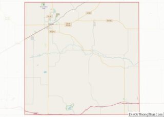
McLean is a town in Gray County, Texas, United States. It is part of the Pampa micropolitan statistical area. Its population was 778 as of the 2010 census.
| Name: | McLean town |
|---|---|
| LSAD Code: | 43 |
| LSAD Description: | town (suffix) |
| State: | Texas |
| County: | Gray County |
| Elevation: | 2,861 ft (872 m) |
| Total Area: | 1.16 sq mi (3.00 km²) |
| Land Area: | 1.16 sq mi (3.00 km²) |
| Water Area: | 0.00 sq mi (0.00 km²) |
| Total Population: | 778 |
| Population Density: | 642.49/sq mi (248.02/km²) |
| ZIP code: | 79057 |
| Area code: | 806 |
| FIPS code: | 4845780 |
| GNISfeature ID: | 1362506 |
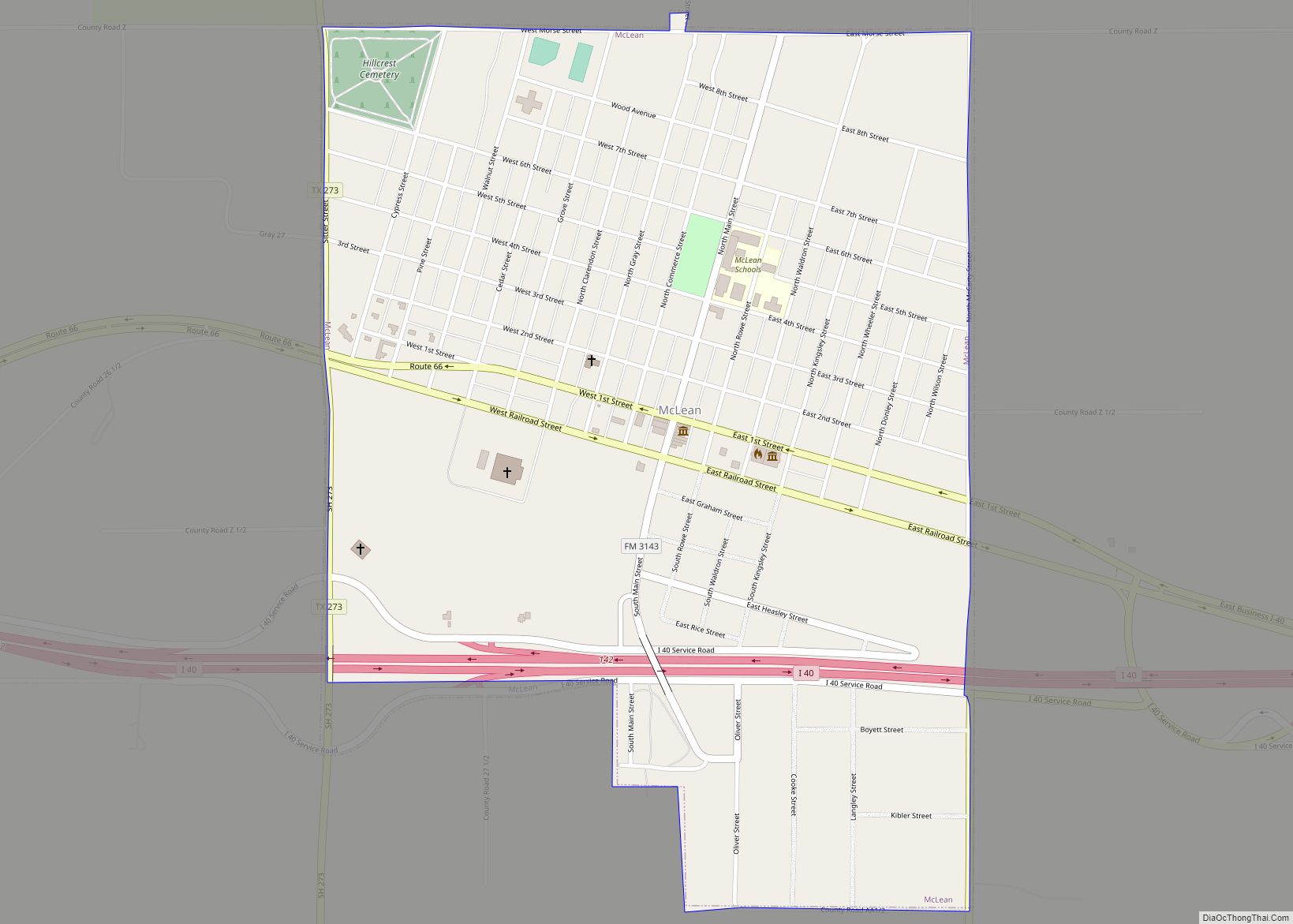
Online Interactive Map
Click on ![]() to view map in "full screen" mode.
to view map in "full screen" mode.
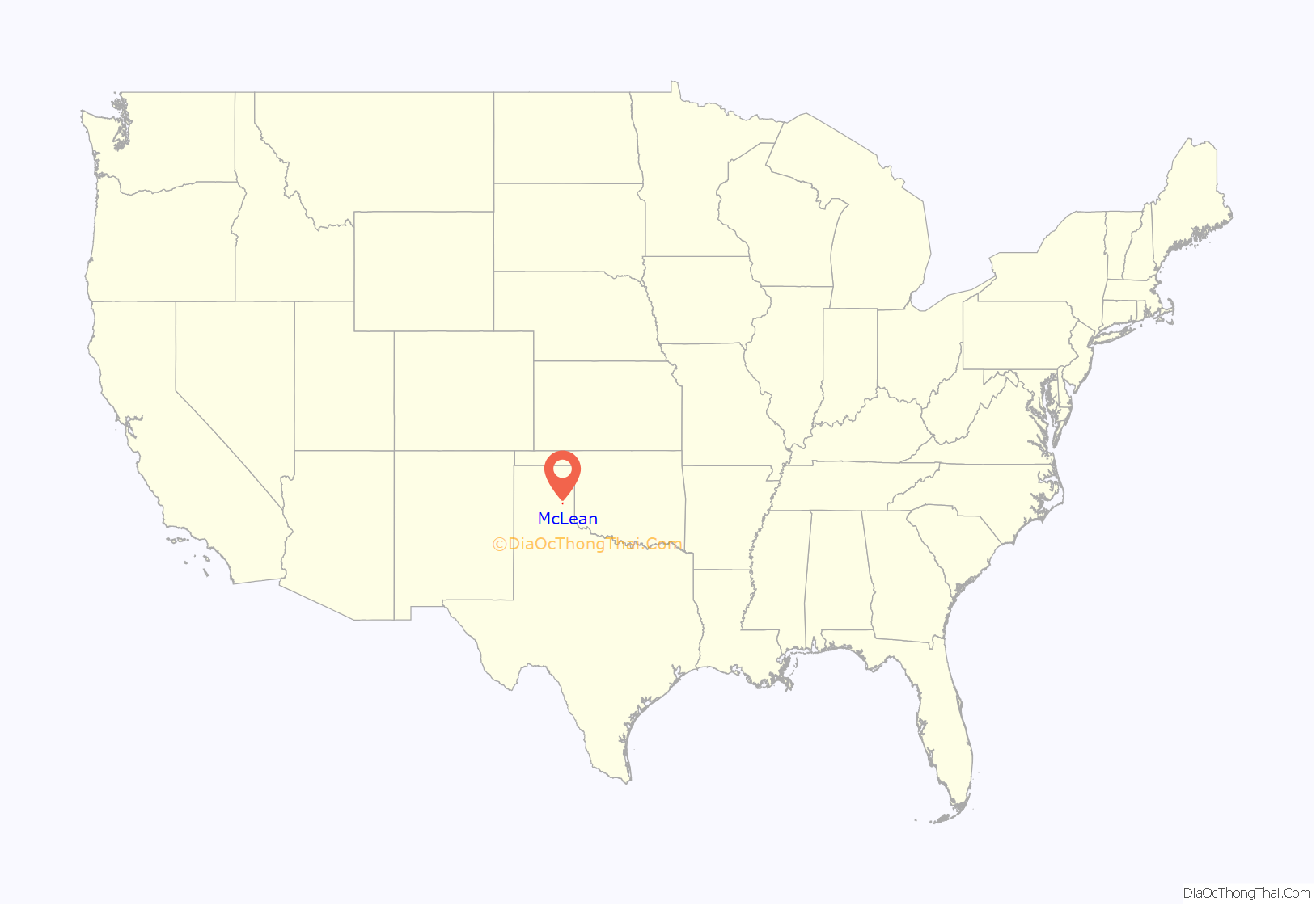
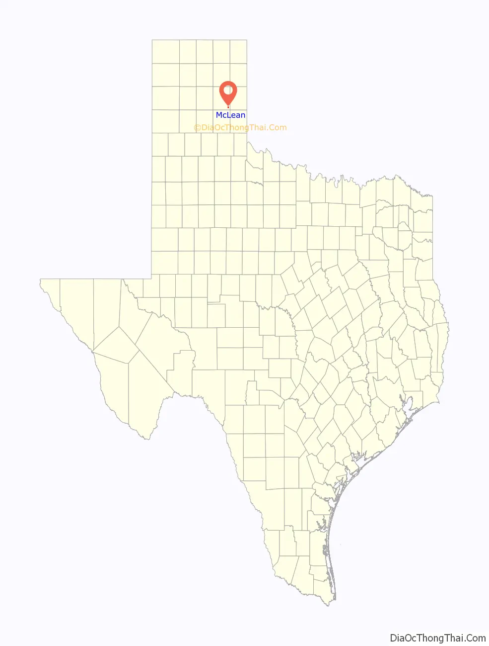
McLean location map. Where is McLean town?
History
In 1901, Alfred Rowe, an English rancher who later perished in the sinking of the Titanic, donated land near a railroad cattle-loading stop for the establishment of a town site. The Choctaw, Oklahoma and Texas Railroad Company constructed a water well and a switch and section house there. The town was named for Judge William P. McLean (1836–1925) of the Texas Legislature and Railroad Commission. The town grew rapidly. By 1904, McLean had three general stores, a bank, two wagon yards and livery stables, a lumber yard, and a newspaper, the McLean News. A windmill pumped water from a well drilled in the middle of Main Street, and citizens hauled the water in barrels and buckets. The town was incorporated in 1909, with C. S. Rice as mayor, and became a center for agriculture.
In 1927, the Mother Road, U.S. Route 66, was built through the town, and it became a stop for tourists and a center for oil, livestock, and agriculture processing and shipping. By 1940, the population had risen to 1,500 with six churches, 59 businesses, and a newspaper. In 1942, a prisoner-of-war camp was built east-northeast of the town, and was operated until 1945, housing about 3,000 German prisoners.
As the prominence of other Texas Panhandle cities, especially Amarillo and Pampa, surpassed McLean, the town began to decrease slowly in size. In 1984, the town was bypassed as part of the final phase of construction of Interstate 40, which replaced the old U.S. Route 66 through that area.
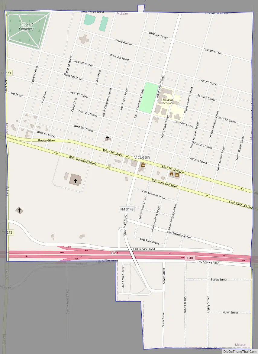
McLean Road Map
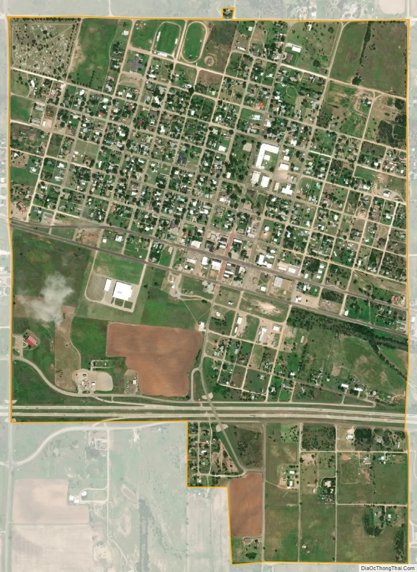
McLean city Satellite Map
Geography
McLean is located in southeastern Gray County at 35°14′2″N 100°36′0″W / 35.23389°N 100.60000°W / 35.23389; -100.60000 (35.233836, –100.600055). Interstate 40 passes through the southern part of the town, leading east 185 miles (298 km) to Oklahoma City and west 74 miles (119 km) to Amarillo. Interstate 40 Business (Old U.S. 66) passes through the town as First Street (westbound) and Railroad Street (eastbound), connecting to I-40 at Exit 141 west of town and Exit 143 to the east. Texas State Highway 273 runs along the western edge of McLean, accessing I-40 at Exit 142 and running north then northwest 35 miles (56 km) to Pampa, the Gray County seat.
According to the United States Census Bureau, McLean has a total area of 1.2 sq mi (3.0 km), all of it land.
See also
Map of Texas State and its subdivision:- Anderson
- Andrews
- Angelina
- Aransas
- Archer
- Armstrong
- Atascosa
- Austin
- Bailey
- Bandera
- Bastrop
- Baylor
- Bee
- Bell
- Bexar
- Blanco
- Borden
- Bosque
- Bowie
- Brazoria
- Brazos
- Brewster
- Briscoe
- Brooks
- Brown
- Burleson
- Burnet
- Caldwell
- Calhoun
- Callahan
- Cameron
- Camp
- Carson
- Cass
- Castro
- Chambers
- Cherokee
- Childress
- Clay
- Cochran
- Coke
- Coleman
- Collin
- Collingsworth
- Colorado
- Comal
- Comanche
- Concho
- Cooke
- Coryell
- Cottle
- Crane
- Crockett
- Crosby
- Culberson
- Dallam
- Dallas
- Dawson
- Deaf Smith
- Delta
- Denton
- Dewitt
- Dickens
- Dimmit
- Donley
- Duval
- Eastland
- Ector
- Edwards
- El Paso
- Ellis
- Erath
- Falls
- Fannin
- Fayette
- Fisher
- Floyd
- Foard
- Fort Bend
- Franklin
- Freestone
- Frio
- Gaines
- Galveston
- Garza
- Gillespie
- Glasscock
- Goliad
- Gonzales
- Gray
- Grayson
- Gregg
- Grimes
- Guadalupe
- Hale
- Hall
- Hamilton
- Hansford
- Hardeman
- Hardin
- Harris
- Harrison
- Hartley
- Haskell
- Hays
- Hemphill
- Henderson
- Hidalgo
- Hill
- Hockley
- Hood
- Hopkins
- Houston
- Howard
- Hudspeth
- Hunt
- Hutchinson
- Irion
- Jack
- Jackson
- Jasper
- Jeff Davis
- Jefferson
- Jim Hogg
- Jim Wells
- Johnson
- Jones
- Karnes
- Kaufman
- Kendall
- Kenedy
- Kent
- Kerr
- Kimble
- King
- Kinney
- Kleberg
- Knox
- La Salle
- Lamar
- Lamb
- Lampasas
- Lavaca
- Lee
- Leon
- Liberty
- Limestone
- Lipscomb
- Live Oak
- Llano
- Loving
- Lubbock
- Lynn
- Madison
- Marion
- Martin
- Mason
- Matagorda
- Maverick
- McCulloch
- McLennan
- McMullen
- Medina
- Menard
- Midland
- Milam
- Mills
- Mitchell
- Montague
- Montgomery
- Moore
- Morris
- Motley
- Nacogdoches
- Navarro
- Newton
- Nolan
- Nueces
- Ochiltree
- Oldham
- Orange
- Palo Pinto
- Panola
- Parker
- Parmer
- Pecos
- Polk
- Potter
- Presidio
- Rains
- Randall
- Reagan
- Real
- Red River
- Reeves
- Refugio
- Roberts
- Robertson
- Rockwall
- Runnels
- Rusk
- Sabine
- San Augustine
- San Jacinto
- San Patricio
- San Saba
- Schleicher
- Scurry
- Shackelford
- Shelby
- Sherman
- Smith
- Somervell
- Starr
- Stephens
- Sterling
- Stonewall
- Sutton
- Swisher
- Tarrant
- Taylor
- Terrell
- Terry
- Throckmorton
- Titus
- Tom Green
- Travis
- Trinity
- Tyler
- Upshur
- Upton
- Uvalde
- Val Verde
- Van Zandt
- Victoria
- Walker
- Waller
- Ward
- Washington
- Webb
- Wharton
- Wheeler
- Wichita
- Wilbarger
- Willacy
- Williamson
- Wilson
- Winkler
- Wise
- Wood
- Yoakum
- Young
- Zapata
- Zavala
- Alabama
- Alaska
- Arizona
- Arkansas
- California
- Colorado
- Connecticut
- Delaware
- District of Columbia
- Florida
- Georgia
- Hawaii
- Idaho
- Illinois
- Indiana
- Iowa
- Kansas
- Kentucky
- Louisiana
- Maine
- Maryland
- Massachusetts
- Michigan
- Minnesota
- Mississippi
- Missouri
- Montana
- Nebraska
- Nevada
- New Hampshire
- New Jersey
- New Mexico
- New York
- North Carolina
- North Dakota
- Ohio
- Oklahoma
- Oregon
- Pennsylvania
- Rhode Island
- South Carolina
- South Dakota
- Tennessee
- Texas
- Utah
- Vermont
- Virginia
- Washington
- West Virginia
- Wisconsin
- Wyoming