Mexia (/məˈheɪə/ (listen) mə-HAY-ə) is a city in Limestone County, Texas, United States. The population was 6,893 at the 2020 census.
The city’s motto, based on the fact that outsiders tend to mispronounce the name /ˈmɛksiə/ Me-hey-ə, is “A great place to live, no matter how you pronounce it.”
Named after General José Antonio Mexía, a Mexican hero for the Republic of Texas Army during the Texas Revolution, the town was founded near his estate. Nearby attractions include Fort Parker Historical recreation, the Confederate Reunion grounds, and Mexia State Supported Living Center (formerly Mexia State School), which began as a prisoner of war camp for members of Field Marshal Erwin Rommel’s Afrika Korps during World War II.
Mexia is also home to the Mexia Public Schools Museum, one of a few museums dedicated to the historical and social significance of a Texas public school system.
Late model Anna Nicole Smith attended Mexia Public Schools.
Mexia hosts a large Juneteenth celebration every year.
| Name: | Mexia city |
|---|---|
| LSAD Code: | 25 |
| LSAD Description: | city (suffix) |
| State: | Texas |
| County: | Limestone County |
| Elevation: | 522 ft (159 m) |
| Total Area: | 7.30 sq mi (18.90 km²) |
| Land Area: | 7.20 sq mi (18.64 km²) |
| Water Area: | 0.10 sq mi (0.25 km²) |
| Total Population: | 6,893 |
| Population Density: | 1,020.28/sq mi (393.95/km²) |
| ZIP code: | 76667 |
| Area code: | 254 |
| FIPS code: | 4847916 |
| GNISfeature ID: | 1362673 |
| Website: | cityofmexia.com |
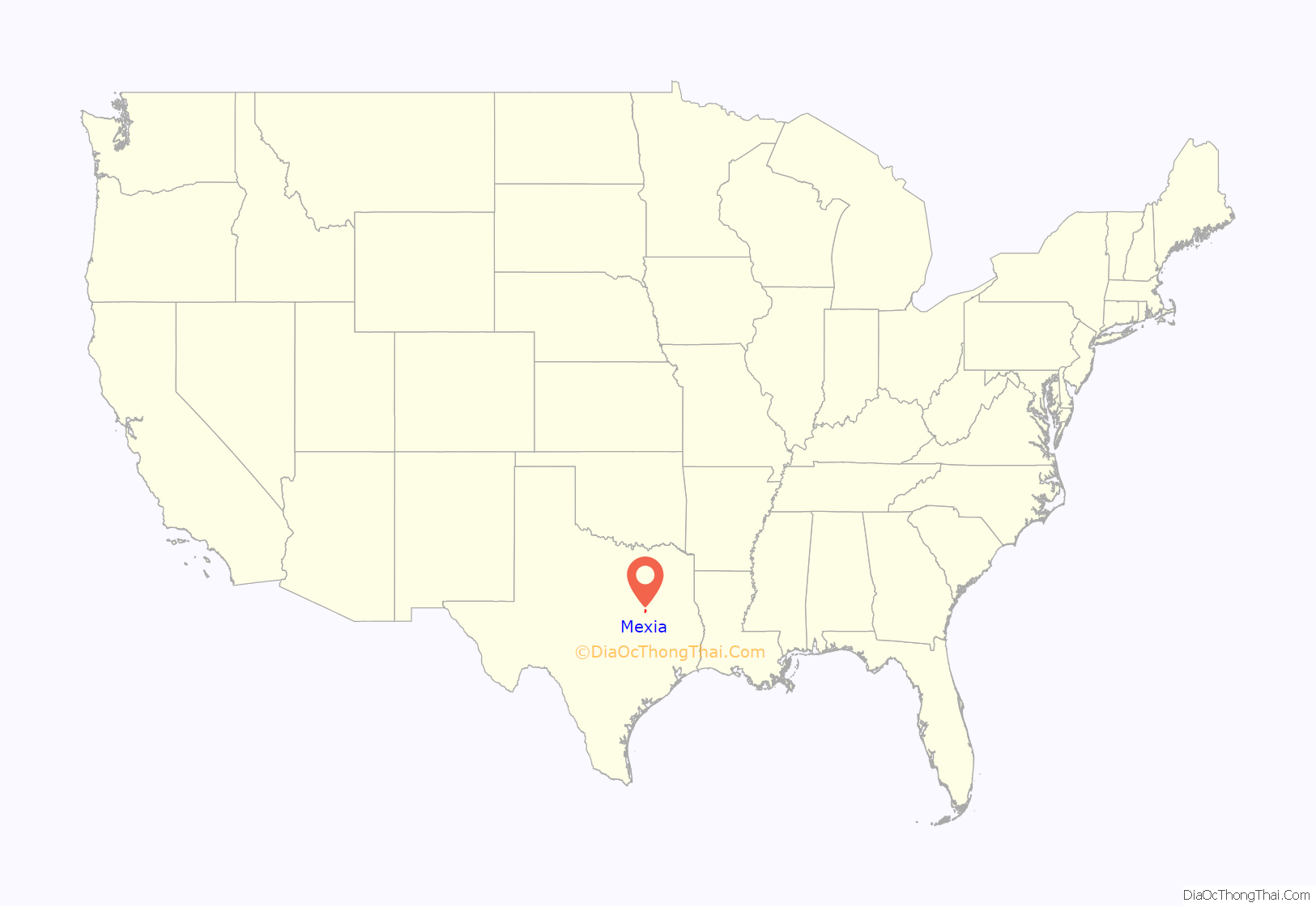
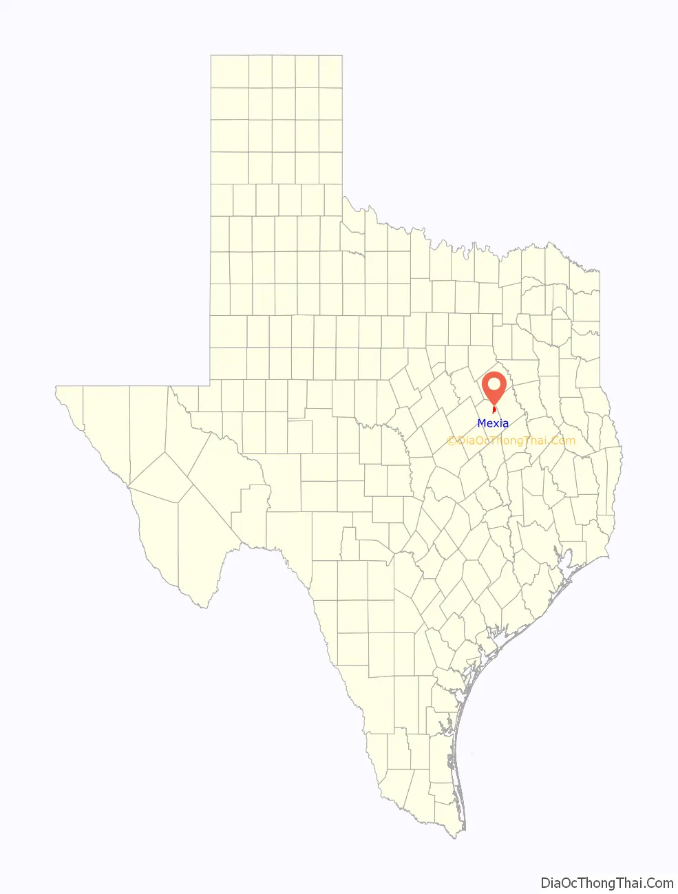
Online Interactive Map
Click on ![]() to view map in "full screen" mode.
to view map in "full screen" mode.
Mexia location map. Where is Mexia city?
History
Mexia was founded as a town in the 19th century. Inhabitants occupied the Fort Parker settlement near the Navasota river. The area is near where the rolling hills of the great plains begin. The hills provided grazing land for the buffalo herds, which plains Indians depended upon for sustenance. Many hunting artifacts from Native American people have been found in the creek beds and draws around Mexia. The Comanche tribe came into conflict with the white settlers in this area. The abduction of Cynthia Ann Parker took place at Fort Parker. Comanches raided the fort and took the nine-year-old Parker girl. She lived among the Comanche people into adulthood and was the mother of Quanah Parker, the last Comanche war chief.
Mexia is at the intersection of US Highway 84 and State highways 14 and 171, twelve miles northeast of Groesbeck in northeastern Limestone County. It was named for the Mexía family, who in 1833 received an eleven-league land grant that included what is now the townsite. The town was laid out in 1870 by a trustee of the Houston and Texas Central Townsite Company, which offered lots for sale in 1871, as the Houston and Texas Central Railway was completed between Hearne and Groesbeck. The Mexia post office began operation in 1872, and the community was incorporated with a mayoral form of government in 1873 by an act of the legislature. J.C. Yarbro was the first mayor. The city’s first newspaper, the Ledger, was established in Fairfield in 1869 and moved to Mexia in 1872. By 1880 Mexia also had four schools, three churches, and a variety of businesses to serve its 1,800 residents; by 1885 the town had a gas works, an opera house, two banks, two sawmills, and 2,000 residents. The Mexia Democrat was established in 1887 and the Weekly News in 1898. Between 1904 and 1906 the Trinity and Brazos Valley Railway built track between Hillsboro and Houston, making Mexia a commercial crossroads for area farmers.
In 1912 the Mexia Gas and Oil Company drilled ten dry holes, but in the eleventh attempt discovered a large natural gas deposit. The Mexia oilfield was discovered in 1920, by Colonel Albert E. Humphreys and his geologist F. Julius Fohs. Oil production peaked in November 1921 at 53,000 BOPD. The population of Mexia increased from 3,482 to nearly 35,000. The rapid growth was excessive for local authorities, and for a short time in 1922 Mexia was under martial law. That year, production for the Mexia field was 35 million barrels produced. Cumulative production of the field totaled 108 million barrels by the mid-1980s. In 1924 Mexia residents passed a new city charter that changed the local government to a city manager system. After the initial oil boom, the population of Mexia declined to 10,000 by the mid-1920s. The prosperity generated by the boom continued until the 1930s, when the Great Depression forced many people to leave in search of work. The number of residents stabilized at 6,500 in the early 1930s, but the number of businesses fell from 280 to 190. In 1942 a camp for prisoners of war was established at Mexia; the facility was converted in 1947 for use as the Mexia State School, which became one of the community’s principal employers. The population was reported as 6,618 in the early 1950s, 5,943 in the early 1970s, 7,172 in the late 1980s, and 6,933 in 1990. In 2000 the population was listed as 6,563.
Mexia made national news in 1981, when three young black men drowned in Lake Mexia after being taken into custody by law enforcement officers for possession of marijuana during the annual Juneteenth celebration. Carl Baker, 19; Anthony Freeman, 18; and Steven Booker, 19; drowned after a boat used to transport them across the lake, which was also occupied by three officers, capsized less than 100 feet from shore. Two police officers and one probation officer who had been in the boat were tried for the offense of criminally negligent homicide, but all were acquitted by a jury in Dallas.
Mexia also made news when its former resident Anna Nicole Smith died, and when Allen Stanford was arrested on allegations of fraud in 2009.
The city of Mexia, the confusion over its correct pronunciation and the city motto are all the subject of an Act 1 Aria in Mark-Anthony Turnage’s Opera Anna Nicole staged by the Royal Opera House, Covent Garden, London. Various imagined residents such as the Town Mayor and head of the Chamber of Commerce also feature alongside of the Operas namesake.
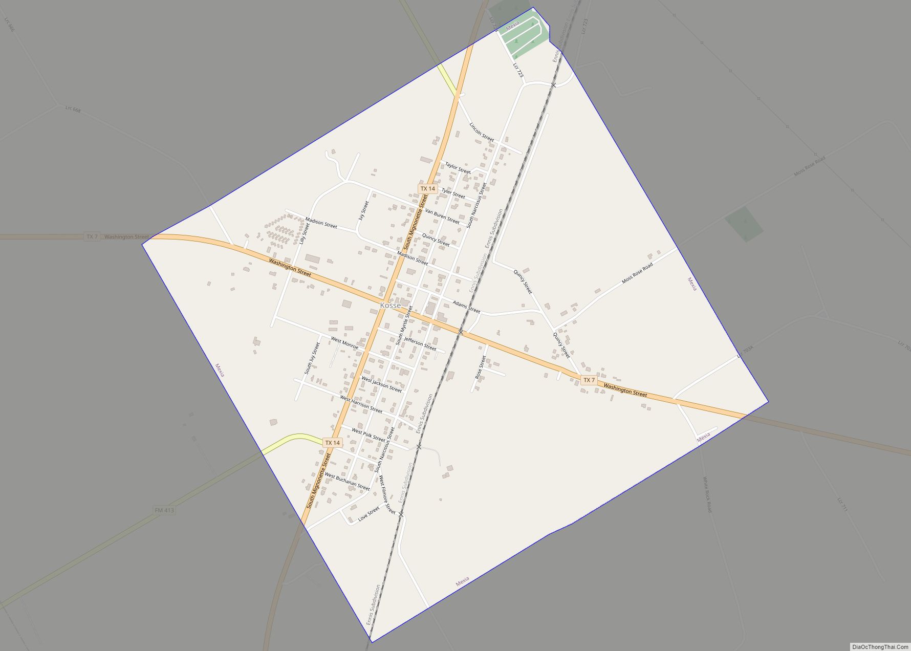
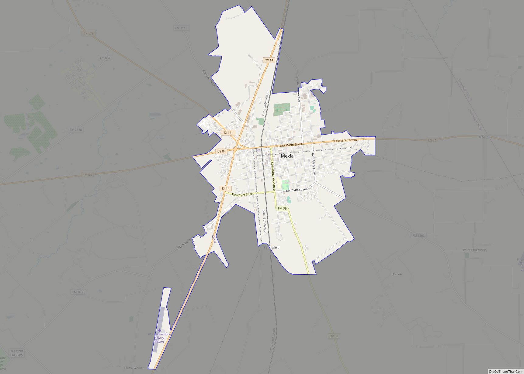
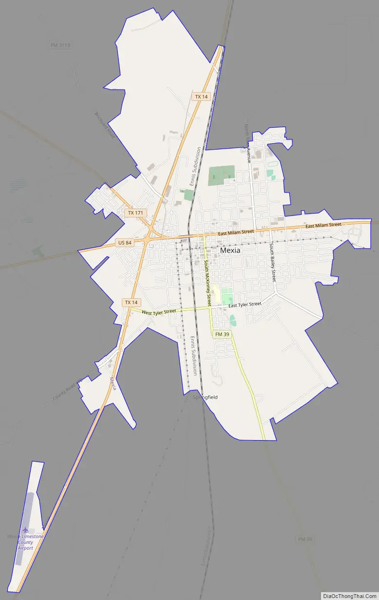
Mexia Road Map
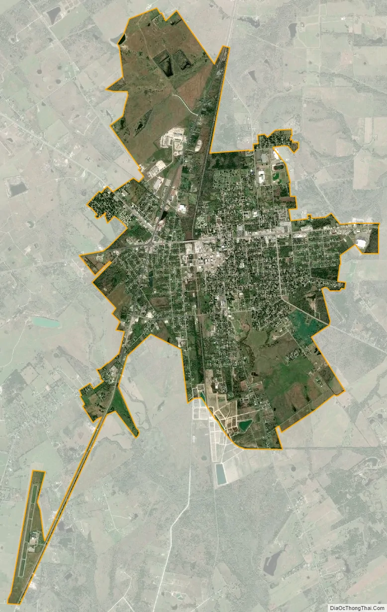
Mexia city Satellite Map
Geography
According to the United States Census Bureau, the city has a total area of 5.2 square miles (13 km), all land.
See also
Map of Texas State and its subdivision:- Anderson
- Andrews
- Angelina
- Aransas
- Archer
- Armstrong
- Atascosa
- Austin
- Bailey
- Bandera
- Bastrop
- Baylor
- Bee
- Bell
- Bexar
- Blanco
- Borden
- Bosque
- Bowie
- Brazoria
- Brazos
- Brewster
- Briscoe
- Brooks
- Brown
- Burleson
- Burnet
- Caldwell
- Calhoun
- Callahan
- Cameron
- Camp
- Carson
- Cass
- Castro
- Chambers
- Cherokee
- Childress
- Clay
- Cochran
- Coke
- Coleman
- Collin
- Collingsworth
- Colorado
- Comal
- Comanche
- Concho
- Cooke
- Coryell
- Cottle
- Crane
- Crockett
- Crosby
- Culberson
- Dallam
- Dallas
- Dawson
- Deaf Smith
- Delta
- Denton
- Dewitt
- Dickens
- Dimmit
- Donley
- Duval
- Eastland
- Ector
- Edwards
- El Paso
- Ellis
- Erath
- Falls
- Fannin
- Fayette
- Fisher
- Floyd
- Foard
- Fort Bend
- Franklin
- Freestone
- Frio
- Gaines
- Galveston
- Garza
- Gillespie
- Glasscock
- Goliad
- Gonzales
- Gray
- Grayson
- Gregg
- Grimes
- Guadalupe
- Hale
- Hall
- Hamilton
- Hansford
- Hardeman
- Hardin
- Harris
- Harrison
- Hartley
- Haskell
- Hays
- Hemphill
- Henderson
- Hidalgo
- Hill
- Hockley
- Hood
- Hopkins
- Houston
- Howard
- Hudspeth
- Hunt
- Hutchinson
- Irion
- Jack
- Jackson
- Jasper
- Jeff Davis
- Jefferson
- Jim Hogg
- Jim Wells
- Johnson
- Jones
- Karnes
- Kaufman
- Kendall
- Kenedy
- Kent
- Kerr
- Kimble
- King
- Kinney
- Kleberg
- Knox
- La Salle
- Lamar
- Lamb
- Lampasas
- Lavaca
- Lee
- Leon
- Liberty
- Limestone
- Lipscomb
- Live Oak
- Llano
- Loving
- Lubbock
- Lynn
- Madison
- Marion
- Martin
- Mason
- Matagorda
- Maverick
- McCulloch
- McLennan
- McMullen
- Medina
- Menard
- Midland
- Milam
- Mills
- Mitchell
- Montague
- Montgomery
- Moore
- Morris
- Motley
- Nacogdoches
- Navarro
- Newton
- Nolan
- Nueces
- Ochiltree
- Oldham
- Orange
- Palo Pinto
- Panola
- Parker
- Parmer
- Pecos
- Polk
- Potter
- Presidio
- Rains
- Randall
- Reagan
- Real
- Red River
- Reeves
- Refugio
- Roberts
- Robertson
- Rockwall
- Runnels
- Rusk
- Sabine
- San Augustine
- San Jacinto
- San Patricio
- San Saba
- Schleicher
- Scurry
- Shackelford
- Shelby
- Sherman
- Smith
- Somervell
- Starr
- Stephens
- Sterling
- Stonewall
- Sutton
- Swisher
- Tarrant
- Taylor
- Terrell
- Terry
- Throckmorton
- Titus
- Tom Green
- Travis
- Trinity
- Tyler
- Upshur
- Upton
- Uvalde
- Val Verde
- Van Zandt
- Victoria
- Walker
- Waller
- Ward
- Washington
- Webb
- Wharton
- Wheeler
- Wichita
- Wilbarger
- Willacy
- Williamson
- Wilson
- Winkler
- Wise
- Wood
- Yoakum
- Young
- Zapata
- Zavala
- Alabama
- Alaska
- Arizona
- Arkansas
- California
- Colorado
- Connecticut
- Delaware
- District of Columbia
- Florida
- Georgia
- Hawaii
- Idaho
- Illinois
- Indiana
- Iowa
- Kansas
- Kentucky
- Louisiana
- Maine
- Maryland
- Massachusetts
- Michigan
- Minnesota
- Mississippi
- Missouri
- Montana
- Nebraska
- Nevada
- New Hampshire
- New Jersey
- New Mexico
- New York
- North Carolina
- North Dakota
- Ohio
- Oklahoma
- Oregon
- Pennsylvania
- Rhode Island
- South Carolina
- South Dakota
- Tennessee
- Texas
- Utah
- Vermont
- Virginia
- Washington
- West Virginia
- Wisconsin
- Wyoming