Kosse is a town in southern Limestone County, Texas, United States. The population was 464 at the 2010 census.
Kosse calls itself “A Little Town with a Big Heart.”
| Name: | Kosse town |
|---|---|
| LSAD Code: | 43 |
| LSAD Description: | town (suffix) |
| State: | Texas |
| County: | Limestone County |
| Elevation: | 499 ft (152 m) |
| Total Area: | 1.30 sq mi (3.37 km²) |
| Land Area: | 1.29 sq mi (3.34 km²) |
| Water Area: | 0.01 sq mi (0.03 km²) |
| Total Population: | 464 |
| Population Density: | 360/sq mi (138.9/km²) |
| ZIP code: | 76653 |
| Area code: | 254 |
| FIPS code: | 4839844 |
| GNISfeature ID: | 1360753 |
| Website: | www.kossetexas.com |
Online Interactive Map
Click on ![]() to view map in "full screen" mode.
to view map in "full screen" mode.
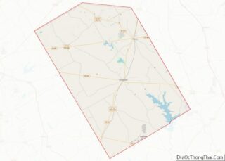
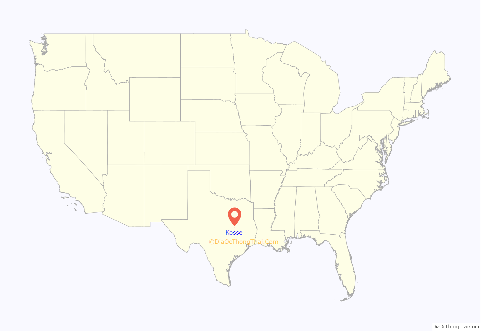
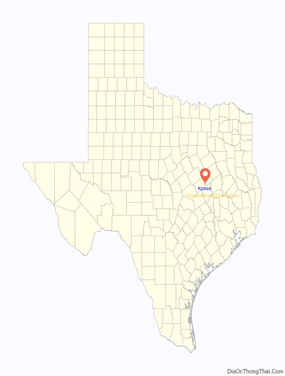
Kosse location map. Where is Kosse town?
History
Early settlement
Initial settlement of the area began in the mid-1840s as a community known as Eutaw. Settlers built homes near Duck Creek and Eutaw was a stage stop for the Franklin-Springfield and Waco-Marlin stage routes.
Arrival of the Houston & Texas Central Railway
Following the Civil War, the area was in the planned route of the Houston and Texas Central Railway (H&TC) which was being constructed to link Houston to Dallas, Denison and the Red River. The H&TC set aside one acre of land along the rail line two miles west of Eutaw as a townsite, and named it for chief engineer Theodore Kosse. For several months in late 1870 and early 1871, Kosse was the northernmost terminus of the railway, and the population briefly boomed. But by the spring of 1871, the rail line had been extended further north to the new terminus of Groesbeck and Kosse’s population was considerably reduced. By 1873, Logan’s Railway Business Directory noted that Kosse “contains about 200 inhabitants and is doing little business. When it was the terminus it was a thriving place, now its glory has faded. Cattle constitute the bulk of shipments from here.”
Incorporation and early years
The new town of Kosse was formally incorporated by an Act of the Texas Legislature on May 22, 1871. The Act named G. N. Beaumont, D. T. Igleheart, J. Huey, R. H. Fielder and a Mr. Young to be commissioners to lay off the town and make a town plat. The town’s first officers were appointed by the Governor, and the first general election was held on the second Tuesday in November, 1872, at which time a mayor, constable and five aldermen were elected for a two-year term. The town was named for H&TC’s chief engineer, Theodore Kosse.
Late 19th century
The first census of Kosse was taken in 1880 when it had a population of 476. Five years later, Kosse had multiple cotton gins, two sawmills, and three gristmills. By 1890 there were 647 residents.
An acre of land was granted for the construction of a public school on October 1, 1884. Kosse became an independent school district in 1893, with J. Thomas Hall as its first superintendent. The district had a total of 225 students. A separate school with 80 students and two teachers served the area’s black community.
On December 22, 1895, a fire burned seven brick buildings and destroyed the merchandise of seventeen firms, causing a loss of $75,000 of which only $30,000 was insured.
Early 20th century
By the turn of the 20th century, Kosse had emerged as a small but stable regional community that supported the surrounding farms and ranches of southern Limestone County.
Kosse was home to 700 residents in 1914. A local Chamber of Commerce was formed in 1921. In 1922, discovery of oil by wildcatter A. E. Humphreys dramatically transformed Kosse into a temporary oil boom town with thousands of new residents. However, the numerous wells drilled around Kosse did not turn out to be producers, and Kosse’s oil boom came to a rapid close early in 1923.
The Great Depression severely impacted Kosse as businesses closed and people left in search of greater employment opportunities. Declining student enrollment caused the Kosse School Board to vote in favor of consolidation with Groesbeck in 1968. Kosse had eleven businesses in 1989.
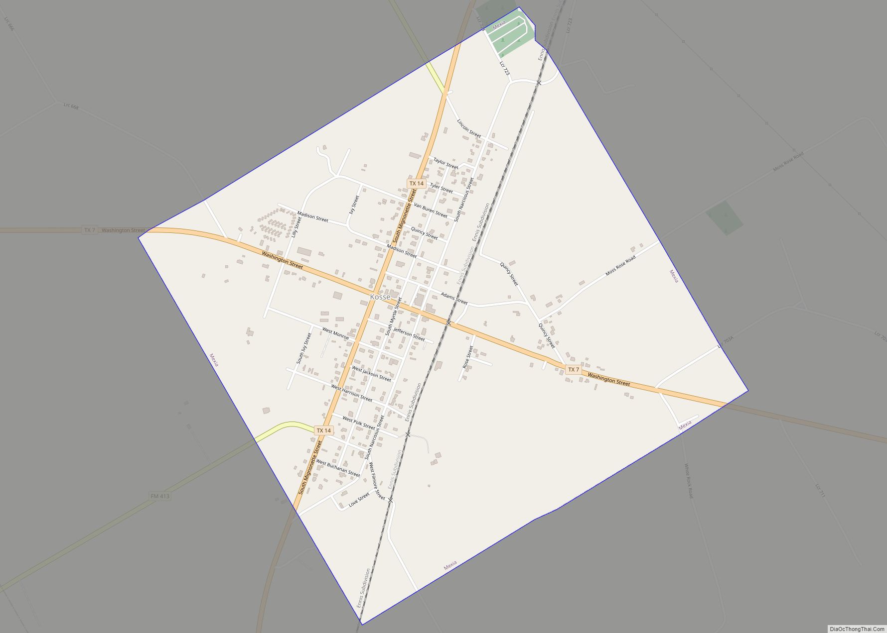
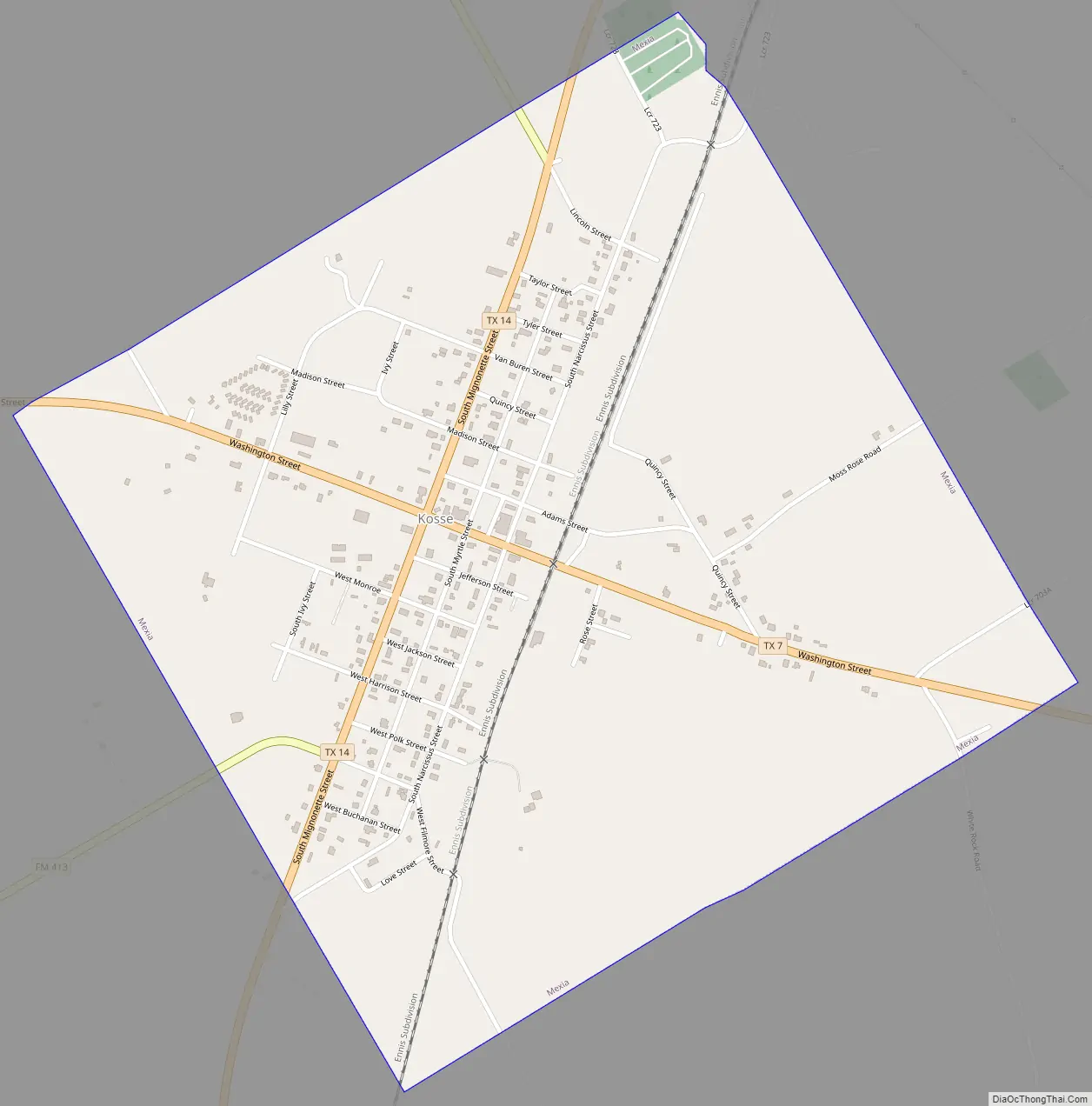
Kosse Road Map
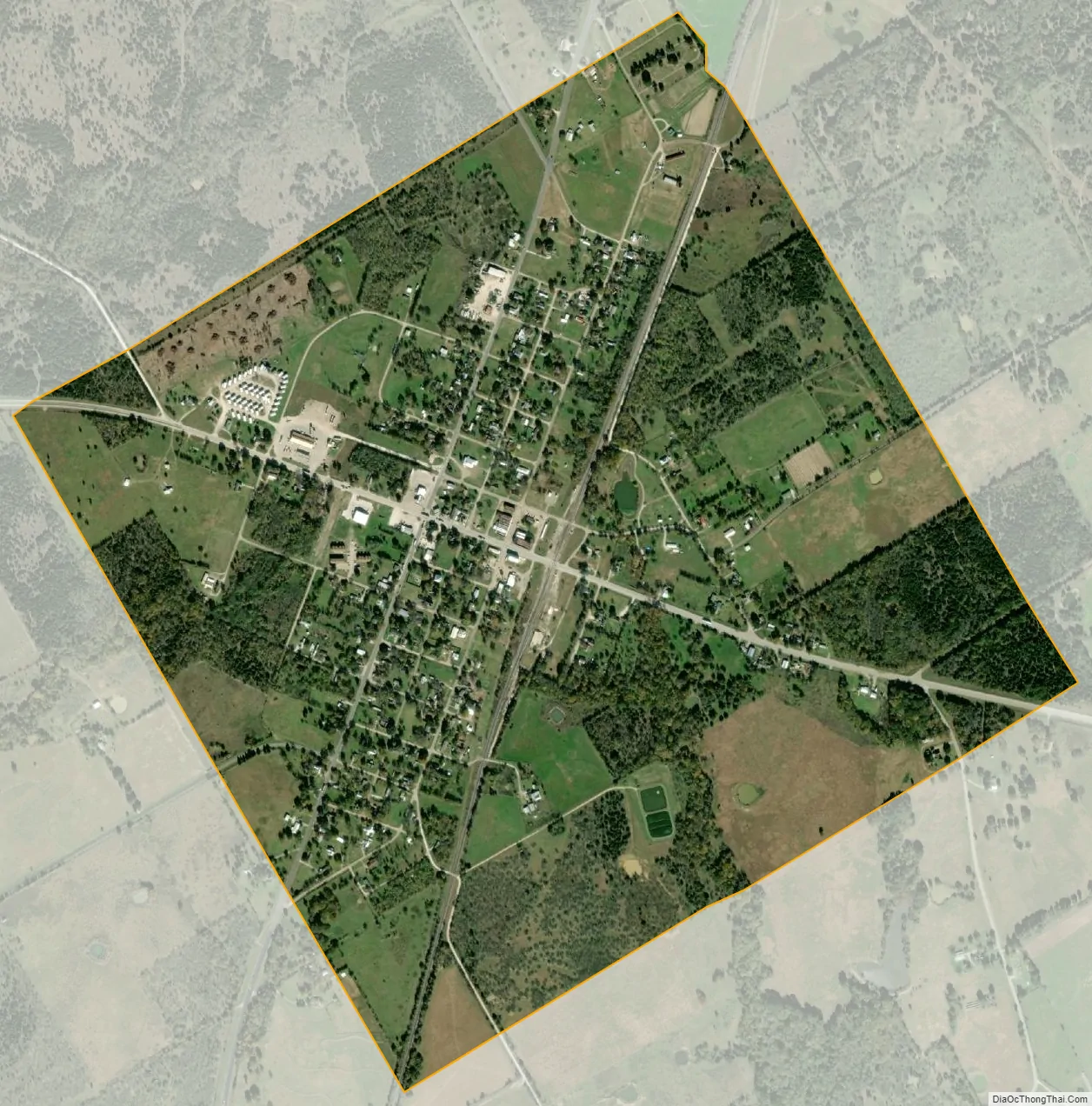
Kosse city Satellite Map
Geography
Kosse is located at 31°18′27″N 96°37′49″W / 31.30750°N 96.63028°W / 31.30750; -96.63028 (31.307452, –96.630267). It is situated at the junction of State Highways 7 and 14 in southwestern Limestone County, approximately 16 miles east of Marlin and 17 miles south of Groesbeck. The closest large cities are Waco, 42 miles to the northwest, and Bryan/College Station, 52 miles south of Kosse.
According to the United States Census Bureau, the town has a total area of 1.3 square miles (3.4 km), all land.
See also
Map of Texas State and its subdivision:- Anderson
- Andrews
- Angelina
- Aransas
- Archer
- Armstrong
- Atascosa
- Austin
- Bailey
- Bandera
- Bastrop
- Baylor
- Bee
- Bell
- Bexar
- Blanco
- Borden
- Bosque
- Bowie
- Brazoria
- Brazos
- Brewster
- Briscoe
- Brooks
- Brown
- Burleson
- Burnet
- Caldwell
- Calhoun
- Callahan
- Cameron
- Camp
- Carson
- Cass
- Castro
- Chambers
- Cherokee
- Childress
- Clay
- Cochran
- Coke
- Coleman
- Collin
- Collingsworth
- Colorado
- Comal
- Comanche
- Concho
- Cooke
- Coryell
- Cottle
- Crane
- Crockett
- Crosby
- Culberson
- Dallam
- Dallas
- Dawson
- Deaf Smith
- Delta
- Denton
- Dewitt
- Dickens
- Dimmit
- Donley
- Duval
- Eastland
- Ector
- Edwards
- El Paso
- Ellis
- Erath
- Falls
- Fannin
- Fayette
- Fisher
- Floyd
- Foard
- Fort Bend
- Franklin
- Freestone
- Frio
- Gaines
- Galveston
- Garza
- Gillespie
- Glasscock
- Goliad
- Gonzales
- Gray
- Grayson
- Gregg
- Grimes
- Guadalupe
- Hale
- Hall
- Hamilton
- Hansford
- Hardeman
- Hardin
- Harris
- Harrison
- Hartley
- Haskell
- Hays
- Hemphill
- Henderson
- Hidalgo
- Hill
- Hockley
- Hood
- Hopkins
- Houston
- Howard
- Hudspeth
- Hunt
- Hutchinson
- Irion
- Jack
- Jackson
- Jasper
- Jeff Davis
- Jefferson
- Jim Hogg
- Jim Wells
- Johnson
- Jones
- Karnes
- Kaufman
- Kendall
- Kenedy
- Kent
- Kerr
- Kimble
- King
- Kinney
- Kleberg
- Knox
- La Salle
- Lamar
- Lamb
- Lampasas
- Lavaca
- Lee
- Leon
- Liberty
- Limestone
- Lipscomb
- Live Oak
- Llano
- Loving
- Lubbock
- Lynn
- Madison
- Marion
- Martin
- Mason
- Matagorda
- Maverick
- McCulloch
- McLennan
- McMullen
- Medina
- Menard
- Midland
- Milam
- Mills
- Mitchell
- Montague
- Montgomery
- Moore
- Morris
- Motley
- Nacogdoches
- Navarro
- Newton
- Nolan
- Nueces
- Ochiltree
- Oldham
- Orange
- Palo Pinto
- Panola
- Parker
- Parmer
- Pecos
- Polk
- Potter
- Presidio
- Rains
- Randall
- Reagan
- Real
- Red River
- Reeves
- Refugio
- Roberts
- Robertson
- Rockwall
- Runnels
- Rusk
- Sabine
- San Augustine
- San Jacinto
- San Patricio
- San Saba
- Schleicher
- Scurry
- Shackelford
- Shelby
- Sherman
- Smith
- Somervell
- Starr
- Stephens
- Sterling
- Stonewall
- Sutton
- Swisher
- Tarrant
- Taylor
- Terrell
- Terry
- Throckmorton
- Titus
- Tom Green
- Travis
- Trinity
- Tyler
- Upshur
- Upton
- Uvalde
- Val Verde
- Van Zandt
- Victoria
- Walker
- Waller
- Ward
- Washington
- Webb
- Wharton
- Wheeler
- Wichita
- Wilbarger
- Willacy
- Williamson
- Wilson
- Winkler
- Wise
- Wood
- Yoakum
- Young
- Zapata
- Zavala
- Alabama
- Alaska
- Arizona
- Arkansas
- California
- Colorado
- Connecticut
- Delaware
- District of Columbia
- Florida
- Georgia
- Hawaii
- Idaho
- Illinois
- Indiana
- Iowa
- Kansas
- Kentucky
- Louisiana
- Maine
- Maryland
- Massachusetts
- Michigan
- Minnesota
- Mississippi
- Missouri
- Montana
- Nebraska
- Nevada
- New Hampshire
- New Jersey
- New Mexico
- New York
- North Carolina
- North Dakota
- Ohio
- Oklahoma
- Oregon
- Pennsylvania
- Rhode Island
- South Carolina
- South Dakota
- Tennessee
- Texas
- Utah
- Vermont
- Virginia
- Washington
- West Virginia
- Wisconsin
- Wyoming