Moran is a city in southeast Shackelford County, Texas, United States. The population was 270 at the 2010 census.
| Name: | Moran city |
|---|---|
| LSAD Code: | 25 |
| LSAD Description: | city (suffix) |
| State: | Texas |
| County: | Shackelford County |
| Elevation: | 1,358 ft (414 m) |
| Total Area: | 0.42 sq mi (1.10 km²) |
| Land Area: | 0.42 sq mi (1.10 km²) |
| Water Area: | 0.00 sq mi (0.00 km²) |
| Total Population: | 270 |
| Population Density: | 611.76/sq mi (236.40/km²) |
| ZIP code: | 76464 |
| Area code: | 325 |
| FIPS code: | 4849320 |
| GNISfeature ID: | 1341895 |
Online Interactive Map
Click on ![]() to view map in "full screen" mode.
to view map in "full screen" mode.
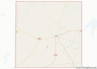
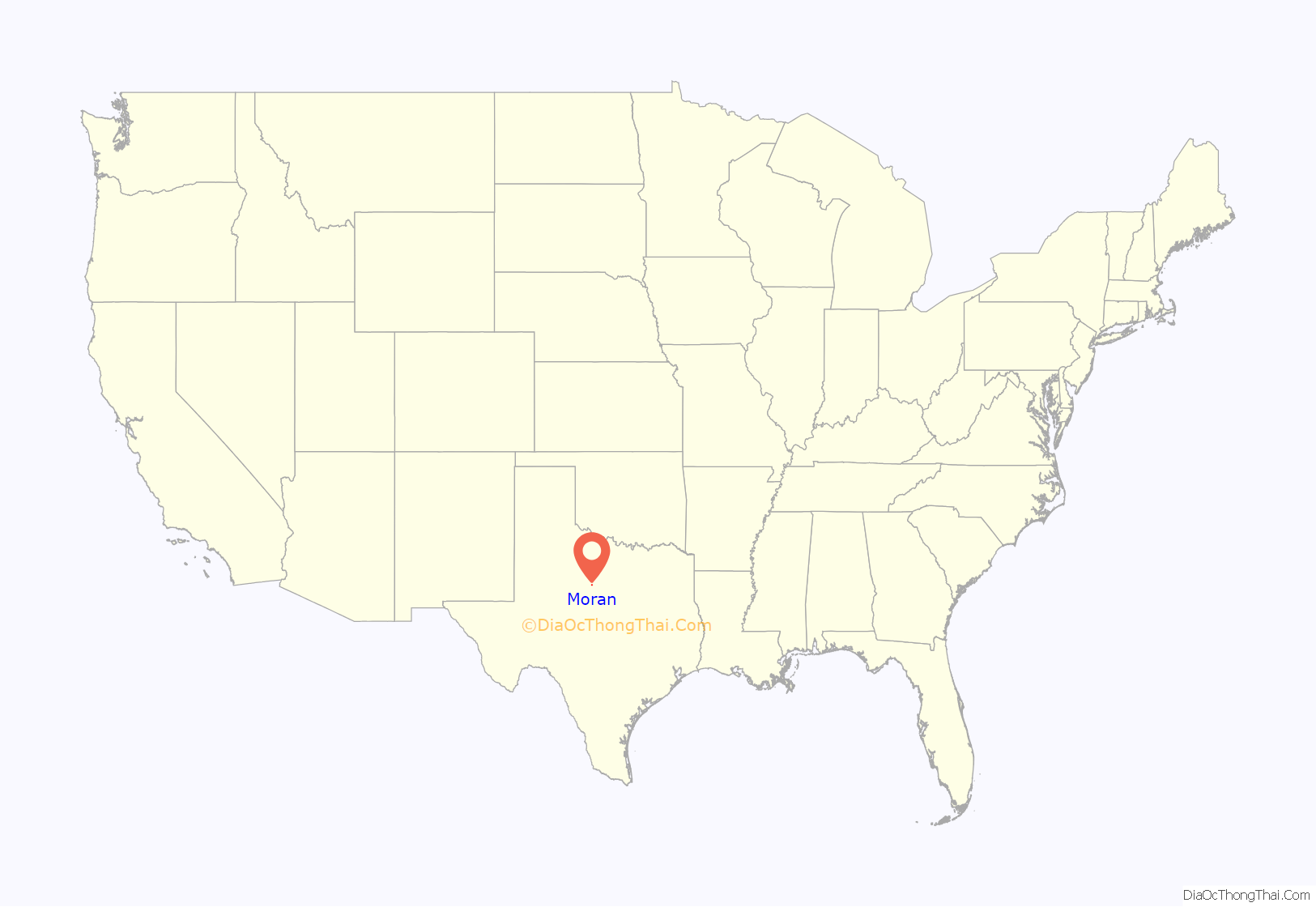
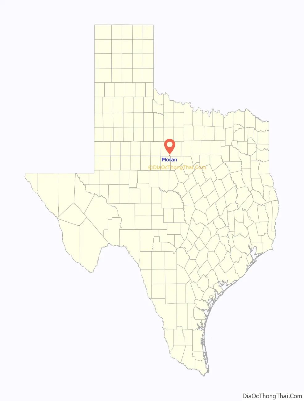
Moran location map. Where is Moran city?
History
Pioneers came to this area as early as the 1860s. During the Civil War (1861–1865), they built the temporary fortress settlement of Mugginsville on Deep Creek 5 miles north of the future town site of Moran. At one time, a branch of the Western Cattle Trail passed nearby. Population increased after the arrival of the Texas Central Railroad in 1881. Hulltown, the original name of the town, was established by Mary and George Washington “Swope” Hull of McDowell, Virginia, who opened a general store at the rail crossing on Deep Creek in 1883. Hull (1849–1911) was the first postmaster. He bought 160 acres between Post Oak and Deep Creeks and platted a town site in March 1884 (he and his family would later move to Oakland, California). Most of the property was bought by Bem Scott, a real estate developer from Indiana, who eventually sold his interests in 1890 to Matthew D. Bray (1845–1926), a prominent local merchant and landowner. For unknown reasons, the town’s name was changed to Hicks in 1890. Later, in order to secure a new railroad depot, the town was renamed a third and final time to Moran in 1892 for Texas Central Railroad owner Charles Moran of New York.
By 1900, the community had several businesses, a school and Baptist, Church of Christ, Cumberland Presbyterian, and Methodist congregations. A newspaper was begun in 1895 and bank in 1902. In November 1910, the Cottle No. 1 natural gas well discovery opened the nearby Moran Field, and was the first commercial gas well completed in this vast west Texas area. In the spring of 1911, gas was piped to Moran for residential and business use. Within two years (in 1913) the cities of Albany, Cisco, and Abilene were supplied for the first time with natural gas. By October 1913, with five producing gas wells, the Moran Field won recognition as one of the most important sources of fossil fuels in Texas. For the next fifteen years, oil and gas discoveries in the area made Moran a boom town with a peak population of 5,000–10,000 at one point in the 1920s. By the 1930s, the boom was over and the population gradually began its decline to the present day. Note: much of the information above comes from the local historical markers to the town and to the Cottle No. 1 gas well.
In the late 1980s, Moran achieved fame as the home of the National Fajita Cook-off, which brought thousands of visitors from all over the world to the sleepy town. In the 2000s, Moran became home to Slide Fire Solutions, a multi-million dollar bump stock production company. The local economy remains tied to farming, ranching, and oil and gas production.
Local Texas historical markers are devoted to: Moran (#3468), Cottle No. 1 Natural Gas Well (#1076), Granville E. Waters (#13204), Moran Cemetery (#17708), and Moran Church of Christ (#17SF02).
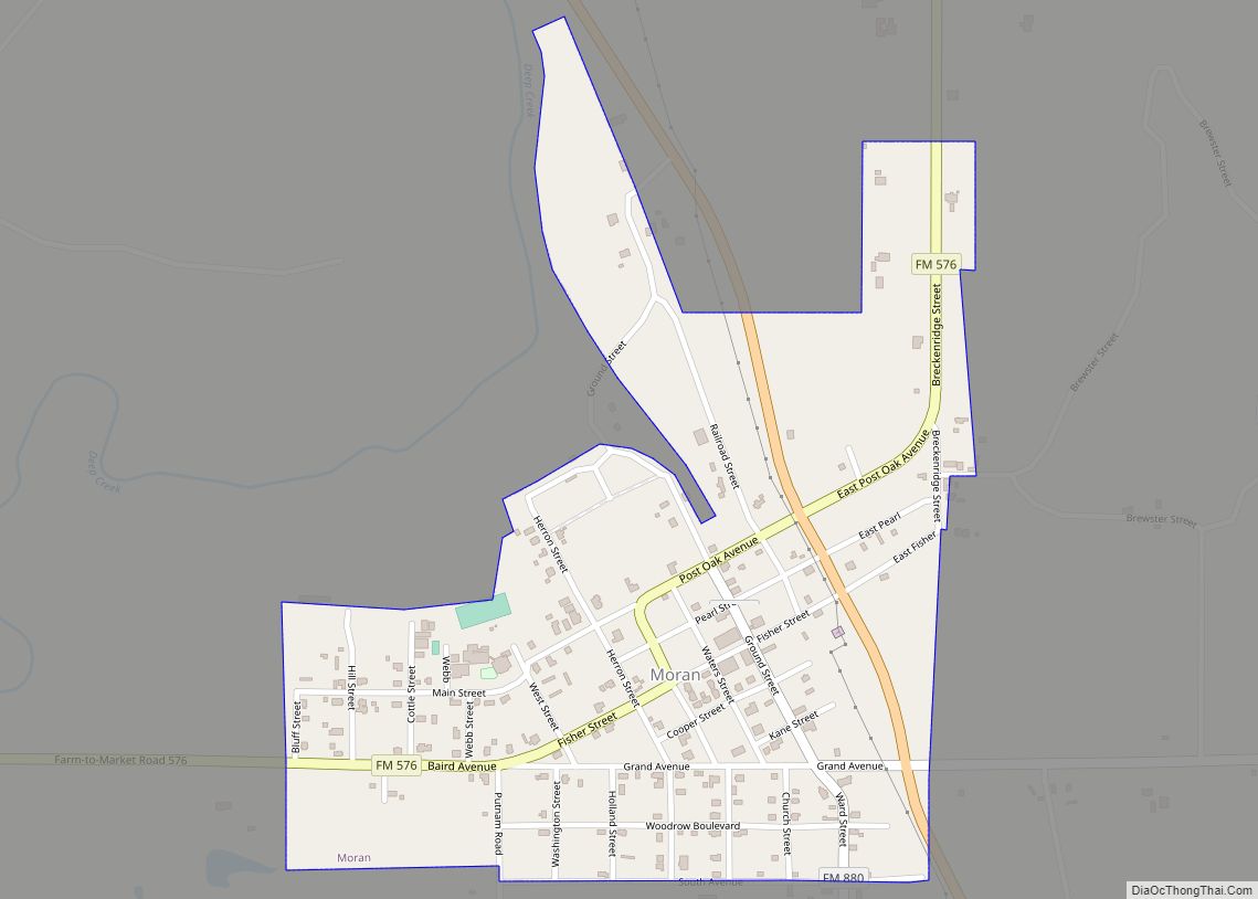
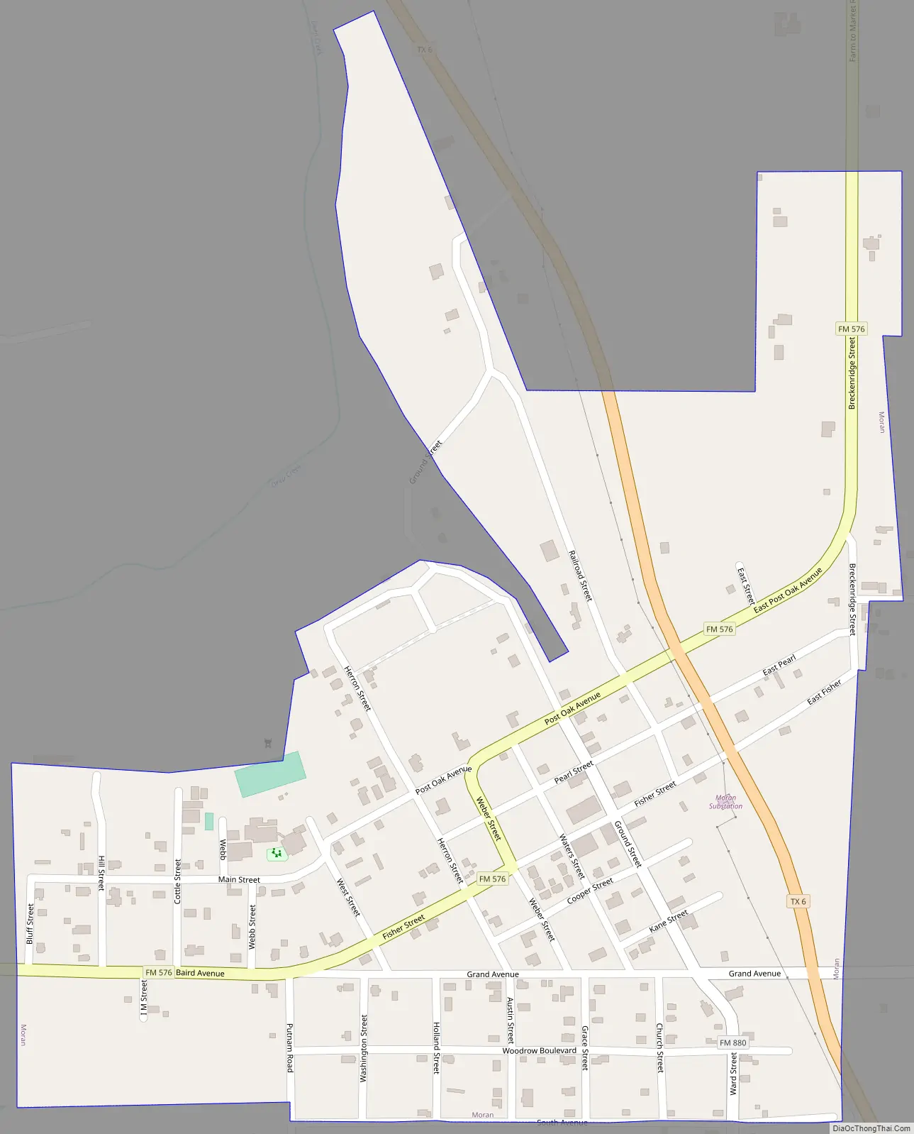
Moran Road Map
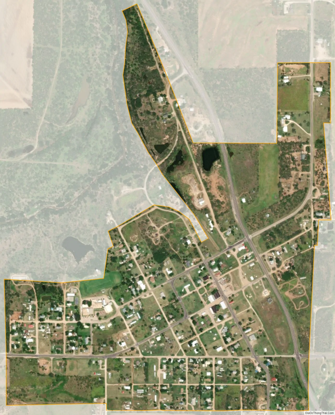
Moran city Satellite Map
Geography
Moran is located at 32°32′45″N 99°09′59″W / 32.545945°N 99.166275°W / 32.545945; -99.166275 (32.545945, –99.166275). The town is situated at the intersection of Texas State Highway 6 and Farm to Market 576 approximately 15 miles southeast of Albany, 18 miles northwest of Cisco, 29 miles southwest of Breckenridge, and 42 miles east-northeast of Abilene. Nearby creeks include Deep Creek, Post Oak Creek, Battle Creek, and Hubbard Creek.
According to the United States Census Bureau, the city has a total area of 0.4 square mile (1.1 km), all land.
See also
Map of Texas State and its subdivision:- Anderson
- Andrews
- Angelina
- Aransas
- Archer
- Armstrong
- Atascosa
- Austin
- Bailey
- Bandera
- Bastrop
- Baylor
- Bee
- Bell
- Bexar
- Blanco
- Borden
- Bosque
- Bowie
- Brazoria
- Brazos
- Brewster
- Briscoe
- Brooks
- Brown
- Burleson
- Burnet
- Caldwell
- Calhoun
- Callahan
- Cameron
- Camp
- Carson
- Cass
- Castro
- Chambers
- Cherokee
- Childress
- Clay
- Cochran
- Coke
- Coleman
- Collin
- Collingsworth
- Colorado
- Comal
- Comanche
- Concho
- Cooke
- Coryell
- Cottle
- Crane
- Crockett
- Crosby
- Culberson
- Dallam
- Dallas
- Dawson
- Deaf Smith
- Delta
- Denton
- Dewitt
- Dickens
- Dimmit
- Donley
- Duval
- Eastland
- Ector
- Edwards
- El Paso
- Ellis
- Erath
- Falls
- Fannin
- Fayette
- Fisher
- Floyd
- Foard
- Fort Bend
- Franklin
- Freestone
- Frio
- Gaines
- Galveston
- Garza
- Gillespie
- Glasscock
- Goliad
- Gonzales
- Gray
- Grayson
- Gregg
- Grimes
- Guadalupe
- Hale
- Hall
- Hamilton
- Hansford
- Hardeman
- Hardin
- Harris
- Harrison
- Hartley
- Haskell
- Hays
- Hemphill
- Henderson
- Hidalgo
- Hill
- Hockley
- Hood
- Hopkins
- Houston
- Howard
- Hudspeth
- Hunt
- Hutchinson
- Irion
- Jack
- Jackson
- Jasper
- Jeff Davis
- Jefferson
- Jim Hogg
- Jim Wells
- Johnson
- Jones
- Karnes
- Kaufman
- Kendall
- Kenedy
- Kent
- Kerr
- Kimble
- King
- Kinney
- Kleberg
- Knox
- La Salle
- Lamar
- Lamb
- Lampasas
- Lavaca
- Lee
- Leon
- Liberty
- Limestone
- Lipscomb
- Live Oak
- Llano
- Loving
- Lubbock
- Lynn
- Madison
- Marion
- Martin
- Mason
- Matagorda
- Maverick
- McCulloch
- McLennan
- McMullen
- Medina
- Menard
- Midland
- Milam
- Mills
- Mitchell
- Montague
- Montgomery
- Moore
- Morris
- Motley
- Nacogdoches
- Navarro
- Newton
- Nolan
- Nueces
- Ochiltree
- Oldham
- Orange
- Palo Pinto
- Panola
- Parker
- Parmer
- Pecos
- Polk
- Potter
- Presidio
- Rains
- Randall
- Reagan
- Real
- Red River
- Reeves
- Refugio
- Roberts
- Robertson
- Rockwall
- Runnels
- Rusk
- Sabine
- San Augustine
- San Jacinto
- San Patricio
- San Saba
- Schleicher
- Scurry
- Shackelford
- Shelby
- Sherman
- Smith
- Somervell
- Starr
- Stephens
- Sterling
- Stonewall
- Sutton
- Swisher
- Tarrant
- Taylor
- Terrell
- Terry
- Throckmorton
- Titus
- Tom Green
- Travis
- Trinity
- Tyler
- Upshur
- Upton
- Uvalde
- Val Verde
- Van Zandt
- Victoria
- Walker
- Waller
- Ward
- Washington
- Webb
- Wharton
- Wheeler
- Wichita
- Wilbarger
- Willacy
- Williamson
- Wilson
- Winkler
- Wise
- Wood
- Yoakum
- Young
- Zapata
- Zavala
- Alabama
- Alaska
- Arizona
- Arkansas
- California
- Colorado
- Connecticut
- Delaware
- District of Columbia
- Florida
- Georgia
- Hawaii
- Idaho
- Illinois
- Indiana
- Iowa
- Kansas
- Kentucky
- Louisiana
- Maine
- Maryland
- Massachusetts
- Michigan
- Minnesota
- Mississippi
- Missouri
- Montana
- Nebraska
- Nevada
- New Hampshire
- New Jersey
- New Mexico
- New York
- North Carolina
- North Dakota
- Ohio
- Oklahoma
- Oregon
- Pennsylvania
- Rhode Island
- South Carolina
- South Dakota
- Tennessee
- Texas
- Utah
- Vermont
- Virginia
- Washington
- West Virginia
- Wisconsin
- Wyoming