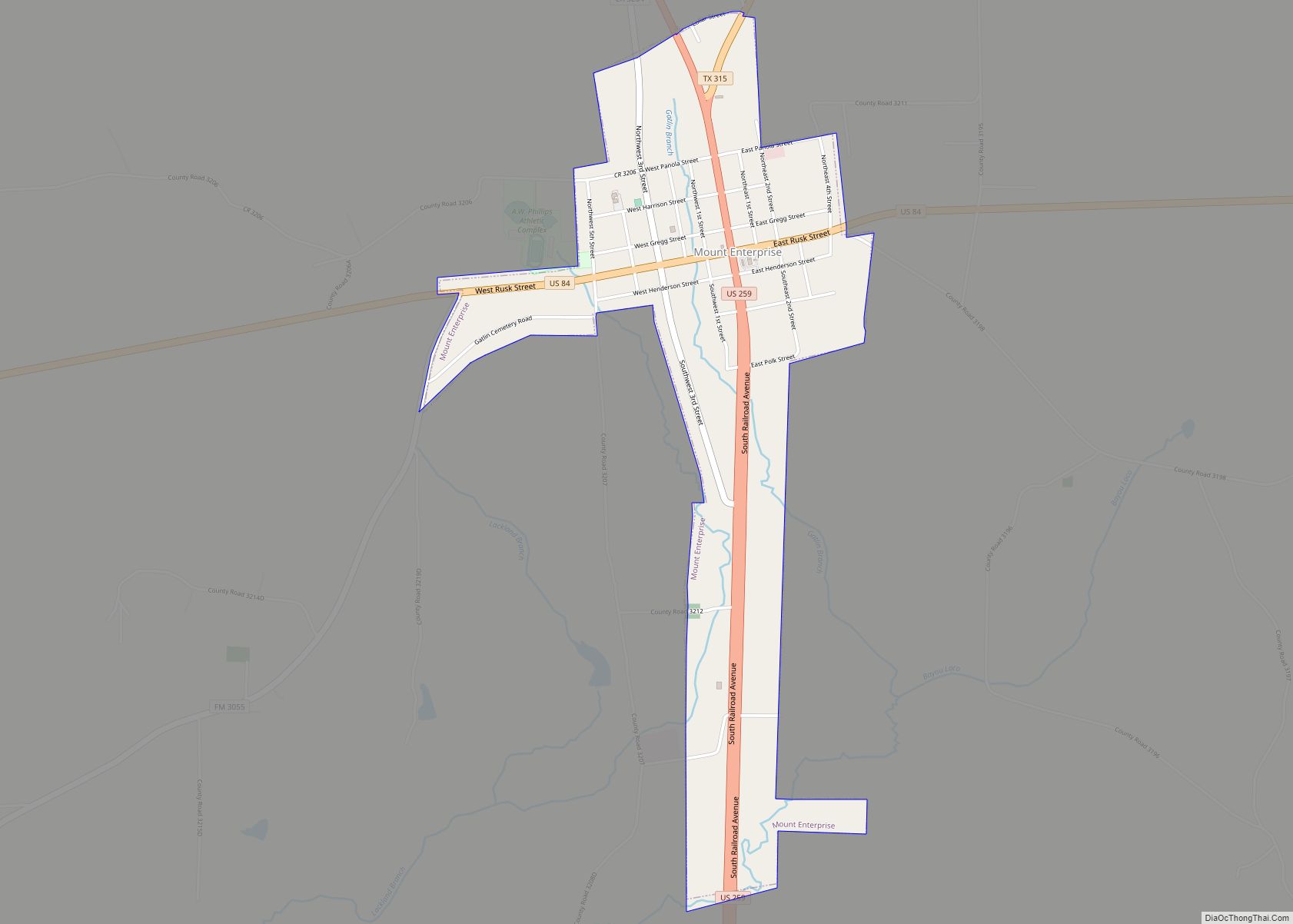
Mount Enterprise is a city in Rusk County, Texas, United States. The population was 447 at the 2010 census.
| Name: | Mount Enterprise city |
|---|---|
| LSAD Code: | 25 |
| LSAD Description: | city (suffix) |
| State: | Texas |
| County: | Rusk County |
| Elevation: | 479 ft (146 m) |
| Total Area: | 1.49 sq mi (3.85 km²) |
| Land Area: | 1.49 sq mi (3.85 km²) |
| Water Area: | 0.00 sq mi (0.00 km²) |
| Total Population: | 447 |
| Population Density: | 293.60/sq mi (113.39/km²) |
| ZIP code: | 75681 |
| Area code: | 903 |
| FIPS code: | 4849728 |
| GNISfeature ID: | 1363243 |
Online Interactive Map
Click on ![]() to view map in "full screen" mode.
to view map in "full screen" mode.
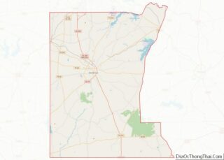
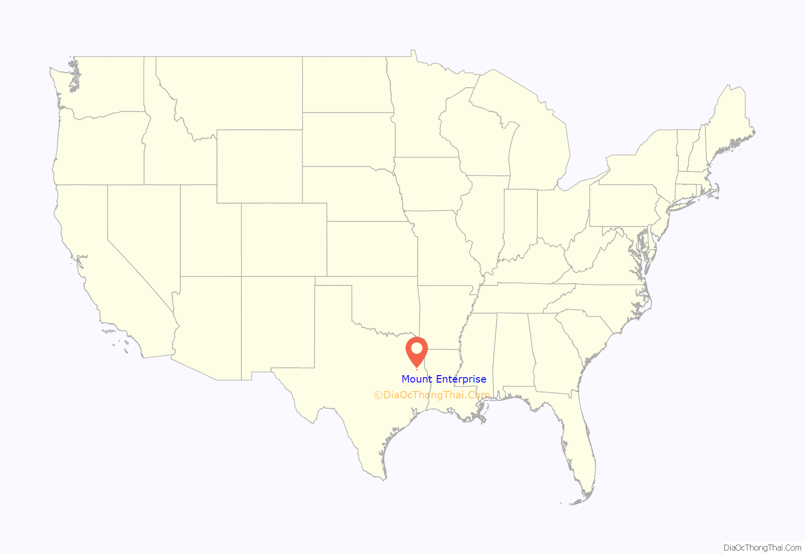
Mount Enterprise location map. Where is Mount Enterprise city?

History
The city of Mount Enterprise, located south of Henderson in rural Rusk County, was named for a small elevation near the town and for the business enterprise of the Vinzent brothers, who settled it in 1832.
The town owes its existence to the presence of promising iron ore in the area. Charles Vinzent considered the “old mountain” nearby to be an “iron mountain,” and he was not far off the mark; the brown, crumbly ore of the Weches formation that outcrops in the area has a better than 50 percent iron content. However, Vinzent’s real enterprise came in the form of manufacturing and retailing. His factory made wagons, buggies, furniture, plows, caskets, and a patented churn. He launched a chain of stores to sell these products, and more, operating out of Mount Enterprise. At one time Vinzent had as many as four stores.
Lumbering was also an early industry of Mount Enterprise; the furniture factory it supported is dated as early as 1850. There were also numerous plantations in the area before the Civil War. In 1846 the Mulberry Grove post office was established with Henry Henson as postmaster. Three years later the name was changed to Mount Enterprise.
Mount Enterprise Male and Female College was begun in 1851, and it lasted until 1855. In 1853 Mount Enterprise Male and Female Academy was established. In 1880 the town had three sawmills, a hotel, two cotton gins, a school, three churches, and a population of 150.
In 1894 the Caro Northern Railway was chartered to operate as a logging road between Mount Enterprise and Caro, in Nacogdoches County, a distance of little over 16 miles. The railroad, which connected Mount Enterprise with the Texas and New Orleans Railroad, came to within a mile of Mount Enterprise, and the town then moved to the railroad. It became the new Mount Enterprise, and the old location was called the old Mount Enterprise.
The railroad was abandoned in 1934, but by 1939 the town had incorporated and still had a number of businesses, a bank, a post office, a newspaper, and a population of 920. After 1940 the population gradually declined to 485 in 1982, when the town had a bank, a post office, and fifteen businesses. In 1990 the population was 501. The population grew to 525 in 2000, but has since dropped to 447 according to the 2010 census.
Mount Enterprise Road Map
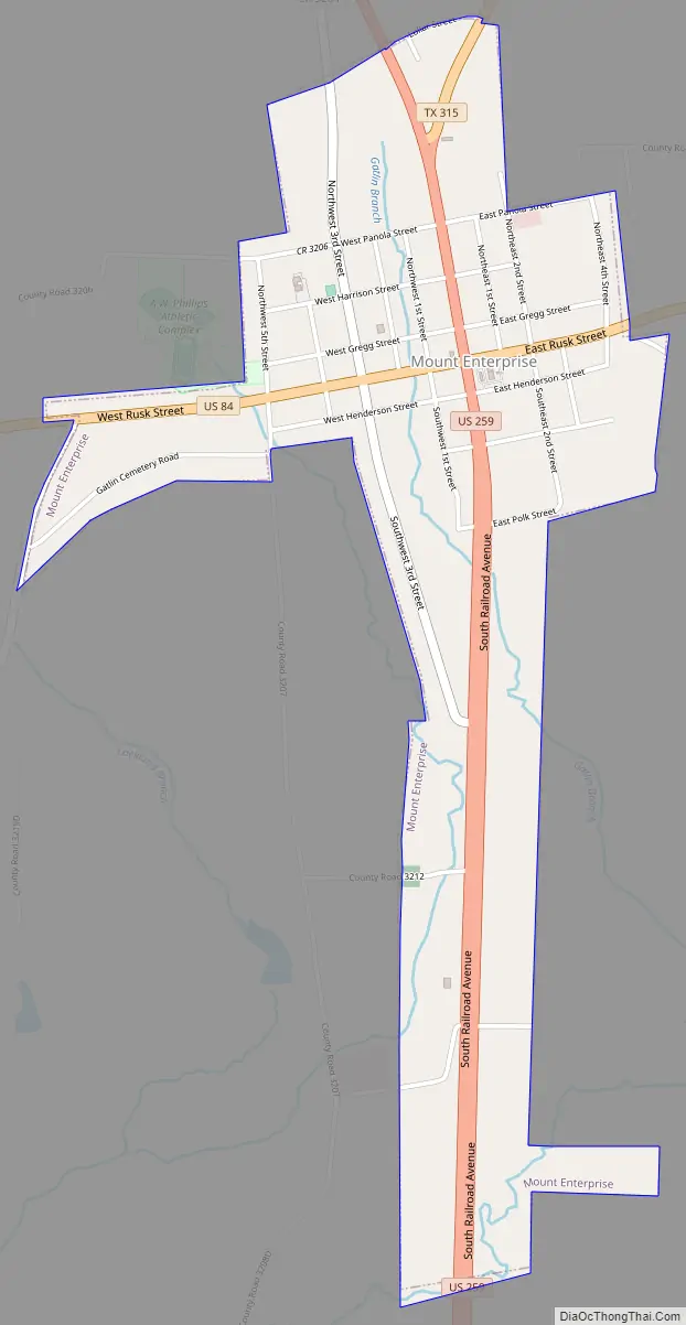
Mount Enterprise city Satellite Map

Geography
Mount Enterprise is located at 31°54′57″N 94°40′54″W / 31.91583°N 94.68167°W / 31.91583; -94.68167 (31.915852, –94.681673).
According to the United States Census Bureau, the city has a total area of 1.5 square miles (3.8 km), all of it land.
See also
Map of Texas State and its subdivision:- Anderson
- Andrews
- Angelina
- Aransas
- Archer
- Armstrong
- Atascosa
- Austin
- Bailey
- Bandera
- Bastrop
- Baylor
- Bee
- Bell
- Bexar
- Blanco
- Borden
- Bosque
- Bowie
- Brazoria
- Brazos
- Brewster
- Briscoe
- Brooks
- Brown
- Burleson
- Burnet
- Caldwell
- Calhoun
- Callahan
- Cameron
- Camp
- Carson
- Cass
- Castro
- Chambers
- Cherokee
- Childress
- Clay
- Cochran
- Coke
- Coleman
- Collin
- Collingsworth
- Colorado
- Comal
- Comanche
- Concho
- Cooke
- Coryell
- Cottle
- Crane
- Crockett
- Crosby
- Culberson
- Dallam
- Dallas
- Dawson
- Deaf Smith
- Delta
- Denton
- Dewitt
- Dickens
- Dimmit
- Donley
- Duval
- Eastland
- Ector
- Edwards
- El Paso
- Ellis
- Erath
- Falls
- Fannin
- Fayette
- Fisher
- Floyd
- Foard
- Fort Bend
- Franklin
- Freestone
- Frio
- Gaines
- Galveston
- Garza
- Gillespie
- Glasscock
- Goliad
- Gonzales
- Gray
- Grayson
- Gregg
- Grimes
- Guadalupe
- Hale
- Hall
- Hamilton
- Hansford
- Hardeman
- Hardin
- Harris
- Harrison
- Hartley
- Haskell
- Hays
- Hemphill
- Henderson
- Hidalgo
- Hill
- Hockley
- Hood
- Hopkins
- Houston
- Howard
- Hudspeth
- Hunt
- Hutchinson
- Irion
- Jack
- Jackson
- Jasper
- Jeff Davis
- Jefferson
- Jim Hogg
- Jim Wells
- Johnson
- Jones
- Karnes
- Kaufman
- Kendall
- Kenedy
- Kent
- Kerr
- Kimble
- King
- Kinney
- Kleberg
- Knox
- La Salle
- Lamar
- Lamb
- Lampasas
- Lavaca
- Lee
- Leon
- Liberty
- Limestone
- Lipscomb
- Live Oak
- Llano
- Loving
- Lubbock
- Lynn
- Madison
- Marion
- Martin
- Mason
- Matagorda
- Maverick
- McCulloch
- McLennan
- McMullen
- Medina
- Menard
- Midland
- Milam
- Mills
- Mitchell
- Montague
- Montgomery
- Moore
- Morris
- Motley
- Nacogdoches
- Navarro
- Newton
- Nolan
- Nueces
- Ochiltree
- Oldham
- Orange
- Palo Pinto
- Panola
- Parker
- Parmer
- Pecos
- Polk
- Potter
- Presidio
- Rains
- Randall
- Reagan
- Real
- Red River
- Reeves
- Refugio
- Roberts
- Robertson
- Rockwall
- Runnels
- Rusk
- Sabine
- San Augustine
- San Jacinto
- San Patricio
- San Saba
- Schleicher
- Scurry
- Shackelford
- Shelby
- Sherman
- Smith
- Somervell
- Starr
- Stephens
- Sterling
- Stonewall
- Sutton
- Swisher
- Tarrant
- Taylor
- Terrell
- Terry
- Throckmorton
- Titus
- Tom Green
- Travis
- Trinity
- Tyler
- Upshur
- Upton
- Uvalde
- Val Verde
- Van Zandt
- Victoria
- Walker
- Waller
- Ward
- Washington
- Webb
- Wharton
- Wheeler
- Wichita
- Wilbarger
- Willacy
- Williamson
- Wilson
- Winkler
- Wise
- Wood
- Yoakum
- Young
- Zapata
- Zavala
- Alabama
- Alaska
- Arizona
- Arkansas
- California
- Colorado
- Connecticut
- Delaware
- District of Columbia
- Florida
- Georgia
- Hawaii
- Idaho
- Illinois
- Indiana
- Iowa
- Kansas
- Kentucky
- Louisiana
- Maine
- Maryland
- Massachusetts
- Michigan
- Minnesota
- Mississippi
- Missouri
- Montana
- Nebraska
- Nevada
- New Hampshire
- New Jersey
- New Mexico
- New York
- North Carolina
- North Dakota
- Ohio
- Oklahoma
- Oregon
- Pennsylvania
- Rhode Island
- South Carolina
- South Dakota
- Tennessee
- Texas
- Utah
- Vermont
- Virginia
- Washington
- West Virginia
- Wisconsin
- Wyoming