Mount Vernon is a town and the county seat of Franklin County, Texas, United States. The population was 2,491 at the 2020 United States census.
| Name: | Mount Vernon town |
|---|---|
| LSAD Code: | 43 |
| LSAD Description: | town (suffix) |
| State: | Texas |
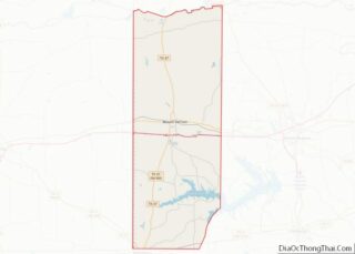
| County: | Franklin County |
| Elevation: | 492 ft (150 m) |
| Total Area: | 4.40 sq mi (11.40 km²) |
| Land Area: | 4.31 sq mi (11.17 km²) |
| Water Area: | 0.09 sq mi (0.24 km²) |
| Total Population: | 2,491 |
| Population Density: | 635.12/sq mi (245.21/km²) |
| ZIP code: | 75457 |
| Area code: | 903 |
| FIPS code: | 4849860 |
| GNISfeature ID: | 1342121 |
| Website: | www.comvtx.com |
Online Interactive Map
Click on ![]() to view map in "full screen" mode.
to view map in "full screen" mode.
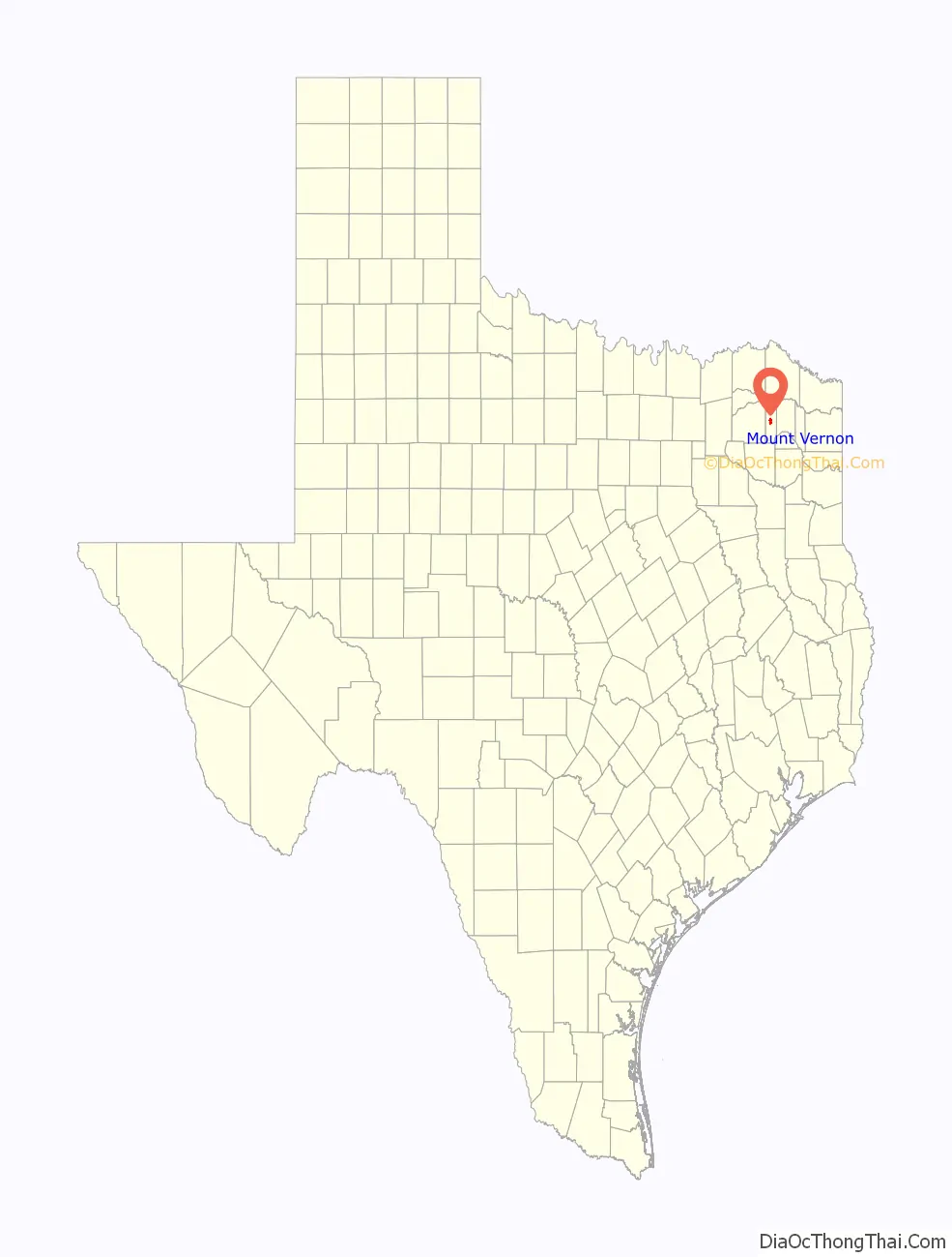
Mount Vernon location map. Where is Mount Vernon town?

History
Mount Vernon started as a settlement near the Fanning Springs (on Holbrook Street south of the present town square). Affidavits filed to establish land titles soon after the Texas Revolution document the settlement by squatters in Spanish Texas commencing in 1818.
By 1848 the United States government established a post office, and in 1849 a formal town site was laid out on land donated by Stephen and Rebecca Keith for the town of Mount Vernon. Since there were two other Mount Vernons in Texas, the post office was called “Keith” and then “Lone Star” before the name “Mount Vernon” became available in 1875. Franklin County was carved out of Titus County in 1875, and Mount Vernon was elected county seat in competition with other communities.
The county’s economy was based in agriculture with corn and cotton, followed by over 500,000 peach trees in production in the 1920s, watermelons in the 1930s, and the state’s top record production of cane syrup in the 1940s. The 1936 discovery of oil on C.G. Hughes’ land in the north part of the county led to a more diversified economy, with oil production continuing today combined with light industry, manufacturing, and diverse agricultural endeavors. Mount Vernon, as county seat, was assured a continuing vital existence as the economic center for the county. The town boasted churches, doctors, lawyers, and many varied stores in a time before people had the ability to travel far. The town voted to incorporate in 1910 under a mayor/council form of government. In 1911 a bond issue was passed to create a public waterworks. Electric and gas utility service followed.
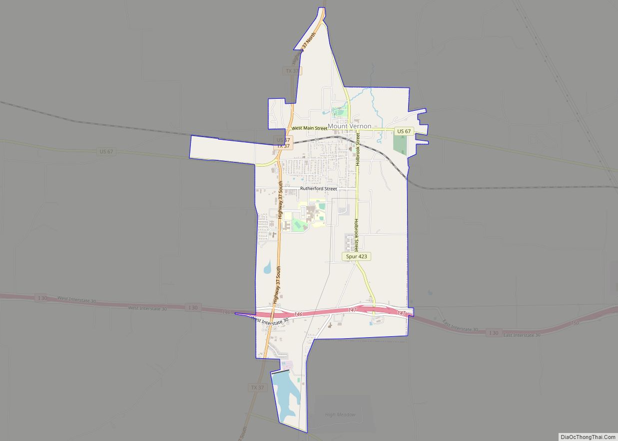
The downtown area reflects a small-town atmosphere. The central plaza has a picturesque gazebo and park benches. On the north side of the square is a classical revival 1912 white limestone courthouse with a chiming clock tower. The courthouse recently underwent an extensive restoration as part of the Texas Historic Courthouse Preservation Program and has been returned to its 1912 grandeur.
History abounds in and around Mount Vernon. Over 50 homes built before World War I still stand around town and are marked with signs designating the original owners and year of construction. Tour maps are available at various locations including the Franklin County Historical Association Museums, Franklin County Chamber of Commerce, and Mount Vernon City Hall. There are over 20 official state historical markers in Franklin County. The Cherokee Trace runs along the eastern edge of the county south toward Nacogdoches. The Choctaw Trail runs through the county toward Dallas. The Bankhead Highway remains as Mount Vernon’s Main Street.
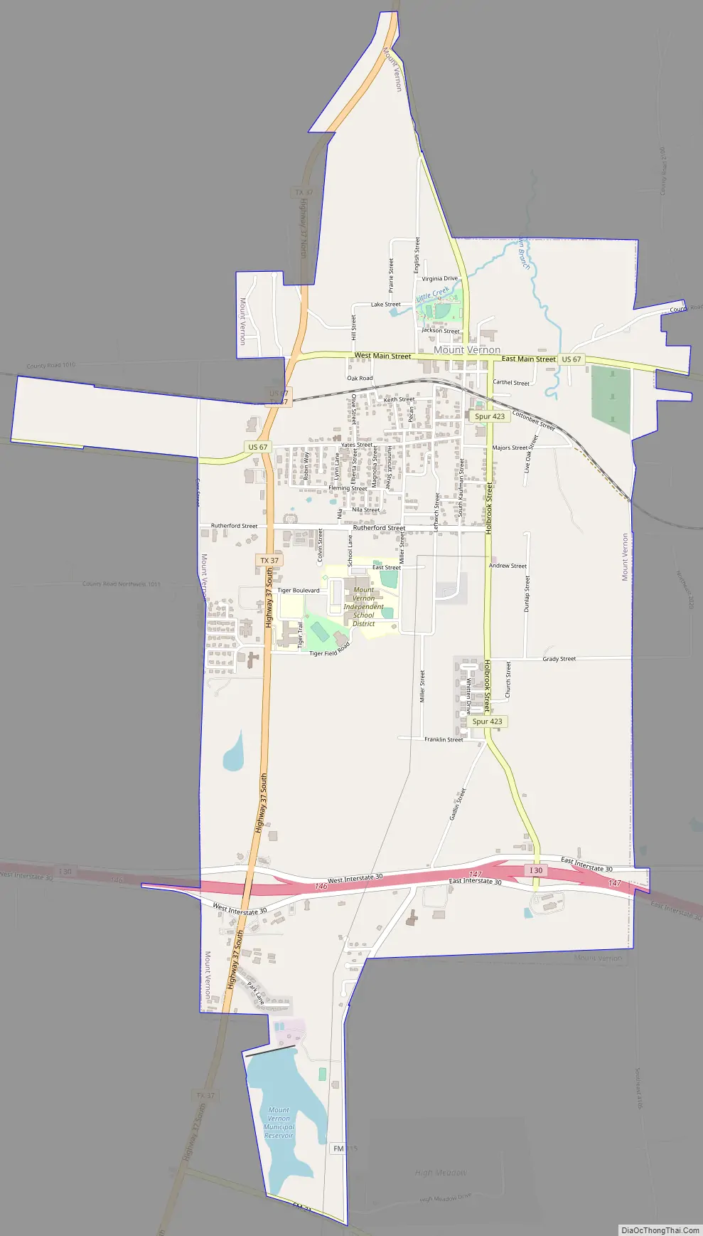
Mount Vernon Road Map
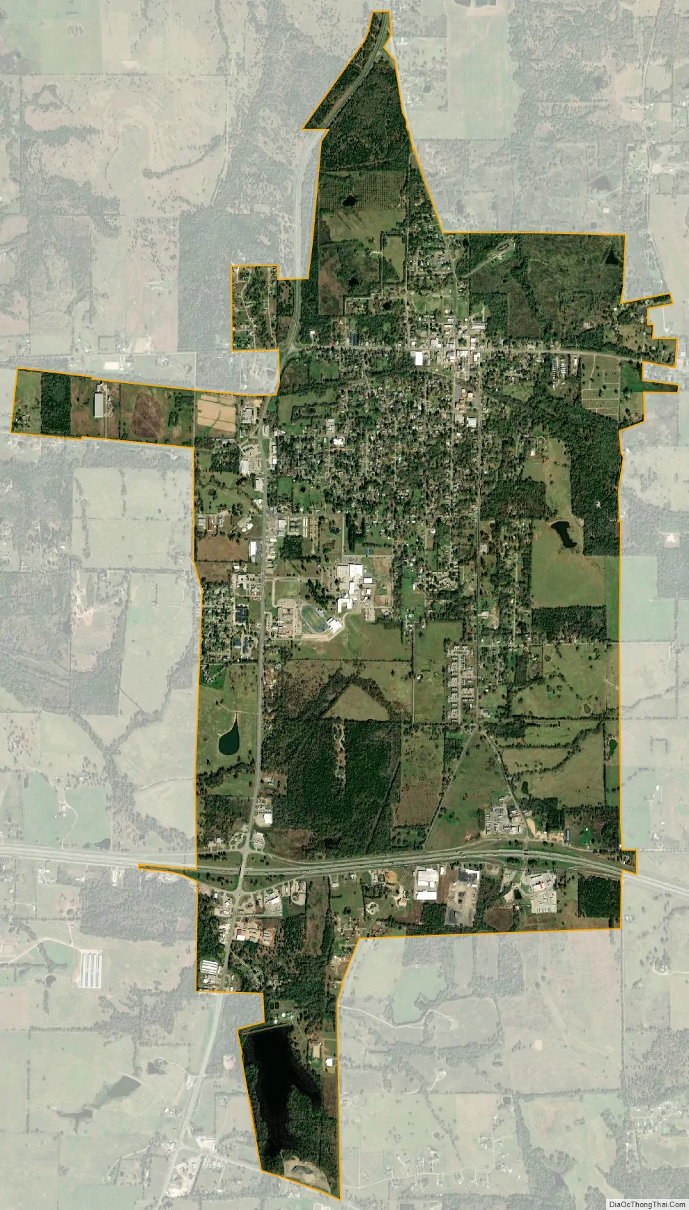
Mount Vernon city Satellite Map
Geography
Mount Vernon is located at the center of Franklin County at 33°10′55″N 95°13′27″W / 33.18194°N 95.22417°W / 33.18194; -95.22417 (33.181890, −95.224147). U.S. Route 67 passes through the north side of town as Main Street, leading east 16 miles (26 km) to Mount Pleasant and west 23 miles (37 km) to Sulphur Springs. Texas State Highway 37 passes through the west side of town, leading north 20 miles (32 km) to Bogata and south 17 miles (27 km) to Winnsboro. Interstate 30 passes through the southern end of town, with access from Exit 146 (Highway 37) and Exit 147. I-30 leads east 78 miles (126 km) to Texarkana and west 101 miles (163 km) to Dallas.
According to the United States Census Bureau, Mount Vernon has a total area of 3.69 square miles (9.55 km), of which 3.67 square miles (9.51 km) is land and 0.02 square miles (0.04 km), or 0.38%, is water.
Climate
See also
Map of Texas State and its subdivision:- Anderson
- Andrews
- Angelina
- Aransas
- Archer
- Armstrong
- Atascosa
- Austin
- Bailey
- Bandera
- Bastrop
- Baylor
- Bee
- Bell
- Bexar
- Blanco
- Borden
- Bosque
- Bowie
- Brazoria
- Brazos
- Brewster
- Briscoe
- Brooks
- Brown
- Burleson
- Burnet
- Caldwell
- Calhoun
- Callahan
- Cameron
- Camp
- Carson
- Cass
- Castro
- Chambers
- Cherokee
- Childress
- Clay
- Cochran
- Coke
- Coleman
- Collin
- Collingsworth
- Colorado
- Comal
- Comanche
- Concho
- Cooke
- Coryell
- Cottle
- Crane
- Crockett
- Crosby
- Culberson
- Dallam
- Dallas
- Dawson
- Deaf Smith
- Delta
- Denton
- Dewitt
- Dickens
- Dimmit
- Donley
- Duval
- Eastland
- Ector
- Edwards
- El Paso
- Ellis
- Erath
- Falls
- Fannin
- Fayette
- Fisher
- Floyd
- Foard
- Fort Bend
- Franklin
- Freestone
- Frio
- Gaines
- Galveston
- Garza
- Gillespie
- Glasscock
- Goliad
- Gonzales
- Gray
- Grayson
- Gregg
- Grimes
- Guadalupe
- Hale
- Hall
- Hamilton
- Hansford
- Hardeman
- Hardin
- Harris
- Harrison
- Hartley
- Haskell
- Hays
- Hemphill
- Henderson
- Hidalgo
- Hill
- Hockley
- Hood
- Hopkins
- Houston
- Howard
- Hudspeth
- Hunt
- Hutchinson
- Irion
- Jack
- Jackson
- Jasper
- Jeff Davis
- Jefferson
- Jim Hogg
- Jim Wells
- Johnson
- Jones
- Karnes
- Kaufman
- Kendall
- Kenedy
- Kent
- Kerr
- Kimble
- King
- Kinney
- Kleberg
- Knox
- La Salle
- Lamar
- Lamb
- Lampasas
- Lavaca
- Lee
- Leon
- Liberty
- Limestone
- Lipscomb
- Live Oak
- Llano
- Loving
- Lubbock
- Lynn
- Madison
- Marion
- Martin
- Mason
- Matagorda
- Maverick
- McCulloch
- McLennan
- McMullen
- Medina
- Menard
- Midland
- Milam
- Mills
- Mitchell
- Montague
- Montgomery
- Moore
- Morris
- Motley
- Nacogdoches
- Navarro
- Newton
- Nolan
- Nueces
- Ochiltree
- Oldham
- Orange
- Palo Pinto
- Panola
- Parker
- Parmer
- Pecos
- Polk
- Potter
- Presidio
- Rains
- Randall
- Reagan
- Real
- Red River
- Reeves
- Refugio
- Roberts
- Robertson
- Rockwall
- Runnels
- Rusk
- Sabine
- San Augustine
- San Jacinto
- San Patricio
- San Saba
- Schleicher
- Scurry
- Shackelford
- Shelby
- Sherman
- Smith
- Somervell
- Starr
- Stephens
- Sterling
- Stonewall
- Sutton
- Swisher
- Tarrant
- Taylor
- Terrell
- Terry
- Throckmorton
- Titus
- Tom Green
- Travis
- Trinity
- Tyler
- Upshur
- Upton
- Uvalde
- Val Verde
- Van Zandt
- Victoria
- Walker
- Waller
- Ward
- Washington
- Webb
- Wharton
- Wheeler
- Wichita
- Wilbarger
- Willacy
- Williamson
- Wilson
- Winkler
- Wise
- Wood
- Yoakum
- Young
- Zapata
- Zavala
- Alabama
- Alaska
- Arizona
- Arkansas
- California
- Colorado
- Connecticut
- Delaware
- District of Columbia
- Florida
- Georgia
- Hawaii
- Idaho
- Illinois
- Indiana
- Iowa
- Kansas
- Kentucky
- Louisiana
- Maine
- Maryland
- Massachusetts
- Michigan
- Minnesota
- Mississippi
- Missouri
- Montana
- Nebraska
- Nevada
- New Hampshire
- New Jersey
- New Mexico
- New York
- North Carolina
- North Dakota
- Ohio
- Oklahoma
- Oregon
- Pennsylvania
- Rhode Island
- South Carolina
- South Dakota
- Tennessee
- Texas
- Utah
- Vermont
- Virginia
- Washington
- West Virginia
- Wisconsin
- Wyoming