Needville is a city in Fort Bend County, Texas, United States. It is within the Houston–Sugar Land metropolitan area. The population was 3,089 at the 2020 census.
| Name: | Needville city |
|---|---|
| LSAD Code: | 25 |
| LSAD Description: | city (suffix) |
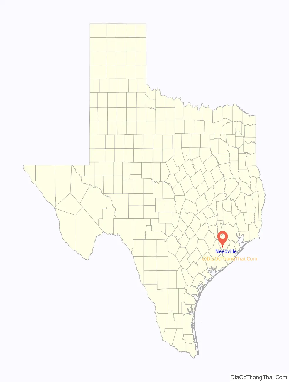
| State: | Texas |
| County: | Fort Bend County |
| Elevation: | 89 ft (27 m) |
| Total Area: | 2.01 sq mi (5.21 km²) |
| Land Area: | 2.01 sq mi (5.20 km²) |
| Water Area: | 0.01 sq mi (0.01 km²) |
| Total Population: | 3,089 |
| Population Density: | 1,545.32/sq mi (596.67/km²) |
| ZIP code: | 77461 |
| Area code: | 979 |
| FIPS code: | 4850628 |
| GNISfeature ID: | 1342402 |
| Website: | cityofneedville.com |
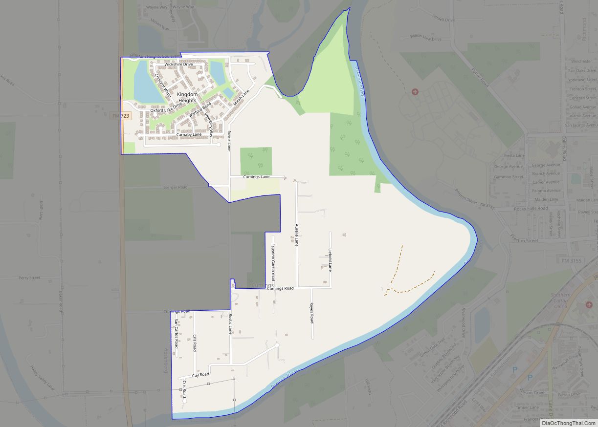
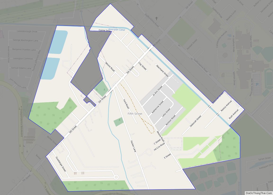
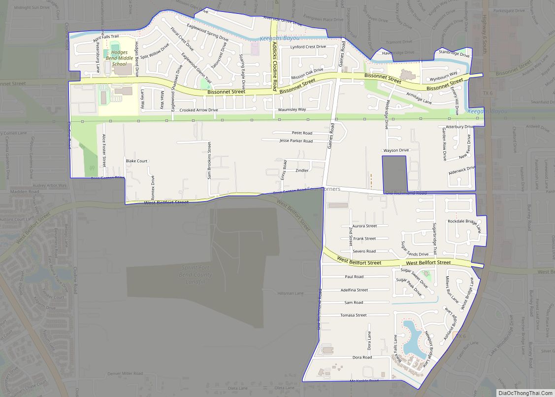
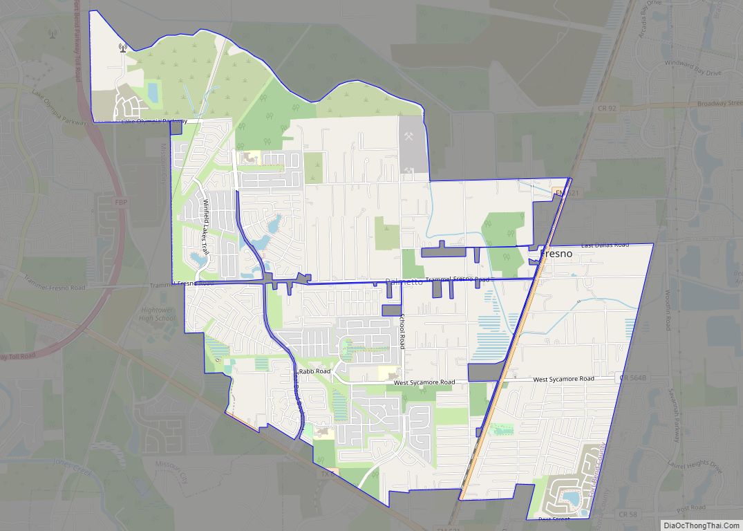
Online Interactive Map
Click on ![]() to view map in "full screen" mode.
to view map in "full screen" mode.
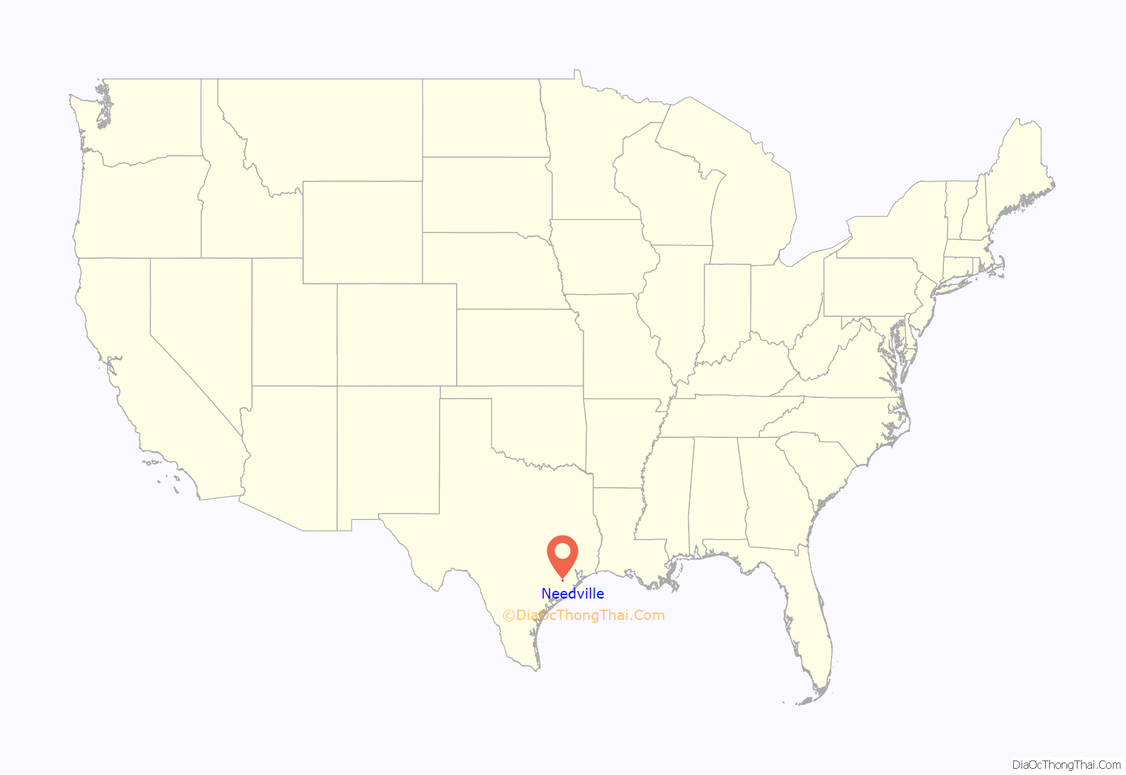
Needville location map. Where is Needville city?
History
August Schendel founded the town of Schendelville in 1891 that contained his house, a store and a cotton gin. In 1894, he applied for a post office using the name “Needmore” as a joke, since they always needed more of everything. Due to Needmore, Texas already existing, the post office amended the name to “Needville”.
By 1898, Schendel had officially platted a town and begun selling lots. A school had been constructed in 1897. By 1903, Needville had a school for white children with one teacher and 97 pupils, and one school for black children with one teacher and 45 pupils. The Round Hall building had been built about 1910 for dances and other social activities, and remained in this service until the 1950s.
Needville had three general stores, two cotton gins, a movie theater, and a population of 100 in 1914. Telephone service arrived in 1916. In 1918, the Needville State Bank opened and the Galveston, Harrisburg and San Antonio Railway built a line through the town. In 1920, Needville reported having a population of 500. It also reported having 12 general stores, four churches, four gins, and an electric power generation plant.
From 1927 through 1931, the Fort Bend county fair was held in Needville. It was then discontinued because of the Great Depression, which caused the fair to run heavily into debt. Natural gas was piped into town in 1929. FM 36 was completed in 1932, allowing all-weather access to Needville. Thereafter, a local school bus transported high school students to schools in Richmond and Rosenberg. Needville formed its own Independent School District (I.S.D.) in 1946 and opened its own high school in 1948. Needville I.S.D. opened a new elementary school in 1960. Integration of black and white schools was completed in 1966.
Needville historical marker
Needville Public Cemetery
St. Michael’s Catholic Church
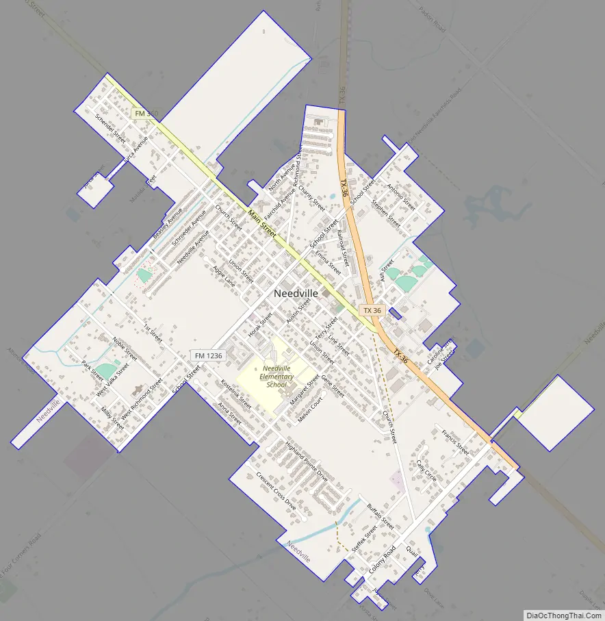
Needville Road Map
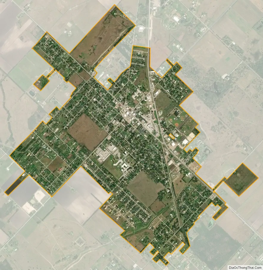
Needville city Satellite Map
Geography
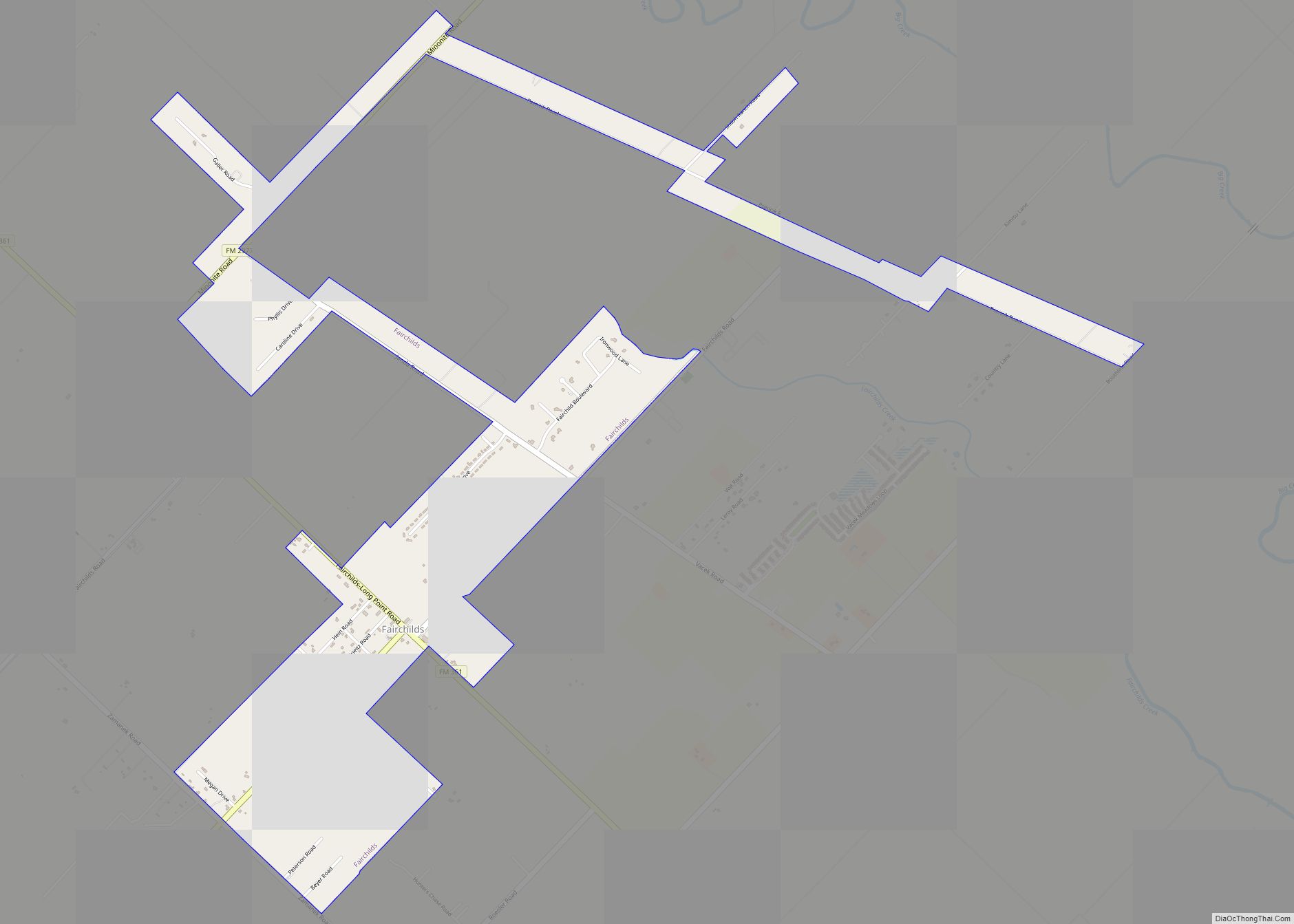
Needville is located in southern Fort Bend County at 29°23′54″N 95°50′24″W / 29.398232°N 95.839880°W / 29.398232; -95.839880 (29.398232, –95.839880). Texas State Highway 36 passes through the city, leading north 11 miles (18 km) to Rosenberg and southeast 21 miles (34 km) to West Columbia. Downtown Houston is 41 miles (66 km) to the northeast. Farm to Market Road 360 starts at SH 36 and heads northwest to Beasley, while Farm to Market Road 1236 goes southwest then southeast. Needville-Fairchilds Road connects with the community of Fairchilds to the northeast.
According to the United States Census Bureau, the city of Needville has a total area of 1.72 square miles (4.46 km), all of it land.
Map of Needville
FM 360 just north of Hwy 36
End of FM 1236 at Hwy 36
See also
Map of Texas State and its subdivision:- Anderson
- Andrews
- Angelina
- Aransas
- Archer
- Armstrong
- Atascosa
- Austin
- Bailey
- Bandera
- Bastrop
- Baylor
- Bee
- Bell
- Bexar
- Blanco
- Borden
- Bosque
- Bowie
- Brazoria
- Brazos
- Brewster
- Briscoe
- Brooks
- Brown
- Burleson
- Burnet
- Caldwell
- Calhoun
- Callahan
- Cameron
- Camp
- Carson
- Cass
- Castro
- Chambers
- Cherokee
- Childress
- Clay
- Cochran
- Coke
- Coleman
- Collin
- Collingsworth
- Colorado
- Comal
- Comanche
- Concho
- Cooke
- Coryell
- Cottle
- Crane
- Crockett
- Crosby
- Culberson
- Dallam
- Dallas
- Dawson
- Deaf Smith
- Delta
- Denton
- Dewitt
- Dickens
- Dimmit
- Donley
- Duval
- Eastland
- Ector
- Edwards
- El Paso
- Ellis
- Erath
- Falls
- Fannin
- Fayette
- Fisher
- Floyd
- Foard
- Fort Bend
- Franklin
- Freestone
- Frio
- Gaines
- Galveston
- Garza
- Gillespie
- Glasscock
- Goliad
- Gonzales
- Gray
- Grayson
- Gregg
- Grimes
- Guadalupe
- Hale
- Hall
- Hamilton
- Hansford
- Hardeman
- Hardin
- Harris
- Harrison
- Hartley
- Haskell
- Hays
- Hemphill
- Henderson
- Hidalgo
- Hill
- Hockley
- Hood
- Hopkins
- Houston
- Howard
- Hudspeth
- Hunt
- Hutchinson
- Irion
- Jack
- Jackson
- Jasper
- Jeff Davis
- Jefferson
- Jim Hogg
- Jim Wells
- Johnson
- Jones
- Karnes
- Kaufman
- Kendall
- Kenedy
- Kent
- Kerr
- Kimble
- King
- Kinney
- Kleberg
- Knox
- La Salle
- Lamar
- Lamb
- Lampasas
- Lavaca
- Lee
- Leon
- Liberty
- Limestone
- Lipscomb
- Live Oak
- Llano
- Loving
- Lubbock
- Lynn
- Madison
- Marion
- Martin
- Mason
- Matagorda
- Maverick
- McCulloch
- McLennan
- McMullen
- Medina
- Menard
- Midland
- Milam
- Mills
- Mitchell
- Montague
- Montgomery
- Moore
- Morris
- Motley
- Nacogdoches
- Navarro
- Newton
- Nolan
- Nueces
- Ochiltree
- Oldham
- Orange
- Palo Pinto
- Panola
- Parker
- Parmer
- Pecos
- Polk
- Potter
- Presidio
- Rains
- Randall
- Reagan
- Real
- Red River
- Reeves
- Refugio
- Roberts
- Robertson
- Rockwall
- Runnels
- Rusk
- Sabine
- San Augustine
- San Jacinto
- San Patricio
- San Saba
- Schleicher
- Scurry
- Shackelford
- Shelby
- Sherman
- Smith
- Somervell
- Starr
- Stephens
- Sterling
- Stonewall
- Sutton
- Swisher
- Tarrant
- Taylor
- Terrell
- Terry
- Throckmorton
- Titus
- Tom Green
- Travis
- Trinity
- Tyler
- Upshur
- Upton
- Uvalde
- Val Verde
- Van Zandt
- Victoria
- Walker
- Waller
- Ward
- Washington
- Webb
- Wharton
- Wheeler
- Wichita
- Wilbarger
- Willacy
- Williamson
- Wilson
- Winkler
- Wise
- Wood
- Yoakum
- Young
- Zapata
- Zavala
- Alabama
- Alaska
- Arizona
- Arkansas
- California
- Colorado
- Connecticut
- Delaware
- District of Columbia
- Florida
- Georgia
- Hawaii
- Idaho
- Illinois
- Indiana
- Iowa
- Kansas
- Kentucky
- Louisiana
- Maine
- Maryland
- Massachusetts
- Michigan
- Minnesota
- Mississippi
- Missouri
- Montana
- Nebraska
- Nevada
- New Hampshire
- New Jersey
- New Mexico
- New York
- North Carolina
- North Dakota
- Ohio
- Oklahoma
- Oregon
- Pennsylvania
- Rhode Island
- South Carolina
- South Dakota
- Tennessee
- Texas
- Utah
- Vermont
- Virginia
- Washington
- West Virginia
- Wisconsin
- Wyoming