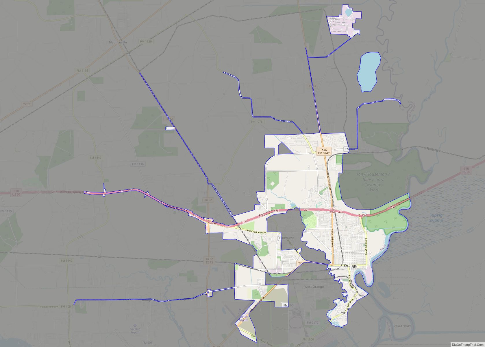
Orange is a city and the county seat of Orange County, Texas, United States. As of the 2020 census, the city population was 19,324. It is the easternmost city in Texas, located on the Sabine River at the border with Louisiana, and is 113 miles (182 km) from Houston. Orange is part of the Beaumont−Port Arthur Metropolitan Statistical Area. Founded in 1836, it is a deep-water port to the Gulf of Mexico.
| Name: | Orange city |
|---|---|
| LSAD Code: | 25 |
| LSAD Description: | city (suffix) |
| State: | Texas |
| County: | Orange County |
| Incorporated: | 1858 as Orange |
| Elevation: | 7 ft (2 m) |
| Total Area: | 24.18 sq mi (62.64 km²) |
| Land Area: | 22.08 sq mi (57.19 km²) |
| Water Area: | 2.10 sq mi (5.45 km²) |
| Total Population: | 19,324 |
| Population Density: | 820.52/sq mi (316.81/km²) |
| ZIP code: | 77630-77632 |
| Area code: | 409 |
| FIPS code: | 4854132 |
| GNISfeature ID: | 1375304 |
| Website: | OrangeTexas.net |
Online Interactive Map
Click on ![]() to view map in "full screen" mode.
to view map in "full screen" mode.
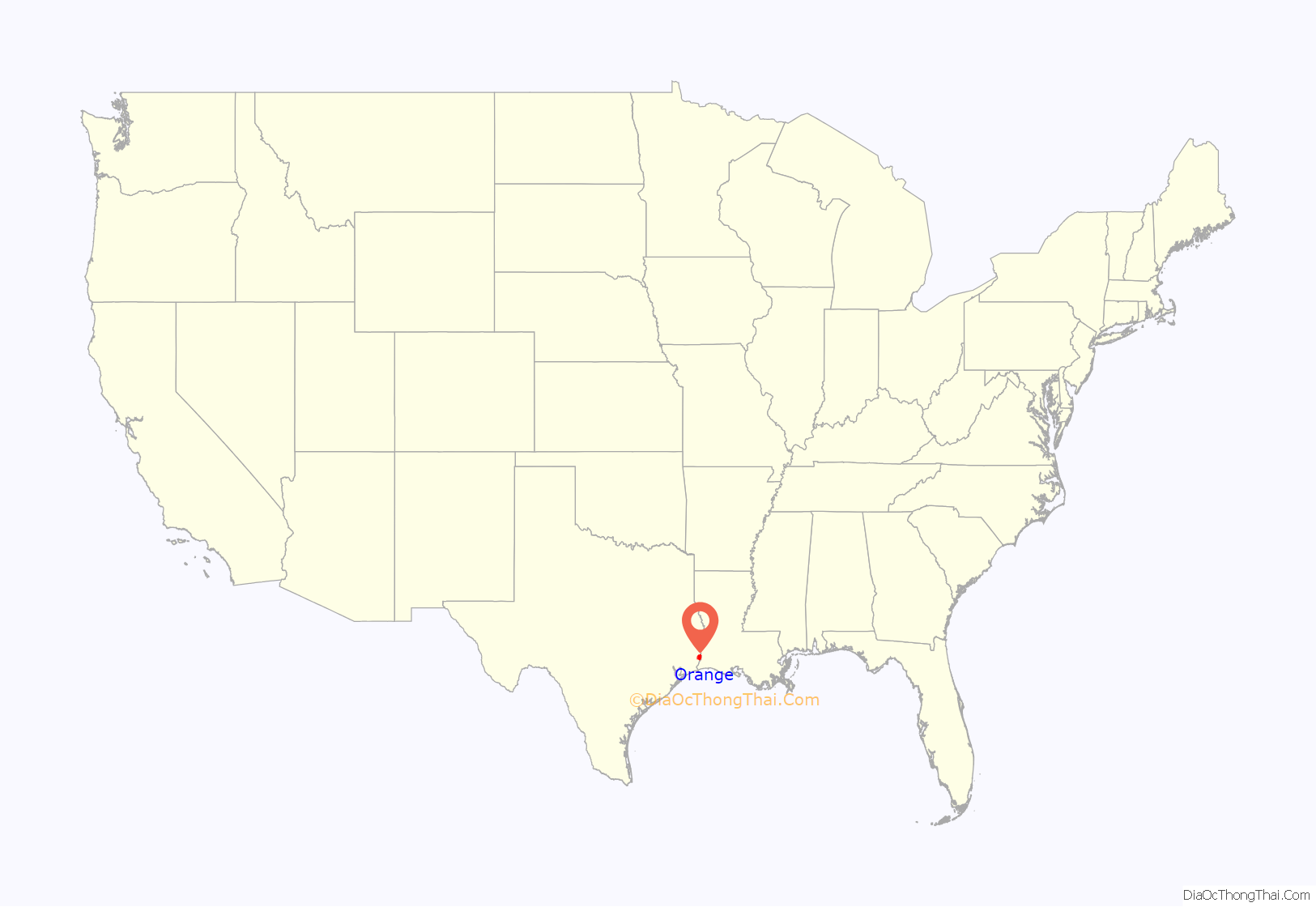
Orange location map. Where is Orange city?
History
This community was originally called Greens Bluff after a man named Resin Green, a Sabine River boatman, who arrived at this location sometime before 1830. A short time later, in 1840, the town was renamed Madison in honor of President James Madison. To resolve the frequent post-office confusion with another Texas community called Madisonville, the town was renamed “Orange” in 1858. The area experienced rapid growth in the late 19th century due to 17 sawmills within the city limits, making Orange the center of the Texas lumber industry. Orange’s growth led to the arrival of many immigrants in the late 19th century, including a moderately sized Jewish population by 1896. In 1898, the county built a courthouse in the city, which later burned down and was replaced by the Orange County Courthouse.
The harbor leading into the Port of Orange was dredged in 1914 to accommodate large ships. Ship building during World War I contributed to the growth in population and economy. The Great Depression, not surprisingly, affected the city negatively, and the local economy was not boosted again until World War II. A U.S. Naval Station was installed and additional housing was provided for thousands of defense workers and servicemen and their families. The population increased to just over 60,000 residents. USS Aulick was the first of 300 ships of various types built in Orange during the war.
After the war, the peace-time population decreased to about 35,000. At this time, the Navy Department announced it had selected Orange as one of eight locations where it would store reserve vessels. The area of the shipyards provided a favorable location, as the Sabine River furnished an abundant supply of fresh water to prevent saltwater corrosion. Also during this period, the local chemical plants expanded, which boosted the economy. The chemical industry continues today as a leading source of revenue to the area. The U.S. Naval Station became a Naval Inactive Ship Maintenance Facility in December 1975, retained 18.5 acres as a Navy and Marine Corps Reserve Center, but decommissioned the center completely in September 2008.
The Port of Orange became the home to the USS Orleck, one of the few naval ships remaining that was built at the Orange shipyards during World War II. The city of Orange sustained a direct hit from Hurricane Rita in 2005, causing damage to the ship. The city decreed that the ship be moved because, as it claimed, the city needed the dock space. Orleck was not allowed to return to the port due to politics (as the city council was wanting the ship cut up and sold for scrap and had a long-running feud with the Restoration Association), so a new location was sought, including one in Arkansas and Lake Charles, Louisiana, for a new home. On May 6, 2009, the Lake Charles city council voted in favor of an ordinance authorizing the city to enter into a “Cooperative Endeavor Agreement” with USS Orleck. On May 20, 2010, the ship was moved to Lake Charles. The grand opening was on April 10, 2011.
Hurricane Ike
Orange was heavily damaged by Hurricane Ike on September 13, 2008. Damage was widespread and severe across Orange County. The 22-foot (6.7 m) storm surge breached the city’s levees, caused catastrophic flooding and damage throughout the city. The storm surge traveled up the Neches River to also flood Rose City.
Orange received winds at hurricane force. Nearly the entire city of 19,000 people was flooded, from 6 in (15 cm) to 15 ft (4.5 m). The mayor of the city said about 375 people, of those who stayed behind during the storm, began to emerge, some needing food, water, and medical care. Many dead fish littered streets and properties. Three people were found dead in Orange County on September 29.
Hurricane Harvey
Orange once again fell victim to widespread flooding when Hurricane Harvey hit the city on August 29, 2017. The flood waters were mostly caused by the rising of the nearby Sabine River, which forms the border between Texas and Louisiana, and its many tributaries. The flooding from Harvey was due to extreme rainfall (50″ to 60″ in 48 hours) that fell after the storm’s landfall, leaving 65% of the county under water. The Sabine did not rise until three days after the storm, when the flood gates of the Toledo Bend Reservoir were opened.
Orange Road Map
Orange city Satellite Map
Geography
Orange is located at 30°6′33″N 93°45′33″W / 30.10917°N 93.75917°W / 30.10917; -93.75917 (30.109217, –93.759133).
According to the United States Census Bureau, the city has a total area of 20.8 square miles (54 km), of which 20.1 square miles (52 km) are land and 0.7 square miles (1.8 km) of it (3.32%) is covered by water.
See also
Map of Texas State and its subdivision:- Anderson
- Andrews
- Angelina
- Aransas
- Archer
- Armstrong
- Atascosa
- Austin
- Bailey
- Bandera
- Bastrop
- Baylor
- Bee
- Bell
- Bexar
- Blanco
- Borden
- Bosque
- Bowie
- Brazoria
- Brazos
- Brewster
- Briscoe
- Brooks
- Brown
- Burleson
- Burnet
- Caldwell
- Calhoun
- Callahan
- Cameron
- Camp
- Carson
- Cass
- Castro
- Chambers
- Cherokee
- Childress
- Clay
- Cochran
- Coke
- Coleman
- Collin
- Collingsworth
- Colorado
- Comal
- Comanche
- Concho
- Cooke
- Coryell
- Cottle
- Crane
- Crockett
- Crosby
- Culberson
- Dallam
- Dallas
- Dawson
- Deaf Smith
- Delta
- Denton
- Dewitt
- Dickens
- Dimmit
- Donley
- Duval
- Eastland
- Ector
- Edwards
- El Paso
- Ellis
- Erath
- Falls
- Fannin
- Fayette
- Fisher
- Floyd
- Foard
- Fort Bend
- Franklin
- Freestone
- Frio
- Gaines
- Galveston
- Garza
- Gillespie
- Glasscock
- Goliad
- Gonzales
- Gray
- Grayson
- Gregg
- Grimes
- Guadalupe
- Hale
- Hall
- Hamilton
- Hansford
- Hardeman
- Hardin
- Harris
- Harrison
- Hartley
- Haskell
- Hays
- Hemphill
- Henderson
- Hidalgo
- Hill
- Hockley
- Hood
- Hopkins
- Houston
- Howard
- Hudspeth
- Hunt
- Hutchinson
- Irion
- Jack
- Jackson
- Jasper
- Jeff Davis
- Jefferson
- Jim Hogg
- Jim Wells
- Johnson
- Jones
- Karnes
- Kaufman
- Kendall
- Kenedy
- Kent
- Kerr
- Kimble
- King
- Kinney
- Kleberg
- Knox
- La Salle
- Lamar
- Lamb
- Lampasas
- Lavaca
- Lee
- Leon
- Liberty
- Limestone
- Lipscomb
- Live Oak
- Llano
- Loving
- Lubbock
- Lynn
- Madison
- Marion
- Martin
- Mason
- Matagorda
- Maverick
- McCulloch
- McLennan
- McMullen
- Medina
- Menard
- Midland
- Milam
- Mills
- Mitchell
- Montague
- Montgomery
- Moore
- Morris
- Motley
- Nacogdoches
- Navarro
- Newton
- Nolan
- Nueces
- Ochiltree
- Oldham
- Orange
- Palo Pinto
- Panola
- Parker
- Parmer
- Pecos
- Polk
- Potter
- Presidio
- Rains
- Randall
- Reagan
- Real
- Red River
- Reeves
- Refugio
- Roberts
- Robertson
- Rockwall
- Runnels
- Rusk
- Sabine
- San Augustine
- San Jacinto
- San Patricio
- San Saba
- Schleicher
- Scurry
- Shackelford
- Shelby
- Sherman
- Smith
- Somervell
- Starr
- Stephens
- Sterling
- Stonewall
- Sutton
- Swisher
- Tarrant
- Taylor
- Terrell
- Terry
- Throckmorton
- Titus
- Tom Green
- Travis
- Trinity
- Tyler
- Upshur
- Upton
- Uvalde
- Val Verde
- Van Zandt
- Victoria
- Walker
- Waller
- Ward
- Washington
- Webb
- Wharton
- Wheeler
- Wichita
- Wilbarger
- Willacy
- Williamson
- Wilson
- Winkler
- Wise
- Wood
- Yoakum
- Young
- Zapata
- Zavala
- Alabama
- Alaska
- Arizona
- Arkansas
- California
- Colorado
- Connecticut
- Delaware
- District of Columbia
- Florida
- Georgia
- Hawaii
- Idaho
- Illinois
- Indiana
- Iowa
- Kansas
- Kentucky
- Louisiana
- Maine
- Maryland
- Massachusetts
- Michigan
- Minnesota
- Mississippi
- Missouri
- Montana
- Nebraska
- Nevada
- New Hampshire
- New Jersey
- New Mexico
- New York
- North Carolina
- North Dakota
- Ohio
- Oklahoma
- Oregon
- Pennsylvania
- Rhode Island
- South Carolina
- South Dakota
- Tennessee
- Texas
- Utah
- Vermont
- Virginia
- Washington
- West Virginia
- Wisconsin
- Wyoming
