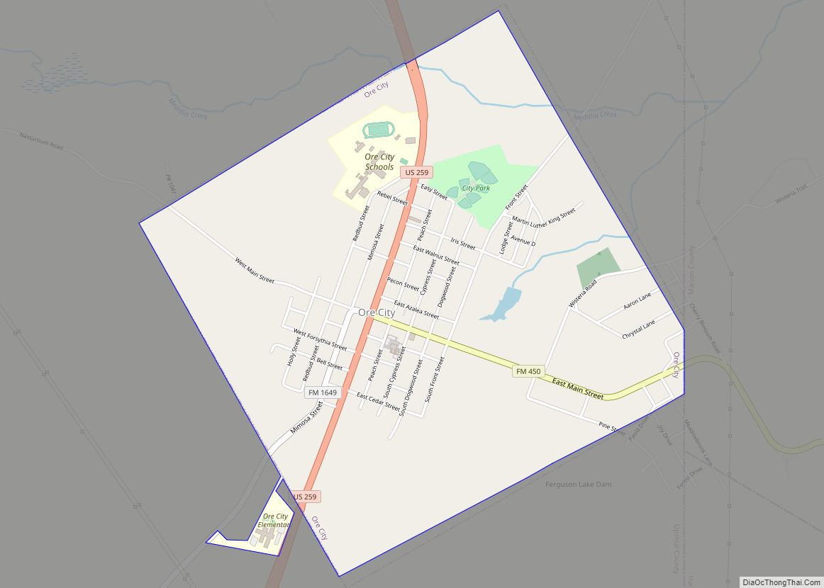
Ore City is a city in Upshur County, Texas, United States. The population was 1,108 at the 2020 census.
| Name: | Ore City city |
|---|---|
| LSAD Code: | 25 |
| LSAD Description: | city (suffix) |
| State: | Texas |
| County: | Upshur County |
| Elevation: | 328 ft (100 m) |
| Total Area: | 2.18 sq mi (5.65 km²) |
| Land Area: | 2.16 sq mi (5.59 km²) |
| Water Area: | 0.02 sq mi (0.06 km²) |
| Total Population: | 1,108 |
| Population Density: | 568.52/sq mi (219.56/km²) |
| ZIP code: | 75683 |
| Area code: | 903 |
| FIPS code: | 4854216 |
| GNISfeature ID: | 1343313 |
Online Interactive Map
Click on ![]() to view map in "full screen" mode.
to view map in "full screen" mode.
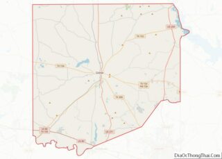
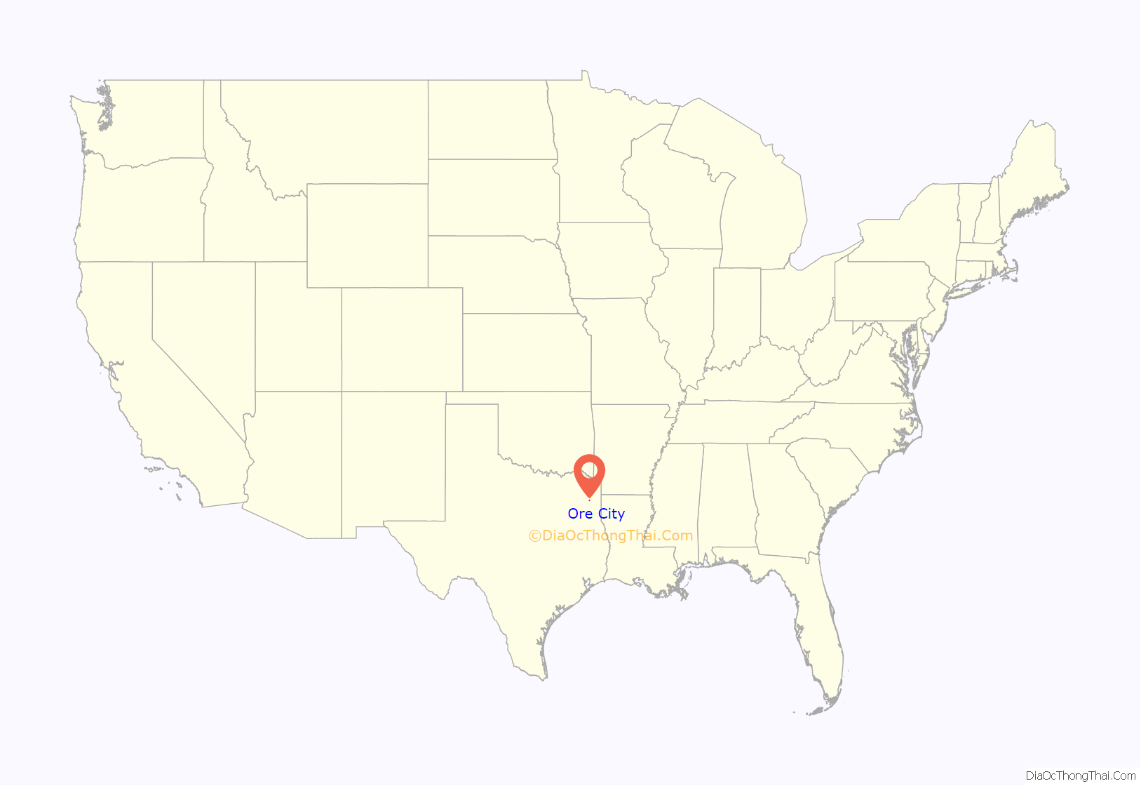
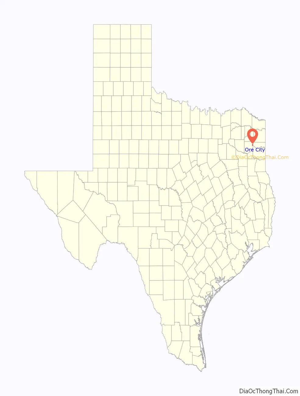
Ore City location map. Where is Ore City city?
History
Originally part of the William Murray League, the area was first settled in the early 1850s by a group from Haywood County, Tennessee. They immediately started The Murray League Methodist Episcopal Church, South as well as the Murray League Institute. After the Civil War, rich iron ore deposits were discovered in the area and ore was mined sporadically from the 1860s through 1900.
Around 1910, a commercial company led by Colonel L.P. Featherstone was formed to mine ore in the area. He persuaded the Santa Fe line to finance a rail link with Port Bolivar. Land for a new city was purchased and platted into streets and lots around 1911. The town was given the name Ore City and a post office was established soon after. By 1914, 30 miles of the line known as the Port Bolivar Iron Ore Railway had been built, connecting Ore City with Longview. The newly founded community had an estimated population of 400. Further construction on the railroad line was halted by the outbreak of World War I. Colonel Featherstone’s company went into bankruptcy and the rail line was abandoned in 1927. Ore City survived and by 1936, around 500 people lived in the community. During World War II, the federal government built a steel plant 10 miles north of Ore City to mine the same ore that previously brought Colonel Featherstone to the area. The plant was completed just as the war ended and was sold to a Texas group as surplus property. They operated it as the Lone Star Steel Company.
Ore City was incorporated in the early 1950s. At that time, the number of residents had fallen to 385. Growth resumed in the mid-1960s and by 1976, Ore City had a population of 900, with 34 businesses operating in the city. More than 1,000 people lived in the city by 2000.
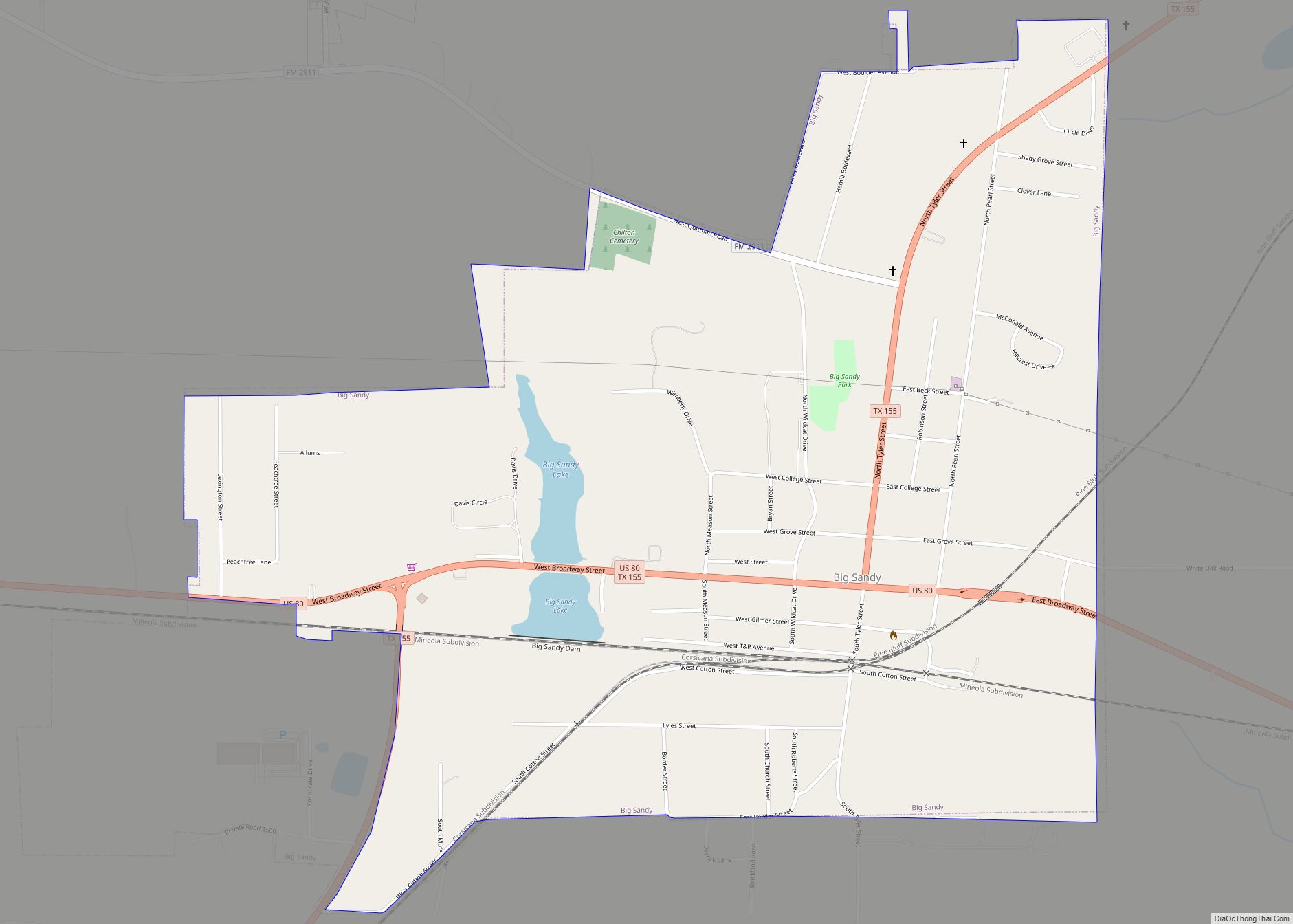
Ore City Road Map
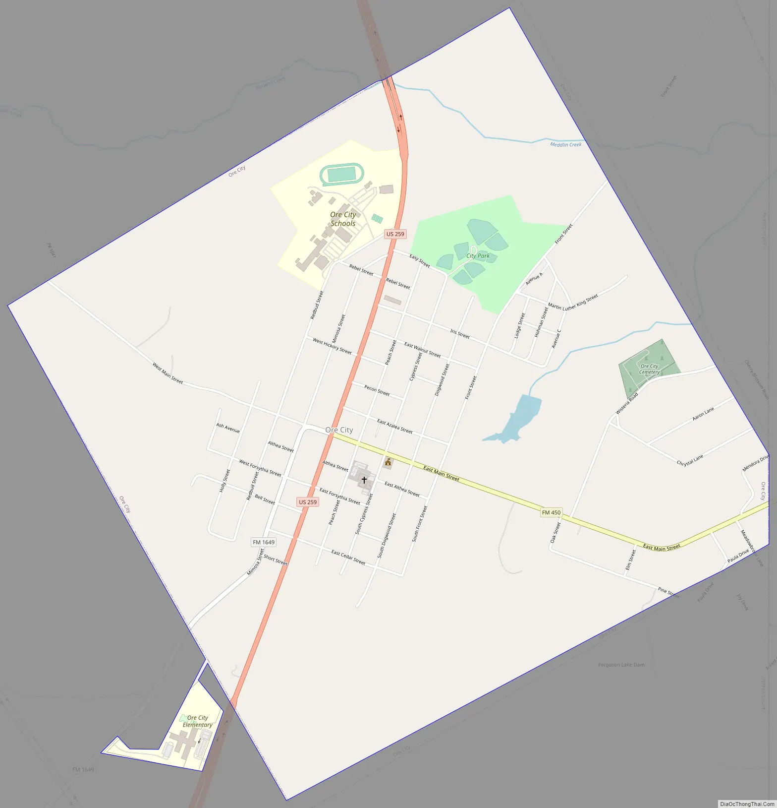
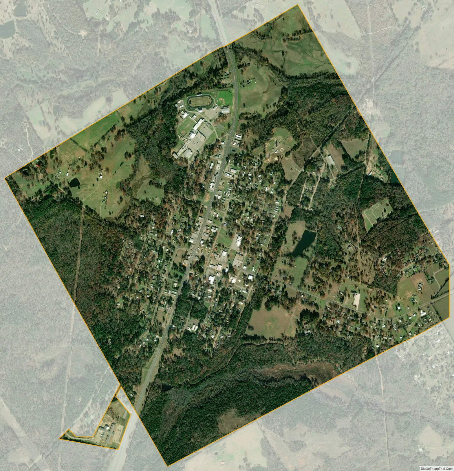
Ore City city Satellite Map
Geography
Ore City is located at 32°48′3″N 94°43′3″W / 32.80083°N 94.71750°W / 32.80083; -94.71750 (32.800770, –94.717446). It is situated about 13 miles northeast of Gilmer at the junction of U.S. Highway 259 and FM 450.
According to the United States Census Bureau, the city has a total area of 2.3 mi (5.9 km), of which 2.3 mi (5.9 km) of it are land and 0.04 mi (0.1 km) of it (0.88%) is covered by water.
See also
Map of Texas State and its subdivision:- Anderson
- Andrews
- Angelina
- Aransas
- Archer
- Armstrong
- Atascosa
- Austin
- Bailey
- Bandera
- Bastrop
- Baylor
- Bee
- Bell
- Bexar
- Blanco
- Borden
- Bosque
- Bowie
- Brazoria
- Brazos
- Brewster
- Briscoe
- Brooks
- Brown
- Burleson
- Burnet
- Caldwell
- Calhoun
- Callahan
- Cameron
- Camp
- Carson
- Cass
- Castro
- Chambers
- Cherokee
- Childress
- Clay
- Cochran
- Coke
- Coleman
- Collin
- Collingsworth
- Colorado
- Comal
- Comanche
- Concho
- Cooke
- Coryell
- Cottle
- Crane
- Crockett
- Crosby
- Culberson
- Dallam
- Dallas
- Dawson
- Deaf Smith
- Delta
- Denton
- Dewitt
- Dickens
- Dimmit
- Donley
- Duval
- Eastland
- Ector
- Edwards
- El Paso
- Ellis
- Erath
- Falls
- Fannin
- Fayette
- Fisher
- Floyd
- Foard
- Fort Bend
- Franklin
- Freestone
- Frio
- Gaines
- Galveston
- Garza
- Gillespie
- Glasscock
- Goliad
- Gonzales
- Gray
- Grayson
- Gregg
- Grimes
- Guadalupe
- Hale
- Hall
- Hamilton
- Hansford
- Hardeman
- Hardin
- Harris
- Harrison
- Hartley
- Haskell
- Hays
- Hemphill
- Henderson
- Hidalgo
- Hill
- Hockley
- Hood
- Hopkins
- Houston
- Howard
- Hudspeth
- Hunt
- Hutchinson
- Irion
- Jack
- Jackson
- Jasper
- Jeff Davis
- Jefferson
- Jim Hogg
- Jim Wells
- Johnson
- Jones
- Karnes
- Kaufman
- Kendall
- Kenedy
- Kent
- Kerr
- Kimble
- King
- Kinney
- Kleberg
- Knox
- La Salle
- Lamar
- Lamb
- Lampasas
- Lavaca
- Lee
- Leon
- Liberty
- Limestone
- Lipscomb
- Live Oak
- Llano
- Loving
- Lubbock
- Lynn
- Madison
- Marion
- Martin
- Mason
- Matagorda
- Maverick
- McCulloch
- McLennan
- McMullen
- Medina
- Menard
- Midland
- Milam
- Mills
- Mitchell
- Montague
- Montgomery
- Moore
- Morris
- Motley
- Nacogdoches
- Navarro
- Newton
- Nolan
- Nueces
- Ochiltree
- Oldham
- Orange
- Palo Pinto
- Panola
- Parker
- Parmer
- Pecos
- Polk
- Potter
- Presidio
- Rains
- Randall
- Reagan
- Real
- Red River
- Reeves
- Refugio
- Roberts
- Robertson
- Rockwall
- Runnels
- Rusk
- Sabine
- San Augustine
- San Jacinto
- San Patricio
- San Saba
- Schleicher
- Scurry
- Shackelford
- Shelby
- Sherman
- Smith
- Somervell
- Starr
- Stephens
- Sterling
- Stonewall
- Sutton
- Swisher
- Tarrant
- Taylor
- Terrell
- Terry
- Throckmorton
- Titus
- Tom Green
- Travis
- Trinity
- Tyler
- Upshur
- Upton
- Uvalde
- Val Verde
- Van Zandt
- Victoria
- Walker
- Waller
- Ward
- Washington
- Webb
- Wharton
- Wheeler
- Wichita
- Wilbarger
- Willacy
- Williamson
- Wilson
- Winkler
- Wise
- Wood
- Yoakum
- Young
- Zapata
- Zavala
- Alabama
- Alaska
- Arizona
- Arkansas
- California
- Colorado
- Connecticut
- Delaware
- District of Columbia
- Florida
- Georgia
- Hawaii
- Idaho
- Illinois
- Indiana
- Iowa
- Kansas
- Kentucky
- Louisiana
- Maine
- Maryland
- Massachusetts
- Michigan
- Minnesota
- Mississippi
- Missouri
- Montana
- Nebraska
- Nevada
- New Hampshire
- New Jersey
- New Mexico
- New York
- North Carolina
- North Dakota
- Ohio
- Oklahoma
- Oregon
- Pennsylvania
- Rhode Island
- South Carolina
- South Dakota
- Tennessee
- Texas
- Utah
- Vermont
- Virginia
- Washington
- West Virginia
- Wisconsin
- Wyoming