Pasadena (/ˌpæsəˈdiːnə/) is a city in the U.S. state of Texas, within the Houston–The Woodlands–Sugar Land metropolitan area. As of the 2020 U.S. census, the city’s population was 151,950, making it the twentieth most populous city in the state of Texas, as well as the second-largest city in Harris County. The area was founded in 1893 by John H. Burnett of Galveston, who named the area after Pasadena, California, because of the perceived lush vegetation.
| Name: | Pasadena city |
|---|---|
| LSAD Code: | 25 |
| LSAD Description: | city (suffix) |
| State: | Texas |
| County: | Harris County |
| Founded: | 1893 |
| Incorporated: | December 22, 1923 and December 26, 1928 |
| Elevation: | 30 ft (9.1 m) |
| Land Area: | 43.68 sq mi (113.14 km²) |
| Water Area: | 1.06 sq mi (2.75 km²) |
| Population Density: | 3,462.00/sq mi (1,336.69/km²) |
| ZIP code: | 77501-77508, 77059 (Brookwood) 77586 (El Jardin) |
| Area code: | 713, 281, 346, and 832 |
| FIPS code: | 4856000 |
| GNISfeature ID: | 1343631 |
| Website: | www.pasadenatx.gov |
Online Interactive Map
Click on ![]() to view map in "full screen" mode.
to view map in "full screen" mode.
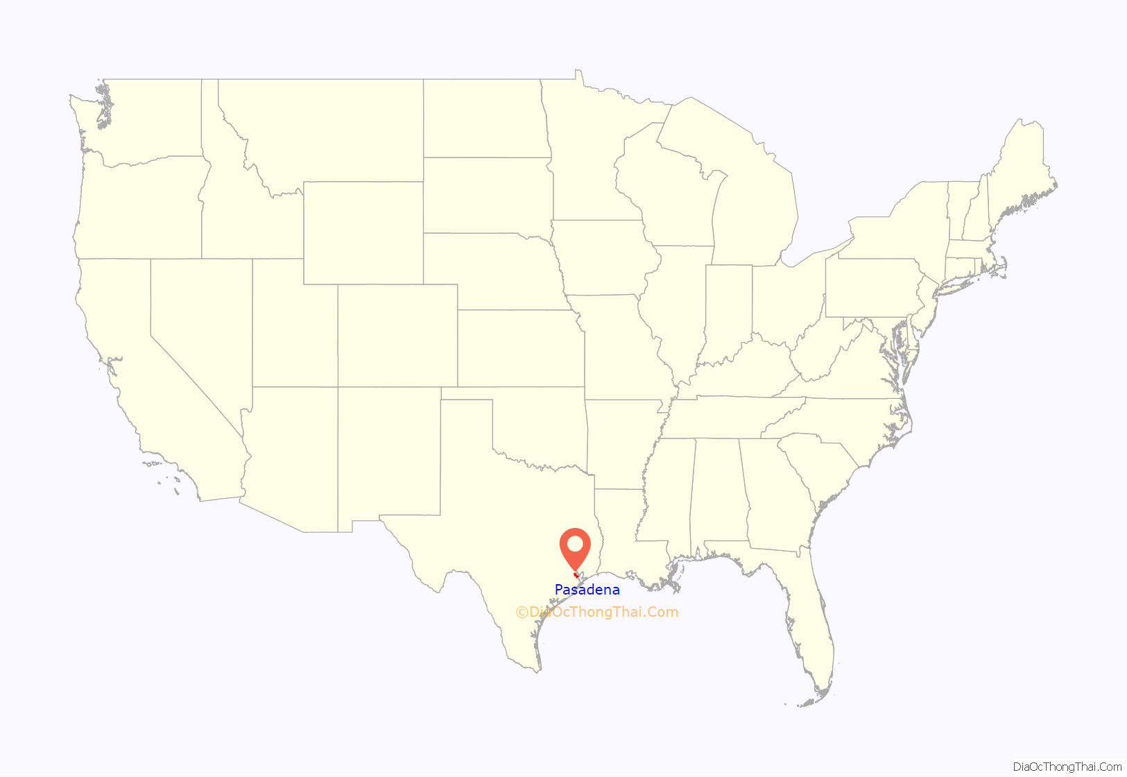
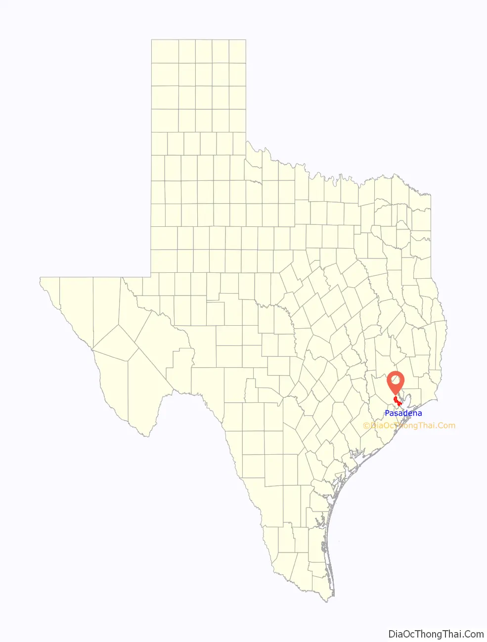
Pasadena location map. Where is Pasadena city?
History
Early history
Prior to European settlement the area around Galveston Bay was settled by the Karankawa and Atakapan tribes, particularly the Akokisa, who lived throughout the Gulf coast region. Spanish explorers such as the Rivas-Iriarte expedition and José Antonio de Evia charted the bay and gave it its name. The pirate Jean Lafitte established a short-lived kingdom based in Galveston in the early 19th century with bases and hide-outs around the bay and around Clear Lake. Lafitte was forced to leave in 1821 by the U.S. Navy.
Following its declaration of independence from Spain the new nation of Mexico moved to colonize its northern territory of Texas by offering land grants to settlers both from within Mexico and from the nearby United States. The colony established by Stephen F. Austin and the Galveston Bay and Texas Land Company of New York rapidly began a wave of settlement around the bay. Following a coup in the Mexican government by General Antonio Lopez de Santa Anna, Texas revolted against Mexican rule in 1835. After several battles and skirmishes the final battle of the Texas Revolution took place near modern Deer Park & La Porte, Texas on April 21, 1836. While the main battlefield was located in the neighboring present-day city of La Porte, Texas. Because this was the last conflict that led to the Mexican surrender, La Porte and neighboring Deer Park have adopted the nickname “Birthplace of Texas“.
20th century
The 1900 hurricane that destroyed Galveston heavily damaged Pasadena, as well. The city received a population boost from some Galveston refugees who relocated to the mainland following the catastrophe. Donations by the newly created Red Cross, including millions of strawberry plants to Gulf Coast farmers, helped revive the community. This and the subsequent establishment of a major strawberry farm in the area by Texaco founder Joseph S. Cullinan made Pasadena a major fruit producer for many years afterward.Rice farmers from Japan settled in the community further diversifying its agriculture. Champion Coated Paper Company of Ohio opened a paper mill in 1973.
In 1901 the Texas Oil Boom began with the gusher at Spindletop. The discovery of the oil field at Goose Creek led to increasing petroleum exploration around Galveston Bay. By 1917–1920 refinery operations had appeared in Pasadena and continued to expand thereafter for example the Pasadena Refining System… The world wars gradually brought further industrial development, with Pasadena’s growth rate surpassing even neighboring Houston.
Pasadena voted to incorporate in 1923, but residents decided to cancel the incorporation one year later. Pasadena incorporated in 1928. Because of the 1928 incorporation, Houston did not incorporate Pasadena’s territory into its city limits, while Houston annexed surrounding areas that were unincorporated.
Texas State Historical Association</ref> These developments helped to diversify the town’s economy significantly. Eventually, the city gained the unofficial moniker Stinkadena by locals due to the pollution from its large industrial base.
Former Pasadena City Council member and State Representative Ray Barnhart described the city at the time as “a lovely community but politically corrupt.” Barnhart recalled that a half dozen Pasadena officials were indicted in the late 1950s and early 1960s for public corruption.
In 1965, Houston Post reporter Gene Goltz Received the Pulitzer Prize for his exposure of government corruption in Pasadena, Texas, which resulted in widespread reforms.
21st century
In the 21st century, Pasadena emerged as a mostly working-class suburb of Houston.
Tornadoes
On October 31, 2015, an EF2 tornado struck a warehouse within Pasadena city limits. Half of the warehouse was completely leveled with its roof completely mangled up. The tornado moved northeast into La Porte city limits and damaged approximately 30 homes.
On January 24, 2023, an EF3 tornado struck northwestern Pasadena. Multiple neighborhoods and apartment complexes were severely damaged by the tornado. No major casualties occurred with this tornado. The tornado would go on to affect Deer Park, and Baytown, Texas.
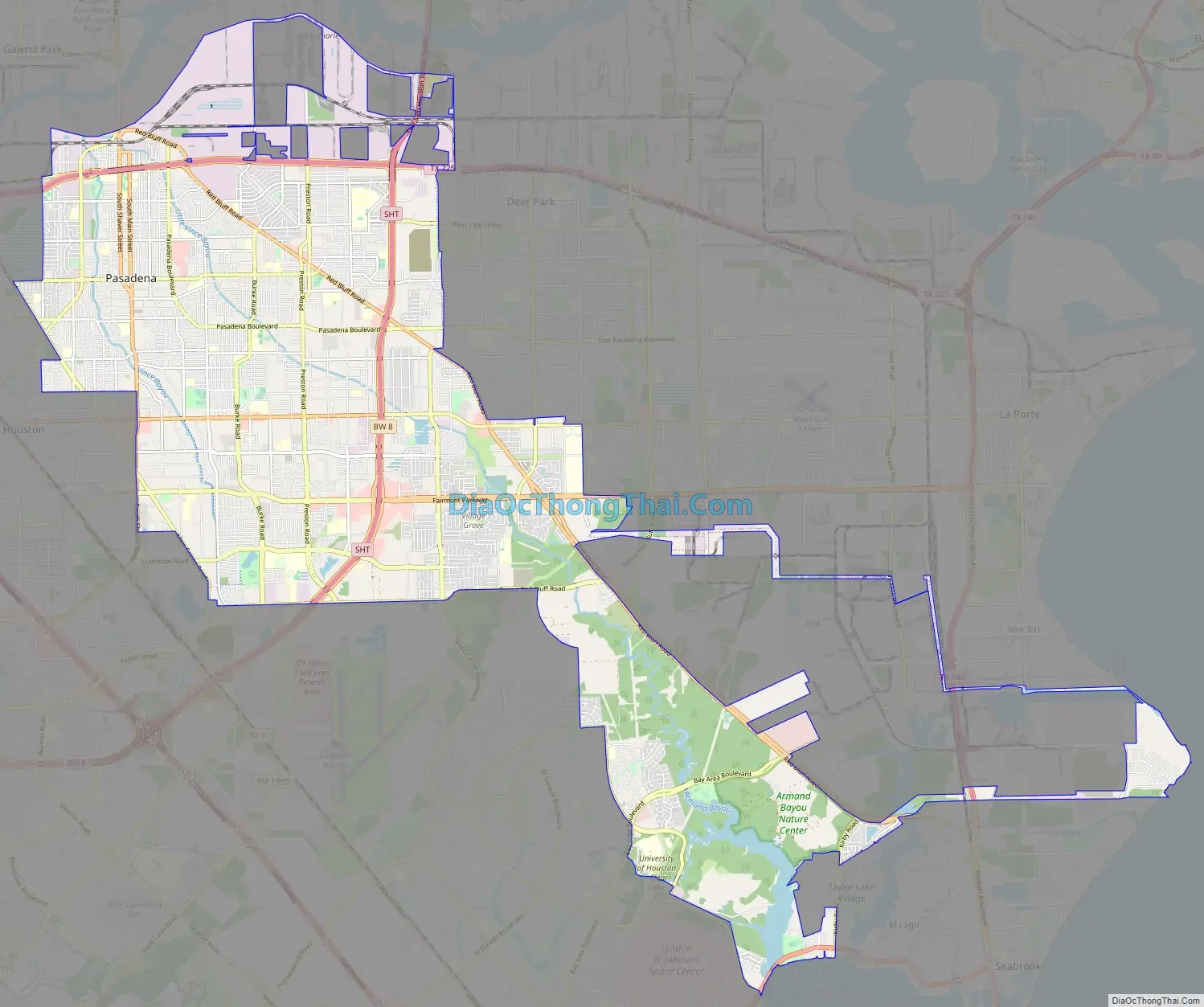
Pasadena Road Map
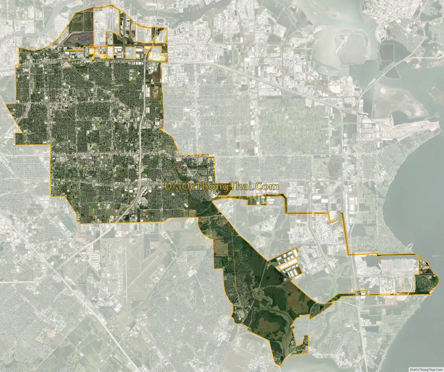
Pasadena city Satellite Map
Geography
According to the United States Census Bureau, the city has a total area of 44.5 square miles (115 km), of which 44.2 square miles (114 km) is land and 0.4 square miles (1.0 km) (0.81%) is water. The city is bordered by the Houston Ship Channel (Buffalo Bayou / San Jacinto River) to the north. The southeasternmost part of the city fronts Galveston Bay.
Climate
The climate in this area is characterized by hot, humid summers and generally mild to cool winters.
Neighborhoods
Neighborhoods in Pasadena include:
- Baywood Oaks
- Baywood Shadows
- Burke Meadows
- Burkeshire
- Country Meadows
- Deepwater
- Golden Acres
- Old Downtown
- Parkland Village
- Parkview Estates
- Parkview Manor
- Parkview South
- Pasadena River Oaks
- Red Bluff Terrace
- Turtle Creek
- Village Grove East
- Village Grove East Townhomes
- Village Grove
- Vista Villas
See also
Map of Texas State and its subdivision:- Anderson
- Andrews
- Angelina
- Aransas
- Archer
- Armstrong
- Atascosa
- Austin
- Bailey
- Bandera
- Bastrop
- Baylor
- Bee
- Bell
- Bexar
- Blanco
- Borden
- Bosque
- Bowie
- Brazoria
- Brazos
- Brewster
- Briscoe
- Brooks
- Brown
- Burleson
- Burnet
- Caldwell
- Calhoun
- Callahan
- Cameron
- Camp
- Carson
- Cass
- Castro
- Chambers
- Cherokee
- Childress
- Clay
- Cochran
- Coke
- Coleman
- Collin
- Collingsworth
- Colorado
- Comal
- Comanche
- Concho
- Cooke
- Coryell
- Cottle
- Crane
- Crockett
- Crosby
- Culberson
- Dallam
- Dallas
- Dawson
- Deaf Smith
- Delta
- Denton
- Dewitt
- Dickens
- Dimmit
- Donley
- Duval
- Eastland
- Ector
- Edwards
- El Paso
- Ellis
- Erath
- Falls
- Fannin
- Fayette
- Fisher
- Floyd
- Foard
- Fort Bend
- Franklin
- Freestone
- Frio
- Gaines
- Galveston
- Garza
- Gillespie
- Glasscock
- Goliad
- Gonzales
- Gray
- Grayson
- Gregg
- Grimes
- Guadalupe
- Hale
- Hall
- Hamilton
- Hansford
- Hardeman
- Hardin
- Harris
- Harrison
- Hartley
- Haskell
- Hays
- Hemphill
- Henderson
- Hidalgo
- Hill
- Hockley
- Hood
- Hopkins
- Houston
- Howard
- Hudspeth
- Hunt
- Hutchinson
- Irion
- Jack
- Jackson
- Jasper
- Jeff Davis
- Jefferson
- Jim Hogg
- Jim Wells
- Johnson
- Jones
- Karnes
- Kaufman
- Kendall
- Kenedy
- Kent
- Kerr
- Kimble
- King
- Kinney
- Kleberg
- Knox
- La Salle
- Lamar
- Lamb
- Lampasas
- Lavaca
- Lee
- Leon
- Liberty
- Limestone
- Lipscomb
- Live Oak
- Llano
- Loving
- Lubbock
- Lynn
- Madison
- Marion
- Martin
- Mason
- Matagorda
- Maverick
- McCulloch
- McLennan
- McMullen
- Medina
- Menard
- Midland
- Milam
- Mills
- Mitchell
- Montague
- Montgomery
- Moore
- Morris
- Motley
- Nacogdoches
- Navarro
- Newton
- Nolan
- Nueces
- Ochiltree
- Oldham
- Orange
- Palo Pinto
- Panola
- Parker
- Parmer
- Pecos
- Polk
- Potter
- Presidio
- Rains
- Randall
- Reagan
- Real
- Red River
- Reeves
- Refugio
- Roberts
- Robertson
- Rockwall
- Runnels
- Rusk
- Sabine
- San Augustine
- San Jacinto
- San Patricio
- San Saba
- Schleicher
- Scurry
- Shackelford
- Shelby
- Sherman
- Smith
- Somervell
- Starr
- Stephens
- Sterling
- Stonewall
- Sutton
- Swisher
- Tarrant
- Taylor
- Terrell
- Terry
- Throckmorton
- Titus
- Tom Green
- Travis
- Trinity
- Tyler
- Upshur
- Upton
- Uvalde
- Val Verde
- Van Zandt
- Victoria
- Walker
- Waller
- Ward
- Washington
- Webb
- Wharton
- Wheeler
- Wichita
- Wilbarger
- Willacy
- Williamson
- Wilson
- Winkler
- Wise
- Wood
- Yoakum
- Young
- Zapata
- Zavala
- Alabama
- Alaska
- Arizona
- Arkansas
- California
- Colorado
- Connecticut
- Delaware
- District of Columbia
- Florida
- Georgia
- Hawaii
- Idaho
- Illinois
- Indiana
- Iowa
- Kansas
- Kentucky
- Louisiana
- Maine
- Maryland
- Massachusetts
- Michigan
- Minnesota
- Mississippi
- Missouri
- Montana
- Nebraska
- Nevada
- New Hampshire
- New Jersey
- New Mexico
- New York
- North Carolina
- North Dakota
- Ohio
- Oklahoma
- Oregon
- Pennsylvania
- Rhode Island
- South Carolina
- South Dakota
- Tennessee
- Texas
- Utah
- Vermont
- Virginia
- Washington
- West Virginia
- Wisconsin
- Wyoming


