Quinlan is a rural city in the southern part of Hunt County, Texas, United States, within the Dallas–Fort Worth metropolitan area. As of the 2010 census, it had a population of 1,394. It is 5 miles (8 km) west of Lake Tawakoni.
| Name: | Quinlan city |
|---|---|
| LSAD Code: | 25 |
| LSAD Description: | city (suffix) |
| State: | Texas |
| County: | Hunt County |
| Elevation: | 512 ft (156 m) |
| Total Area: | 1.29 sq mi (3.35 km²) |
| Land Area: | 1.29 sq mi (3.35 km²) |
| Water Area: | 0.00 sq mi (0.00 km²) |
| Total Population: | 1,394 |
| Population Density: | 1,178.65/sq mi (455.15/km²) |
| ZIP code: | 75474 |
| Area code: | 903 |
| FIPS code: | 4860140 |
| GNISfeature ID: | 1344664 |
| Website: | www.cityofquinlan.net |
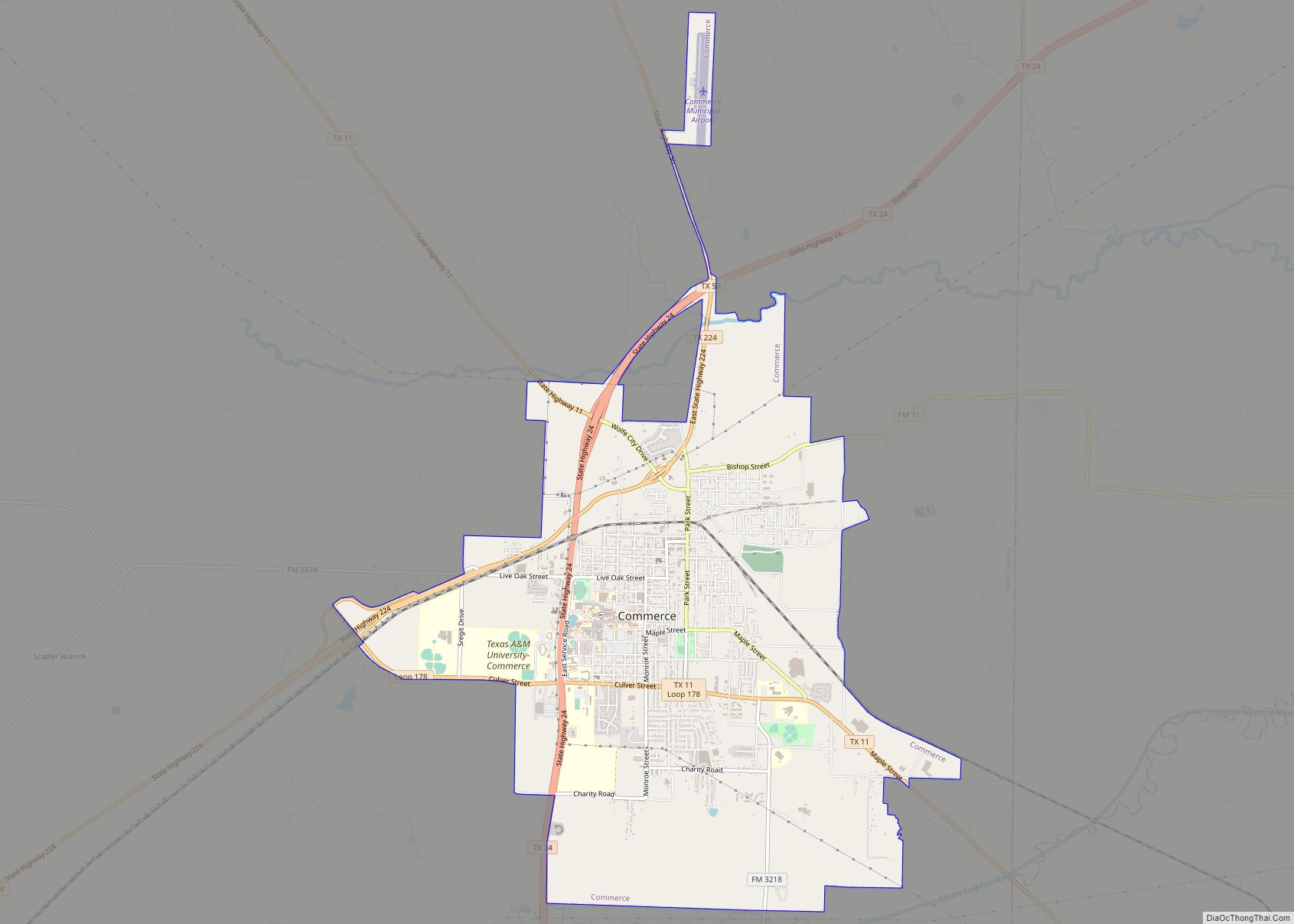
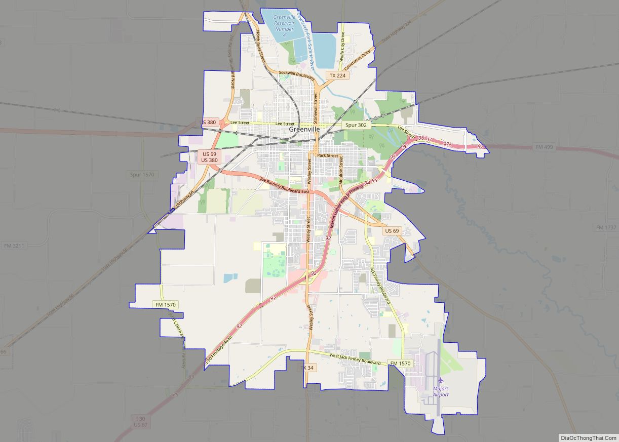
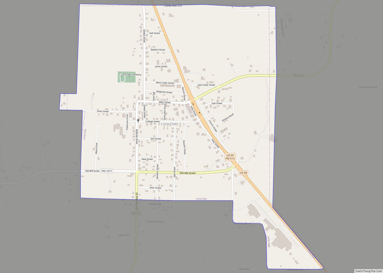
Online Interactive Map
Click on ![]() to view map in "full screen" mode.
to view map in "full screen" mode.
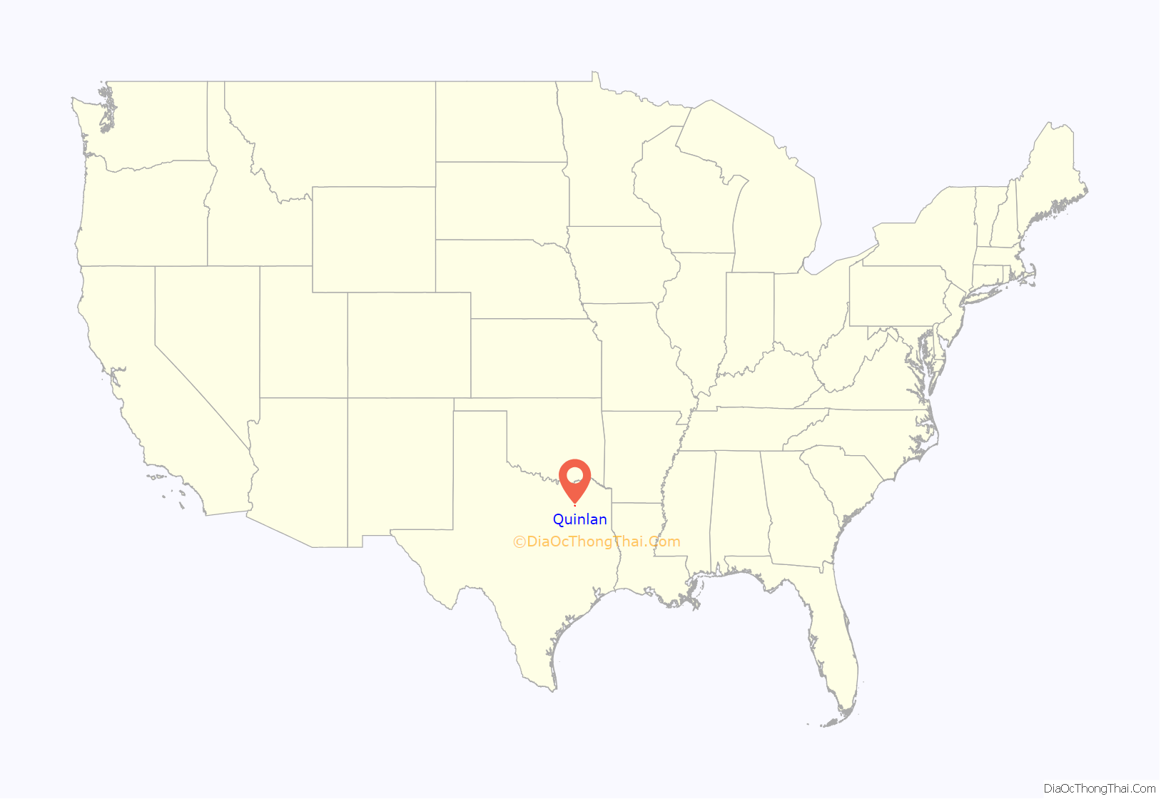
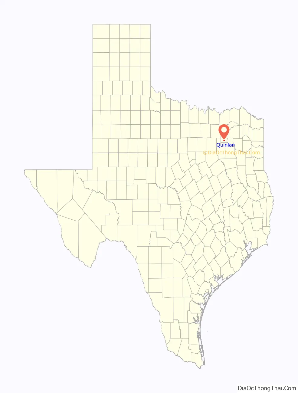
Quinlan location map. Where is Quinlan city?
History
The city of Quinlan began about 1892 as a stop on the Texas Midland Railroad, which was owned by famed bond investor Hetty Green, called by the contemporary press “The Witch of Wall Street”. The railroad was operated by her son, Edward H.R. Green. Texas Midland became a subsidiary of the Houston & Texas Central Railroad, and the city which built up around a depot constructed here between the towns of Roberts and Greenville was named Quinlan in honor of George A. Quinlan, the general manager of the Houston & Texas Central railroad.
The post office opened in Quinlan in 1894, and by 1896, the city was incorporated. Harry Ford served as first mayor. Quinlan soon became the center of a large agricultural area, providing a railroad shipping point for growers of cotton and other crops. By the early 20th century, the town boasted three cotton gins, numerous businesses and fraternal organizations, banks, schools, churches, and homes.
Oil exploration and production overtook cotton farming as the area’s economic base in the 1930s and 1940s, and the construction of Lake Tawakoni in the 1950s brought another economic boost to the community.
Some of the earliest settlers were John M. Cook and R. K. Epperson, who moved their businesses from Roberts. The settlement received a post office in 1894, and by 1900, its population had reached 362. This growth, no doubt induced by the presence of the railroad, continued through the first quarter of the 20th century. In 1904, 463 persons lived in Quinlan. The number rose to 537 by 1910 and 600 by 1914, when Quinlan had 20 businesses, including a bank and a weekly newspaper. In 1925, this “retail trade center for southern Hunt, northern Kaufman and Van Zandt Counties” had an elementary school, a high school, and 35 businesses, and managed a cotton harvest of some 5,000 bales. In 1933, Quinlan had 512 residents and 30 businesses; in 1952, the population of 599 supported 25 businesses; in 1964, the community had 621 persons and 22 businesses. After the mid-1960s, Quinlan grew considerably, largely due to its proximity to Lake Tawakoni. Quinlan had a population of 900 in 1976 and 1,002 in 1988, when it had 51 businesses. In 1990, its population was 1,360.
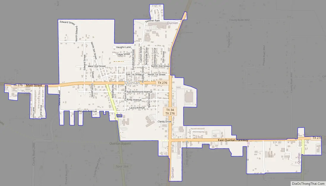
Quinlan Road Map
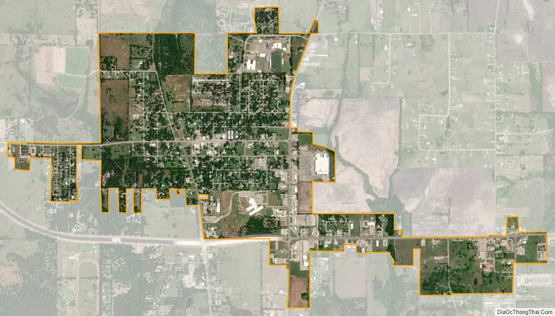
Quinlan city Satellite Map
Geography
Quinlan is in southern Hunt County. Texas State Highway 34 passes through the eastern side of the city, leading north 16 miles (26 km) to Greenville, the county seat, and southwest the same distance to Terrell. Highway 276 passes through Quinlan as its Main Street, leading east across Lake Tawakoni 22 miles (35 km) to Emory and west 20 miles (32 km) to Rockwall. Downtown Dallas is 42 miles (68 km) west of Quinlan.
According to the U.S. Census Bureau, Quinlan has an area of 1.3 square miles (3.4 km), all of it land.
Climate
See also
Map of Texas State and its subdivision:- Anderson
- Andrews
- Angelina
- Aransas
- Archer
- Armstrong
- Atascosa
- Austin
- Bailey
- Bandera
- Bastrop
- Baylor
- Bee
- Bell
- Bexar
- Blanco
- Borden
- Bosque
- Bowie
- Brazoria
- Brazos
- Brewster
- Briscoe
- Brooks
- Brown
- Burleson
- Burnet
- Caldwell
- Calhoun
- Callahan
- Cameron
- Camp
- Carson
- Cass
- Castro
- Chambers
- Cherokee
- Childress
- Clay
- Cochran
- Coke
- Coleman
- Collin
- Collingsworth
- Colorado
- Comal
- Comanche
- Concho
- Cooke
- Coryell
- Cottle
- Crane
- Crockett
- Crosby
- Culberson
- Dallam
- Dallas
- Dawson
- Deaf Smith
- Delta
- Denton
- Dewitt
- Dickens
- Dimmit
- Donley
- Duval
- Eastland
- Ector
- Edwards
- El Paso
- Ellis
- Erath
- Falls
- Fannin
- Fayette
- Fisher
- Floyd
- Foard
- Fort Bend
- Franklin
- Freestone
- Frio
- Gaines
- Galveston
- Garza
- Gillespie
- Glasscock
- Goliad
- Gonzales
- Gray
- Grayson
- Gregg
- Grimes
- Guadalupe
- Hale
- Hall
- Hamilton
- Hansford
- Hardeman
- Hardin
- Harris
- Harrison
- Hartley
- Haskell
- Hays
- Hemphill
- Henderson
- Hidalgo
- Hill
- Hockley
- Hood
- Hopkins
- Houston
- Howard
- Hudspeth
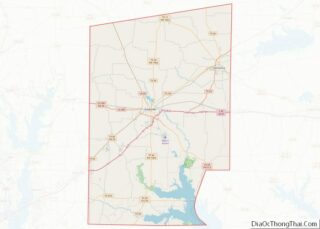
- Hunt
- Hutchinson
- Irion
- Jack
- Jackson
- Jasper
- Jeff Davis
- Jefferson
- Jim Hogg
- Jim Wells
- Johnson
- Jones
- Karnes
- Kaufman
- Kendall
- Kenedy
- Kent
- Kerr
- Kimble
- King
- Kinney
- Kleberg
- Knox
- La Salle
- Lamar
- Lamb
- Lampasas
- Lavaca
- Lee
- Leon
- Liberty
- Limestone
- Lipscomb
- Live Oak
- Llano
- Loving
- Lubbock
- Lynn
- Madison
- Marion
- Martin
- Mason
- Matagorda
- Maverick
- McCulloch
- McLennan
- McMullen
- Medina
- Menard
- Midland
- Milam
- Mills
- Mitchell
- Montague
- Montgomery
- Moore
- Morris
- Motley
- Nacogdoches
- Navarro
- Newton
- Nolan
- Nueces
- Ochiltree
- Oldham
- Orange
- Palo Pinto
- Panola
- Parker
- Parmer
- Pecos
- Polk
- Potter
- Presidio
- Rains
- Randall
- Reagan
- Real
- Red River
- Reeves
- Refugio
- Roberts
- Robertson
- Rockwall
- Runnels
- Rusk
- Sabine
- San Augustine
- San Jacinto
- San Patricio
- San Saba
- Schleicher
- Scurry
- Shackelford
- Shelby
- Sherman
- Smith
- Somervell
- Starr
- Stephens
- Sterling
- Stonewall
- Sutton
- Swisher
- Tarrant
- Taylor
- Terrell
- Terry
- Throckmorton
- Titus
- Tom Green
- Travis
- Trinity
- Tyler
- Upshur
- Upton
- Uvalde
- Val Verde
- Van Zandt
- Victoria
- Walker
- Waller
- Ward
- Washington
- Webb
- Wharton
- Wheeler
- Wichita
- Wilbarger
- Willacy
- Williamson
- Wilson
- Winkler
- Wise
- Wood
- Yoakum
- Young
- Zapata
- Zavala
- Alabama
- Alaska
- Arizona
- Arkansas
- California
- Colorado
- Connecticut
- Delaware
- District of Columbia
- Florida
- Georgia
- Hawaii
- Idaho
- Illinois
- Indiana
- Iowa
- Kansas
- Kentucky
- Louisiana
- Maine
- Maryland
- Massachusetts
- Michigan
- Minnesota
- Mississippi
- Missouri
- Montana
- Nebraska
- Nevada
- New Hampshire
- New Jersey
- New Mexico
- New York
- North Carolina
- North Dakota
- Ohio
- Oklahoma
- Oregon
- Pennsylvania
- Rhode Island
- South Carolina
- South Dakota
- Tennessee
- Texas
- Utah
- Vermont
- Virginia
- Washington
- West Virginia
- Wisconsin
- Wyoming