Rockwall is a city in Rockwall County, Texas, United States, which is part of the Dallas/Fort Worth metroplex. It is the county seat of Rockwall County. The U.S. Census Bureau estimates that as of the 2020 census, Rockwall’s population is 47,251, up from 45,888 in 2019. The name Rockwall is derived from a naturally jointed geological formation, which has the appearance of an artificial wall.
| Name: | Rockwall city |
|---|---|
| LSAD Code: | 25 |
| LSAD Description: | city (suffix) |
| State: | Texas |
| County: | Rockwall County |
| Elevation: | 561 ft (171 m) |
| Total Area: | 29.97 sq mi (77.62 km²) |
| Land Area: | 29.47 sq mi (76.33 km²) |
| Water Area: | 0.50 sq mi (1.29 km²) 1.63% |
| Total Population: | 47,251 |
| Population Density: | 1,600/sq mi (610/km²) |
| ZIP code: | 75032 75087 |
| Area code: | 214, 469, 945, 972 |
| FIPS code: | 4862828 |
| GNISfeature ID: | 2410982 |
| Website: | www.rockwall.com |
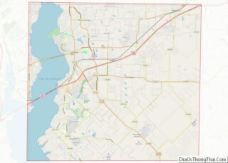
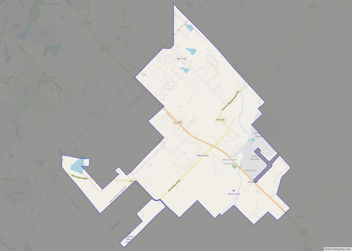
Online Interactive Map
Click on ![]() to view map in "full screen" mode.
to view map in "full screen" mode.
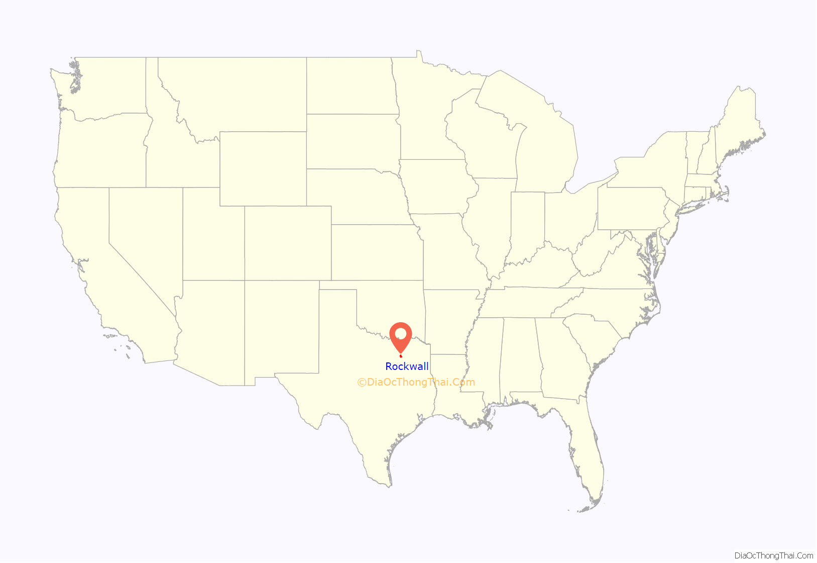
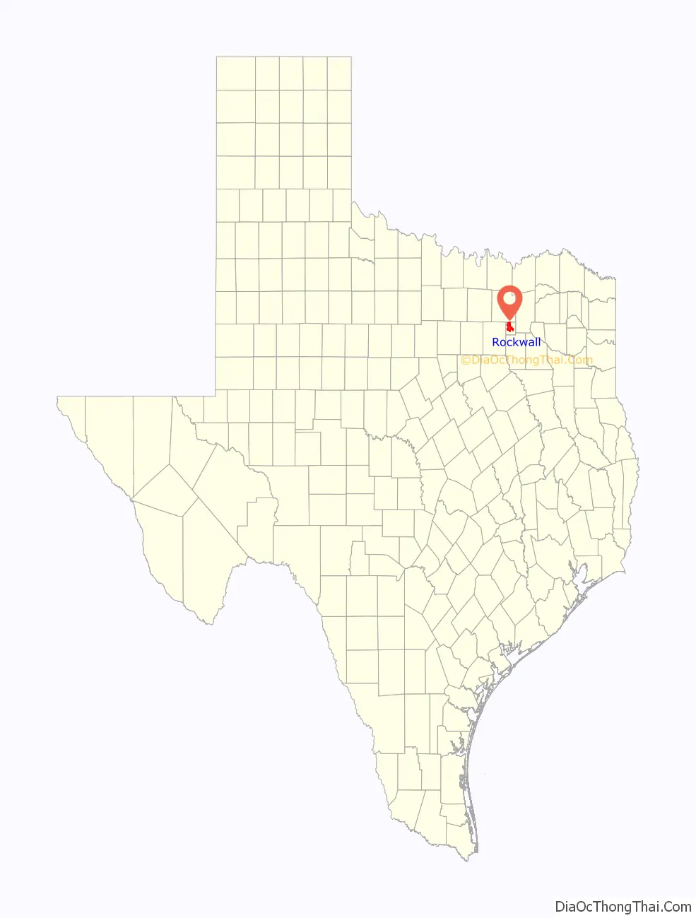
Rockwall location map. Where is Rockwall city?
History
The association of Paleo-Indian artifacts with extinct Pleistocene mammal remains in various archeological sites within the Texas Prairie-Savannah Region of eastern North Central Texas, including a site in Collin County, and Clovis points recovered from the Brushy Creek Clovis Site in Hunt County demonstrates that the Rockwall region was occupied by prehistoric Native American cultures at least as far back as 13,500 to 13,000 years ago. More recently, the Rockwall region was occupied by Caddo Indians. Creek Indians moved to the area in the early 19th century.
In 1851, the first Anglo-American settlers moved to the area, and wells were dug. During the digging, they found large underground rock walls that were initially believed to be man-made. Later study of the wall-like features by geologists and archaeologists found them to be jointed, natural sandstone dikes that had intruded Cretaceous marl. The wall, when viewed from above, runs in long straight lines with angles that form a near perfect rectangle. The eastern wall has several deviations that run in straight lines with sharp angles, which would be unusual for a natural formation in an already unusual closed loop wall formation.
The town was established April 17, 1854 and named after these natural rock walls. While originally part of Kaufman County, in 1873, Rockwall County was formed with Rockwall being the county seat.
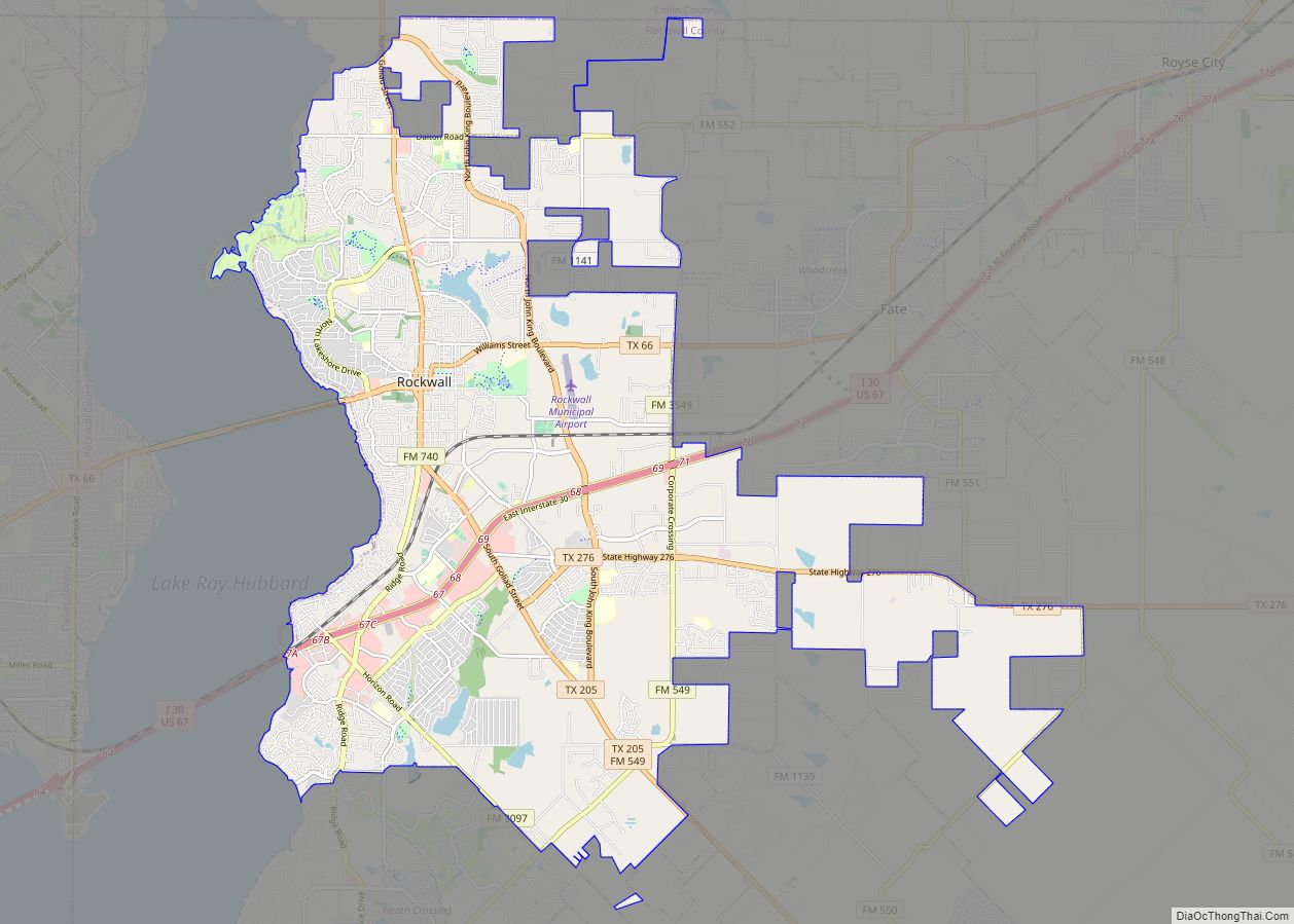
Rockwall Road Map
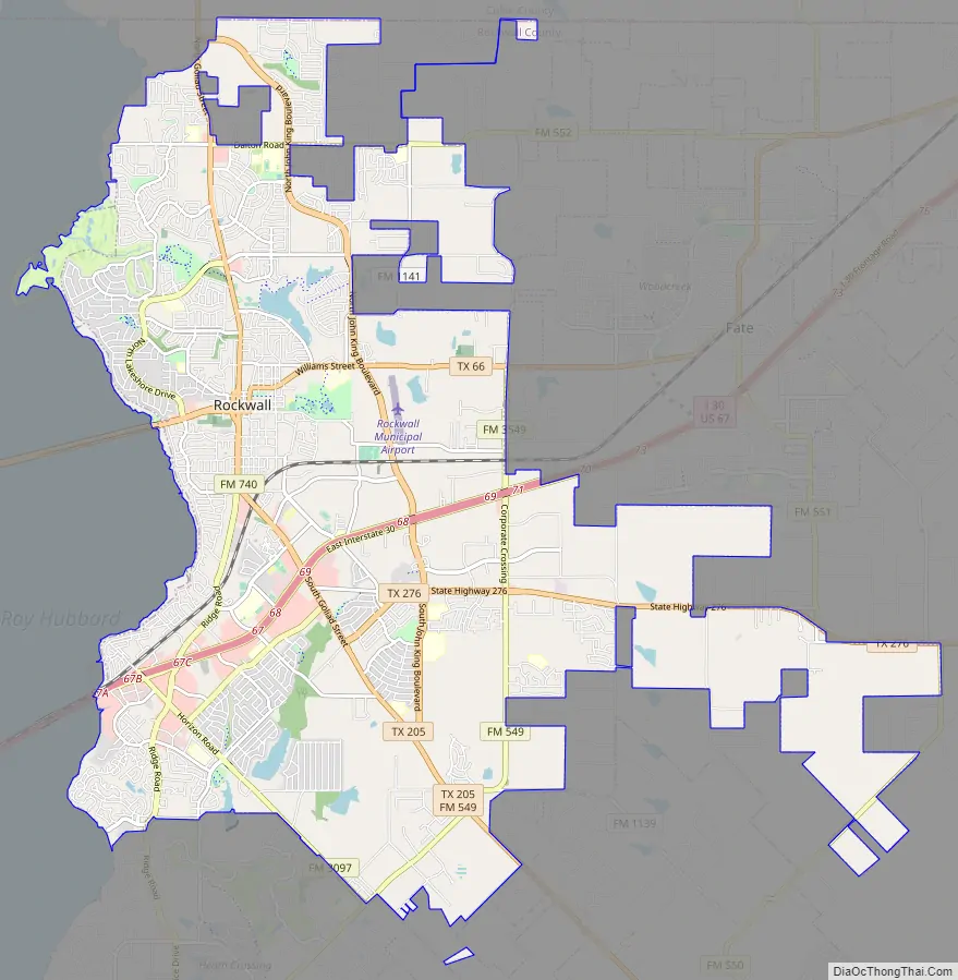
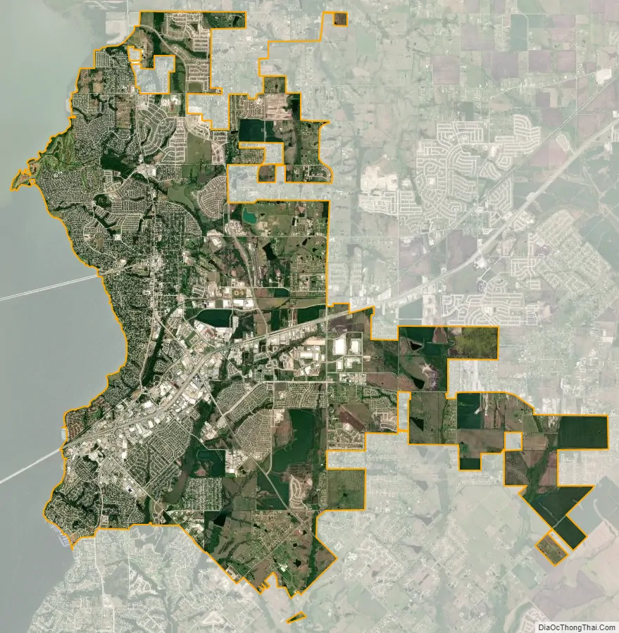
Rockwall city Satellite Map
Geography
According to the United States Census Bureau, the city has a total area of 31.6 square miles (82 km), of which, 22.3 square miles (58 km) of it is land and 0.4 square miles (1.0 km) of it (1.63%) is water.
Rockwall is on the east shore of Lake Ray Hubbard about 20 miles northeast of Dallas. It is on state highways 205 and 66, north of Interstate 30.
Climate
The climate in this area is characterized by hot, humid summers and generally mild to cool winters. According to the Köppen Climate Classification system, Rockwall has a humid subtropical climate, abbreviated “Cfa” on climate maps.
See also
Map of Texas State and its subdivision:- Anderson
- Andrews
- Angelina
- Aransas
- Archer
- Armstrong
- Atascosa
- Austin
- Bailey
- Bandera
- Bastrop
- Baylor
- Bee
- Bell
- Bexar
- Blanco
- Borden
- Bosque
- Bowie
- Brazoria
- Brazos
- Brewster
- Briscoe
- Brooks
- Brown
- Burleson
- Burnet
- Caldwell
- Calhoun
- Callahan
- Cameron
- Camp
- Carson
- Cass
- Castro
- Chambers
- Cherokee
- Childress
- Clay
- Cochran
- Coke
- Coleman
- Collin
- Collingsworth
- Colorado
- Comal
- Comanche
- Concho
- Cooke
- Coryell
- Cottle
- Crane
- Crockett
- Crosby
- Culberson
- Dallam
- Dallas
- Dawson
- Deaf Smith
- Delta
- Denton
- Dewitt
- Dickens
- Dimmit
- Donley
- Duval
- Eastland
- Ector
- Edwards
- El Paso
- Ellis
- Erath
- Falls
- Fannin
- Fayette
- Fisher
- Floyd
- Foard
- Fort Bend
- Franklin
- Freestone
- Frio
- Gaines
- Galveston
- Garza
- Gillespie
- Glasscock
- Goliad
- Gonzales
- Gray
- Grayson
- Gregg
- Grimes
- Guadalupe
- Hale
- Hall
- Hamilton
- Hansford
- Hardeman
- Hardin
- Harris
- Harrison
- Hartley
- Haskell
- Hays
- Hemphill
- Henderson
- Hidalgo
- Hill
- Hockley
- Hood
- Hopkins
- Houston
- Howard
- Hudspeth
- Hunt
- Hutchinson
- Irion
- Jack
- Jackson
- Jasper
- Jeff Davis
- Jefferson
- Jim Hogg
- Jim Wells
- Johnson
- Jones
- Karnes
- Kaufman
- Kendall
- Kenedy
- Kent
- Kerr
- Kimble
- King
- Kinney
- Kleberg
- Knox
- La Salle
- Lamar
- Lamb
- Lampasas
- Lavaca
- Lee
- Leon
- Liberty
- Limestone
- Lipscomb
- Live Oak
- Llano
- Loving
- Lubbock
- Lynn
- Madison
- Marion
- Martin
- Mason
- Matagorda
- Maverick
- McCulloch
- McLennan
- McMullen
- Medina
- Menard
- Midland
- Milam
- Mills
- Mitchell
- Montague
- Montgomery
- Moore
- Morris
- Motley
- Nacogdoches
- Navarro
- Newton
- Nolan
- Nueces
- Ochiltree
- Oldham
- Orange
- Palo Pinto
- Panola
- Parker
- Parmer
- Pecos
- Polk
- Potter
- Presidio
- Rains
- Randall
- Reagan
- Real
- Red River
- Reeves
- Refugio
- Roberts
- Robertson
- Rockwall
- Runnels
- Rusk
- Sabine
- San Augustine
- San Jacinto
- San Patricio
- San Saba
- Schleicher
- Scurry
- Shackelford
- Shelby
- Sherman
- Smith
- Somervell
- Starr
- Stephens
- Sterling
- Stonewall
- Sutton
- Swisher
- Tarrant
- Taylor
- Terrell
- Terry
- Throckmorton
- Titus
- Tom Green
- Travis
- Trinity
- Tyler
- Upshur
- Upton
- Uvalde
- Val Verde
- Van Zandt
- Victoria
- Walker
- Waller
- Ward
- Washington
- Webb
- Wharton
- Wheeler
- Wichita
- Wilbarger
- Willacy
- Williamson
- Wilson
- Winkler
- Wise
- Wood
- Yoakum
- Young
- Zapata
- Zavala
- Alabama
- Alaska
- Arizona
- Arkansas
- California
- Colorado
- Connecticut
- Delaware
- District of Columbia
- Florida
- Georgia
- Hawaii
- Idaho
- Illinois
- Indiana
- Iowa
- Kansas
- Kentucky
- Louisiana
- Maine
- Maryland
- Massachusetts
- Michigan
- Minnesota
- Mississippi
- Missouri
- Montana
- Nebraska
- Nevada
- New Hampshire
- New Jersey
- New Mexico
- New York
- North Carolina
- North Dakota
- Ohio
- Oklahoma
- Oregon
- Pennsylvania
- Rhode Island
- South Carolina
- South Dakota
- Tennessee
- Texas
- Utah
- Vermont
- Virginia
- Washington
- West Virginia
- Wisconsin
- Wyoming