Ranger is a city in Eastland County, Texas, United States. Its population was 2,468 at the 2010 census. Ranger College, a community college, is the second-largest employer in the community.
During the 1920s, Ranger, like nearby Cisco, Eastland, and Desdemona, was a petroleum boomtown.
| Name: | Ranger city |
|---|---|
| LSAD Code: | 25 |
| LSAD Description: | city (suffix) |
| State: | Texas |
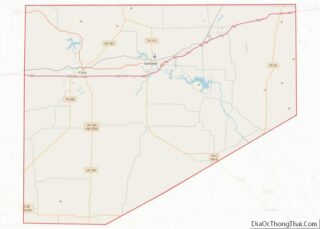
| County: | Eastland County |
| Elevation: | 1,437 ft (438 m) |
| Total Area: | 7.13 sq mi (18.46 km²) |
| Land Area: | 7.00 sq mi (18.12 km²) |
| Water Area: | 0.13 sq mi (0.34 km²) |
| Total Population: | 2,468 |
| Population Density: | 352.82/sq mi (136.22/km²) |
| ZIP code: | 76470 |
| Area code: | 254 |
| FIPS code: | 4860632 |
| GNISfeature ID: | 1344793 |
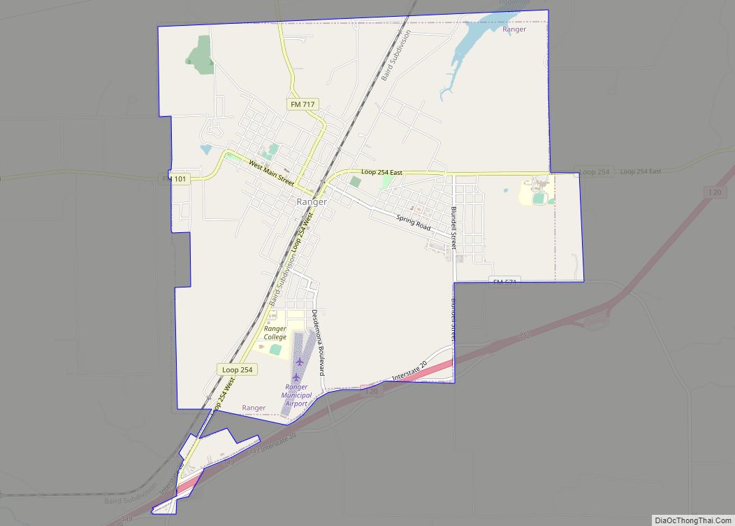
Online Interactive Map
Click on ![]() to view map in "full screen" mode.
to view map in "full screen" mode.
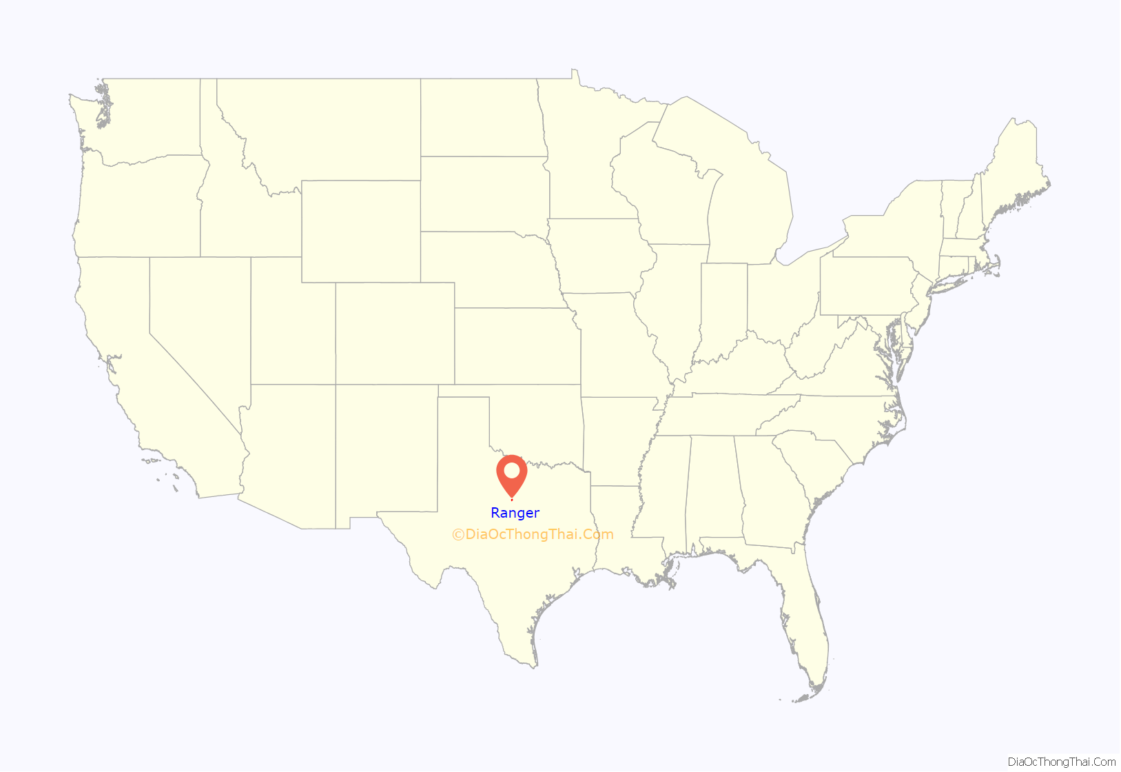
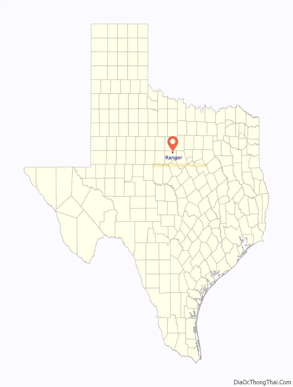
Ranger location map. Where is Ranger city?
History
The Texas Pacific Coal Company of Thurber, Texas, drilled a gas well north of Ranger in August 1917, after town civic leaders offered acreage in return for four test wells. Then on 11 October 1917, the McClesky well, 1 mile southwest of Ranger, produced oil at 1200 BOPD. Production came from the Strawn Formation sandstones at 1,300 to 2,000 feet (400 to 610 m), the Smithwick Shale, and the Marble Falls Formation limestone at 3,200 to 3,400 feet (980 to 1,040 m) feet. The Ranger Oil Field production peaked in July 1919 at 80,000 BOPD. The oil boom brought many seeking jobs, including farm boys and demobilized veterans.
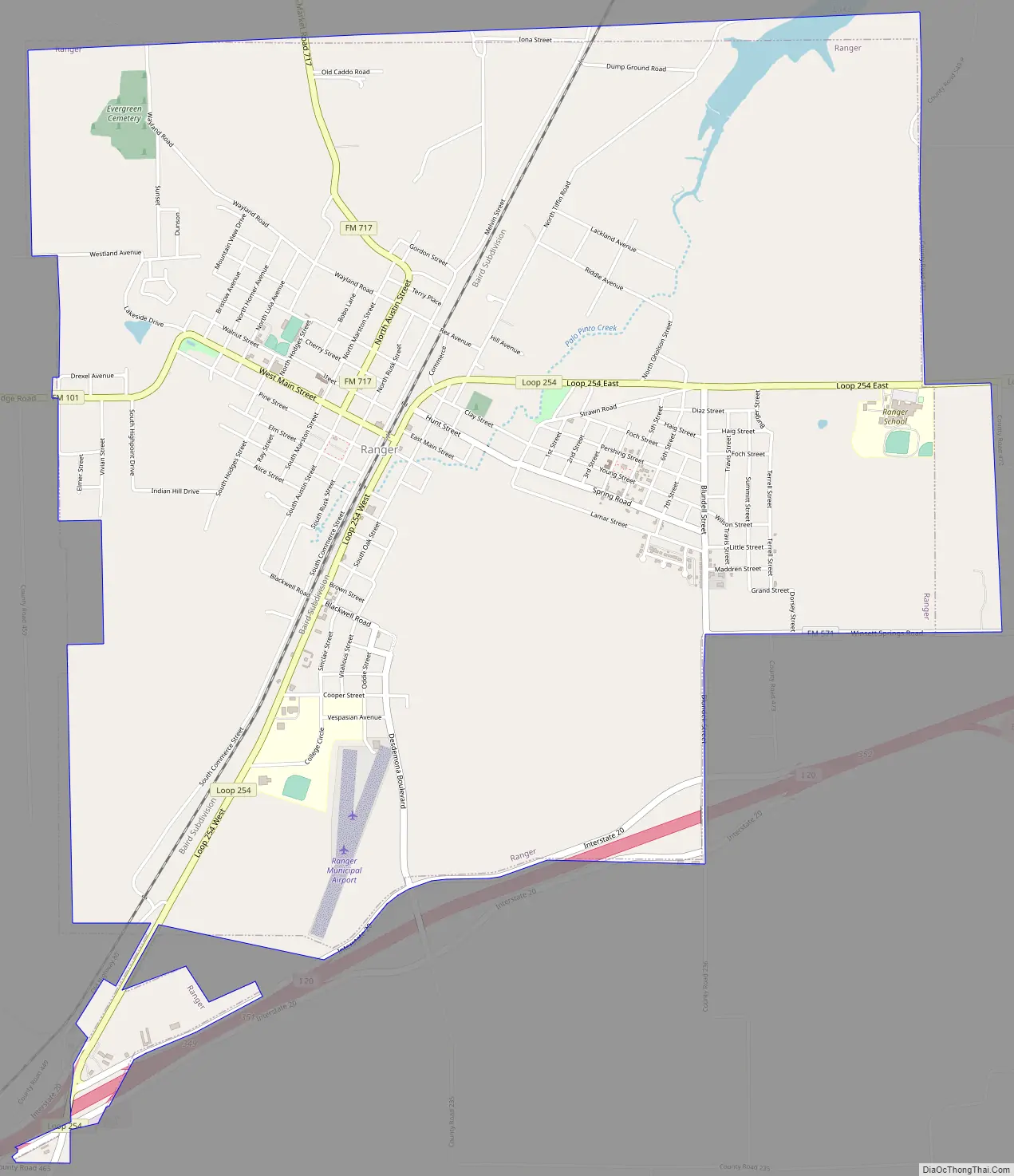
Ranger Road Map
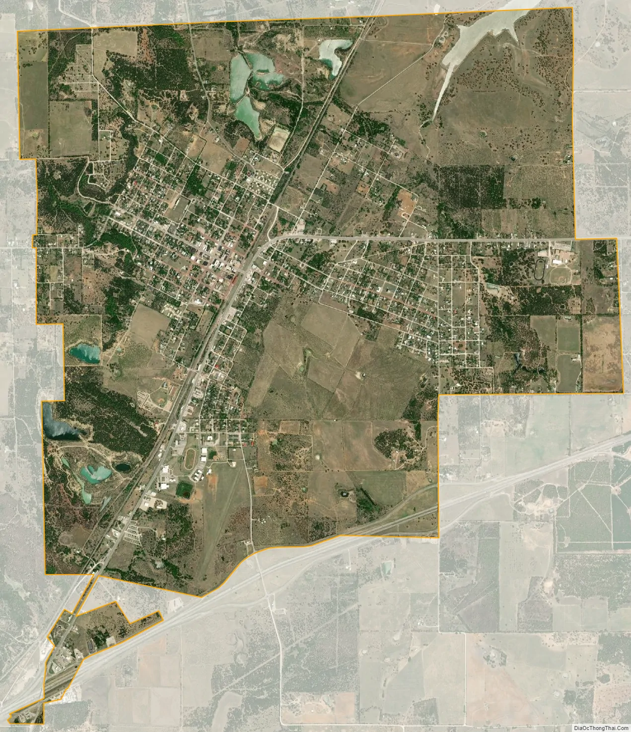
Ranger city Satellite Map
Geography
Ranger is located in northeastern Eastland County at 32°28′12″N 98°40′36″W / 32.47000°N 98.67667°W / 32.47000; -98.67667 (32.470102, –98.676734). Interstate 20 passes south and east of the city, with access from Exits 349, 351, 352, and 354. I-20 leads east 85 miles (137 km) to Fort Worth and west 65 miles (105 km) to Abilene. Eastland, the county seat, is 10 miles (16 km) to the west.
According to the United States Census Bureau, the city of Ranger has a total area of 7.1 square miles (18.5 km), of which 0.1 square miles (0.3 km), or 1.83%, is covered by water.
Ranger Antique Airfield dates back to 1911. Pilot Amelia Earhart landed at the field in 1931 in her Pitcairn Autogyro. Ranger Airfield has two grass runways: 1/19 – 3400 x 80 ft and 17/35; 1950 x 60 ft.
Climate
The climate in this area is characterized by hot, humid summers and generally mild to cool winters. According to the Köppen climate classification, Ranger has a humid subtropical climate, Cfa on climate maps.
See also
Map of Texas State and its subdivision:- Anderson
- Andrews
- Angelina
- Aransas
- Archer
- Armstrong
- Atascosa
- Austin
- Bailey
- Bandera
- Bastrop
- Baylor
- Bee
- Bell
- Bexar
- Blanco
- Borden
- Bosque
- Bowie
- Brazoria
- Brazos
- Brewster
- Briscoe
- Brooks
- Brown
- Burleson
- Burnet
- Caldwell
- Calhoun
- Callahan
- Cameron
- Camp
- Carson
- Cass
- Castro
- Chambers
- Cherokee
- Childress
- Clay
- Cochran
- Coke
- Coleman
- Collin
- Collingsworth
- Colorado
- Comal
- Comanche
- Concho
- Cooke
- Coryell
- Cottle
- Crane
- Crockett
- Crosby
- Culberson
- Dallam
- Dallas
- Dawson
- Deaf Smith
- Delta
- Denton
- Dewitt
- Dickens
- Dimmit
- Donley
- Duval
- Eastland
- Ector
- Edwards
- El Paso
- Ellis
- Erath
- Falls
- Fannin
- Fayette
- Fisher
- Floyd
- Foard
- Fort Bend
- Franklin
- Freestone
- Frio
- Gaines
- Galveston
- Garza
- Gillespie
- Glasscock
- Goliad
- Gonzales
- Gray
- Grayson
- Gregg
- Grimes
- Guadalupe
- Hale
- Hall
- Hamilton
- Hansford
- Hardeman
- Hardin
- Harris
- Harrison
- Hartley
- Haskell
- Hays
- Hemphill
- Henderson
- Hidalgo
- Hill
- Hockley
- Hood
- Hopkins
- Houston
- Howard
- Hudspeth
- Hunt
- Hutchinson
- Irion
- Jack
- Jackson
- Jasper
- Jeff Davis
- Jefferson
- Jim Hogg
- Jim Wells
- Johnson
- Jones
- Karnes
- Kaufman
- Kendall
- Kenedy
- Kent
- Kerr
- Kimble
- King
- Kinney
- Kleberg
- Knox
- La Salle
- Lamar
- Lamb
- Lampasas
- Lavaca
- Lee
- Leon
- Liberty
- Limestone
- Lipscomb
- Live Oak
- Llano
- Loving
- Lubbock
- Lynn
- Madison
- Marion
- Martin
- Mason
- Matagorda
- Maverick
- McCulloch
- McLennan
- McMullen
- Medina
- Menard
- Midland
- Milam
- Mills
- Mitchell
- Montague
- Montgomery
- Moore
- Morris
- Motley
- Nacogdoches
- Navarro
- Newton
- Nolan
- Nueces
- Ochiltree
- Oldham
- Orange
- Palo Pinto
- Panola
- Parker
- Parmer
- Pecos
- Polk
- Potter
- Presidio
- Rains
- Randall
- Reagan
- Real
- Red River
- Reeves
- Refugio
- Roberts
- Robertson
- Rockwall
- Runnels
- Rusk
- Sabine
- San Augustine
- San Jacinto
- San Patricio
- San Saba
- Schleicher
- Scurry
- Shackelford
- Shelby
- Sherman
- Smith
- Somervell
- Starr
- Stephens
- Sterling
- Stonewall
- Sutton
- Swisher
- Tarrant
- Taylor
- Terrell
- Terry
- Throckmorton
- Titus
- Tom Green
- Travis
- Trinity
- Tyler
- Upshur
- Upton
- Uvalde
- Val Verde
- Van Zandt
- Victoria
- Walker
- Waller
- Ward
- Washington
- Webb
- Wharton
- Wheeler
- Wichita
- Wilbarger
- Willacy
- Williamson
- Wilson
- Winkler
- Wise
- Wood
- Yoakum
- Young
- Zapata
- Zavala
- Alabama
- Alaska
- Arizona
- Arkansas
- California
- Colorado
- Connecticut
- Delaware
- District of Columbia
- Florida
- Georgia
- Hawaii
- Idaho
- Illinois
- Indiana
- Iowa
- Kansas
- Kentucky
- Louisiana
- Maine
- Maryland
- Massachusetts
- Michigan
- Minnesota
- Mississippi
- Missouri
- Montana
- Nebraska
- Nevada
- New Hampshire
- New Jersey
- New Mexico
- New York
- North Carolina
- North Dakota
- Ohio
- Oklahoma
- Oregon
- Pennsylvania
- Rhode Island
- South Carolina
- South Dakota
- Tennessee
- Texas
- Utah
- Vermont
- Virginia
- Washington
- West Virginia
- Wisconsin
- Wyoming