Santa Fe (English: Holy Faith) is a city in Galveston County, Texas, United States. It is named for the Santa Fe Railroad (now part of BNSF Railway) which runs through the town alongside State Highway 6. The population of Santa Fe at the 2010 census was 12,222.
| Name: | Santa Fe city |
|---|---|
| LSAD Code: | 25 |
| LSAD Description: | city (suffix) |
| State: | Texas |
| County: | Galveston County |
| Elevation: | 30 ft (9 m) |
| Total Area: | 17.08 sq mi (44.25 km²) |
| Land Area: | 16.89 sq mi (43.76 km²) |
| Water Area: | 0.19 sq mi (0.49 km²) |
| Total Population: | 12,222 |
| Population Density: | 796.03/sq mi (307.34/km²) |
| Area code: | 409 |
| FIPS code: | 4865726 |
| GNISfeature ID: | 1351043 |
| Website: | ci.santa-fe.tx.us |
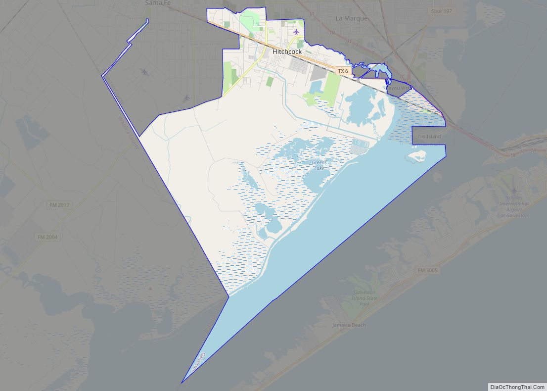
Online Interactive Map
Click on ![]() to view map in "full screen" mode.
to view map in "full screen" mode.
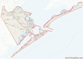
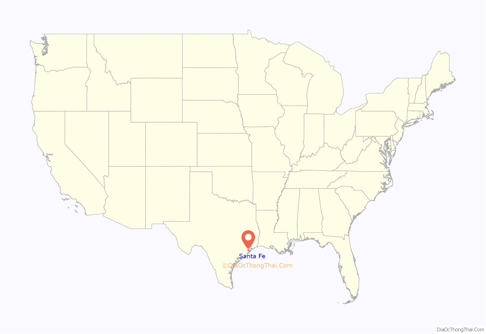
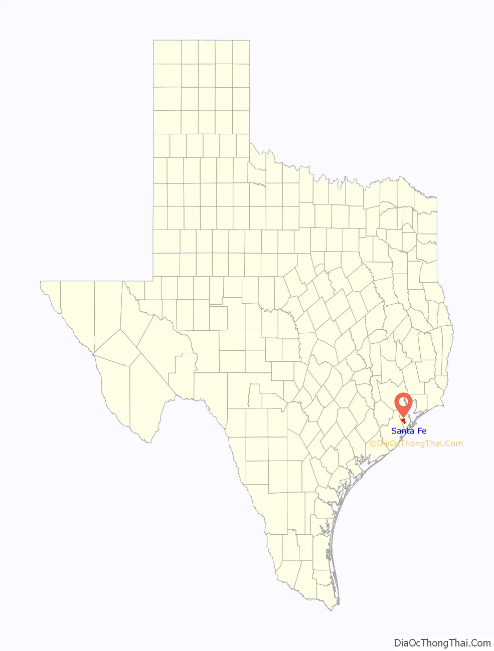
Santa Fe location map. Where is Santa Fe city?
History
In 1877, the Gulf, Colorado and Santa Fe Railway was built through the western part of Galveston county. By the turn of the century, three small, unincorporated towns had formed along the railway: Alta Loma, Arcadia, and Algoa. The Santa Fe Independent School District which was named after the railway, was established shortly afterward to serve the area.
In the mid-1970s, the neighboring city of Hitchcock attempted to annex an area in eastern Alta Loma known as the Morningview neighborhood. Amid intense opposition to becoming part of Hitchcock, residents began a petitioning effort to incorporate the area into a new city. On January 21, 1978, a ballot proposal to incorporate Alta Loma and parts of Arcadia passed by a wide margin and the city of Santa Fe was born. Santa Fe has since grown to include all of Arcadia and parts of Algoa, and ironically is now twice the size of Hitchcock.
On February 14, 1981, the Ku Klux Klan hosted a fish fry on a private farm in Santa Fe to protest the growing presence of Vietnamese shrimpers in the Gulf. During the event, a Vietnamese fishing boat was ceremonially burned. The controversy and similar conflicts in nearby port towns like Rockport, led to a decision of the United States District Court, S.D. Texas, Houston Division Vietnamese Fishermen’s Association v. Knights of the Ku Klux Klan, and also was the basis of the story for the 1985 Ed Harris film Alamo Bay.
On June 19, 2000, the Supreme Court ruled that the Santa Fe Independent School District’s policy of permitting “student-led, student-initiated” prayer at football games and other school events violated the Constitution’s prohibitions against the establishment of state religion.
On the morning of May 18, 2018, a school shooting occurred at Santa Fe High School when 17-year-old student Dimitrios Pagourtzis opened fire in an art classroom, killing ten students including Sabika Sheikh, 17 (an exchange student from Pakistan) and faculty and injuring thirteen others. Students and faculty evacuated the building when a fire alarm was activated. Pagourtzis surrendered after being injured in an exchange of gunfire with school officers. Originally scheduled to stand trial in January 2020 for ten counts of capital murder, Pagourtzis has been in custody at a state mental hospital since being found unfit to stand trial in November 2019.
Old High School Now on the National Register of Historical Places
Hitchcock Depot–Santa Fe (Alta Loma)–a Recorded Texas Landmark
Santa Fe City Hall
Miller-Brautigam Home–a Recorded Texas Landmark
Reclining Buddha at Linh Son Buddhist Temple, Santa Fe, Texas
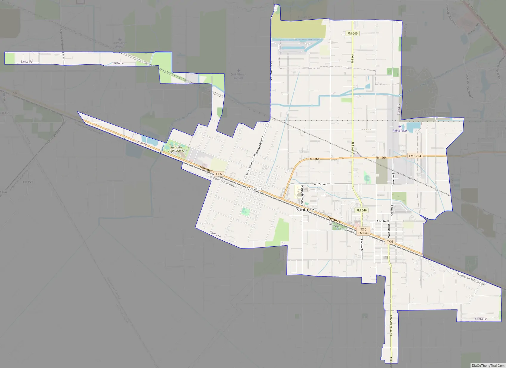
Santa Fe Road Map
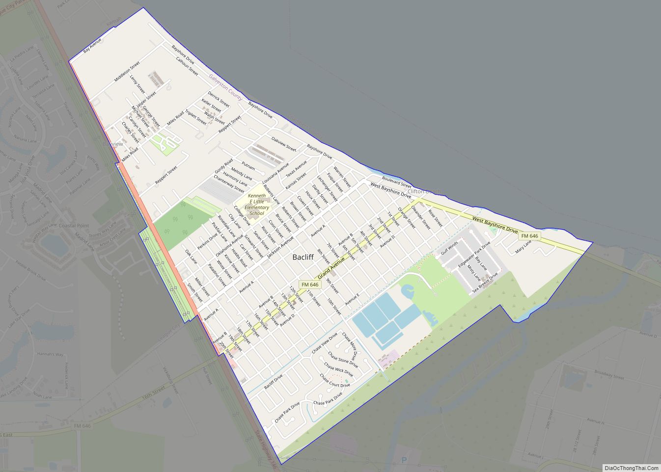
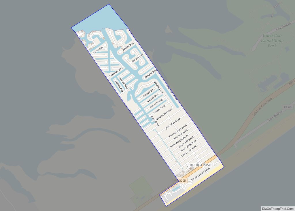
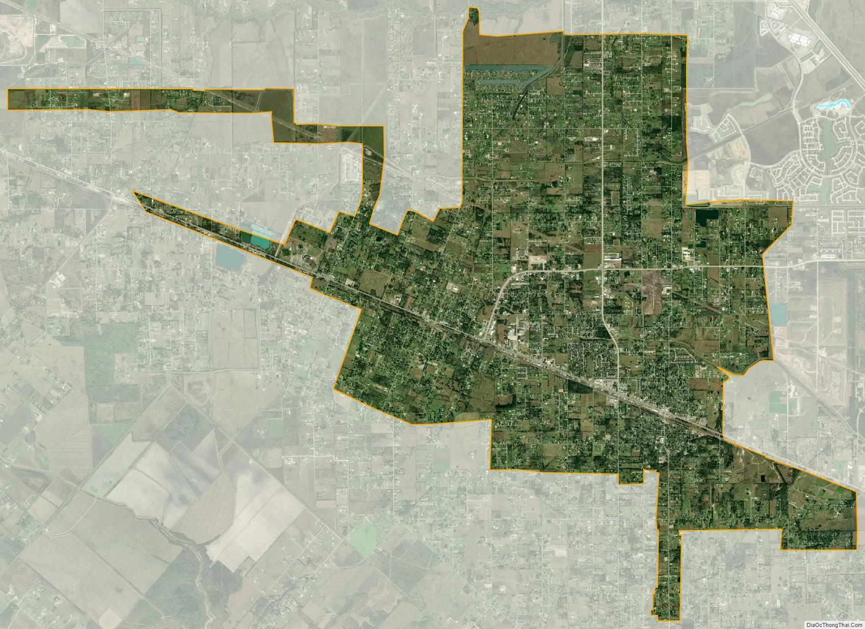
Santa Fe city Satellite Map
Geography
Santa Fe is located at 29°22′50″N 95°6′15″W / 29.38056°N 95.10417°W / 29.38056; -95.10417 (29.380651, –95.104163) on a low coastal plain that averages between 19 feet (5.8 m) and 27 feet (8.2 m) above sea level. The primary waterways are Highland Bayou and Halls Bayou, which both flow southeastward and empty into West Bay. Being prone to flash flooding, the area is lined with numerous drainage ditches, culverts, diversionary canals and reservoirs.
According to the United States Census Bureau, the city has a total area of 17.3 square miles (44.9 km), of which 17.1 square miles (44.4 km) is land and 0.19 square miles (0.5 km), or 1.10%, is water.
It is 35 miles (56 km) south of downtown Houston and 20 miles (32 km) northwest of Galveston. In 2019 Skip Hollandworth of Texas Monthly wrote that Santa Fe “still feels very much like a small town” despite that distance.
Santa Fe has a climate of hot, humid summers and cool, mild winters. Average annual temperature is 68.6 degrees F with 56.5 inches of annual rainfall. Santa Fe averages 71.7 days above 90 degrees F. In the Köppen Climate Classification system, Santa Fe has a humid subtropical climate, abbreviated “Cfa.”
See also
Map of Texas State and its subdivision:- Anderson
- Andrews
- Angelina
- Aransas
- Archer
- Armstrong
- Atascosa
- Austin
- Bailey
- Bandera
- Bastrop
- Baylor
- Bee
- Bell
- Bexar
- Blanco
- Borden
- Bosque
- Bowie
- Brazoria
- Brazos
- Brewster
- Briscoe
- Brooks
- Brown
- Burleson
- Burnet
- Caldwell
- Calhoun
- Callahan
- Cameron
- Camp
- Carson
- Cass
- Castro
- Chambers
- Cherokee
- Childress
- Clay
- Cochran
- Coke
- Coleman
- Collin
- Collingsworth
- Colorado
- Comal
- Comanche
- Concho
- Cooke
- Coryell
- Cottle
- Crane
- Crockett
- Crosby
- Culberson
- Dallam
- Dallas
- Dawson
- Deaf Smith
- Delta
- Denton
- Dewitt
- Dickens
- Dimmit
- Donley
- Duval
- Eastland
- Ector
- Edwards
- El Paso
- Ellis
- Erath
- Falls
- Fannin
- Fayette
- Fisher
- Floyd
- Foard
- Fort Bend
- Franklin
- Freestone
- Frio
- Gaines
- Galveston
- Garza
- Gillespie
- Glasscock
- Goliad
- Gonzales
- Gray
- Grayson
- Gregg
- Grimes
- Guadalupe
- Hale
- Hall
- Hamilton
- Hansford
- Hardeman
- Hardin
- Harris
- Harrison
- Hartley
- Haskell
- Hays
- Hemphill
- Henderson
- Hidalgo
- Hill
- Hockley
- Hood
- Hopkins
- Houston
- Howard
- Hudspeth
- Hunt
- Hutchinson
- Irion
- Jack
- Jackson
- Jasper
- Jeff Davis
- Jefferson
- Jim Hogg
- Jim Wells
- Johnson
- Jones
- Karnes
- Kaufman
- Kendall
- Kenedy
- Kent
- Kerr
- Kimble
- King
- Kinney
- Kleberg
- Knox
- La Salle
- Lamar
- Lamb
- Lampasas
- Lavaca
- Lee
- Leon
- Liberty
- Limestone
- Lipscomb
- Live Oak
- Llano
- Loving
- Lubbock
- Lynn
- Madison
- Marion
- Martin
- Mason
- Matagorda
- Maverick
- McCulloch
- McLennan
- McMullen
- Medina
- Menard
- Midland
- Milam
- Mills
- Mitchell
- Montague
- Montgomery
- Moore
- Morris
- Motley
- Nacogdoches
- Navarro
- Newton
- Nolan
- Nueces
- Ochiltree
- Oldham
- Orange
- Palo Pinto
- Panola
- Parker
- Parmer
- Pecos
- Polk
- Potter
- Presidio
- Rains
- Randall
- Reagan
- Real
- Red River
- Reeves
- Refugio
- Roberts
- Robertson
- Rockwall
- Runnels
- Rusk
- Sabine
- San Augustine
- San Jacinto
- San Patricio
- San Saba
- Schleicher
- Scurry
- Shackelford
- Shelby
- Sherman
- Smith
- Somervell
- Starr
- Stephens
- Sterling
- Stonewall
- Sutton
- Swisher
- Tarrant
- Taylor
- Terrell
- Terry
- Throckmorton
- Titus
- Tom Green
- Travis
- Trinity
- Tyler
- Upshur
- Upton
- Uvalde
- Val Verde
- Van Zandt
- Victoria
- Walker
- Waller
- Ward
- Washington
- Webb
- Wharton
- Wheeler
- Wichita
- Wilbarger
- Willacy
- Williamson
- Wilson
- Winkler
- Wise
- Wood
- Yoakum
- Young
- Zapata
- Zavala
- Alabama
- Alaska
- Arizona
- Arkansas
- California
- Colorado
- Connecticut
- Delaware
- District of Columbia
- Florida
- Georgia
- Hawaii
- Idaho
- Illinois
- Indiana
- Iowa
- Kansas
- Kentucky
- Louisiana
- Maine
- Maryland
- Massachusetts
- Michigan
- Minnesota
- Mississippi
- Missouri
- Montana
- Nebraska
- Nevada
- New Hampshire
- New Jersey
- New Mexico
- New York
- North Carolina
- North Dakota
- Ohio
- Oklahoma
- Oregon
- Pennsylvania
- Rhode Island
- South Carolina
- South Dakota
- Tennessee
- Texas
- Utah
- Vermont
- Virginia
- Washington
- West Virginia
- Wisconsin
- Wyoming