Schertz (/ʃɜːrts/ shurts) is a city in Guadalupe, Bexar, and Comal counties in the U.S. state of Texas, within the San Antonio–New Braunfels metropolitan area. The population was 42,002 at the 2020 census, up from 31,465 at the 2010 census. Schertz was settled by Alsatian emigrants in the 1800s.
| Name: | Schertz city |
|---|---|
| LSAD Code: | 25 |
| LSAD Description: | city (suffix) |
| State: | Texas |
| County: | Bexar County, Comal County, Guadalupe County |
| Elevation: | 712 ft (217 m) |
| Total Area: | 32.27 sq mi (83.57 km²) |
| Land Area: | 32.08 sq mi (83.10 km²) |
| Water Area: | 0.18 sq mi (0.47 km²) |
| Total Population: | 42,002 |
| Population Density: | 1,310.37/sq mi (505.94/km²) |
| ZIP code: | 78154, 78108, 78132 |
| Area code: | 210/726, 830 |
| FIPS code: | 4866128 |
| GNISfeature ID: | 1346761 |
| Website: | schertz.com |
Online Interactive Map
Click on ![]() to view map in "full screen" mode.
to view map in "full screen" mode.
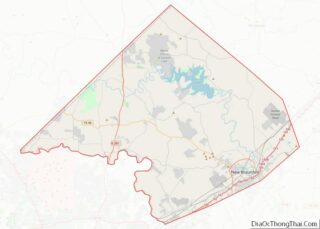
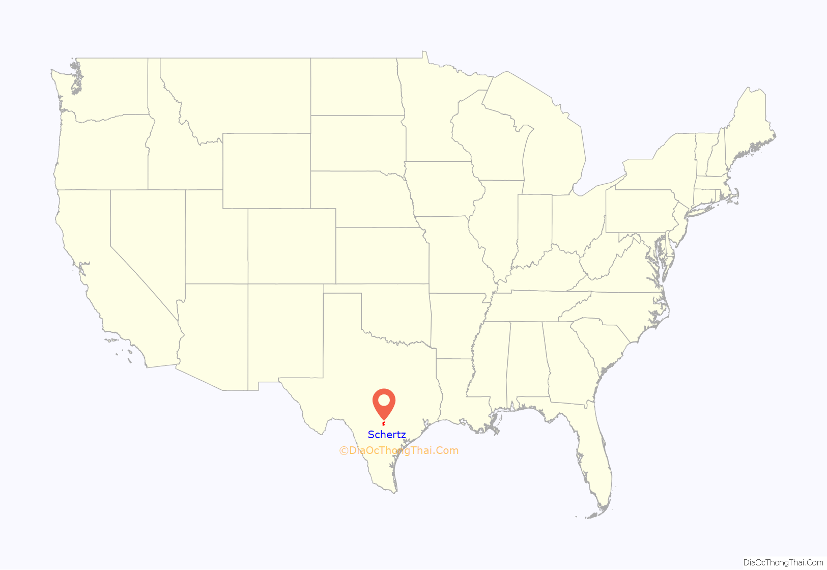
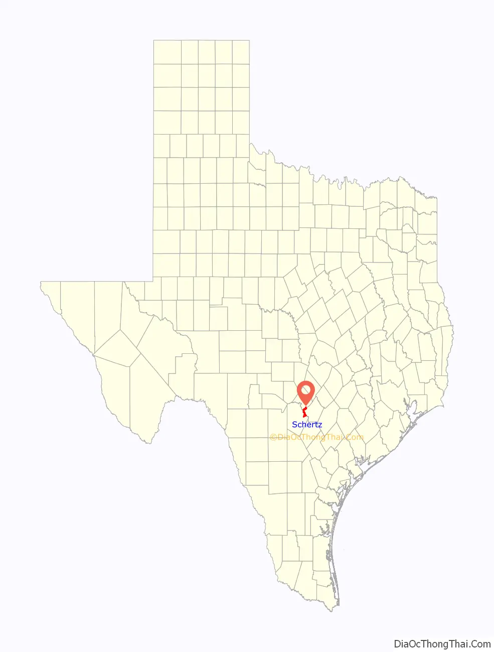
Schertz location map. Where is Schertz city?
History
Schertz is the third-largest city in the San Antonio-New Braunfels metropolitan area and the largest city of the Randolph Metrocom, which consists of cities surrounding Randolph Air Force Base. The Metrocom is located on San Antonio’s far northeast side. In addition to Schertz, other Randolph Metrocom communities include Live Oak, Kirby, Converse, Marion, Cibolo, Universal City, Windcrest, Garden Ridge, and Selma. These towns are located in Comal, Bexar, and Guadalupe counties and combined have a total of 355,000 residents and growing rapidly.
Since the late 1990s, Schertz experienced substantial growth. In five years, from 2000–2005, the city’s population jumped from 18,694 to 26,463. In 2006 alone, the population rose from 26,463 to 34,000.
The first settlers came to Schertz around 1843. Some of the families on the immediate land surrounding Schertz were the Boettigers, Schertzs, Schneiders, Seilers, Maskes, and Mergeles. Members of the Schertz family still reside in the city. The first name of Schertz was “Cibolo Pit”, then “Cut Off”, thus named because when Cibolo Creek flooded, the settlement was cut off.
The first settlers planted wheat, oats, and corn, which did not need special equipment to harvest and process. In later years, cotton was planted, and proved to be a productive cash crop. In 1870, the first gin was built by the Schertz family. It was powered by mules and then later by steam. This gin was located where the post office is at the present time. The second cotton gin built by Weyel and Kallies was between First and Second streets. In later years, there also was a corn sheller and lumber yard. The first school, built in 1890, was across Cibolo Creek where the Randolph Stables are now located. In 1917 a new two-story brick school was built, later torn down to make room for the O’Henry School. The land for the school was donated by Adolph Schertz.
In 1876, one of the largest boosts to Schertz came when the Galveston, Harrisburg, and San Antonio Railroad was built through the town. This gave the people a chance to travel to San Antonio by rail instead of wagon or buggy, besides goods being shipped in and out. The first post office was established in 1882. At that time Schertz was still known as Cut Off. In 1899 it officially became Schertz. Sebastian Schertz owned and operated a general store when the railroad was constructed.
A big and very active shooting club was located on the site that is now the City Park. There was an annual shooting tournament called Koenig Schiessen or “King Shoot”. This was a two-day affair with people coming from San Antonio by train. The last night, a big dance was held to close the event for that year. A piece of live coal, blown from a switch engine that was carrying gravel cars to or from the rock crusher, is believed to have blown on the shingle roof of the dance hall, setting it on fire and completely destroying it. It was later rebuilt, but eventually the club disbanded. The rockcrusher was at one time located in Cibolo Creek across from the public utilities of the city of Schertz. This was destroyed in 1913 when Cibolo Creek had its biggest recorded flood.
The first church in Schertz is the present day United Methodist Church on First Street. One of the oldest business buildings, the red brick building on Main Street, was built by Willie Schertz. It is now a plumbing and hardware store and Masonic meeting place. It was the first mercantile store. On the site of the present-day Schertz Bank, a two-story hotel, a five-room hospital and drug store complex was built in 1909. The hotel was built by Henry Ebert. Dr. Watson was the resident doctor. This doctor used two methods of transportation to see his patients, a horse-drawn hack for good roads and horseback for emergencies in bad weather and long distances. In 1917 another red brick hospital on Main Street was built by Dr. C.M. Cotham and Miss Cora Karbach, a nurse. It served the surrounding communities for many years and is now an old apartment house. The first bank was chartered in 1913, and one of the first bankers was Mr. Glass. He organized the National Home Guard during World War I, which drilled at night in the second story of the building that at the present time is the Masonic Lodge meeting place.
Randolph Field (now Randolph Air Force Base) was a boon to Schertz in the late 1920s. Farm land was bought as the Air Corps needed 2,000 acres (8 km) for the air academy (the “West Point of the Air”), which opened in 1930. There were three sites considered. The present site was chosen because there was less fog in the area and the fog lifted earlier in the day, which meant more flying time. All of this boosted the economy not only for Schertz and the surrounding communities but also for the areas of New Braunfels, Seguin, and San Antonio.
The V.F.W. of Schertz was chartered in 1946. The first fire protection was from the Randolph Field Fire Department. Schertz businesses and citizens organized a fire department, and the first business meeting of the Schertz Fire Department was February 8, 1956. Archie Woodward was the first fire chief. A combination fire station and city hall were built, and the Schertz library is now in this building. A new library has recently been built next to the previous library. Schertz was incorporated as a city by the state of Texas in 1958.
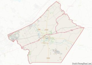
Schertz Road Map
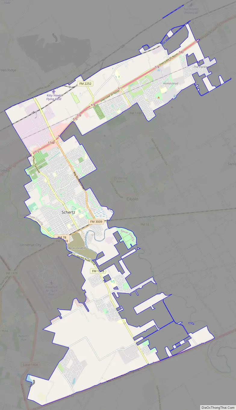
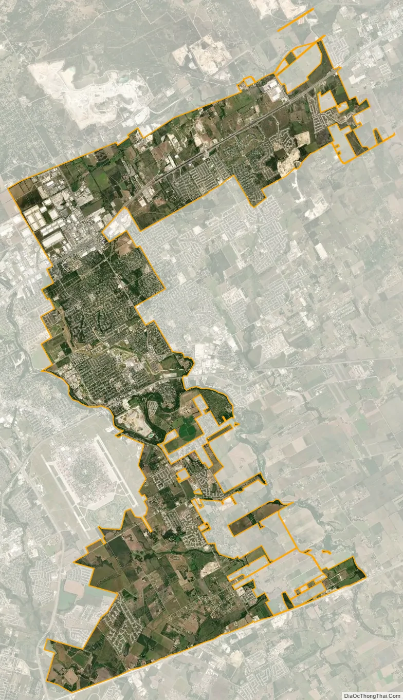
Schertz city Satellite Map
Geography
The original center of Schertz is located in western Guadalupe County at 29°33′21″N 98°16′22″W / 29.55583°N 98.27278°W / 29.55583; -98.27278. City Hall, located at 1400 Schertz Parkway, is also in Guadalupe County. Large tracts of the city now extend north into Comal County and south into Bexar County. Cibolo Creek, forming the boundary between Guadalupe and Bexar counties, runs through the city just south of the historic downtown. Schertz is bordered by Cibolo to the east, a narrow strip of San Antonio to the south along Interstate 10, Converse and Randolph AFB to the southwest, Universal City and Selma to the west, Garden Ridge to the north, and New Braunfels to the northeast.
Interstate 35 runs through the northern part of the city, with access from exits 174 through 180. I-35 runs 19 miles (31 km) southeast to downtown San Antonio and 6 miles (10 km) from the northeastern city limits to the center of New Braunfels.
According to the United States Census Bureau, Schertz has a total area of 28.6 square miles (74.0 km), of which 28.4 square miles (73.6 km) is land and 0.19 square miles (0.5 km), or 0.63%, is water.
See also
Map of Texas State and its subdivision:- Anderson
- Andrews
- Angelina
- Aransas
- Archer
- Armstrong
- Atascosa
- Austin
- Bailey
- Bandera
- Bastrop
- Baylor
- Bee
- Bell
- Bexar
- Blanco
- Borden
- Bosque
- Bowie
- Brazoria
- Brazos
- Brewster
- Briscoe
- Brooks
- Brown
- Burleson
- Burnet
- Caldwell
- Calhoun
- Callahan
- Cameron
- Camp
- Carson
- Cass
- Castro
- Chambers
- Cherokee
- Childress
- Clay
- Cochran
- Coke
- Coleman
- Collin
- Collingsworth
- Colorado
- Comal
- Comanche
- Concho
- Cooke
- Coryell
- Cottle
- Crane
- Crockett
- Crosby
- Culberson
- Dallam
- Dallas
- Dawson
- Deaf Smith
- Delta
- Denton
- Dewitt
- Dickens
- Dimmit
- Donley
- Duval
- Eastland
- Ector
- Edwards
- El Paso
- Ellis
- Erath
- Falls
- Fannin
- Fayette
- Fisher
- Floyd
- Foard
- Fort Bend
- Franklin
- Freestone
- Frio
- Gaines
- Galveston
- Garza
- Gillespie
- Glasscock
- Goliad
- Gonzales
- Gray
- Grayson
- Gregg
- Grimes
- Guadalupe
- Hale
- Hall
- Hamilton
- Hansford
- Hardeman
- Hardin
- Harris
- Harrison
- Hartley
- Haskell
- Hays
- Hemphill
- Henderson
- Hidalgo
- Hill
- Hockley
- Hood
- Hopkins
- Houston
- Howard
- Hudspeth
- Hunt
- Hutchinson
- Irion
- Jack
- Jackson
- Jasper
- Jeff Davis
- Jefferson
- Jim Hogg
- Jim Wells
- Johnson
- Jones
- Karnes
- Kaufman
- Kendall
- Kenedy
- Kent
- Kerr
- Kimble
- King
- Kinney
- Kleberg
- Knox
- La Salle
- Lamar
- Lamb
- Lampasas
- Lavaca
- Lee
- Leon
- Liberty
- Limestone
- Lipscomb
- Live Oak
- Llano
- Loving
- Lubbock
- Lynn
- Madison
- Marion
- Martin
- Mason
- Matagorda
- Maverick
- McCulloch
- McLennan
- McMullen
- Medina
- Menard
- Midland
- Milam
- Mills
- Mitchell
- Montague
- Montgomery
- Moore
- Morris
- Motley
- Nacogdoches
- Navarro
- Newton
- Nolan
- Nueces
- Ochiltree
- Oldham
- Orange
- Palo Pinto
- Panola
- Parker
- Parmer
- Pecos
- Polk
- Potter
- Presidio
- Rains
- Randall
- Reagan
- Real
- Red River
- Reeves
- Refugio
- Roberts
- Robertson
- Rockwall
- Runnels
- Rusk
- Sabine
- San Augustine
- San Jacinto
- San Patricio
- San Saba
- Schleicher
- Scurry
- Shackelford
- Shelby
- Sherman
- Smith
- Somervell
- Starr
- Stephens
- Sterling
- Stonewall
- Sutton
- Swisher
- Tarrant
- Taylor
- Terrell
- Terry
- Throckmorton
- Titus
- Tom Green
- Travis
- Trinity
- Tyler
- Upshur
- Upton
- Uvalde
- Val Verde
- Van Zandt
- Victoria
- Walker
- Waller
- Ward
- Washington
- Webb
- Wharton
- Wheeler
- Wichita
- Wilbarger
- Willacy
- Williamson
- Wilson
- Winkler
- Wise
- Wood
- Yoakum
- Young
- Zapata
- Zavala
- Alabama
- Alaska
- Arizona
- Arkansas
- California
- Colorado
- Connecticut
- Delaware
- District of Columbia
- Florida
- Georgia
- Hawaii
- Idaho
- Illinois
- Indiana
- Iowa
- Kansas
- Kentucky
- Louisiana
- Maine
- Maryland
- Massachusetts
- Michigan
- Minnesota
- Mississippi
- Missouri
- Montana
- Nebraska
- Nevada
- New Hampshire
- New Jersey
- New Mexico
- New York
- North Carolina
- North Dakota
- Ohio
- Oklahoma
- Oregon
- Pennsylvania
- Rhode Island
- South Carolina
- South Dakota
- Tennessee
- Texas
- Utah
- Vermont
- Virginia
- Washington
- West Virginia
- Wisconsin
- Wyoming