Van Alstyne is a city in Grayson and Collin Counties in the U.S. state of Texas. The population was 3,046 at the 2010 census, up from 2,502 at the 2000 census. The Grayson County portion of Van Alstyne is part of the Sherman–Denison Metropolitan Statistical Area.
| Name: | Van Alstyne city |
|---|---|
| LSAD Code: | 25 |
| LSAD Description: | city (suffix) |
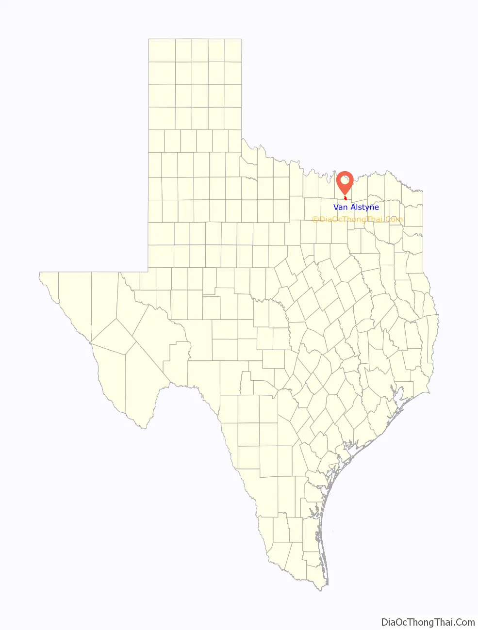
| State: | Texas |
| County: | Collin County, Grayson County |
| Elevation: | 784 ft (239 m) |
| Land Area: | 5.33 sq mi (13.81 km²) |
| Water Area: | 0.00 sq mi (0.00 km²) |
| Population Density: | 820.93/sq mi (316.98/km²) |
| ZIP code: | 75495 |
| Area code: | 903 |
| FIPS code: | 4874924 |
| GNISfeature ID: | 1370567 |
| Website: | www.cityofvanalstyne.us |
Online Interactive Map
Click on ![]() to view map in "full screen" mode.
to view map in "full screen" mode.
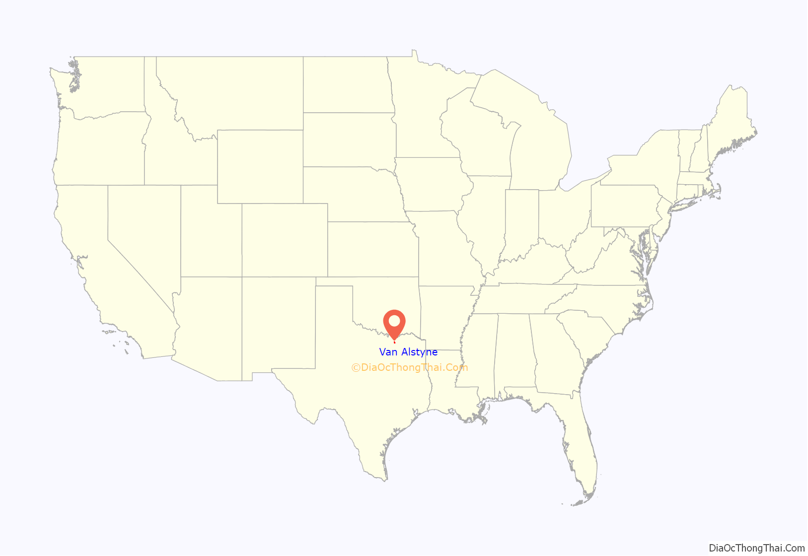
Van Alstyne location map. Where is Van Alstyne city?
History
Van Alstyne was built in 1873, for settlers to be near the railroad stop of the Houston and Texas Central Railway. The town was named for either William A. Van Alstyne, a civil engineer with the railroad, or for Marie Van Alstyne, a shareholder in the railroad company.
The town was incorporated in 1890.
Per a Van Alstyne Leader newspaper article September 3, 2015 the Outlaw “Bushwhacker Bill” Wilson, on whom the Clint Eastwood movie The Outlaw Josey Wales is based, was murdered somewhere in the vicinity of either the intersection of Texas Hwy 5 and Prong Creek 1 mile North of Van Alstyne or South of Van Alstyne halfway to the old ghost town of Mantua.
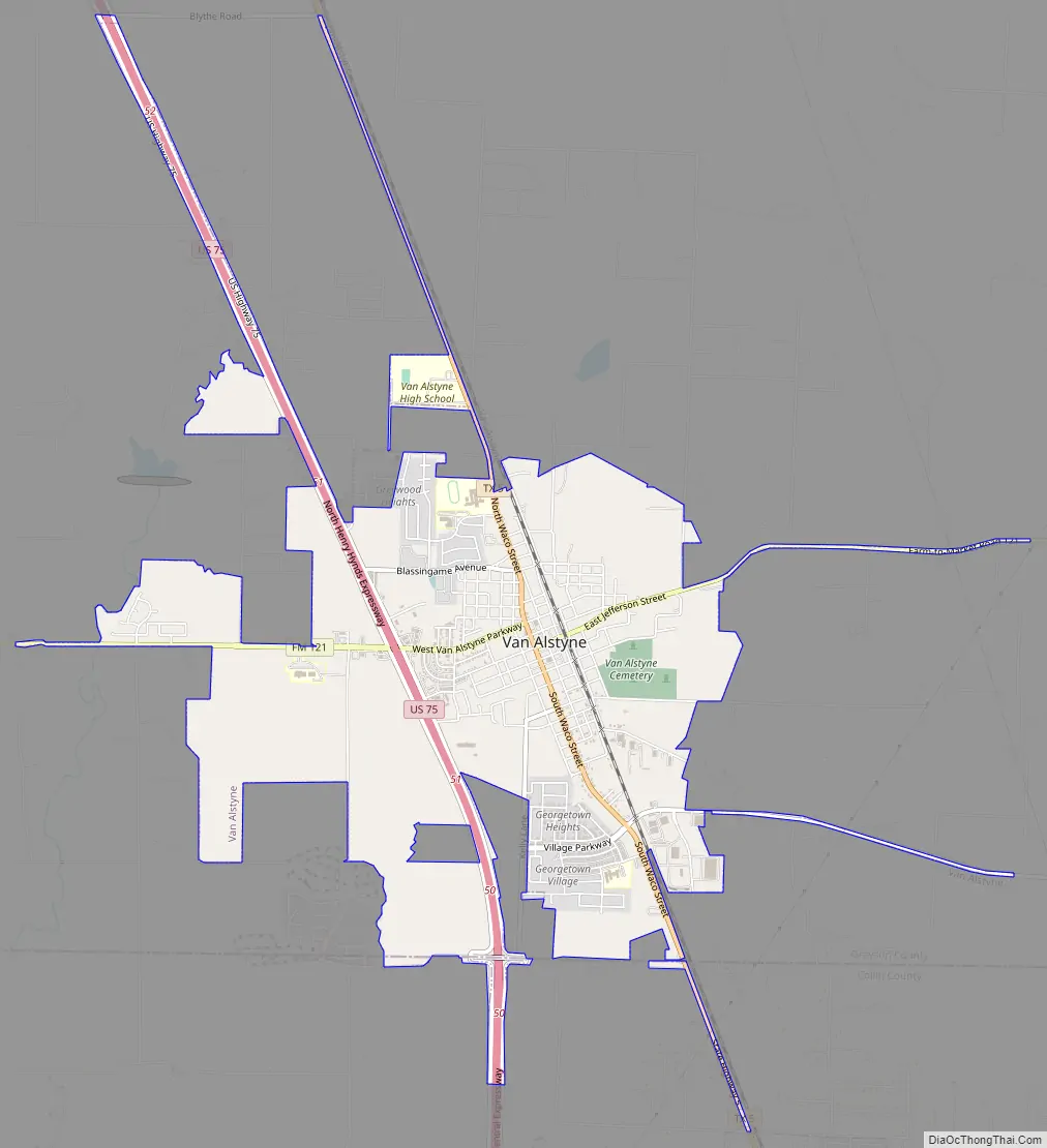
Van Alstyne Road Map
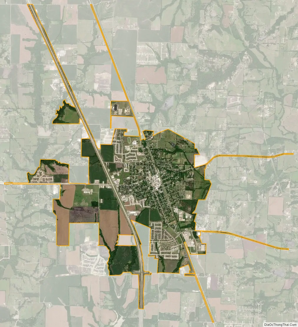
Van Alstyne city Satellite Map
Geography
Van Alstyne is located in southeastern Grayson County at 33°25′26″N 96°34′43″W / 33.42389°N 96.57861°W / 33.42389; -96.57861 (33.423911, –96.578730). The city limits extend south slightly into Collin County.
The U.S. Route 75 freeway runs through the western side of the city, with access from Exits 50 and 51. US 75 leads north 27 miles (43 km) to Denison and south 50 miles (80 km) to the center of Dallas. Van Alstyne’s immediate neighbors are Anna to the south and Howe to the north.
According to the United States Census, Van Alstyne has a total area of 4.1 square miles (10.5 km), all of it land.
See also
Map of Texas State and its subdivision:- Anderson
- Andrews
- Angelina
- Aransas
- Archer
- Armstrong
- Atascosa
- Austin
- Bailey
- Bandera
- Bastrop
- Baylor
- Bee
- Bell
- Bexar
- Blanco
- Borden
- Bosque
- Bowie
- Brazoria
- Brazos
- Brewster
- Briscoe
- Brooks
- Brown
- Burleson
- Burnet
- Caldwell
- Calhoun
- Callahan
- Cameron
- Camp
- Carson
- Cass
- Castro
- Chambers
- Cherokee
- Childress
- Clay
- Cochran
- Coke
- Coleman
- Collin
- Collingsworth
- Colorado
- Comal
- Comanche
- Concho
- Cooke
- Coryell
- Cottle
- Crane
- Crockett
- Crosby
- Culberson
- Dallam
- Dallas
- Dawson
- Deaf Smith
- Delta
- Denton
- Dewitt
- Dickens
- Dimmit
- Donley
- Duval
- Eastland
- Ector
- Edwards
- El Paso
- Ellis
- Erath
- Falls
- Fannin
- Fayette
- Fisher
- Floyd
- Foard
- Fort Bend
- Franklin
- Freestone
- Frio
- Gaines
- Galveston
- Garza
- Gillespie
- Glasscock
- Goliad
- Gonzales
- Gray
- Grayson
- Gregg
- Grimes
- Guadalupe
- Hale
- Hall
- Hamilton
- Hansford
- Hardeman
- Hardin
- Harris
- Harrison
- Hartley
- Haskell
- Hays
- Hemphill
- Henderson
- Hidalgo
- Hill
- Hockley
- Hood
- Hopkins
- Houston
- Howard
- Hudspeth
- Hunt
- Hutchinson
- Irion
- Jack
- Jackson
- Jasper
- Jeff Davis
- Jefferson
- Jim Hogg
- Jim Wells
- Johnson
- Jones
- Karnes
- Kaufman
- Kendall
- Kenedy
- Kent
- Kerr
- Kimble
- King
- Kinney
- Kleberg
- Knox
- La Salle
- Lamar
- Lamb
- Lampasas
- Lavaca
- Lee
- Leon
- Liberty
- Limestone
- Lipscomb
- Live Oak
- Llano
- Loving
- Lubbock
- Lynn
- Madison
- Marion
- Martin
- Mason
- Matagorda
- Maverick
- McCulloch
- McLennan
- McMullen
- Medina
- Menard
- Midland
- Milam
- Mills
- Mitchell
- Montague
- Montgomery
- Moore
- Morris
- Motley
- Nacogdoches
- Navarro
- Newton
- Nolan
- Nueces
- Ochiltree
- Oldham
- Orange
- Palo Pinto
- Panola
- Parker
- Parmer
- Pecos
- Polk
- Potter
- Presidio
- Rains
- Randall
- Reagan
- Real
- Red River
- Reeves
- Refugio
- Roberts
- Robertson
- Rockwall
- Runnels
- Rusk
- Sabine
- San Augustine
- San Jacinto
- San Patricio
- San Saba
- Schleicher
- Scurry
- Shackelford
- Shelby
- Sherman
- Smith
- Somervell
- Starr
- Stephens
- Sterling
- Stonewall
- Sutton
- Swisher
- Tarrant
- Taylor
- Terrell
- Terry
- Throckmorton
- Titus
- Tom Green
- Travis
- Trinity
- Tyler
- Upshur
- Upton
- Uvalde
- Val Verde
- Van Zandt
- Victoria
- Walker
- Waller
- Ward
- Washington
- Webb
- Wharton
- Wheeler
- Wichita
- Wilbarger
- Willacy
- Williamson
- Wilson
- Winkler
- Wise
- Wood
- Yoakum
- Young
- Zapata
- Zavala
- Alabama
- Alaska
- Arizona
- Arkansas
- California
- Colorado
- Connecticut
- Delaware
- District of Columbia
- Florida
- Georgia
- Hawaii
- Idaho
- Illinois
- Indiana
- Iowa
- Kansas
- Kentucky
- Louisiana
- Maine
- Maryland
- Massachusetts
- Michigan
- Minnesota
- Mississippi
- Missouri
- Montana
- Nebraska
- Nevada
- New Hampshire
- New Jersey
- New Mexico
- New York
- North Carolina
- North Dakota
- Ohio
- Oklahoma
- Oregon
- Pennsylvania
- Rhode Island
- South Carolina
- South Dakota
- Tennessee
- Texas
- Utah
- Vermont
- Virginia
- Washington
- West Virginia
- Wisconsin
- Wyoming