Vidor (/ˈvaɪdər/ VY-dər) is a city in western Orange County, Texas, United States. A city of Southeast Texas, it lies at the intersection of Interstate 10 and Farm to Market Road 105, 6 miles (9.7 km) east of Beaumont. The town is mainly a bedroom community for the nearby refining complexes in Beaumont and Port Arthur and is part of the Beaumont-Port Arthur metropolitan statistical area. Its population was 9,789 at the 2020 census.
The area was heavily logged after the construction of the Texarkana and Fort Smith Railway that was later part of a line that ran from Kansas City to Port Arthur, Texas. The city was named after lumberman Charles Shelton Vidor, owner of the Miller-Vidor Lumber Company and father of director King Vidor. By 1909, the Vidor community had a post office and four years later a company tram road was built. Almost all Vidor residents worked for the company. In 1924, the Miller-Vidor Lumber Company moved to Lakeview, just north of Vidor, in search of virgin timber. A small settlement remained and the Miller-Vidor subdivision was laid out in 1929.
Vidor had and still has a reputation as a “sundown town”, where African Americans are not allowed after sunset. In 1993, after district court judge William Wayne Justice ordered that 36 counties in East Texas, including Vidor, desegregate public housing by making some units available for minorities, the Klan from another area held a march in the community after a long legal battle was lost by Vidor’s leaders. Church leaders held a well-attended prayer rally in opposition to the KKK hatred. After four Black families moved into the complex, the residents suffered racial threats including a bomb threat to the complex. All nine Black residents eventually moved out under this pressure. One of the residents, Bill Simpson, was interviewed about his negative experiences while living there. “I’ve had people who drive by and tell me they’re going home to get a rope and come back and hang me. . . .” During the George Floyd protests of 2020, Black Lives Matter held a rally in Vidor that was attended by a diverse crowd of 150–200 people.
In 2005, 2008, and 2017, Vidor and surrounding areas suffered extensive damage from Hurricanes Rita, Ike, and Harvey. A mandatory evacuation was imposed upon its residents for about two weeks.
| Name: | Vidor city |
|---|---|
| LSAD Code: | 25 |
| LSAD Description: | city (suffix) |
| State: | Texas |
| County: | Orange County |
| Elevation: | 23 ft (7 m) |
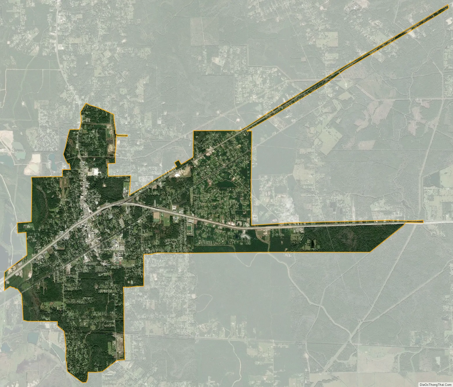
| Total Area: | 12.12 sq mi (31.39 km²) |
| Land Area: | 12.02 sq mi (31.12 km²) |
| Water Area: | 0.10 sq mi (0.27 km²) |
| Total Population: | 9,789 |
| Population Density: | 865.83/sq mi (334.29/km²) |
| ZIP code: | 77662, 77670 |
| Area code: | 409 |
| FIPS code: | 4875476 |
| GNISfeature ID: | 1349270 |
| Website: | cityofvidor.com |
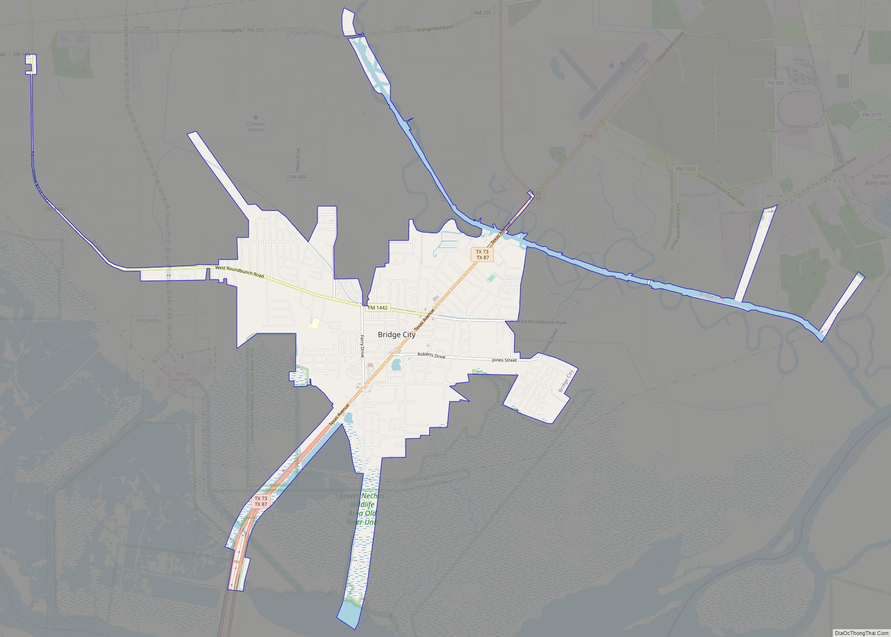
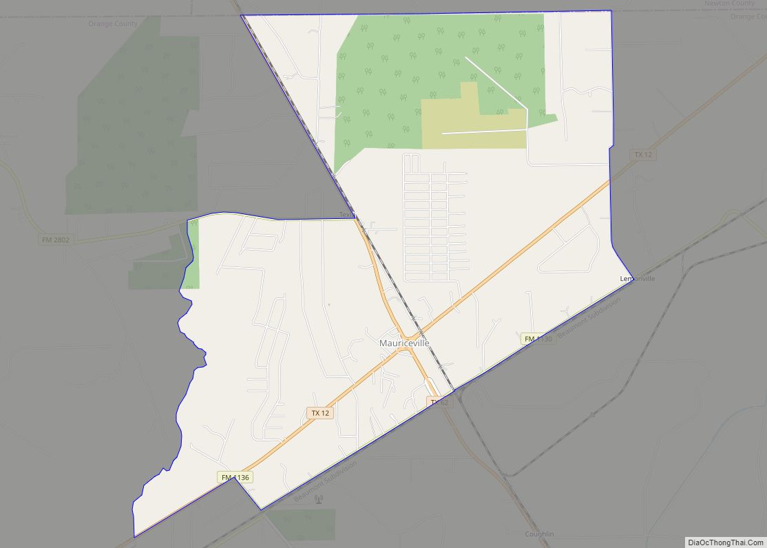
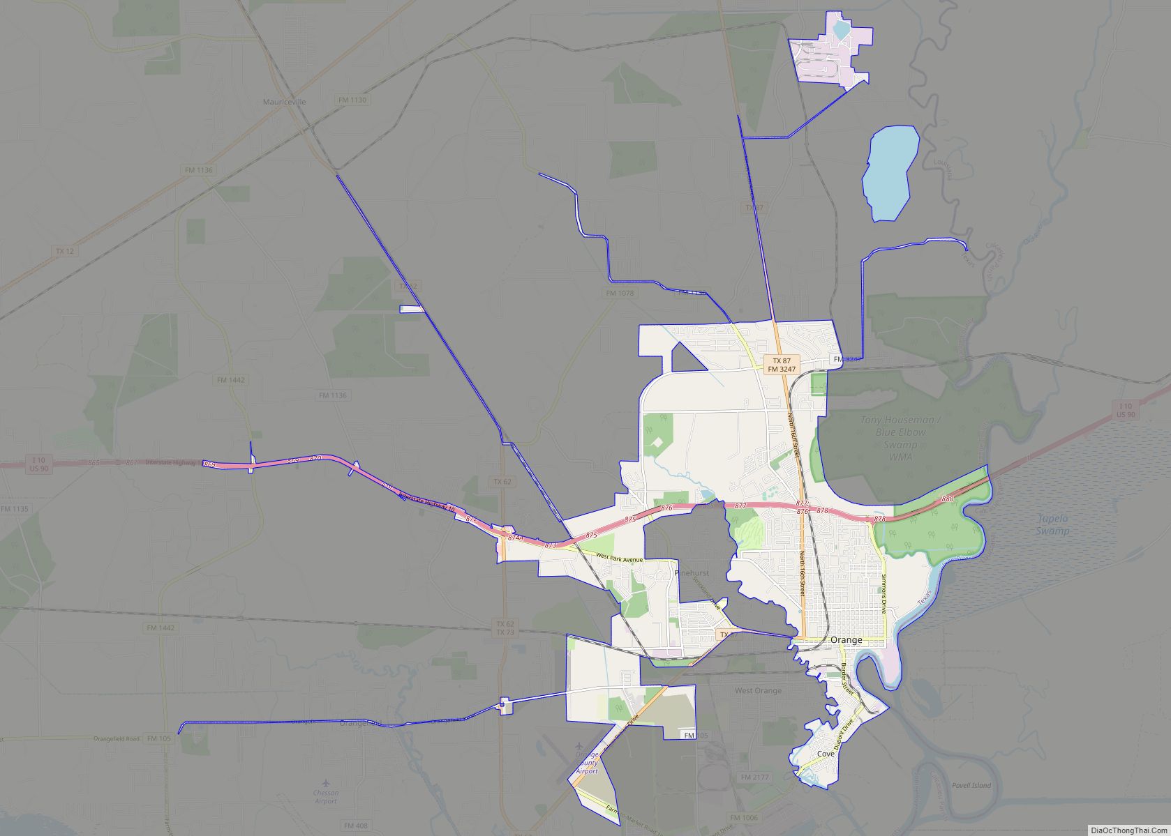
Online Interactive Map
Click on ![]() to view map in "full screen" mode.
to view map in "full screen" mode.
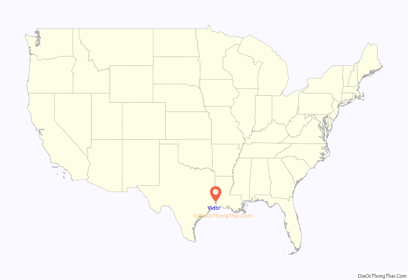
Vidor location map. Where is Vidor city?
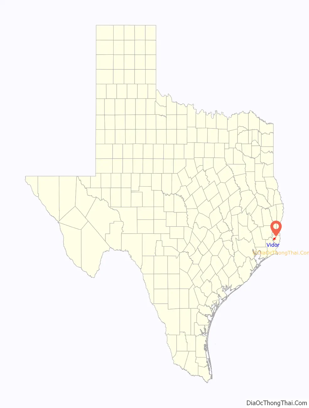
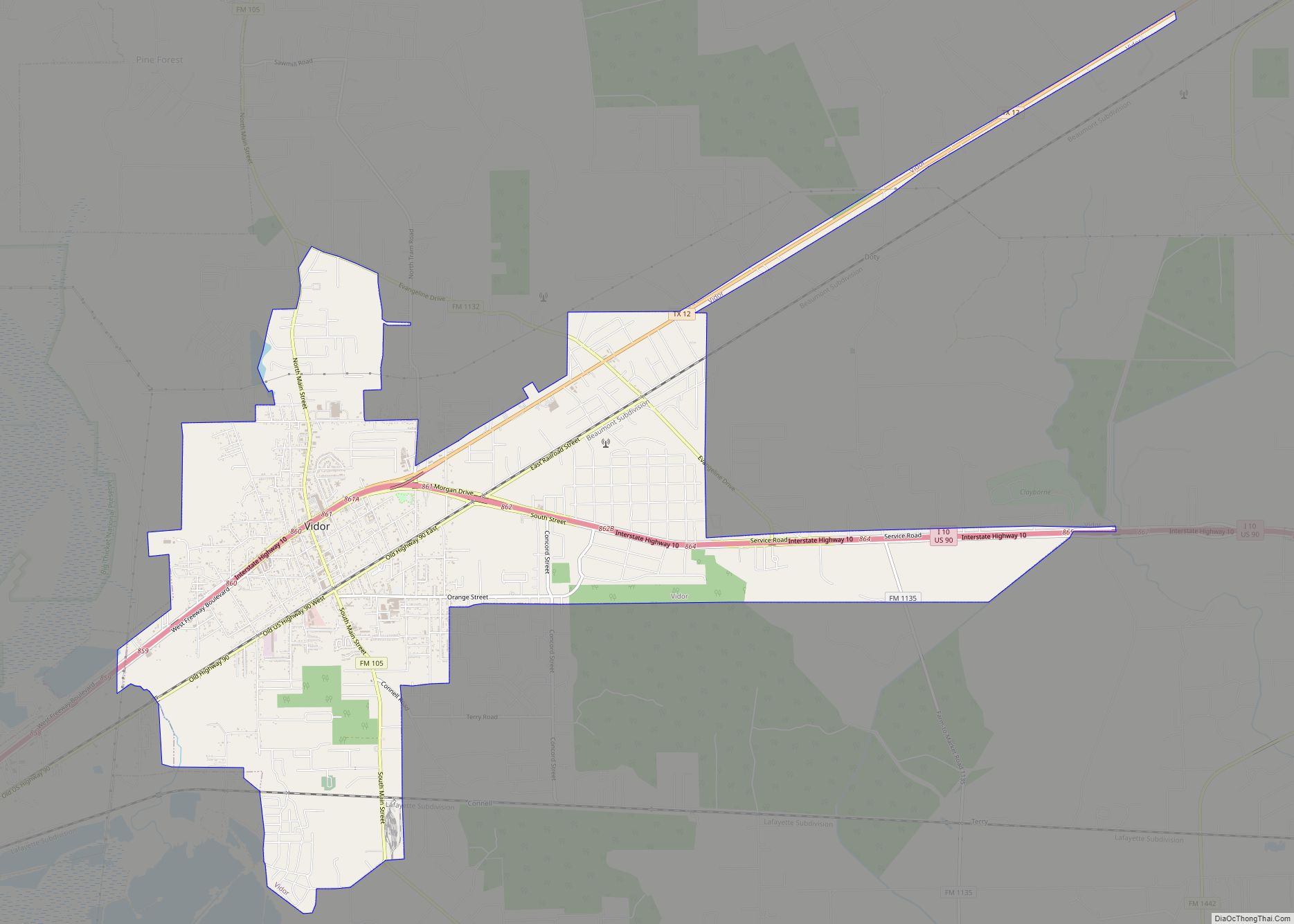
Vidor Road Map
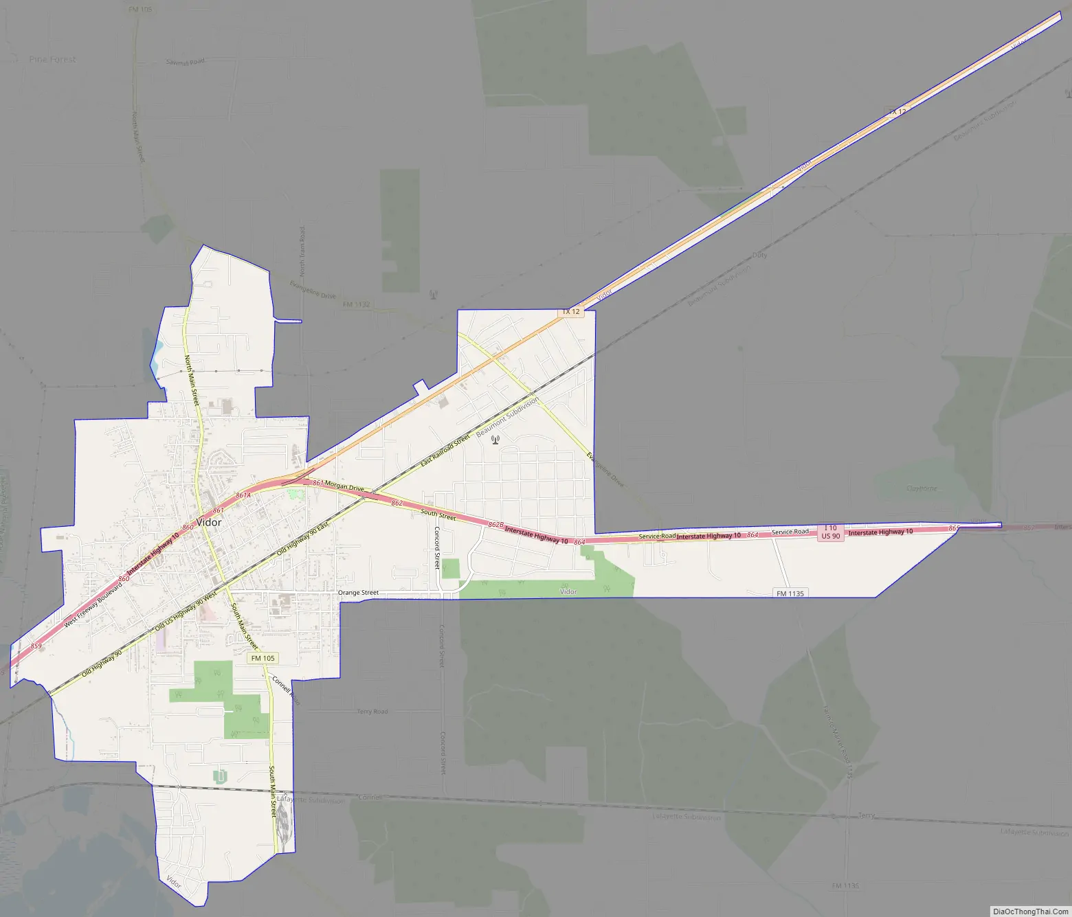
Vidor city Satellite Map
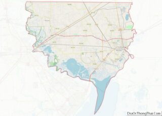
Geography
Vidor is located at 30°7′53″N 93°59′47″W / 30.13139°N 93.99639°W / 30.13139; -93.99639 (30.131492, –93.996292).
According to the United States Census Bureau, the city has a total area of 10.6 square miles (27 km), of which, 10.6 square miles (27 km) are land and 0.09% is covered by water.
See also
Map of Texas State and its subdivision:- Anderson
- Andrews
- Angelina
- Aransas
- Archer
- Armstrong
- Atascosa
- Austin
- Bailey
- Bandera
- Bastrop
- Baylor
- Bee
- Bell
- Bexar
- Blanco
- Borden
- Bosque
- Bowie
- Brazoria
- Brazos
- Brewster
- Briscoe
- Brooks
- Brown
- Burleson
- Burnet
- Caldwell
- Calhoun
- Callahan
- Cameron
- Camp
- Carson
- Cass
- Castro
- Chambers
- Cherokee
- Childress
- Clay
- Cochran
- Coke
- Coleman
- Collin
- Collingsworth
- Colorado
- Comal
- Comanche
- Concho
- Cooke
- Coryell
- Cottle
- Crane
- Crockett
- Crosby
- Culberson
- Dallam
- Dallas
- Dawson
- Deaf Smith
- Delta
- Denton
- Dewitt
- Dickens
- Dimmit
- Donley
- Duval
- Eastland
- Ector
- Edwards
- El Paso
- Ellis
- Erath
- Falls
- Fannin
- Fayette
- Fisher
- Floyd
- Foard
- Fort Bend
- Franklin
- Freestone
- Frio
- Gaines
- Galveston
- Garza
- Gillespie
- Glasscock
- Goliad
- Gonzales
- Gray
- Grayson
- Gregg
- Grimes
- Guadalupe
- Hale
- Hall
- Hamilton
- Hansford
- Hardeman
- Hardin
- Harris
- Harrison
- Hartley
- Haskell
- Hays
- Hemphill
- Henderson
- Hidalgo
- Hill
- Hockley
- Hood
- Hopkins
- Houston
- Howard
- Hudspeth
- Hunt
- Hutchinson
- Irion
- Jack
- Jackson
- Jasper
- Jeff Davis
- Jefferson
- Jim Hogg
- Jim Wells
- Johnson
- Jones
- Karnes
- Kaufman
- Kendall
- Kenedy
- Kent
- Kerr
- Kimble
- King
- Kinney
- Kleberg
- Knox
- La Salle
- Lamar
- Lamb
- Lampasas
- Lavaca
- Lee
- Leon
- Liberty
- Limestone
- Lipscomb
- Live Oak
- Llano
- Loving
- Lubbock
- Lynn
- Madison
- Marion
- Martin
- Mason
- Matagorda
- Maverick
- McCulloch
- McLennan
- McMullen
- Medina
- Menard
- Midland
- Milam
- Mills
- Mitchell
- Montague
- Montgomery
- Moore
- Morris
- Motley
- Nacogdoches
- Navarro
- Newton
- Nolan
- Nueces
- Ochiltree
- Oldham
- Orange
- Palo Pinto
- Panola
- Parker
- Parmer
- Pecos
- Polk
- Potter
- Presidio
- Rains
- Randall
- Reagan
- Real
- Red River
- Reeves
- Refugio
- Roberts
- Robertson
- Rockwall
- Runnels
- Rusk
- Sabine
- San Augustine
- San Jacinto
- San Patricio
- San Saba
- Schleicher
- Scurry
- Shackelford
- Shelby
- Sherman
- Smith
- Somervell
- Starr
- Stephens
- Sterling
- Stonewall
- Sutton
- Swisher
- Tarrant
- Taylor
- Terrell
- Terry
- Throckmorton
- Titus
- Tom Green
- Travis
- Trinity
- Tyler
- Upshur
- Upton
- Uvalde
- Val Verde
- Van Zandt
- Victoria
- Walker
- Waller
- Ward
- Washington
- Webb
- Wharton
- Wheeler
- Wichita
- Wilbarger
- Willacy
- Williamson
- Wilson
- Winkler
- Wise
- Wood
- Yoakum
- Young
- Zapata
- Zavala
- Alabama
- Alaska
- Arizona
- Arkansas
- California
- Colorado
- Connecticut
- Delaware
- District of Columbia
- Florida
- Georgia
- Hawaii
- Idaho
- Illinois
- Indiana
- Iowa
- Kansas
- Kentucky
- Louisiana
- Maine
- Maryland
- Massachusetts
- Michigan
- Minnesota
- Mississippi
- Missouri
- Montana
- Nebraska
- Nevada
- New Hampshire
- New Jersey
- New Mexico
- New York
- North Carolina
- North Dakota
- Ohio
- Oklahoma
- Oregon
- Pennsylvania
- Rhode Island
- South Carolina
- South Dakota
- Tennessee
- Texas
- Utah
- Vermont
- Virginia
- Washington
- West Virginia
- Wisconsin
- Wyoming