Weslaco /ˈwɛsləˌkoʊ/ is a city in Hidalgo County, Texas, United States. As of the 2020 census the population was 41,103, and in 2020 the estimated population was 41,103. It is located at the southern tip of Texas in the Rio Grande Valley near the Mexican border, across the Rio Grande from the city of Nuevo Progreso, Rio Bravo, Tamaulipas.
Weslaco derives its name from the W.E. Stewart Land Company. It was the hometown of Harlon Block, one of the Marines photographed raising the flag at Iwo Jima, and of film and television actor David Spielberg.
Streets north of the railroad tracks have Spanish names, and streets south of the railroad tracks bear names in English, as a consequence of a 1921 municipal ordinance which declared that land north of the tracks be reserved for Hispanic residences and businesses, and land south of the tracks be reserved for “Anglo” residences and businesses. During World War II, sandbag production reached a peak in Weslaco, and the town declared itself the “sandbagging capital of the world”.
Weslaco is part of the McAllen–Edinburg–Mission and Reynosa–McAllen metropolitan areas.
| Name: | Weslaco city |
|---|---|
| LSAD Code: | 25 |
| LSAD Description: | city (suffix) |
| State: | Texas |
| County: | Hidalgo County |
| Elevation: | 79 ft (24 m) |
| Total Area: | 16.45 sq mi (42.61 km²) |
| Land Area: | 16.38 sq mi (42.42 km²) |
| Water Area: | 0.07 sq mi (0.19 km²) |
| Total Population: | 35,670 |
| Population Density: | 2,541.61/sq mi (981.35/km²) |
| Area code: | 956 |
| FIPS code: | 4877272 |
| GNISfeature ID: | 1349656 |
| Website: | www.weslacotx.gov |
Online Interactive Map
Click on ![]() to view map in "full screen" mode.
to view map in "full screen" mode.
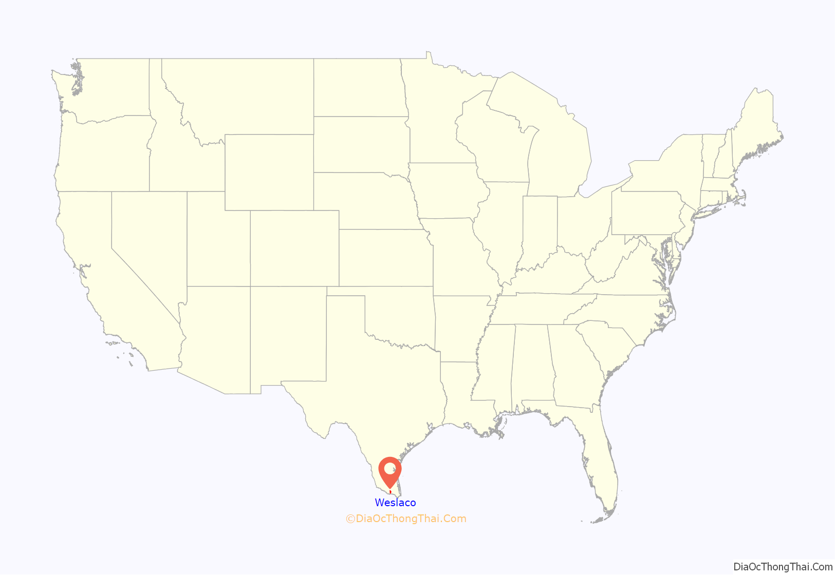
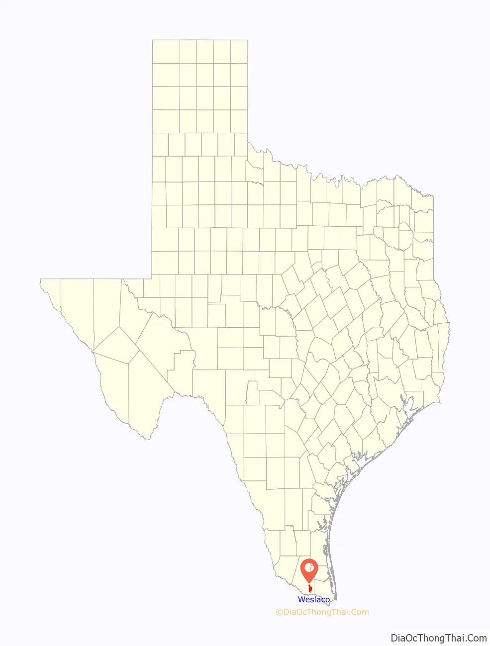
Weslaco location map. Where is Weslaco city?
History
The present location of Weslaco was originally part of the Llano Grande Land Grant granted to Juan José Ynojosa de Ballí in 1790. After Ynojosa’s death, the grant was allocated to his children. Manuela and María received the land on which Weslaco is located today. The Ballí family ranched and maintained ownership of the land until 1852. In 1904, the Hidalgo and San Miguel extension of the St. Louis, Brownsville and Mexico Railway made its way to the site. It was promoted by Uriah Lott, Lon C. Hill, Jr., and others interested in developing the area through farming as opposed to ranching. The American Rio Grande Land and Irrigation Company of neighboring Mercedes purchased a major portion of the Llano Grande grant and platted the West Tract in 1913. In an effort to control raids from Mexico, the United States government stationed troops along the Rio Grande in 1916. A camp was established at the Llano Grande railroad depot. This camp was located between Mercedes and the current site of Weslaco. A watchtower was constructed at Progreso by these troops.
On December 14, 1917, the irrigation company sold 30,000 acres (12,000 ha) at ninety dollars an acre to the W. E. Stewart Land Company. The town name “Weslaco” was derived from the company’s name. The Stewart Company later sold the townsite to Ed C. Couch, Dan R. Couch, R. C. Couch, and R. L. Reeves. The site was surveyed and platted on September 18, 1919, by H. E. Bennett and Ed Payne, a civil engineer hired by Elver Gudo, Ed Couch and R. L. Reeves, whose partners, fearing failure, had backed out of the venture. Nearby communities circulated flyers discouraging settlement at the proposed town. Nevertheless, the sale of lots was held on December 8–10, 1919. Prices ranged from $50 to $400 per lot. To make a claim, individuals had to choose a lot and camp on it until the day of the sale. Lots were given away free to church groups. Three cars were also given away as a promotion during the sale.
In 1941 stamp collector Oliver Rumbel and Weslaco Postmaster Davenport discovered at the Weslaco post office 26 panes (totalling 1,300 stamps) of the 1938 6 cent eagle airmail stamp printed in ultramarine and carmine rather than dark blue and carmine. This color error is recognized by the Scott catalog as C23c. No other examples of this color error were ever reported.
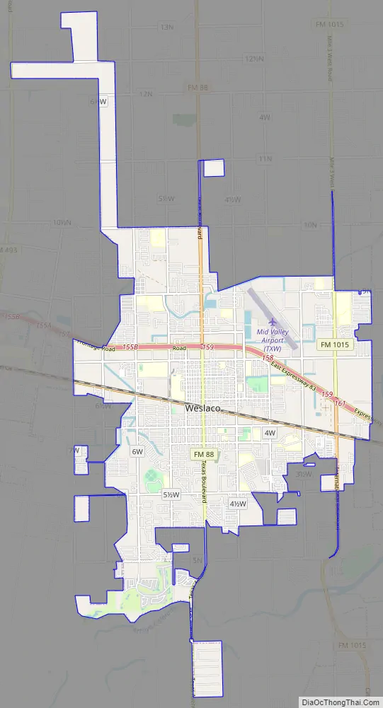
Weslaco Road Map
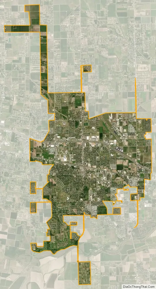
Weslaco city Satellite Map
Geography
Weslaco is located in southeastern Hidalgo County at 26°9′33″N 97°59′15″W / 26.15917°N 97.98750°W / 26.15917; -97.98750 (26.159130, –97.987374). It is bordered to the east by the city of Mercedes and to the west by the city of Donna. Interstate 2 and U.S. Route 83 pass through Weslaco, leading west 16 miles (26 km) to McAllen and east 19 miles (31 km) to Harlingen. Weslaco is 5 miles (8 km) north of Progreso and 7 miles (11 km) north of the bridge over the Rio Grande to Nuevo Progreso in the Mexican state of Tamaulipas.
According to the United States Census Bureau, Weslaco has a total area of 14.8 square miles (38.3 km), of which 14.7 square miles (38.1 km) are land and 0.1 square miles (0.2 km), or 0.49%, are water.
See also
Map of Texas State and its subdivision:- Anderson
- Andrews
- Angelina
- Aransas
- Archer
- Armstrong
- Atascosa
- Austin
- Bailey
- Bandera
- Bastrop
- Baylor
- Bee
- Bell
- Bexar
- Blanco
- Borden
- Bosque
- Bowie
- Brazoria
- Brazos
- Brewster
- Briscoe
- Brooks
- Brown
- Burleson
- Burnet
- Caldwell
- Calhoun
- Callahan
- Cameron
- Camp
- Carson
- Cass
- Castro
- Chambers
- Cherokee
- Childress
- Clay
- Cochran
- Coke
- Coleman
- Collin
- Collingsworth
- Colorado
- Comal
- Comanche
- Concho
- Cooke
- Coryell
- Cottle
- Crane
- Crockett
- Crosby
- Culberson
- Dallam
- Dallas
- Dawson
- Deaf Smith
- Delta
- Denton
- Dewitt
- Dickens
- Dimmit
- Donley
- Duval
- Eastland
- Ector
- Edwards
- El Paso
- Ellis
- Erath
- Falls
- Fannin
- Fayette
- Fisher
- Floyd
- Foard
- Fort Bend
- Franklin
- Freestone
- Frio
- Gaines
- Galveston
- Garza
- Gillespie
- Glasscock
- Goliad
- Gonzales
- Gray
- Grayson
- Gregg
- Grimes
- Guadalupe
- Hale
- Hall
- Hamilton
- Hansford
- Hardeman
- Hardin
- Harris
- Harrison
- Hartley
- Haskell
- Hays
- Hemphill
- Henderson
- Hidalgo
- Hill
- Hockley
- Hood
- Hopkins
- Houston
- Howard
- Hudspeth
- Hunt
- Hutchinson
- Irion
- Jack
- Jackson
- Jasper
- Jeff Davis
- Jefferson
- Jim Hogg
- Jim Wells
- Johnson
- Jones
- Karnes
- Kaufman
- Kendall
- Kenedy
- Kent
- Kerr
- Kimble
- King
- Kinney
- Kleberg
- Knox
- La Salle
- Lamar
- Lamb
- Lampasas
- Lavaca
- Lee
- Leon
- Liberty
- Limestone
- Lipscomb
- Live Oak
- Llano
- Loving
- Lubbock
- Lynn
- Madison
- Marion
- Martin
- Mason
- Matagorda
- Maverick
- McCulloch
- McLennan
- McMullen
- Medina
- Menard
- Midland
- Milam
- Mills
- Mitchell
- Montague
- Montgomery
- Moore
- Morris
- Motley
- Nacogdoches
- Navarro
- Newton
- Nolan
- Nueces
- Ochiltree
- Oldham
- Orange
- Palo Pinto
- Panola
- Parker
- Parmer
- Pecos
- Polk
- Potter
- Presidio
- Rains
- Randall
- Reagan
- Real
- Red River
- Reeves
- Refugio
- Roberts
- Robertson
- Rockwall
- Runnels
- Rusk
- Sabine
- San Augustine
- San Jacinto
- San Patricio
- San Saba
- Schleicher
- Scurry
- Shackelford
- Shelby
- Sherman
- Smith
- Somervell
- Starr
- Stephens
- Sterling
- Stonewall
- Sutton
- Swisher
- Tarrant
- Taylor
- Terrell
- Terry
- Throckmorton
- Titus
- Tom Green
- Travis
- Trinity
- Tyler
- Upshur
- Upton
- Uvalde
- Val Verde
- Van Zandt
- Victoria
- Walker
- Waller
- Ward
- Washington
- Webb
- Wharton
- Wheeler
- Wichita
- Wilbarger
- Willacy
- Williamson
- Wilson
- Winkler
- Wise
- Wood
- Yoakum
- Young
- Zapata
- Zavala
- Alabama
- Alaska
- Arizona
- Arkansas
- California
- Colorado
- Connecticut
- Delaware
- District of Columbia
- Florida
- Georgia
- Hawaii
- Idaho
- Illinois
- Indiana
- Iowa
- Kansas
- Kentucky
- Louisiana
- Maine
- Maryland
- Massachusetts
- Michigan
- Minnesota
- Mississippi
- Missouri
- Montana
- Nebraska
- Nevada
- New Hampshire
- New Jersey
- New Mexico
- New York
- North Carolina
- North Dakota
- Ohio
- Oklahoma
- Oregon
- Pennsylvania
- Rhode Island
- South Carolina
- South Dakota
- Tennessee
- Texas
- Utah
- Vermont
- Virginia
- Washington
- West Virginia
- Wisconsin
- Wyoming


