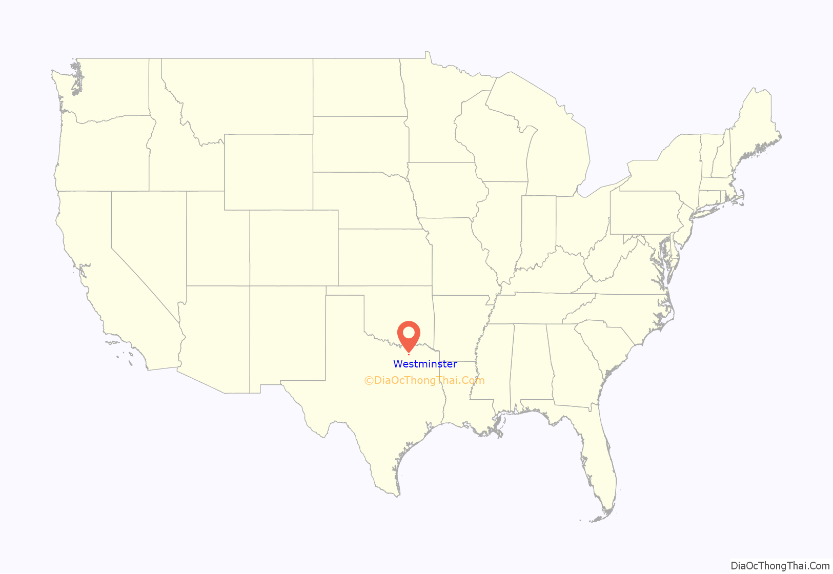
Westminster (/wɛstˈmɪnstər/) is an unincorporated community and census-designated place (CDP) in northeastern Collin County, Texas, United States. The population was 861 as of the 2010 census, up from 390 at the 2000 census, at which time it was a city.
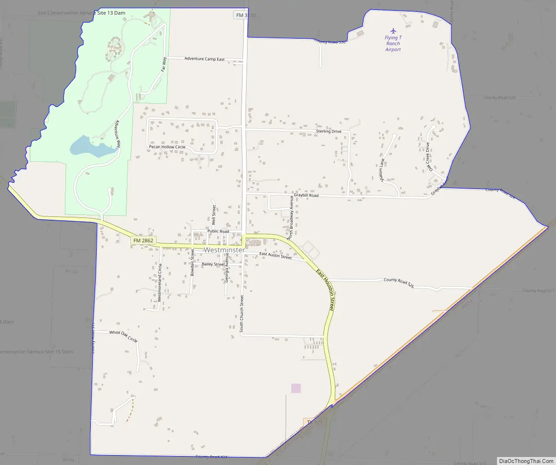
Westminster is located at the intersection of FM 3133 and FM 2862, northeast of McKinney, east of Anna, west of Leonard, north of Blue Ridge, and southeast of Van Alstyne.
| Name: | Westminster CDP |
|---|---|
| LSAD Code: | 57 |
| LSAD Description: | CDP (suffix) |
| State: | Texas |
| County: | Collin County |
| Elevation: | 699 ft (213 m) |
| Total Area: | 3.99 sq mi (10.34 km²) |
| Land Area: | 3.98 sq mi (10.32 km²) |
| Water Area: | 0.008 sq mi (0.02 km²) |
| Total Population: | 861 |
| Population Density: | 216/sq mi (83.4/km²) |
| ZIP code: | 75485 |
| Area code: | 972 |
| FIPS code: | 4877680 |
| GNISfeature ID: | 1388222 |
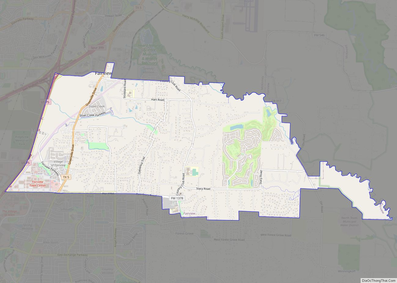
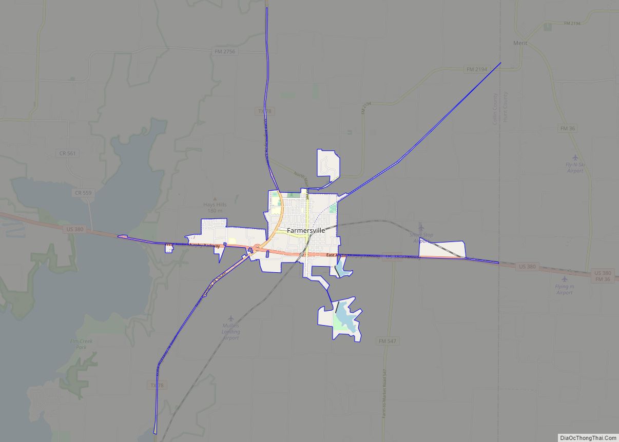
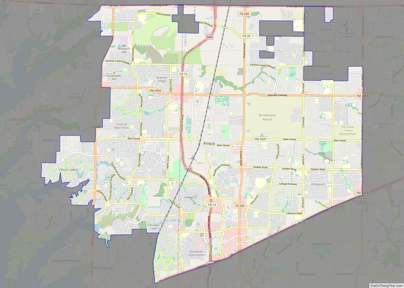
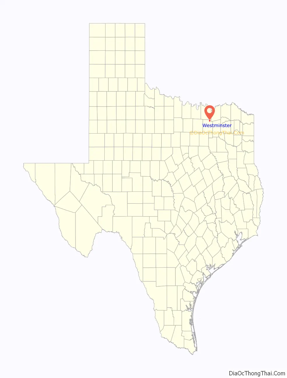
Online Interactive Map
Click on ![]() to view map in "full screen" mode.
to view map in "full screen" mode.
Westminster location map. Where is Westminster CDP?
History
The city was first settled in 1860, and named “Seven Points”. It grew quickly, and by 1885 had absorbed the neighbouring communities of Prospect and Graybill. In 1888, a private school was established; the building was later sold to the Methodist Church, establishing Westminster College. The college, a preparatory school for prospective ministers, was named after Westminster, Maryland, a Methodist stronghold in an otherwise predominantly Catholic state.
Within a year, the residents of Seven Points decided to change the name of their community to Westminster. The town received a post office branch in 1899, and Westminster was incorporated after a vote of 38 to 19 against, on June 17, 1916. Around the same time, the Greenville and Whitewright Northern Traction Company built a railway line from Anna to Blue Ridge that passed through Westminster.
Economic and population growth followed afterward, and from the turn of the 20th century into the 1920s, Westminster served as a cotton market and trade center for local farmers. The population grew to a high of 600, with several businesses and a high school In 1920, however, the railroad line was abandoned, and other railroads bypassed the town.
During the Great Depression, the population of Westminster was reduced by over half (to 268), and the town never had the renewed growth of its larger neighbors (such as Van Alstyne, Anna or Melissa); most of the town’s businesses had closed by World War II.
The population continued to decline until the early 1970s, when it slowly began to recover. By 1990, Westminster’s population was 388.
Westminster received a volunteer fire department in the 1990s. Fire department establishment started by lifelong resident Sam Geer. S.Geer seen a need in the small town for need in fire department response. Geer was the fire chief since the beginning until 2013 when he was made an Honorary Chief.
During the night of May 9, 2006, at around 10:30 P.M., an F3 tornado swept through the small community of Westminster, leveling many homes, damaging several others, and killing 3. Several others were injured and taken to local hospitals, while the American Red Cross set up shelter at Anna High School in nearby Anna. Sirens sounded in Anna, but due to the small population, sirens are not installed in Westminster, giving no warning to its residents. The storm struck very quickly, allowing little time to prepare.
Westminster High School was one of the last (if not the last) Texas school to field an eight-man football team. During the 1983 season, they beat a Dallas area team 90–0.
Westminster Road Map
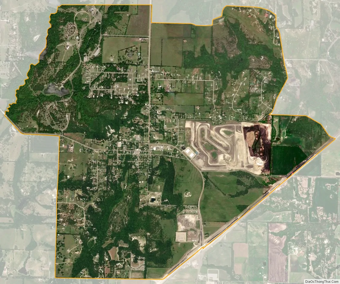
Westminster city Satellite Map
Geography
Westminster is located in northeastern Collin County.
According to the United States Census Bureau, in 2000 the city had a total area of 1.8 square miles (4.7 km), of which 1.8 square miles (4.7 km) was land and 0.55% was water. In 2010, the Westminster CDP had a total area of 4.0 square miles (10.3 km), of which 0.01 square miles (0.02 km), or 0.17%, was water.
See also
Map of Texas State and its subdivision:- Anderson
- Andrews
- Angelina
- Aransas
- Archer
- Armstrong
- Atascosa
- Austin
- Bailey
- Bandera
- Bastrop
- Baylor
- Bee
- Bell
- Bexar
- Blanco
- Borden
- Bosque
- Bowie
- Brazoria
- Brazos
- Brewster
- Briscoe
- Brooks
- Brown
- Burleson
- Burnet
- Caldwell
- Calhoun
- Callahan
- Cameron
- Camp
- Carson
- Cass
- Castro
- Chambers
- Cherokee
- Childress
- Clay
- Cochran
- Coke
- Coleman
- Collin
- Collingsworth
- Colorado
- Comal
- Comanche
- Concho
- Cooke
- Coryell
- Cottle
- Crane
- Crockett
- Crosby
- Culberson
- Dallam
- Dallas
- Dawson
- Deaf Smith
- Delta
- Denton
- Dewitt
- Dickens
- Dimmit
- Donley
- Duval
- Eastland
- Ector
- Edwards
- El Paso
- Ellis
- Erath
- Falls
- Fannin
- Fayette
- Fisher
- Floyd
- Foard
- Fort Bend
- Franklin
- Freestone
- Frio
- Gaines
- Galveston
- Garza
- Gillespie
- Glasscock
- Goliad
- Gonzales
- Gray
- Grayson
- Gregg
- Grimes
- Guadalupe
- Hale
- Hall
- Hamilton
- Hansford
- Hardeman
- Hardin
- Harris
- Harrison
- Hartley
- Haskell
- Hays
- Hemphill
- Henderson
- Hidalgo
- Hill
- Hockley
- Hood
- Hopkins
- Houston
- Howard
- Hudspeth
- Hunt
- Hutchinson
- Irion
- Jack
- Jackson
- Jasper
- Jeff Davis
- Jefferson
- Jim Hogg
- Jim Wells
- Johnson
- Jones
- Karnes
- Kaufman
- Kendall
- Kenedy
- Kent
- Kerr
- Kimble
- King
- Kinney
- Kleberg
- Knox
- La Salle
- Lamar
- Lamb
- Lampasas
- Lavaca
- Lee
- Leon
- Liberty
- Limestone
- Lipscomb
- Live Oak
- Llano
- Loving
- Lubbock
- Lynn
- Madison
- Marion
- Martin
- Mason
- Matagorda
- Maverick
- McCulloch
- McLennan
- McMullen
- Medina
- Menard
- Midland
- Milam
- Mills
- Mitchell
- Montague
- Montgomery
- Moore
- Morris
- Motley
- Nacogdoches
- Navarro
- Newton
- Nolan
- Nueces
- Ochiltree
- Oldham
- Orange
- Palo Pinto
- Panola
- Parker
- Parmer
- Pecos
- Polk
- Potter
- Presidio
- Rains
- Randall
- Reagan
- Real
- Red River
- Reeves
- Refugio
- Roberts
- Robertson
- Rockwall
- Runnels
- Rusk
- Sabine
- San Augustine
- San Jacinto
- San Patricio
- San Saba
- Schleicher
- Scurry
- Shackelford
- Shelby
- Sherman
- Smith
- Somervell
- Starr
- Stephens
- Sterling
- Stonewall
- Sutton
- Swisher
- Tarrant
- Taylor
- Terrell
- Terry
- Throckmorton
- Titus
- Tom Green
- Travis
- Trinity
- Tyler
- Upshur
- Upton
- Uvalde
- Val Verde
- Van Zandt
- Victoria
- Walker
- Waller
- Ward
- Washington
- Webb
- Wharton
- Wheeler
- Wichita
- Wilbarger
- Willacy
- Williamson
- Wilson
- Winkler
- Wise
- Wood
- Yoakum
- Young
- Zapata
- Zavala
- Alabama
- Alaska
- Arizona
- Arkansas
- California
- Colorado
- Connecticut
- Delaware
- District of Columbia
- Florida
- Georgia
- Hawaii
- Idaho
- Illinois
- Indiana
- Iowa
- Kansas
- Kentucky
- Louisiana
- Maine
- Maryland
- Massachusetts
- Michigan
- Minnesota
- Mississippi
- Missouri
- Montana
- Nebraska
- Nevada
- New Hampshire
- New Jersey
- New Mexico
- New York
- North Carolina
- North Dakota
- Ohio
- Oklahoma
- Oregon
- Pennsylvania
- Rhode Island
- South Carolina
- South Dakota
- Tennessee
- Texas
- Utah
- Vermont
- Virginia
- Washington
- West Virginia
- Wisconsin
- Wyoming