Willis is a city in Montgomery County, Texas, United States, located eight miles north of Conroe in north central Montgomery County. The city began to develop in 1870 after what is now the Union Pacific Railroad built track through the area. As a part of the Piney Woods, the Willis economy has historically been driven by lumber, agriculture, and the manufacture of lumber and agriculture equipment. From the late nineteenth to early twentieth century, it produced tobacco as a commodity crop. Competition from Cuba reduced its contribution to the economy.
As of 2020, the population of Willis was estimated to be 6,431. In 2008, after Willis’s population passed 5,000, the city established a home rule city charter.
| Name: | Willis city |
|---|---|
| LSAD Code: | 25 |
| LSAD Description: | city (suffix) |
| State: | Texas |
| County: | Montgomery County |
| Incorporated: | 1937 (Home Rule: 2008) |
| Elevation: | 381 ft (116 m) |
| Total Area: | 4.73 sq mi (12.26 km²) |
| Land Area: | 4.73 sq mi (12.26 km²) |
| Water Area: | 0.00 sq mi (0.01 km²) |
| Total Population: | 6,431 |
| Population Density: | 1,484.89/sq mi (573.38/km²) |
| ZIP code: | 77318, 77378 |
| Area code: | 936 |
| FIPS code: | 4879408 |
| GNISfeature ID: | 1371602 |
| Website: | www.ci.willis.tx.us |
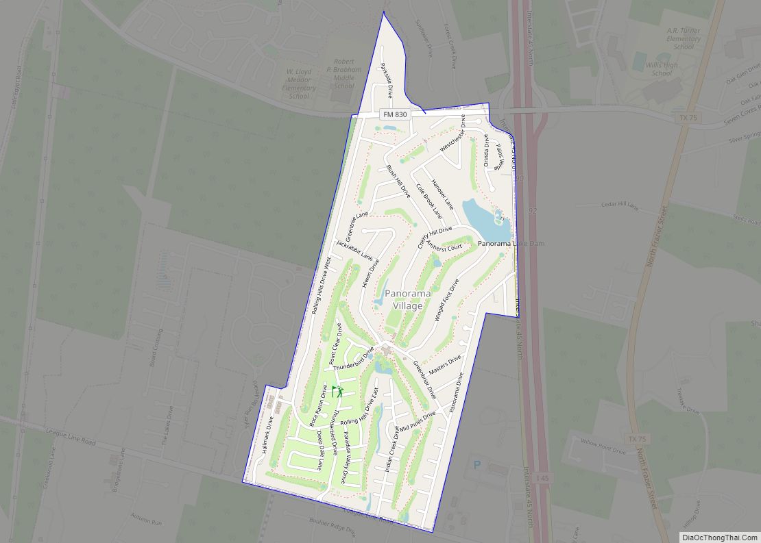
Online Interactive Map
Click on ![]() to view map in "full screen" mode.
to view map in "full screen" mode.
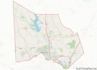
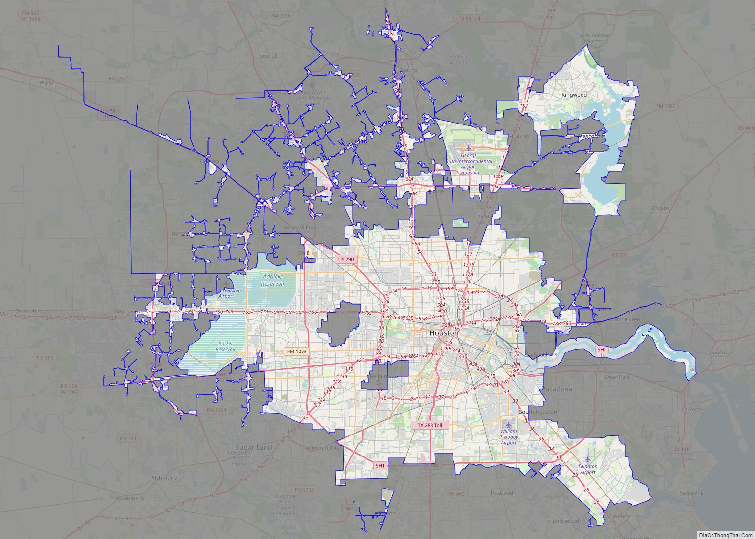
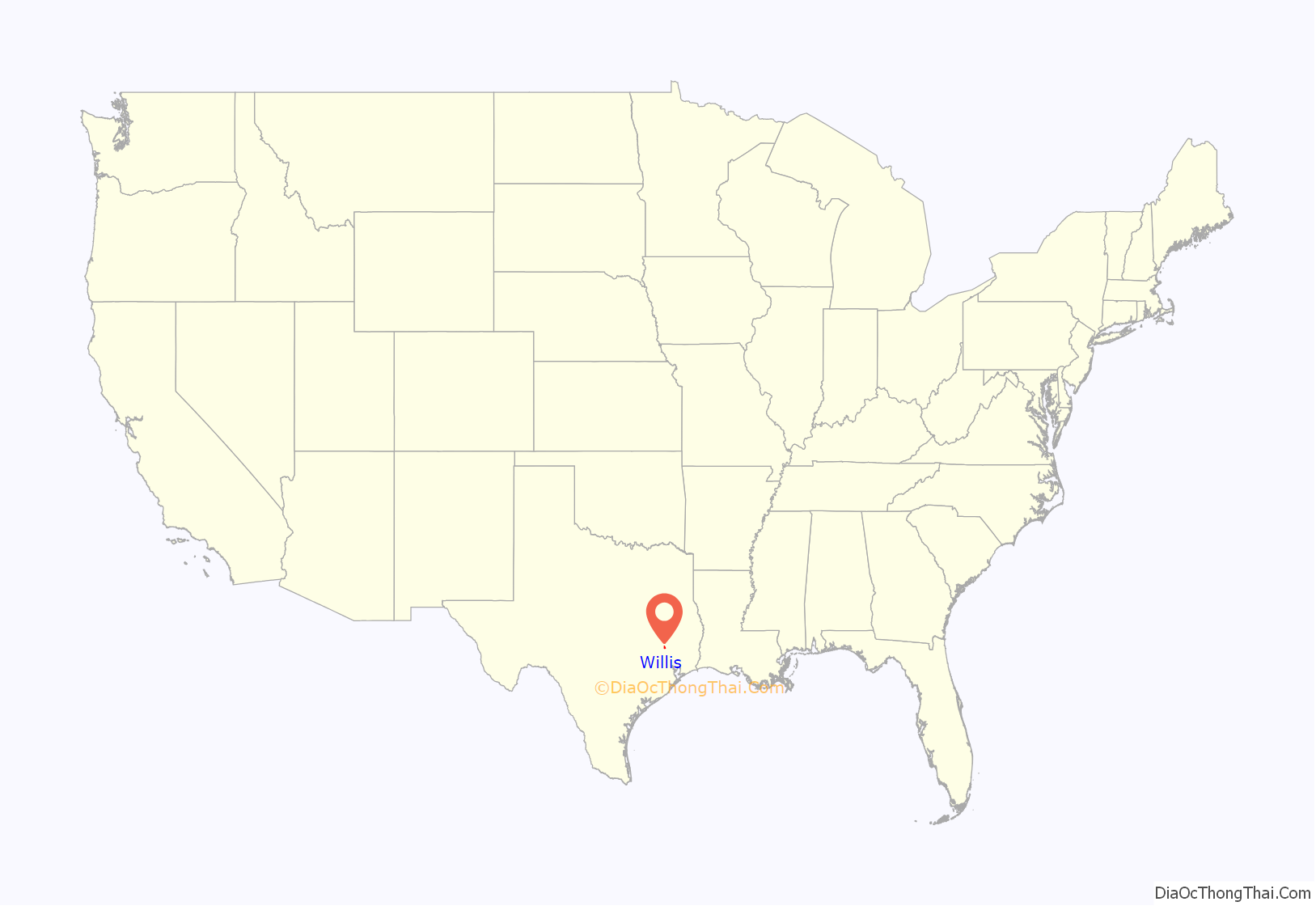
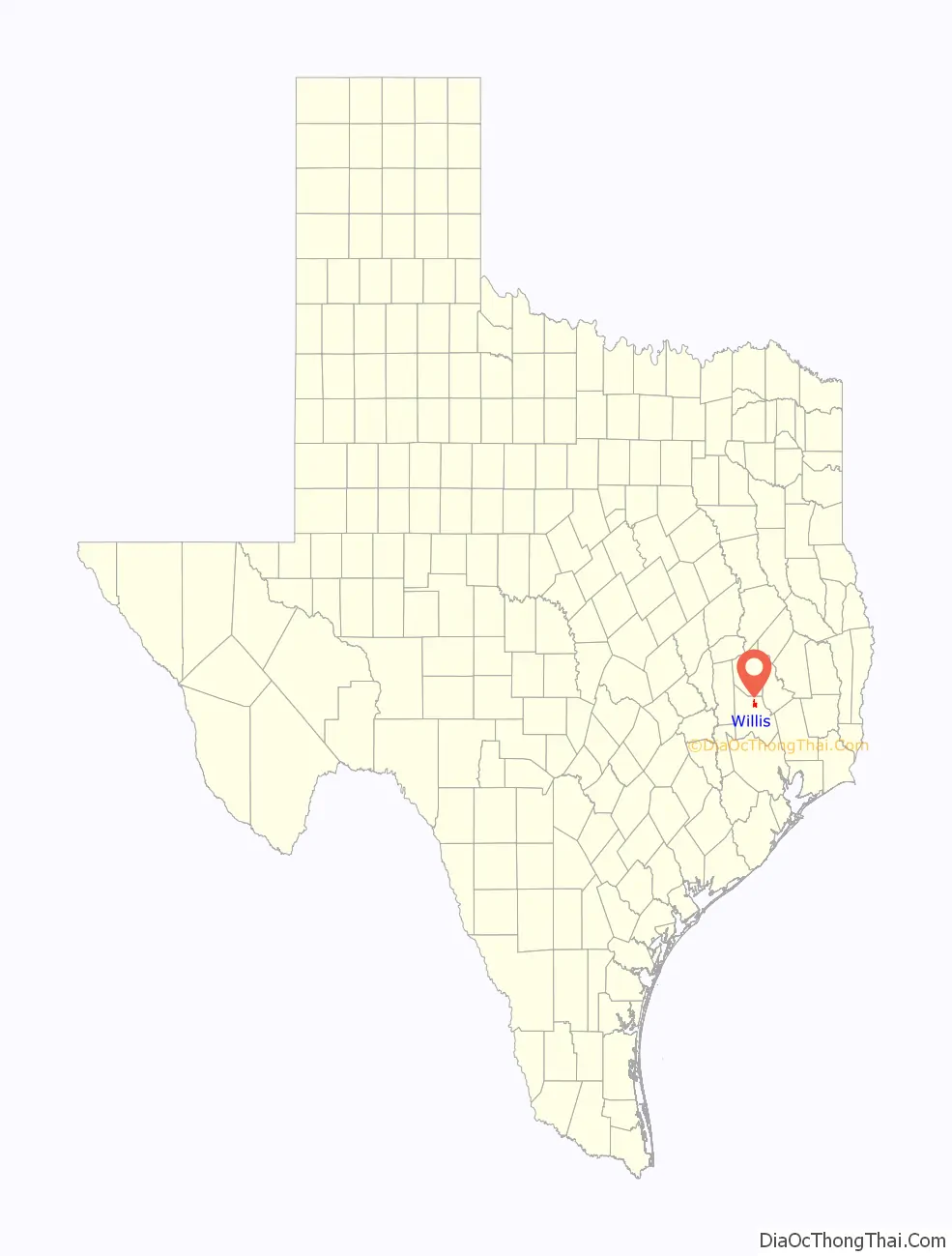
Willis location map. Where is Willis city?
History
Before the founding of Willis, most residents in the area lived in a settlement known as Danville, formed in the 1830s four miles west of present-day New Waverly. A few Danville residents in the 1850s settled to the south, founding the new community of what is now Willis.
Several of these early Danville residents were large planters, who held numerous enslaved African Americans to work the labor-intensive tobacco crops on their plantations. In the 1850s, enslaved African Americans outnumbered whites in Danville: there were 600 slaves and 400 whites. After the Civil War, many freedmen and their families moved away from the plantations to the Willis area. There in 1867 they established Thomas Chapel United Methodist Church, which is the oldest church in Willis.
In 1870, the Houston and Great Northern Railroad (now the Union Pacific Railroad) decided to build a railroad through Montgomery County. After residents of Danville refused to allow the railway through their town, Peter J. and Richard S. Willis donated a parcel of their landholdings in Montgomery County so the railroad and station stop could be built there. They founded the town of Willis in the process. Upon the railroad’s completion in 1872, many residents of Danville, Old Waverly, and Montgomery moved to the new town of Willis.
In 1874, a county election was held to determine whether the county seat of Montgomery County should be transferred from the town of Montgomery to Willis. Although Willis received more votes (788 to 646), it did not gain the requisite two-thirds majority, so the county seat remained officially in Montgomery. A protracted legal battle ended in 1878 when the Supreme Court of Texas ruled in favor of Montgomery. With several county officials and Willis residents refusing to accept the results, another county seat election was held in 1880. That year Montgomery won the vote over Willis, 1308 to 1243. The dispute between the two towns finally ended in 1889, when Conroe was selected as the county seat.
In the 1870s, the main occupations were farming, shipping, and the manufacture of lumber and agricultural products. In 1891, local Willis residents started growing Cuban tobacco, and Willis developed as a center for the production of cigars and other tobacco products. During the early years of the Great Depression, Willis suffered from falling demand in lumber products and a sharp decline in the demand for tobacco products. A man named Tom Payne was lynched in Willis in 1927.
The economy began to recover in 1931 during the Texas oil boom, when oil was discovered in the area. In the 1930s and 40s, the development of U.S. Route 75, along with the recovery of the lumber industry during World War II, fully revitalized the local economy.
In the mid to late 20th century through the present, agriculture and lumber remain vital components of the Willis economy, in addition to the retail, service, and manufacturing industries.
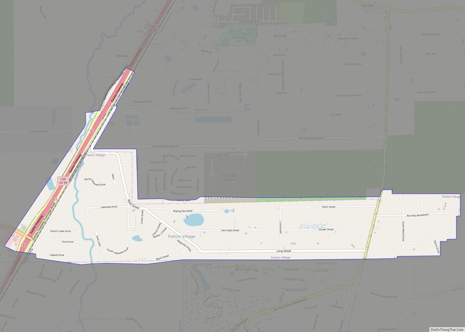
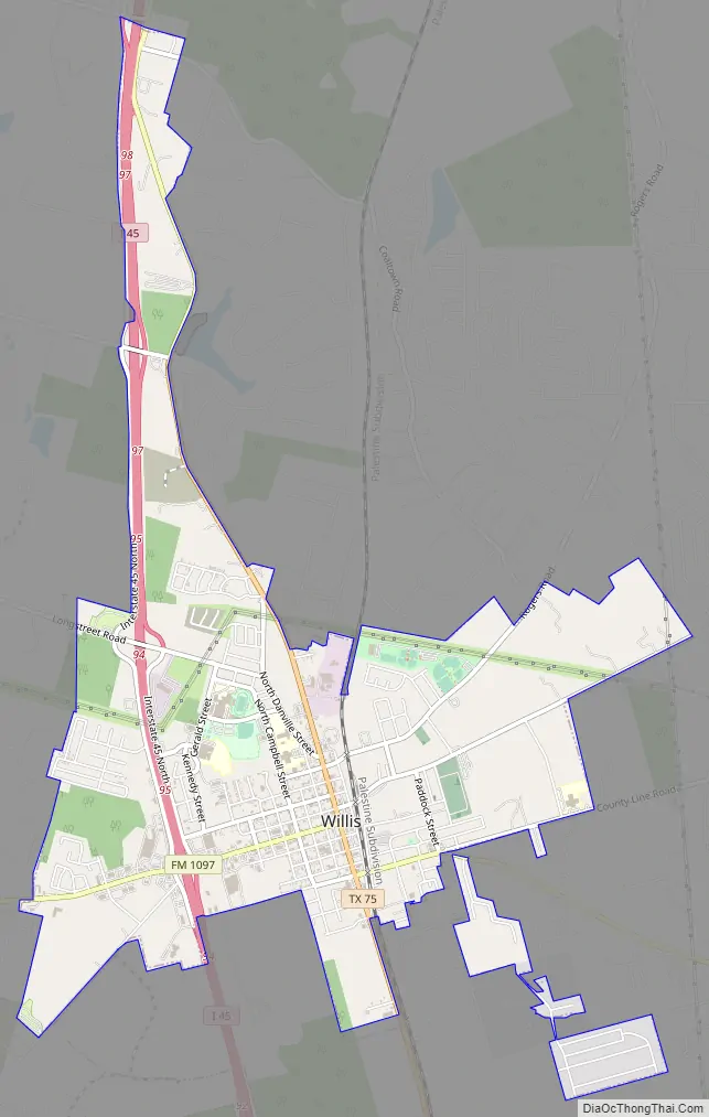
Willis Road Map
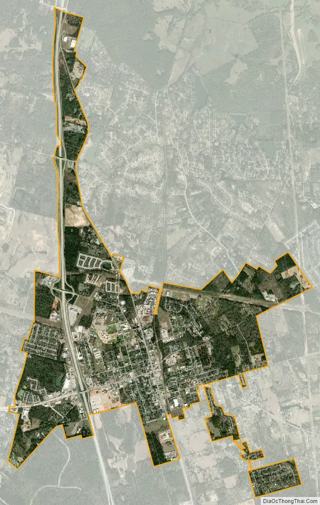
Willis city Satellite Map
Geography
Willis is located at 30°25′22″N 95°28′44″W / 30.42278°N 95.47889°W / 30.42278; -95.47889 (30.422640, –95.478829).
According to the United States Census Bureau, the city has a total area of 3.3 square miles (8.5 km), all of it land.
See also
Map of Texas State and its subdivision:- Anderson
- Andrews
- Angelina
- Aransas
- Archer
- Armstrong
- Atascosa
- Austin
- Bailey
- Bandera
- Bastrop
- Baylor
- Bee
- Bell
- Bexar
- Blanco
- Borden
- Bosque
- Bowie
- Brazoria
- Brazos
- Brewster
- Briscoe
- Brooks
- Brown
- Burleson
- Burnet
- Caldwell
- Calhoun
- Callahan
- Cameron
- Camp
- Carson
- Cass
- Castro
- Chambers
- Cherokee
- Childress
- Clay
- Cochran
- Coke
- Coleman
- Collin
- Collingsworth
- Colorado
- Comal
- Comanche
- Concho
- Cooke
- Coryell
- Cottle
- Crane
- Crockett
- Crosby
- Culberson
- Dallam
- Dallas
- Dawson
- Deaf Smith
- Delta
- Denton
- Dewitt
- Dickens
- Dimmit
- Donley
- Duval
- Eastland
- Ector
- Edwards
- El Paso
- Ellis
- Erath
- Falls
- Fannin
- Fayette
- Fisher
- Floyd
- Foard
- Fort Bend
- Franklin
- Freestone
- Frio
- Gaines
- Galveston
- Garza
- Gillespie
- Glasscock
- Goliad
- Gonzales
- Gray
- Grayson
- Gregg
- Grimes
- Guadalupe
- Hale
- Hall
- Hamilton
- Hansford
- Hardeman
- Hardin
- Harris
- Harrison
- Hartley
- Haskell
- Hays
- Hemphill
- Henderson
- Hidalgo
- Hill
- Hockley
- Hood
- Hopkins
- Houston
- Howard
- Hudspeth
- Hunt
- Hutchinson
- Irion
- Jack
- Jackson
- Jasper
- Jeff Davis
- Jefferson
- Jim Hogg
- Jim Wells
- Johnson
- Jones
- Karnes
- Kaufman
- Kendall
- Kenedy
- Kent
- Kerr
- Kimble
- King
- Kinney
- Kleberg
- Knox
- La Salle
- Lamar
- Lamb
- Lampasas
- Lavaca
- Lee
- Leon
- Liberty
- Limestone
- Lipscomb
- Live Oak
- Llano
- Loving
- Lubbock
- Lynn
- Madison
- Marion
- Martin
- Mason
- Matagorda
- Maverick
- McCulloch
- McLennan
- McMullen
- Medina
- Menard
- Midland
- Milam
- Mills
- Mitchell
- Montague
- Montgomery
- Moore
- Morris
- Motley
- Nacogdoches
- Navarro
- Newton
- Nolan
- Nueces
- Ochiltree
- Oldham
- Orange
- Palo Pinto
- Panola
- Parker
- Parmer
- Pecos
- Polk
- Potter
- Presidio
- Rains
- Randall
- Reagan
- Real
- Red River
- Reeves
- Refugio
- Roberts
- Robertson
- Rockwall
- Runnels
- Rusk
- Sabine
- San Augustine
- San Jacinto
- San Patricio
- San Saba
- Schleicher
- Scurry
- Shackelford
- Shelby
- Sherman
- Smith
- Somervell
- Starr
- Stephens
- Sterling
- Stonewall
- Sutton
- Swisher
- Tarrant
- Taylor
- Terrell
- Terry
- Throckmorton
- Titus
- Tom Green
- Travis
- Trinity
- Tyler
- Upshur
- Upton
- Uvalde
- Val Verde
- Van Zandt
- Victoria
- Walker
- Waller
- Ward
- Washington
- Webb
- Wharton
- Wheeler
- Wichita
- Wilbarger
- Willacy
- Williamson
- Wilson
- Winkler
- Wise
- Wood
- Yoakum
- Young
- Zapata
- Zavala
- Alabama
- Alaska
- Arizona
- Arkansas
- California
- Colorado
- Connecticut
- Delaware
- District of Columbia
- Florida
- Georgia
- Hawaii
- Idaho
- Illinois
- Indiana
- Iowa
- Kansas
- Kentucky
- Louisiana
- Maine
- Maryland
- Massachusetts
- Michigan
- Minnesota
- Mississippi
- Missouri
- Montana
- Nebraska
- Nevada
- New Hampshire
- New Jersey
- New Mexico
- New York
- North Carolina
- North Dakota
- Ohio
- Oklahoma
- Oregon
- Pennsylvania
- Rhode Island
- South Carolina
- South Dakota
- Tennessee
- Texas
- Utah
- Vermont
- Virginia
- Washington
- West Virginia
- Wisconsin
- Wyoming