Kenedy is a city in Karnes County, Texas, United States, named for Mifflin Kenedy, who bought 400,000 acres (1,600 km) and wanted to develop a new town that would carry his name. The population was 3,473 at the 2020 census, up from 3,296 at the 2010 census.
| Name: | Kenedy city |
|---|---|
| LSAD Code: | 25 |
| LSAD Description: | city (suffix) |
| State: | Texas |
| County: | Karnes County |
| Elevation: | 266 ft (81 m) |
| Total Area: | 3.68 sq mi (9.52 km²) |
| Land Area: | 3.67 sq mi (9.49 km²) |
| Water Area: | 0.01 sq mi (0.03 km²) |
| Total Population: | 3,473 |
| Population Density: | 914.62/sq mi (353.17/km²) |
| ZIP code: | 78119 |
| Area code: | 830 |
| FIPS code: | 4838860 |
| GNISfeature ID: | 1360572 |
| Website: | www.cityofkenedy.org |
Online Interactive Map
Click on ![]() to view map in "full screen" mode.
to view map in "full screen" mode.
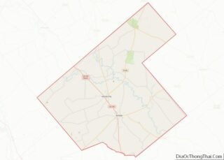
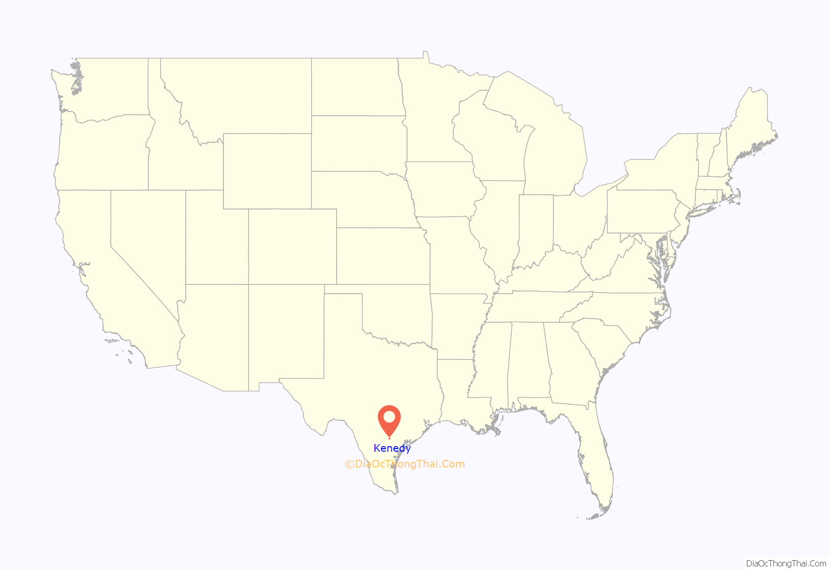
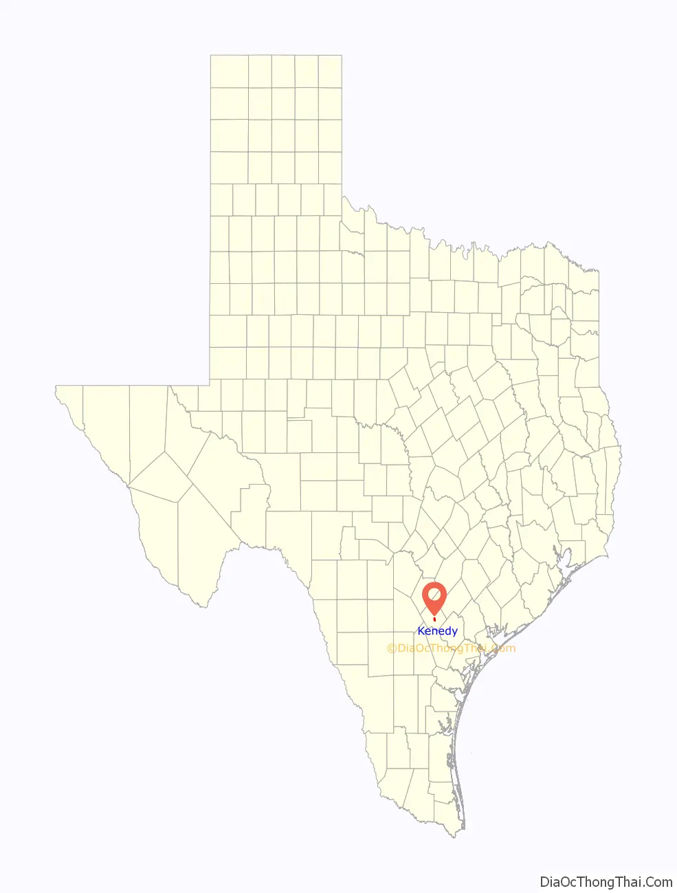
Kenedy location map. Where is Kenedy city?
History
In the early 1900s many of Kenedy’s gunfighter shootings caused the town to be nicknamed “Six Shooter Junction”.
During World War II, the Kenedy Allen Detention Camp was located near the outskirts of the town, on a former Civilian Conservation Corps site. Though it later served as a prisoner of war camp, it started as an internment camp for people of German, Italian and Japanese ancestry deported from Latin America, as well as some who were long-term residents of the U.S. The camp opened in April 1942, when the first group of Latin American deportees arrived: 456 Germans, 156 Japanese and 14 Italians. Despite State Department prisoner exchanges, in which German and Japanese Latin Americans were “repatriated” and traded for U.S. citizens in Axis custody, Kenedy’s population swelled to 2,007 by October 1943: 1,168 Germans, 705 Japanese, 72 Italians, and 62 “miscellaneous”. The 705 of Japanese descent included U.S. civilians. In 1944, the remaining internees were transferred to other facilities, and by September it had been converted to a German POW camp; beginning in July 1945, the camp was also used to house Japanese POWs. The camp was closed at the end of the war, in September 1945.
The John B. Connally Unit, a state prison, is located 2 miles (3 km) south of the city limits. On December 13, 2000, a group called the Texas Seven escaped from that prison. They would go on a deadly crime spree before being caught.
On July 24, 2019, the Karnes Countywide Newspaper featured a story on a Kenedy house with ties to a world famous San Antonio landmark. Blueprints by Hugman-Silber Architects were discovered in the cedar closet of the house. The blueprints were drawn and traced by Robert H.H. Hugman, the acknowledged visionary behind the San Antonio River Walk.
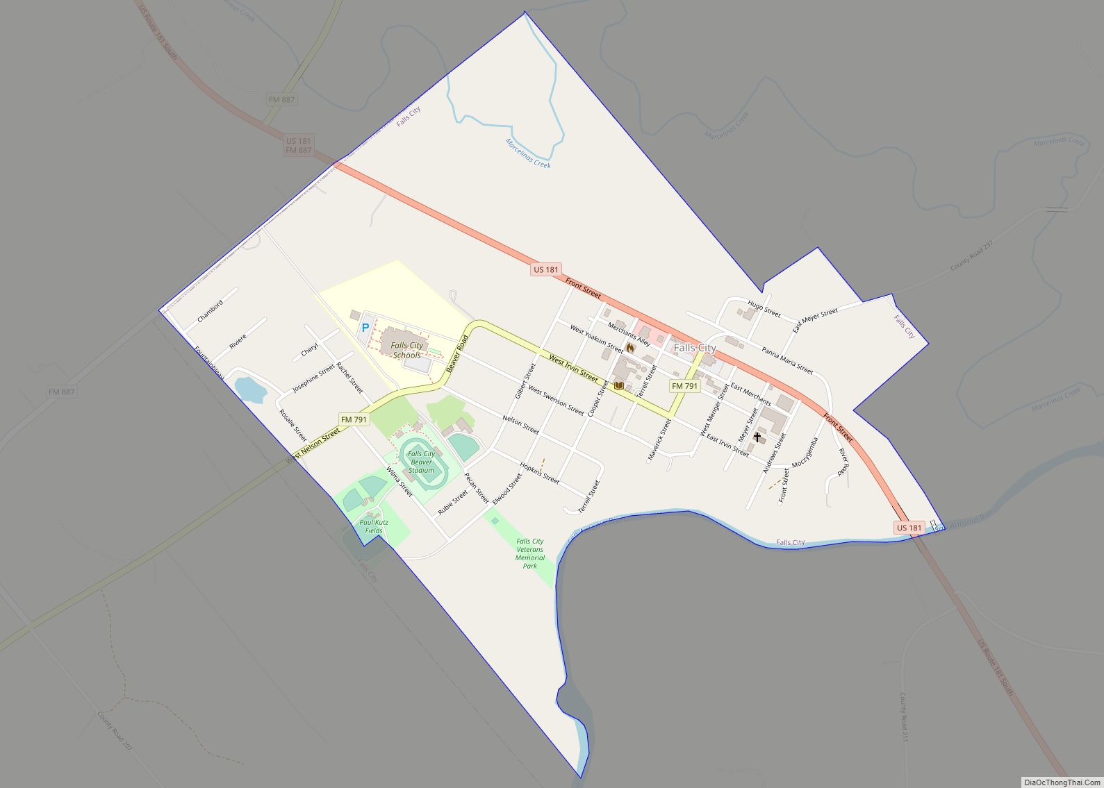
Kenedy Road Map
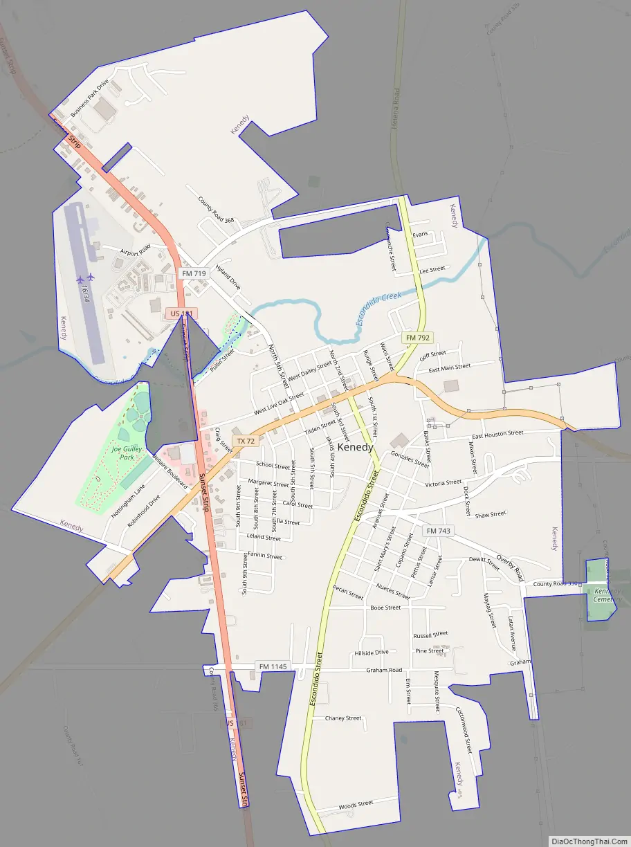
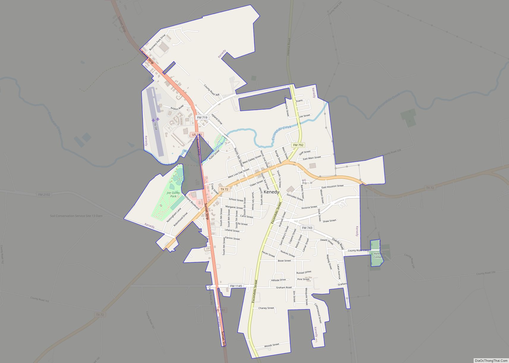
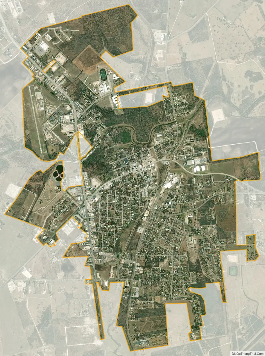
Kenedy city Satellite Map
Geography
Kenedy is located in south-central Karnes County at 28°49′N 97°51′W / 28.817°N 97.850°W / 28.817; -97.850 (28.8143, –97.8496). U.S. Route 181 runs through the west side of the city, leading northwest 6 miles (10 km) to Karnes City, the county seat, and 60 miles (97 km) to San Antonio. To the south US-181 leads 31 miles (50 km) to Beeville and 88 miles (142 km) to Corpus Christi. Texas State Highway 72 (Main Street) passes through the center of Kenedy, leading northeast 25 miles (40 km) to Yorktown and southwest 33 miles (53 km) to Three Rivers.
According to the United States Census Bureau, the city of Kenedy has a total area of 3.6 square miles (9.4 km), of which 0.01 square miles (0.03 km), or 0.29%, are water.
See also
Map of Texas State and its subdivision:- Anderson
- Andrews
- Angelina
- Aransas
- Archer
- Armstrong
- Atascosa
- Austin
- Bailey
- Bandera
- Bastrop
- Baylor
- Bee
- Bell
- Bexar
- Blanco
- Borden
- Bosque
- Bowie
- Brazoria
- Brazos
- Brewster
- Briscoe
- Brooks
- Brown
- Burleson
- Burnet
- Caldwell
- Calhoun
- Callahan
- Cameron
- Camp
- Carson
- Cass
- Castro
- Chambers
- Cherokee
- Childress
- Clay
- Cochran
- Coke
- Coleman
- Collin
- Collingsworth
- Colorado
- Comal
- Comanche
- Concho
- Cooke
- Coryell
- Cottle
- Crane
- Crockett
- Crosby
- Culberson
- Dallam
- Dallas
- Dawson
- Deaf Smith
- Delta
- Denton
- Dewitt
- Dickens
- Dimmit
- Donley
- Duval
- Eastland
- Ector
- Edwards
- El Paso
- Ellis
- Erath
- Falls
- Fannin
- Fayette
- Fisher
- Floyd
- Foard
- Fort Bend
- Franklin
- Freestone
- Frio
- Gaines
- Galveston
- Garza
- Gillespie
- Glasscock
- Goliad
- Gonzales
- Gray
- Grayson
- Gregg
- Grimes
- Guadalupe
- Hale
- Hall
- Hamilton
- Hansford
- Hardeman
- Hardin
- Harris
- Harrison
- Hartley
- Haskell
- Hays
- Hemphill
- Henderson
- Hidalgo
- Hill
- Hockley
- Hood
- Hopkins
- Houston
- Howard
- Hudspeth
- Hunt
- Hutchinson
- Irion
- Jack
- Jackson
- Jasper
- Jeff Davis
- Jefferson
- Jim Hogg
- Jim Wells
- Johnson
- Jones
- Karnes
- Kaufman
- Kendall
- Kenedy
- Kent
- Kerr
- Kimble
- King
- Kinney
- Kleberg
- Knox
- La Salle
- Lamar
- Lamb
- Lampasas
- Lavaca
- Lee
- Leon
- Liberty
- Limestone
- Lipscomb
- Live Oak
- Llano
- Loving
- Lubbock
- Lynn
- Madison
- Marion
- Martin
- Mason
- Matagorda
- Maverick
- McCulloch
- McLennan
- McMullen
- Medina
- Menard
- Midland
- Milam
- Mills
- Mitchell
- Montague
- Montgomery
- Moore
- Morris
- Motley
- Nacogdoches
- Navarro
- Newton
- Nolan
- Nueces
- Ochiltree
- Oldham
- Orange
- Palo Pinto
- Panola
- Parker
- Parmer
- Pecos
- Polk
- Potter
- Presidio
- Rains
- Randall
- Reagan
- Real
- Red River
- Reeves
- Refugio
- Roberts
- Robertson
- Rockwall
- Runnels
- Rusk
- Sabine
- San Augustine
- San Jacinto
- San Patricio
- San Saba
- Schleicher
- Scurry
- Shackelford
- Shelby
- Sherman
- Smith
- Somervell
- Starr
- Stephens
- Sterling
- Stonewall
- Sutton
- Swisher
- Tarrant
- Taylor
- Terrell
- Terry
- Throckmorton
- Titus
- Tom Green
- Travis
- Trinity
- Tyler
- Upshur
- Upton
- Uvalde
- Val Verde
- Van Zandt
- Victoria
- Walker
- Waller
- Ward
- Washington
- Webb
- Wharton
- Wheeler
- Wichita
- Wilbarger
- Willacy
- Williamson
- Wilson
- Winkler
- Wise
- Wood
- Yoakum
- Young
- Zapata
- Zavala
- Alabama
- Alaska
- Arizona
- Arkansas
- California
- Colorado
- Connecticut
- Delaware
- District of Columbia
- Florida
- Georgia
- Hawaii
- Idaho
- Illinois
- Indiana
- Iowa
- Kansas
- Kentucky
- Louisiana
- Maine
- Maryland
- Massachusetts
- Michigan
- Minnesota
- Mississippi
- Missouri
- Montana
- Nebraska
- Nevada
- New Hampshire
- New Jersey
- New Mexico
- New York
- North Carolina
- North Dakota
- Ohio
- Oklahoma
- Oregon
- Pennsylvania
- Rhode Island
- South Carolina
- South Dakota
- Tennessee
- Texas
- Utah
- Vermont
- Virginia
- Washington
- West Virginia
- Wisconsin
- Wyoming