Carrizo Springs is the largest city in and the county seat of Dimmit County, Texas, United States. The population was 5,368 at the 2010 census. (2018 estimate 5,470).
The name of the town is derived from the local springs, which were named by the Spanish for the cane grass that once grew around them. It is the oldest town in Dimmit County. Artesian wells in the area are known for their pure, clean water. This water is often exported from Carrizo Springs for use as holy water.
| Name: | Carrizo Springs city |
|---|---|
| LSAD Code: | 25 |
| LSAD Description: | city (suffix) |
| State: | Texas |
| County: | Dimmit County |
| Elevation: | 604 ft (184 m) |
| Total Area: | 3.10 sq mi (8.03 km²) |
| Land Area: | 3.09 sq mi (8.00 km²) |
| Water Area: | 0.01 sq mi (0.03 km²) |
| Total Population: | 5,368 |
| Population Density: | 1,735.28/sq mi (669.90/km²) |
| ZIP code: | 78834 |
| Area code: | 830 |
| FIPS code: | 4812988 |
| GNISfeature ID: | 1372953 |
| Website: | cityofcarrizo.org |
Online Interactive Map
Click on ![]() to view map in "full screen" mode.
to view map in "full screen" mode.
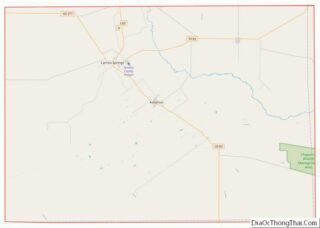
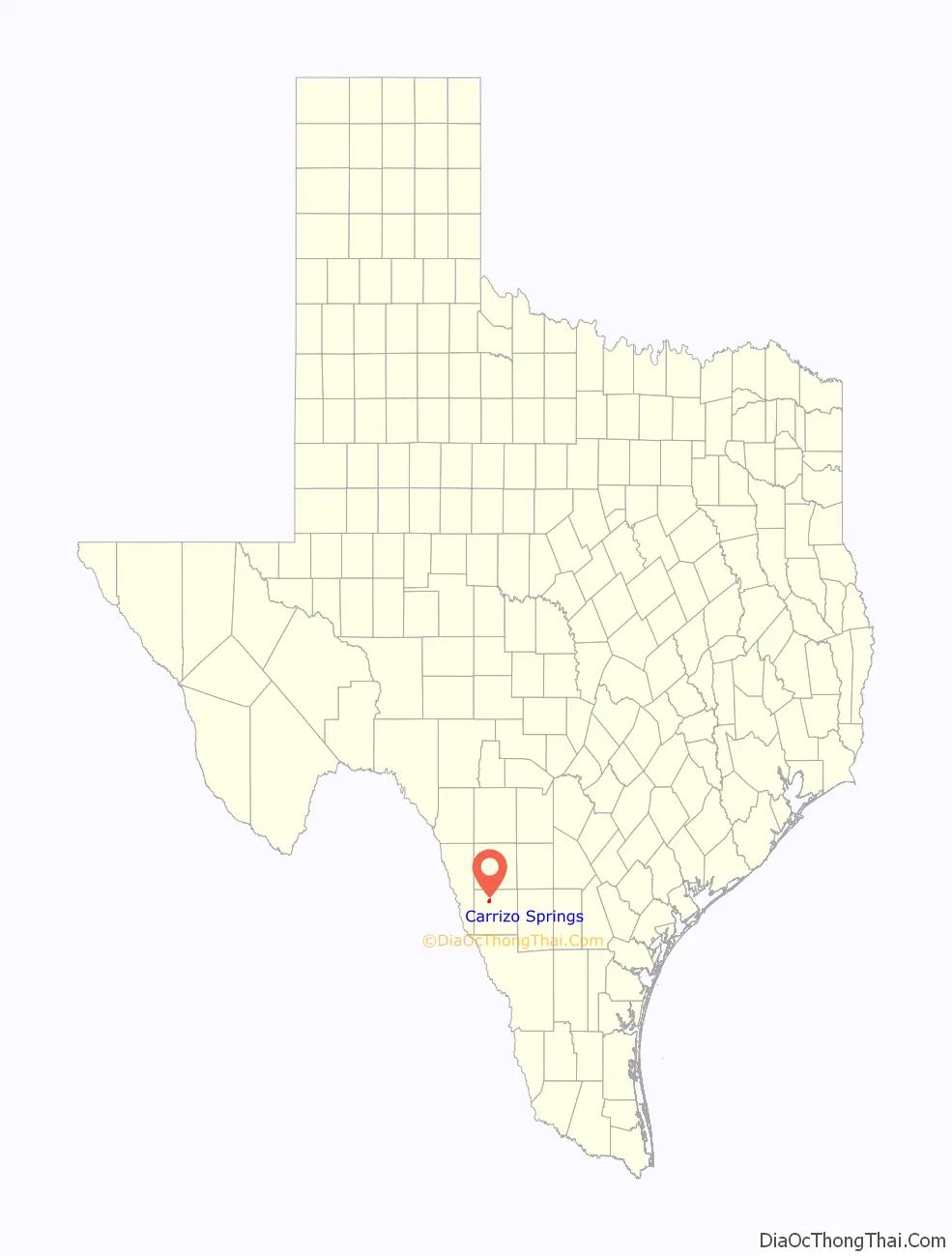
Carrizo Springs location map. Where is Carrizo Springs city?

History
Carrizo Springs lies along U.S. Route 83, about 82 miles northwest of Laredo and 45 miles north of the Mexican border. Route 83 intersects U.S. Route 277 there. The name “Carrizo Springs” derives from similarly named springs in the area; the name is Spanish for a type of grass once common in the area. Founded in 1865 by settlers from Atascosa County, Carrizo Springs is the oldest community in the county.
Carrizo Springs, along with San Antonio, Uvalde, Crystal City, and Corpus Christi, was a major stop on the defunct San Antonio, Uvalde and Gulf Railroad, a Class I line, which operated from 1909 until it was merged into the Missouri Pacific Railroad in 1956.
More recently, Carrizo Springs has become the home of the only olive orchard and oil press in Texas.
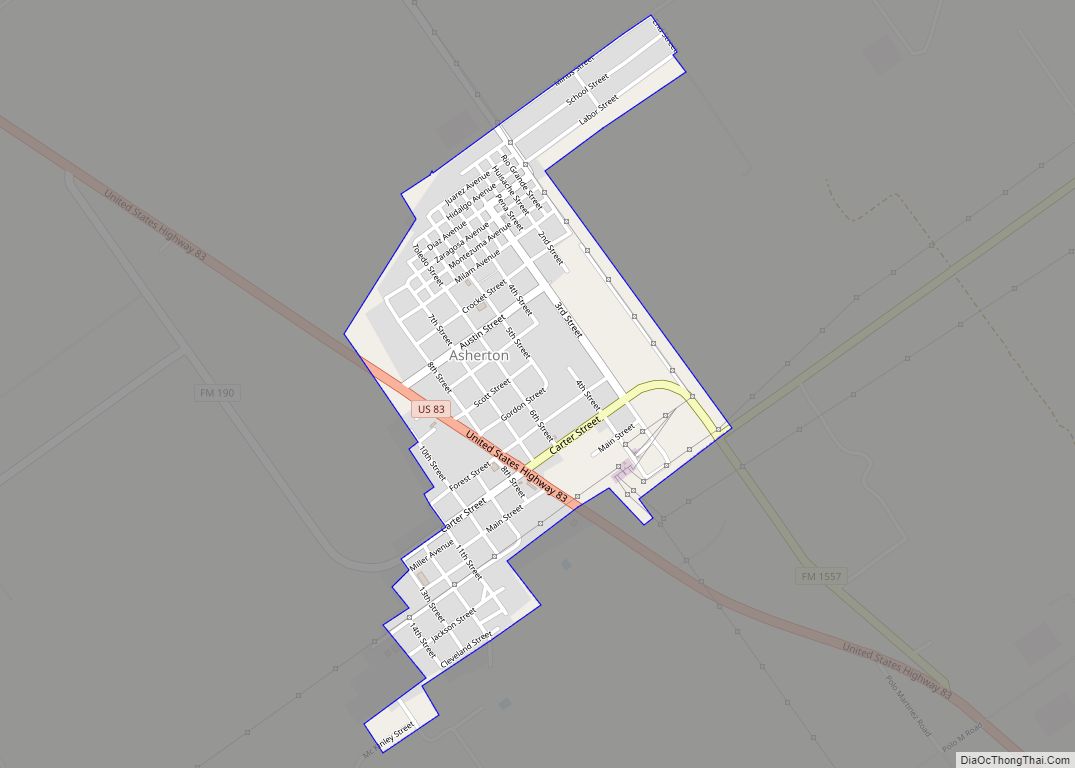
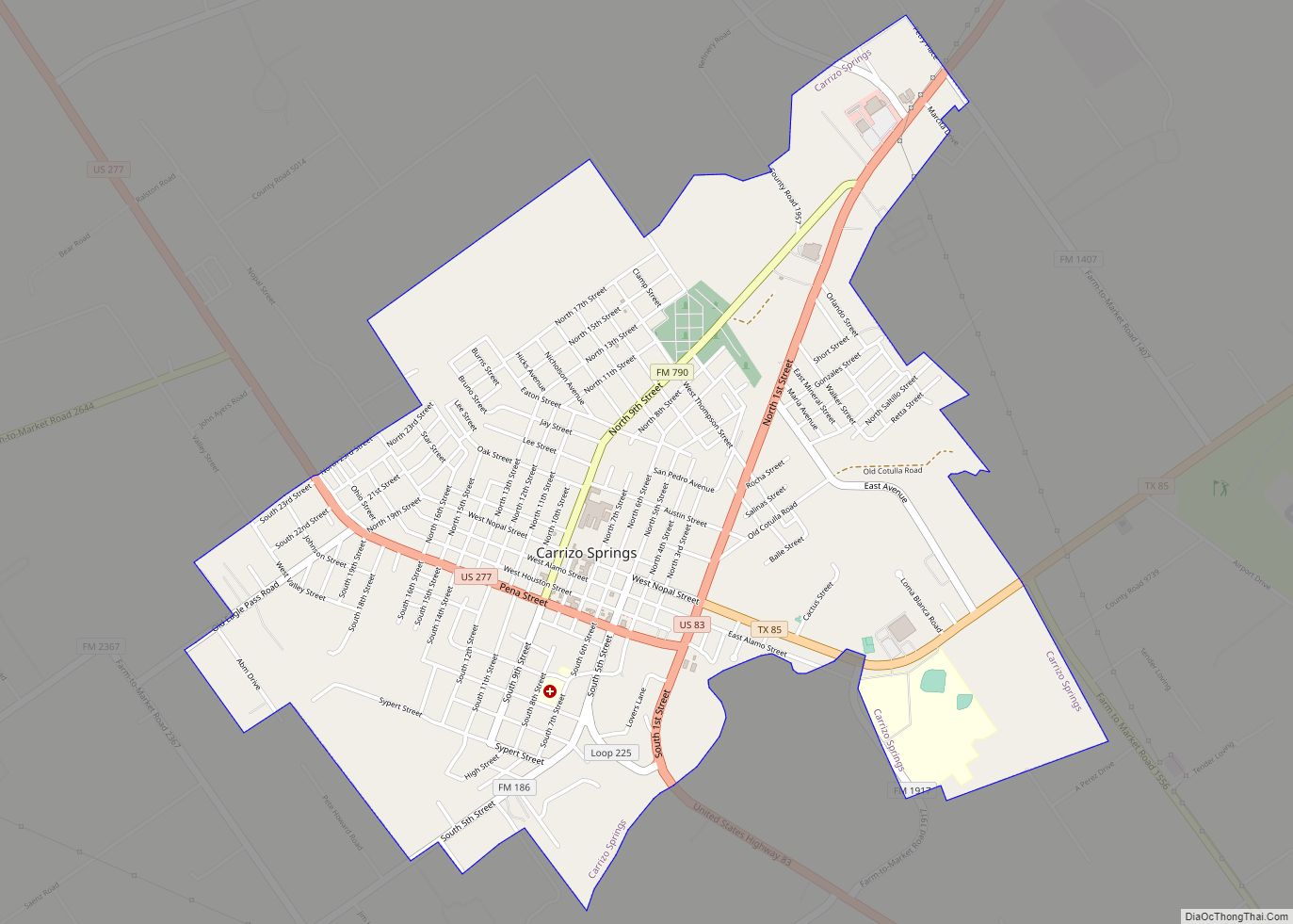
Carrizo Springs Road Map

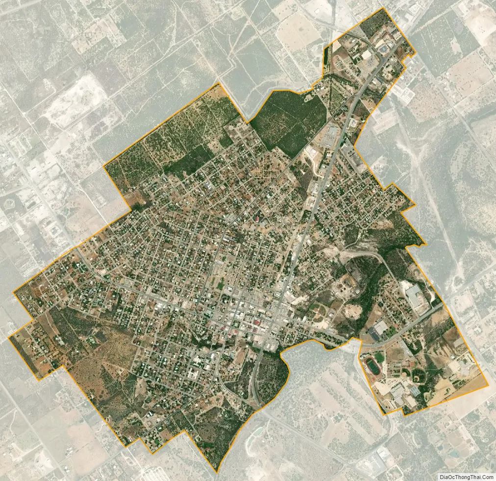
Carrizo Springs city Satellite Map
Geography
Carrizo Springs is located at 28°31′36″N 99°51′45″W / 28.52667°N 99.86250°W / 28.52667; -99.86250 (28.526699, –99.862423).
According to the United States Census Bureau, the city has a total area of 3.1 square miles (8.0 km), of which 3.1 sq mi (8.0 km) are land and less than 0.01 mi is covered by water.
Climate
Carrizo Springs experiences a hot semi-arid climate with mild winters and hot summers. During the spring season, as well occasionally during the fall season, severe thunderstorms often build on the Serranias Del Burro to the distant west of Carrizo Springs. This is believed to occur due to the uplift of moisture from the Gulf of Mexico which is channeled along the Rio Grande River.
See also
Map of Texas State and its subdivision:- Anderson
- Andrews
- Angelina
- Aransas
- Archer
- Armstrong
- Atascosa
- Austin
- Bailey
- Bandera
- Bastrop
- Baylor
- Bee
- Bell
- Bexar
- Blanco
- Borden
- Bosque
- Bowie
- Brazoria
- Brazos
- Brewster
- Briscoe
- Brooks
- Brown
- Burleson
- Burnet
- Caldwell
- Calhoun
- Callahan
- Cameron
- Camp
- Carson
- Cass
- Castro
- Chambers
- Cherokee
- Childress
- Clay
- Cochran
- Coke
- Coleman
- Collin
- Collingsworth
- Colorado
- Comal
- Comanche
- Concho
- Cooke
- Coryell
- Cottle
- Crane
- Crockett
- Crosby
- Culberson
- Dallam
- Dallas
- Dawson
- Deaf Smith
- Delta
- Denton
- Dewitt
- Dickens
- Dimmit
- Donley
- Duval
- Eastland
- Ector
- Edwards
- El Paso
- Ellis
- Erath
- Falls
- Fannin
- Fayette
- Fisher
- Floyd
- Foard
- Fort Bend
- Franklin
- Freestone
- Frio
- Gaines
- Galveston
- Garza
- Gillespie
- Glasscock
- Goliad
- Gonzales
- Gray
- Grayson
- Gregg
- Grimes
- Guadalupe
- Hale
- Hall
- Hamilton
- Hansford
- Hardeman
- Hardin
- Harris
- Harrison
- Hartley
- Haskell
- Hays
- Hemphill
- Henderson
- Hidalgo
- Hill
- Hockley
- Hood
- Hopkins
- Houston
- Howard
- Hudspeth
- Hunt
- Hutchinson
- Irion
- Jack
- Jackson
- Jasper
- Jeff Davis
- Jefferson
- Jim Hogg
- Jim Wells
- Johnson
- Jones
- Karnes
- Kaufman
- Kendall
- Kenedy
- Kent
- Kerr
- Kimble
- King
- Kinney
- Kleberg
- Knox
- La Salle
- Lamar
- Lamb
- Lampasas
- Lavaca
- Lee
- Leon
- Liberty
- Limestone
- Lipscomb
- Live Oak
- Llano
- Loving
- Lubbock
- Lynn
- Madison
- Marion
- Martin
- Mason
- Matagorda
- Maverick
- McCulloch
- McLennan
- McMullen
- Medina
- Menard
- Midland
- Milam
- Mills
- Mitchell
- Montague
- Montgomery
- Moore
- Morris
- Motley
- Nacogdoches
- Navarro
- Newton
- Nolan
- Nueces
- Ochiltree
- Oldham
- Orange
- Palo Pinto
- Panola
- Parker
- Parmer
- Pecos
- Polk
- Potter
- Presidio
- Rains
- Randall
- Reagan
- Real
- Red River
- Reeves
- Refugio
- Roberts
- Robertson
- Rockwall
- Runnels
- Rusk
- Sabine
- San Augustine
- San Jacinto
- San Patricio
- San Saba
- Schleicher
- Scurry
- Shackelford
- Shelby
- Sherman
- Smith
- Somervell
- Starr
- Stephens
- Sterling
- Stonewall
- Sutton
- Swisher
- Tarrant
- Taylor
- Terrell
- Terry
- Throckmorton
- Titus
- Tom Green
- Travis
- Trinity
- Tyler
- Upshur
- Upton
- Uvalde
- Val Verde
- Van Zandt
- Victoria
- Walker
- Waller
- Ward
- Washington
- Webb
- Wharton
- Wheeler
- Wichita
- Wilbarger
- Willacy
- Williamson
- Wilson
- Winkler
- Wise
- Wood
- Yoakum
- Young
- Zapata
- Zavala
- Alabama
- Alaska
- Arizona
- Arkansas
- California
- Colorado
- Connecticut
- Delaware
- District of Columbia
- Florida
- Georgia
- Hawaii
- Idaho
- Illinois
- Indiana
- Iowa
- Kansas
- Kentucky
- Louisiana
- Maine
- Maryland
- Massachusetts
- Michigan
- Minnesota
- Mississippi
- Missouri
- Montana
- Nebraska
- Nevada
- New Hampshire
- New Jersey
- New Mexico
- New York
- North Carolina
- North Dakota
- Ohio
- Oklahoma
- Oregon
- Pennsylvania
- Rhode Island
- South Carolina
- South Dakota
- Tennessee
- Texas
- Utah
- Vermont
- Virginia
- Washington
- West Virginia
- Wisconsin
- Wyoming