Carrollton is a city in Dallas, Denton, and Collin counties in the U.S. state of Texas. As of the 2020 census, its population was 133,434, making it the 23rd-most populous city in Texas.
| Name: | Carrollton city |
|---|---|
| LSAD Code: | 25 |
| LSAD Description: | city (suffix) |
| State: | Texas |
| County: | Collin County, Dallas County, Denton County |
| Elevation: | 482 ft (147 m) |
| Land Area: | 36.66 sq mi (94.94 km²) |
| Water Area: | 0.77 sq mi (2.00 km²) 2.19% |
| Population Density: | 3,798.78/sq mi (1,466.70/km²) |
| ZIP code: | 75006, 75007, 75010, 75011 |
| Area code: | 214, 469, 945, 972 |
| FIPS code: | 4813024 |
| GNISfeature ID: | 2409992 |
| Website: | http://www.cityofcarrollton.com |
Online Interactive Map
Click on ![]() to view map in "full screen" mode.
to view map in "full screen" mode.
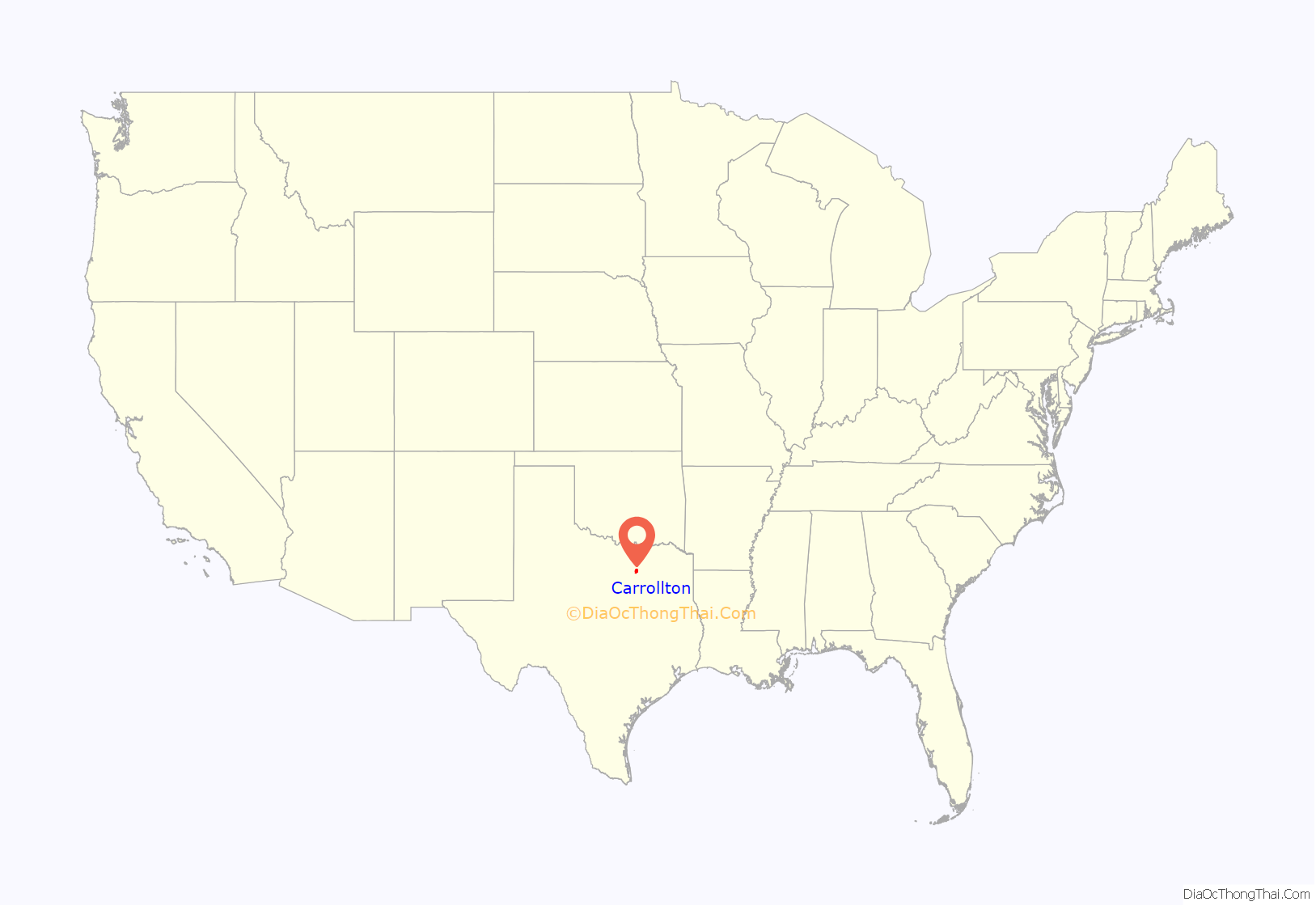
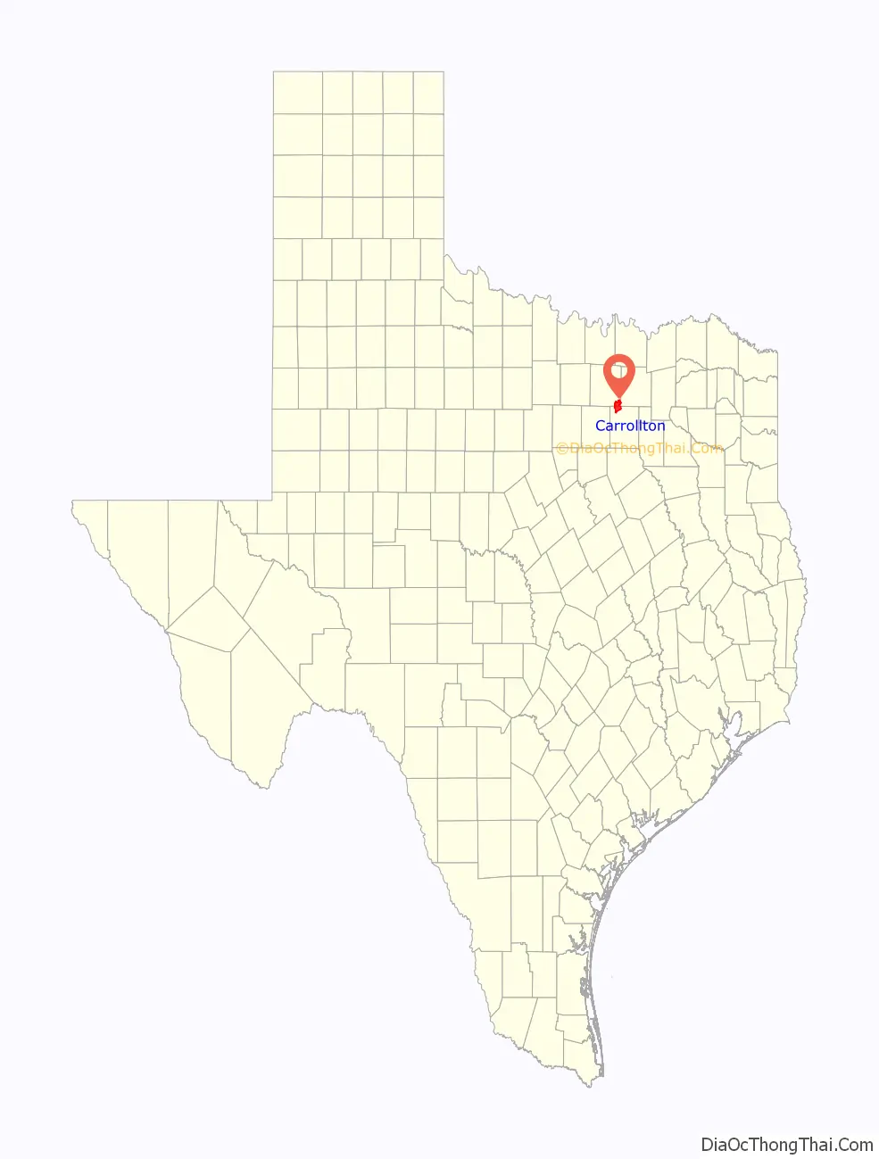
Carrollton location map. Where is Carrollton city?
History
The area was first settled by Jared Ford in 1842 by William and Mary Larner on a site within the Peters Colony grant. In 1844, the A. W. Perry family claimed land in the area around Trinity Mills where, in partnership with Wade H. Witt, a mill was established.
The English colony, a group of families in the northeastern area of settlement which crossed into Denton County, was home to large landowners including the Furneaux, Jackson, Morgan, and Rowe families. It is most likely that Carrollton was named for Carrollton, Illinois, the original home of many of these settlers.
Early on, Carrollton’s livelihood was exclusively agricultural, but following the construction of the Dallas-Wichita Railroad through Trinity Mills in 1878, the community began to grow in its industrial significance. Carrollton’s significance was further strengthened when the railroad was extended to Denton in 1880 by Jay Gould, who sold the line to the Missouri–Kansas–Texas Railroad (the Katy) in 1881. By 1885, Carrollton had flour mills, cotton gins, two churches, a school, and a population of 150. The St. Louis Southwestern Railway (the “Cotton Belt”) crossed the Katy in 1888, and the town became a shipping center for livestock, cotton, cotton seed, and grain, helping the town surpass Trinity Mills to the north.
In 1913 Carrollton was officially incorporated, and W.F. Vinson was elected mayor. A gravel industry that began in Carrollton in 1912 transformed the city, by the late 1940s, to a “grain and gravel” town. The city also supported a brick plant and a dairy industry, and National Metal Products established itself in the city in 1946.
After World War II the city grew rapidly. In 1950 its population stood at 1,610, and it grew to 4,242 in 1960 and 13,855 in 1970. At this point, significant suburban growth began spilling out of north Dallas, and the city grew tremendously between 1970 and 1980, with a documented growth of 193% to 40,595 inhabitants. By 1983, the population was 52,000, by 1990, it had reached 82,169, and by 2010 the population had grown to 119,097.
As a suburb of Dallas, in 2006 named to America’s “Top 100 Places to Live” by Relocate America. Also in 2006, it was selected as the 19th best place to live in the United States by Money magazine. In 2008 it was named by Money magazine the 15th best place to live among small cities.
In 1996 there was a successful recall of Mayor Gary Blanscet and council members Linda Caldwell, Bernis Francis, Stan Hampton, Bob Novinsky, Bert Colter & Stan Sewell. All were removed from office and replaced in a special election.
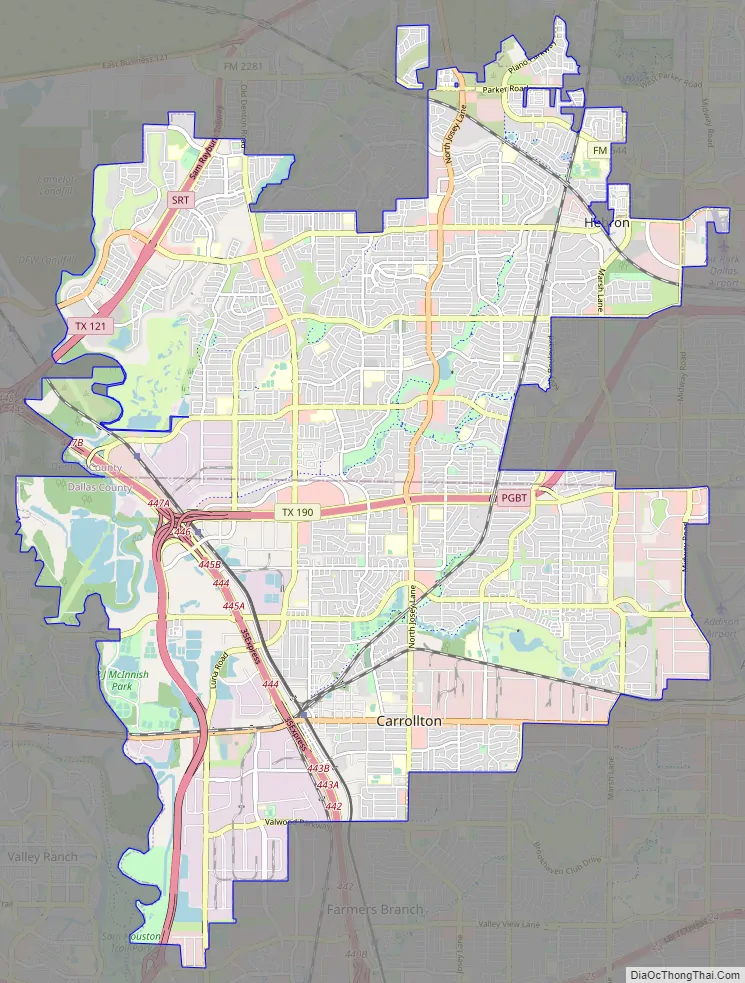
Carrollton Road Map
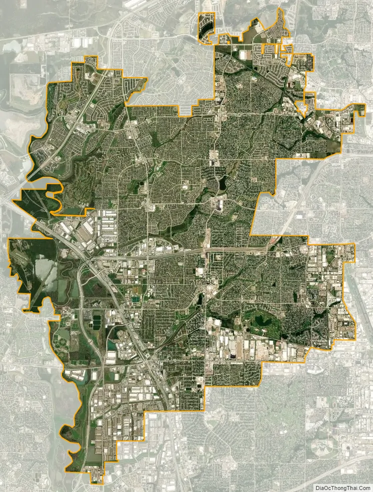
Carrollton city Satellite Map
Geography
According to the United States Census Bureau, Carrollton has a total area of 37.1 square miles (96.1 km), of which 36.3 square miles (94.0 km) is land and 0.81 square miles (2.1 km), or 2.19%, is water. Carrollton is located in portions of three counties: Dallas, Denton, and Collin.
Climate
On average, the warmest month is July. The highest recorded temperature was 112 °F in 1980. The average coolest month is January. The lowest recorded temperature was 1 °F in 1989. The most precipitation on average occurs in May. Carrollton is considered to have a humid subtropical climate.
See also
Map of Texas State and its subdivision:- Anderson
- Andrews
- Angelina
- Aransas
- Archer
- Armstrong
- Atascosa
- Austin
- Bailey
- Bandera
- Bastrop
- Baylor
- Bee
- Bell
- Bexar
- Blanco
- Borden
- Bosque
- Bowie
- Brazoria
- Brazos
- Brewster
- Briscoe
- Brooks
- Brown
- Burleson
- Burnet
- Caldwell
- Calhoun
- Callahan
- Cameron
- Camp
- Carson
- Cass
- Castro
- Chambers
- Cherokee
- Childress
- Clay
- Cochran
- Coke
- Coleman
- Collin
- Collingsworth
- Colorado
- Comal
- Comanche
- Concho
- Cooke
- Coryell
- Cottle
- Crane
- Crockett
- Crosby
- Culberson
- Dallam
- Dallas
- Dawson
- Deaf Smith
- Delta
- Denton
- Dewitt
- Dickens
- Dimmit
- Donley
- Duval
- Eastland
- Ector
- Edwards
- El Paso
- Ellis
- Erath
- Falls
- Fannin
- Fayette
- Fisher
- Floyd
- Foard
- Fort Bend
- Franklin
- Freestone
- Frio
- Gaines
- Galveston
- Garza
- Gillespie
- Glasscock
- Goliad
- Gonzales
- Gray
- Grayson
- Gregg
- Grimes
- Guadalupe
- Hale
- Hall
- Hamilton
- Hansford
- Hardeman
- Hardin
- Harris
- Harrison
- Hartley
- Haskell
- Hays
- Hemphill
- Henderson
- Hidalgo
- Hill
- Hockley
- Hood
- Hopkins
- Houston
- Howard
- Hudspeth
- Hunt
- Hutchinson
- Irion
- Jack
- Jackson
- Jasper
- Jeff Davis
- Jefferson
- Jim Hogg
- Jim Wells
- Johnson
- Jones
- Karnes
- Kaufman
- Kendall
- Kenedy
- Kent
- Kerr
- Kimble
- King
- Kinney
- Kleberg
- Knox
- La Salle
- Lamar
- Lamb
- Lampasas
- Lavaca
- Lee
- Leon
- Liberty
- Limestone
- Lipscomb
- Live Oak
- Llano
- Loving
- Lubbock
- Lynn
- Madison
- Marion
- Martin
- Mason
- Matagorda
- Maverick
- McCulloch
- McLennan
- McMullen
- Medina
- Menard
- Midland
- Milam
- Mills
- Mitchell
- Montague
- Montgomery
- Moore
- Morris
- Motley
- Nacogdoches
- Navarro
- Newton
- Nolan
- Nueces
- Ochiltree
- Oldham
- Orange
- Palo Pinto
- Panola
- Parker
- Parmer
- Pecos
- Polk
- Potter
- Presidio
- Rains
- Randall
- Reagan
- Real
- Red River
- Reeves
- Refugio
- Roberts
- Robertson
- Rockwall
- Runnels
- Rusk
- Sabine
- San Augustine
- San Jacinto
- San Patricio
- San Saba
- Schleicher
- Scurry
- Shackelford
- Shelby
- Sherman
- Smith
- Somervell
- Starr
- Stephens
- Sterling
- Stonewall
- Sutton
- Swisher
- Tarrant
- Taylor
- Terrell
- Terry
- Throckmorton
- Titus
- Tom Green
- Travis
- Trinity
- Tyler
- Upshur
- Upton
- Uvalde
- Val Verde
- Van Zandt
- Victoria
- Walker
- Waller
- Ward
- Washington
- Webb
- Wharton
- Wheeler
- Wichita
- Wilbarger
- Willacy
- Williamson
- Wilson
- Winkler
- Wise
- Wood
- Yoakum
- Young
- Zapata
- Zavala
- Alabama
- Alaska
- Arizona
- Arkansas
- California
- Colorado
- Connecticut
- Delaware
- District of Columbia
- Florida
- Georgia
- Hawaii
- Idaho
- Illinois
- Indiana
- Iowa
- Kansas
- Kentucky
- Louisiana
- Maine
- Maryland
- Massachusetts
- Michigan
- Minnesota
- Mississippi
- Missouri
- Montana
- Nebraska
- Nevada
- New Hampshire
- New Jersey
- New Mexico
- New York
- North Carolina
- North Dakota
- Ohio
- Oklahoma
- Oregon
- Pennsylvania
- Rhode Island
- South Carolina
- South Dakota
- Tennessee
- Texas
- Utah
- Vermont
- Virginia
- Washington
- West Virginia
- Wisconsin
- Wyoming


