Channing is a city in Hartley County, Texas, in the United States. It is the county seat of Hartley County. As of the 2020 United States census, the city’s population was 281.
| Name: | Channing city |
|---|---|
| LSAD Code: | 25 |
| LSAD Description: | city (suffix) |
| State: | Texas |
| County: | Hartley County |
| Elevation: | 3,806 ft (1,160 m) |
| Total Area: | 0.99 sq mi (2.57 km²) |
| Land Area: | 0.99 sq mi (2.57 km²) |
| Water Area: | 0.00 sq mi (0.00 km²) |
| Total Population: | 363 |
| Population Density: | 346.77/sq mi (133.87/km²) |
| ZIP code: | 79018 |
| Area code: | 806 |
| FIPS code: | 4814260 |
| GNISfeature ID: | 1354290 |
Online Interactive Map
Click on ![]() to view map in "full screen" mode.
to view map in "full screen" mode.
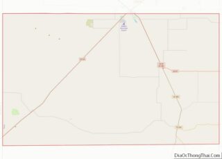
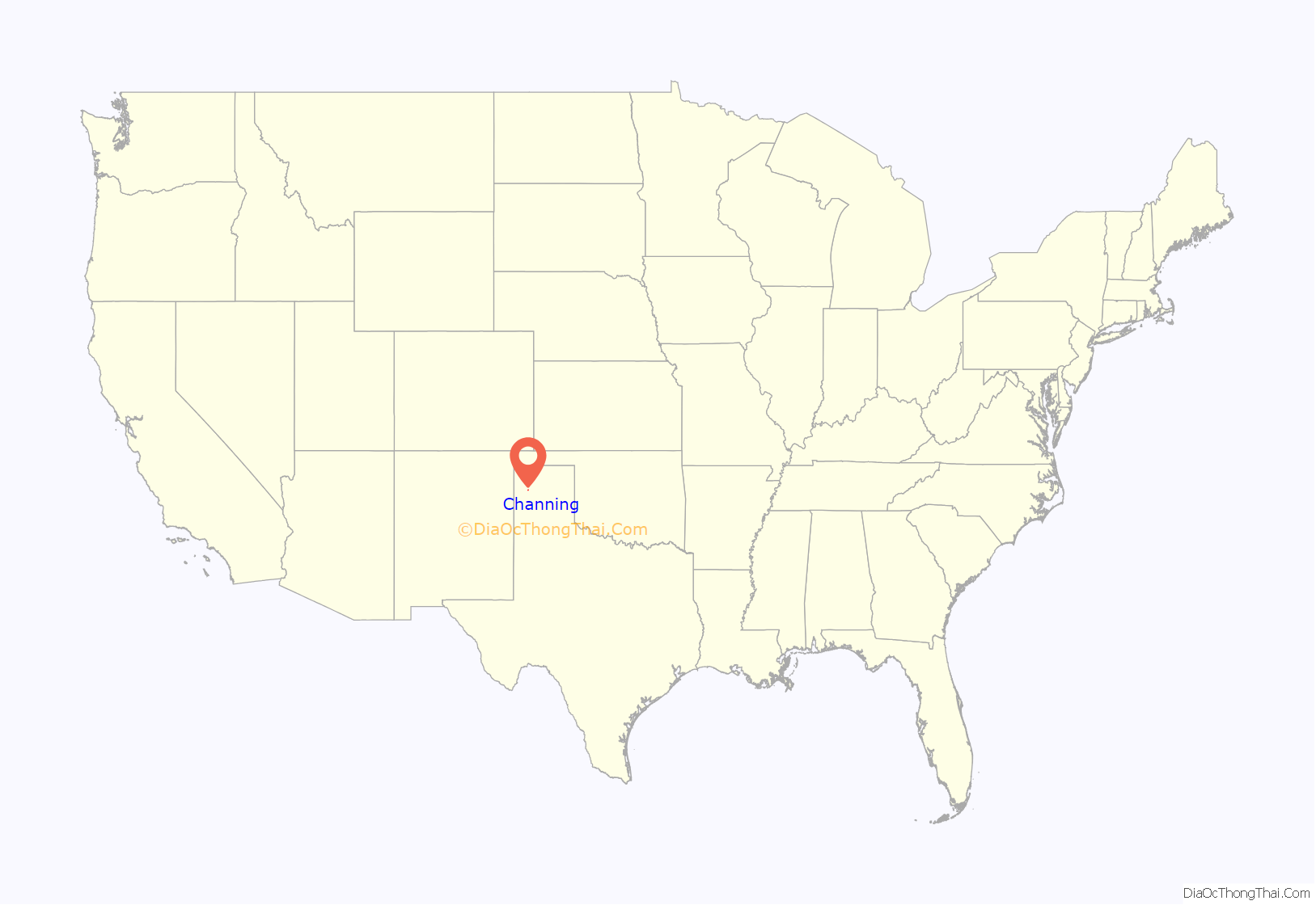
Channing location map. Where is Channing city?
History
Channing was founded in 1888 by George Channing Rivers, a paymaster for the Fort Worth and Denver City Railway. The settlement was originally called Rivers. Since the name Rivers duplicated another community in Texas, the name was changed to Channing later that year. Channing developed directly from its association with the XIT Ranch, a property that once included land in as many as 10 counties in the Texas Panhandle.
In 1891, Willis D. Twitchell platted Channing’s business district. At that time, Channing was the headquarters of the XIT. Albert Boyce, the ranch’s general manager and one of the most prominent early citizens, built the first house in the community. By 1900, Channing had two stores, a post office, lumber yard, and school.
Two elections, one in November 1896 and the other in 1903, were required for Channing to replace Hartley as county seat. The frame courthouse was pulled to Channing on wheels by mounted XIT cowboys in 1903. A brick courthouse was completed in 1906 and the original courthouse was converted into the once-famous Hotel Rivers. One of the first public libraries in the Panhandle was established in 1908 by a local women’s club. The estimated population at this time was about 600.
The XIT, which conducted most of its business from Channing, was the town’s chief customer until liquidation of the ranch in 1911. The local economy was severely impacted, although the real-estate market temporarily thrived from the sale of XIT lands. A fire swept through the business district on September 6, 1931, destroying seven buildings, including Hotel Rivers. By 1940, Channing had an estimated population of 475 with several businesses, a high school, and three churches. A restored XIT office building is located in Channing as a museum.
Channing was incorporated in 1960. At the time of incorporation, the population was 390. The number of inhabitants declined to 336 in 1970, 304 in 1980, and 277 in 1990, mainly because of its accessibility to the larger communities of Dalhart and Amarillo. By 2000, the population rose to 356, a 28.5% increase over the 1990 figure.
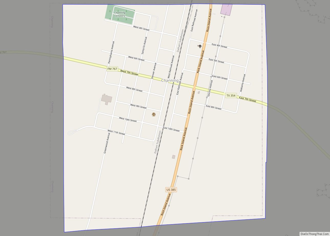
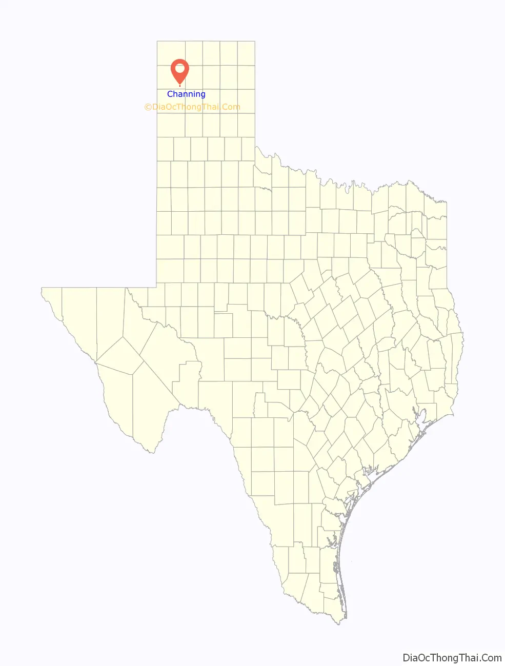
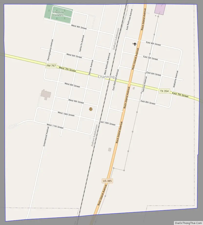
Channing Road Map
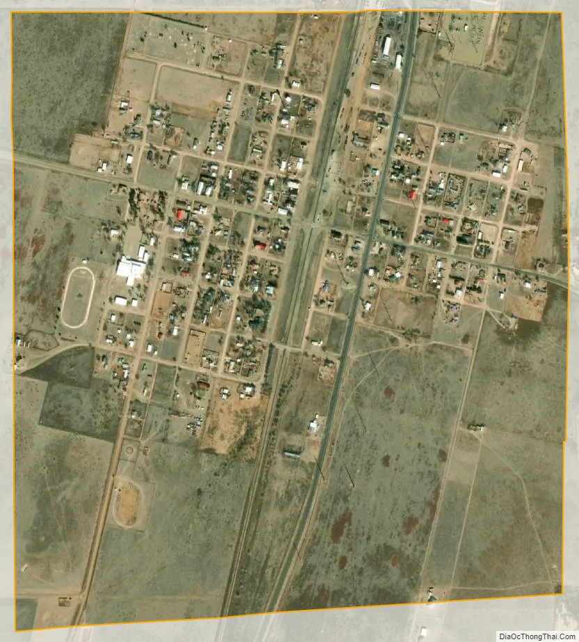
Channing city Satellite Map
Geography
Channing is located at 35°41′1″N 102°19′55″W / 35.68361°N 102.33194°W / 35.68361; -102.33194 (35.683612, –102.331817). It is situated at the junction of U.S. Highway 385, State Highway 354, and FM 767 in southeastern Hartley County, about 30 miles south of Dalhart. According to the United States Census Bureau, the city has a total area of 0.3 sq mi (2.6 km), all of it land.
Climate
According to the Köppen climate classification, Channing has a semiarid climate, BSk on climate maps.
See also
Map of Texas State and its subdivision:- Anderson
- Andrews
- Angelina
- Aransas
- Archer
- Armstrong
- Atascosa
- Austin
- Bailey
- Bandera
- Bastrop
- Baylor
- Bee
- Bell
- Bexar
- Blanco
- Borden
- Bosque
- Bowie
- Brazoria
- Brazos
- Brewster
- Briscoe
- Brooks
- Brown
- Burleson
- Burnet
- Caldwell
- Calhoun
- Callahan
- Cameron
- Camp
- Carson
- Cass
- Castro
- Chambers
- Cherokee
- Childress
- Clay
- Cochran
- Coke
- Coleman
- Collin
- Collingsworth
- Colorado
- Comal
- Comanche
- Concho
- Cooke
- Coryell
- Cottle
- Crane
- Crockett
- Crosby
- Culberson
- Dallam
- Dallas
- Dawson
- Deaf Smith
- Delta
- Denton
- Dewitt
- Dickens
- Dimmit
- Donley
- Duval
- Eastland
- Ector
- Edwards
- El Paso
- Ellis
- Erath
- Falls
- Fannin
- Fayette
- Fisher
- Floyd
- Foard
- Fort Bend
- Franklin
- Freestone
- Frio
- Gaines
- Galveston
- Garza
- Gillespie
- Glasscock
- Goliad
- Gonzales
- Gray
- Grayson
- Gregg
- Grimes
- Guadalupe
- Hale
- Hall
- Hamilton
- Hansford
- Hardeman
- Hardin
- Harris
- Harrison
- Hartley
- Haskell
- Hays
- Hemphill
- Henderson
- Hidalgo
- Hill
- Hockley
- Hood
- Hopkins
- Houston
- Howard
- Hudspeth
- Hunt
- Hutchinson
- Irion
- Jack
- Jackson
- Jasper
- Jeff Davis
- Jefferson
- Jim Hogg
- Jim Wells
- Johnson
- Jones
- Karnes
- Kaufman
- Kendall
- Kenedy
- Kent
- Kerr
- Kimble
- King
- Kinney
- Kleberg
- Knox
- La Salle
- Lamar
- Lamb
- Lampasas
- Lavaca
- Lee
- Leon
- Liberty
- Limestone
- Lipscomb
- Live Oak
- Llano
- Loving
- Lubbock
- Lynn
- Madison
- Marion
- Martin
- Mason
- Matagorda
- Maverick
- McCulloch
- McLennan
- McMullen
- Medina
- Menard
- Midland
- Milam
- Mills
- Mitchell
- Montague
- Montgomery
- Moore
- Morris
- Motley
- Nacogdoches
- Navarro
- Newton
- Nolan
- Nueces
- Ochiltree
- Oldham
- Orange
- Palo Pinto
- Panola
- Parker
- Parmer
- Pecos
- Polk
- Potter
- Presidio
- Rains
- Randall
- Reagan
- Real
- Red River
- Reeves
- Refugio
- Roberts
- Robertson
- Rockwall
- Runnels
- Rusk
- Sabine
- San Augustine
- San Jacinto
- San Patricio
- San Saba
- Schleicher
- Scurry
- Shackelford
- Shelby
- Sherman
- Smith
- Somervell
- Starr
- Stephens
- Sterling
- Stonewall
- Sutton
- Swisher
- Tarrant
- Taylor
- Terrell
- Terry
- Throckmorton
- Titus
- Tom Green
- Travis
- Trinity
- Tyler
- Upshur
- Upton
- Uvalde
- Val Verde
- Van Zandt
- Victoria
- Walker
- Waller
- Ward
- Washington
- Webb
- Wharton
- Wheeler
- Wichita
- Wilbarger
- Willacy
- Williamson
- Wilson
- Winkler
- Wise
- Wood
- Yoakum
- Young
- Zapata
- Zavala
- Alabama
- Alaska
- Arizona
- Arkansas
- California
- Colorado
- Connecticut
- Delaware
- District of Columbia
- Florida
- Georgia
- Hawaii
- Idaho
- Illinois
- Indiana
- Iowa
- Kansas
- Kentucky
- Louisiana
- Maine
- Maryland
- Massachusetts
- Michigan
- Minnesota
- Mississippi
- Missouri
- Montana
- Nebraska
- Nevada
- New Hampshire
- New Jersey
- New Mexico
- New York
- North Carolina
- North Dakota
- Ohio
- Oklahoma
- Oregon
- Pennsylvania
- Rhode Island
- South Carolina
- South Dakota
- Tennessee
- Texas
- Utah
- Vermont
- Virginia
- Washington
- West Virginia
- Wisconsin
- Wyoming