Dalhart is a city in Dallam and Hartley counties in the U.S. state of Texas, and the county seat of Dallam County. The population was 7,930 at the 2010 census.
| Name: | Dalhart city |
|---|---|
| LSAD Code: | 25 |
| LSAD Description: | city (suffix) |
| State: | Texas |
| County: | Dallam County, Hartley County |
| Elevation: | 3,983 ft (1,214 m) |
| Total Area: | 4.79 sq mi (12.41 km²) |
| Land Area: | 4.78 sq mi (12.39 km²) |
| Water Area: | 0.01 sq mi (0.03 km²) |
| Total Population: | 7,930 |
| Population Density: | 1,737.77/sq mi (670.94/km²) |
| ZIP code: | 79022 |
| Area code: | 806 |
| FIPS code: | 4818524 |
| GNISfeature ID: | 1355552 |
| Website: | dalharttx.gov |
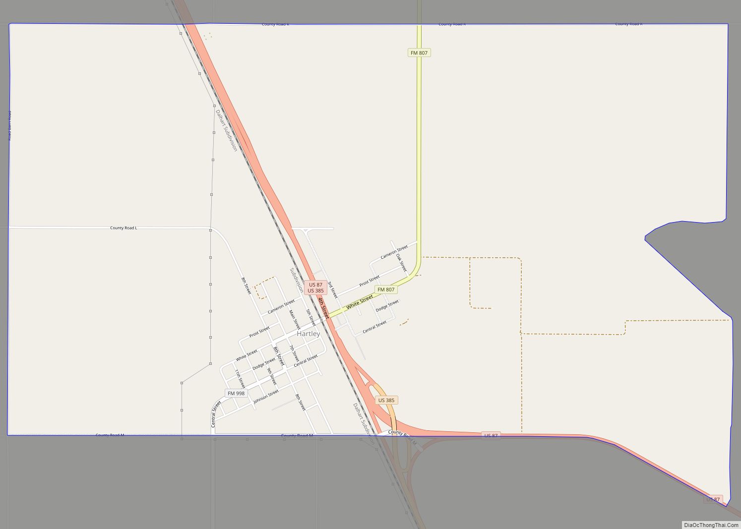
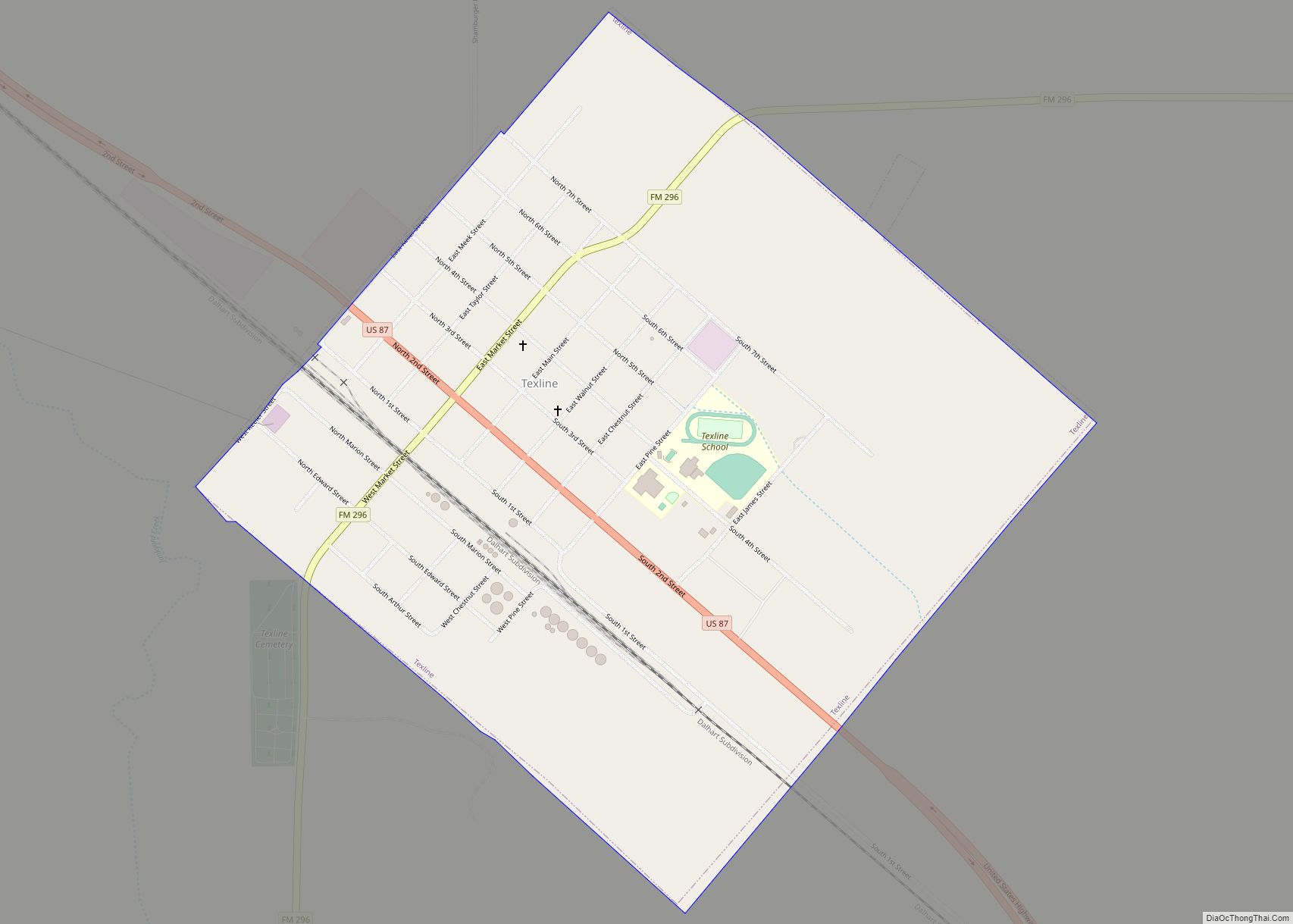
Online Interactive Map
Click on ![]() to view map in "full screen" mode.
to view map in "full screen" mode.
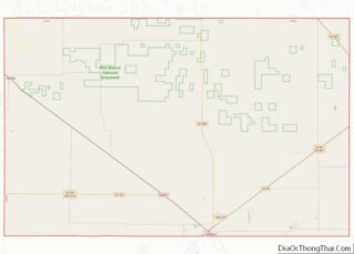
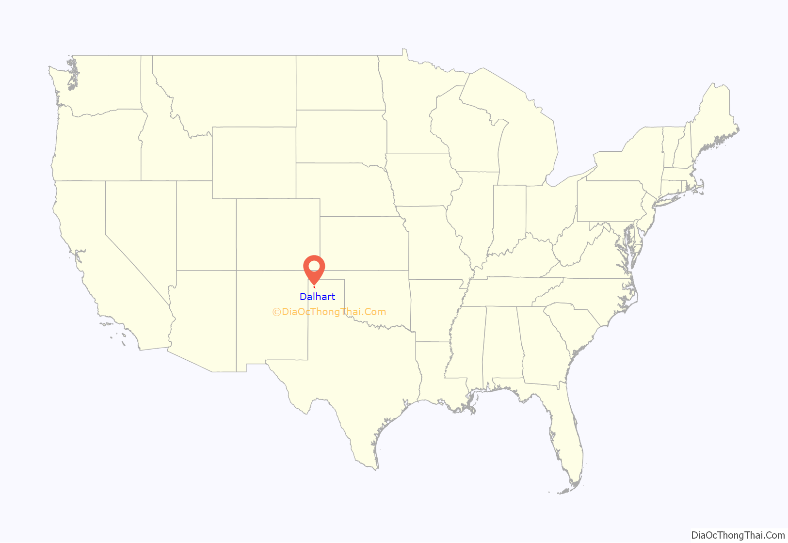
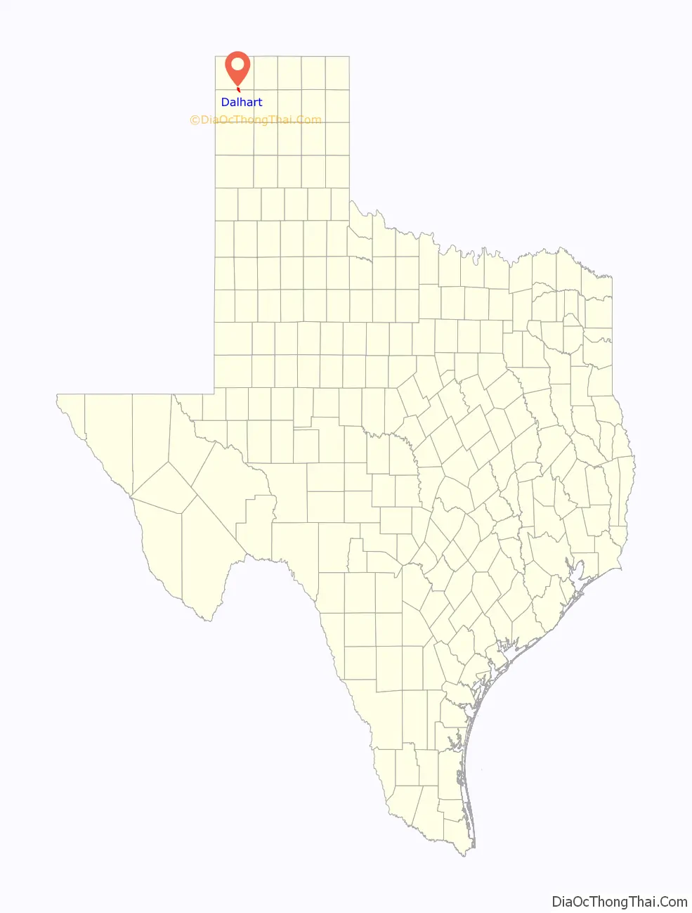
Dalhart location map. Where is Dalhart city?
History
Founded in 1901, Dalhart is named for its location on the border of Dallam and Hartley Counties; its name is a portmanteau of the names of the two counties. The city was founded at the site of a railroad junction, which heavily contributed to its early growth.
Dalhart was in the center of the Dust Bowl, an area adversely affected by a long period of drought and dust storms during the Great Depression of the 1930s. Here, Tex Thornton, operating on the now debunked concussion theory, coaxed today’s inflation-adjusted equivalent of $1 million from the locals on claims he could fire rocket-powered explosives into the clouds and cause rain.
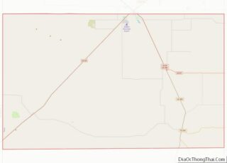
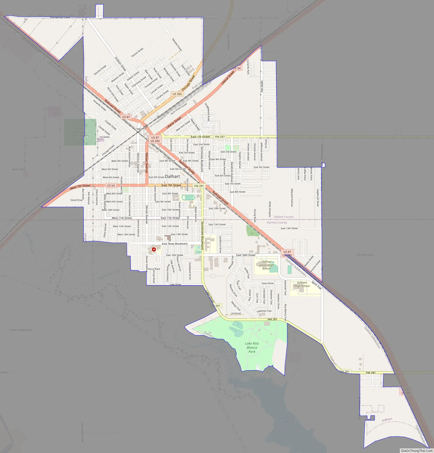
Dalhart Road Map
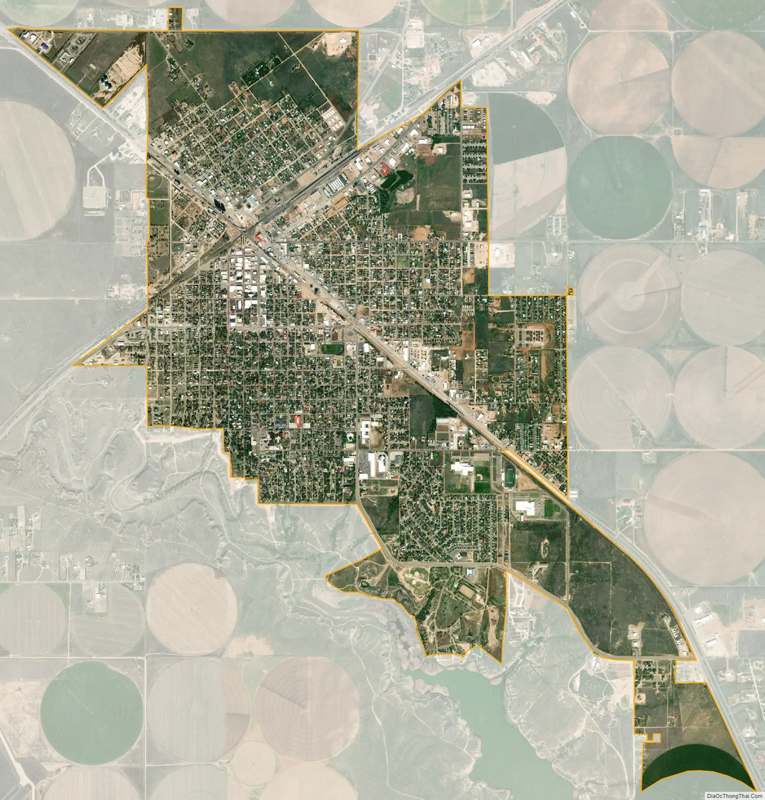
Dalhart city Satellite Map
Geography
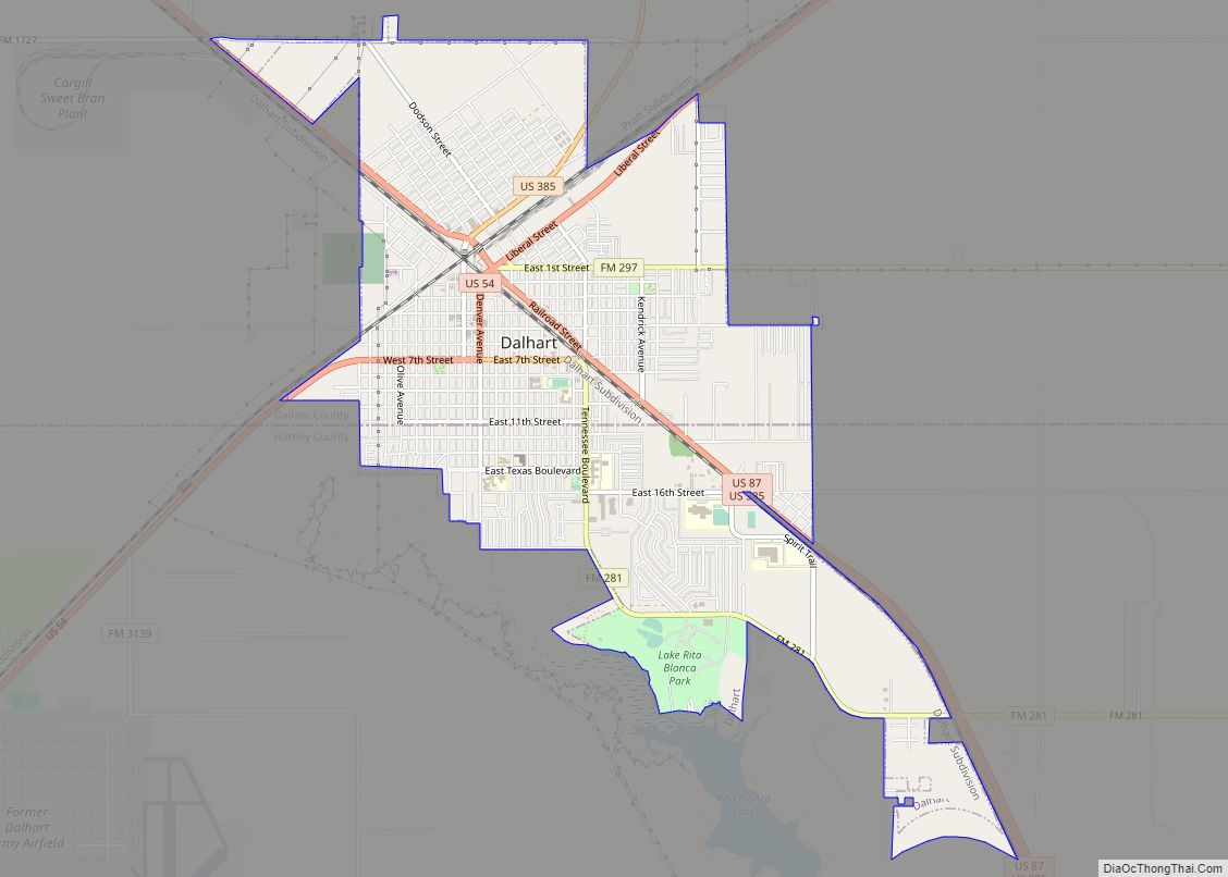
Dalhart is located in northwestern Texas at 36°3′39″N 102°31′7″W / 36.06083°N 102.51861°W / 36.06083; -102.51861 (36.060856, −102.518656). According to the United States Census Bureau, the city has a total area of 4.8 square miles (12.4 km), of which 0.01 square miles (0.03 km), or 0.21%, is covered by water. Dalhart sits in the Southern Great Plains and is heavily impacted by its agriculture industry. Dalhart is about 70 miles northwest of Amarillo, the nearest city that has a population over 100,000.
Dalhart sits at the intersection of U.S. Highway 87, 385, and 54. Two miles south of Dalhart is the former Rita Blanca State Park, site of Rita Blanca Canyon, now maintained by the City of Dalhart. It is 1,680 acres, plus the 160 acres of Lake Rita Blanca, on Rita Blanca Creek. The park has playground equipment and hiking/biking/riding trails. The city has added a Lake Center at which guests can check-out various items such as bicycles, board games, fishing poles & tackle, golf discs, and more.
Dalhart is located closer to six other state capitals than to Texas’ capital of Austin. In surface mileage (over major highways), Dalhart is 570 miles (920 km) from Austin, but is 261 miles (420 km) from Santa Fe, New Mexico, 313 miles (504 km) from Oklahoma City, Oklahoma, 348 miles (560 km) from Denver, Colorado, 448 miles (721 km) from Cheyenne, Wyoming, 461 miles (742 km) from Topeka, Kansas, and 544 miles (875 km) from Lincoln, Nebraska.
As the crow flies, Dalhart is 491 miles (790 km) from Austin, but 201 miles (323 km) from Santa Fe, 281 miles (452 km) from Oklahoma City, 289 miles (465 km) from Denver, 375 miles (604 km) from Cheyenne, 434 miles (698 km) from Topeka, and 458 miles (737 km) from Lincoln.
Climate
Dalhart experiences a semiarid climate (Köppen BSk) with cool, dry winters and hot summers. The average annual rainfall of less than 17 inches or 430 millimetres strongly influences both Dalhart’s ecological climate and agricultural practices, especially center-pivot irrigation.
Since records began in 1948, the hottest temperature in Dalhart has been 110 °F (43.3 °C) on June 26, 2011, and the coldest −21 °F (−29.4 °C) on January 4, 1959. On average, 65 afternoons each year will reach or top 90 °F or 32.2 °C, 133.8 mornings will fall to or below freezing, 10.1 afternoons will fail to top freezing, and two mornings will fall to or below 0 °F (−17.8 °C). The hottest complete month has been July 2011 with a mean maximum of 99.81 °F or 37.7 °C and the coldest January 1963 with a mean minimum of 7.55 °F or −13.6 °C. The wettest calendar year has been 1985 with 28.03 inches (712.0 mm) and the driest 2011 with only 6.04 inches (153.4 mm).
See also
Map of Texas State and its subdivision:- Anderson
- Andrews
- Angelina
- Aransas
- Archer
- Armstrong
- Atascosa
- Austin
- Bailey
- Bandera
- Bastrop
- Baylor
- Bee
- Bell
- Bexar
- Blanco
- Borden
- Bosque
- Bowie
- Brazoria
- Brazos
- Brewster
- Briscoe
- Brooks
- Brown
- Burleson
- Burnet
- Caldwell
- Calhoun
- Callahan
- Cameron
- Camp
- Carson
- Cass
- Castro
- Chambers
- Cherokee
- Childress
- Clay
- Cochran
- Coke
- Coleman
- Collin
- Collingsworth
- Colorado
- Comal
- Comanche
- Concho
- Cooke
- Coryell
- Cottle
- Crane
- Crockett
- Crosby
- Culberson
- Dallam
- Dallas
- Dawson
- Deaf Smith
- Delta
- Denton
- Dewitt
- Dickens
- Dimmit
- Donley
- Duval
- Eastland
- Ector
- Edwards
- El Paso
- Ellis
- Erath
- Falls
- Fannin
- Fayette
- Fisher
- Floyd
- Foard
- Fort Bend
- Franklin
- Freestone
- Frio
- Gaines
- Galveston
- Garza
- Gillespie
- Glasscock
- Goliad
- Gonzales
- Gray
- Grayson
- Gregg
- Grimes
- Guadalupe
- Hale
- Hall
- Hamilton
- Hansford
- Hardeman
- Hardin
- Harris
- Harrison
- Hartley
- Haskell
- Hays
- Hemphill
- Henderson
- Hidalgo
- Hill
- Hockley
- Hood
- Hopkins
- Houston
- Howard
- Hudspeth
- Hunt
- Hutchinson
- Irion
- Jack
- Jackson
- Jasper
- Jeff Davis
- Jefferson
- Jim Hogg
- Jim Wells
- Johnson
- Jones
- Karnes
- Kaufman
- Kendall
- Kenedy
- Kent
- Kerr
- Kimble
- King
- Kinney
- Kleberg
- Knox
- La Salle
- Lamar
- Lamb
- Lampasas
- Lavaca
- Lee
- Leon
- Liberty
- Limestone
- Lipscomb
- Live Oak
- Llano
- Loving
- Lubbock
- Lynn
- Madison
- Marion
- Martin
- Mason
- Matagorda
- Maverick
- McCulloch
- McLennan
- McMullen
- Medina
- Menard
- Midland
- Milam
- Mills
- Mitchell
- Montague
- Montgomery
- Moore
- Morris
- Motley
- Nacogdoches
- Navarro
- Newton
- Nolan
- Nueces
- Ochiltree
- Oldham
- Orange
- Palo Pinto
- Panola
- Parker
- Parmer
- Pecos
- Polk
- Potter
- Presidio
- Rains
- Randall
- Reagan
- Real
- Red River
- Reeves
- Refugio
- Roberts
- Robertson
- Rockwall
- Runnels
- Rusk
- Sabine
- San Augustine
- San Jacinto
- San Patricio
- San Saba
- Schleicher
- Scurry
- Shackelford
- Shelby
- Sherman
- Smith
- Somervell
- Starr
- Stephens
- Sterling
- Stonewall
- Sutton
- Swisher
- Tarrant
- Taylor
- Terrell
- Terry
- Throckmorton
- Titus
- Tom Green
- Travis
- Trinity
- Tyler
- Upshur
- Upton
- Uvalde
- Val Verde
- Van Zandt
- Victoria
- Walker
- Waller
- Ward
- Washington
- Webb
- Wharton
- Wheeler
- Wichita
- Wilbarger
- Willacy
- Williamson
- Wilson
- Winkler
- Wise
- Wood
- Yoakum
- Young
- Zapata
- Zavala
- Alabama
- Alaska
- Arizona
- Arkansas
- California
- Colorado
- Connecticut
- Delaware
- District of Columbia
- Florida
- Georgia
- Hawaii
- Idaho
- Illinois
- Indiana
- Iowa
- Kansas
- Kentucky
- Louisiana
- Maine
- Maryland
- Massachusetts
- Michigan
- Minnesota
- Mississippi
- Missouri
- Montana
- Nebraska
- Nevada
- New Hampshire
- New Jersey
- New Mexico
- New York
- North Carolina
- North Dakota
- Ohio
- Oklahoma
- Oregon
- Pennsylvania
- Rhode Island
- South Carolina
- South Dakota
- Tennessee
- Texas
- Utah
- Vermont
- Virginia
- Washington
- West Virginia
- Wisconsin
- Wyoming