Donna is a city in Hidalgo County, Texas, United States. The population was 16,797 at the 2020 census.
| Name: | Donna city |
|---|---|
| LSAD Code: | 25 |
| LSAD Description: | city (suffix) |
| State: | Texas |
| County: | Hidalgo County |
| Elevation: | 92 ft (28 m) |
| Total Area: | 8.30 sq mi (21.50 km²) |
| Land Area: | 8.29 sq mi (21.48 km²) |
| Water Area: | 0.01 sq mi (0.03 km²) |
| Total Population: | 16,797 |
| Population Density: | 2,000/sq mi (780/km²) |
| ZIP code: | 78537 |
| Area code: | 956 |
| FIPS code: | 4820884 |
| GNISfeature ID: | 1334485 |
| Website: | cityofdonna.org |
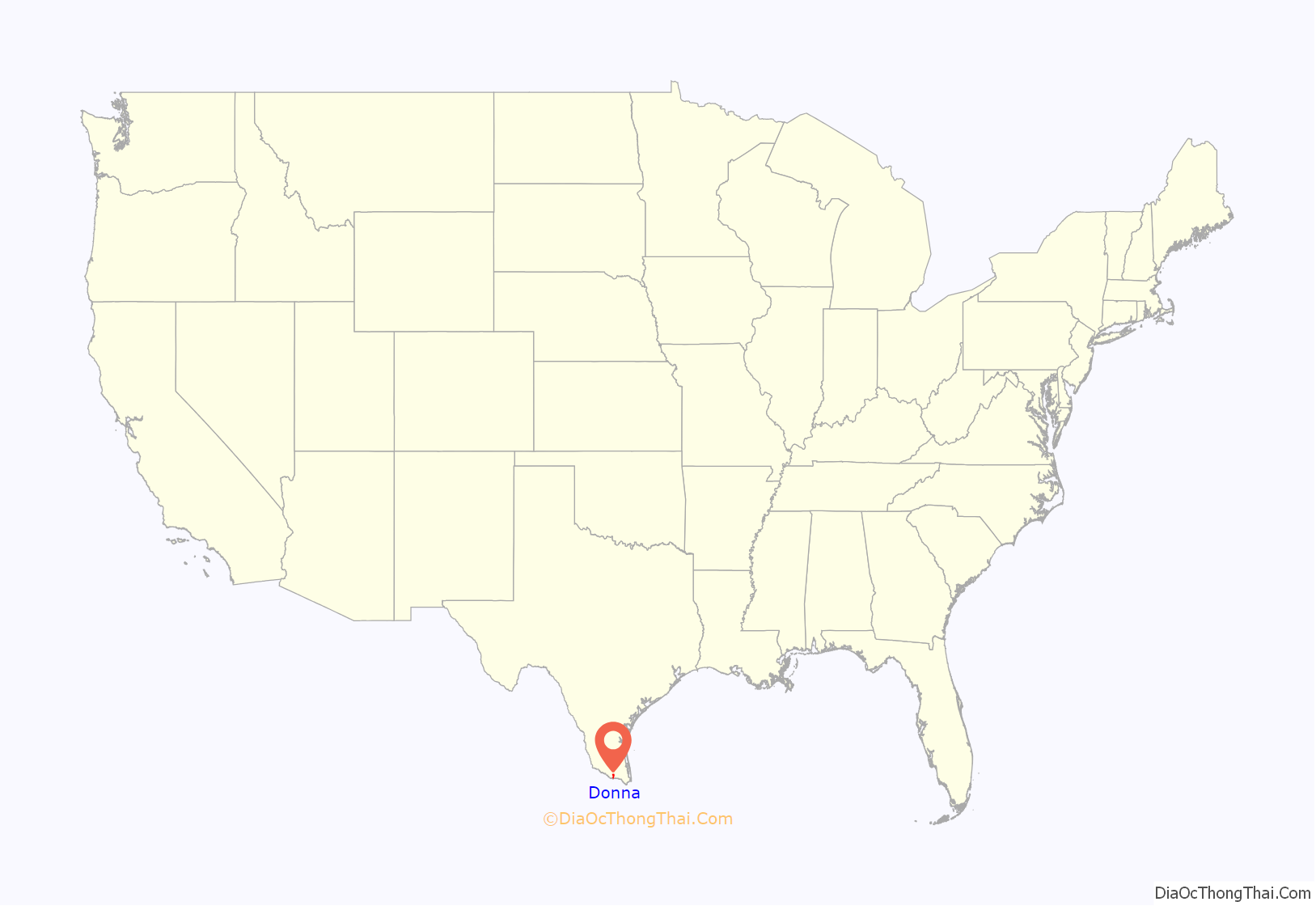
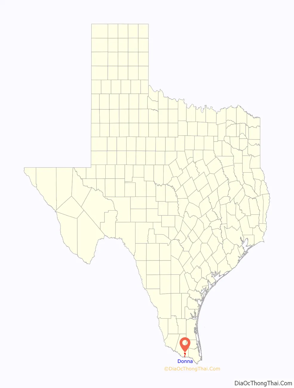
Online Interactive Map
Click on ![]() to view map in "full screen" mode.
to view map in "full screen" mode.
Donna location map. Where is Donna city?
History
Donna is in southeastern Hidalgo County, 11 miles (18 km) east of McAllen, in territory that was granted to Lino Cabazos as part of the La Blanca land grant on May 19, 1834, by the Mexican state of Tamaulipas. The Cabazos family inhabited the area for at least twenty years after taking possession of the land, and their descendants continued to live in the area into the twentieth century. The first known Anglo-American settler was John F. Webber, who, accompanied by his wife Sylvia (Hector), a former slave, settled in the area in 1839. The Webbers moved to the area in order to escape persecution for their interracial marriage.
Several families from northern states, including the Ruthven, Champion, and Hooks families, settled the area. Thomas Jefferson Hooks arrived in the Lower Rio Grande valley in 1900 and the following year moved his family to Run in southeastern Hidalgo County. In May 1902 he helped to form the La Blanca Agricultural Company, which purchased 23,000 acres (93 km) fronting the river 2 miles (3 km) east and west of the site of present Donna and extending north 18 miles (29 km). He gave part of his purchase to his 21-year-old daughter, Donna Hooks Fletcher, a divorcée.
She settled in the area and established the Alameda (Grove) Ranch. Fletcher stocked the ranch with Jersey cattle purchased from the Lassater Ranch in Falfurrias and ran a successful butter business. The Hidalgo and San Miguel Extension (later called the Sam Fordyce Branch) of the St. Louis, Brownsville and Mexico Railway reached the site in July 1904, when the town was founded. In 1907 the town received a depot and was named “Donna” in honor of Donna Fletcher, who was postmistress when the Donna post office opened in 1908.
That year the first store in west Donna was established by Ed Ruthven, and the community was recognized as the Texas station that shipped the most produce in a year. A 500-ton-capacity sugar mill was built in Donna that year. The Donna Developer was first printed on December 1, 1910, in Chapin. That year the Community Church was constructed and shared by the town’s Protestant groups. The First Presbyterian Church was founded on July 10, and the First Baptist Church was organized on July 24, 1910. The telephone exchange was installed in 1911. Donna incorporated on April 13, 1911. By 1912 the town was divided into Donna and East Donna. East Donna, the Mexican side of town, had a post office named “Beatriz”, after Beatriz Hooks, from 1912 to 1916. Saint Joseph Catholic Church and a school for Mexican children were located there.
A store was moved from Run to Donna in 1914 by Andrew Champion. In 1915 Donna had a population of 1,500, a bank, a hotel, four churches, two cotton gins, the sugar mill, and a weekly newspaper named the Donna Dispatch, published by B. L. Brooks. In 1916 the Donna Light and Power Company was incorporated by A. F. Hester Sr., T. J. Hooks, Dr. J. B. Roberts, and twenty stockholders. The American Legion Hall, Donna Border Post No. 107, was dedicated in 1920. Donna had an estimated population of 1,579 in 1925. By 1936 it had a population of 4,103, a railroad stop, multiple dwellings, and 110 businesses.
The citizens of Donna first started using the motto “The City with a Heart in the Heart of the Rio Grande Valley” to promote the city in the 1940s. By 1945 the town had a population of 4,712 and 78 businesses, and it continued to be a citrus and vegetable growing center. In 1953 Donna had three gins, three wholesale groceries, hardware and farm implements dealers, a wholesale distributor for feed mills, and the Donna News. The election of 1954 drew attention to Donna when Bob Jefferys, a newspaperman, requested that a special contingent of Texas Rangers be sent to the city by Governor Allan Shivers. He alleged that the election campaign was becoming violent because political bosses were physically threatening voters. The American Legion Hall was designated a historical landmark in 1964. In 1967 Donna reported 110 businesses (including eight manufacturers), ten churches, a bank, a library, and a newspaper.
From 1920 through the mid-1960s Donna had segregated schools. A third school for migrant students was in operation through the 1970s. The justification for its operation was that migrant children needed more attention because of their parents’ work. It was opened to children in the third to eighth grade and had a separate campus. Donna had a population of 8,982 and 122 businesses in 1978. After the 1970s the economy in Donna continued to be based on fruits, vegetables, and the tourist trade. In 2000 Donna had a population of 14,768 and 369 businesses.
There are five colonias immediately south of the Donna city limits off Farm-to-Market Road 493. Colonia Nueva is on Farm-to-Market Road 493 2 miles (3 km) south of Donna; Colonia Algeria is on River Road and Eleventh Street next to the city dump; Colonia Tierra Prieta is on the east side of Farm-to-Market Road 493; Colonia Salinas is south of Donna; and South Donna is a subdivision. Water is provided to the colonias by Colonia Nueva Water Distribution System, a privately owned enterprise that purchases water from the city of Donna and resells it to 400 colonia domiciles. Tierra Prieta also receives water from North Alamo Water Supply Corporation; it had an estimated population of 180 in 1986.
In 1998 Pablo Lucio Vasquez murdered David Cardenas.
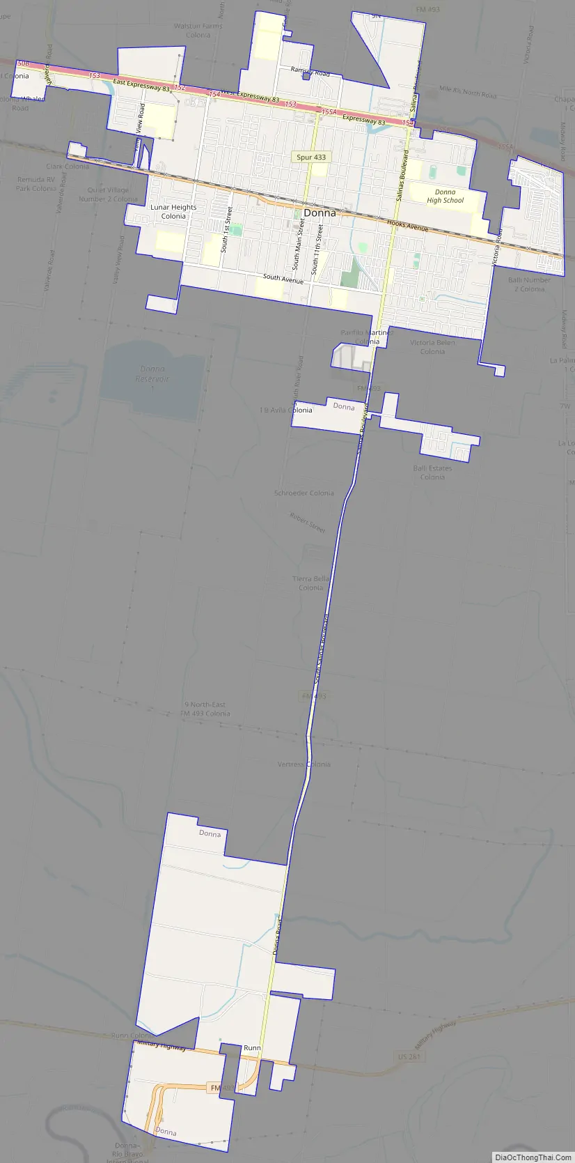
Donna Road Map
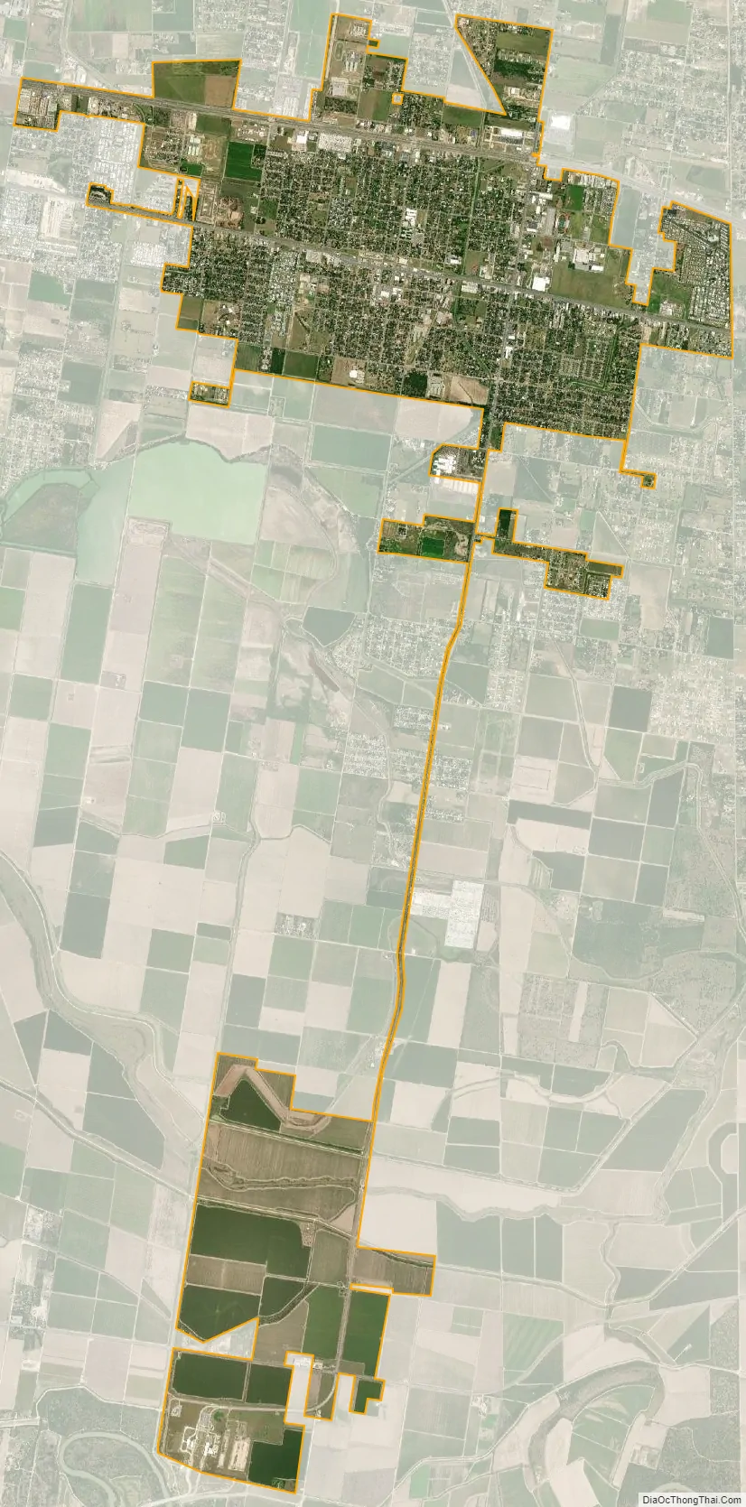
Donna city Satellite Map
Geography
Donna is located in southern Texas at 26°10′13″N 98°2′57″W / 26.17028°N 98.04917°W / 26.17028; -98.04917 (26.170336, –98.049037). It is bordered on the east by the city of Weslaco and on the west by Alamo. The southern boundary of Donna is a few miles north of the Rio Grande, the international border between the United States and Mexico.
Interstate 2/U.S. Highway 83 pass through the northern side of the city, leading west 11 miles (18 km) to McAllen and east 23 miles (37 km) to Harlingen. Via McAllen it is 244 miles (393 km) south of San Antonio. Hooks Avenue is the main road through the center of Donna.
According to the United States Census Bureau, the city has a total area of 8.3 square miles (21.5 km), of which 0.01 square miles (0.03 km), or 0.13%, are water.
Climate
The city can be classified as a hot semiarid climate (Köppen: BSh) similar to that found in southwest Texas and northwest Mexico. Donna, according to the climate map and the data used can be considered the easternmost city with a semi-arid climate in the eastern United States, not far from a humid subtropical climate due to the greater proximity of the coast, which probably limits the group B of Köppen further east of the state.
See also
Map of Texas State and its subdivision:- Anderson
- Andrews
- Angelina
- Aransas
- Archer
- Armstrong
- Atascosa
- Austin
- Bailey
- Bandera
- Bastrop
- Baylor
- Bee
- Bell
- Bexar
- Blanco
- Borden
- Bosque
- Bowie
- Brazoria
- Brazos
- Brewster
- Briscoe
- Brooks
- Brown
- Burleson
- Burnet
- Caldwell
- Calhoun
- Callahan
- Cameron
- Camp
- Carson
- Cass
- Castro
- Chambers
- Cherokee
- Childress
- Clay
- Cochran
- Coke
- Coleman
- Collin
- Collingsworth
- Colorado
- Comal
- Comanche
- Concho
- Cooke
- Coryell
- Cottle
- Crane
- Crockett
- Crosby
- Culberson
- Dallam
- Dallas
- Dawson
- Deaf Smith
- Delta
- Denton
- Dewitt
- Dickens
- Dimmit
- Donley
- Duval
- Eastland
- Ector
- Edwards
- El Paso
- Ellis
- Erath
- Falls
- Fannin
- Fayette
- Fisher
- Floyd
- Foard
- Fort Bend
- Franklin
- Freestone
- Frio
- Gaines
- Galveston
- Garza
- Gillespie
- Glasscock
- Goliad
- Gonzales
- Gray
- Grayson
- Gregg
- Grimes
- Guadalupe
- Hale
- Hall
- Hamilton
- Hansford
- Hardeman
- Hardin
- Harris
- Harrison
- Hartley
- Haskell
- Hays
- Hemphill
- Henderson
- Hidalgo
- Hill
- Hockley
- Hood
- Hopkins
- Houston
- Howard
- Hudspeth
- Hunt
- Hutchinson
- Irion
- Jack
- Jackson
- Jasper
- Jeff Davis
- Jefferson
- Jim Hogg
- Jim Wells
- Johnson
- Jones
- Karnes
- Kaufman
- Kendall
- Kenedy
- Kent
- Kerr
- Kimble
- King
- Kinney
- Kleberg
- Knox
- La Salle
- Lamar
- Lamb
- Lampasas
- Lavaca
- Lee
- Leon
- Liberty
- Limestone
- Lipscomb
- Live Oak
- Llano
- Loving
- Lubbock
- Lynn
- Madison
- Marion
- Martin
- Mason
- Matagorda
- Maverick
- McCulloch
- McLennan
- McMullen
- Medina
- Menard
- Midland
- Milam
- Mills
- Mitchell
- Montague
- Montgomery
- Moore
- Morris
- Motley
- Nacogdoches
- Navarro
- Newton
- Nolan
- Nueces
- Ochiltree
- Oldham
- Orange
- Palo Pinto
- Panola
- Parker
- Parmer
- Pecos
- Polk
- Potter
- Presidio
- Rains
- Randall
- Reagan
- Real
- Red River
- Reeves
- Refugio
- Roberts
- Robertson
- Rockwall
- Runnels
- Rusk
- Sabine
- San Augustine
- San Jacinto
- San Patricio
- San Saba
- Schleicher
- Scurry
- Shackelford
- Shelby
- Sherman
- Smith
- Somervell
- Starr
- Stephens
- Sterling
- Stonewall
- Sutton
- Swisher
- Tarrant
- Taylor
- Terrell
- Terry
- Throckmorton
- Titus
- Tom Green
- Travis
- Trinity
- Tyler
- Upshur
- Upton
- Uvalde
- Val Verde
- Van Zandt
- Victoria
- Walker
- Waller
- Ward
- Washington
- Webb
- Wharton
- Wheeler
- Wichita
- Wilbarger
- Willacy
- Williamson
- Wilson
- Winkler
- Wise
- Wood
- Yoakum
- Young
- Zapata
- Zavala
- Alabama
- Alaska
- Arizona
- Arkansas
- California
- Colorado
- Connecticut
- Delaware
- District of Columbia
- Florida
- Georgia
- Hawaii
- Idaho
- Illinois
- Indiana
- Iowa
- Kansas
- Kentucky
- Louisiana
- Maine
- Maryland
- Massachusetts
- Michigan
- Minnesota
- Mississippi
- Missouri
- Montana
- Nebraska
- Nevada
- New Hampshire
- New Jersey
- New Mexico
- New York
- North Carolina
- North Dakota
- Ohio
- Oklahoma
- Oregon
- Pennsylvania
- Rhode Island
- South Carolina
- South Dakota
- Tennessee
- Texas
- Utah
- Vermont
- Virginia
- Washington
- West Virginia
- Wisconsin
- Wyoming


