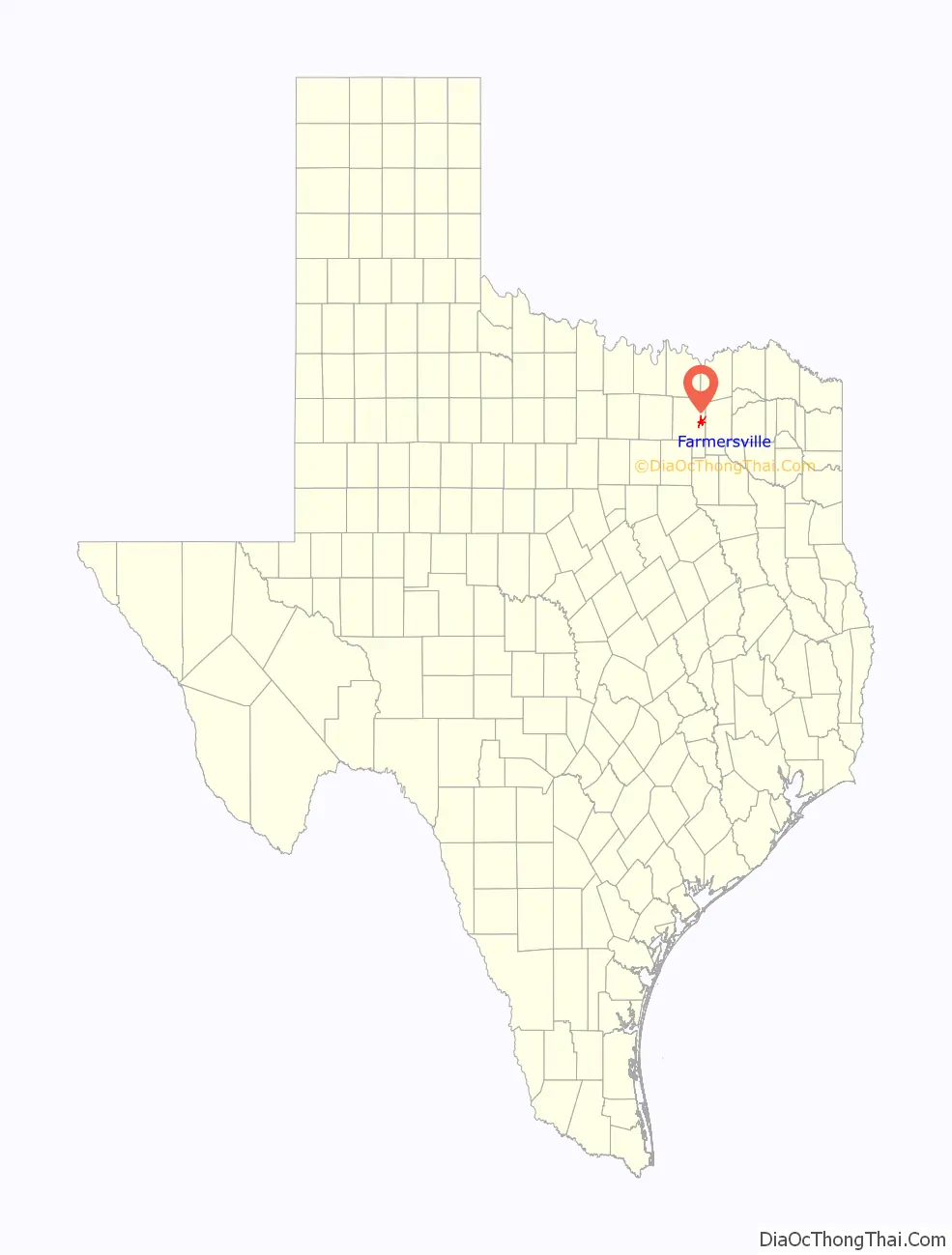
Farmersville is a city in Collin County, Texas (as well as a small portion in Hunt County, Texas), United States. The population was 3,612 at the 2020 census.
| Name: | Farmersville city |
|---|---|
| LSAD Code: | 25 |
| LSAD Description: | city (suffix) |
| State: | Texas |
| County: | Collin County |
| Elevation: | 653 ft (199 m) |
| Total Area: | 4.27 sq mi (11.07 km²) |
| Land Area: | 4.11 sq mi (10.63 km²) |
| Water Area: | 0.17 sq mi (0.43 km²) |
| Total Population: | 3,612 |
| Population Density: | 884.29/sq mi (341.39/km²) |
| ZIP code: | 75442 |
| Area code: | 972 |
| FIPS code: | 4825488 |
| GNISfeature ID: | 1335715 |
| Website: | www.farmersvilletx.com |
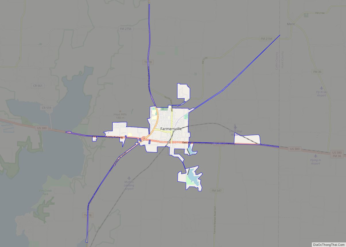
Online Interactive Map
Click on ![]() to view map in "full screen" mode.
to view map in "full screen" mode.
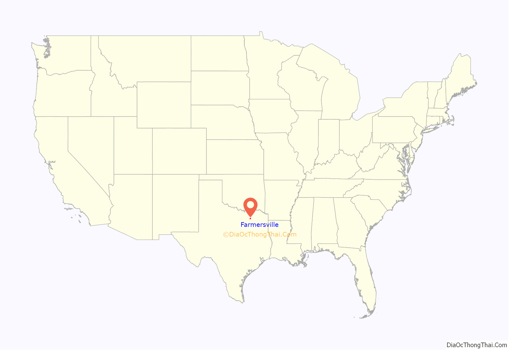
Farmersville location map. Where is Farmersville city?
History
Farmersville originated in 1849 as a settlement on the Jefferson-McKinney Road, and near Republic of Texas National Road. The settlement was named by pioneers William Pickney Chapman & John Hendrex for their chief occupation. After 1854, the Yearys and their neighbors of Sugar Hill (2 miles northeast) began relocating here. H.M. Markham, practicing here by 1855, is said to have been Collin County’s earliest physician. The first Methodist Church was organized in 1856. William Gotcher on March 4, 1859, donated land for the public square. A school was operating as early as the 1860s. The first Baptist Church was organized on May 14, 1865.
The town was incorporated on June 2, 1873. First mayor: John S. Rike. Aldermen: James Church, Ben King, John Murchison, Tom Tatum, John P. Utt. Marshall: Jeff Hines.
Institutions from the 1880s that are still in operation include the Farmersville Times, which is the oldest newspaper in Collin County, and the First Bank, as well as the two churches mentioned above.
On June 15, 1945, Audie Murphy, the most decorated soldier of World War II, came home to a hero’s welcome in Farmersville. Thousand’s filled the square to listen to a speech given by him, and the event was noted in the July 16, 1945 edition of Life Magazine. A Texas Historical Commission plaque notes the event on the square.
As the town became a trade center, agriculture kept pace. Farmersville in the 1930s was known as the “Onion Capital of North Texas”, annually shipping over 1,000 carloads of onions. Along with some small industry, cattle, cotton, and maize crops remain important.
On May 8, 2021, in honor of Audie Murphy, the most decorated soldier of WWII, a “Sister City Pact” with Holtzwihr, France was signed. This ceremony was to announce the common bond between the two cities and recognize Murphy’s heroism at the Battle of Holtzwihr on January 26, 1945.
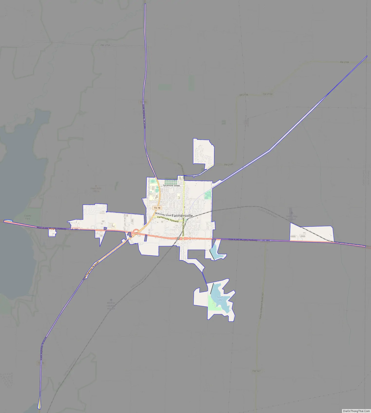
Farmersville Road Map
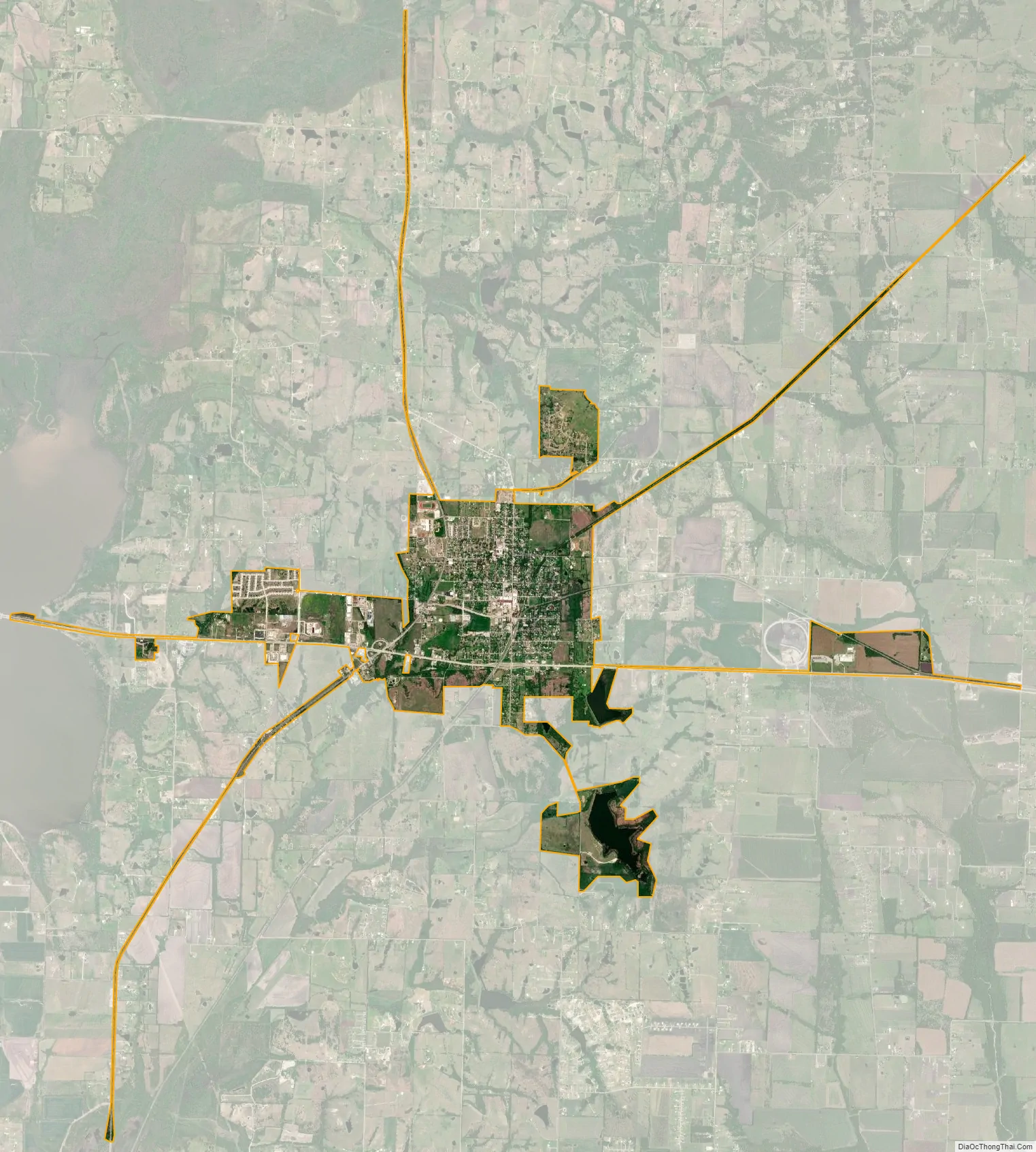
Farmersville city Satellite Map
Geography
U.S. Route 380 crosses the south side of the city, leading west 18 miles (29 km) to McKinney and east 15 miles (24 km) to Greenville. Texas State Highway 78 passes through the west side of Farmersville, leading north 10 miles (16 km) to Blue Ridge and southwest 27 miles (43 km) to Garland. The north end of Lavon Lake is 4 miles (6 km) to the west.
According to the United States Census Bureau, Farmersville has a total area of 4.0 square miles (10.4 km), of which 3.8 square miles (9.9 km) is land and 0.2 square miles (0.4 km), or 4.18%, is water.
Climate
The climate in this area is characterized by hot, humid summers and generally mild to cool winters. According to the Köppen Climate Classification system, Farmersville has a humid subtropical climate, abbreviated “Cfa” on climate maps.
See also
Map of Texas State and its subdivision:- Anderson
- Andrews
- Angelina
- Aransas
- Archer
- Armstrong
- Atascosa
- Austin
- Bailey
- Bandera
- Bastrop
- Baylor
- Bee
- Bell
- Bexar
- Blanco
- Borden
- Bosque
- Bowie
- Brazoria
- Brazos
- Brewster
- Briscoe
- Brooks
- Brown
- Burleson
- Burnet
- Caldwell
- Calhoun
- Callahan
- Cameron
- Camp
- Carson
- Cass
- Castro
- Chambers
- Cherokee
- Childress
- Clay
- Cochran
- Coke
- Coleman
- Collin
- Collingsworth
- Colorado
- Comal
- Comanche
- Concho
- Cooke
- Coryell
- Cottle
- Crane
- Crockett
- Crosby
- Culberson
- Dallam
- Dallas
- Dawson
- Deaf Smith
- Delta
- Denton
- Dewitt
- Dickens
- Dimmit
- Donley
- Duval
- Eastland
- Ector
- Edwards
- El Paso
- Ellis
- Erath
- Falls
- Fannin
- Fayette
- Fisher
- Floyd
- Foard
- Fort Bend
- Franklin
- Freestone
- Frio
- Gaines
- Galveston
- Garza
- Gillespie
- Glasscock
- Goliad
- Gonzales
- Gray
- Grayson
- Gregg
- Grimes
- Guadalupe
- Hale
- Hall
- Hamilton
- Hansford
- Hardeman
- Hardin
- Harris
- Harrison
- Hartley
- Haskell
- Hays
- Hemphill
- Henderson
- Hidalgo
- Hill
- Hockley
- Hood
- Hopkins
- Houston
- Howard
- Hudspeth
- Hunt
- Hutchinson
- Irion
- Jack
- Jackson
- Jasper
- Jeff Davis
- Jefferson
- Jim Hogg
- Jim Wells
- Johnson
- Jones
- Karnes
- Kaufman
- Kendall
- Kenedy
- Kent
- Kerr
- Kimble
- King
- Kinney
- Kleberg
- Knox
- La Salle
- Lamar
- Lamb
- Lampasas
- Lavaca
- Lee
- Leon
- Liberty
- Limestone
- Lipscomb
- Live Oak
- Llano
- Loving
- Lubbock
- Lynn
- Madison
- Marion
- Martin
- Mason
- Matagorda
- Maverick
- McCulloch
- McLennan
- McMullen
- Medina
- Menard
- Midland
- Milam
- Mills
- Mitchell
- Montague
- Montgomery
- Moore
- Morris
- Motley
- Nacogdoches
- Navarro
- Newton
- Nolan
- Nueces
- Ochiltree
- Oldham
- Orange
- Palo Pinto
- Panola
- Parker
- Parmer
- Pecos
- Polk
- Potter
- Presidio
- Rains
- Randall
- Reagan
- Real
- Red River
- Reeves
- Refugio
- Roberts
- Robertson
- Rockwall
- Runnels
- Rusk
- Sabine
- San Augustine
- San Jacinto
- San Patricio
- San Saba
- Schleicher
- Scurry
- Shackelford
- Shelby
- Sherman
- Smith
- Somervell
- Starr
- Stephens
- Sterling
- Stonewall
- Sutton
- Swisher
- Tarrant
- Taylor
- Terrell
- Terry
- Throckmorton
- Titus
- Tom Green
- Travis
- Trinity
- Tyler
- Upshur
- Upton
- Uvalde
- Val Verde
- Van Zandt
- Victoria
- Walker
- Waller
- Ward
- Washington
- Webb
- Wharton
- Wheeler
- Wichita
- Wilbarger
- Willacy
- Williamson
- Wilson
- Winkler
- Wise
- Wood
- Yoakum
- Young
- Zapata
- Zavala
- Alabama
- Alaska
- Arizona
- Arkansas
- California
- Colorado
- Connecticut
- Delaware
- District of Columbia
- Florida
- Georgia
- Hawaii
- Idaho
- Illinois
- Indiana
- Iowa
- Kansas
- Kentucky
- Louisiana
- Maine
- Maryland
- Massachusetts
- Michigan
- Minnesota
- Mississippi
- Missouri
- Montana
- Nebraska
- Nevada
- New Hampshire
- New Jersey
- New Mexico
- New York
- North Carolina
- North Dakota
- Ohio
- Oklahoma
- Oregon
- Pennsylvania
- Rhode Island
- South Carolina
- South Dakota
- Tennessee
- Texas
- Utah
- Vermont
- Virginia
- Washington
- West Virginia
- Wisconsin
- Wyoming