Fresno is an unincorporated community and census-designated place (CDP) in Fort Bend County, Texas, United States. The local population was 24,486 as of the 2020 census, up from 19,069 at the 2010 census, and 6,603 at the 2000 census.
Fresno is located in the extra-territorial jurisdiction (ETJ) of Houston, which is the fourth largest city in the nation in population. Fresno is bordered by Houston to the north, the suburban Fort Bend County cities of Missouri City to the west and northwest, Arcola to the south and southwest, and the Brazoria County city of Pearland to the east.
| Name: | Fresno CDP |
|---|---|
| LSAD Code: | 57 |
| LSAD Description: | CDP (suffix) |
| State: | Texas |
| County: | Fort Bend County |
| Elevation: | 72 ft (22 m) |
| Total Area: | 9.3 sq mi (24.1 km²) |
| Land Area: | 9.2 sq mi (23.8 km²) |
| Water Area: | 0.1 sq mi (0.3 km²) |
| Total Population: | 24,486 |
| Population Density: | 2,630/sq mi (1,016/km²) |
| ZIP code: | 77545 |
| Area code: | 281 |
| FIPS code: | 4827540 |
| GNISfeature ID: | 1336203 |
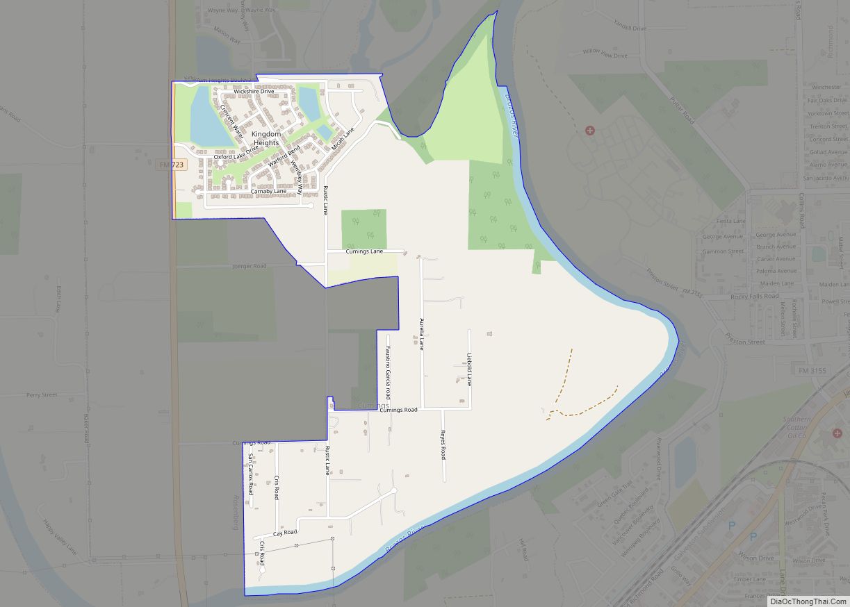
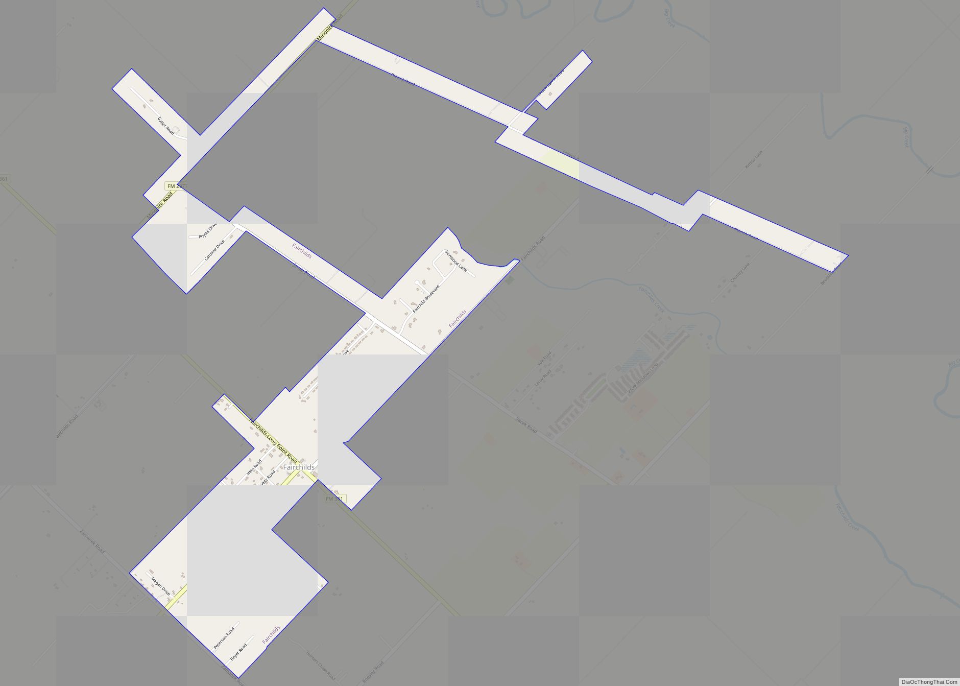
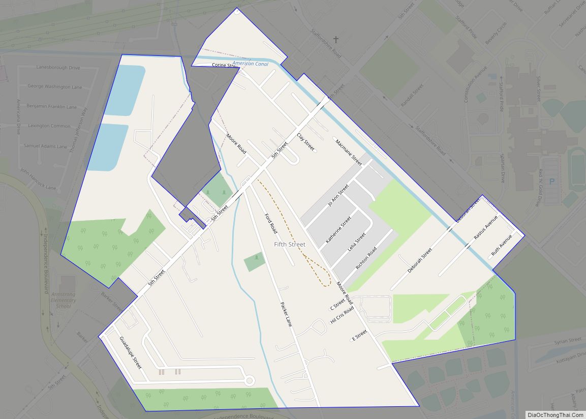
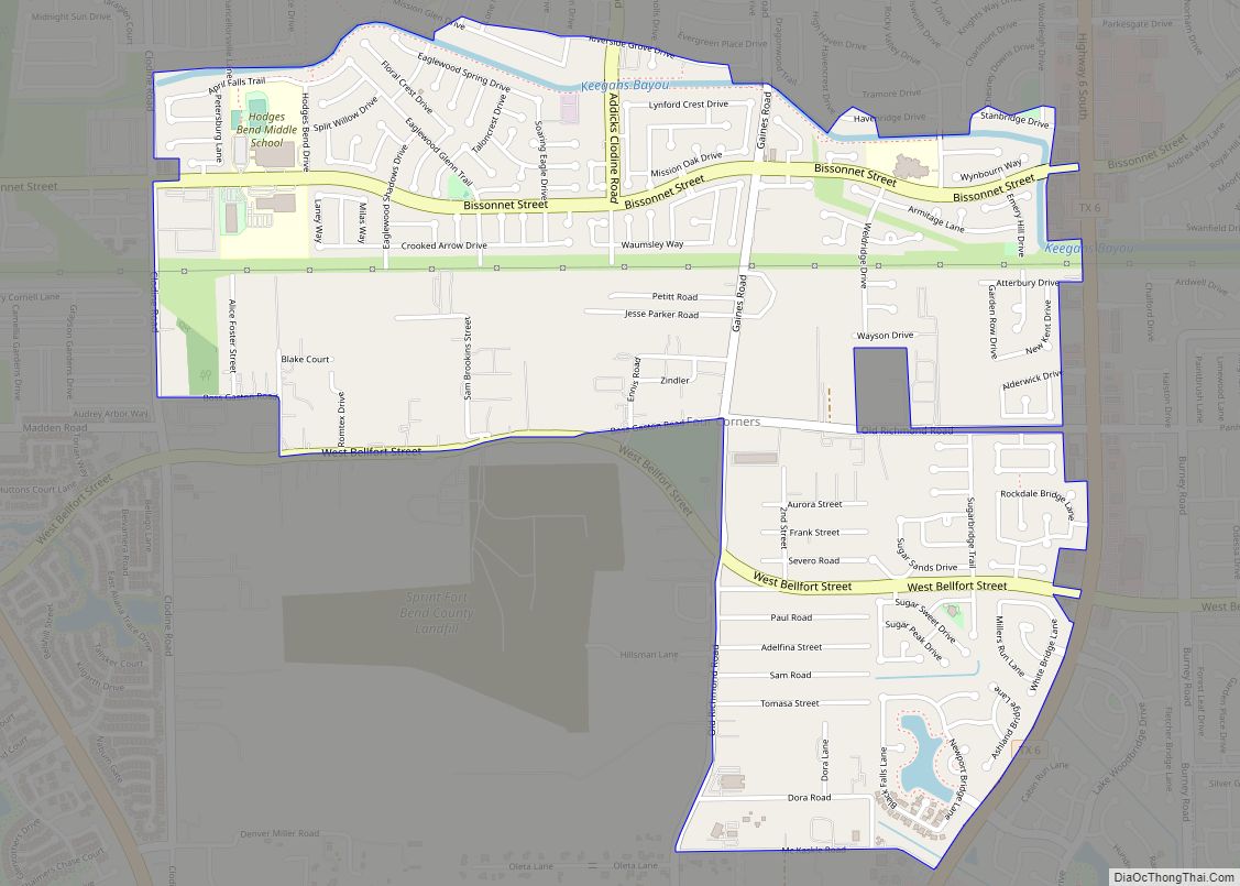
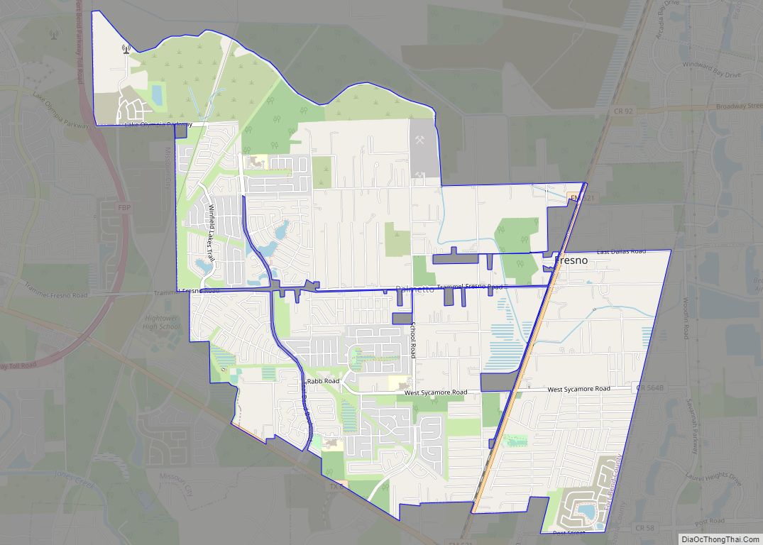
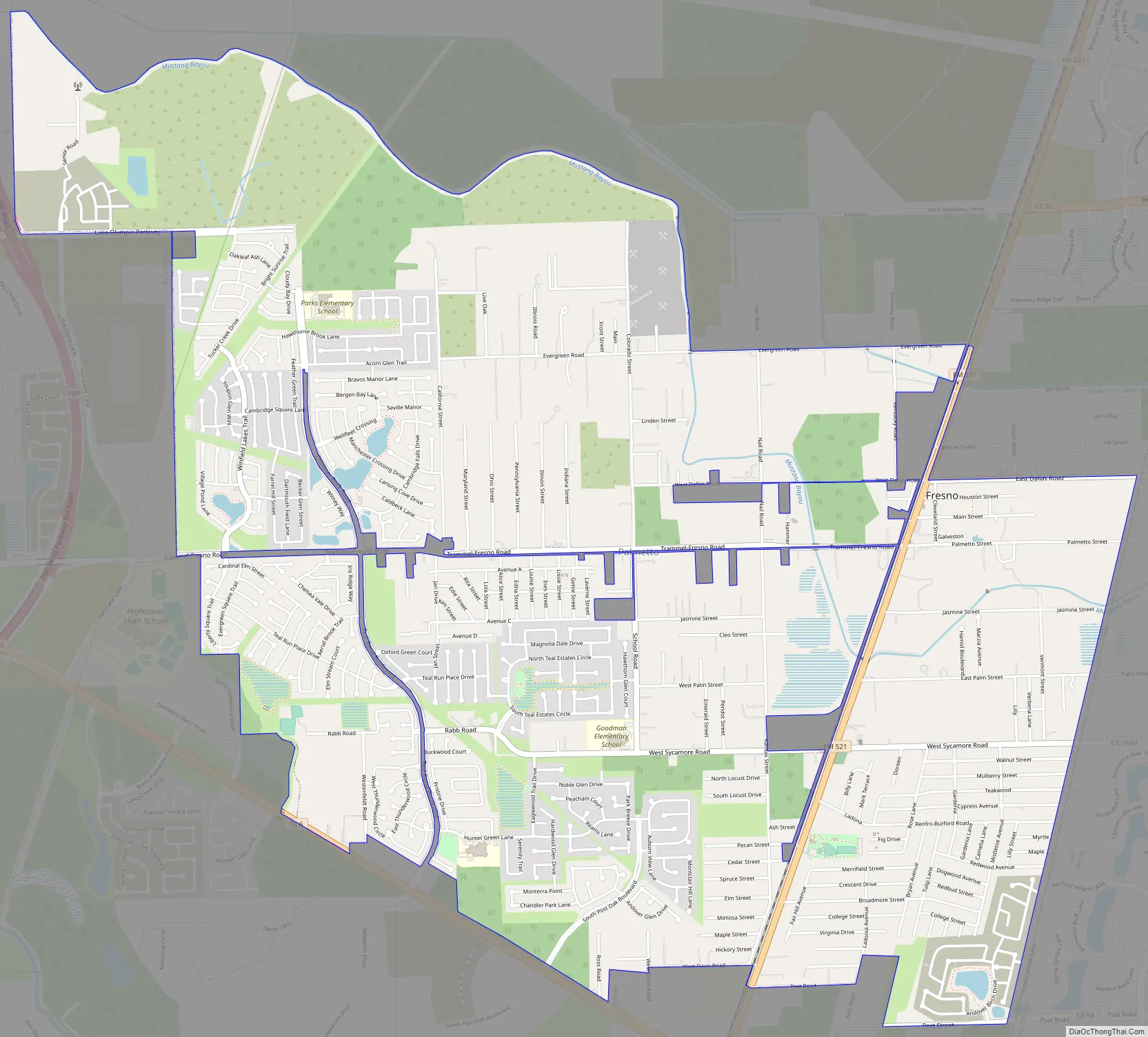
Online Interactive Map
Click on ![]() to view map in "full screen" mode.
to view map in "full screen" mode.
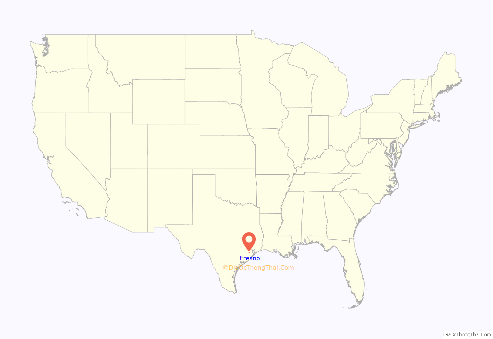
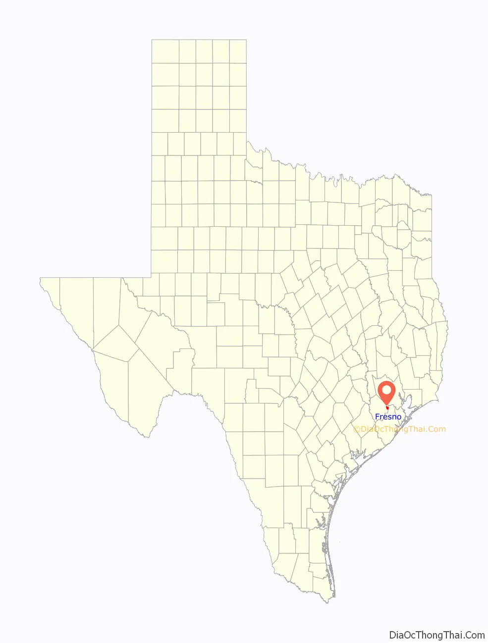
Fresno location map. Where is Fresno CDP?
History
A settler from Fresno, California, reportedly chose the name. The town is on land patented in 1880 once surrounded by cotton plantations. Fresno acquired a post office in 1910. In 1914 it had a telephone connection, a general store, a hardware store, and a population of 32. By 1933 the town had only ten inhabitants and one business. In 1936 it had three rows of dwellings on both sides of a paved highway (old Hwy 288, present day FM 521) and was served by the International-Great Northern Railroad. By 1946 the population had risen to 100, a level maintained throughout the 1960s. In 1970 the figure had increased to 120; two years later it had grown to 161. During the 1970s and 1980s the population of Fresno increased more rapidly as the area was affected by growth of Houston.
Growth in the 1990s and 2000s
With its prime location on FM 521 and north of State Highway 6 in unincorporated Fort Bend County, developers have recently built large bedroom communities over what was once forest and grazing land, and a number of first-time homeowners have made the Fresno area home.
The demographics in the Fresno area have changed dramatically since the last United States Census in 2000 due to a large increase in home building.
The area is heavily Democratic in nature, and due to population increases in the area, Fresno was switched from Fort Bend County Precinct Two jurisdiction in 2003 and is now located within Fort Bend County Precinct One, which is located primarily on the western side of Fort Bend County, some 25 to 30 miles (40 to 48 km) away from Fresno, which is located in far eastern Fort Bend County.
Among the largest communities in Fresno are the six neighborhoods that make up the Fort Bend MUD #23 area. Teal Run, the oldest of the neighborhoods, was originally started in the 1980s, and development stopped with the Houston oil crash in the late 1980s. Construction in the subdivision started again in 1992.
The Estates of Teal Run, located at the intersection of Raab and Sycamore Road, was started in 1999.
Teal Run North (Villages of Teal Run and Teal Run Meadows), located just off Teal Bend Boulevard, directly adjacent to both Teal Run and Teal Run Estates, was started in 2001. There are over 3,100 total homes in the Fort Bend MUD #23 area in 2006.
NewPoint Estates, located across from Teal Run on Highway 6 and Darby Road, is an area for acreage-type home sites, stables and expensive properties. A number of Houston area professional athletes make this neighborhood home.
Winfield Lakes, which is located on Trammel Fresno Road, was started in 2004.
Andover Farms, which is located on Highway 6 and South Post Oak Road, was started in 2004.
Cambridge Falls, a David Weekley homes site located next to Winfield Lakes, started with infrastructure additions (lights, gas, water, sewer lines, streets) in 2005 and has built many spec homes, which are now available for purchase.
The newly built Fort Bend Tollway has given eastern Fort Bend County residents another option of travel into the city of Houston, as the Tollway is 6.2 miles (10.0 km) long from Highway 6 to U.S. Highway 90 in southwest Houston, and eventually will travel all the way to Loop 610. The average commute time for those living in eastern Fort Bend County using the full route from Highway 6 to Loop 610 (when it opens) should average 20 minutes. A typical trip down FM 521, which turns into Almeda in Houston, or State Highway 288 north into the Texas Medical Center, takes at least 30–45 minutes in rush hour traffic.
A Houston Chronicle article from February 25, 2007, titled “Straddling urban, rural in Fresno” highlights the unregulated nature of Fresno.
Fresno Road Map
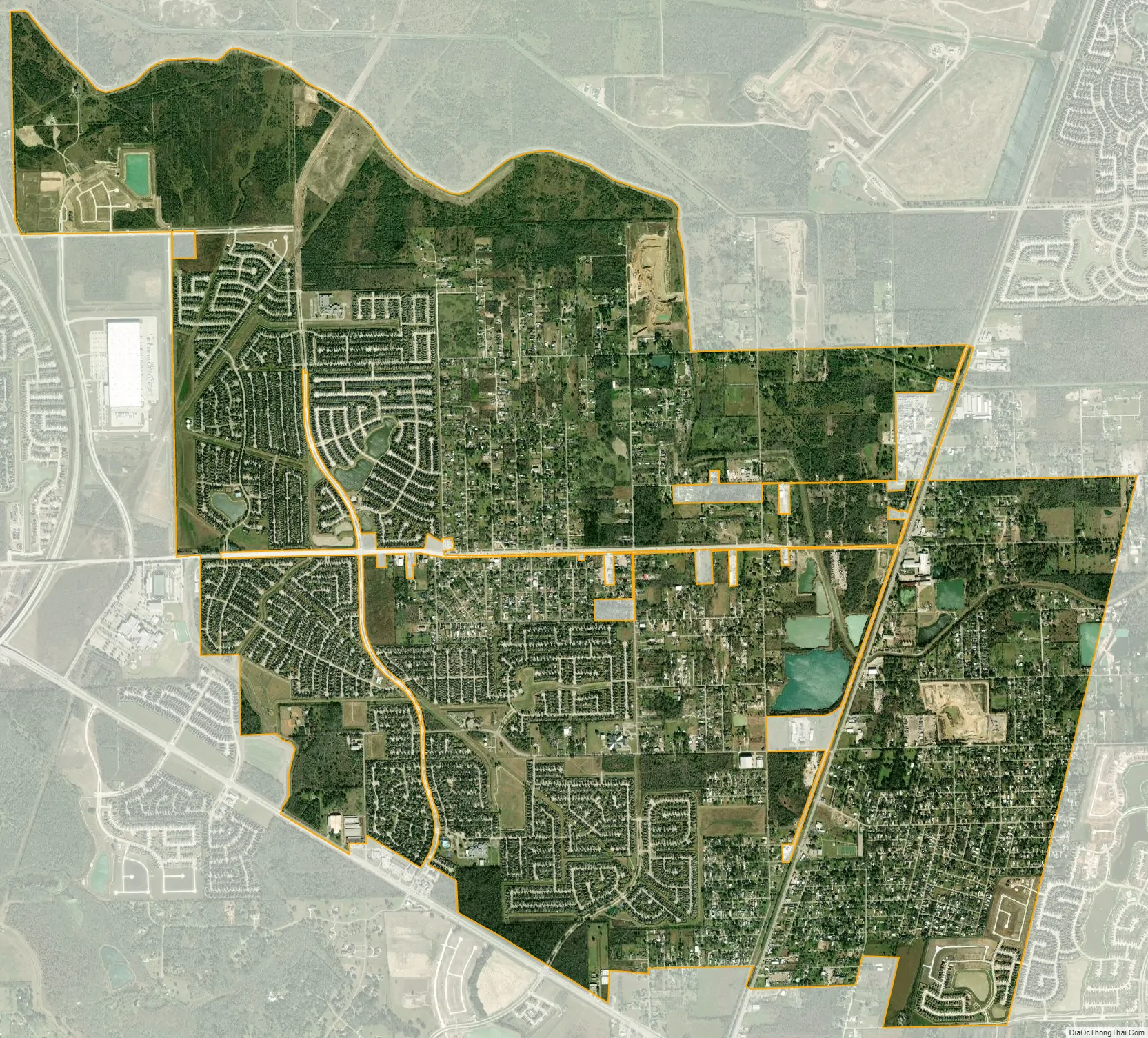
Fresno city Satellite Map
Geography
Fresno is located in eastern Fort Bend County at 29°31′36″N 95°27′35″W / 29.52667°N 95.45972°W / 29.52667; -95.45972 (29.526728, -95.459849). The eastern edge of Fresno is the Brazoria County line. Downtown Houston is 17 miles (27 km) to the north, the center of Missouri City is 11 miles (18 km) to the northwest, the center of Pearland is 11 miles (18 km) to the east, and Manvel is 9 miles (14 km) to the southeast.
According to the United States Census Bureau, the Fresno CDP has a total area of 9.3 square miles (24.1 km), of which 9.2 square miles (23.8 km) of it is land and 0.1 square miles (0.3 km), or 1.35%, is water.
See also
Map of Texas State and its subdivision:- Anderson
- Andrews
- Angelina
- Aransas
- Archer
- Armstrong
- Atascosa
- Austin
- Bailey
- Bandera
- Bastrop
- Baylor
- Bee
- Bell
- Bexar
- Blanco
- Borden
- Bosque
- Bowie
- Brazoria
- Brazos
- Brewster
- Briscoe
- Brooks
- Brown
- Burleson
- Burnet
- Caldwell
- Calhoun
- Callahan
- Cameron
- Camp
- Carson
- Cass
- Castro
- Chambers
- Cherokee
- Childress
- Clay
- Cochran
- Coke
- Coleman
- Collin
- Collingsworth
- Colorado
- Comal
- Comanche
- Concho
- Cooke
- Coryell
- Cottle
- Crane
- Crockett
- Crosby
- Culberson
- Dallam
- Dallas
- Dawson
- Deaf Smith
- Delta
- Denton
- Dewitt
- Dickens
- Dimmit
- Donley
- Duval
- Eastland
- Ector
- Edwards
- El Paso
- Ellis
- Erath
- Falls
- Fannin
- Fayette
- Fisher
- Floyd
- Foard
- Fort Bend
- Franklin
- Freestone
- Frio
- Gaines
- Galveston
- Garza
- Gillespie
- Glasscock
- Goliad
- Gonzales
- Gray
- Grayson
- Gregg
- Grimes
- Guadalupe
- Hale
- Hall
- Hamilton
- Hansford
- Hardeman
- Hardin
- Harris
- Harrison
- Hartley
- Haskell
- Hays
- Hemphill
- Henderson
- Hidalgo
- Hill
- Hockley
- Hood
- Hopkins
- Houston
- Howard
- Hudspeth
- Hunt
- Hutchinson
- Irion
- Jack
- Jackson
- Jasper
- Jeff Davis
- Jefferson
- Jim Hogg
- Jim Wells
- Johnson
- Jones
- Karnes
- Kaufman
- Kendall
- Kenedy
- Kent
- Kerr
- Kimble
- King
- Kinney
- Kleberg
- Knox
- La Salle
- Lamar
- Lamb
- Lampasas
- Lavaca
- Lee
- Leon
- Liberty
- Limestone
- Lipscomb
- Live Oak
- Llano
- Loving
- Lubbock
- Lynn
- Madison
- Marion
- Martin
- Mason
- Matagorda
- Maverick
- McCulloch
- McLennan
- McMullen
- Medina
- Menard
- Midland
- Milam
- Mills
- Mitchell
- Montague
- Montgomery
- Moore
- Morris
- Motley
- Nacogdoches
- Navarro
- Newton
- Nolan
- Nueces
- Ochiltree
- Oldham
- Orange
- Palo Pinto
- Panola
- Parker
- Parmer
- Pecos
- Polk
- Potter
- Presidio
- Rains
- Randall
- Reagan
- Real
- Red River
- Reeves
- Refugio
- Roberts
- Robertson
- Rockwall
- Runnels
- Rusk
- Sabine
- San Augustine
- San Jacinto
- San Patricio
- San Saba
- Schleicher
- Scurry
- Shackelford
- Shelby
- Sherman
- Smith
- Somervell
- Starr
- Stephens
- Sterling
- Stonewall
- Sutton
- Swisher
- Tarrant
- Taylor
- Terrell
- Terry
- Throckmorton
- Titus
- Tom Green
- Travis
- Trinity
- Tyler
- Upshur
- Upton
- Uvalde
- Val Verde
- Van Zandt
- Victoria
- Walker
- Waller
- Ward
- Washington
- Webb
- Wharton
- Wheeler
- Wichita
- Wilbarger
- Willacy
- Williamson
- Wilson
- Winkler
- Wise
- Wood
- Yoakum
- Young
- Zapata
- Zavala
- Alabama
- Alaska
- Arizona
- Arkansas
- California
- Colorado
- Connecticut
- Delaware
- District of Columbia
- Florida
- Georgia
- Hawaii
- Idaho
- Illinois
- Indiana
- Iowa
- Kansas
- Kentucky
- Louisiana
- Maine
- Maryland
- Massachusetts
- Michigan
- Minnesota
- Mississippi
- Missouri
- Montana
- Nebraska
- Nevada
- New Hampshire
- New Jersey
- New Mexico
- New York
- North Carolina
- North Dakota
- Ohio
- Oklahoma
- Oregon
- Pennsylvania
- Rhode Island
- South Carolina
- South Dakota
- Tennessee
- Texas
- Utah
- Vermont
- Virginia
- Washington
- West Virginia
- Wisconsin
- Wyoming