Missouri City is a city in the U.S. state of Texas, within the Houston–The Woodlands–Sugar Land metropolitan area. The city is mostly in Fort Bend County, with a small portion in Harris County. As of the 2020 census, the city had a population of 74,259, up from 67,358 in 2010. The population was estimated at 75,457 in 2019.
| Name: | Missouri City city |
|---|---|
| LSAD Code: | 25 |
| LSAD Description: | city (suffix) |
| State: | Texas |
| County: | Fort Bend County, Harris County |
| Elevation: | 75 ft (23 m) |
| Total Area: | 30.39 sq mi (78.72 km²) |
| Land Area: | 29.01 sq mi (75.14 km²) |
| Water Area: | 1.38 sq mi (3.58 km²) |
| Total Population: | 74,259 |
| Population Density: | 2,601.07/sq mi (1,004.28/km²) |
| ZIP code: | 77459, 77489, 77545, 77071, 77479 |
| FIPS code: | 4848804 |
| GNISfeature ID: | 1374972 |
| Website: | www.missouricitytx.gov |
Online Interactive Map
Click on ![]() to view map in "full screen" mode.
to view map in "full screen" mode.
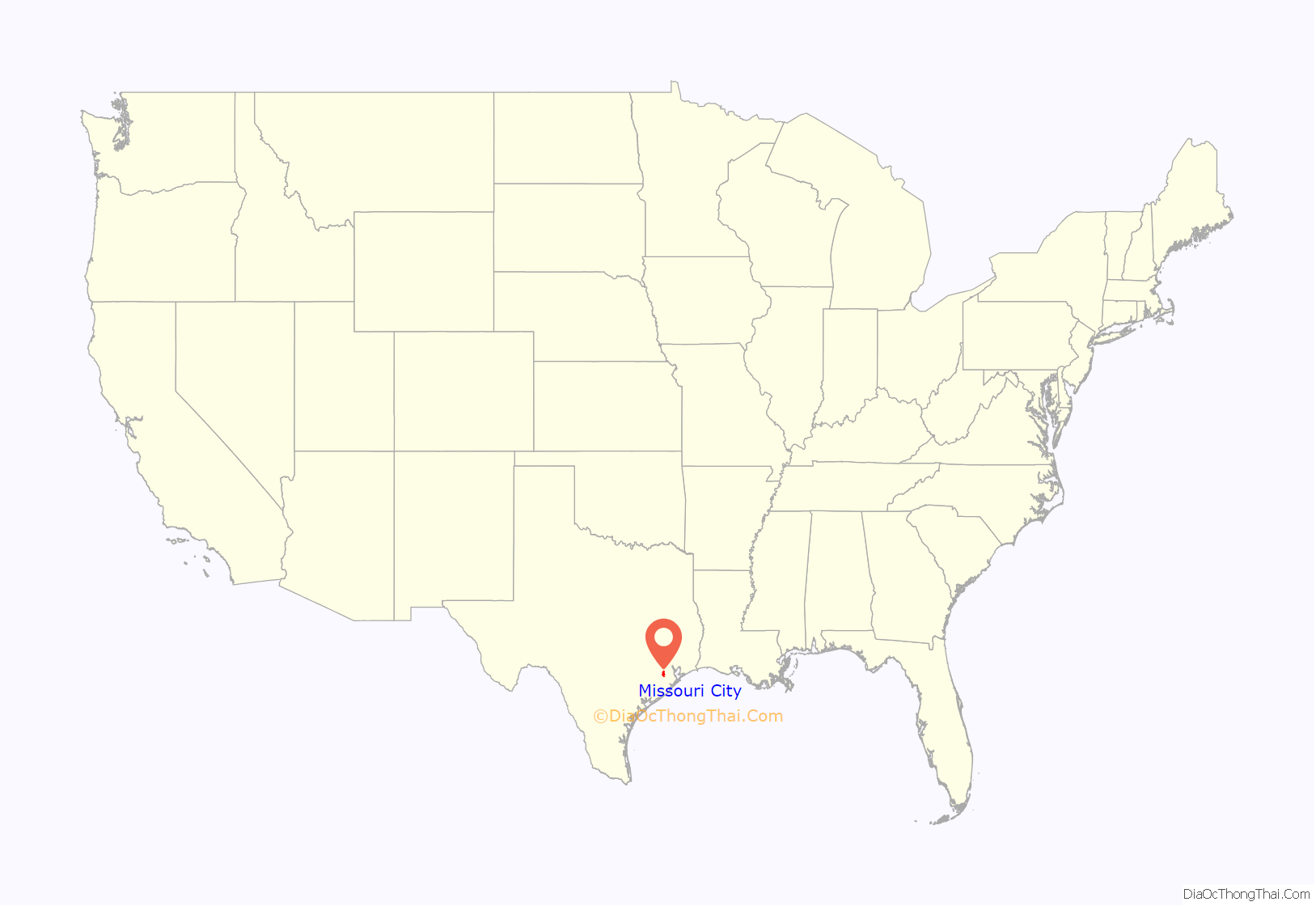
Missouri City location map. Where is Missouri City city?
History
The area in which Missouri City is now located holds a significant part in the history of Texas that dates back to its early days as part of the United States. In August 1853, the Buffalo Bayou, Brazos and Colorado Railway (BBB&C), began operating its first 20 miles (32 km) of rail line that stretched from Harrisburg (now Houston) to Stafford’s Point (now Stafford). It was the first railroad to begin operating in Texas, and the first standard gauge railroad west of the Mississippi River.
The railway continued its extension westward until, in 1883, it linked with its eastward counterpart, completing the Sunset Route from Los Angeles to New Orleans. Today, the route of the BBB&C (now owned by the Union Pacific Railroad) is still an important and heavily operated railroad line.
In 1890, two real estate investors from Houston (R.M. Cash and L.E. Luckle) purchased 4 sq mi (10 km) of land directly on the route of the BBB&C, only a mile and a half from its first stop at Stafford’s Point. They advertised the property as “a land of genial sunshine and eternal summer” in St. Louis, Missouri, and its surrounding areas. Three years later, W.R. McElroy purchased 80 acres (32 ha) in the same vicinity, and in an effort to promote the area jointly with Cash and Luckle in St. Louis, he named it “Missouri City”. Its first settlers were, however, from Arlington, Texas, between Dallas and Fort Worth.
The settlement was officially registered in Texas in 1894, and began to take shape as a railroad town along Main Street and Blue Ridge Road, now known as US 90A and Texas Parkway, respectively. Its growth took an unexpected turn when, on February 14, 1895, shortly after the first group of settlers had arrived, the town was hit with a blizzard. This discouraged some of the newcomers, who gave up and moved elsewhere. Those unwavered stayed and found success in farming and ranching.
Among its first businesses were a blacksmith shop, a depot, and a general store, which also housed the first post office. The first Catholic church was built in 1913, but was destroyed by a hurricane in 1915. The new church built to replace it stood until 1990.
Oil was discovered at Blue Ridge 4 mi (6 km) southeast of town in 1919; soon after, a salt mine opened there. Missouri City became the railroad shipping point for these two resources. In 1925, at the same location, natural gas was discovered. After a pipeline had been constructed the following year, Missouri City became the first town in Fort Bend County to make use of natural gas.
With the benefit of a railroad, Missouri City had already been home to commuters who, by train, traveled to adjacent towns such as Stafford’s Point and Sugar Land to work. With the increase of automobiles and the improvement of roads and highways in the early part of the 20th century, the developing community of Missouri City gradually attracted a wealth of newcomers. This gave birth to a new generation of commuters, replacing railroad commuting that eventually became obsolete. By the 1950s, the town began to take shape as a notable “bedroom community” suburb of Houston.
After fear and rumor spread of possible annexation of the unincorporated town by Houston, town leaders scrambled to piece together a city government. On March 13, 1956, the community that began as a small settlement more than 55 years earlier was incorporated.
Missouri City has since seen tremendous economic growth, moving eastward, southward, and then westward. The city was first made over by Fondren Park (in Harris County), near US 90A, in the early 1960s, followed by Quail Valley, along Cartwright Road between Texas Parkway and Murphy Road, in the late 1960s. Unlike neighboring Houston, Missouri City has been a zoned city since 1981. Multifamily complexes (e.g. apartments and condominiums) are a rare find because of the current zoning ordinance.
In the 1980s, an influx of middle-class African Americans – most of them first-time homeowners – were attracted to developing communities south and west of Houston. Many of them made the subdivisions of Missouri City home. This influx occurred after an economic downturn caused property values and interest rates to drop. Teal Run and other unincorporated areas east of Highway 6 became ethnically diverse before neighborhoods farther west. Movement by black families has been characterized by neighborhood hopping, whereby families who can afford to move go to majority-white neighborhoods, ostensibly to escape possible negative influences to their children. As a result of the influx, some white families moved to different communities and neighborhoods in a response known as “white flight”. Many of the newcomers were employees within nearby Houston work centers (e.g., Texas Medical Center and Greenway Plaza). In 2000, Missouri City was named a model city for middle-class African Americans by Black Entertainment Television. Today, Missouri City is a prime example of wealthy, majority-Black suburbs in the U.S.
The Missouri City area’s recent upscale, master-planned residential developments include Lake Olympia, south of Quail Valley, and portions of Riverstone, south of State Highway 6. The nearby unincorporated area of Sienna Plantation, also located south of Highway 6, is situated on and around land once occupied by plantations, where among other things, sugarcane and cotton were harvested.
In 2018 Yolanda Ford became the first black mayor and first female mayor of Missouri City. In 2020, Ford lost her campaign for reelection.
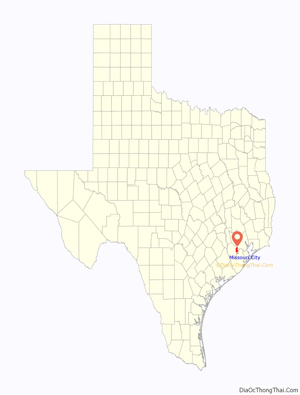
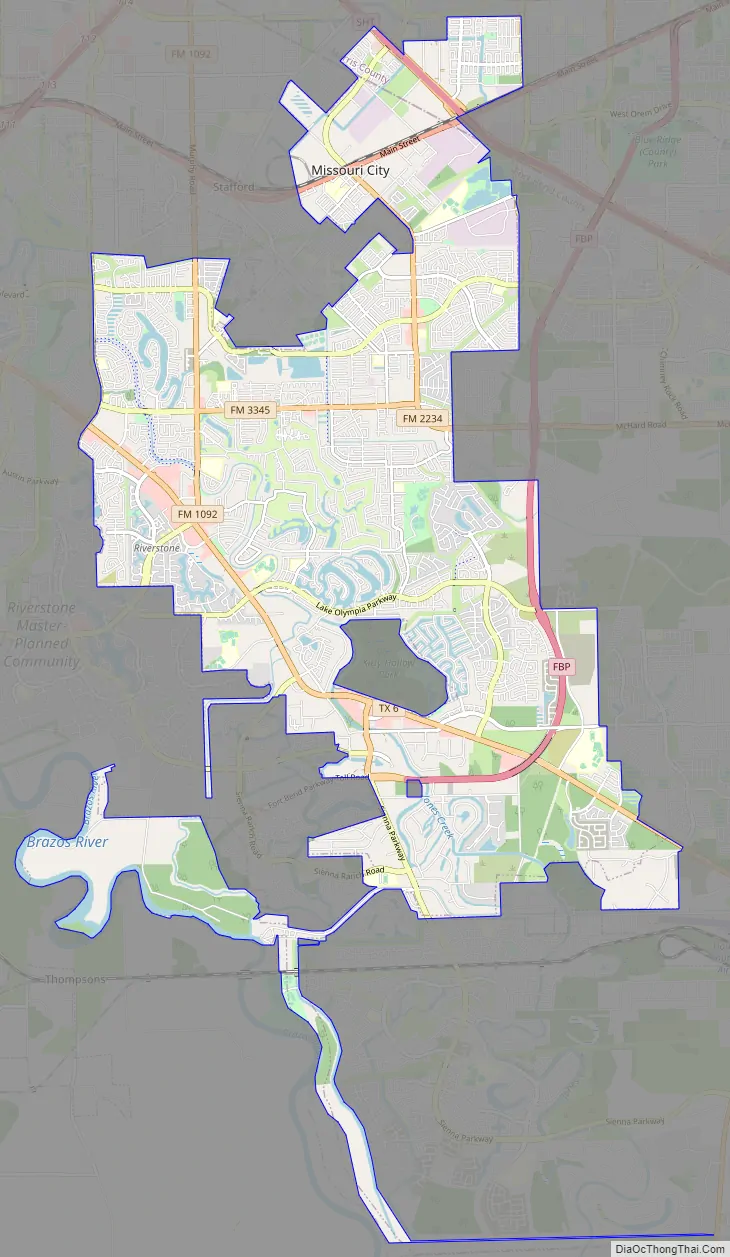
Missouri City Road Map
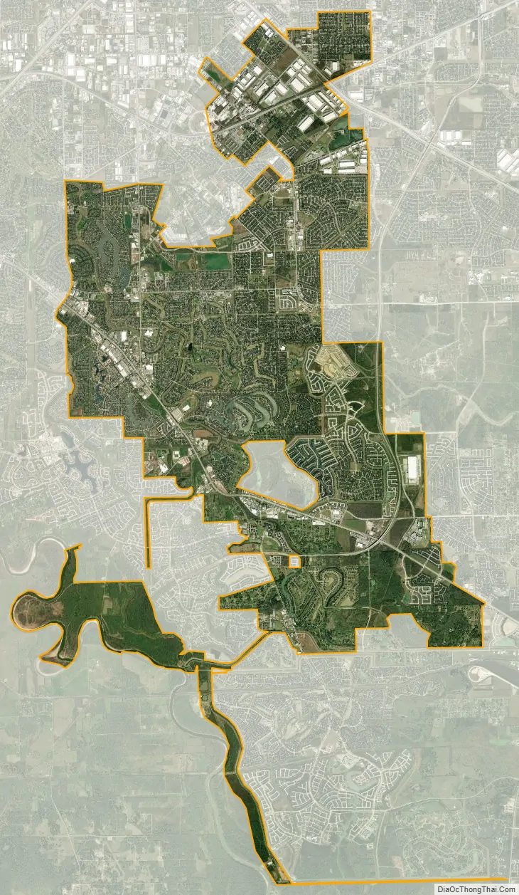
Missouri City city Satellite Map
Geography
Missouri City is located in eastern Fort Bend County with a portion of the city extending north into Harris County. Missouri City is bordered by the city of Houston to the north and east, Stafford to the northwest, Sugar Land to the west, and Arcola to the southeast, as well as unincorporated communities such as Fifth Street to the north, Fresno to the east, and Sienna Plantation to the south. Downtown Houston is 17 mi (27 km) to the northeast. Oyster Creek flows in a southerly direction through the municipality.
According to the United States Census Bureau, Missouri City has a total area of 29.8 square miles (77.2 km), of which 28.4 square miles (73.6 km) are land and 1.4 square miles (3.6 km), or 4.65%, are covered by water.
Communities
Former communities annexed into Missouri City have included:
- DeWalt
- Trammels
See also
Map of Texas State and its subdivision:- Anderson
- Andrews
- Angelina
- Aransas
- Archer
- Armstrong
- Atascosa
- Austin
- Bailey
- Bandera
- Bastrop
- Baylor
- Bee
- Bell
- Bexar
- Blanco
- Borden
- Bosque
- Bowie
- Brazoria
- Brazos
- Brewster
- Briscoe
- Brooks
- Brown
- Burleson
- Burnet
- Caldwell
- Calhoun
- Callahan
- Cameron
- Camp
- Carson
- Cass
- Castro
- Chambers
- Cherokee
- Childress
- Clay
- Cochran
- Coke
- Coleman
- Collin
- Collingsworth
- Colorado
- Comal
- Comanche
- Concho
- Cooke
- Coryell
- Cottle
- Crane
- Crockett
- Crosby
- Culberson
- Dallam
- Dallas
- Dawson
- Deaf Smith
- Delta
- Denton
- Dewitt
- Dickens
- Dimmit
- Donley
- Duval
- Eastland
- Ector
- Edwards
- El Paso
- Ellis
- Erath
- Falls
- Fannin
- Fayette
- Fisher
- Floyd
- Foard
- Fort Bend
- Franklin
- Freestone
- Frio
- Gaines
- Galveston
- Garza
- Gillespie
- Glasscock
- Goliad
- Gonzales
- Gray
- Grayson
- Gregg
- Grimes
- Guadalupe
- Hale
- Hall
- Hamilton
- Hansford
- Hardeman
- Hardin
- Harris
- Harrison
- Hartley
- Haskell
- Hays
- Hemphill
- Henderson
- Hidalgo
- Hill
- Hockley
- Hood
- Hopkins
- Houston
- Howard
- Hudspeth
- Hunt
- Hutchinson
- Irion
- Jack
- Jackson
- Jasper
- Jeff Davis
- Jefferson
- Jim Hogg
- Jim Wells
- Johnson
- Jones
- Karnes
- Kaufman
- Kendall
- Kenedy
- Kent
- Kerr
- Kimble
- King
- Kinney
- Kleberg
- Knox
- La Salle
- Lamar
- Lamb
- Lampasas
- Lavaca
- Lee
- Leon
- Liberty
- Limestone
- Lipscomb
- Live Oak
- Llano
- Loving
- Lubbock
- Lynn
- Madison
- Marion
- Martin
- Mason
- Matagorda
- Maverick
- McCulloch
- McLennan
- McMullen
- Medina
- Menard
- Midland
- Milam
- Mills
- Mitchell
- Montague
- Montgomery
- Moore
- Morris
- Motley
- Nacogdoches
- Navarro
- Newton
- Nolan
- Nueces
- Ochiltree
- Oldham
- Orange
- Palo Pinto
- Panola
- Parker
- Parmer
- Pecos
- Polk
- Potter
- Presidio
- Rains
- Randall
- Reagan
- Real
- Red River
- Reeves
- Refugio
- Roberts
- Robertson
- Rockwall
- Runnels
- Rusk
- Sabine
- San Augustine
- San Jacinto
- San Patricio
- San Saba
- Schleicher
- Scurry
- Shackelford
- Shelby
- Sherman
- Smith
- Somervell
- Starr
- Stephens
- Sterling
- Stonewall
- Sutton
- Swisher
- Tarrant
- Taylor
- Terrell
- Terry
- Throckmorton
- Titus
- Tom Green
- Travis
- Trinity
- Tyler
- Upshur
- Upton
- Uvalde
- Val Verde
- Van Zandt
- Victoria
- Walker
- Waller
- Ward
- Washington
- Webb
- Wharton
- Wheeler
- Wichita
- Wilbarger
- Willacy
- Williamson
- Wilson
- Winkler
- Wise
- Wood
- Yoakum
- Young
- Zapata
- Zavala
- Alabama
- Alaska
- Arizona
- Arkansas
- California
- Colorado
- Connecticut
- Delaware
- District of Columbia
- Florida
- Georgia
- Hawaii
- Idaho
- Illinois
- Indiana
- Iowa
- Kansas
- Kentucky
- Louisiana
- Maine
- Maryland
- Massachusetts
- Michigan
- Minnesota
- Mississippi
- Missouri
- Montana
- Nebraska
- Nevada
- New Hampshire
- New Jersey
- New Mexico
- New York
- North Carolina
- North Dakota
- Ohio
- Oklahoma
- Oregon
- Pennsylvania
- Rhode Island
- South Carolina
- South Dakota
- Tennessee
- Texas
- Utah
- Vermont
- Virginia
- Washington
- West Virginia
- Wisconsin
- Wyoming


