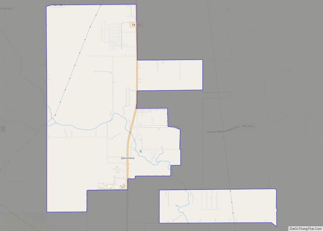
Geronimo is an unincorporated community and census-designated place (CDP) in Guadalupe County, Texas, United States. The population was 1,032 at the 2010 census, up from 619 at the 2000 census. It is part of the San Antonio Metropolitan Statistical Area.
| Name: | Geronimo CDP |
|---|---|
| LSAD Code: | 57 |
| LSAD Description: | CDP (suffix) |
| State: | Texas |
| County: | Guadalupe County |
| Elevation: | 581 ft (177 m) |
| Total Area: | 8.1 sq mi (21.1 km²) |
| Land Area: | 8.1 sq mi (21.1 km²) |
| Water Area: | 0.0 sq mi (0.0 km²) |
| Total Population: | 1,032 |
| Population Density: | 127/sq mi (48.9/km²) |
| ZIP code: | 78155 |
| Area code: | 830 |
| FIPS code: | 4829384 |
| GNISfeature ID: | 1336502 |
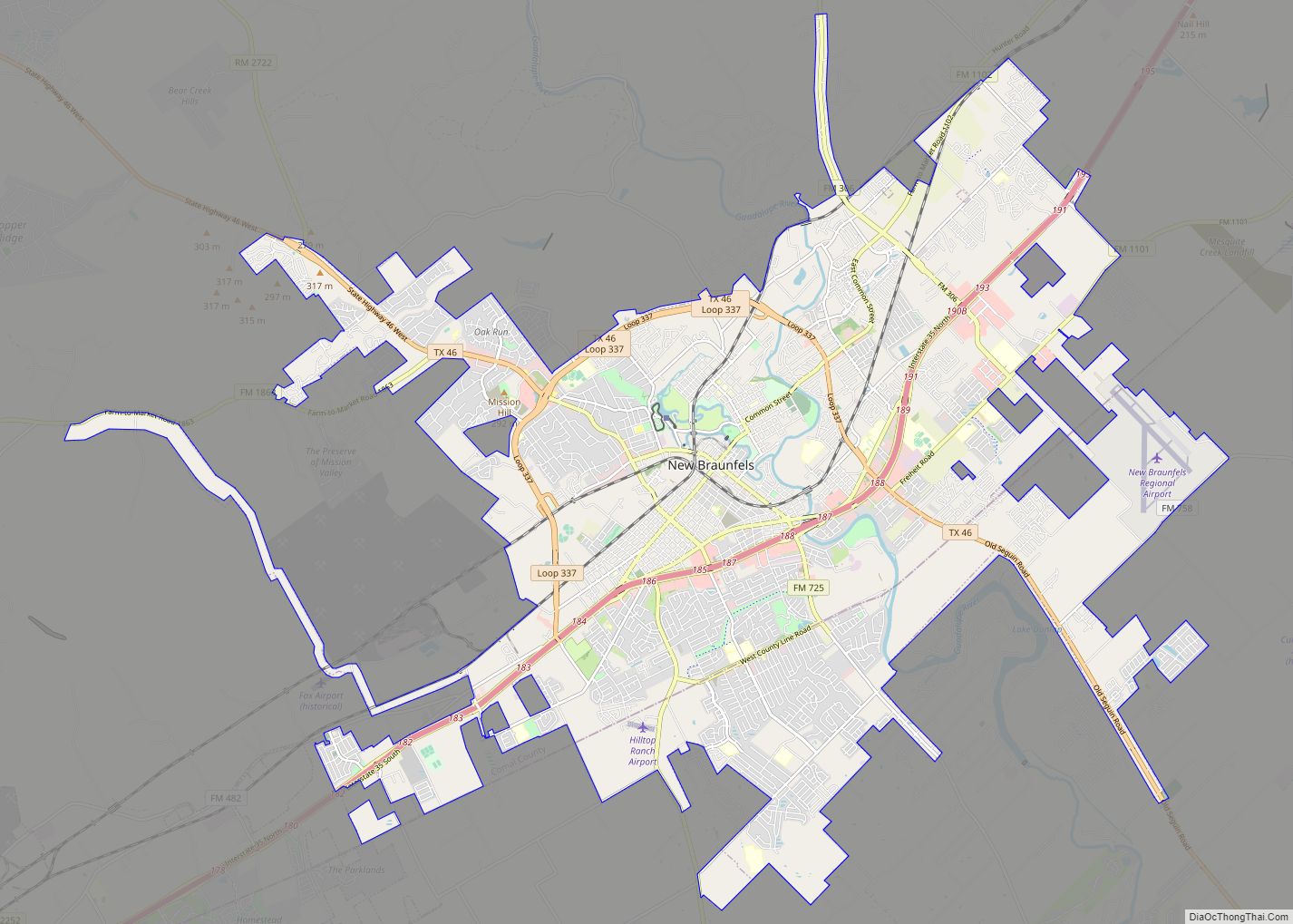
Online Interactive Map
Click on ![]() to view map in "full screen" mode.
to view map in "full screen" mode.
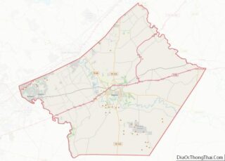
Geronimo location map. Where is Geronimo CDP?


History
In 1831 during the Mexican Texas period, James Bowie surveyed eleven leagues of land within the colony of Green DeWitt. Located on the northeast bank of the Guadalupe River, the area surrounded the natural springs called “Tio Geronimo”. José Antonio Navarro purchased land and lived here later, 1840–1853. As a champion of human rights, he was a signer of the Texas Declaration of Independence, the Constitution of the Republic of Texas, and the Constitution of the State of Texas.
Navarro lived here on his 6,000-acre (24 km) San Geronimo Ranch. It was located on Geronimo Creek and named for Saint Jerome (translator of the Bible into Latin). The town and creek are named to honor this saint, although others claim that the name comes from original owner of the springs, “Tio” (Uncle) Geronimo Flores. José Antonio Navarro’s brother, Luciano Navarro, also ran a ranch in the area. The area is about 6 miles (10 km) north of Seguin, the Guadalupe County seat.
In the mid-1800s, Geronimo became popular as a social center for German settlers. German settlers from Schumansville moved into the area in 1860 and formed a community. One enterprising settler opened a bank and German civic center. The community had grown into a small town by 1891, sporting a general store, a post office (former bank), a steam-powered cotton gin, and a population of twenty. A one-teacher school brought education to forty students in 1904. By 1917, the post office had relocated, sharing occupancy with a local feed store. In 1919, a park, complete with a spring-fed swimming pool, was constructed beside Geronimo Creek. After World War II, Geronimo hosted two gins and 123 residents.
Geronimo Road Map

Geronimo city Satellite Map

Geography
Geronimo is located in northern Guadalupe County at 29°39′56″N 97°57′56″W / 29.66556°N 97.96556°W / 29.66556; -97.96556 (29.665506, -97.965544), along Texas State Highway 123, which leads north 15 miles (24 km) to San Marcos and south 6 miles (10 km) to Seguin, the Guadalupe County seat. New Braunfels is 13 miles (21 km) to the west via Farm-to-Market Roads.
According to the United States Census Bureau, the Geronimo CDP has a total area of 8.1 square miles (21.1 km), all of it land.
See also
Map of Texas State and its subdivision:- Anderson
- Andrews
- Angelina
- Aransas
- Archer
- Armstrong
- Atascosa
- Austin
- Bailey
- Bandera
- Bastrop
- Baylor
- Bee
- Bell
- Bexar
- Blanco
- Borden
- Bosque
- Bowie
- Brazoria
- Brazos
- Brewster
- Briscoe
- Brooks
- Brown
- Burleson
- Burnet
- Caldwell
- Calhoun
- Callahan
- Cameron
- Camp
- Carson
- Cass
- Castro
- Chambers
- Cherokee
- Childress
- Clay
- Cochran
- Coke
- Coleman
- Collin
- Collingsworth
- Colorado
- Comal
- Comanche
- Concho
- Cooke
- Coryell
- Cottle
- Crane
- Crockett
- Crosby
- Culberson
- Dallam
- Dallas
- Dawson
- Deaf Smith
- Delta
- Denton
- Dewitt
- Dickens
- Dimmit
- Donley
- Duval
- Eastland
- Ector
- Edwards
- El Paso
- Ellis
- Erath
- Falls
- Fannin
- Fayette
- Fisher
- Floyd
- Foard
- Fort Bend
- Franklin
- Freestone
- Frio
- Gaines
- Galveston
- Garza
- Gillespie
- Glasscock
- Goliad
- Gonzales
- Gray
- Grayson
- Gregg
- Grimes
- Guadalupe
- Hale
- Hall
- Hamilton
- Hansford
- Hardeman
- Hardin
- Harris
- Harrison
- Hartley
- Haskell
- Hays
- Hemphill
- Henderson
- Hidalgo
- Hill
- Hockley
- Hood
- Hopkins
- Houston
- Howard
- Hudspeth
- Hunt
- Hutchinson
- Irion
- Jack
- Jackson
- Jasper
- Jeff Davis
- Jefferson
- Jim Hogg
- Jim Wells
- Johnson
- Jones
- Karnes
- Kaufman
- Kendall
- Kenedy
- Kent
- Kerr
- Kimble
- King
- Kinney
- Kleberg
- Knox
- La Salle
- Lamar
- Lamb
- Lampasas
- Lavaca
- Lee
- Leon
- Liberty
- Limestone
- Lipscomb
- Live Oak
- Llano
- Loving
- Lubbock
- Lynn
- Madison
- Marion
- Martin
- Mason
- Matagorda
- Maverick
- McCulloch
- McLennan
- McMullen
- Medina
- Menard
- Midland
- Milam
- Mills
- Mitchell
- Montague
- Montgomery
- Moore
- Morris
- Motley
- Nacogdoches
- Navarro
- Newton
- Nolan
- Nueces
- Ochiltree
- Oldham
- Orange
- Palo Pinto
- Panola
- Parker
- Parmer
- Pecos
- Polk
- Potter
- Presidio
- Rains
- Randall
- Reagan
- Real
- Red River
- Reeves
- Refugio
- Roberts
- Robertson
- Rockwall
- Runnels
- Rusk
- Sabine
- San Augustine
- San Jacinto
- San Patricio
- San Saba
- Schleicher
- Scurry
- Shackelford
- Shelby
- Sherman
- Smith
- Somervell
- Starr
- Stephens
- Sterling
- Stonewall
- Sutton
- Swisher
- Tarrant
- Taylor
- Terrell
- Terry
- Throckmorton
- Titus
- Tom Green
- Travis
- Trinity
- Tyler
- Upshur
- Upton
- Uvalde
- Val Verde
- Van Zandt
- Victoria
- Walker
- Waller
- Ward
- Washington
- Webb
- Wharton
- Wheeler
- Wichita
- Wilbarger
- Willacy
- Williamson
- Wilson
- Winkler
- Wise
- Wood
- Yoakum
- Young
- Zapata
- Zavala
- Alabama
- Alaska
- Arizona
- Arkansas
- California
- Colorado
- Connecticut
- Delaware
- District of Columbia
- Florida
- Georgia
- Hawaii
- Idaho
- Illinois
- Indiana
- Iowa
- Kansas
- Kentucky
- Louisiana
- Maine
- Maryland
- Massachusetts
- Michigan
- Minnesota
- Mississippi
- Missouri
- Montana
- Nebraska
- Nevada
- New Hampshire
- New Jersey
- New Mexico
- New York
- North Carolina
- North Dakota
- Ohio
- Oklahoma
- Oregon
- Pennsylvania
- Rhode Island
- South Carolina
- South Dakota
- Tennessee
- Texas
- Utah
- Vermont
- Virginia
- Washington
- West Virginia
- Wisconsin
- Wyoming