Groom is a town in Carson County, Texas, United States. The population was 574 at the 2010 census. It is part of the Amarillo, Texas Metropolitan Statistical Area. It is on Interstate Highway 40 (Historic Route 66) 42 miles (68 km) east of Amarillo and 215 miles (346 km) west of Oklahoma City.
| Name: | Groom town |
|---|---|
| LSAD Code: | 43 |
| LSAD Description: | town (suffix) |
| State: | Texas |
| County: | Carson County |
| Elevation: | 3,255 ft (992 m) |
| Total Area: | 0.74 sq mi (1.93 km²) |
| Land Area: | 0.74 sq mi (1.93 km²) |
| Water Area: | 0.00 sq mi (0.00 km²) |
| Total Population: | 574 |
| Population Density: | 739.25/sq mi (285.34/km²) |
| ZIP code: | 79039 |
| Area code: | 806 |
| FIPS code: | 4831292 |
| GNISfeature ID: | 1358463 |
Online Interactive Map
Click on ![]() to view map in "full screen" mode.
to view map in "full screen" mode.
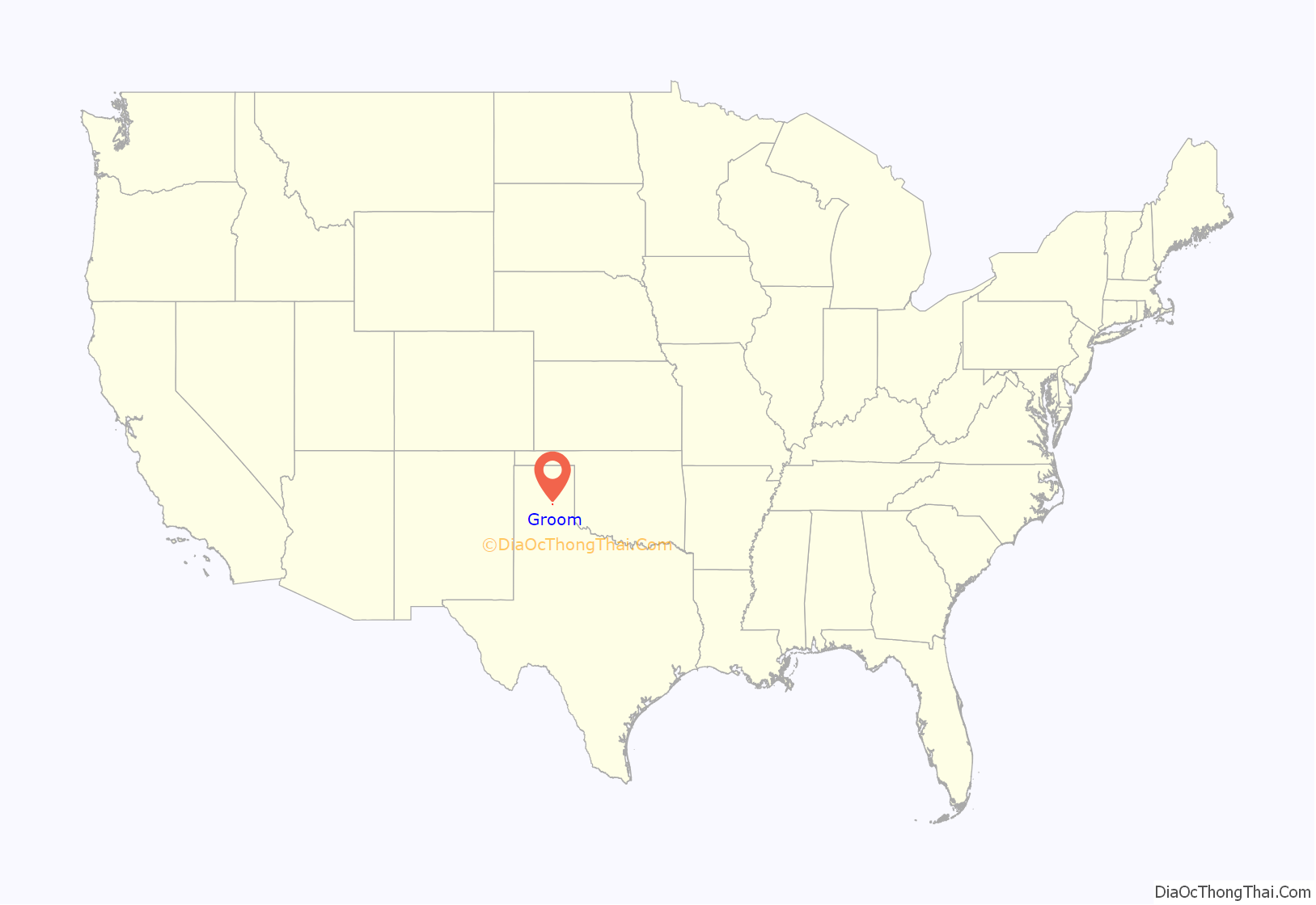
Groom location map. Where is Groom town?
History
Early exploration
The route from Fort Smith, Arkansas, to Santa Fe, New Mexico, along the Canadian River was charted circa 1849 by Captain Randolph Barnes Marcy. Published in 1859, Marcy’s book, The Prairie Traveler: A Handbook for Overland Expeditions, contained maps and illustrations of routes between the Mississippi and the Pacific and was used as a basic manual by westward-bound wagon trains and travelers for years.
Colonel B. B. Groom
Colonel B. B. Groom, an experienced cattleman near Lexington, Kentucky, leased from the New York and Texas Land Company 592,920 acres (2,399.5 km) of land in Hutchinson, Carson, Gray, and Roberts counties in the Texas Panhandle in 1882, resulting in the organization of the Francklyn Land and Cattle Company. Groom purchased an estimated 1,300 head of shorthorns in 1882 and selected the Diamond F brand, approved by the Francklyn officials and filed as the company’s brand in October 1882. Unfortunately, Groom’s vision of the finest and most desirable cattle ranch in the United States did not materialize for him. The Francklyn Land and Cattle Company became insolvent in 1886. The bondholders foreclosed and organized a new company known as White Deer Lands (later White Deer Land Company), under the management of the agent Timothy Dwight Hobart, one of the subsequent founders of Pampa, Texas.
Harrison Groom
Colonel Groom’s son, Harrison Groom, established a camp at the edge of a little lake just west of the present town of White Deer.
The town
The site of Groom was chosen in 1902, along the route of the Chicago, Rock Island and Gulf Railway. Groom was first incorporated in 1911.
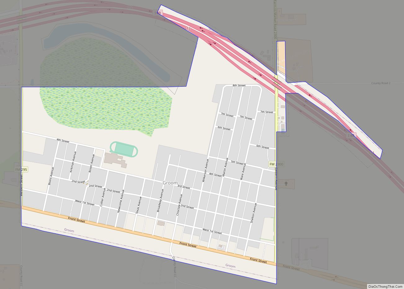
Groom Road Map
Groom city Satellite Map
Geography
Groom is located in the southeastern corner of Carson County at 35°12′11″N 101°6′24″W / 35.20306°N 101.10667°W / 35.20306; -101.10667 (35.203112, –101.106710). Interstate 40 bypasses the town to the north, with access from Exits 110 through 114. Historic Route 66 (Business Route 40) passes through the center of town.
According to the United States Census Bureau, the town has a total area of 0.75 square miles (1.93 km), all of it land.
See also
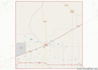
Map of Texas State and its subdivision:- Anderson
- Andrews
- Angelina
- Aransas
- Archer
- Armstrong
- Atascosa
- Austin
- Bailey
- Bandera
- Bastrop
- Baylor
- Bee
- Bell
- Bexar
- Blanco
- Borden
- Bosque
- Bowie
- Brazoria
- Brazos
- Brewster
- Briscoe
- Brooks
- Brown
- Burleson
- Burnet
- Caldwell
- Calhoun
- Callahan
- Cameron
- Camp
- Carson
- Cass
- Castro
- Chambers
- Cherokee
- Childress
- Clay
- Cochran
- Coke
- Coleman
- Collin
- Collingsworth
- Colorado
- Comal
- Comanche
- Concho
- Cooke
- Coryell
- Cottle
- Crane
- Crockett
- Crosby
- Culberson
- Dallam
- Dallas
- Dawson
- Deaf Smith
- Delta
- Denton
- Dewitt
- Dickens
- Dimmit
- Donley
- Duval
- Eastland
- Ector
- Edwards
- El Paso
- Ellis
- Erath
- Falls
- Fannin
- Fayette
- Fisher
- Floyd
- Foard
- Fort Bend
- Franklin
- Freestone
- Frio
- Gaines
- Galveston
- Garza
- Gillespie
- Glasscock
- Goliad
- Gonzales
- Gray
- Grayson
- Gregg
- Grimes
- Guadalupe
- Hale
- Hall
- Hamilton
- Hansford
- Hardeman
- Hardin
- Harris
- Harrison
- Hartley
- Haskell
- Hays
- Hemphill
- Henderson
- Hidalgo
- Hill
- Hockley
- Hood
- Hopkins
- Houston
- Howard
- Hudspeth
- Hunt
- Hutchinson
- Irion
- Jack
- Jackson
- Jasper
- Jeff Davis
- Jefferson
- Jim Hogg
- Jim Wells
- Johnson
- Jones
- Karnes
- Kaufman
- Kendall
- Kenedy
- Kent
- Kerr
- Kimble
- King
- Kinney
- Kleberg
- Knox
- La Salle
- Lamar
- Lamb
- Lampasas
- Lavaca
- Lee
- Leon
- Liberty
- Limestone
- Lipscomb
- Live Oak
- Llano
- Loving
- Lubbock
- Lynn
- Madison
- Marion
- Martin
- Mason
- Matagorda
- Maverick
- McCulloch
- McLennan
- McMullen
- Medina
- Menard
- Midland
- Milam
- Mills
- Mitchell
- Montague
- Montgomery
- Moore
- Morris
- Motley
- Nacogdoches
- Navarro
- Newton
- Nolan
- Nueces
- Ochiltree
- Oldham
- Orange
- Palo Pinto
- Panola
- Parker
- Parmer
- Pecos
- Polk
- Potter
- Presidio
- Rains
- Randall
- Reagan
- Real
- Red River
- Reeves
- Refugio
- Roberts
- Robertson
- Rockwall
- Runnels
- Rusk
- Sabine
- San Augustine
- San Jacinto
- San Patricio
- San Saba
- Schleicher
- Scurry
- Shackelford
- Shelby
- Sherman
- Smith
- Somervell
- Starr
- Stephens
- Sterling
- Stonewall
- Sutton
- Swisher
- Tarrant
- Taylor
- Terrell
- Terry
- Throckmorton
- Titus
- Tom Green
- Travis
- Trinity
- Tyler
- Upshur
- Upton
- Uvalde
- Val Verde
- Van Zandt
- Victoria
- Walker
- Waller
- Ward
- Washington
- Webb
- Wharton
- Wheeler
- Wichita
- Wilbarger
- Willacy
- Williamson
- Wilson
- Winkler
- Wise
- Wood
- Yoakum
- Young
- Zapata
- Zavala
- Alabama
- Alaska
- Arizona
- Arkansas
- California
- Colorado
- Connecticut
- Delaware
- District of Columbia
- Florida
- Georgia
- Hawaii
- Idaho
- Illinois
- Indiana
- Iowa
- Kansas
- Kentucky
- Louisiana
- Maine
- Maryland
- Massachusetts
- Michigan
- Minnesota
- Mississippi
- Missouri
- Montana
- Nebraska
- Nevada
- New Hampshire
- New Jersey
- New Mexico
- New York
- North Carolina
- North Dakota
- Ohio
- Oklahoma
- Oregon
- Pennsylvania
- Rhode Island
- South Carolina
- South Dakota
- Tennessee
- Texas
- Utah
- Vermont
- Virginia
- Washington
- West Virginia
- Wisconsin
- Wyoming
