White Deer is a town in Carson County, Texas, United States. The population was 1,000 at the 2010 census. It is part of the Amarillo metropolitan statistical area.
| Name: | White Deer town |
|---|---|
| LSAD Code: | 43 |
| LSAD Description: | town (suffix) |
| State: | Texas |
| County: | Carson County |
| Elevation: | 3,366 ft (1,026 m) |
| Total Area: | 1.74 sq mi (4.51 km²) |
| Land Area: | 1.74 sq mi (4.51 km²) |
| Water Area: | 0.00 sq mi (0.00 km²) |
| Total Population: | 1,000 |
| Population Density: | 548.85/sq mi (211.94/km²) |
| ZIP code: | 79097 |
| Area code: | 806 |
| FIPS code: | 4878316 |
| GNISfeature ID: | 1371364 |
| Website: | www.whitedeer.us |
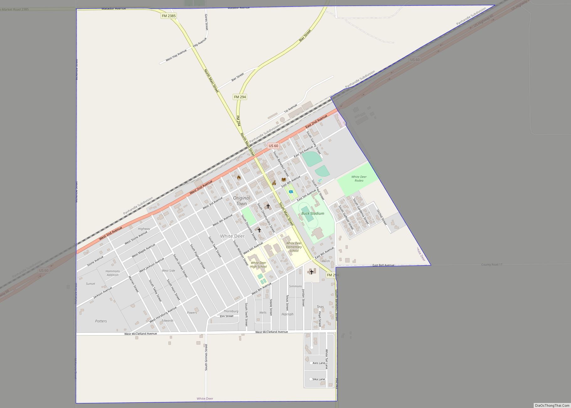
Online Interactive Map
Click on ![]() to view map in "full screen" mode.
to view map in "full screen" mode.
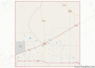
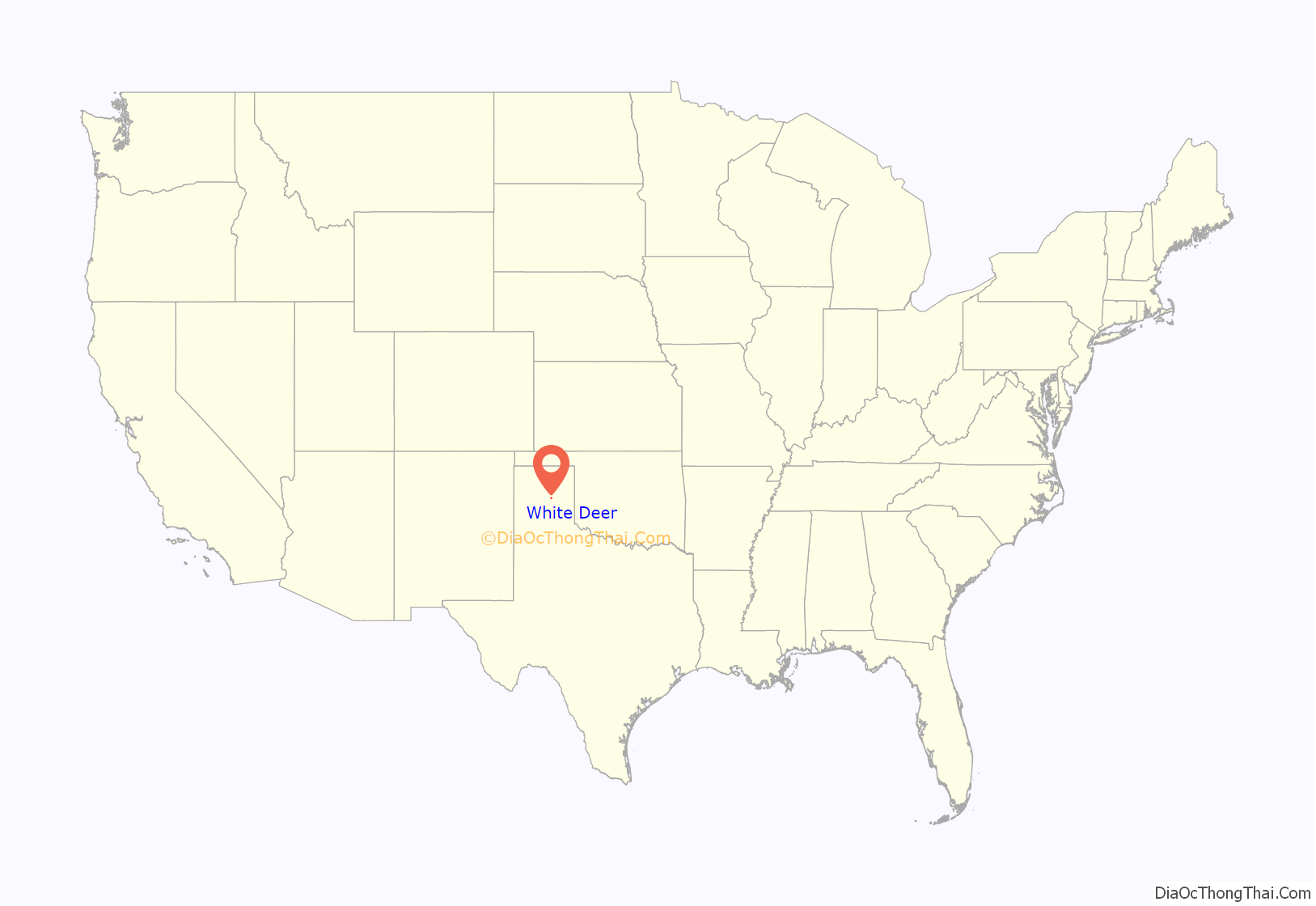
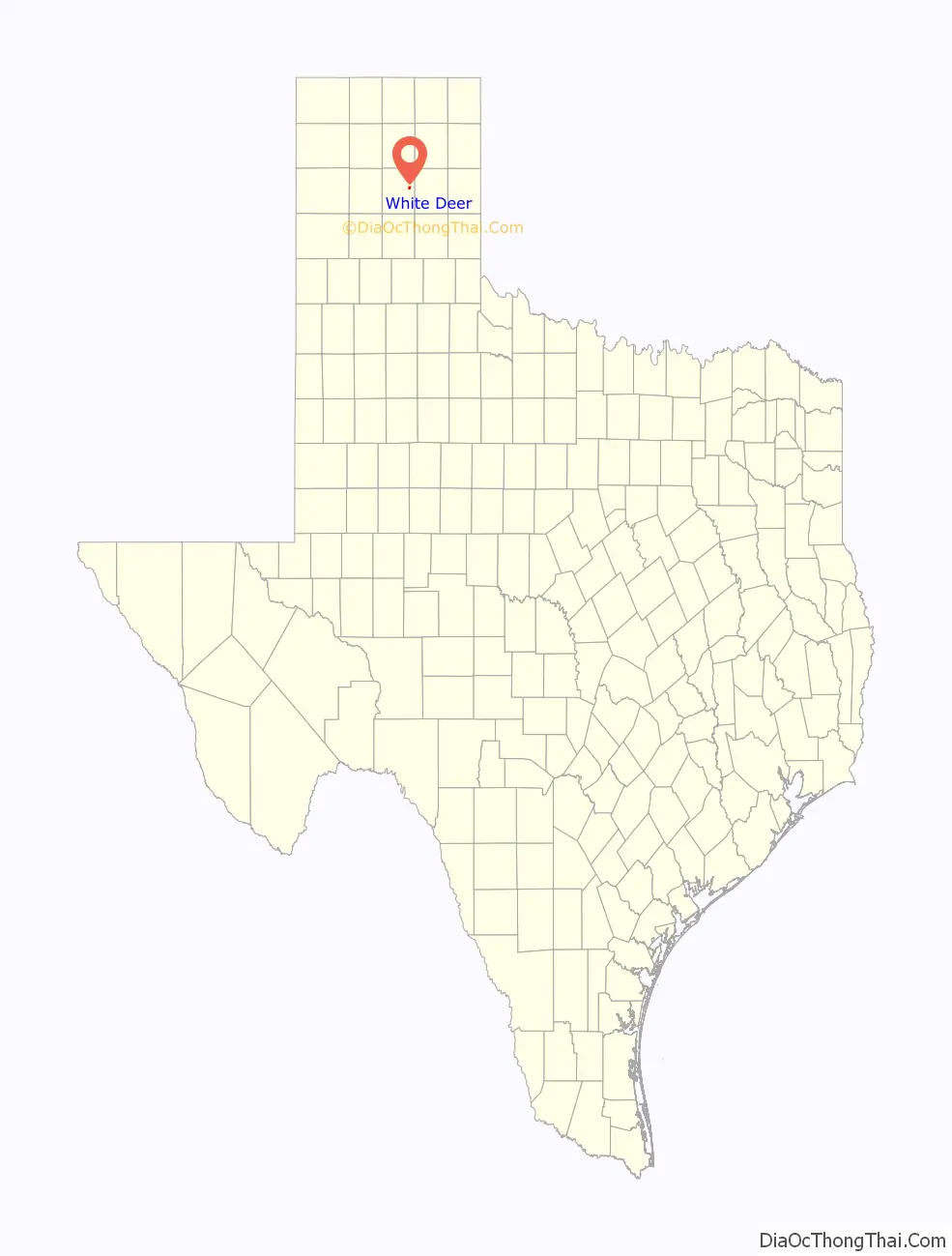
White Deer location map. Where is White Deer town?
History
The community was first settled around 1882, when the British-owned Francklyn Land and Cattle Company, later reorganized as the White Deer Land Company, occupied the area and began stocking it with cattle. George Tyng, general manager of the property, built the headquarters for White Deer or Diamond F Ranch at the site in 1887. Around the same time, the Purcell Company purchased land in the vicinity as a right-of-way for the Southern Kansas Railway of Texas. A depot was built in 1888. The site was initially known as “Paton” (after John Paton), then “Whig”, before being renamed White Deer in January 1899 – after nearby White Deer Creek. During the 1890s, British shareholders began selling land for small farms and ranches to settlers. The community moved to its present location near the railroad line in 1908. A year later, Henry Czerner and Ben Urbanczyk established a community of Polish farmers from Central Texas at the northeastern edge of town. About 50 people were living in White Deer by 1910.
The discovery of oil and gas in Carson County in 1919 brought growth to White Deer and the surrounding area. The community incorporated in 1921, and the population had risen to 200 by the mid-1920s. At the peak of the oil boom in the late 1920s, White Deer was home to nearly 3,000 people. Soon after, the city experienced a period of decline. A disastrous fire in 1931, the negative economic impact of the Great Depression, and tornadoes in 1945 and 1951 were all contributing factors in White Deer’s decline. In the late 1950s, the town became a shipping point for grain and cattle produced in the area. By 1980, the population was 1,210. That figure decreased to 1,125 in 1990 and 1,060 in 2000.
A statue of a white deer stands on a concrete pedestal in the middle of the town’s main intersection. At its base is a historical marker, erected in 1965, that commemorates the town’s rich history.
White Deer Road Map
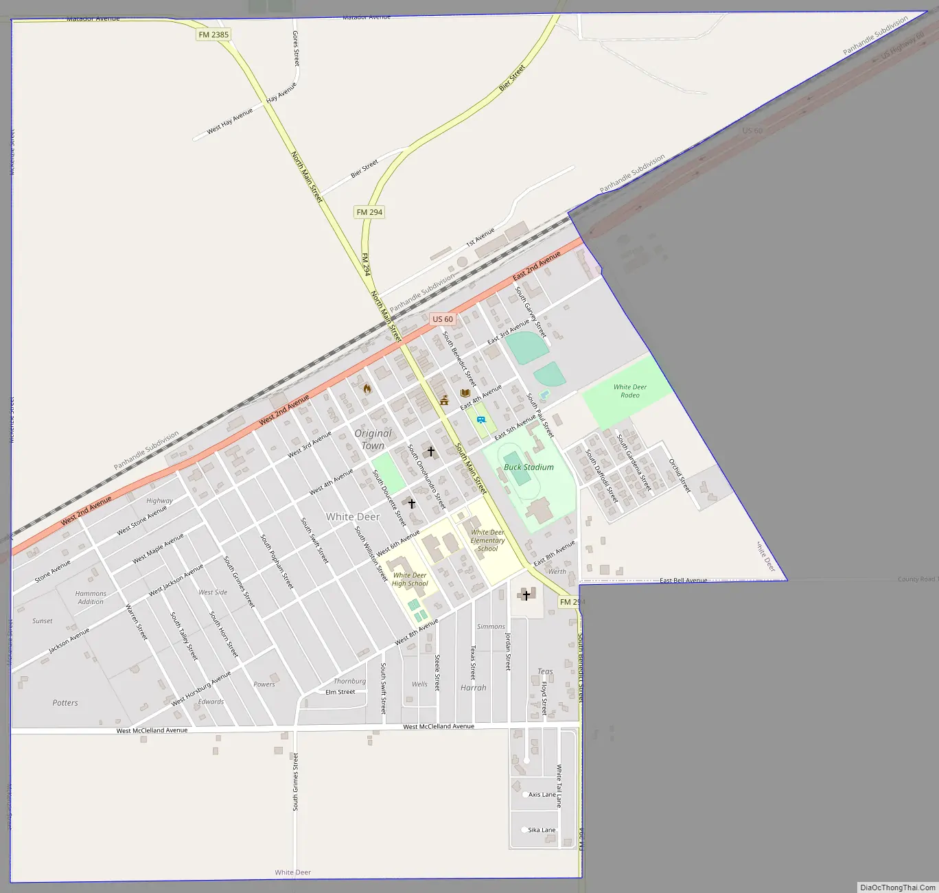
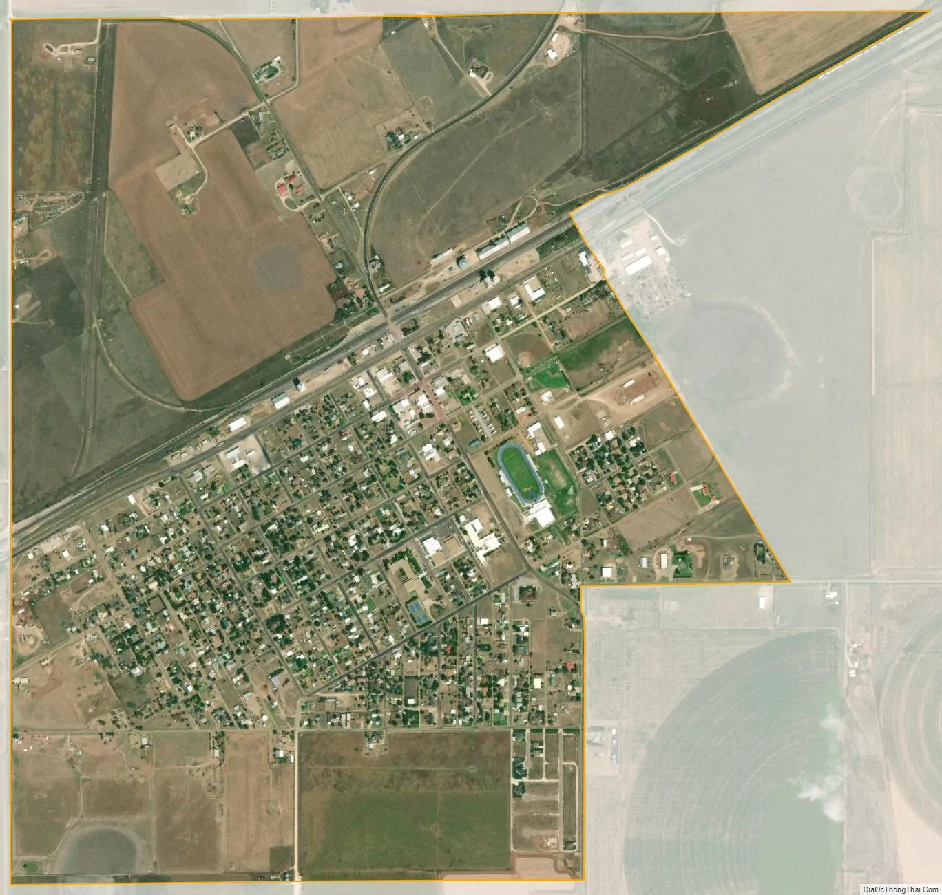
White Deer city Satellite Map
Geography
White Deer is located at 35°25′52″N 101°10′33″W / 35.431015°N 101.175749°W / 35.431015; -101.175749. It is situated along U.S. Highway 60 in east central Carson County, 13 miles (21 km) northeast of Panhandle, the Carson County seat, and 40 miles (64 km) northeast of Amarillo.
According to the United States Census Bureau, the town has a total area of 1.7 square miles (4.5 km), all of it land.
Climate
According to the Köppen climate classification, White Deer has a semiarid climate, BSk on climate maps.
See also
Map of Texas State and its subdivision:- Anderson
- Andrews
- Angelina
- Aransas
- Archer
- Armstrong
- Atascosa
- Austin
- Bailey
- Bandera
- Bastrop
- Baylor
- Bee
- Bell
- Bexar
- Blanco
- Borden
- Bosque
- Bowie
- Brazoria
- Brazos
- Brewster
- Briscoe
- Brooks
- Brown
- Burleson
- Burnet
- Caldwell
- Calhoun
- Callahan
- Cameron
- Camp
- Carson
- Cass
- Castro
- Chambers
- Cherokee
- Childress
- Clay
- Cochran
- Coke
- Coleman
- Collin
- Collingsworth
- Colorado
- Comal
- Comanche
- Concho
- Cooke
- Coryell
- Cottle
- Crane
- Crockett
- Crosby
- Culberson
- Dallam
- Dallas
- Dawson
- Deaf Smith
- Delta
- Denton
- Dewitt
- Dickens
- Dimmit
- Donley
- Duval
- Eastland
- Ector
- Edwards
- El Paso
- Ellis
- Erath
- Falls
- Fannin
- Fayette
- Fisher
- Floyd
- Foard
- Fort Bend
- Franklin
- Freestone
- Frio
- Gaines
- Galveston
- Garza
- Gillespie
- Glasscock
- Goliad
- Gonzales
- Gray
- Grayson
- Gregg
- Grimes
- Guadalupe
- Hale
- Hall
- Hamilton
- Hansford
- Hardeman
- Hardin
- Harris
- Harrison
- Hartley
- Haskell
- Hays
- Hemphill
- Henderson
- Hidalgo
- Hill
- Hockley
- Hood
- Hopkins
- Houston
- Howard
- Hudspeth
- Hunt
- Hutchinson
- Irion
- Jack
- Jackson
- Jasper
- Jeff Davis
- Jefferson
- Jim Hogg
- Jim Wells
- Johnson
- Jones
- Karnes
- Kaufman
- Kendall
- Kenedy
- Kent
- Kerr
- Kimble
- King
- Kinney
- Kleberg
- Knox
- La Salle
- Lamar
- Lamb
- Lampasas
- Lavaca
- Lee
- Leon
- Liberty
- Limestone
- Lipscomb
- Live Oak
- Llano
- Loving
- Lubbock
- Lynn
- Madison
- Marion
- Martin
- Mason
- Matagorda
- Maverick
- McCulloch
- McLennan
- McMullen
- Medina
- Menard
- Midland
- Milam
- Mills
- Mitchell
- Montague
- Montgomery
- Moore
- Morris
- Motley
- Nacogdoches
- Navarro
- Newton
- Nolan
- Nueces
- Ochiltree
- Oldham
- Orange
- Palo Pinto
- Panola
- Parker
- Parmer
- Pecos
- Polk
- Potter
- Presidio
- Rains
- Randall
- Reagan
- Real
- Red River
- Reeves
- Refugio
- Roberts
- Robertson
- Rockwall
- Runnels
- Rusk
- Sabine
- San Augustine
- San Jacinto
- San Patricio
- San Saba
- Schleicher
- Scurry
- Shackelford
- Shelby
- Sherman
- Smith
- Somervell
- Starr
- Stephens
- Sterling
- Stonewall
- Sutton
- Swisher
- Tarrant
- Taylor
- Terrell
- Terry
- Throckmorton
- Titus
- Tom Green
- Travis
- Trinity
- Tyler
- Upshur
- Upton
- Uvalde
- Val Verde
- Van Zandt
- Victoria
- Walker
- Waller
- Ward
- Washington
- Webb
- Wharton
- Wheeler
- Wichita
- Wilbarger
- Willacy
- Williamson
- Wilson
- Winkler
- Wise
- Wood
- Yoakum
- Young
- Zapata
- Zavala
- Alabama
- Alaska
- Arizona
- Arkansas
- California
- Colorado
- Connecticut
- Delaware
- District of Columbia
- Florida
- Georgia
- Hawaii
- Idaho
- Illinois
- Indiana
- Iowa
- Kansas
- Kentucky
- Louisiana
- Maine
- Maryland
- Massachusetts
- Michigan
- Minnesota
- Mississippi
- Missouri
- Montana
- Nebraska
- Nevada
- New Hampshire
- New Jersey
- New Mexico
- New York
- North Carolina
- North Dakota
- Ohio
- Oklahoma
- Oregon
- Pennsylvania
- Rhode Island
- South Carolina
- South Dakota
- Tennessee
- Texas
- Utah
- Vermont
- Virginia
- Washington
- West Virginia
- Wisconsin
- Wyoming