Karnes City is a city in and county seat of Karnes County, Texas, United States. The population was 3,111 at the 2020 census, up from 3,042 at the 2010 census. The town was named after Henry Karnes of the Texas Revolution. Karnes is 24 miles (39 km) southeast of Floresville and 54 miles (87 km) southeast of San Antonio on U.S. Highway 181.
| Name: | Karnes City city |
|---|---|
| LSAD Code: | 25 |
| LSAD Description: | city (suffix) |
| State: | Texas |
| County: | Karnes County |
| Elevation: | 430 ft (131 m) |
| Total Area: | 2.31 sq mi (6.00 km²) |
| Land Area: | 2.29 sq mi (5.92 km²) |
| Water Area: | 0.03 sq mi (0.08 km²) |
| Total Population: | 3,111 |
| Population Density: | 1,479.88/sq mi (571.32/km²) |
| ZIP code: | 78118 |
| Area code: | 830 |
| FIPS code: | 4838452 |
| GNISfeature ID: | 1360493 |
| Website: | cityofkctx.com |
Online Interactive Map
Click on ![]() to view map in "full screen" mode.
to view map in "full screen" mode.
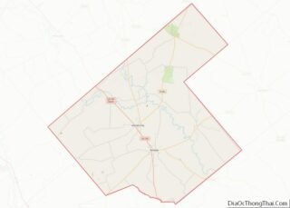
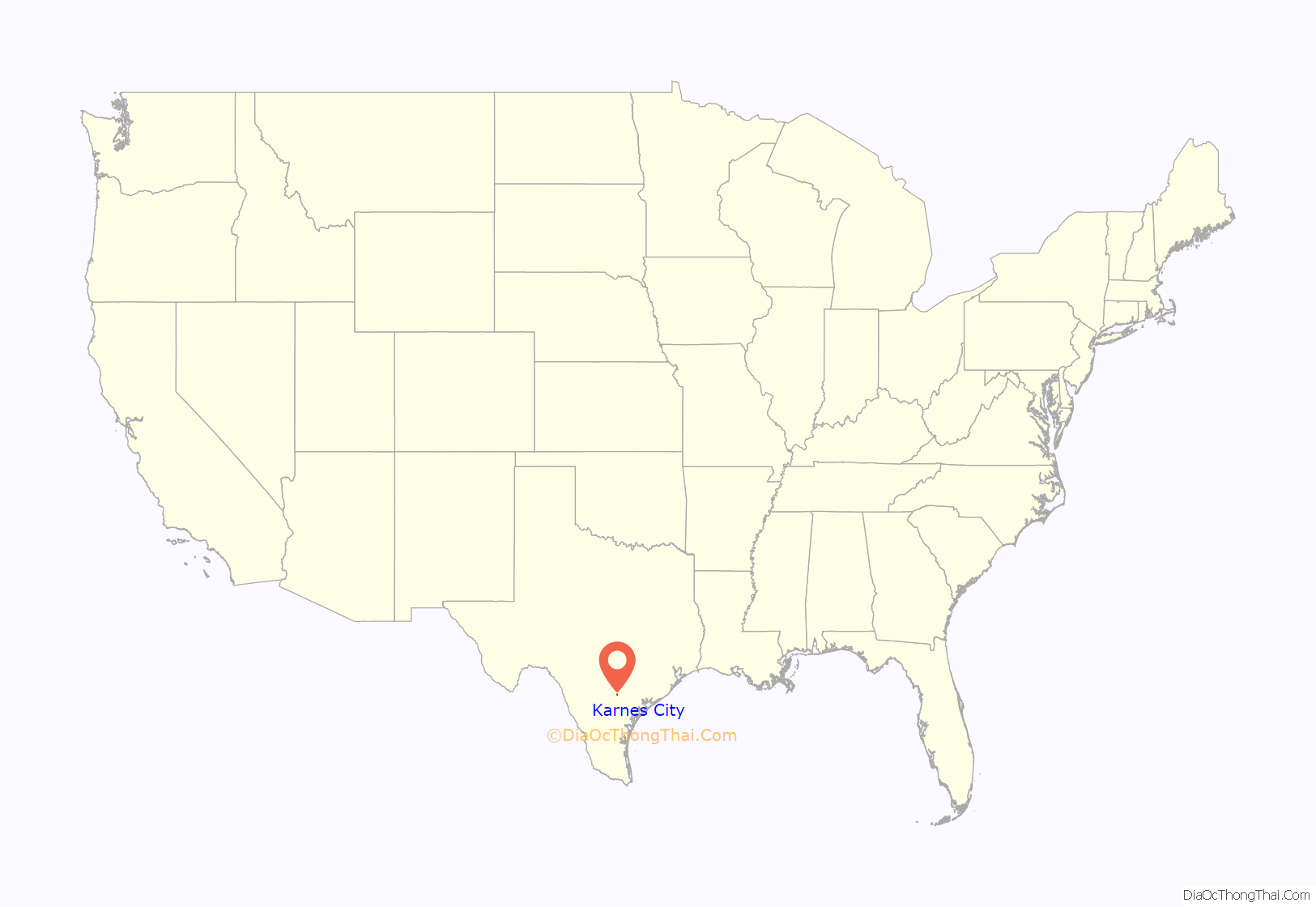
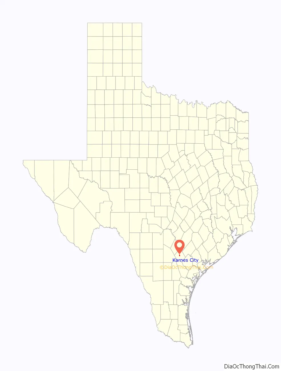
Karnes City location map. Where is Karnes City city?
History
In 1894, as a result of a special election, the county seat was moved from Helena to Karnes City. Ten years earlier, Colonel William G. Butler (1831–1912) had blamed Helena and its corrupt mayor for the death of his son, Emmett, who was killed on December 26, 1884, by a stray bullet from a bar fight. Butler, a wealthy rancher, retaliated by arranging for the San Antonio and Aransas Pass Railway, which started construction in 1885, to bypass Helena.
The railway started operation in 1886. By 1890, with no rail line, Helena was at a disadvantage for serving the county’s needs. In 1890, a group of businessmen purchased land on the rail line, 7 miles (11 km) southwest of Helena, with the specific intent of building a new town to serve as the county seat. The new town, named for Colonel Henry Wax Karnes (1812–1840), veteran of the Texas Revolution and a leader of the Texas Rangers, was a viable settlement by 1894, when the county voted to move its seat from Helena. Karnes City continued to grow, while Helena faded into a ghost town.
The story was fictionalized in the 1969 episode “The Oldest Law” of the television series Death Valley Days. In the episode, Jim Davis played the role of Colonel Butler, while Stacy Harris played Helena’s mayor.
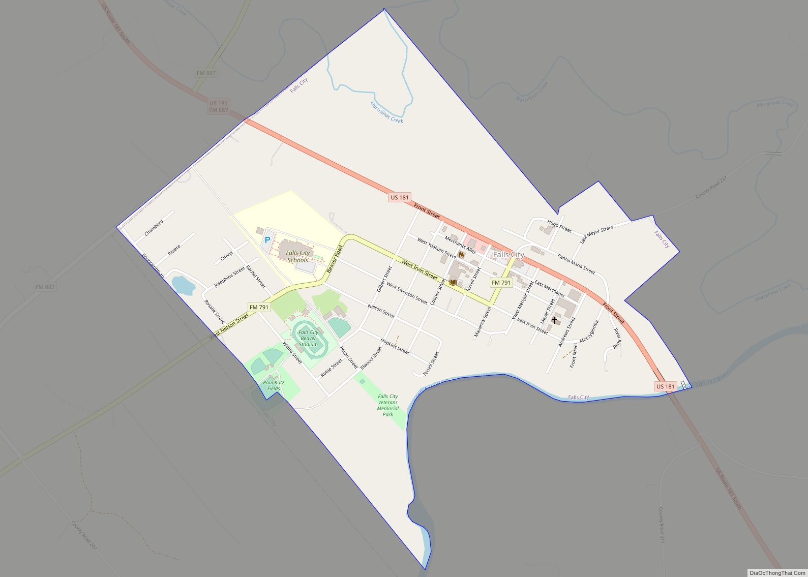
Karnes City Road Map
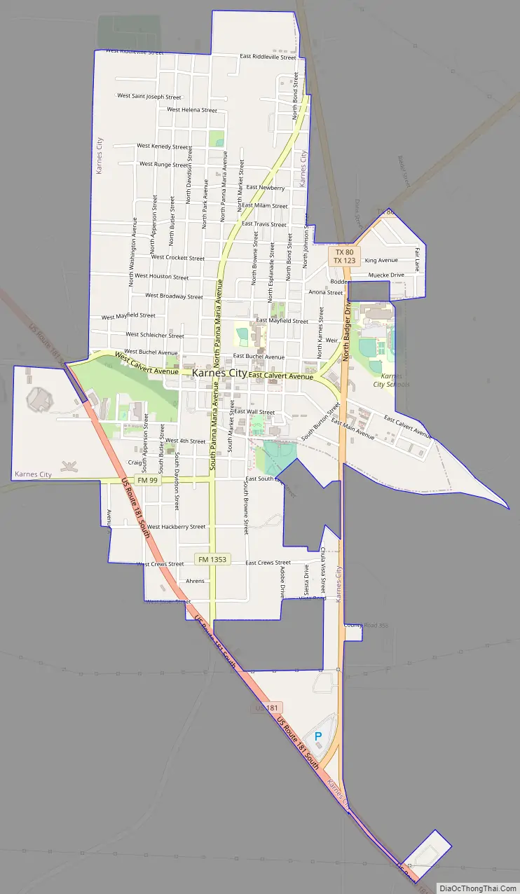
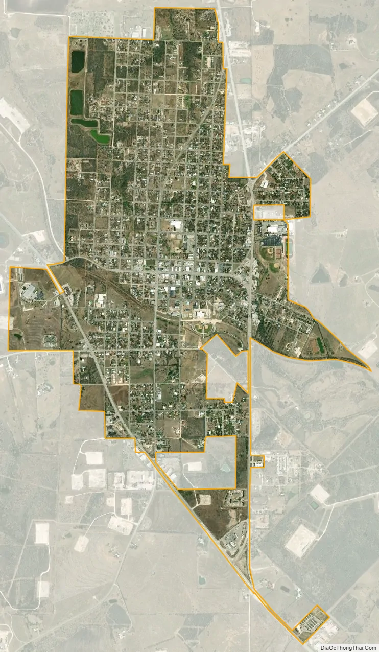
Karnes City city Satellite Map
Geography
Karnes City is located in central Karnes County at 28°53′N 97°54′W / 28.883°N 97.900°W / 28.883; -97.900 (28.8882, –97.9013). According to the United States Census Bureau, the city has a total area of 2.1 square miles (5.5 km), of which 0.03 square miles (0.08 km), or 1.37%, are water.
U.S. 181 runs through the southwest side of Karnes City, leading northwest 54 miles (87 km) to San Antonio and south 37 miles (60 km) to Beeville. Texas State Highway 123 runs north from Karnes City 25 miles (40 km) to Stockdale, and State Highway 80 leads northeast 19 miles (31 km) to Gillett.
See also
Map of Texas State and its subdivision:- Anderson
- Andrews
- Angelina
- Aransas
- Archer
- Armstrong
- Atascosa
- Austin
- Bailey
- Bandera
- Bastrop
- Baylor
- Bee
- Bell
- Bexar
- Blanco
- Borden
- Bosque
- Bowie
- Brazoria
- Brazos
- Brewster
- Briscoe
- Brooks
- Brown
- Burleson
- Burnet
- Caldwell
- Calhoun
- Callahan
- Cameron
- Camp
- Carson
- Cass
- Castro
- Chambers
- Cherokee
- Childress
- Clay
- Cochran
- Coke
- Coleman
- Collin
- Collingsworth
- Colorado
- Comal
- Comanche
- Concho
- Cooke
- Coryell
- Cottle
- Crane
- Crockett
- Crosby
- Culberson
- Dallam
- Dallas
- Dawson
- Deaf Smith
- Delta
- Denton
- Dewitt
- Dickens
- Dimmit
- Donley
- Duval
- Eastland
- Ector
- Edwards
- El Paso
- Ellis
- Erath
- Falls
- Fannin
- Fayette
- Fisher
- Floyd
- Foard
- Fort Bend
- Franklin
- Freestone
- Frio
- Gaines
- Galveston
- Garza
- Gillespie
- Glasscock
- Goliad
- Gonzales
- Gray
- Grayson
- Gregg
- Grimes
- Guadalupe
- Hale
- Hall
- Hamilton
- Hansford
- Hardeman
- Hardin
- Harris
- Harrison
- Hartley
- Haskell
- Hays
- Hemphill
- Henderson
- Hidalgo
- Hill
- Hockley
- Hood
- Hopkins
- Houston
- Howard
- Hudspeth
- Hunt
- Hutchinson
- Irion
- Jack
- Jackson
- Jasper
- Jeff Davis
- Jefferson
- Jim Hogg
- Jim Wells
- Johnson
- Jones
- Karnes
- Kaufman
- Kendall
- Kenedy
- Kent
- Kerr
- Kimble
- King
- Kinney
- Kleberg
- Knox
- La Salle
- Lamar
- Lamb
- Lampasas
- Lavaca
- Lee
- Leon
- Liberty
- Limestone
- Lipscomb
- Live Oak
- Llano
- Loving
- Lubbock
- Lynn
- Madison
- Marion
- Martin
- Mason
- Matagorda
- Maverick
- McCulloch
- McLennan
- McMullen
- Medina
- Menard
- Midland
- Milam
- Mills
- Mitchell
- Montague
- Montgomery
- Moore
- Morris
- Motley
- Nacogdoches
- Navarro
- Newton
- Nolan
- Nueces
- Ochiltree
- Oldham
- Orange
- Palo Pinto
- Panola
- Parker
- Parmer
- Pecos
- Polk
- Potter
- Presidio
- Rains
- Randall
- Reagan
- Real
- Red River
- Reeves
- Refugio
- Roberts
- Robertson
- Rockwall
- Runnels
- Rusk
- Sabine
- San Augustine
- San Jacinto
- San Patricio
- San Saba
- Schleicher
- Scurry
- Shackelford
- Shelby
- Sherman
- Smith
- Somervell
- Starr
- Stephens
- Sterling
- Stonewall
- Sutton
- Swisher
- Tarrant
- Taylor
- Terrell
- Terry
- Throckmorton
- Titus
- Tom Green
- Travis
- Trinity
- Tyler
- Upshur
- Upton
- Uvalde
- Val Verde
- Van Zandt
- Victoria
- Walker
- Waller
- Ward
- Washington
- Webb
- Wharton
- Wheeler
- Wichita
- Wilbarger
- Willacy
- Williamson
- Wilson
- Winkler
- Wise
- Wood
- Yoakum
- Young
- Zapata
- Zavala
- Alabama
- Alaska
- Arizona
- Arkansas
- California
- Colorado
- Connecticut
- Delaware
- District of Columbia
- Florida
- Georgia
- Hawaii
- Idaho
- Illinois
- Indiana
- Iowa
- Kansas
- Kentucky
- Louisiana
- Maine
- Maryland
- Massachusetts
- Michigan
- Minnesota
- Mississippi
- Missouri
- Montana
- Nebraska
- Nevada
- New Hampshire
- New Jersey
- New Mexico
- New York
- North Carolina
- North Dakota
- Ohio
- Oklahoma
- Oregon
- Pennsylvania
- Rhode Island
- South Carolina
- South Dakota
- Tennessee
- Texas
- Utah
- Vermont
- Virginia
- Washington
- West Virginia
- Wisconsin
- Wyoming