Keller is a city in Tarrant County, Texas, in the Dallas–Fort Worth metroplex. According to the 2020 census, the city’s population is 45,776, making Keller the 71st most populated city in Texas. The most recent population estimate, as of July 1, 2021, is 45,397.
In the early 1850s, settlers established Keller and the town became a stop on the Texas and Pacific Railway. The settlers settled around the wooded region in Keller because of Keller’s proximity to the Trinity River water supply and abundant farmland. On November 16, 1955, Keller became incorporated.
Keller is mostly residential, featuring more than 300 acres (120 ha) of developed land for 11 park sites and more than 26 miles of hiking and biking trails. The city prides itself as “Texas’s Most Family Friendly City.”
| Name: | Keller city |
|---|---|
| LSAD Code: | 25 |
| LSAD Description: | city (suffix) |
| State: | Texas |
| County: | Tarrant County |
| Elevation: | 709 ft (216 m) |
| Total Area: | 18.50 sq mi (47.92 km²) |
| Land Area: | 18.45 sq mi (47.79 km²) |
| Water Area: | 0.05 sq mi (0.13 km²) |
| Total Population: | 47,006 |
| Population Density: | 2,558.69/sq mi (987.92/km²) |
| ZIP code: | 76248, 76262, 76180 |
| Area code: | 817 682 |
| FIPS code: | 4838632 |
| GNISfeature ID: | 1338994 |
| Website: | CityOfKeller.com |
Online Interactive Map
Click on ![]() to view map in "full screen" mode.
to view map in "full screen" mode.
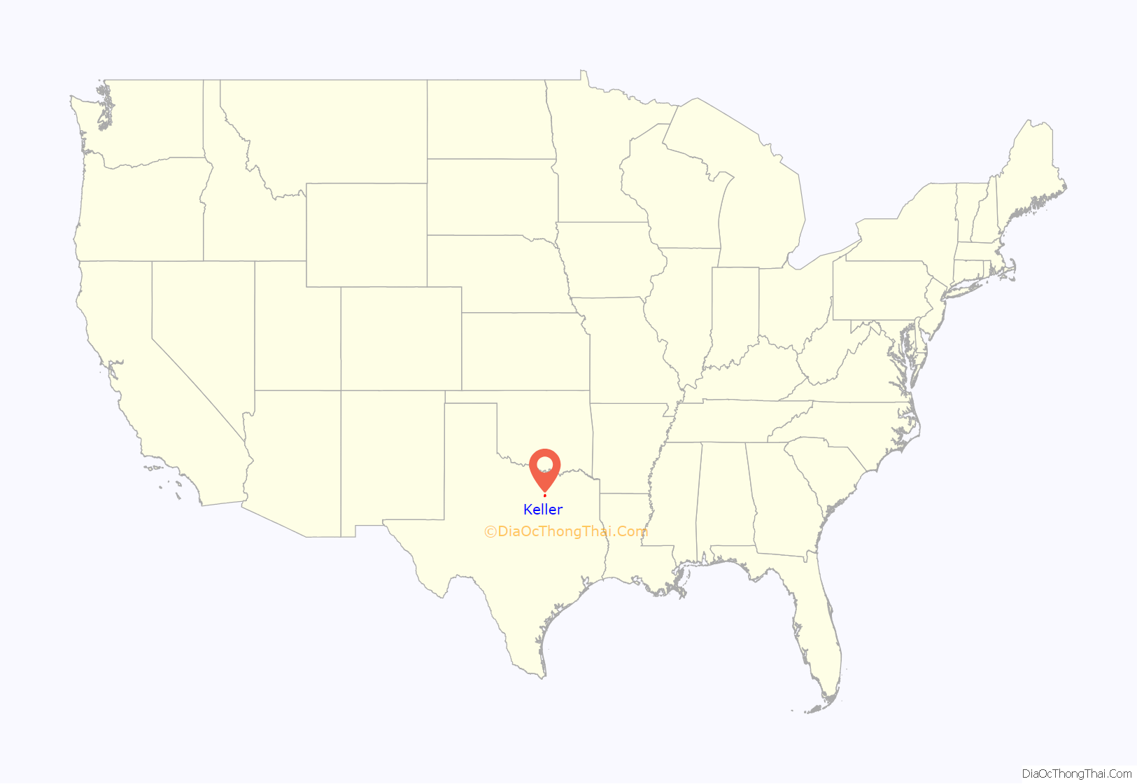
Keller location map. Where is Keller city?

History
Before establishment
Keller is in the western fringe of the Eastern Cross Timbers in northeast Tarrant County, part of the frontier of the Peters Colony settlers of the 1840s. In the mid-1840s, the area was first settled by a group of families from Missouri that homesteaded near the head-waters of Big Bear Creek. Mount Gilead Baptist Church was established on July 13, 1850. In 1859, the little log church was burned in an Indian raid. It served as the only schoolhouse in that part of the county until about 1910.
The area became known as ‘Double Springs’ for the two large springs approximately 1⁄2 mile north of Mt. Gilead Baptist Church. In the early 1870s, the Double Springs area had a cotton gin, a grist mill, a blacksmith shop and several stores. In 1896, an artesian well was drilled in Keller; the Double Springs filled with silt over time and eventually were plugged and lost until rediscovery in 1984. Today Samantha Springs produces more than 200,000 gallons of water per day.
Establishment of Keller
The Texas and Pacific Railway between Fort Worth and Texarkana was completed in June 1881, and the first train ran on this track on May 9, 1881, which ran parallel with parts of the old Chisom cattle drive trail. With the advent of rail service, new villages were established all along the line. The Keller of today was one of them. On July 19, 1881, H.W. Black, a druggist of Tarrant County, set aside 40 acres (0.16 km) out of the north end of the 62 acres (0.25 km) deeded to him by A.C. Roberts (being a part of the Samuel Needham Survey) for a town site to be known as Athol, situated 14 miles (23 km) northeast of Fort Worth. The land was dedicated to the public for streets and alleyways, but title to the remainder of the 62 acres (0.25 km) was held by Mr. Black. Settlers migrated to the new village, and before a year had passed the name of the town was changed from Athol to Keller, honoring John C. Keller, a foreman on the railroad. Streets were named and those in the original 40-acre (0.16 km) site still carry the names given to them in 1881. Streets going north and south are Lamar, Main and Elm; those running east and west are Price, Taylor, Hill, Vine, Bates, Olive and Pecan.
Modern Keller
New residential development is gradually filling in open spaces, with neighboring towns affording no opportunity to expand its boundaries. The 1980 Census calculated Keller’s population at 4,555; today, nearly 45,000 residents call Keller home. City facilities include Keller Town Hall on Bear Creek Parkway, the Keller Public Library and Keller Senior Activities Center on Johnson Road, the Municipal Service Center on Bear Creek Pkwy. West, and the city’s recreation and aquatic center known as The Keller Pointe on Rufe Snow Drive. The city also recently renovated and expanded its police facility, which houses the Regional Jail, Regional Animal Adoption Center and regional 911 dispatch center, NETCOM, serving the cities of Keller, Colleyville, Southlake and Westlake.
The Keller Independent School District serves portions of the cities of Colleyville, Fort Worth, Haltom City, Hurst, North Richland Hills, Southlake, Watauga, and Westlake, as well as the entire city of Keller. Its 51 square miles (130 km) encompass the third-largest land area in Tarrant County. Enrollment in the school district has doubled during the past 10 years and is expected to do the same during the next decade, making it the ninth fastest-growing school district in Texas. The U.S. Census Bureau’s American Community Survey listed Keller as one of the “Nation’s Richest Cities” with a population over 20,000 in 2021, ranked number 45 with median household income of $141,364. Neighboring Southlake was ranked number 1.
Keller Road Map
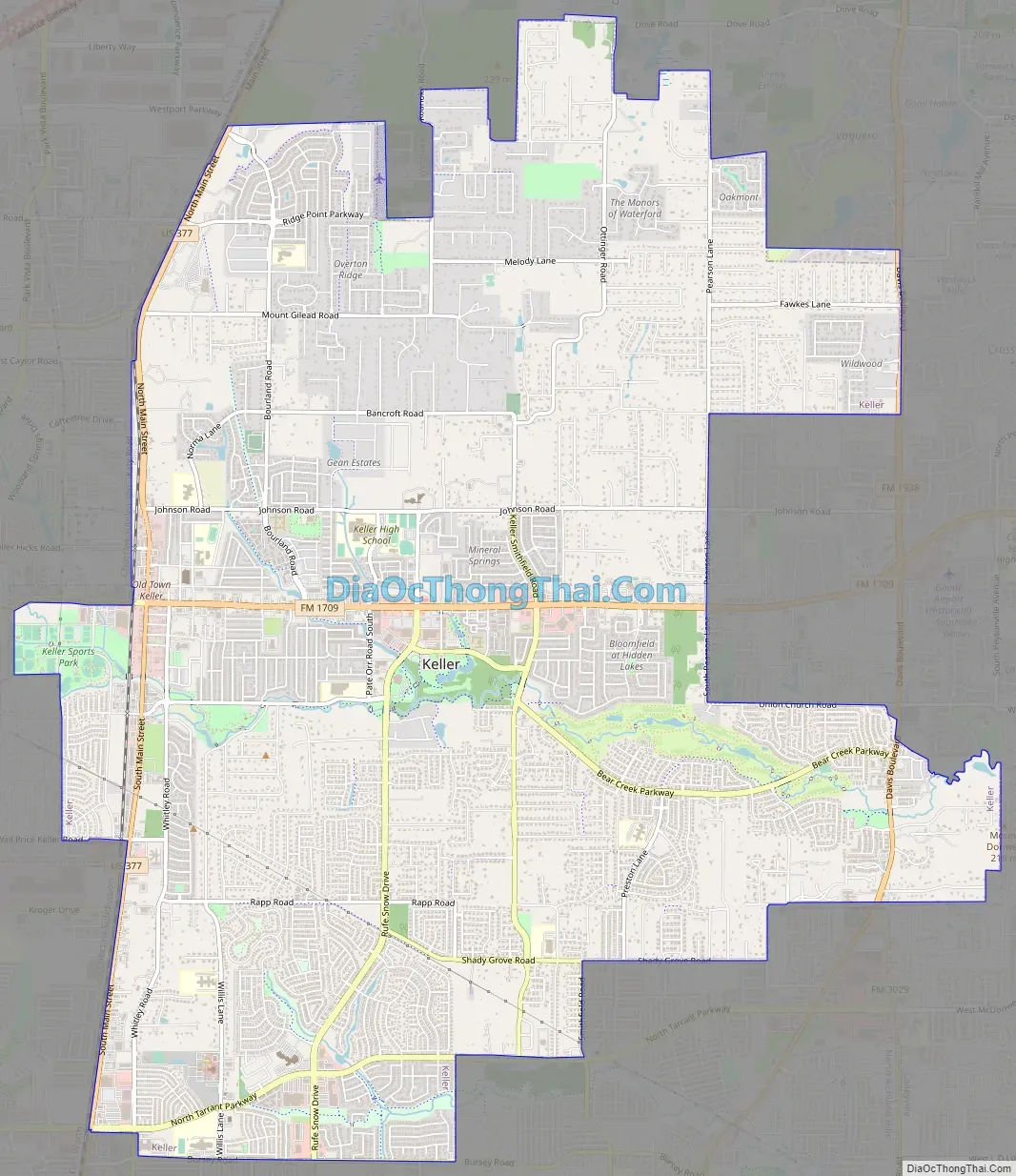
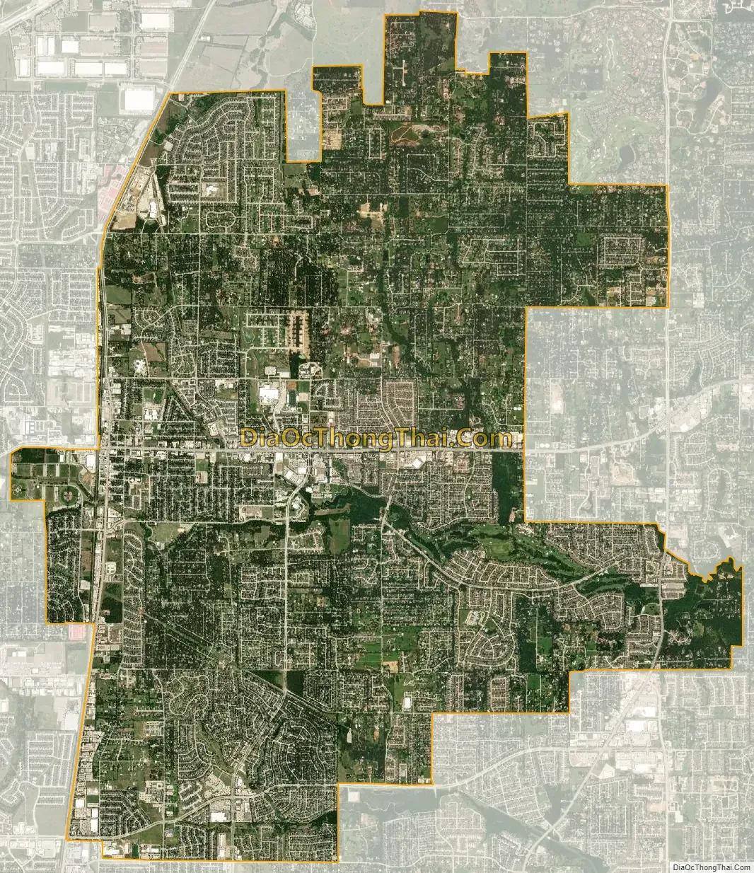
Keller city Satellite Map
Geography
Keller is located at 32°55′39″N 97°14′10″W / 32.92750°N 97.23611°W / 32.92750; -97.23611 (32.927533, −97.235995). According to the United States Census Bureau, the city has a total area of 18.4 square miles (47.8 km). Keller is east of Interstate 35W, south of Highway 114 and Alliance Gate Freeway.
Surrounding cities
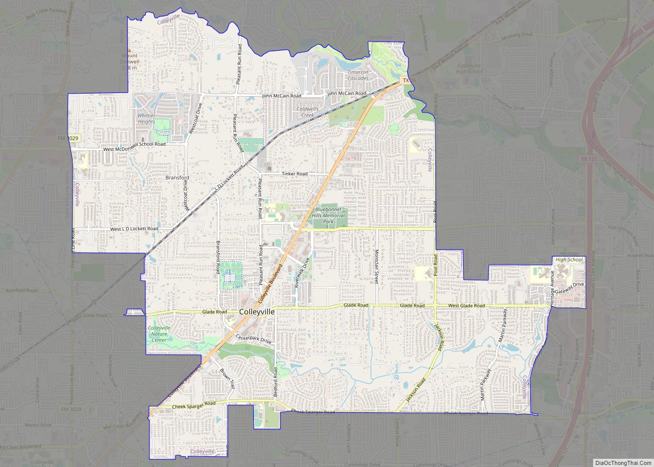
Here is the list of cities surrounding The City of Keller, whom which are located in either Denton or Tarrant County.
Fort Worth, Southlake, Roanoke
Climate
The climate in this area is characterized by hot, humid summers and generally mild to cool winters. According to the Köppen Climate Classification system, Keller has a humid subtropical climate, abbreviated “Cfa” on climate maps.
See also
Map of Texas State and its subdivision:- Anderson
- Andrews
- Angelina
- Aransas
- Archer
- Armstrong
- Atascosa
- Austin
- Bailey
- Bandera
- Bastrop
- Baylor
- Bee
- Bell
- Bexar
- Blanco
- Borden
- Bosque
- Bowie
- Brazoria
- Brazos
- Brewster
- Briscoe
- Brooks
- Brown
- Burleson
- Burnet
- Caldwell
- Calhoun
- Callahan
- Cameron
- Camp
- Carson
- Cass
- Castro
- Chambers
- Cherokee
- Childress
- Clay
- Cochran
- Coke
- Coleman
- Collin
- Collingsworth
- Colorado
- Comal
- Comanche
- Concho
- Cooke
- Coryell
- Cottle
- Crane
- Crockett
- Crosby
- Culberson
- Dallam
- Dallas
- Dawson
- Deaf Smith
- Delta
- Denton
- Dewitt
- Dickens
- Dimmit
- Donley
- Duval
- Eastland
- Ector
- Edwards
- El Paso
- Ellis
- Erath
- Falls
- Fannin
- Fayette
- Fisher
- Floyd
- Foard
- Fort Bend
- Franklin
- Freestone
- Frio
- Gaines
- Galveston
- Garza
- Gillespie
- Glasscock
- Goliad
- Gonzales
- Gray
- Grayson
- Gregg
- Grimes
- Guadalupe
- Hale
- Hall
- Hamilton
- Hansford
- Hardeman
- Hardin
- Harris
- Harrison
- Hartley
- Haskell
- Hays
- Hemphill
- Henderson
- Hidalgo
- Hill
- Hockley
- Hood
- Hopkins
- Houston
- Howard
- Hudspeth
- Hunt
- Hutchinson
- Irion
- Jack
- Jackson
- Jasper
- Jeff Davis
- Jefferson
- Jim Hogg
- Jim Wells
- Johnson
- Jones
- Karnes
- Kaufman
- Kendall
- Kenedy
- Kent
- Kerr
- Kimble
- King
- Kinney
- Kleberg
- Knox
- La Salle
- Lamar
- Lamb
- Lampasas
- Lavaca
- Lee
- Leon
- Liberty
- Limestone
- Lipscomb
- Live Oak
- Llano
- Loving
- Lubbock
- Lynn
- Madison
- Marion
- Martin
- Mason
- Matagorda
- Maverick
- McCulloch
- McLennan
- McMullen
- Medina
- Menard
- Midland
- Milam
- Mills
- Mitchell
- Montague
- Montgomery
- Moore
- Morris
- Motley
- Nacogdoches
- Navarro
- Newton
- Nolan
- Nueces
- Ochiltree
- Oldham
- Orange
- Palo Pinto
- Panola
- Parker
- Parmer
- Pecos
- Polk
- Potter
- Presidio
- Rains
- Randall
- Reagan
- Real
- Red River
- Reeves
- Refugio
- Roberts
- Robertson
- Rockwall
- Runnels
- Rusk
- Sabine
- San Augustine
- San Jacinto
- San Patricio
- San Saba
- Schleicher
- Scurry
- Shackelford
- Shelby
- Sherman
- Smith
- Somervell
- Starr
- Stephens
- Sterling
- Stonewall
- Sutton
- Swisher
- Tarrant
- Taylor
- Terrell
- Terry
- Throckmorton
- Titus
- Tom Green
- Travis
- Trinity
- Tyler
- Upshur
- Upton
- Uvalde
- Val Verde
- Van Zandt
- Victoria
- Walker
- Waller
- Ward
- Washington
- Webb
- Wharton
- Wheeler
- Wichita
- Wilbarger
- Willacy
- Williamson
- Wilson
- Winkler
- Wise
- Wood
- Yoakum
- Young
- Zapata
- Zavala
- Alabama
- Alaska
- Arizona
- Arkansas
- California
- Colorado
- Connecticut
- Delaware
- District of Columbia
- Florida
- Georgia
- Hawaii
- Idaho
- Illinois
- Indiana
- Iowa
- Kansas
- Kentucky
- Louisiana
- Maine
- Maryland
- Massachusetts
- Michigan
- Minnesota
- Mississippi
- Missouri
- Montana
- Nebraska
- Nevada
- New Hampshire
- New Jersey
- New Mexico
- New York
- North Carolina
- North Dakota
- Ohio
- Oklahoma
- Oregon
- Pennsylvania
- Rhode Island
- South Carolina
- South Dakota
- Tennessee
- Texas
- Utah
- Vermont
- Virginia
- Washington
- West Virginia
- Wisconsin
- Wyoming