Nederland (/ˈniːdərlənd/ NEE-dər-lənd) is a city in Jefferson County, Texas, United States. The population was 18,856 at the 2020 census.
The city was settled in 1897 along what is now Boston Avenue and incorporated in 1940. It was settled by Dutch immigrants on land sold by the Kansas City Southern railroad. It is part of the Beaumont–Port Arthur metropolitan area. Nederland is also a part of an area known as “the Golden Triangle”, which comprises Beaumont, Port Arthur, and Orange. The city is adjacent to the Jack Brooks Regional Airport.
| Name: | Nederland city |
|---|---|
| LSAD Code: | 25 |
| LSAD Description: | city (suffix) |
| State: | Texas |
| County: | Jefferson County |
| Incorporated: | 1940 |
| Elevation: | 16 ft (5 m) |
| Total Area: | 6.05 sq mi (15.67 km²) |
| Land Area: | 5.92 sq mi (15.34 km²) |
| Water Area: | 0.13 sq mi (0.33 km²) |
| Total Population: | 18,856 |
| Population Density: | 2,932.31/sq mi (1,132.20/km²) |
| ZIP code: | 77627 |
| Area code: | 409 |
| FIPS code: | 4850580 |
| GNISfeature ID: | 1363634 |
| Website: | www.ci.nederland.tx.us |
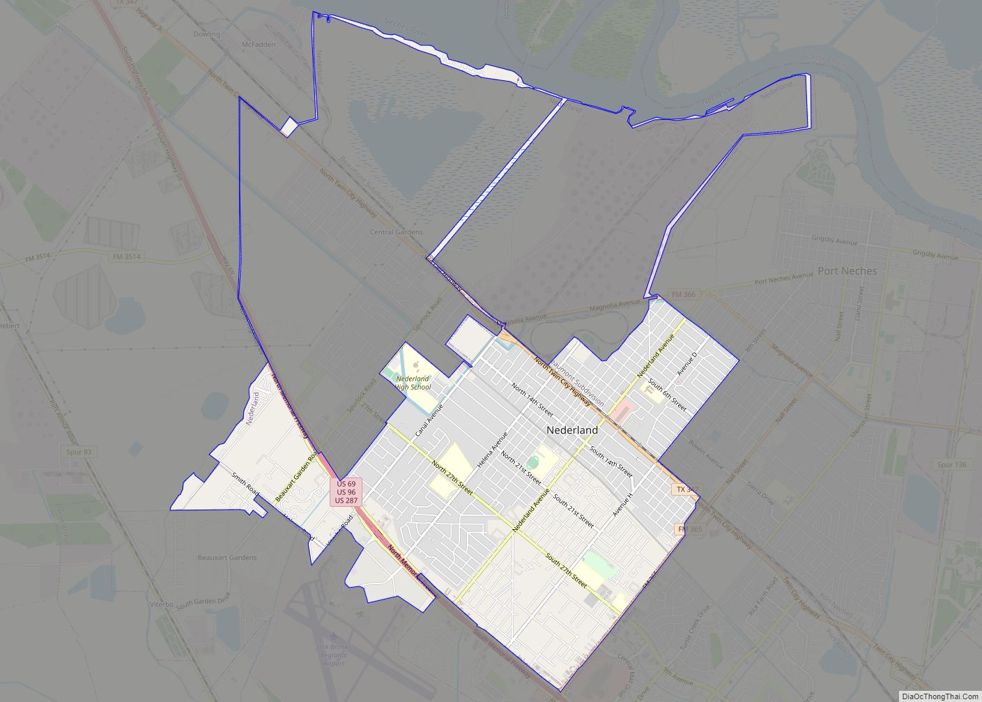
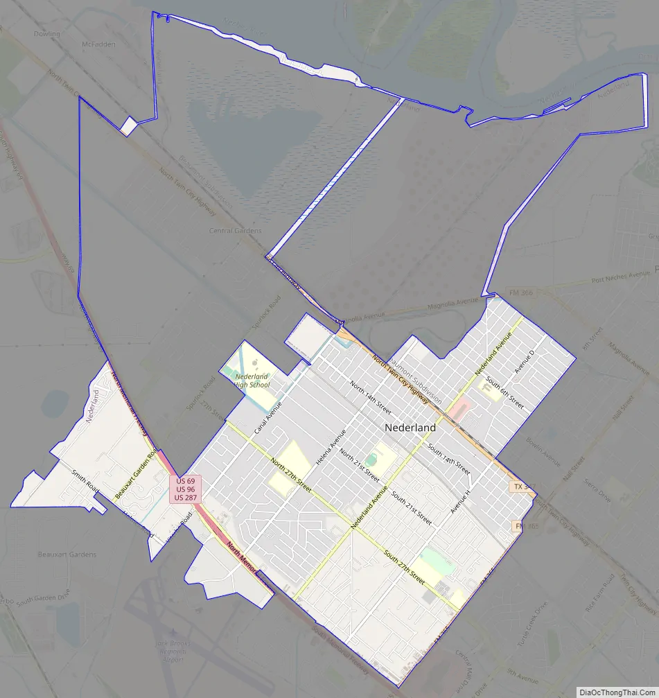
Online Interactive Map
Click on ![]() to view map in "full screen" mode.
to view map in "full screen" mode.
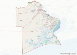
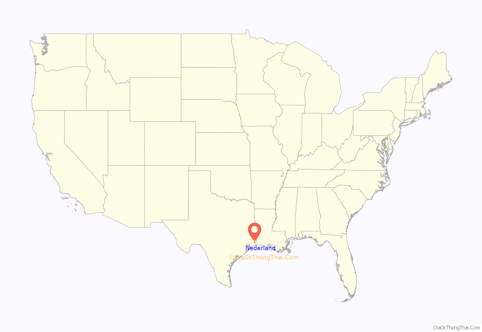
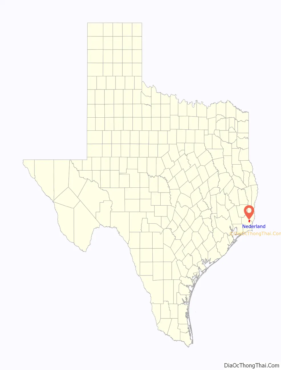
Nederland location map. Where is Nederland city?
History
Nederland was founded in 1897 by Dutch settlers as a repayment for financial services of Dutch bankers who financed the Kansas City Southern railroad line that runs through the center of the city. (Nederland, which literally translates to “Lowland”, is the Dutch name for the Netherlands.) The more prominent families were named Rienstra, Doornbos, and Van Oostrom, and their descendants still live in the area today. Tradition says they were attracted to the flat coastal terrain that reminded them of their homeland (although the heat most certainly did not).
Nederland’s early economy was driven by rice and dairy farming. However, the depression of 1907 and overproduction caused the rice industry in the town to collapse. Many Dutch settlers moved away from the area during this time, but a small percentage remained. After the Spindletop gusher discovery of 1901 and the establishment of the Sun Oil (Now Entergy Transfer) terminal near Nederland, the town became a residential community for the workers of the nearby oil terminals.
Nederland became incorporated as a city in 1940. The surrounding larger cities of Beaumont, Port Arthur, and Orange came to be known as the Golden Triangle. In the 1940s and 1950s, the Port of Port Arthur and the Port of Beaumont were as important as New Orleans, Houston, or Galveston, and Nederland thrived as a result.
The refineries also attracted a large population of blue-collar laborers into the area. The area drew particularly heavily from southern Louisiana, and a strong Cajun flair is evident throughout the community. With the decline of oil prices in the 1980s, the local economy suffered and Nederland experienced slight population losses, but has stabilized in the late 1990s and 2000s.
Nederland is the ending location of the Keystone Pipeline.
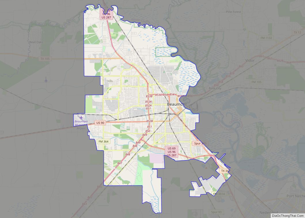
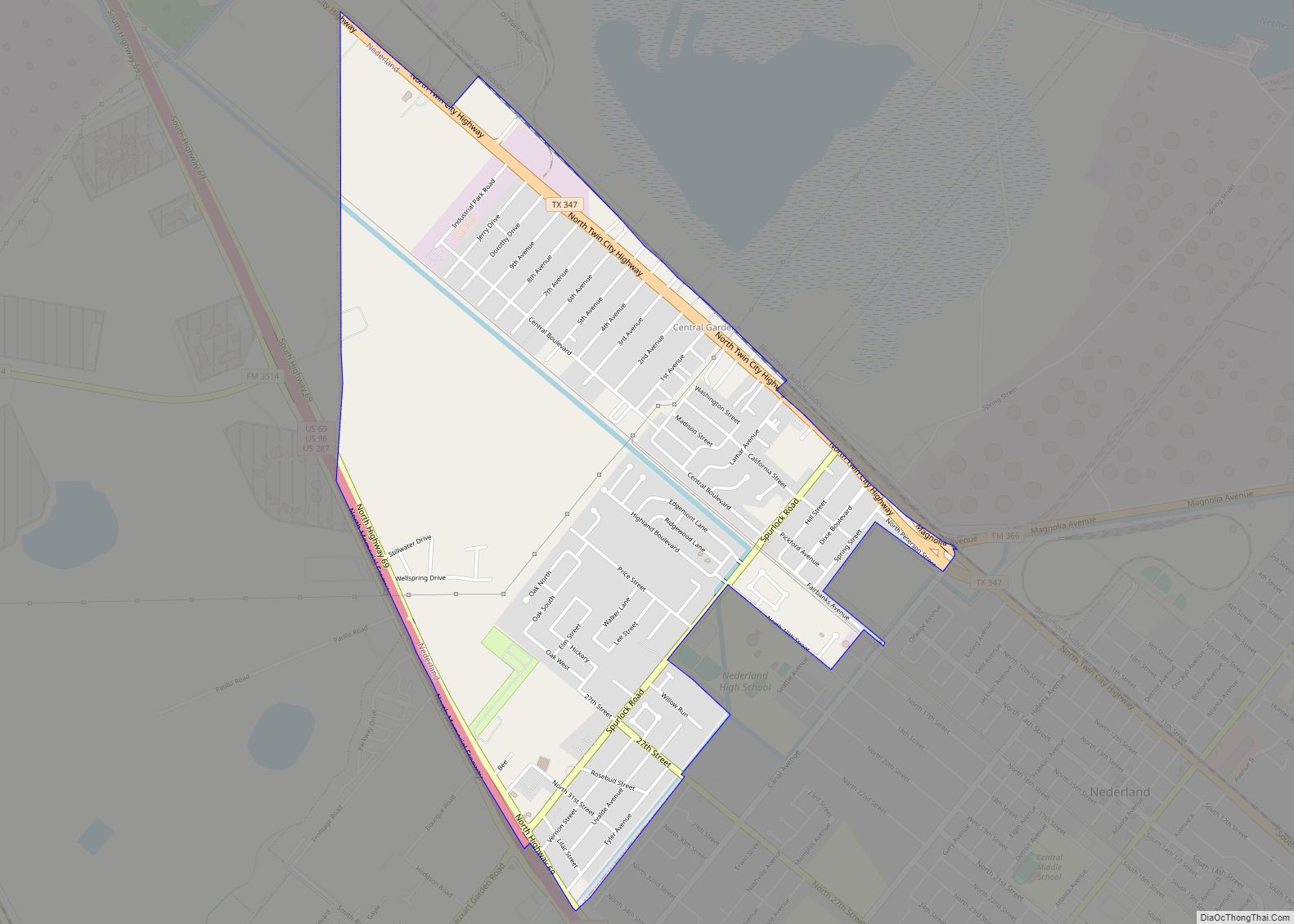
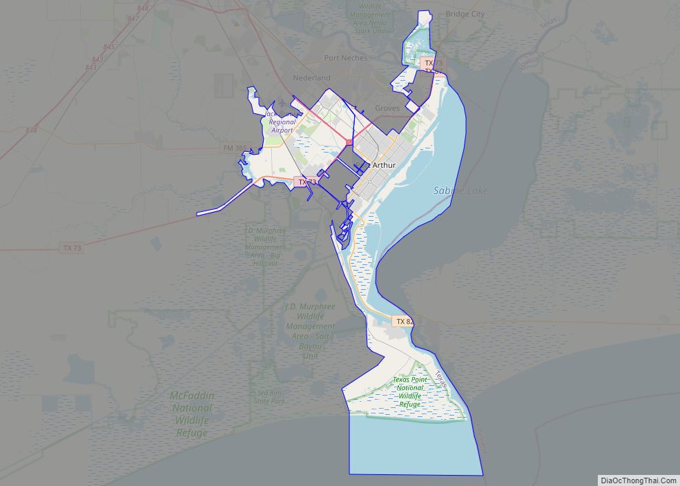
Nederland Road Map
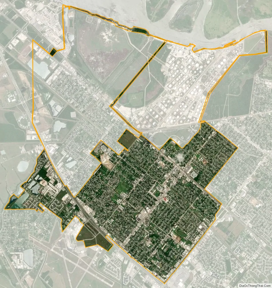
Nederland city Satellite Map
Geography
Nederland is located in eastern Jefferson County at 29°58′23″N 93°59′48″W / 29.97306°N 93.99667°W / 29.97306; -93.99667 (29.973113, –93.996715). It is bordered to the east by Port Neches, to the south by Port Arthur, and to the north by unincorporated Central Gardens. Texas State Highway 347 runs through the northeast side of the city, close to downtown, and the U.S. Route 69/96/287 freeway runs through the southwest side. Nederland is 10 miles (16 km) southeast of downtown Beaumont and 8 miles (13 km) northwest of the center of Port Arthur. It is about 90 miles (140 km) east of Houston.
According to the United States Census Bureau, Nederland has a total area of 5.8 square miles (15.1 km), of which 5.7 square miles (14.8 km) are land and 0.1 square miles (0.3 km), or 2.19%, are water.
Climate
Nederland is on a subtropical coastal plain. The proximity to the coast contributes to high humidity during the summer months. The region also has its share of tropical storms.
On September 23, 2005, Nederland was hit by Hurricane Rita, a category 3 hurricane causing 12 billion dollars of damage in southeast Texas and southwest Louisiana.
On September 13, 2007, Nederland was hit by Hurricane Humberto, a category 1 hurricane. The eye of the hurricane passed over the city.
On September 13, 2008, Nederland was hit by hurricane-force winds of Hurricane Ike, a category 2 hurricane that came ashore at Galveston and pushed an 18-foot (5.5 m) storm surge ahead of it. The Golden Triangle area of Nederland, Port Arthur, Port Neches and Beaumont were spared from the surge by the sea wall that surrounds Port Arthur. Bridge City, Orange and the outlying areas were severely flooded.
From August 26 to 30, 2017, Hurricane Harvey set the record for the highest rainfall from a tropical cyclone in United States history, when 60.58 inches (1,539 mm) of precipitation fell in Nederland.
See also
Map of Texas State and its subdivision:- Anderson
- Andrews
- Angelina
- Aransas
- Archer
- Armstrong
- Atascosa
- Austin
- Bailey
- Bandera
- Bastrop
- Baylor
- Bee
- Bell
- Bexar
- Blanco
- Borden
- Bosque
- Bowie
- Brazoria
- Brazos
- Brewster
- Briscoe
- Brooks
- Brown
- Burleson
- Burnet
- Caldwell
- Calhoun
- Callahan
- Cameron
- Camp
- Carson
- Cass
- Castro
- Chambers
- Cherokee
- Childress
- Clay
- Cochran
- Coke
- Coleman
- Collin
- Collingsworth
- Colorado
- Comal
- Comanche
- Concho
- Cooke
- Coryell
- Cottle
- Crane
- Crockett
- Crosby
- Culberson
- Dallam
- Dallas
- Dawson
- Deaf Smith
- Delta
- Denton
- Dewitt
- Dickens
- Dimmit
- Donley
- Duval
- Eastland
- Ector
- Edwards
- El Paso
- Ellis
- Erath
- Falls
- Fannin
- Fayette
- Fisher
- Floyd
- Foard
- Fort Bend
- Franklin
- Freestone
- Frio
- Gaines
- Galveston
- Garza
- Gillespie
- Glasscock
- Goliad
- Gonzales
- Gray
- Grayson
- Gregg
- Grimes
- Guadalupe
- Hale
- Hall
- Hamilton
- Hansford
- Hardeman
- Hardin
- Harris
- Harrison
- Hartley
- Haskell
- Hays
- Hemphill
- Henderson
- Hidalgo
- Hill
- Hockley
- Hood
- Hopkins
- Houston
- Howard
- Hudspeth
- Hunt
- Hutchinson
- Irion
- Jack
- Jackson
- Jasper
- Jeff Davis
- Jefferson
- Jim Hogg
- Jim Wells
- Johnson
- Jones
- Karnes
- Kaufman
- Kendall
- Kenedy
- Kent
- Kerr
- Kimble
- King
- Kinney
- Kleberg
- Knox
- La Salle
- Lamar
- Lamb
- Lampasas
- Lavaca
- Lee
- Leon
- Liberty
- Limestone
- Lipscomb
- Live Oak
- Llano
- Loving
- Lubbock
- Lynn
- Madison
- Marion
- Martin
- Mason
- Matagorda
- Maverick
- McCulloch
- McLennan
- McMullen
- Medina
- Menard
- Midland
- Milam
- Mills
- Mitchell
- Montague
- Montgomery
- Moore
- Morris
- Motley
- Nacogdoches
- Navarro
- Newton
- Nolan
- Nueces
- Ochiltree
- Oldham
- Orange
- Palo Pinto
- Panola
- Parker
- Parmer
- Pecos
- Polk
- Potter
- Presidio
- Rains
- Randall
- Reagan
- Real
- Red River
- Reeves
- Refugio
- Roberts
- Robertson
- Rockwall
- Runnels
- Rusk
- Sabine
- San Augustine
- San Jacinto
- San Patricio
- San Saba
- Schleicher
- Scurry
- Shackelford
- Shelby
- Sherman
- Smith
- Somervell
- Starr
- Stephens
- Sterling
- Stonewall
- Sutton
- Swisher
- Tarrant
- Taylor
- Terrell
- Terry
- Throckmorton
- Titus
- Tom Green
- Travis
- Trinity
- Tyler
- Upshur
- Upton
- Uvalde
- Val Verde
- Van Zandt
- Victoria
- Walker
- Waller
- Ward
- Washington
- Webb
- Wharton
- Wheeler
- Wichita
- Wilbarger
- Willacy
- Williamson
- Wilson
- Winkler
- Wise
- Wood
- Yoakum
- Young
- Zapata
- Zavala
- Alabama
- Alaska
- Arizona
- Arkansas
- California
- Colorado
- Connecticut
- Delaware
- District of Columbia
- Florida
- Georgia
- Hawaii
- Idaho
- Illinois
- Indiana
- Iowa
- Kansas
- Kentucky
- Louisiana
- Maine
- Maryland
- Massachusetts
- Michigan
- Minnesota
- Mississippi
- Missouri
- Montana
- Nebraska
- Nevada
- New Hampshire
- New Jersey
- New Mexico
- New York
- North Carolina
- North Dakota
- Ohio
- Oklahoma
- Oregon
- Pennsylvania
- Rhode Island
- South Carolina
- South Dakota
- Tennessee
- Texas
- Utah
- Vermont
- Virginia
- Washington
- West Virginia
- Wisconsin
- Wyoming