Royse City is a city in Rockwall County in the U.S. state of Texas. It also extends into Collin and Hunt counties. The population was 2,957 at the 2000 census, rising to 9,349 in 2010. The estimated population in 2018 was 12,998. In 2020, its population grew to 13,508.
| Name: | Royse City city |
|---|---|
| LSAD Code: | 25 |
| LSAD Description: | city (suffix) |
| State: | Texas |
| County: | Collin County, Hunt County, Rockwall County |
| Elevation: | 554 ft (169 m) |
| Total Area: | 18.42 sq mi (47.71 km²) |
| Land Area: | 18.30 sq mi (47.38 km²) |
| Water Area: | 0.13 sq mi (0.33 km²) |
| Total Population: | 13,508 |
| Population Density: | 803.61/sq mi (310.27/km²) |
| ZIP code: | 75189 |
| Area code: | 214, 469, 945, 972 |
| FIPS code: | 4863668 |
| GNISfeature ID: | 1345732 |
| Website: | www.roysecity.com |
Online Interactive Map
Click on ![]() to view map in "full screen" mode.
to view map in "full screen" mode.
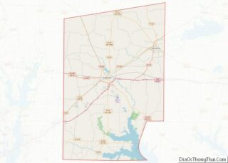
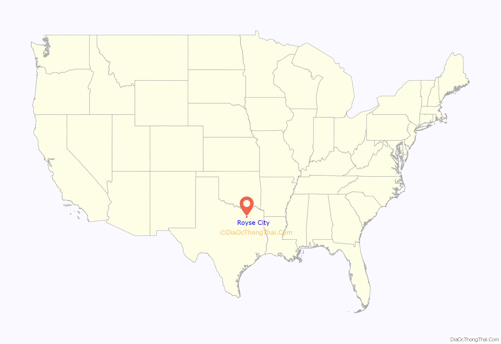
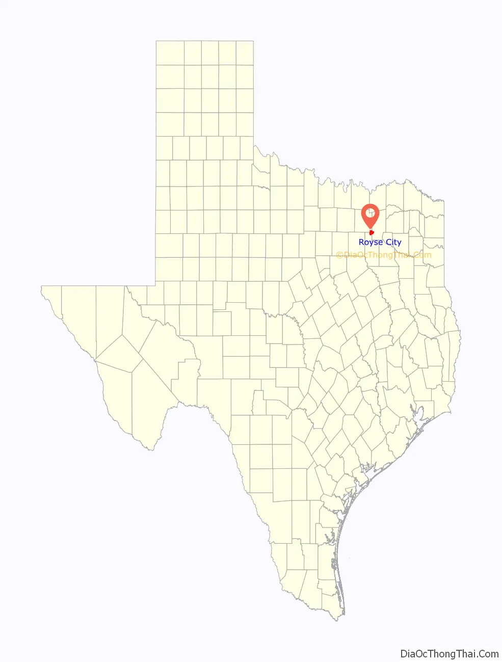
Royse City location map. Where is Royse City city?
History
Garrett Burgess Griffin Royse, better known as Byrd Royse, was born in Adair County, Kentucky, on January 31, 1838, to William and Mary Stone Royse. He was the seventh of 14 children. Around 1850, Royse’s future grandmother-in-law, Mrs. Nancy McCasland, and her sons bought several tracts of land that were later to be known as Royse City.
Royse was instrumental in getting the Missouri, Kansas and Texas Railway line brought from Greenville to Dallas through Rockwall County. Royse City was settled in 1885, when the railway came through the area. The town was named after G. B. Royse, who plotted the town and sold the first lots.
After its founding, Royse City preserved its stable, small, country-town status due to its proximity to Garland (21 miles away) and Dallas (33 miles).
Interstate 30 was constructed just south of the city in the mid-1960s. The city grew south to meet the interstate.
In 2000, Royse City had a population of 2,957. Still a small town, Royse City was feeling the impacts of the rapid growth of the Dallas-Fort Worth area, along with Rockwall County. The city’s location along Interstate 30 between Rockwall and Greenville helped to fuel this growth.
Royse City has grown rapidly to the north and south as newer subdivisions have been built. By 2010, Royse City had a population of 9,349, according to the U.S. Census Bureau. This represents a growth rate of 216.2%.
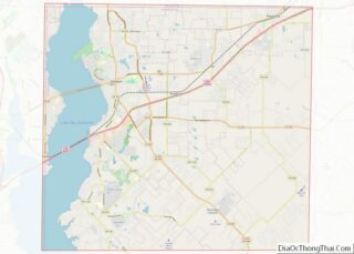
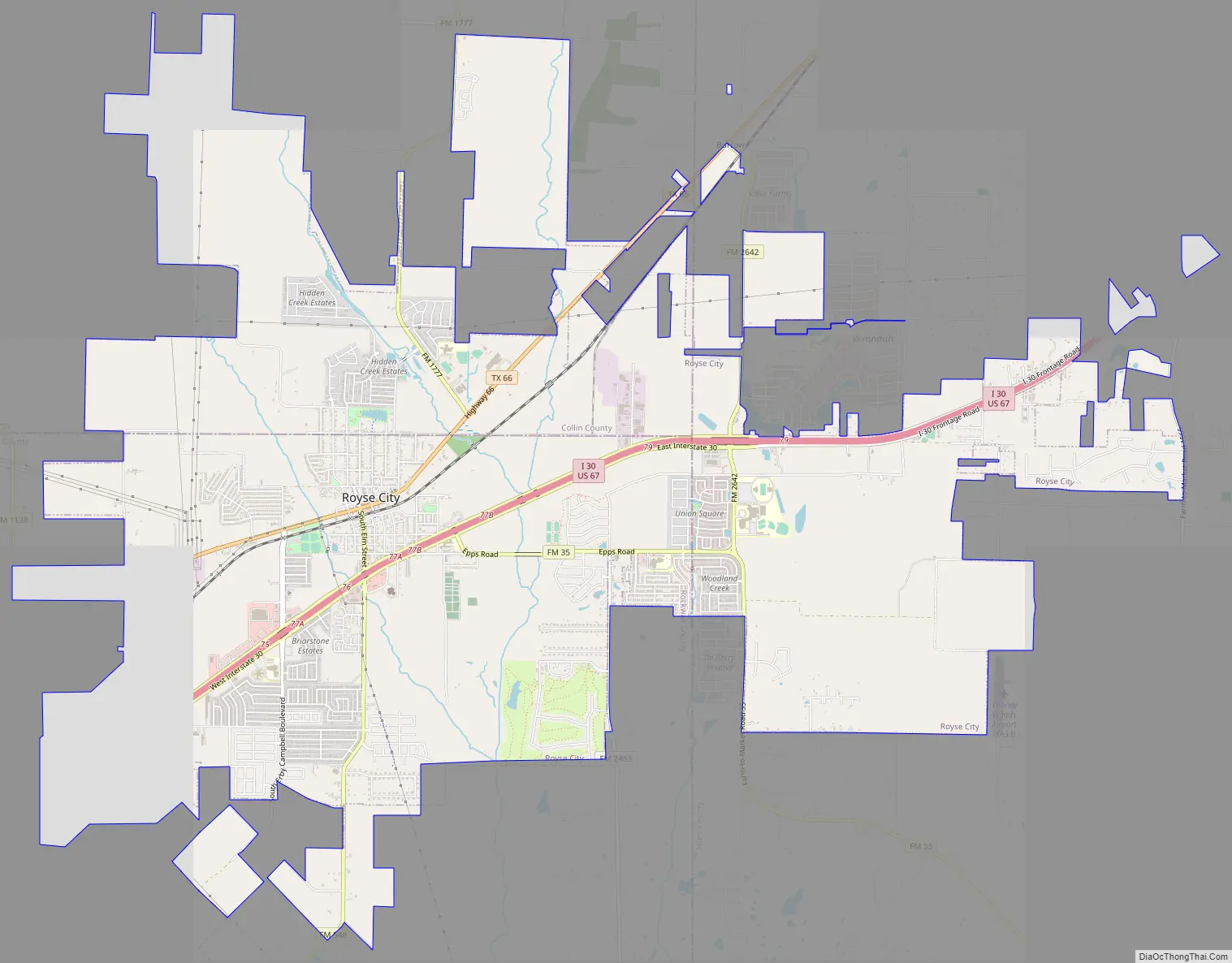
Royse City Road Map
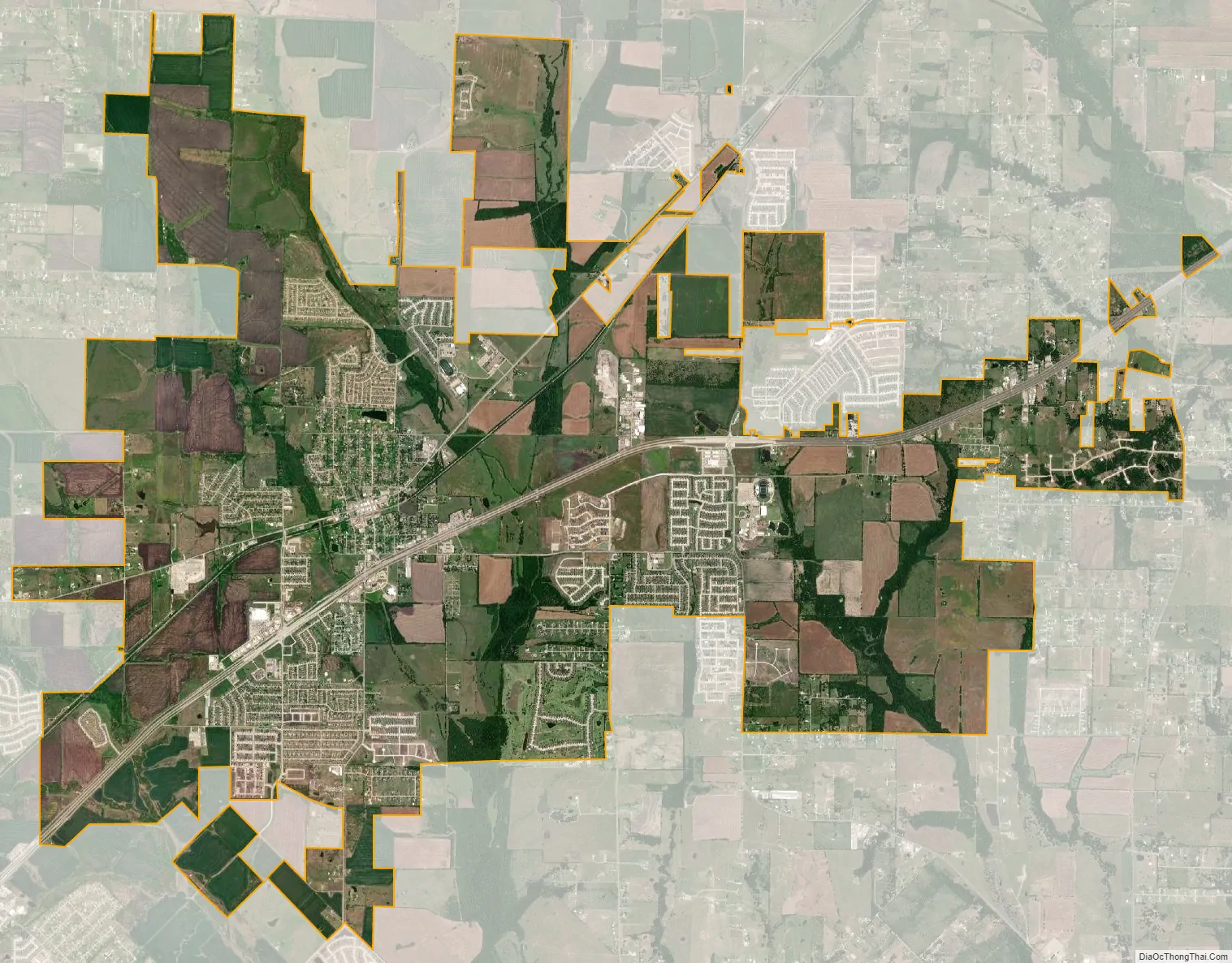
Royse City city Satellite Map
Geography
Royse City is located in the northeast corner of Rockwall County, and extends north into Collin County and east into Hunt County. According to the United States Census Bureau, Royse City has a total area of 15.1 square miles (39.2 km), of which 15.0 square miles (38.9 km) are land and 0.1 square miles (0.3 km), or 0.75%, is covered by water.
See also
Map of Texas State and its subdivision:- Anderson
- Andrews
- Angelina
- Aransas
- Archer
- Armstrong
- Atascosa
- Austin
- Bailey
- Bandera
- Bastrop
- Baylor
- Bee
- Bell
- Bexar
- Blanco
- Borden
- Bosque
- Bowie
- Brazoria
- Brazos
- Brewster
- Briscoe
- Brooks
- Brown
- Burleson
- Burnet
- Caldwell
- Calhoun
- Callahan
- Cameron
- Camp
- Carson
- Cass
- Castro
- Chambers
- Cherokee
- Childress
- Clay
- Cochran
- Coke
- Coleman
- Collin
- Collingsworth
- Colorado
- Comal
- Comanche
- Concho
- Cooke
- Coryell
- Cottle
- Crane
- Crockett
- Crosby
- Culberson
- Dallam
- Dallas
- Dawson
- Deaf Smith
- Delta
- Denton
- Dewitt
- Dickens
- Dimmit
- Donley
- Duval
- Eastland
- Ector
- Edwards
- El Paso
- Ellis
- Erath
- Falls
- Fannin
- Fayette
- Fisher
- Floyd
- Foard
- Fort Bend
- Franklin
- Freestone
- Frio
- Gaines
- Galveston
- Garza
- Gillespie
- Glasscock
- Goliad
- Gonzales
- Gray
- Grayson
- Gregg
- Grimes
- Guadalupe
- Hale
- Hall
- Hamilton
- Hansford
- Hardeman
- Hardin
- Harris
- Harrison
- Hartley
- Haskell
- Hays
- Hemphill
- Henderson
- Hidalgo
- Hill
- Hockley
- Hood
- Hopkins
- Houston
- Howard
- Hudspeth
- Hunt
- Hutchinson
- Irion
- Jack
- Jackson
- Jasper
- Jeff Davis
- Jefferson
- Jim Hogg
- Jim Wells
- Johnson
- Jones
- Karnes
- Kaufman
- Kendall
- Kenedy
- Kent
- Kerr
- Kimble
- King
- Kinney
- Kleberg
- Knox
- La Salle
- Lamar
- Lamb
- Lampasas
- Lavaca
- Lee
- Leon
- Liberty
- Limestone
- Lipscomb
- Live Oak
- Llano
- Loving
- Lubbock
- Lynn
- Madison
- Marion
- Martin
- Mason
- Matagorda
- Maverick
- McCulloch
- McLennan
- McMullen
- Medina
- Menard
- Midland
- Milam
- Mills
- Mitchell
- Montague
- Montgomery
- Moore
- Morris
- Motley
- Nacogdoches
- Navarro
- Newton
- Nolan
- Nueces
- Ochiltree
- Oldham
- Orange
- Palo Pinto
- Panola
- Parker
- Parmer
- Pecos
- Polk
- Potter
- Presidio
- Rains
- Randall
- Reagan
- Real
- Red River
- Reeves
- Refugio
- Roberts
- Robertson
- Rockwall
- Runnels
- Rusk
- Sabine
- San Augustine
- San Jacinto
- San Patricio
- San Saba
- Schleicher
- Scurry
- Shackelford
- Shelby
- Sherman
- Smith
- Somervell
- Starr
- Stephens
- Sterling
- Stonewall
- Sutton
- Swisher
- Tarrant
- Taylor
- Terrell
- Terry
- Throckmorton
- Titus
- Tom Green
- Travis
- Trinity
- Tyler
- Upshur
- Upton
- Uvalde
- Val Verde
- Van Zandt
- Victoria
- Walker
- Waller
- Ward
- Washington
- Webb
- Wharton
- Wheeler
- Wichita
- Wilbarger
- Willacy
- Williamson
- Wilson
- Winkler
- Wise
- Wood
- Yoakum
- Young
- Zapata
- Zavala
- Alabama
- Alaska
- Arizona
- Arkansas
- California
- Colorado
- Connecticut
- Delaware
- District of Columbia
- Florida
- Georgia
- Hawaii
- Idaho
- Illinois
- Indiana
- Iowa
- Kansas
- Kentucky
- Louisiana
- Maine
- Maryland
- Massachusetts
- Michigan
- Minnesota
- Mississippi
- Missouri
- Montana
- Nebraska
- Nevada
- New Hampshire
- New Jersey
- New Mexico
- New York
- North Carolina
- North Dakota
- Ohio
- Oklahoma
- Oregon
- Pennsylvania
- Rhode Island
- South Carolina
- South Dakota
- Tennessee
- Texas
- Utah
- Vermont
- Virginia
- Washington
- West Virginia
- Wisconsin
- Wyoming