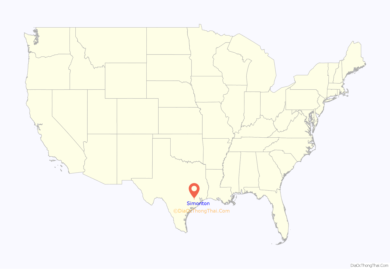
Simonton is a city in Fort Bend County, Texas, United States, within the Houston–Sugar Land–Baytown metropolitan area. Simonton is located at the intersection of Farm roads 1093 and 1489, approximately fourteen miles northwest of Richmond, Texas and five miles west of Fulshear, Texas. As of the 2020 U.S. Census, the city population was 647, down from 814 at the 2010 census.
| Name: | Simonton city |
|---|---|
| LSAD Code: | 25 |
| LSAD Description: | city (suffix) |
| State: | Texas |
| County: | Fort Bend County |
| Elevation: | 115 ft (35 m) |
| Total Area: | 2.37 sq mi (6.14 km²) |
| Land Area: | 2.35 sq mi (6.09 km²) |
| Water Area: | 0.02 sq mi (0.05 km²) |
| Total Population: | 647 |
| Population Density: | 376.17/sq mi (145.22/km²) |
| ZIP code: | 77476 |
| Area code: | 281/346/713/832 |
| FIPS code: | 4867964 |
| GNISfeature ID: | 1347151 |
| Website: | simontontexas.org |
Online Interactive Map
Click on ![]() to view map in "full screen" mode.
to view map in "full screen" mode.
Simonton location map. Where is Simonton city?
History
The Simonton Plantation
The first event that shaped Simonton’s history was when James Simonton and his brother Theophilus bought 4000 acres of land in Northwest Fort Bend County in the 1840s. The two Simonton brothers built a plantation next to the Brazos River. They raised cotton. The year 1850 is officially designated as the founding year for the Simonton since the 1850 US Census showed the two brothers, their mother, Mary, and Theophilus’s wife and two sons residing on the property. Another brother, Joseph, and his family moved to the plantation in the 1850s. In 1857, Theophilus helped charter the Richmond Masonic Hall Association, symbolizing the elite status of the Simonton family in Fort Bend County. The town of Simonton joined Fulshear and Pittsville as the main rural towns in Northwest Fort Bend County.
American Civil War
At the onset of the US Civil War, the 1860 US Census shows that the Simonton’s owned one of the largest and most prosperous plantations in Fort Bend County with a real property value at $200,000 and personal property valued at $155,000. The Simonton brothers have been identified as among the largest slaveholders in Texas. According to the 1860 US census and a subsequent research, there were 105 slaves on the Simonton plantation on the eve of the Civil War. This census also revealed that their plantation had 975 improved acres that produced 11,000 bushels of corn and 600 bales of cotton. Like many Texas plantation owners, they supported the Confederacy.
Post-Civil War Reconstruction
The plantation was broken up and sold after the war. Tracts of land were sold to incoming settlers. The Simonton’s actively resisted the post-Civil War Reconstruction efforts. During the Fort Bend Jaybird-Woodpecker political battles during post-Civil War Reconstruction, the Simonton brothers joined the Jaybirds, a faction within the Democratic Party, who wanted to oust the Woodpeckers, primarily blacks and their white allies, from the county administration. In October 1888 in nearby Pittsville, Theophilus Simonton Jr. was arrested by the county sheriff for fatally shooting a local black leader, Lamar Johnson, and injuring his half-brother, Taylor Randonan. This incident gained regional and national attention on the deep racial divisions of the Jaybird-Woodpecker War raging throughout Fort Bend County.
End of the Pioneer Era
The Simonton family’s position and presence gradually dwindled after the deaths of the pioneer brothers and the influx of European immigrants who passed through Galveston during the late 19th and early 20th Century.
Their deaths accompanied by the industrial revolution that was sweeping the United States drastically altered the economic means, and thus the social and political roles, in Simonton as well as throughout Fort Bend Country.
According to oral history documentation, the Ku Klux Klan was present in Simonton from the early 20th Century, as they were in many Texas small towns, and were especially active due to the influx of foreign-born immigrants, who moved to Simonton to work as farm and ranch help for the local cattle ranches and pecan groves.
From Busy Town to Quiet Crossroads Community
The next event shaping Simonton history was the advent, around 1888, of the San Antonio and Aransas Pass Railroad. It’s said the company wanted the track to run through Pittsville (near what is now Fulshear) where the terrain was more level. However, the landowners in that area refused to sell the railroad a right-of-way because they believed the trains would scare their cattle. So the line was laid across the hills and creeks between Fulshear and Simonton. Water was as necessary as coal for the steam-powered locomotives, and Simonton became one of the main watering stops. With the tracks, came the people. With the tracks also came the opportunity to ship the area’s farm produce to other parts of the country.
In subsequent years, Simonton developed into a robust agricultural community. Snap shots of this historical has been noted in several oral historical accounts:
- Red Potato Farming. In 1906, D.H. (Dave) Mullins, who came to Simonton from Kansas, began growing potatoes on a commercial scale – 150 acres that first year. Later he and J.R. Spencer, also from Kansas, working together, planted 1000 acres of red potatoes. Other farmers followed suit; and during one of the best years, 800 railroad cars of potatoes were shipped out of Simonton to places like Chicago, Kansas City, and Cincinnati. The Simonton area became one of the country’s major producers of red potatoes. Gradually the red potato demand dwindled due to the onset of a disease and Luther Burbank’s development of the white potato. In its place, alfalfa, cotton, pecans, and pure-bred cattle ranching replaced the acres of potatoes.
- Pure-bred Cattle Ranching. The Simonton-Fulshear-Brookshire became known as the “River Oaks of the pure-bred cattle business” and was tied in closely with the annual Houston Livestock Show. The pure-bred breeders in the community included the Diamond C Ranch (Herefords), Pecan Acres (Brahman cattle), Figure 4 Ranch (Charolais, Brahman, and Charbray), and the Bar C Ranch (Brahman, Charbray, and Charolais).
- Prison farm. From 1898 to 1909, Simonton was the site of a prison farm. A Captain South was in charge of convicts who cleared the land from Simonton to the Brazos River for farming of ribbon cane for syrup. Until very recently, a barn used by these convicts as a mess hall, bars still on the windows, stood near the Simonton crossroads.
- Busy Town. During the years that agriculture output was important, Simonton developed a busy “downtown”. There were as many as three general stores. One, owned by A.A. (Tom) Mullins, offered a hotel on the second floor with potato buyers and railroad men as regular guests. Another hotel located in the Scruggs home, was run by a Mrs. Bentley, whose culinary skills made Simonton a favored meal stop for travelers. There was also a blacksmith shop, two cotton gins, a lumber yard, a post office and the railroad depot.
- Education. In 1893, the first school for white students was established in Simonton. A census of eligible school children taken in 1911 revealed 544 students. In 1925, noted Houston architect Louis Glover designed this two-story school for nine grades. The art deco-style building which exists today has a “stuccoed brick symmetrical façade with porticoes, grouped windows and ornamentation tiles.” In subsequent years in the Great Depression, the facility was used to host dances, suppers, elections, and church services, The school was annexed into the Lamar Consolidated ISD in 1950. The school for black students was also established.
- H. Berkman & Co. General Store. It was built by Hyman “Harry” Berkman, who came to Simonton from Poland in 1913, during the agricultural boom in Simonton in the early 20th century. The store contained the post office, the general store, and butcher shop. Maurice and Flo Berkman (married June 24, 1956), who were members of the now defunct Jewish synagogue in Warton, Texas, operated store for more than 62 years until their retirement and subsequent move to Houston.
- Dwindling Population. As agricultural output declined and railroad traffic dwindled, people started moving away, mostly to Houston with its growing industry and higher wages. The depot closed in 1953; and it wasn’t long before the last cotton gin closed down. Eventually, what was left was a small café, a pecan barn, the post office, a small liquor store and Berkman’s general store.
Gradually by 1957, Simonton had changed from a busy small town to a quiet crossroads community. Then came the beginnings of a new stage in the life of the town. Vernon Evans, owner of the nearby Rue Ranch, and his son-in-law, A.E. “Snake” Bailey, bought 850 acres of land along FM 1093 to be developed as a western community with stables and a small arena and club house, the hub around which houses would be built. The development was called Valley Lodge. Valley Lodge subdivision was the first subdivision out of the city of Houston within commuting distance.
Harvesting potatoes in Fort Bend County, Tx
International VIP – Chinese Vice Premier Deng Xiaoping’s 1979 Visit to the Simonton Rodeo
In the months following the Sino-US normalization, China’s Vice Premier Deng Xiaoping visited the United States for nine days in 1979, visiting Washington, Atlanta, Houston and Seattle. On February 2 during his visit to Houston, he spent an evening in Simonton at the Roundup Rodeo. In 1963 the Round Up was built on FM 1093. Also the brainchild of “Snake” Bailey, it is a large indoor rodeo arena in full swing every Saturday night, drawing people from Houston and elsewhere for a taste of the “real west.” He rode in a stagecoach, and later a barrel racer gave the premier a cowboy-style duster and a ten-gallon hat, both of which he donned and displayed before the crowd.
Deng’s visit to the Simonton rodeo is considered to be the tipping point in the thaw of US-China relations.
The Simonton Rodeo closed by 1997 when it was bought and restored by Benchmark Wireline, an oil services company. A China Daily Global video captures the memories of this visit, including Katie Van Dries whose father Luke owned the rodeo at that time.
The photographs of Deng in the cowboy hat appeared in American newspapers, displaying a distinctly human side to a previously mysterious Chinese leader. As Ezra F. Vogel, a biographer of Deng, put it, the
This excitement generated change Sino-American perceptions of each other, as exemplified in a Chinese Foreign Ministry video “The Cowboy-Hat and “Deng Whirlwind — The First Visit to the United States by a Leader of New China.”
City Incorporated
In 1979, the community incorporated as the City of Simonton. The population grew to 603 in 1980 and 718 in 2000. In 2010 the population was 814.
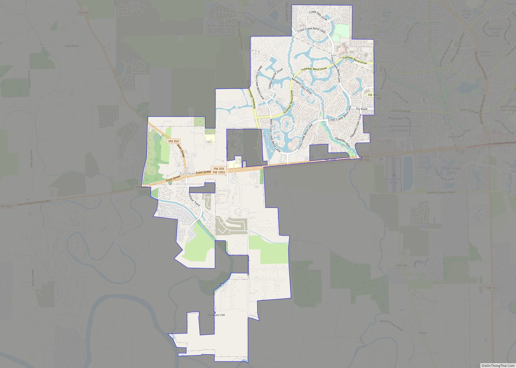
Simonton Road Map
Simonton city Satellite Map
Geography
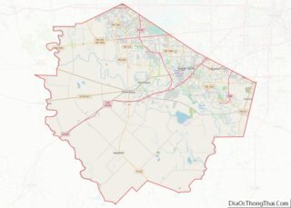
Simonton is located in northwestern Fort Bend County at 29°40′47″N 95°59′25″W / 29.67972°N 95.99028°W / 29.67972; -95.99028 (29.679783, –95.990302). The center of town is 2 miles (3 km) east of the Brazos River and 16 miles (26 km) northwest of Rosenberg. Downtown Houston is 38 miles (61 km) to the east. According to the United States Census Bureau, Simonton has a total area of 2.0 square miles (5.2 km), of which 0.004 square miles (0.01 km), or 0.24%, is water.
Almost all of the City is located within the Federal Emergency Management Agency (FEMA) 100-year floodplain of the Brazos River. See the FEMA Preliminary Map 2017.1.30 panel 80 and FEMA Preliminary Map 2017.1.30 panel 90. Real-time river gauges for the Brazos River are available here.
Simonton has been plagued by repeated flooding due to being located one mile east of the Brazos River, and it considered to located in the 100-year floodplain of the Brazos River. The most significant Brazos River flooding recorded were:
- 1913 Major Flood.
- October 1991 with 100 homes flooded
- December 1995 with 125 homes flooded and caused approximately $2.5 million dollars damage
- May 2016 when cows became stranded.
- August 2017 as a result of Hurricane Harvey.
While plagued by flooding, the City of Simonton purchased two drainage pumps for $95,000 that has reduced the impact of the Brazos River flooding. These pumps were partly paid for by a grant from the Federal Emergency Management Agency’s Hazard Mitigation Grant Program (HMGP).
See also
Map of Texas State and its subdivision:- Anderson
- Andrews
- Angelina
- Aransas
- Archer
- Armstrong
- Atascosa
- Austin
- Bailey
- Bandera
- Bastrop
- Baylor
- Bee
- Bell
- Bexar
- Blanco
- Borden
- Bosque
- Bowie
- Brazoria
- Brazos
- Brewster
- Briscoe
- Brooks
- Brown
- Burleson
- Burnet
- Caldwell
- Calhoun
- Callahan
- Cameron
- Camp
- Carson
- Cass
- Castro
- Chambers
- Cherokee
- Childress
- Clay
- Cochran
- Coke
- Coleman
- Collin
- Collingsworth
- Colorado
- Comal
- Comanche
- Concho
- Cooke
- Coryell
- Cottle
- Crane
- Crockett
- Crosby
- Culberson
- Dallam
- Dallas
- Dawson
- Deaf Smith
- Delta
- Denton
- Dewitt
- Dickens
- Dimmit
- Donley
- Duval
- Eastland
- Ector
- Edwards
- El Paso
- Ellis
- Erath
- Falls
- Fannin
- Fayette
- Fisher
- Floyd
- Foard
- Fort Bend
- Franklin
- Freestone
- Frio
- Gaines
- Galveston
- Garza
- Gillespie
- Glasscock
- Goliad
- Gonzales
- Gray
- Grayson
- Gregg
- Grimes
- Guadalupe
- Hale
- Hall
- Hamilton
- Hansford
- Hardeman
- Hardin
- Harris
- Harrison
- Hartley
- Haskell
- Hays
- Hemphill
- Henderson
- Hidalgo
- Hill
- Hockley
- Hood
- Hopkins
- Houston
- Howard
- Hudspeth
- Hunt
- Hutchinson
- Irion
- Jack
- Jackson
- Jasper
- Jeff Davis
- Jefferson
- Jim Hogg
- Jim Wells
- Johnson
- Jones
- Karnes
- Kaufman
- Kendall
- Kenedy
- Kent
- Kerr
- Kimble
- King
- Kinney
- Kleberg
- Knox
- La Salle
- Lamar
- Lamb
- Lampasas
- Lavaca
- Lee
- Leon
- Liberty
- Limestone
- Lipscomb
- Live Oak
- Llano
- Loving
- Lubbock
- Lynn
- Madison
- Marion
- Martin
- Mason
- Matagorda
- Maverick
- McCulloch
- McLennan
- McMullen
- Medina
- Menard
- Midland
- Milam
- Mills
- Mitchell
- Montague
- Montgomery
- Moore
- Morris
- Motley
- Nacogdoches
- Navarro
- Newton
- Nolan
- Nueces
- Ochiltree
- Oldham
- Orange
- Palo Pinto
- Panola
- Parker
- Parmer
- Pecos
- Polk
- Potter
- Presidio
- Rains
- Randall
- Reagan
- Real
- Red River
- Reeves
- Refugio
- Roberts
- Robertson
- Rockwall
- Runnels
- Rusk
- Sabine
- San Augustine
- San Jacinto
- San Patricio
- San Saba
- Schleicher
- Scurry
- Shackelford
- Shelby
- Sherman
- Smith
- Somervell
- Starr
- Stephens
- Sterling
- Stonewall
- Sutton
- Swisher
- Tarrant
- Taylor
- Terrell
- Terry
- Throckmorton
- Titus
- Tom Green
- Travis
- Trinity
- Tyler
- Upshur
- Upton
- Uvalde
- Val Verde
- Van Zandt
- Victoria
- Walker
- Waller
- Ward
- Washington
- Webb
- Wharton
- Wheeler
- Wichita
- Wilbarger
- Willacy
- Williamson
- Wilson
- Winkler
- Wise
- Wood
- Yoakum
- Young
- Zapata
- Zavala
- Alabama
- Alaska
- Arizona
- Arkansas
- California
- Colorado
- Connecticut
- Delaware
- District of Columbia
- Florida
- Georgia
- Hawaii
- Idaho
- Illinois
- Indiana
- Iowa
- Kansas
- Kentucky
- Louisiana
- Maine
- Maryland
- Massachusetts
- Michigan
- Minnesota
- Mississippi
- Missouri
- Montana
- Nebraska
- Nevada
- New Hampshire
- New Jersey
- New Mexico
- New York
- North Carolina
- North Dakota
- Ohio
- Oklahoma
- Oregon
- Pennsylvania
- Rhode Island
- South Carolina
- South Dakota
- Tennessee
- Texas
- Utah
- Vermont
- Virginia
- Washington
- West Virginia
- Wisconsin
- Wyoming
