Stafford is a city in the U.S. state of Texas, in the Houston–The Woodlands–Sugar Land metropolitan area. The city is mostly in Fort Bend County, with a small part in Harris County. As of the 2020 census, Stafford’s population was 17,666, down from 17,693 at the 2010 census.
| Name: | Stafford city |
|---|---|
| LSAD Code: | 25 |
| LSAD Description: | city (suffix) |
| State: | Texas |
| County: | Fort Bend County, Harris County |
| Elevation: | 85 ft (26 m) |
| Total Area: | 7.04 sq mi (18.24 km²) |
| Land Area: | 7.01 sq mi (18.16 km²) |
| Water Area: | 0.03 sq mi (0.09 km²) |
| Total Population: | 17,666 |
| Population Density: | 2,476.39/sq mi (956.11/km²) |
| ZIP code: | 77477, 77497 |
| Area code: | 281 |
| FIPS code: | 4869908 |
| GNISfeature ID: | 1347777 |
| Website: | www.staffordtx.gov |
Online Interactive Map
Click on ![]() to view map in "full screen" mode.
to view map in "full screen" mode.
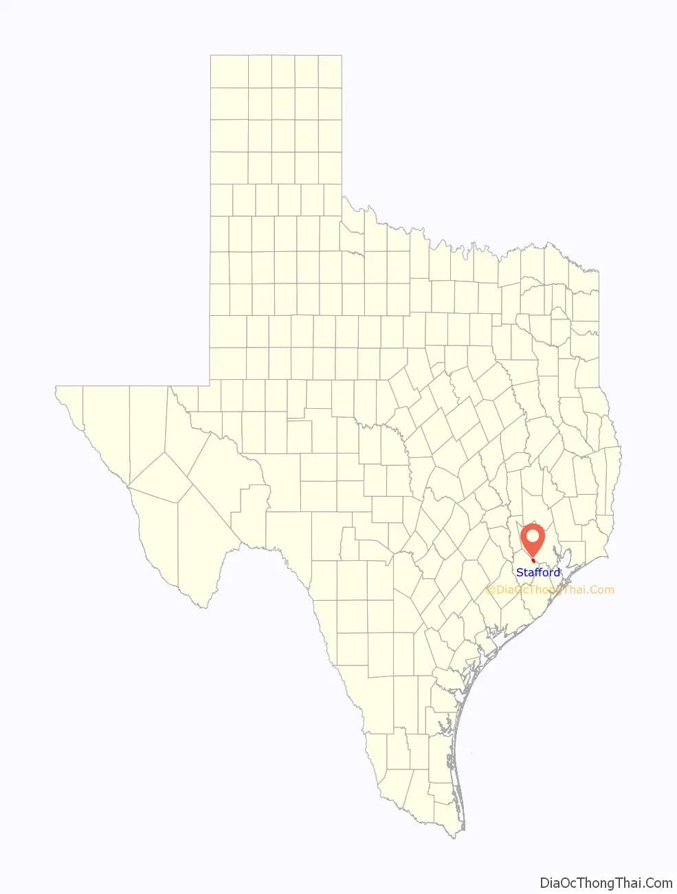
Stafford location map. Where is Stafford city?

History
William Stafford established a plantation with a cane mill and a horse-powered cotton gin in 1830. On April 15, 1836, during the Texas Revolution, the forces of Antonio López de Santa Anna stopped at Stafford’s plantation and ordered it burned. Stafford rebuilt his plantation and resided there until his 1840 death. A settlement called “Stafford’s Point” was established around the plantation; it became a townsite in August 1853, when the Buffalo Bayou, Brazos and Colorado Railway began stopping there. Stafford’s Point had a post office from 1854 to 1869. “Staffordville” had a post office from January 5 to February 26, 1869. The settlement, now known as Stafford, operated a post office from 1869 to 1918; the post office reopened in 1929.
In 1884, Stafford had 50 residents, two general stores, and a grocer. By 1896, it had a population of 300. By 1914, the population fell to 100. In 1931, 320 people lived in Stafford. This increased to 400 in 1946. Stafford incorporated as a city in 1956.
Stafford Road Map

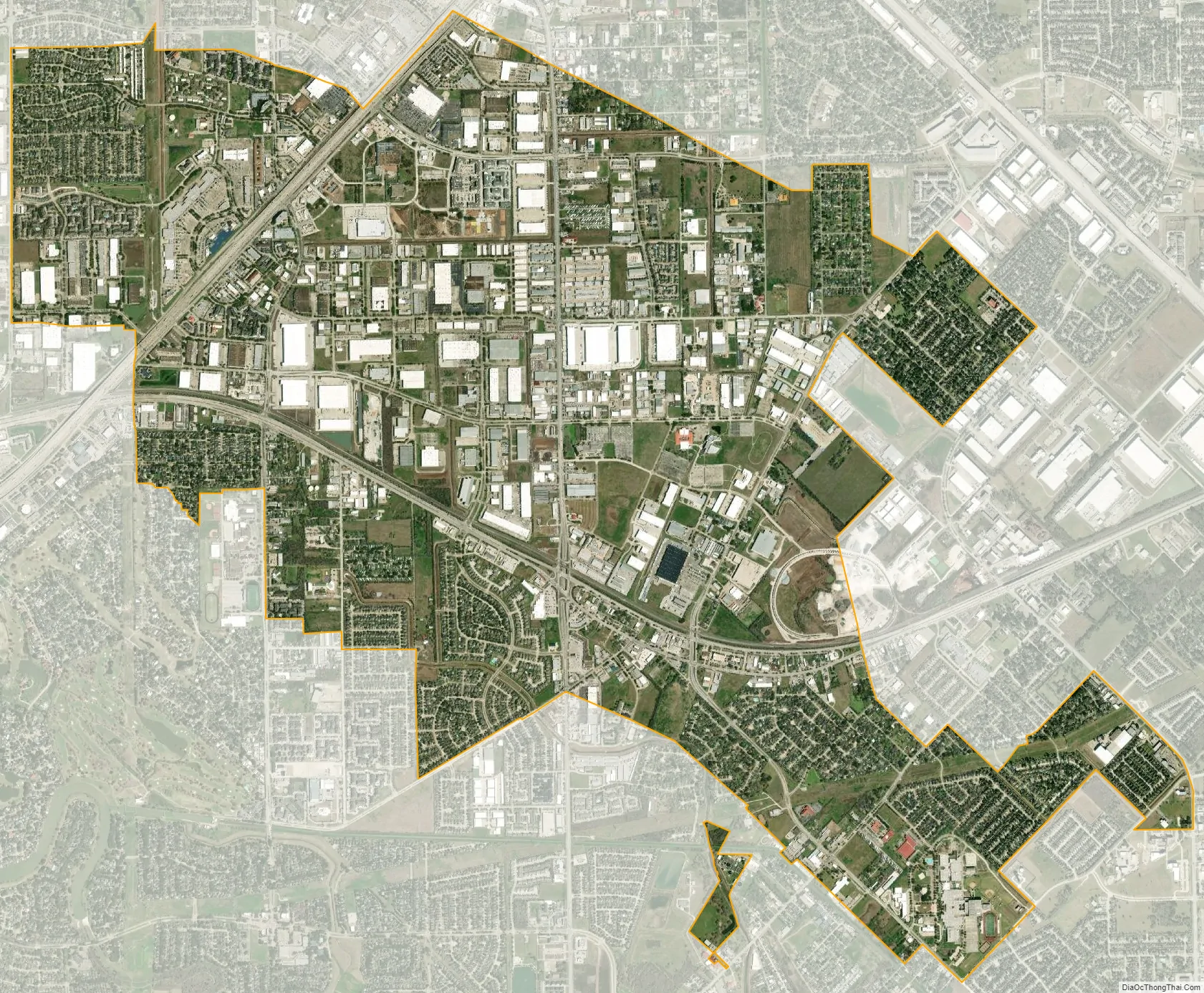
Stafford city Satellite Map
Geography
Stafford is in eastern Fort Bend County at 29°37′27″N 95°33′48″W / 29.62417°N 95.56333°W / 29.62417; -95.56333 (29.624186, –95.563359). A small part of the city extends northeast into Harris County. It is bordered by Houston to the north, Meadows Place to the northwest, Sugar Land to the west, and Missouri City to the south and east.
The Southwest Freeway (Interstate 69) passes through northwest Stafford, leading northeast 16 miles (26 km) to the center of Houston and southwest 18 miles (29 km) to Rosenberg. U.S. 90 Alternate passes through Stafford as Main Street, leading west 5 miles (8 km) to Sugar Land and northeast 18 miles (29 km) to the Houston East End.
According to the United States Census Bureau, Stafford has an area of 7.0 square miles (18.2 km), of which 7.0 square miles (18.1 km) is land and 0.04 square miles (0.1 km), or 0.58%, is water.
Climate
Stafford’s climate is characterized by hot, humid summers and generally mild to cool winters. According to the Köppen climate classification system, Stafford has a humid subtropical climate, Cfa on climate maps.
Extraterritorial jurisdiction
Stafford has two areas of extraterritorial jurisdiction. They are within the Houston Independent School District, including an area at Beltway 8 and Stafford Road and another area between Beltway 8 and Murphy Road. One area within the Alief Independent School District is next to the City of Meadows Place along Interstate 69/U.S. Route 59. Areas in the Fort Bend Independent School District include part of Fifth Street and an area around U.S. Route 90 Alternate, Dulles Avenue, and Avenue E. The City of Stafford has avoided annexing these areas, because doing so would give it territory in school districts other than the Stafford Municipal School District (SMSD) and the city wants its city limits and the SMSD to have the same area. The SMSD cannot annex these areas without the other school districts’ permission.
See also
Map of Texas State and its subdivision:- Anderson
- Andrews
- Angelina
- Aransas
- Archer
- Armstrong
- Atascosa
- Austin
- Bailey
- Bandera
- Bastrop
- Baylor
- Bee
- Bell
- Bexar
- Blanco
- Borden
- Bosque
- Bowie
- Brazoria
- Brazos
- Brewster
- Briscoe
- Brooks
- Brown
- Burleson
- Burnet
- Caldwell
- Calhoun
- Callahan
- Cameron
- Camp
- Carson
- Cass
- Castro
- Chambers
- Cherokee
- Childress
- Clay
- Cochran
- Coke
- Coleman
- Collin
- Collingsworth
- Colorado
- Comal
- Comanche
- Concho
- Cooke
- Coryell
- Cottle
- Crane
- Crockett
- Crosby
- Culberson
- Dallam
- Dallas
- Dawson
- Deaf Smith
- Delta
- Denton
- Dewitt
- Dickens
- Dimmit
- Donley
- Duval
- Eastland
- Ector
- Edwards
- El Paso
- Ellis
- Erath
- Falls
- Fannin
- Fayette
- Fisher
- Floyd
- Foard
- Fort Bend
- Franklin
- Freestone
- Frio
- Gaines
- Galveston
- Garza
- Gillespie
- Glasscock
- Goliad
- Gonzales
- Gray
- Grayson
- Gregg
- Grimes
- Guadalupe
- Hale
- Hall
- Hamilton
- Hansford
- Hardeman
- Hardin
- Harris
- Harrison
- Hartley
- Haskell
- Hays
- Hemphill
- Henderson
- Hidalgo
- Hill
- Hockley
- Hood
- Hopkins
- Houston
- Howard
- Hudspeth
- Hunt
- Hutchinson
- Irion
- Jack
- Jackson
- Jasper
- Jeff Davis
- Jefferson
- Jim Hogg
- Jim Wells
- Johnson
- Jones
- Karnes
- Kaufman
- Kendall
- Kenedy
- Kent
- Kerr
- Kimble
- King
- Kinney
- Kleberg
- Knox
- La Salle
- Lamar
- Lamb
- Lampasas
- Lavaca
- Lee
- Leon
- Liberty
- Limestone
- Lipscomb
- Live Oak
- Llano
- Loving
- Lubbock
- Lynn
- Madison
- Marion
- Martin
- Mason
- Matagorda
- Maverick
- McCulloch
- McLennan
- McMullen
- Medina
- Menard
- Midland
- Milam
- Mills
- Mitchell
- Montague
- Montgomery
- Moore
- Morris
- Motley
- Nacogdoches
- Navarro
- Newton
- Nolan
- Nueces
- Ochiltree
- Oldham
- Orange
- Palo Pinto
- Panola
- Parker
- Parmer
- Pecos
- Polk
- Potter
- Presidio
- Rains
- Randall
- Reagan
- Real
- Red River
- Reeves
- Refugio
- Roberts
- Robertson
- Rockwall
- Runnels
- Rusk
- Sabine
- San Augustine
- San Jacinto
- San Patricio
- San Saba
- Schleicher
- Scurry
- Shackelford
- Shelby
- Sherman
- Smith
- Somervell
- Starr
- Stephens
- Sterling
- Stonewall
- Sutton
- Swisher
- Tarrant
- Taylor
- Terrell
- Terry
- Throckmorton
- Titus
- Tom Green
- Travis
- Trinity
- Tyler
- Upshur
- Upton
- Uvalde
- Val Verde
- Van Zandt
- Victoria
- Walker
- Waller
- Ward
- Washington
- Webb
- Wharton
- Wheeler
- Wichita
- Wilbarger
- Willacy
- Williamson
- Wilson
- Winkler
- Wise
- Wood
- Yoakum
- Young
- Zapata
- Zavala
- Alabama
- Alaska
- Arizona
- Arkansas
- California
- Colorado
- Connecticut
- Delaware
- District of Columbia
- Florida
- Georgia
- Hawaii
- Idaho
- Illinois
- Indiana
- Iowa
- Kansas
- Kentucky
- Louisiana
- Maine
- Maryland
- Massachusetts
- Michigan
- Minnesota
- Mississippi
- Missouri
- Montana
- Nebraska
- Nevada
- New Hampshire
- New Jersey
- New Mexico
- New York
- North Carolina
- North Dakota
- Ohio
- Oklahoma
- Oregon
- Pennsylvania
- Rhode Island
- South Carolina
- South Dakota
- Tennessee
- Texas
- Utah
- Vermont
- Virginia
- Washington
- West Virginia
- Wisconsin
- Wyoming


