Sugar Land is the largest city in Fort Bend County, Texas, United States, located in the southwestern part of the Houston–The Woodlands–Sugar Land metropolitan area. Located about 19 miles (31 km) southwest of downtown Houston, Sugar Land is a populous suburban municipality centered around the junction of Texas State Highway 6 and Interstate 69/U.S. Route 59.
Beginning in the 19th century, the present-day Sugar Land area was home to a large sugar plantation situated in the fertile floodplain of the Brazos River. Following the consolidation of local plantations into Imperial Sugar Company in 1908, Sugar Land grew steadily as a company town and incorporated as a city in 1959. Since then, Sugar Land has grown rapidly alongside other edge cities around Houston, with large-scale development of master-planned communities contributing to population swells since the 1980s.
Sugar Land is one of the most affluent and fastest-growing cities in Texas. Its population increased more than 158% between 1990 and 2000. Between 2000 and 2007, Sugar Land also had a 46% increase in jobs. As of the 2010 census, the city’s population was 78,817. Following the annexation of the Greatwood and New Territory communities in December 2017, the city’s population was estimated at 118,488 as of 2019.
Sugar Land is home to the headquarters of Imperial Sugar; the company’s main sugar refinery and distribution center were once located in the city. The Imperial Sugar crown logo is featured in the city seal and logo.
| Name: | Sugar Land city |
|---|---|
| LSAD Code: | 25 |
| LSAD Description: | city (suffix) |
| State: | Texas |
| County: | Fort Bend County |
| Elevation: | 100 ft (30 m) |
| Total Area: | 42.90 sq mi (111.12 km²) |
| Land Area: | 40.47 sq mi (104.81 km²) |
| Water Area: | 2.44 sq mi (6.31 km²) |
| Total Population: | 111,026 |
| Population Density: | 2,927.94/sq mi (1,130.49/km²) |
| ZIP code: | 77478-79, 77487, 77496, and 77498 |
| Area code: | Mostly 281 also 713, 832, and 346 |
| FIPS code: | 4870808 |
| GNISfeature ID: | 1348034 |
| Website: | www.sugarlandtx.gov |
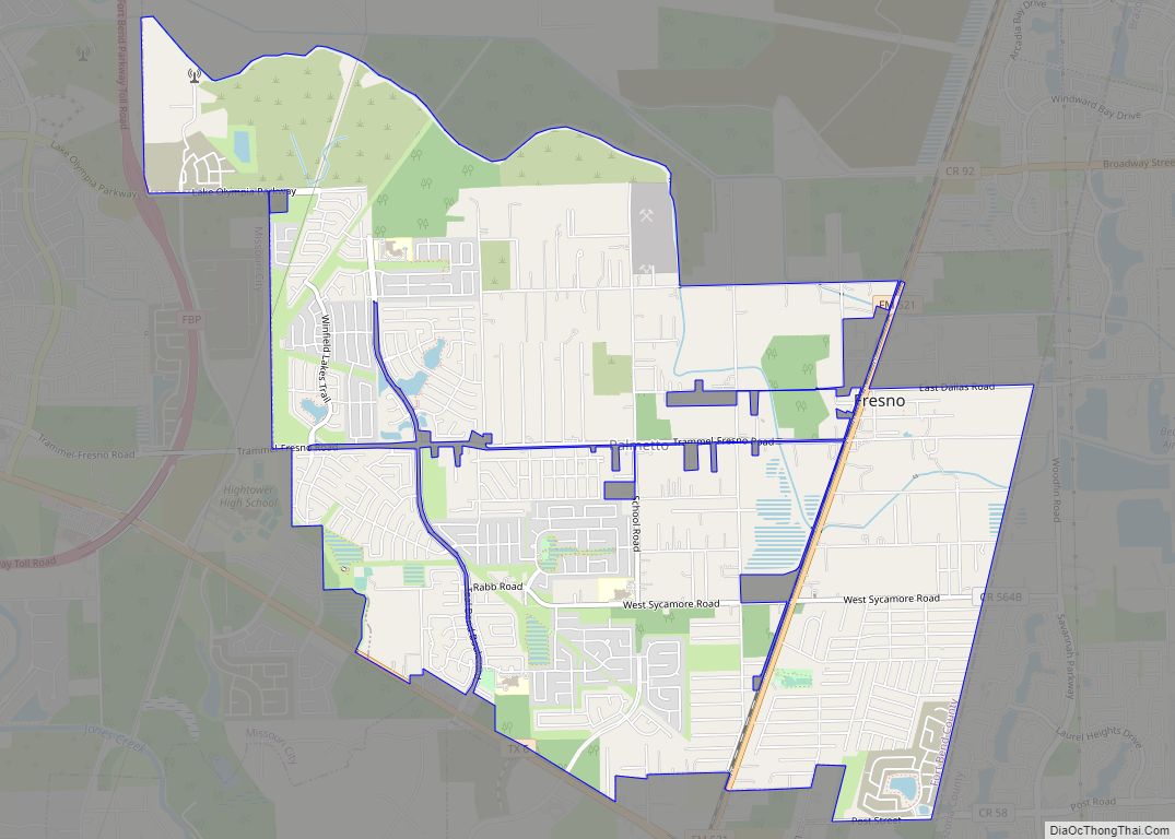
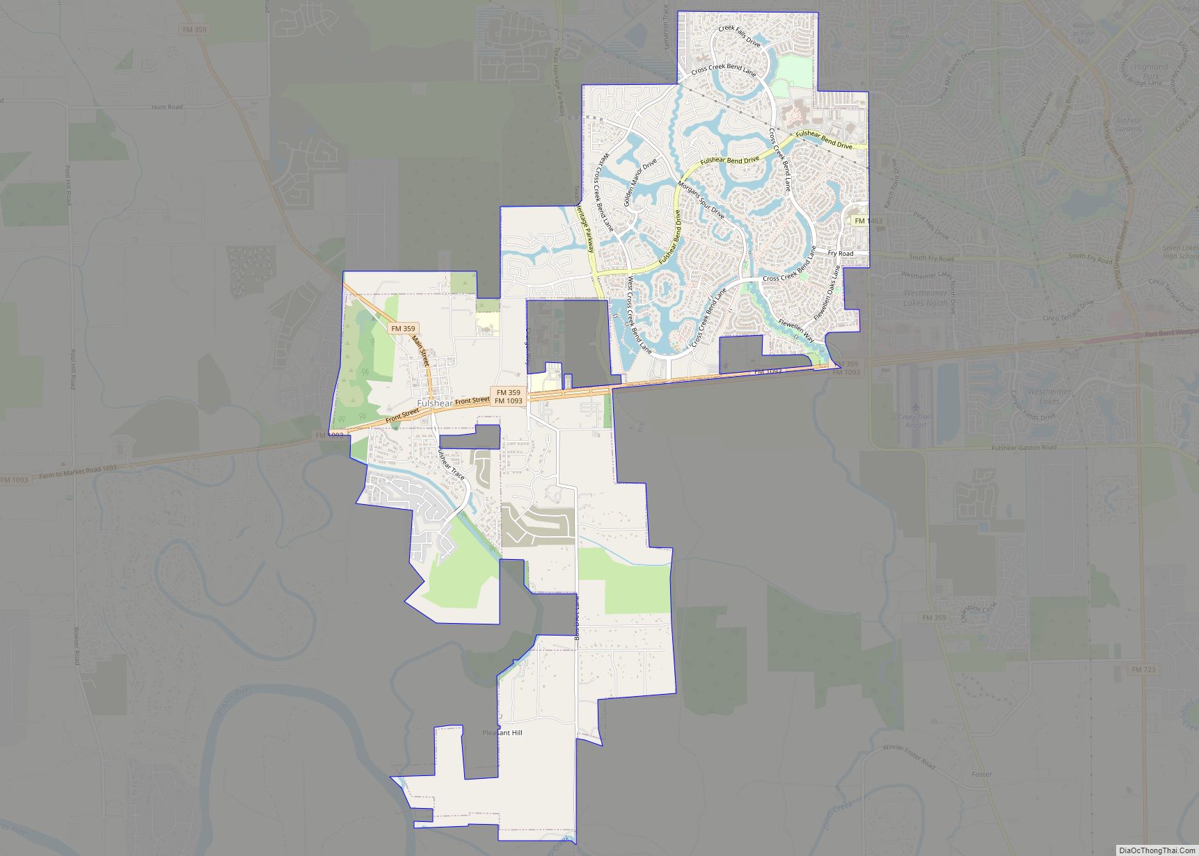
Online Interactive Map
Click on ![]() to view map in "full screen" mode.
to view map in "full screen" mode.
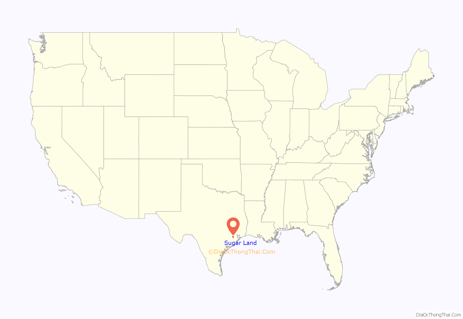
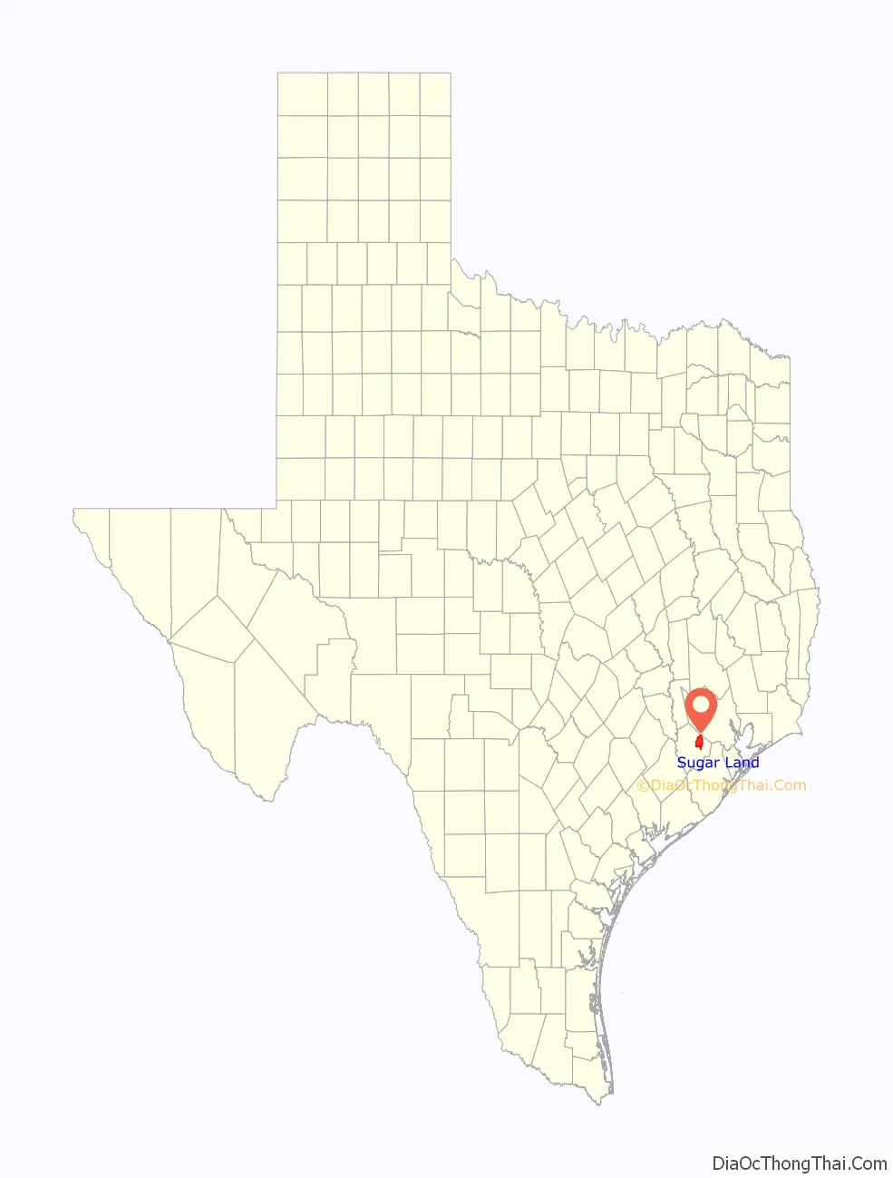
Sugar Land location map. Where is Sugar Land city?
History
Sugar Land’s founding
Sugar Land has roots in the original Mexican land grant made to Anglo-American Stephen F. Austin. One of the first settlers of the land, Samuel M. Williams, called this area “Oakland Plantation”. Williams’ brother, Nathaniel, purchased the land from Austin in 1838. They developed the plantation by growing cotton, corn, and sugarcane.
During these early years, the plantation was the center of social life along the Brazos River. In 1853, Benjamin Terry and William J. Kyle purchased the Oakland Plantation from the Williams family. Terry is known for organizing a division of Texas Rangers during the Civil War and for naming the town.
Upon the deaths of Terry and Kyle, Colonel E. H. Cunningham bought the 12,500-acre (5,100 ha) plantation soon after the Civil War. He had a sugar-refining plant built here, and developed the town around it in 1879, platting the land and attracting settlers during the post-Reconstruction era.
Company town
In 1906, the Kempner family of Galveston, under the leadership of Isaac H. Kempner, and in partnership with Logan J. Copenhaver, purchased the 5,300-acre (2,100 ha) Ellis Plantation, one of the few plantations in Fort Bend County to survive the Civil War. The Ellis Plantation had originally been part of the Jesse Cartwright league; Will Ellis had operated it after the Civil War by a system of tenant farming, made up mostly of African-American families who were previously enslaved on the land.
In 1908, the partnership acquired the adjoining 12,500-acre (5,100 ha) Cunningham Plantation, with its raw-sugar mill and cane-sugar refinery. The partnership changed the name to Imperial Sugar Company; Kempner associated the name “Imperial”, which was also the name of a small raw-sugar mill on the Ellis Plantation, with the Imperial Hotel in New York City.
Around the turn of the 20th century, most of the sugarcane crops were destroyed by a harsh winter. As part of the Kempner-Copenhaver agreement, Copenhaver moved to the site to serve as general manager and build the company-owned town of Sugar Land.
The trains running through Sugar Land are on the route of the oldest railroad in Texas. They run adjacent to the sugar refinery, west of the town, and through the center of what used to be known as the Imperial State Prison Farm. It operated with convict lease labor. Between the end of the Civil War and 1912, more than 3,500 prisoners died in Texas as a result of the racist convict leasing program. Archaeologists have uncovered unmarked graves of African Americans from this period in the region around Sugar Land’s prison and sugar factory. Since the early 21st century, this area has been largely redeveloped as the suburban planned community of Telfair.
As a company town from the 1910s until 1959, Sugar Land was virtually self-contained. Imperial Sugar Company provided housing for the workers, encouraged construction of schools, built a hospital to treat workers, and provided businesses to meet the workers’ needs. Many of the original houses built by the Imperial Sugar Company remain today in The Hill and Mayfield Park areas of Sugar Land, and have been passed down through generations of family members.
During the 1950s, Imperial Sugar wanted to expand the town by building more houses. It developed a new subdivision, Venetian Estates, which featured waterfront homesites on Oyster Creek and on man-made lakes.
Development of city
As the company town expanded, so did the interest of establishing a municipal government. Voters chose to make Sugar Land a general-law city in 1959, with T. E. Harman becoming the first mayor.
In the early 1960s, a new subdivision development called Covington Woods was constructed. Later that year, the Imperial Cattle Ranch sold about 1,200 acres (490 ha) to a developer to create what became Sugar Creek in 1968. As a master-planned community, Sugar Creek introduced the concept of country club living to Sugar Land. Custom houses were built to surround two golf courses, and country clubs, swimming pools, and a private home security service were part of the amenities developed.
The success of Sugar Creek, buoyed by the construction of U.S. Highway 59, quickly made Sugar Land’s vast farmlands attractive to real-estate developers for residential housing. In 1977, development began on First Colony, a master-planned community encompassing 10,000 acres (4,000 ha). Developed by a Gerald Hines-led consortium that became known as Sugarland Properties Inc., development on First Colony would continue over the next 30 years. The master-planned community offered homebuyers formal landscaping, neighborhoods segmented by price range, extensive green belts, a golf course and country club, lakes and boulevards, neighborhood amenities, and shopping.
Around the same time as First Colony, another master-planned community development called Sugar Mill was started in the northern portion of Sugar Land, offering traditional, lakefront, and estate lots. The master-planned communities of Greatwood and New Territory, at the time situated west of the city in what was then its extraterritorial jurisdiction, also began to be developed by the end of the 1980s.
In addition to the development of master-planned communities targeted at commuters from Houston, Sugar Land began attracting the attention of major corporations throughout the 1980s. Many chose to base their operations in the city. Fluor Daniel, Schlumberger, Unocal, and others began to locate offices and facilities in the city. This resulted in a favorable 40/60 ratio of residential to commercial tax base within the city.
In 1981, a special city election was held for the purpose of establishing a home-rule municipal government. Voters approved the adoption of a home-rule charter, which established a mayor-council form of government, with all powers of the city vested in a council composed of a mayor and five councilmen, elected from single-member districts.
A special city election was held August 9, 1986, to submit the proposed changes to the electorate for consideration. By a majority of the voters, amendments to the charter were approved that provided for a change in the city’s form of government from that of “mayor-council” (strong mayor) to that of a “council-manager” form of government, which provides for a professional city manager to be the chief administrative officer of the city. Approval of this amendment authorized the mayor to be a voting member of council, in addition to performing duties as presiding officer of the council.
Sugar Land annexed Sugar Creek in 1986, after the latter community was nearly built-out. That same year, the city organized the largest celebration in its history, the Texas Sesquicentennial Celebration, celebrating 150 years of Texan independence from Mexican rule (DGA).
Suburban expansion
An amendment on May 5, 1990, changed the composition of the city council, adding a mayor and two council members, each to be elected at-large, to the five-member council. The at-large positions require election by a majority of voters, which reduces representation of any minority interests.
Throughout much of the 1990s, Sugar Land grew rapidly. The majority of residents are white-collar and college-educated, working in Houston’s energy industry. An abundance of commercial development, with numerous low-rise office buildings, banks, and high-class restaurants, has taken place along both Interstate 69/U.S. Highway 59 and State Highway 6.
Sugar Land added to its tax base with the opening of First Colony Mall in 1996. The more than one-million-square-foot (100,000 m) mall, the first in Fort Bend County, is located at the busiest intersection of the city: Interstate 69/U.S. 59 and State Highway 6. The mall was named after the 10,000-acre (4,000 ha) master-planned community of First Colony.
In November 1997, Sugar Land annexed the remaining municipal utility districts of the 10,000-acre (4,000 ha) First Colony master-planned community, bringing the city’s population to almost 60,000. This was Sugar Land’s largest annexation at the time.
After 2000
Sugar Land boasted the highest growth among Texas’ largest cities, per the U.S. Census 2000, when it had a population of 63,328. In 2003, Sugar Land became a “principal” city, recognized in the metropolitan area’s official title change to Houston–Sugar Land–Baytown, with Sugar Land replacing Galveston as the second-most important city in the metropolitan area after Houston. The metro area is now officially referred to as the Houston-The Woodlands-Sugar Land metropolitan area.
With its population increase, the city needed to attract higher education facilities. In 2002, the University of Houston System at Fort Bend moved to a new 250-acre (100 ha) campus located off the University Boulevard and Interstate 69/U.S. 59 intersection. The city helped fund the Albert and Mamie George Building, and as a result, the multi-institution teaching center was renamed as the University of Houston Sugar Land.
In 2003, the Imperial Sugar Company refinery plant and distribution center were closed, but the effect on the local economy was minimal. Sugar Land has become an affluent Houston suburb rather than the blue-collar, agriculture-dependent town it was a generation ago. Many of its lower-income residents, including African American workers who at one time made up the majority working sugarcane, have been displaced and have had to seek work and housing elsewhere. The company maintains its headquarters in Sugar Land.
The Texas Department of Transportation sold 2,018 acres (817 ha) of prison land in the western portion of Sugar Land to Newland Communities, a developer, by bid in 2003. The developer announced plans to build a new master-planned community called Telfair in this location. In July 2004, Sugar Land annexed all of this land into the city limits to control the quality of development, extending the city limits westward. This was unusual, since Sugar Land had earlier annexed only built-out areas, not lands prior to development.
In December 2005, Sugar Land annexed the recently built-out, master-planned community of Avalon and four sections of Brazos Landing subdivision, adding about 3,200 residents. The city eventually annexed the communities of River Park, Greatwood, and New Territory, with the latter two being annexed on December 12, 2017, bringing the city proper’s population to 117,869.
In the 2010s, development began on the Imperial master-planned community, located in undeveloped territory east of Sugar Land Regional Airport and incorporating the former refinery property of Imperial Sugar Company. This development includes Constellation Field, home of the Sugar Land Space Cowboys, originally an independent baseball team but later a member of affiliated Minor League Baseball. Retail needs are to be served in the planned Imperial Market development. In 2017, the 6,400-seat Smart Financial Centre concert hall opened its doors.
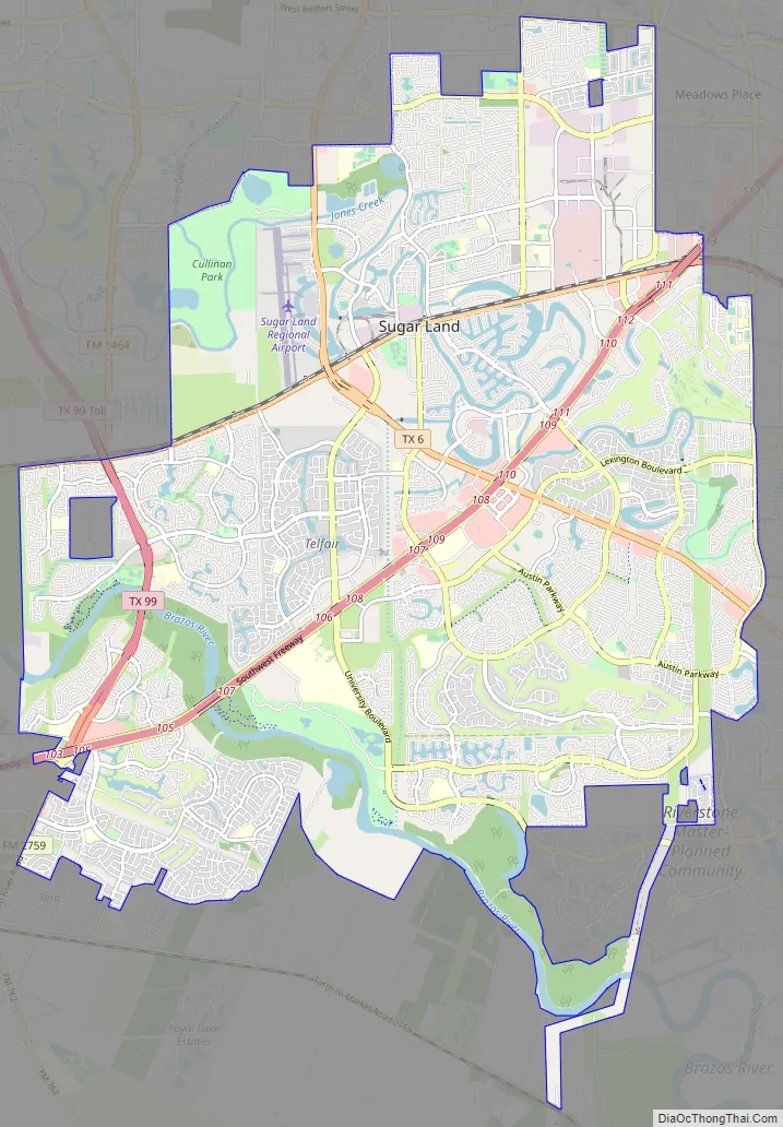
Sugar Land Road Map
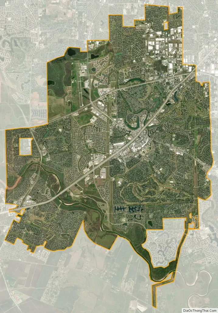
Sugar Land city Satellite Map
Geography
Geography
Sugar Land is located in northeast Fort Bend County, 20 miles (32 km) southwest of downtown Houston. It is bordered by Houston to the northeast, and by Stafford, Missouri City, and Meadows Place to the east. According to the United States Census Bureau, the city of Sugar Land has a total area of 34.0 square miles (88.1 km), of which 32.4 square miles (83.9 km) are land and 1.6 square miles (4.2 km), or 4.82%, are covered by water. The elevation of most of the city is between 70 and 90 feet (21 and 27 m) above sea level. The elevation of Sugar Land Regional Airport (SGR) is 82 feet (25 m).
Sugar Land has two major waterways running through the city. The southwestern and southern portion of the city were developed along the Brazos River, which runs into Brazoria County. Oyster Creek runs from the northwest to the eastern portion of the city limits and into Missouri City. Sugar Land developers have built many artificial lakes connecting to Oyster Creek or the Brazos River, as part of new master-planned communities.
Sugar Land and other surrounding areas are subsiding and the rate of subsidence is increasing. The area sunk about 1 foot between 1943 and 1964, while it sunk over 6 feet between 1988 and 2016 Currently, it is estimated that Sugar Land is subsiding at a rate of between 10 and 25 millimeters per year. The subsidence is exacerbated by Climate Change, increased suburban development, and inadequate replenishment. The subsidence has significant human cost. For example, the historic flooding caused by Hurricane Harvey was worse than it would have otherwise been due to the effect, and houses and buildings in the city are sinking and having their foundations damaged. To manage the rapidly increasing subsidence, the Texas State Legislature created the Fort Bend Subsidence District in 1989. The US Geologic Survey and the US Army Corps of Engineers have performed studies and monitoring of the subsidence.
Hydrology
Sugar Land sits atop three aquifers: Chicot, Evangeline, and Jasper. The Chicot and Evangeline Aquifers have been the primary source of municipal water for Sugar Land, Houston, Galveston and other surrounding areas. The Jasper Aquifer is the only one of the three that is not used to extract drinking water. Due to the rapid building of suburbs in the city and surrounding region, aquifer replenishment has significantly decreased. The city government has enacted a program to manage the aquifers.
Geology
Underpinning the area’s land surface are unconsolidated clays, clay shales, and poorly cemented sands, extending to depths of several miles. The region’s geology developed from stream deposits from the erosion of the Rocky Mountains. These sediments consist of a series of sands and clays deposited on decaying organic matter that, over time, were transformed into oil and natural gas. Beneath these tiers is a water-deposited layer of halite, a rock salt. The porous layers were compressed over time and forced upward. As it pushed upward, the salt dragged surrounding sediments into dome shapes, often trapping oil and gas that seeped from the surrounding porous sands.
The region is earthquake-free. While the neighboring city of Houston contains 86 mapped and historically active surface faults with an aggregate length of 149 miles (240 km), the clay below the surface in Sugar Land precludes the buildup of friction that produces ground shaking in earthquakes. These faults move only very gradually in what is termed “fault creep”.
Climate
Sugar Land’s climate is classified as being humid subtropical, featuring two seasons, a wet season from April to October, and a dry season from November to March. The city is located in the Gulf coastal plains biome, and the vegetation is classified as a temperate grassland. The average yearly precipitation is 48 inches. Prevailing winds are from the south and southeast during most of the year, bringing heat and moisture from the Gulf of Mexico.
In the summer, daily high temperatures are in the 95 °F (35 °C) range throughout much of July and August. The air tends to feel still and the abundant humidity, with dewpoints typically in the low to mid 70°Fs, creates a heat index around 100 °F each day. Summer thunderstorms are common with 30 to 50% of the days having thunder. The highest temperature recorded in the area was 109 °F in September 2000.
Winters in the area are cool and mild. The average winter high/low is 62/45 °F (16/7 °C). The coldest period is usually in January, when north winds bring winter rains. Snow is almost unheard of and typically does not accumulate. One such rare snowstorm hit Houston on Christmas Eve 2004. A few inches accumulated, but had melted by the next afternoon. The earliest snowfall to occur in any winter fell on December 4, 2009.
See also
Map of Texas State and its subdivision:- Anderson
- Andrews
- Angelina
- Aransas
- Archer
- Armstrong
- Atascosa
- Austin
- Bailey
- Bandera
- Bastrop
- Baylor
- Bee
- Bell
- Bexar
- Blanco
- Borden
- Bosque
- Bowie
- Brazoria
- Brazos
- Brewster
- Briscoe
- Brooks
- Brown
- Burleson
- Burnet
- Caldwell
- Calhoun
- Callahan
- Cameron
- Camp
- Carson
- Cass
- Castro
- Chambers
- Cherokee
- Childress
- Clay
- Cochran
- Coke
- Coleman
- Collin
- Collingsworth
- Colorado
- Comal
- Comanche
- Concho
- Cooke
- Coryell
- Cottle
- Crane
- Crockett
- Crosby
- Culberson
- Dallam
- Dallas
- Dawson
- Deaf Smith
- Delta
- Denton
- Dewitt
- Dickens
- Dimmit
- Donley
- Duval
- Eastland
- Ector
- Edwards
- El Paso
- Ellis
- Erath
- Falls
- Fannin
- Fayette
- Fisher
- Floyd
- Foard
- Fort Bend
- Franklin
- Freestone
- Frio
- Gaines
- Galveston
- Garza
- Gillespie
- Glasscock
- Goliad
- Gonzales
- Gray
- Grayson
- Gregg
- Grimes
- Guadalupe
- Hale
- Hall
- Hamilton
- Hansford
- Hardeman
- Hardin
- Harris
- Harrison
- Hartley
- Haskell
- Hays
- Hemphill
- Henderson
- Hidalgo
- Hill
- Hockley
- Hood
- Hopkins
- Houston
- Howard
- Hudspeth
- Hunt
- Hutchinson
- Irion
- Jack
- Jackson
- Jasper
- Jeff Davis
- Jefferson
- Jim Hogg
- Jim Wells
- Johnson
- Jones
- Karnes
- Kaufman
- Kendall
- Kenedy
- Kent
- Kerr
- Kimble
- King
- Kinney
- Kleberg
- Knox
- La Salle
- Lamar
- Lamb
- Lampasas
- Lavaca
- Lee
- Leon
- Liberty
- Limestone
- Lipscomb
- Live Oak
- Llano
- Loving
- Lubbock
- Lynn
- Madison
- Marion
- Martin
- Mason
- Matagorda
- Maverick
- McCulloch
- McLennan
- McMullen
- Medina
- Menard
- Midland
- Milam
- Mills
- Mitchell
- Montague
- Montgomery
- Moore
- Morris
- Motley
- Nacogdoches
- Navarro
- Newton
- Nolan
- Nueces
- Ochiltree
- Oldham
- Orange
- Palo Pinto
- Panola
- Parker
- Parmer
- Pecos
- Polk
- Potter
- Presidio
- Rains
- Randall
- Reagan
- Real
- Red River
- Reeves
- Refugio
- Roberts
- Robertson
- Rockwall
- Runnels
- Rusk
- Sabine
- San Augustine
- San Jacinto
- San Patricio
- San Saba
- Schleicher
- Scurry
- Shackelford
- Shelby
- Sherman
- Smith
- Somervell
- Starr
- Stephens
- Sterling
- Stonewall
- Sutton
- Swisher
- Tarrant
- Taylor
- Terrell
- Terry
- Throckmorton
- Titus
- Tom Green
- Travis
- Trinity
- Tyler
- Upshur
- Upton
- Uvalde
- Val Verde
- Van Zandt
- Victoria
- Walker
- Waller
- Ward
- Washington
- Webb
- Wharton
- Wheeler
- Wichita
- Wilbarger
- Willacy
- Williamson
- Wilson
- Winkler
- Wise
- Wood
- Yoakum
- Young
- Zapata
- Zavala
- Alabama
- Alaska
- Arizona
- Arkansas
- California
- Colorado
- Connecticut
- Delaware
- District of Columbia
- Florida
- Georgia
- Hawaii
- Idaho
- Illinois
- Indiana
- Iowa
- Kansas
- Kentucky
- Louisiana
- Maine
- Maryland
- Massachusetts
- Michigan
- Minnesota
- Mississippi
- Missouri
- Montana
- Nebraska
- Nevada
- New Hampshire
- New Jersey
- New Mexico
- New York
- North Carolina
- North Dakota
- Ohio
- Oklahoma
- Oregon
- Pennsylvania
- Rhode Island
- South Carolina
- South Dakota
- Tennessee
- Texas
- Utah
- Vermont
- Virginia
- Washington
- West Virginia
- Wisconsin
- Wyoming