Taylor is a city in Williamson County, Texas, United States. The population was 13,575 at the 2000 census; it was 15,191 at the 2010 census; it was 16,267 at the 2020 census.
| Name: | Taylor city |
|---|---|
| LSAD Code: | 25 |
| LSAD Description: | city (suffix) |
| State: | Texas |
| County: | Williamson County |
| Elevation: | 564 ft (172 m) |
| Total Area: | 20.62 sq mi (53.40 km²) |
| Land Area: | 20.50 sq mi (53.10 km²) |
| Water Area: | 0.11 sq mi (0.29 km²) |
| Total Population: | 16,267 |
| Population Density: | 847.79/sq mi (327.34/km²) |
| ZIP code: | 76574 |
| Area code: | 512 & 737 |
| FIPS code: | 4871948 |
| GNISfeature ID: | 1369631 |
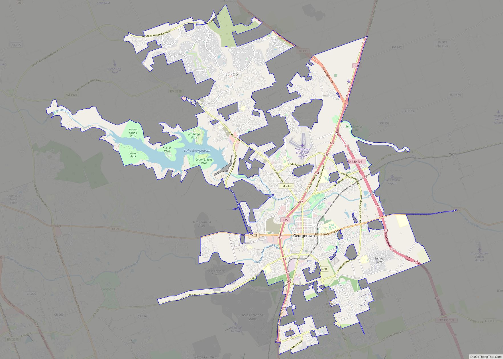
Online Interactive Map
Click on ![]() to view map in "full screen" mode.
to view map in "full screen" mode.
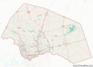
Taylor location map. Where is Taylor city?


History
In 1876, the Texas Land Company auctioned lots in anticipation of the arrival of the International-Great Northern Railroad when Taylor was founded that year. The city was named after Edward Moses Taylor, a railroad official, under the name Taylorsville, which officially became Taylor in 1892. Immigrants from Moravia and Bohemia (now the Czech Republic) and other Slavic states, as well as from Germany and Austria, helped establish the town. It soon became a busy shipping point for cattle, grain, and cotton.
By 1878, the town had 1,000 residents and 32 businesses, 29 of which were destroyed by fire in 1879. Recovery was rapid, however, and more substantial buildings were constructed. In 1882, the Taylor, Bastrop and Houston Railway (later part of the Missouri-Kansas-Texas Railroad) reached the community, and machine shops and a roundhouse served both rail lines. In 1882, the town was incorporated with a mayor-council form of city government, and in 1883, a public school system replaced a number of private schools.
By 1890, Taylor had two banks and the first savings and loan institution in Texas. An electric company, a cotton compress, and several newspapers were among the new enterprises. A water line from the San Gabriel River, a 100-man volunteer fire department, imported and local entertainment, and an annual fair made noteworthy news items by 1900.
Since 1900, Taylor’s population growth has averaged roughly 128 new residents per year, based on an estimated population of 1100 in 1900. Between 2000 and 2010, the population grew 11.9%, from 13,575 to 15,191, about 1.2% per year.
On September 9 and 10, 1921, eighty-seven people in and around Taylor were killed in flooding of the San Gabriel River and Brushy Creek after 39.7 inches (1,010 mm) of rain fell in 36 hours on Williamson County.
Taylor Road Map

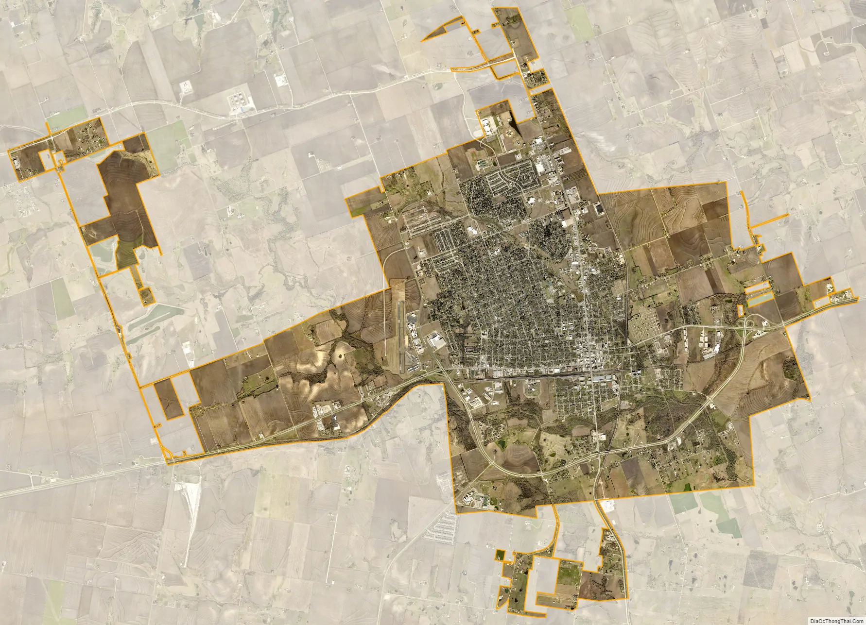
Taylor city Satellite Map
Geography
Taylor is located at 30°34′21″N 97°25′00″W / 30.572371°N 97.416546°W / 30.572371; -97.416546Coordinates: 30°34′21″N 97°25′00″W / 30.572371°N 97.416546°W / 30.572371; -97.416546 (30.572371, –97.416546), about 9 miles east of Hutto, 8 miles south of Granger, and about 29 miles northeast of Austin.
According to the United States Census Bureau, the city has a total area of 13.6 square miles (35.1 km), of which 13.5 square miles (35.0 km) of it are land and 0.04 square miles (0.1 km) of it (0.22%) is covered by water.
Climate
The climate in this area is characterized by hot, humid summers and generally mild to cool winters. According to the Köppen climate classification, Taylor has a humid subtropical climate, Cfa on climate maps.
See also
Map of Texas State and its subdivision:- Anderson
- Andrews
- Angelina
- Aransas
- Archer
- Armstrong
- Atascosa
- Austin
- Bailey
- Bandera
- Bastrop
- Baylor
- Bee
- Bell
- Bexar
- Blanco
- Borden
- Bosque
- Bowie
- Brazoria
- Brazos
- Brewster
- Briscoe
- Brooks
- Brown
- Burleson
- Burnet
- Caldwell
- Calhoun
- Callahan
- Cameron
- Camp
- Carson
- Cass
- Castro
- Chambers
- Cherokee
- Childress
- Clay
- Cochran
- Coke
- Coleman
- Collin
- Collingsworth
- Colorado
- Comal
- Comanche
- Concho
- Cooke
- Coryell
- Cottle
- Crane
- Crockett
- Crosby
- Culberson
- Dallam
- Dallas
- Dawson
- Deaf Smith
- Delta
- Denton
- Dewitt
- Dickens
- Dimmit
- Donley
- Duval
- Eastland
- Ector
- Edwards
- El Paso
- Ellis
- Erath
- Falls
- Fannin
- Fayette
- Fisher
- Floyd
- Foard
- Fort Bend
- Franklin
- Freestone
- Frio
- Gaines
- Galveston
- Garza
- Gillespie
- Glasscock
- Goliad
- Gonzales
- Gray
- Grayson
- Gregg
- Grimes
- Guadalupe
- Hale
- Hall
- Hamilton
- Hansford
- Hardeman
- Hardin
- Harris
- Harrison
- Hartley
- Haskell
- Hays
- Hemphill
- Henderson
- Hidalgo
- Hill
- Hockley
- Hood
- Hopkins
- Houston
- Howard
- Hudspeth
- Hunt
- Hutchinson
- Irion
- Jack
- Jackson
- Jasper
- Jeff Davis
- Jefferson
- Jim Hogg
- Jim Wells
- Johnson
- Jones
- Karnes
- Kaufman
- Kendall
- Kenedy
- Kent
- Kerr
- Kimble
- King
- Kinney
- Kleberg
- Knox
- La Salle
- Lamar
- Lamb
- Lampasas
- Lavaca
- Lee
- Leon
- Liberty
- Limestone
- Lipscomb
- Live Oak
- Llano
- Loving
- Lubbock
- Lynn
- Madison
- Marion
- Martin
- Mason
- Matagorda
- Maverick
- McCulloch
- McLennan
- McMullen
- Medina
- Menard
- Midland
- Milam
- Mills
- Mitchell
- Montague
- Montgomery
- Moore
- Morris
- Motley
- Nacogdoches
- Navarro
- Newton
- Nolan
- Nueces
- Ochiltree
- Oldham
- Orange
- Palo Pinto
- Panola
- Parker
- Parmer
- Pecos
- Polk
- Potter
- Presidio
- Rains
- Randall
- Reagan
- Real
- Red River
- Reeves
- Refugio
- Roberts
- Robertson
- Rockwall
- Runnels
- Rusk
- Sabine
- San Augustine
- San Jacinto
- San Patricio
- San Saba
- Schleicher
- Scurry
- Shackelford
- Shelby
- Sherman
- Smith
- Somervell
- Starr
- Stephens
- Sterling
- Stonewall
- Sutton
- Swisher
- Tarrant
- Taylor
- Terrell
- Terry
- Throckmorton
- Titus
- Tom Green
- Travis
- Trinity
- Tyler
- Upshur
- Upton
- Uvalde
- Val Verde
- Van Zandt
- Victoria
- Walker
- Waller
- Ward
- Washington
- Webb
- Wharton
- Wheeler
- Wichita
- Wilbarger
- Willacy
- Williamson
- Wilson
- Winkler
- Wise
- Wood
- Yoakum
- Young
- Zapata
- Zavala
- Alabama
- Alaska
- Arizona
- Arkansas
- California
- Colorado
- Connecticut
- Delaware
- District of Columbia
- Florida
- Georgia
- Hawaii
- Idaho
- Illinois
- Indiana
- Iowa
- Kansas
- Kentucky
- Louisiana
- Maine
- Maryland
- Massachusetts
- Michigan
- Minnesota
- Mississippi
- Missouri
- Montana
- Nebraska
- Nevada
- New Hampshire
- New Jersey
- New Mexico
- New York
- North Carolina
- North Dakota
- Ohio
- Oklahoma
- Oregon
- Pennsylvania
- Rhode Island
- South Carolina
- South Dakota
- Tennessee
- Texas
- Utah
- Vermont
- Virginia
- Washington
- West Virginia
- Wisconsin
- Wyoming