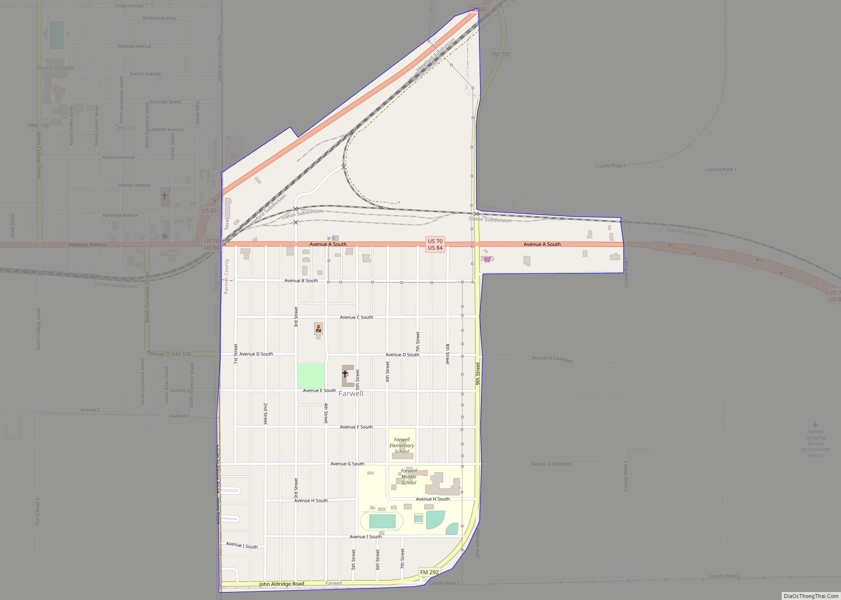
Farwell is a city in and the county seat of Parmer County, Texas, United States. Its population was 1,363 at the 2010 census. The city is located on the Texas-New Mexico border with the city of Texico, New Mexico across the border.
| Name: | Farwell city |
|---|---|
| LSAD Code: | 25 |
| LSAD Description: | city (suffix) |
| State: | Texas |
| County: | Parmer County |
| Elevation: | 4,144 ft (1,263 m) |
| Total Area: | 0.82 sq mi (2.13 km²) |
| Land Area: | 0.82 sq mi (2.13 km²) |
| Water Area: | 0.00 sq mi (0.00 km²) |
| Total Population: | 1,363 |
| Population Density: | 1,572/sq mi (607/km²) |
| ZIP code: | 79325 |
| Area code: | 806 |
| FIPS code: | 4825548 |
| GNISfeature ID: | 1357260 |
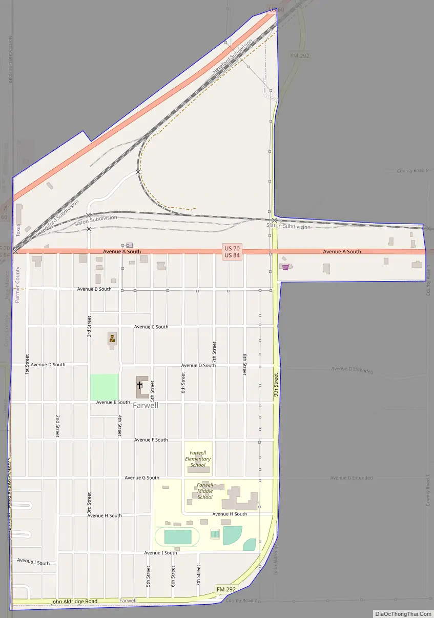
Online Interactive Map
Click on ![]() to view map in "full screen" mode.
to view map in "full screen" mode.
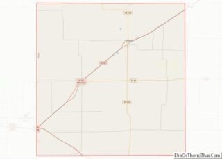
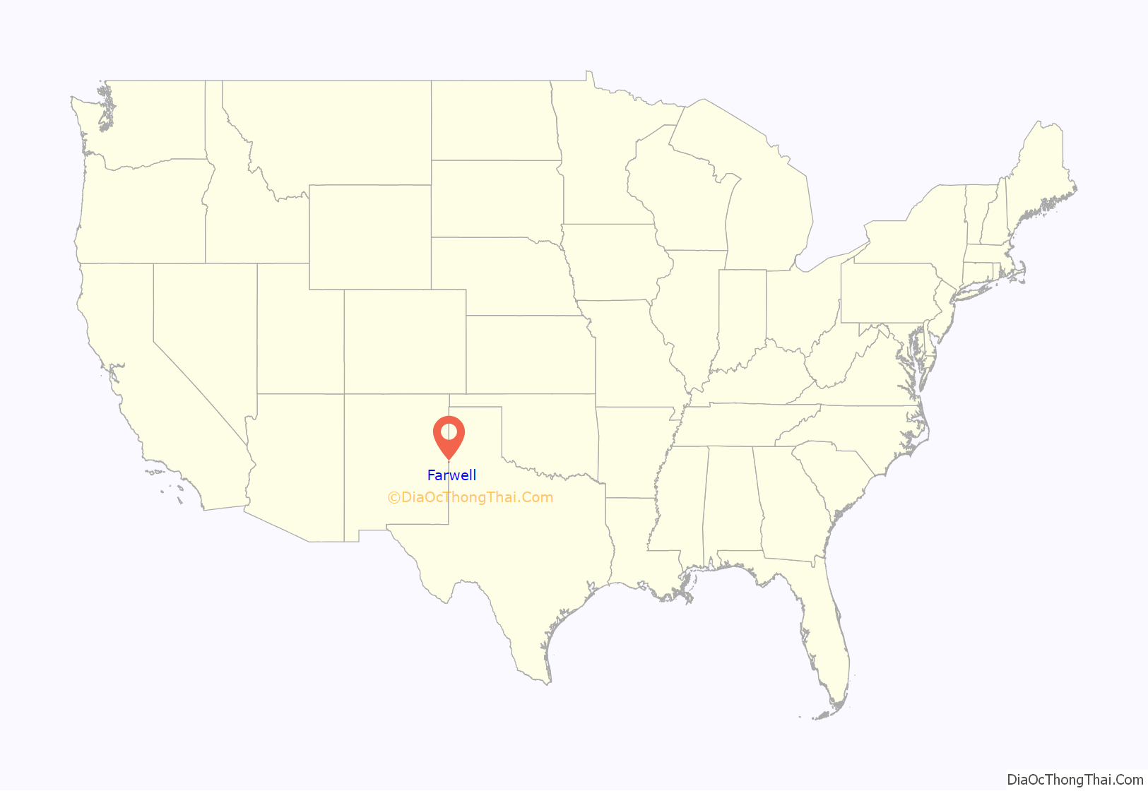
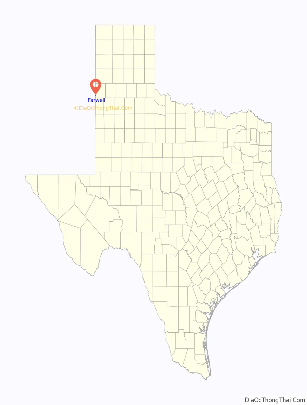
Farwell location map. Where is Farwell city?
History
Farwell began as a cow camp for the XIT Ranch, a huge ranch that was established in 1880. Farwell was named for brothers Charles B. and John V. Farwell of Lake Forest, Illinois, who built the Texas State Capitol building in exchange for 3,050,000 acres of ranchland. That region of Texas had been controlled by the Comanche from about 1725, when they defeated the Apache and forced them to migrate to the [Sierra Blanca range] in New Mexico and to other regions [the southern most point of the Rockies is near Santa Fe]. The Red River War of 1874–1875—the biggest military operation the U.S. had between the Civil War and World War One—had five armies converge on that part of the High Plains, ultimately defeating the main Comanche force in Palo Duro Canyon (80 mi northeast of Farwell) by driving off and slaughtering the Comanches’ horses.
The Farwell brothers established the XIT on their new land, ultimately employing 800 cowboys, stringing over 6,000 miles of barbed wire, and hiring former Texas Rangers to defeat the hundreds of cattle rustlers operating across the state line in the New Mexico territory. Many researchers hold that the XIT ultimately failed because of that massive rustling operation, ultimately persuading stockholders to begin selling off the ranch to families who came to that part of the High Plains drawn by the cheap price of land. When the cow camp that would become Farwell was established is not documented, but when Parmer County was created in 1907 (previously part of Deaf Smith County to its north), the election was held for county seat in a contest among Farwell, Bovina, Parmerton, and Friona, all to Farwell’s northeast, all which had started as cow camps, but had varying success thus far in attracting settlers who ran saloons, stores, stables, and other services for the cowboys. Parmerton was initially voted county seat that year, and a one-story courthouse was built there.
The election was hotly contested by politicians in the other towns, so a new vote was scheduled. Cowboys, who were the largest demographic, lived in their saddles and sleeping bags most of the time, with no fixed address. A new regulation was established that each man would vote in the place where he did his laundry. Farwell, possessing the only laundry at that time, thus received all the cowboy votes, though Friona was, and remains, about four times the size of Farwell, so Farwell became county seat in the 1908 vote. The Farwell courthouse was erected quickly thereafter. When the decision was made to begin selling off the XIT to settlers, they would arrive in Farwell on the railroad, which had reached there in 1899, linking rail to the east with rail to the west of the Rockies Mountains via the track laid between Farwell and Belen, New Mexico. Families from across America arrived by train, stayed in the four-story Farwell Hotel, and toured the available homestead sites by touring cars.
Many of the families then traveled to Farwell and the rest of the region in covered wagons and established their homes in dugouts in the prairie soil (no stone or trees indigenous to the area were available for construction). Dry-land farming and herding were always risky, but families persevered year by year, often relying entirely on their small windmill pumping enough water for the home, a milk cow, some chickens, a few fruit trees, and vegetable gardens when crops and cattle withered during droughts and wind storms.
When the premier historian of U.S. western history, Walter Prescott Webb, wrote that the American character sprang from the unforgiving conditions of the High Plains, he could have had Farwell and its surrounding ranchers and farmers in mind.
Farwell Road Map
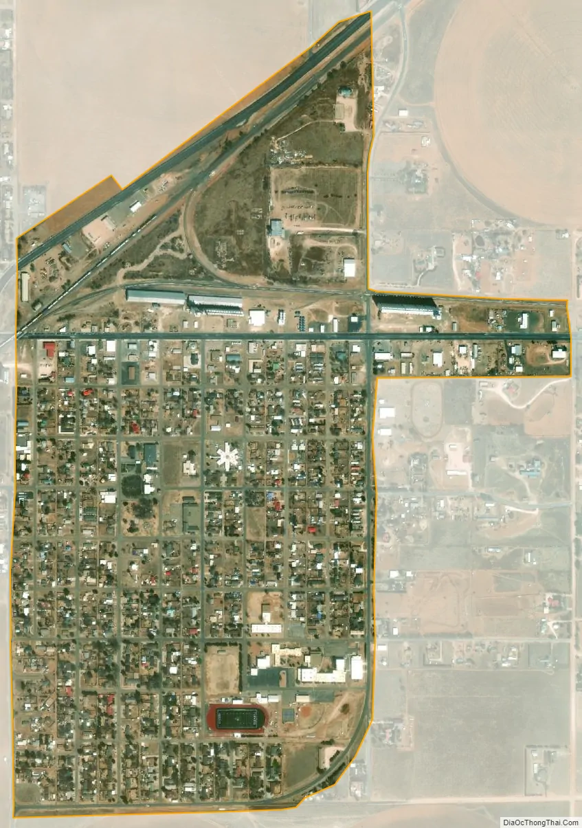
Farwell city Satellite Map
Geography
Farwell lies on the level plains of the Llano Estacado at 34°22′59″N 103°2′18″W / 34.38306°N 103.03833°W / 34.38306; -103.03833 (34.382919, –103.038339). According to the United States Census Bureau, the city has a total area of 0.8 square miles (2.1 km), all of it land.
It is located 10 miles (16 km) east of Clovis, New Mexico, 88 miles (142 km) northwest of Lubbock, Texas, and 95 mi (152.888 km) southwest of Amarillo, Texas. It lies at the junction of two branches of the BNSF Railway from Belen. One branch goes northeast toward Amarillo and the Midwest; the other southeast toward Lubbock and the Texas Gulf Coast.
For years, a dispute had been simmering over which state Farwell (and her sister city on the other side of the state line, Texico) is lawfully a part of: Texas or New Mexico. The straight north–south border between the two states was originally defined as the 103rd meridian, but the 1859 survey that was supposed to mark that boundary mistakenly set the border between 2.29 and 3.77 miles too far west of that line, making the current towns of Farwell, Texline and a part of Glenrio appear to be within Texas. New Mexico’s short border with Oklahoma, in contrast, was surveyed on the correct meridian. New Mexico’s draft constitution in 1910 stated that the border is on the 103rd meridian as intended. The disputed strip, hundreds of miles long, includes parts of valuable oilfields of the Permian Basin. A bill was passed in the New Mexico Senate to fund and file a lawsuit in the U.S. Supreme Court to recover the strip from Texas, but the bill did not become law. Today, land in the strip is included in Texas land surveys and all purposes is taxed and governed by the State of Texas.
See also
Map of Texas State and its subdivision:- Anderson
- Andrews
- Angelina
- Aransas
- Archer
- Armstrong
- Atascosa
- Austin
- Bailey
- Bandera
- Bastrop
- Baylor
- Bee
- Bell
- Bexar
- Blanco
- Borden
- Bosque
- Bowie
- Brazoria
- Brazos
- Brewster
- Briscoe
- Brooks
- Brown
- Burleson
- Burnet
- Caldwell
- Calhoun
- Callahan
- Cameron
- Camp
- Carson
- Cass
- Castro
- Chambers
- Cherokee
- Childress
- Clay
- Cochran
- Coke
- Coleman
- Collin
- Collingsworth
- Colorado
- Comal
- Comanche
- Concho
- Cooke
- Coryell
- Cottle
- Crane
- Crockett
- Crosby
- Culberson
- Dallam
- Dallas
- Dawson
- Deaf Smith
- Delta
- Denton
- Dewitt
- Dickens
- Dimmit
- Donley
- Duval
- Eastland
- Ector
- Edwards
- El Paso
- Ellis
- Erath
- Falls
- Fannin
- Fayette
- Fisher
- Floyd
- Foard
- Fort Bend
- Franklin
- Freestone
- Frio
- Gaines
- Galveston
- Garza
- Gillespie
- Glasscock
- Goliad
- Gonzales
- Gray
- Grayson
- Gregg
- Grimes
- Guadalupe
- Hale
- Hall
- Hamilton
- Hansford
- Hardeman
- Hardin
- Harris
- Harrison
- Hartley
- Haskell
- Hays
- Hemphill
- Henderson
- Hidalgo
- Hill
- Hockley
- Hood
- Hopkins
- Houston
- Howard
- Hudspeth
- Hunt
- Hutchinson
- Irion
- Jack
- Jackson
- Jasper
- Jeff Davis
- Jefferson
- Jim Hogg
- Jim Wells
- Johnson
- Jones
- Karnes
- Kaufman
- Kendall
- Kenedy
- Kent
- Kerr
- Kimble
- King
- Kinney
- Kleberg
- Knox
- La Salle
- Lamar
- Lamb
- Lampasas
- Lavaca
- Lee
- Leon
- Liberty
- Limestone
- Lipscomb
- Live Oak
- Llano
- Loving
- Lubbock
- Lynn
- Madison
- Marion
- Martin
- Mason
- Matagorda
- Maverick
- McCulloch
- McLennan
- McMullen
- Medina
- Menard
- Midland
- Milam
- Mills
- Mitchell
- Montague
- Montgomery
- Moore
- Morris
- Motley
- Nacogdoches
- Navarro
- Newton
- Nolan
- Nueces
- Ochiltree
- Oldham
- Orange
- Palo Pinto
- Panola
- Parker
- Parmer
- Pecos
- Polk
- Potter
- Presidio
- Rains
- Randall
- Reagan
- Real
- Red River
- Reeves
- Refugio
- Roberts
- Robertson
- Rockwall
- Runnels
- Rusk
- Sabine
- San Augustine
- San Jacinto
- San Patricio
- San Saba
- Schleicher
- Scurry
- Shackelford
- Shelby
- Sherman
- Smith
- Somervell
- Starr
- Stephens
- Sterling
- Stonewall
- Sutton
- Swisher
- Tarrant
- Taylor
- Terrell
- Terry
- Throckmorton
- Titus
- Tom Green
- Travis
- Trinity
- Tyler
- Upshur
- Upton
- Uvalde
- Val Verde
- Van Zandt
- Victoria
- Walker
- Waller
- Ward
- Washington
- Webb
- Wharton
- Wheeler
- Wichita
- Wilbarger
- Willacy
- Williamson
- Wilson
- Winkler
- Wise
- Wood
- Yoakum
- Young
- Zapata
- Zavala
- Alabama
- Alaska
- Arizona
- Arkansas
- California
- Colorado
- Connecticut
- Delaware
- District of Columbia
- Florida
- Georgia
- Hawaii
- Idaho
- Illinois
- Indiana
- Iowa
- Kansas
- Kentucky
- Louisiana
- Maine
- Maryland
- Massachusetts
- Michigan
- Minnesota
- Mississippi
- Missouri
- Montana
- Nebraska
- Nevada
- New Hampshire
- New Jersey
- New Mexico
- New York
- North Carolina
- North Dakota
- Ohio
- Oklahoma
- Oregon
- Pennsylvania
- Rhode Island
- South Carolina
- South Dakota
- Tennessee
- Texas
- Utah
- Vermont
- Virginia
- Washington
- West Virginia
- Wisconsin
- Wyoming