Valley View is a city in Cooke County, Texas, United States. Its population was 757 at the 2010 census.
| Name: | Valley View city |
|---|---|
| LSAD Code: | 25 |
| LSAD Description: | city (suffix) |
| State: | Texas |
| County: | Cooke County |
| Elevation: | 722 ft (220 m) |
| Total Area: | 3.54 sq mi (9.17 km²) |
| Land Area: | 3.54 sq mi (9.16 km²) |
| Water Area: | 0.00 sq mi (0.01 km²) |
| Total Population: | 757 |
| Population Density: | 238.97/sq mi (92.27/km²) |
| ZIP code: | 76272 |
| Area code: | 940 |
| FIPS code: | 4874756 |
| GNISfeature ID: | 1370559 |
| Website: | www.cityofvv.com |
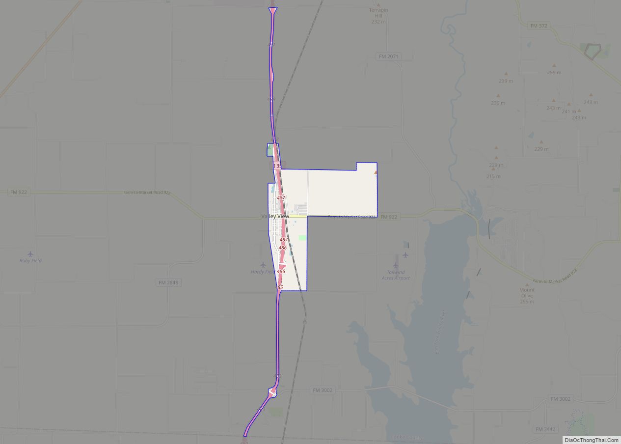
Online Interactive Map
Click on ![]() to view map in "full screen" mode.
to view map in "full screen" mode.
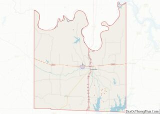
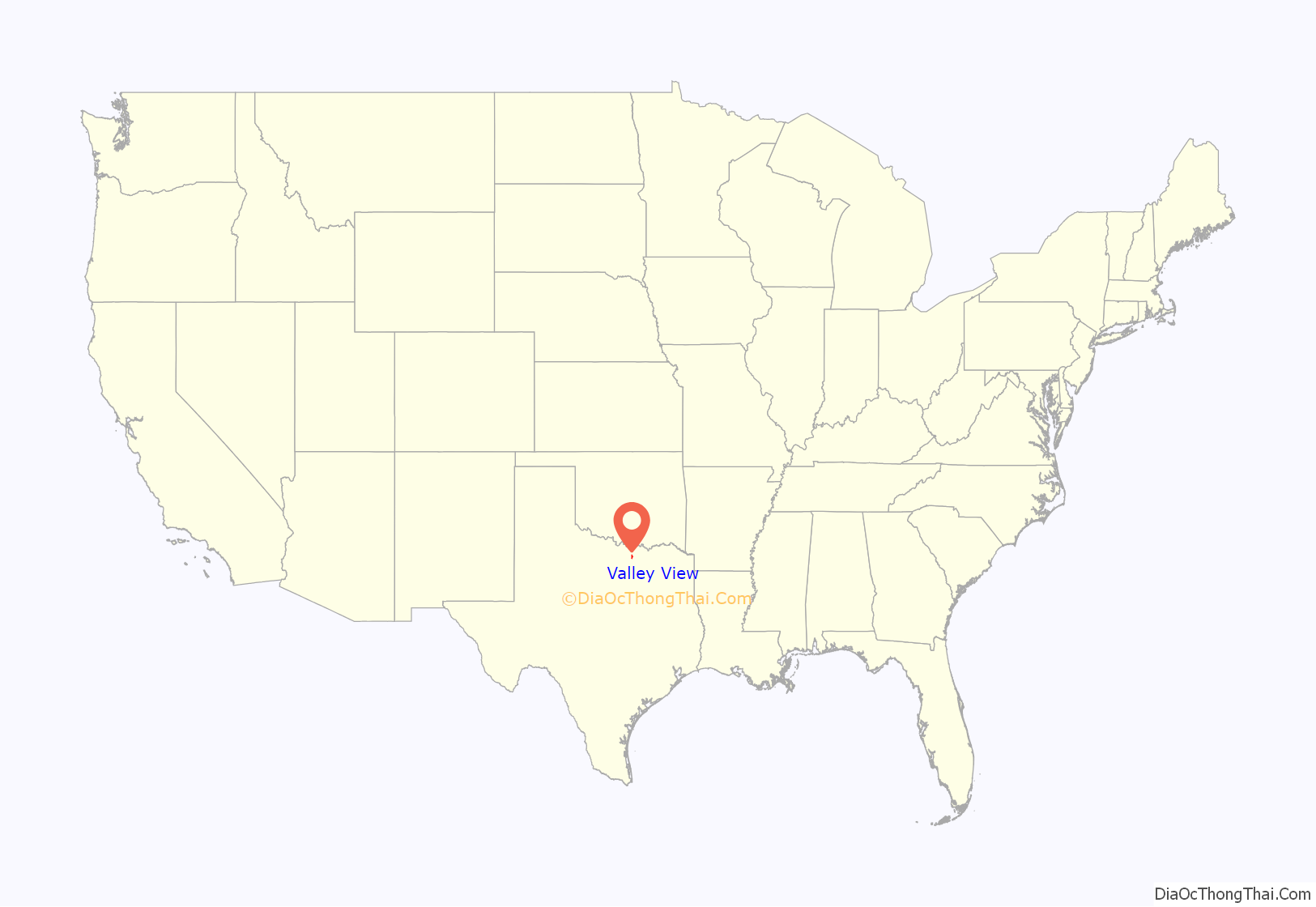
Valley View location map. Where is Valley View city?

History
The town was first settled in 1870 by the Lee family. L.W. Lee plotted a town on his land in 1872, naming it “Valley View”, presumably for the view offered at the site of Spring Creek valley. Eighteen families moved in, and a post office opened in the community that same year.
A blacksmith shop was opened in 1873, and the shop was used for the community’s first school. By 1884, the town had an estimated 250 inhabitants, three steam gristmills and cotton gins, and three general stores, and it shipped cotton, livestock, and wheat. The Gulf, Colorado and Santa Fe Railway (now the BNSF Railway) reached the town in 1886. Valley View had four church buildings and a hotel by 1890, and the Valley View Independent School District was incorporated in 1902. In 1903, the town witnessed dramatic growth with the completion of a two-story brick school house and six brick business buildings, the arrival of telephone service, and the opening of a bank. The following year the Valley View News began publishing weekly. The community had an estimated population of 600 by 1914.
Two fires struck the town in 1924. In the fall, the east side of the town square was burned down. On the morning of December 19, bank robbers started a second fire as they robbed the First National Bank (later named the Valley View National Bank and was owned by Thomas R. Couch) of $5,000. A further two city blocks were destroyed.
Valley View’s population was estimated at 700 from the 1920s through the mid-1960s. In 1970, it was 805, but the town declined during the next decade. When Valley View formally incorporated in 1980, it had 514 inhabitants and six businesses. The town began to grow again in the 1980s and had a population of 640 in 1990.
John Marvin Jones, a member of the U.S. House of Representatives from 1916 to 1940 and later chief judge of the federal Court of Claims, was born in Valley View.
Valley View Road Map

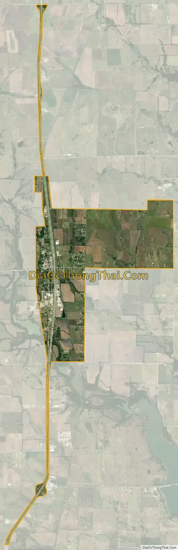
Valley View city Satellite Map
Geography
Valley View is located in southern Cooke County at 33°29′37″N 97°9′52″W / 33.49361°N 97.16444°W / 33.49361; -97.16444 (33.493656, –97.164403). Interstate 35/U.S. Route 77 passes just east of the center of town, with access from exits 485 through 487. The highway leads north 10 miles (16 km) to Gainesville, the county seat, and south 20 miles (32 km) to Denton.
According to the United States Census Bureau, Valley View has a total area of 3.6 square miles (9.2 km), of which 0.004 square miles (0.01 km), or 0.13%, is covered by water.
Climate
The climate in this area is characterized by hot, humid summers and generally mild to cool winters. According to the Köppen climate classification, Valley View has a humid subtropical climate, Cfa on climate maps.
See also
Map of Texas State and its subdivision:- Anderson
- Andrews
- Angelina
- Aransas
- Archer
- Armstrong
- Atascosa
- Austin
- Bailey
- Bandera
- Bastrop
- Baylor
- Bee
- Bell
- Bexar
- Blanco
- Borden
- Bosque
- Bowie
- Brazoria
- Brazos
- Brewster
- Briscoe
- Brooks
- Brown
- Burleson
- Burnet
- Caldwell
- Calhoun
- Callahan
- Cameron
- Camp
- Carson
- Cass
- Castro
- Chambers
- Cherokee
- Childress
- Clay
- Cochran
- Coke
- Coleman
- Collin
- Collingsworth
- Colorado
- Comal
- Comanche
- Concho
- Cooke
- Coryell
- Cottle
- Crane
- Crockett
- Crosby
- Culberson
- Dallam
- Dallas
- Dawson
- Deaf Smith
- Delta
- Denton
- Dewitt
- Dickens
- Dimmit
- Donley
- Duval
- Eastland
- Ector
- Edwards
- El Paso
- Ellis
- Erath
- Falls
- Fannin
- Fayette
- Fisher
- Floyd
- Foard
- Fort Bend
- Franklin
- Freestone
- Frio
- Gaines
- Galveston
- Garza
- Gillespie
- Glasscock
- Goliad
- Gonzales
- Gray
- Grayson
- Gregg
- Grimes
- Guadalupe
- Hale
- Hall
- Hamilton
- Hansford
- Hardeman
- Hardin
- Harris
- Harrison
- Hartley
- Haskell
- Hays
- Hemphill
- Henderson
- Hidalgo
- Hill
- Hockley
- Hood
- Hopkins
- Houston
- Howard
- Hudspeth
- Hunt
- Hutchinson
- Irion
- Jack
- Jackson
- Jasper
- Jeff Davis
- Jefferson
- Jim Hogg
- Jim Wells
- Johnson
- Jones
- Karnes
- Kaufman
- Kendall
- Kenedy
- Kent
- Kerr
- Kimble
- King
- Kinney
- Kleberg
- Knox
- La Salle
- Lamar
- Lamb
- Lampasas
- Lavaca
- Lee
- Leon
- Liberty
- Limestone
- Lipscomb
- Live Oak
- Llano
- Loving
- Lubbock
- Lynn
- Madison
- Marion
- Martin
- Mason
- Matagorda
- Maverick
- McCulloch
- McLennan
- McMullen
- Medina
- Menard
- Midland
- Milam
- Mills
- Mitchell
- Montague
- Montgomery
- Moore
- Morris
- Motley
- Nacogdoches
- Navarro
- Newton
- Nolan
- Nueces
- Ochiltree
- Oldham
- Orange
- Palo Pinto
- Panola
- Parker
- Parmer
- Pecos
- Polk
- Potter
- Presidio
- Rains
- Randall
- Reagan
- Real
- Red River
- Reeves
- Refugio
- Roberts
- Robertson
- Rockwall
- Runnels
- Rusk
- Sabine
- San Augustine
- San Jacinto
- San Patricio
- San Saba
- Schleicher
- Scurry
- Shackelford
- Shelby
- Sherman
- Smith
- Somervell
- Starr
- Stephens
- Sterling
- Stonewall
- Sutton
- Swisher
- Tarrant
- Taylor
- Terrell
- Terry
- Throckmorton
- Titus
- Tom Green
- Travis
- Trinity
- Tyler
- Upshur
- Upton
- Uvalde
- Val Verde
- Van Zandt
- Victoria
- Walker
- Waller
- Ward
- Washington
- Webb
- Wharton
- Wheeler
- Wichita
- Wilbarger
- Willacy
- Williamson
- Wilson
- Winkler
- Wise
- Wood
- Yoakum
- Young
- Zapata
- Zavala
- Alabama
- Alaska
- Arizona
- Arkansas
- California
- Colorado
- Connecticut
- Delaware
- District of Columbia
- Florida
- Georgia
- Hawaii
- Idaho
- Illinois
- Indiana
- Iowa
- Kansas
- Kentucky
- Louisiana
- Maine
- Maryland
- Massachusetts
- Michigan
- Minnesota
- Mississippi
- Missouri
- Montana
- Nebraska
- Nevada
- New Hampshire
- New Jersey
- New Mexico
- New York
- North Carolina
- North Dakota
- Ohio
- Oklahoma
- Oregon
- Pennsylvania
- Rhode Island
- South Carolina
- South Dakota
- Tennessee
- Texas
- Utah
- Vermont
- Virginia
- Washington
- West Virginia
- Wisconsin
- Wyoming