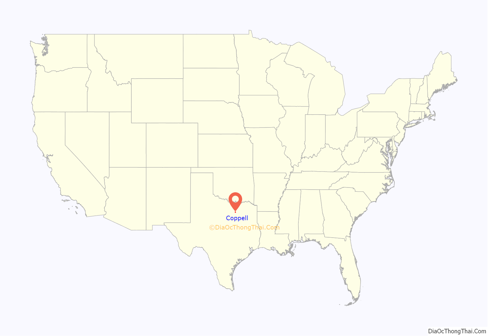
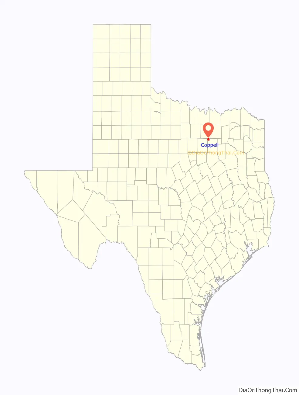
Coppell (/kəˈpɛl/ ca-PEL) is a city in the northwest corner of Dallas County in the U.S. state of Texas. It is a suburb of Dallas and a bedroom community in the Dallas–Fort Worth metroplex. Its population was 42,983 at the 2020 census. A small area in the far northern portion of the city extends into neighboring Denton County.
| Name: | Coppell city |
|---|---|
| LSAD Code: | 25 |
| LSAD Description: | city (suffix) |
| State: | Texas |
| County: | Dallas County, Denton County |
| Elevation: | 512 ft (156 m) |
| Total Area: | 14.73 sq mi (38.15 km²) |
| Land Area: | 14.41 sq mi (37.33 km²) |
| Water Area: | 0.31 sq mi (0.81 km²) 2.00% |
| Total Population: | 41,290 |
| Population Density: | 2,873.47/sq mi (1,109.47/km²) |
| ZIP code: | 75019 |
| Area code: | 972, 214 |
| FIPS code: | 4816612 |
| GNISfeature ID: | 2410224 |
| Website: | www.coppelltx.gov |
Online Interactive Map
Click on ![]() to view map in "full screen" mode.
to view map in "full screen" mode.
Coppell location map. Where is Coppell city?
History
The Coppell area was settled by German and French immigrants in the 1840s. Members of the Peters Colony also settled here in the 1840s. Originally named Gibbs Station, after Barnett Gibbs (one of Texas’s first lieutenant governors), the town was renamed in 1892 for George Coppell, a wealthy English financier, who came to the United States in the 1880s, and was reportedly heavily involved with the final construction of the local railroad line. Popular belief is that he was an engineer, but little or no evidence supports that claim.
In 1955, the community was incorporated through a ballot measure that passed by a vote of 41 to 1. Spurred by the opening of Dallas/Fort Worth International Airport (DFW Airport) in 1974, the city was radically transformed from a tiny farming village to a large, upper-middle class suburban community in the 1980s and 1990s. By 2000, almost all of the residentially zoned land in the city was developed, and the population grew to over 35,000. In addition to suburban homes, the city has a growing commercial base of warehouses and transportation centers on the south and west sides of the city, closest in proximity to the airport.
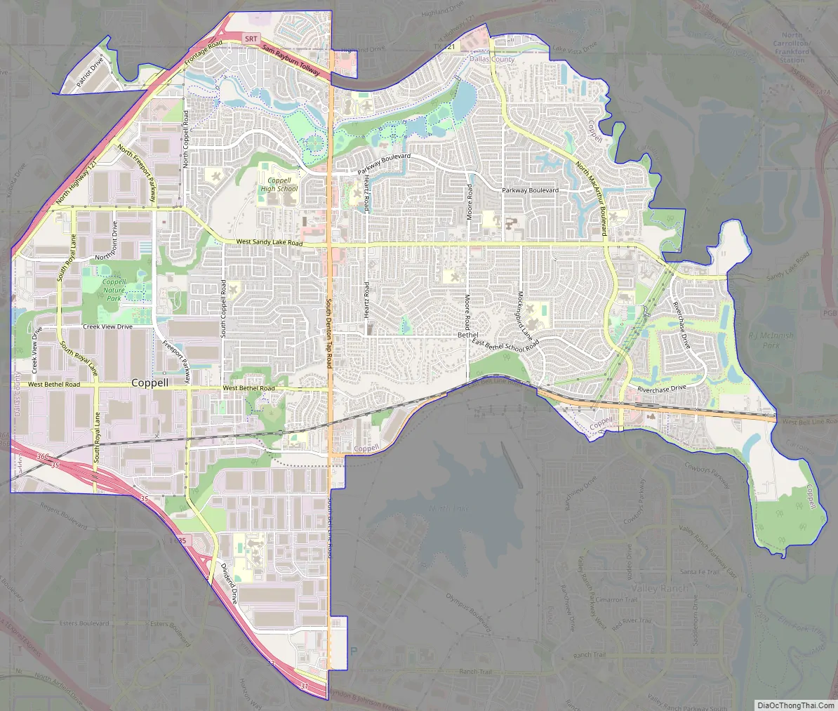
Coppell Road Map
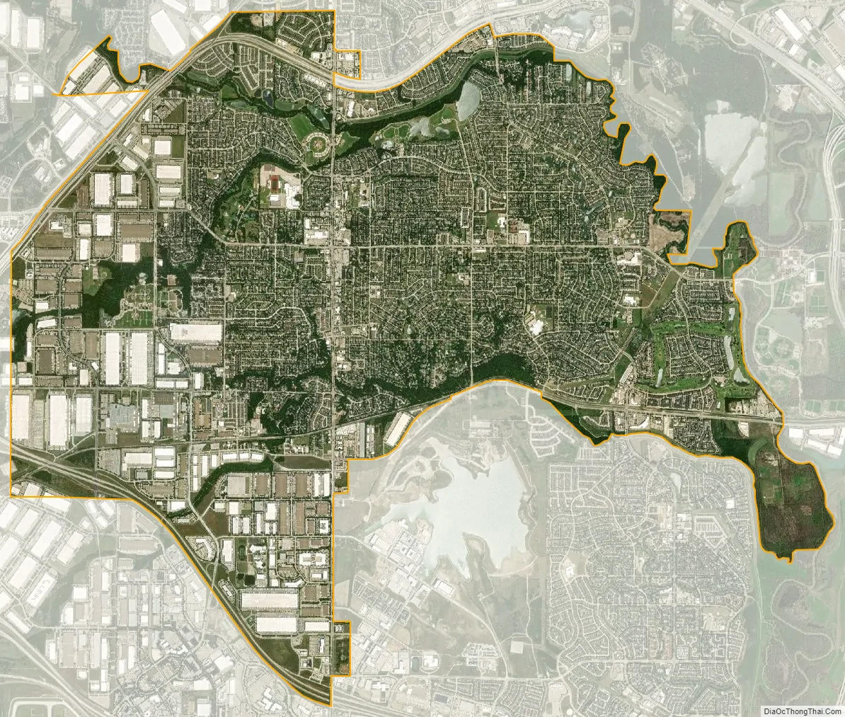
Coppell city Satellite Map
Geography
Coppell is located at 32°58′2″N 96°59′12″W / 32.96722°N 96.98667°W / 32.96722; -96.98667 (32.967341, −96.986564).
According to the United States Census Bureau, the city has a total area of 14.7 square miles (38.0 km), of which 14.4 square miles (37.3 km) are land and 0.31 square miles (0.8 km), or 2.00%, is covered by water.
Coppell occupies the northwest corner of Dallas County and lies in proximity to DFW Airport. A portion of the airport property is within the city limits of Coppell. It is bordered on the west by Grapevine, on the north by Lewisville, on the east by Carrollton, and on the south by Irving and Dallas.
See also
Map of Texas State and its subdivision:- Anderson
- Andrews
- Angelina
- Aransas
- Archer
- Armstrong
- Atascosa
- Austin
- Bailey
- Bandera
- Bastrop
- Baylor
- Bee
- Bell
- Bexar
- Blanco
- Borden
- Bosque
- Bowie
- Brazoria
- Brazos
- Brewster
- Briscoe
- Brooks
- Brown
- Burleson
- Burnet
- Caldwell
- Calhoun
- Callahan
- Cameron
- Camp
- Carson
- Cass
- Castro
- Chambers
- Cherokee
- Childress
- Clay
- Cochran
- Coke
- Coleman
- Collin
- Collingsworth
- Colorado
- Comal
- Comanche
- Concho
- Cooke
- Coryell
- Cottle
- Crane
- Crockett
- Crosby
- Culberson
- Dallam
- Dallas
- Dawson
- Deaf Smith
- Delta
- Denton
- Dewitt
- Dickens
- Dimmit
- Donley
- Duval
- Eastland
- Ector
- Edwards
- El Paso
- Ellis
- Erath
- Falls
- Fannin
- Fayette
- Fisher
- Floyd
- Foard
- Fort Bend
- Franklin
- Freestone
- Frio
- Gaines
- Galveston
- Garza
- Gillespie
- Glasscock
- Goliad
- Gonzales
- Gray
- Grayson
- Gregg
- Grimes
- Guadalupe
- Hale
- Hall
- Hamilton
- Hansford
- Hardeman
- Hardin
- Harris
- Harrison
- Hartley
- Haskell
- Hays
- Hemphill
- Henderson
- Hidalgo
- Hill
- Hockley
- Hood
- Hopkins
- Houston
- Howard
- Hudspeth
- Hunt
- Hutchinson
- Irion
- Jack
- Jackson
- Jasper
- Jeff Davis
- Jefferson
- Jim Hogg
- Jim Wells
- Johnson
- Jones
- Karnes
- Kaufman
- Kendall
- Kenedy
- Kent
- Kerr
- Kimble
- King
- Kinney
- Kleberg
- Knox
- La Salle
- Lamar
- Lamb
- Lampasas
- Lavaca
- Lee
- Leon
- Liberty
- Limestone
- Lipscomb
- Live Oak
- Llano
- Loving
- Lubbock
- Lynn
- Madison
- Marion
- Martin
- Mason
- Matagorda
- Maverick
- McCulloch
- McLennan
- McMullen
- Medina
- Menard
- Midland
- Milam
- Mills
- Mitchell
- Montague
- Montgomery
- Moore
- Morris
- Motley
- Nacogdoches
- Navarro
- Newton
- Nolan
- Nueces
- Ochiltree
- Oldham
- Orange
- Palo Pinto
- Panola
- Parker
- Parmer
- Pecos
- Polk
- Potter
- Presidio
- Rains
- Randall
- Reagan
- Real
- Red River
- Reeves
- Refugio
- Roberts
- Robertson
- Rockwall
- Runnels
- Rusk
- Sabine
- San Augustine
- San Jacinto
- San Patricio
- San Saba
- Schleicher
- Scurry
- Shackelford
- Shelby
- Sherman
- Smith
- Somervell
- Starr
- Stephens
- Sterling
- Stonewall
- Sutton
- Swisher
- Tarrant
- Taylor
- Terrell
- Terry
- Throckmorton
- Titus
- Tom Green
- Travis
- Trinity
- Tyler
- Upshur
- Upton
- Uvalde
- Val Verde
- Van Zandt
- Victoria
- Walker
- Waller
- Ward
- Washington
- Webb
- Wharton
- Wheeler
- Wichita
- Wilbarger
- Willacy
- Williamson
- Wilson
- Winkler
- Wise
- Wood
- Yoakum
- Young
- Zapata
- Zavala
- Alabama
- Alaska
- Arizona
- Arkansas
- California
- Colorado
- Connecticut
- Delaware
- District of Columbia
- Florida
- Georgia
- Hawaii
- Idaho
- Illinois
- Indiana
- Iowa
- Kansas
- Kentucky
- Louisiana
- Maine
- Maryland
- Massachusetts
- Michigan
- Minnesota
- Mississippi
- Missouri
- Montana
- Nebraska
- Nevada
- New Hampshire
- New Jersey
- New Mexico
- New York
- North Carolina
- North Dakota
- Ohio
- Oklahoma
- Oregon
- Pennsylvania
- Rhode Island
- South Carolina
- South Dakota
- Tennessee
- Texas
- Utah
- Vermont
- Virginia
- Washington
- West Virginia
- Wisconsin
- Wyoming


