Richardson is a city in Dallas and Collin counties in the U.S. state of Texas. As of the 2020 United States census, the city had a total population of 119,469. Richardson is an inner suburb of the city of Dallas.
It is home to the University of Texas at Dallas and the Telecom Corridor, with a high concentration of telecommunications companies. More than 5,000 businesses have operations within Richardson’s 28 square miles (73 km), including many of the world’s largest telecommunications and networking companies, such as AT&T, Verizon, Cisco Systems, Samsung, ZTE, MetroPCS, Texas Instruments, Qorvo, and Fujitsu. Richardson’s largest employment base is provided by the insurance industry, with Blue Cross and Blue Shield of Texas’s headquarters, a regional hub for the insurance company GEICO, regional offices for United Healthcare, and one of State Farm Insurance’s three national regional hubs located in the community.
| Name: | Richardson city |
|---|---|
| LSAD Code: | 25 |
| LSAD Description: | city (suffix) |
| State: | Texas |
| County: | Collin County, Dallas County |
| Elevation: | 630 ft (192 m) |
| Total Area: | 28.66 sq mi (74.22 km²) |
| Land Area: | 28.57 sq mi (73.99 km²) |
| Water Area: | 0.09 sq mi (0.23 km²) |
| Total Population: | 119,469 |
| Population Density: | 4,168.49/sq mi (1,609.66/km²) |
| ZIP code: | 75080–75083, 75085 |
| Area code: | 214, 469, 945, 972 |
| FIPS code: | 4861796 |
| GNISfeature ID: | 1345172 |
| Website: | www.cor.net |
Online Interactive Map
Click on ![]() to view map in "full screen" mode.
to view map in "full screen" mode.
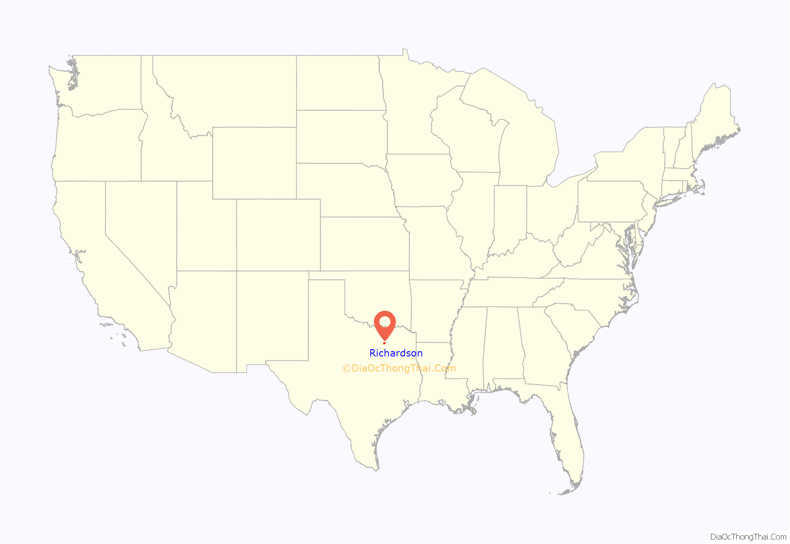
Richardson location map. Where is Richardson city?
History
Emigrants from Kentucky and Tennessee settled near present-day Richardson in the 1840s. Before the Civil War, a small settlement called Breckenridge, located near present-day Richland College, was established. In 1873, the Houston & Texas Central Railroad built a depot northwest of Breckenridge. After the H.&T.C. purchased acreage for a townsite from two local land-owners, the site was surveyed and laid out in blocks and lots, which the railroad began selling in 1874. The town was named after the secretary of the Houston & Texas Central Railroad, Alfred S. Richardson.
In 1908, the Texas Electric Railway, an electric railway known as the Interurban, connected Richardson to Denison, Waco, Corsicana and Dallas. In 1910 the population was approximately 600. A red brick schoolhouse was built in 1914 and is now the administrative office for the Richardson Independent School District. In 1924 the Red Brick Road, the present-day Greenville Avenue, was completed. The completion of the road brought increased traffic, population and property values. The town incorporated and elected a mayor in 1925. In 1940 the population was approximately 740.
After World War II the city experienced major increases in population, which stood at approximately 1,300 by 1950. Throughout the 1950s the city continued to see growth including the opening of the Collins Radio Richardson office, Central Expressway, a police department, shopping centers, and many homes. Texas Instruments opened its offices in Dallas on the southern border of Richardson in 1956. This was followed by significant gains in land values, population, and economic status. In the 1960s Richardson experienced additional growth including several new parks, facilities, and the creation of the University of Texas at Dallas within the city limits. By 1972 the population was approximately 56,000. Residential growth continued through the 1970s and slowed in the 1980s. Commercial development increased throughout the 1980s. Richardson had a population of 74,840 according to the 1990 census. Population increases throughout the 1990s were primarily from development of the northeast part of the city. The city of Buckingham, after being completely surrounded by Richardson, was annexed into the city in 1996.
Richardson had a population of 91,802 as of the 2000 census. By 2002 Richardson had four Dallas Area Rapid Transit (DART) light rail stations and had built the Eisemann Center for Performing Arts and Corporate Presentations and the adjacent Galatyn Park urban center, which has a 2-acre public pedestrian plaza, a luxury hotel, and mixed-use development. Richardson was a “dry city” with no alcohol sales until November 2006, when the local option election passed to allow the sale of beer and wine in grocery and convenience stores. In the fall of 2008 Peter Perfect, a Style Network television show, came to Richardson. The business-makeover show remodeled SpiritWear, an apparel and embroidery store in the city’s historic downtown area. The episode first aired on January 22, 2009. It was the first episode of the series to be filmed outside of California.
In 2006, Richardson was ranked as the 15th best place to live in the United States by Money magazine. This ranked Richardson the 3rd best place to live in Texas. In 2007, the Morgan Quitno 14th Annual America’s Safest and Most Dangerous Cities Awards pronounced Richardson the 69th safest city in America. In the same study Richardson ranked the 5th safest city in Texas. In 2008, Richardson was ranked as the 18th best place to live in the United States by Money magazine. This ranked Richardson the 4th best place to live in Texas. In 2009, Business Week’s annual report on the “Best Places to Raise Kids,” ranked Richardson in 2nd place in Texas. Richardson was the first North Texas city recognized as a best workplace for commuters by the United States Environmental Protection Agency and the United States Department of Transportation in 2004. As of 2010 the city has continued to be recognized every year since 2004. In 2011 the Texas Recreation and Park Society awarded Richardson with the Texas Gold Medal for excellence in the field of recreation and park management. In 2014, Richardson was called the “5th happiest mid-sized city in America” by national real estate website and blog, Movoto.com, based on a number of metrics, such as low unemployment, low crime, and high income. In 2014 Richardson was named America’s 17th Best City to Live in by 24/7 Wall St., based on crime, economy, education, housing, environment, leisure and infrastructure. D Magazine ranked Richardson Heights as one of the top 5 neighborhoods on the rise in 2014. Richardson ranked number 2 on SmartAsset’s Boomtowns of 2015. In August 2016, Safeco Insurance listed Richardson as the 9th safest midsized city in the nation based on overall property crime rates. In November 2016, The Dallas Morning News ranked the Breckinridge Park neighborhood as the 6th best neighborhood in Dallas–Fort Worth. In 2016, Richardson ranked 2nd on SmartAsset’s healthiest housing markets in American and 6th best college towns to live in. USA Today and 24/7 Wall St. ranked Richardson the 3rd best city to live in for 2016. KJKK ranked Richardson the 4th best place to live in Texas in 2016. Movoto ranked Richardson as the 3rd best Dallas suburb for young professionals in 2016. During August 2016, Richardson made Thrill-list’s “The 7 Stages of Living in Dallas” and was named the 3rd overall best real-estate market in the United States by WalletHub.
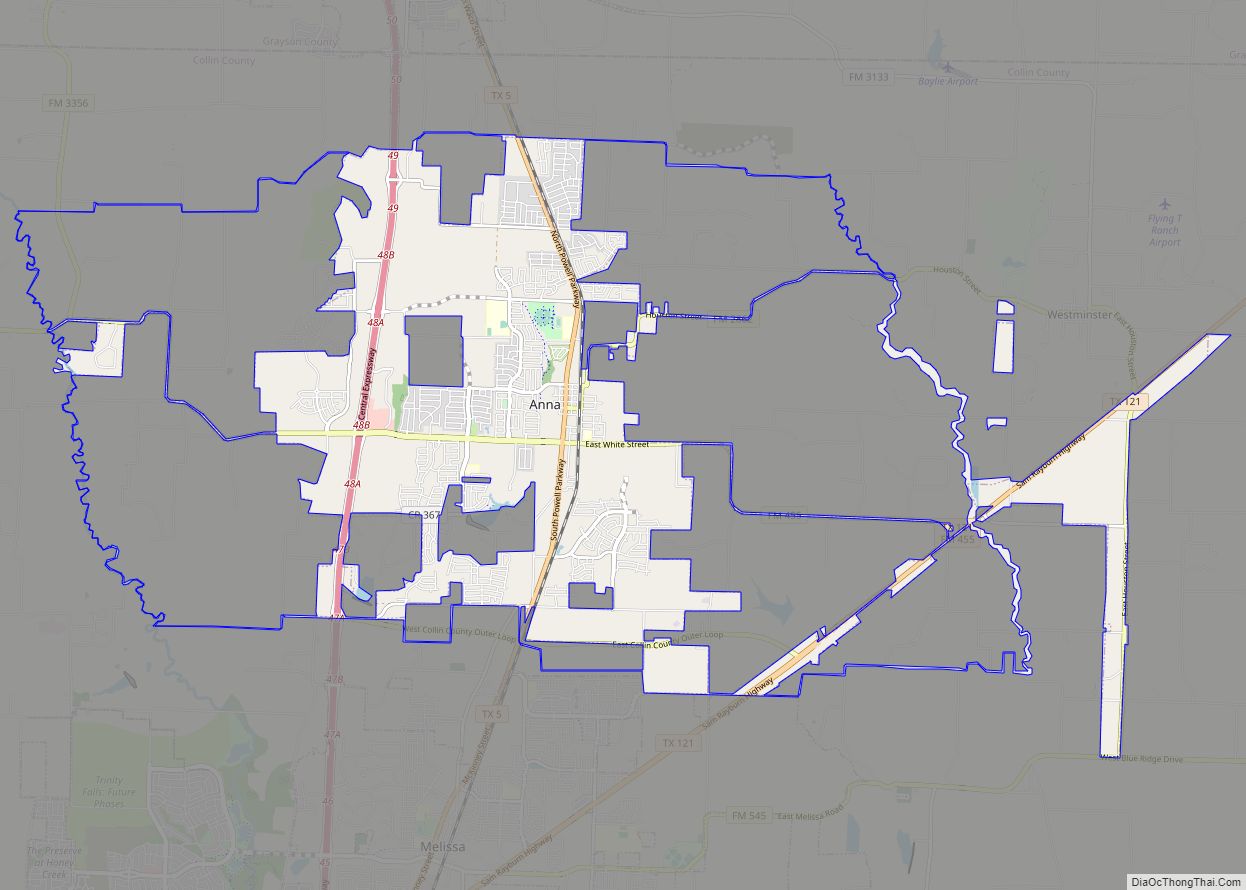
Richardson Road Map
Richardson city Satellite Map
Geography
The cities of Dallas, Plano and Garland, Texas constitute almost all of the Richardson border apart from the municipality’s extreme northeastern “panhandle.”
The Lake Highlands area of northeast Dallas borders Richardson to the south, North Dallas to the southwest, Far North Dallas to the west, West Plano to the northwest, East Plano to the north, the city of Murphy to the northeast, Sachse to the east, and Garland to the southeast.
Richardson is located at 32°57′56″N 96°42′57″W / 32.965628°N 96.715707°W / 32.965628; -96.715707.
According to the United States Census Bureau, the city has a total area of 28.6 square miles (74.2 km), of which 28.6 square miles (74.0 km) is land and 0.08 square miles (0.2 km), or 0.32%, is water.
Approximately two-thirds of the city is in Dallas County, with the northern third of the city in Collin County. Of the 28.6 square miles (74.2 km) contained within the borders of the city of Richardson, 18.2 square miles (47 km) lie in Dallas County; the other 9.2 square miles (24 km) are in Collin County.
Climate
The climate in this area is characterized by hot, humid summers and generally mild to cool winters. According to the Köppen Climate Classification system, Richardson has a humid subtropical climate, abbreviated “Cfa” on climate maps.
See also
Map of Texas State and its subdivision:- Anderson
- Andrews
- Angelina
- Aransas
- Archer
- Armstrong
- Atascosa
- Austin
- Bailey
- Bandera
- Bastrop
- Baylor
- Bee
- Bell
- Bexar
- Blanco
- Borden
- Bosque
- Bowie
- Brazoria
- Brazos
- Brewster
- Briscoe
- Brooks
- Brown
- Burleson
- Burnet
- Caldwell
- Calhoun
- Callahan
- Cameron
- Camp
- Carson
- Cass
- Castro
- Chambers
- Cherokee
- Childress
- Clay
- Cochran
- Coke
- Coleman
- Collin
- Collingsworth
- Colorado
- Comal
- Comanche
- Concho
- Cooke
- Coryell
- Cottle
- Crane
- Crockett
- Crosby
- Culberson
- Dallam
- Dallas
- Dawson
- Deaf Smith
- Delta
- Denton
- Dewitt
- Dickens
- Dimmit
- Donley
- Duval
- Eastland
- Ector
- Edwards
- El Paso
- Ellis
- Erath
- Falls
- Fannin
- Fayette
- Fisher
- Floyd
- Foard
- Fort Bend
- Franklin
- Freestone
- Frio
- Gaines
- Galveston
- Garza
- Gillespie
- Glasscock
- Goliad
- Gonzales
- Gray
- Grayson
- Gregg
- Grimes
- Guadalupe
- Hale
- Hall
- Hamilton
- Hansford
- Hardeman
- Hardin
- Harris
- Harrison
- Hartley
- Haskell
- Hays
- Hemphill
- Henderson
- Hidalgo
- Hill
- Hockley
- Hood
- Hopkins
- Houston
- Howard
- Hudspeth
- Hunt
- Hutchinson
- Irion
- Jack
- Jackson
- Jasper
- Jeff Davis
- Jefferson
- Jim Hogg
- Jim Wells
- Johnson
- Jones
- Karnes
- Kaufman
- Kendall
- Kenedy
- Kent
- Kerr
- Kimble
- King
- Kinney
- Kleberg
- Knox
- La Salle
- Lamar
- Lamb
- Lampasas
- Lavaca
- Lee
- Leon
- Liberty
- Limestone
- Lipscomb
- Live Oak
- Llano
- Loving
- Lubbock
- Lynn
- Madison
- Marion
- Martin
- Mason
- Matagorda
- Maverick
- McCulloch
- McLennan
- McMullen
- Medina
- Menard
- Midland
- Milam
- Mills
- Mitchell
- Montague
- Montgomery
- Moore
- Morris
- Motley
- Nacogdoches
- Navarro
- Newton
- Nolan
- Nueces
- Ochiltree
- Oldham
- Orange
- Palo Pinto
- Panola
- Parker
- Parmer
- Pecos
- Polk
- Potter
- Presidio
- Rains
- Randall
- Reagan
- Real
- Red River
- Reeves
- Refugio
- Roberts
- Robertson
- Rockwall
- Runnels
- Rusk
- Sabine
- San Augustine
- San Jacinto
- San Patricio
- San Saba
- Schleicher
- Scurry
- Shackelford
- Shelby
- Sherman
- Smith
- Somervell
- Starr
- Stephens
- Sterling
- Stonewall
- Sutton
- Swisher
- Tarrant
- Taylor
- Terrell
- Terry
- Throckmorton
- Titus
- Tom Green
- Travis
- Trinity
- Tyler
- Upshur
- Upton
- Uvalde
- Val Verde
- Van Zandt
- Victoria
- Walker
- Waller
- Ward
- Washington
- Webb
- Wharton
- Wheeler
- Wichita
- Wilbarger
- Willacy
- Williamson
- Wilson
- Winkler
- Wise
- Wood
- Yoakum
- Young
- Zapata
- Zavala
- Alabama
- Alaska
- Arizona
- Arkansas
- California
- Colorado
- Connecticut
- Delaware
- District of Columbia
- Florida
- Georgia
- Hawaii
- Idaho
- Illinois
- Indiana
- Iowa
- Kansas
- Kentucky
- Louisiana
- Maine
- Maryland
- Massachusetts
- Michigan
- Minnesota
- Mississippi
- Missouri
- Montana
- Nebraska
- Nevada
- New Hampshire
- New Jersey
- New Mexico
- New York
- North Carolina
- North Dakota
- Ohio
- Oklahoma
- Oregon
- Pennsylvania
- Rhode Island
- South Carolina
- South Dakota
- Tennessee
- Texas
- Utah
- Vermont
- Virginia
- Washington
- West Virginia
- Wisconsin
- Wyoming
