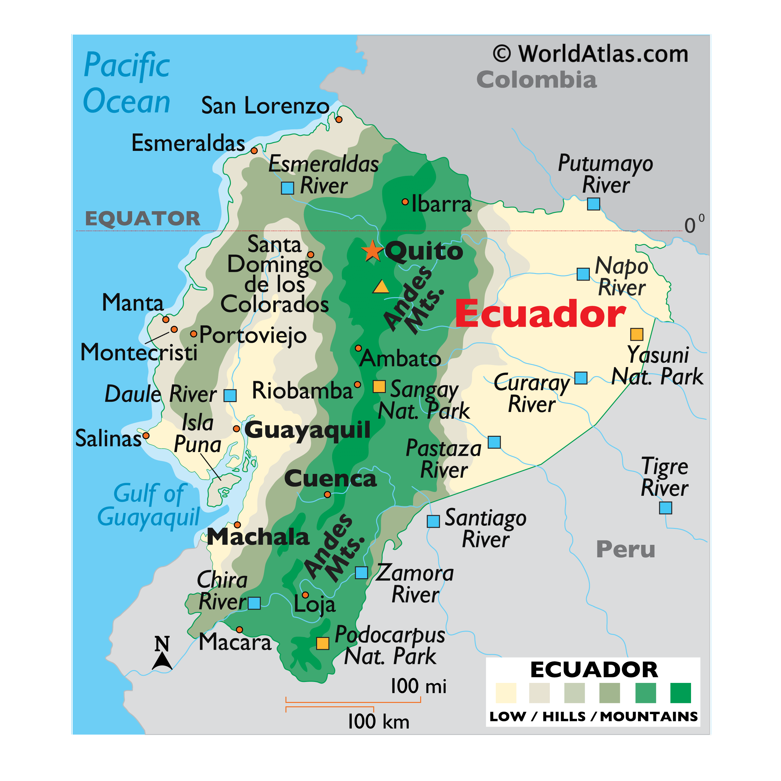
Covering an area of 283,561 sq.km (109,484 sq mi), Ecuador is a country located in northwestern South America.
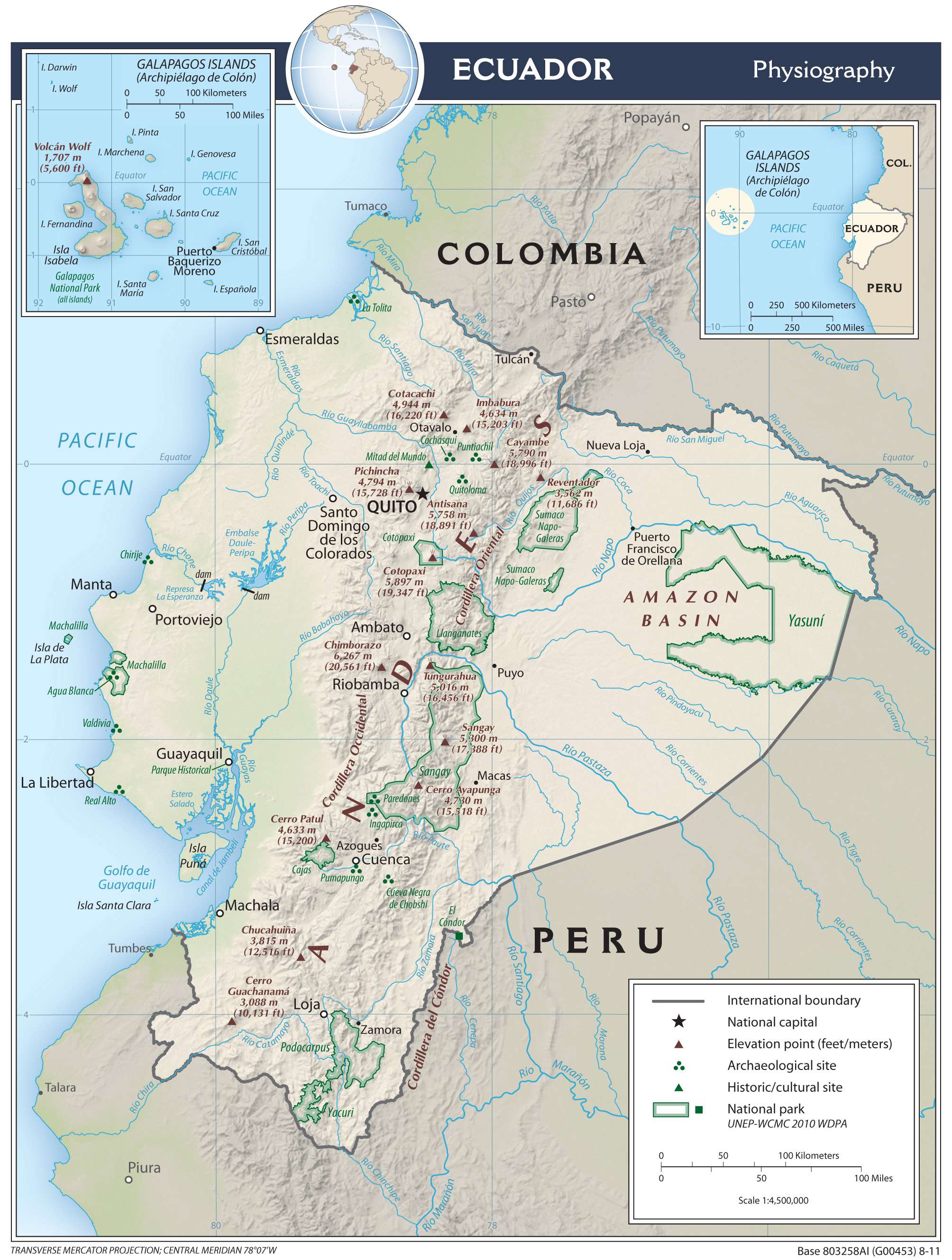
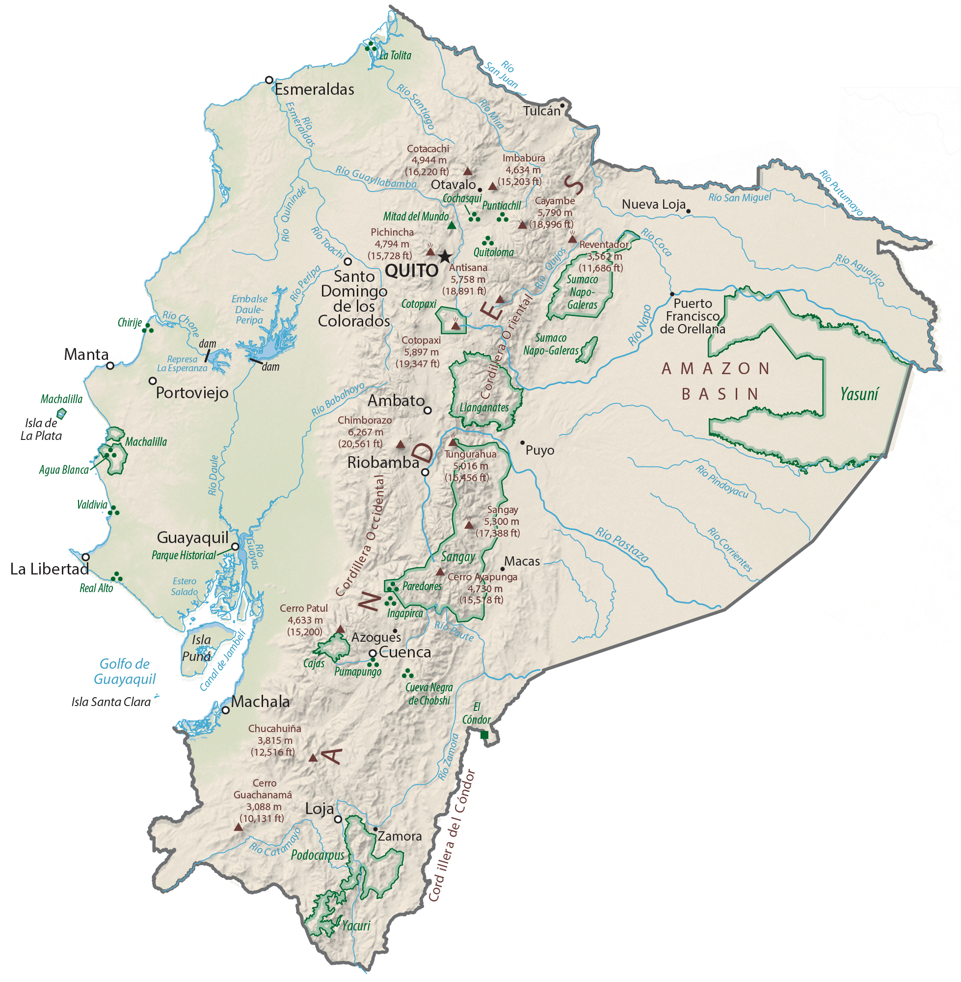
Ecuador is divided into four geographic regions: the coastal lowlands and mountain area; the Central Andes Mountains and its two major chains (Cordillera Occidental in the West) and the (Cordillera Oriental in the east); the lower mountains that fade into rolling hills and lowlands of the east, and the territory of the Galapagos Islands – officially called the Archipielago de Colon – located about 1,000km to the west.
The Andes includes over 20 peaks atleast 13,779 ft (4,200m) in height with most located in the Cordillera Occidental. The highest point in Ecuador is Mount Chimborazo, at 20,560ft (6,268m); while the lowest point is at the Pacific Ocean. In addition, there are over 30 peaks that are volcanic in nature, including many active ones. Located in the Andes Mountains, Cotopaxi is one of the world’s highest active volcanoes. Most rivers in Ecuador rise in the upper elevations of the Andes, flowing east toward the Amazon River, or west into the Pacific Ocean. The most significant include the Babahoyo, Chira, Coca, Curaray, Daule, Esmeraldas, Guayas, Napo, Paztaza and the Putumayo, on its northeastern border with Colombia.
| Flag: |  |
|---|---|
| Legal Name: | Republic of Ecuador |
| Capital Value: | Quito |
| Official languages: | Spanish |
| Demonym(s): | Ecuadorian |
| Government: | Unitary presidential republic |
| Legislature: | National Assembly |
| Total Area: | 283,561 km² |
| Land Area: | 276,841 km² |
| Water Area: | 6,720 km² |
| Population: | 17,373,662 |
| Density: | 69/km (178.7/sq mi) (148th) |
| GDP: | $107.44 Billion |
| GDP Per Capita: | $6,183.82 |
| Currency Value: | <p>the US dollar became Ecuador’s currency in 2001</p> |
| Driving side: | right |
| Calling code: | +593 |
| Internet TLD: | .ec |
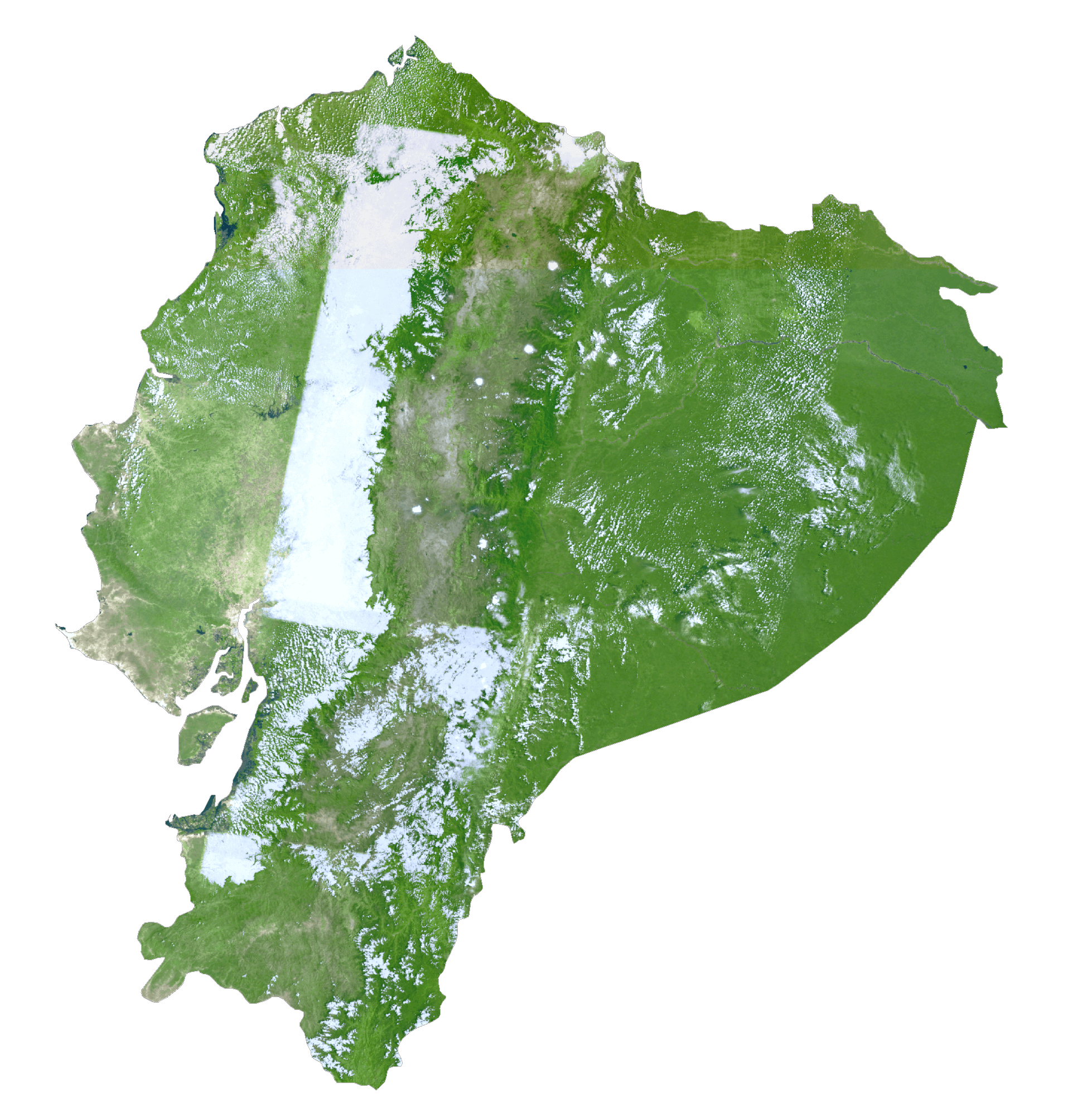
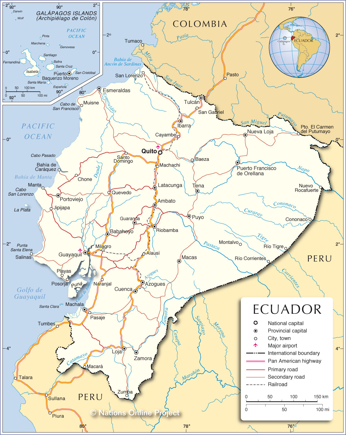
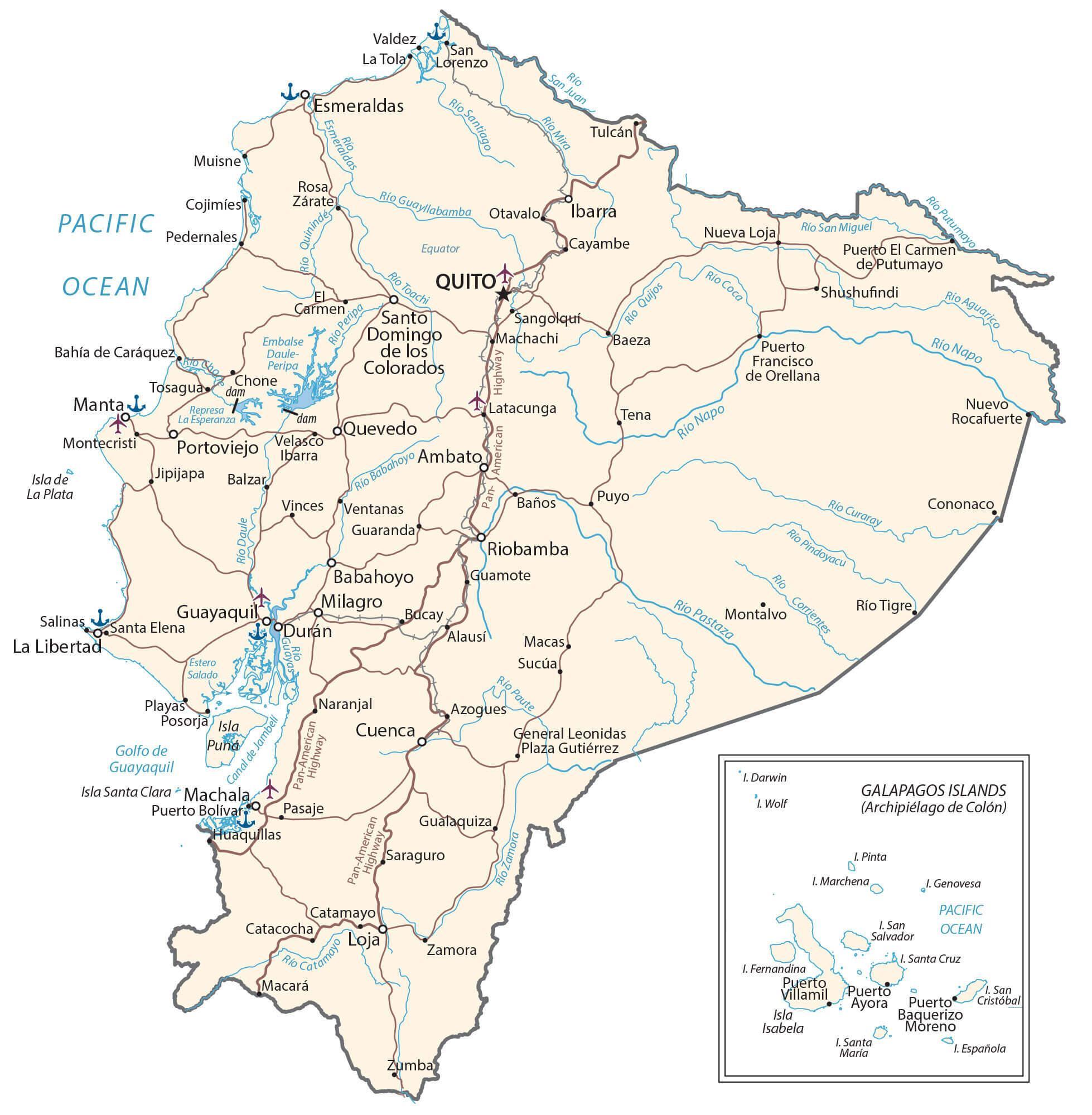
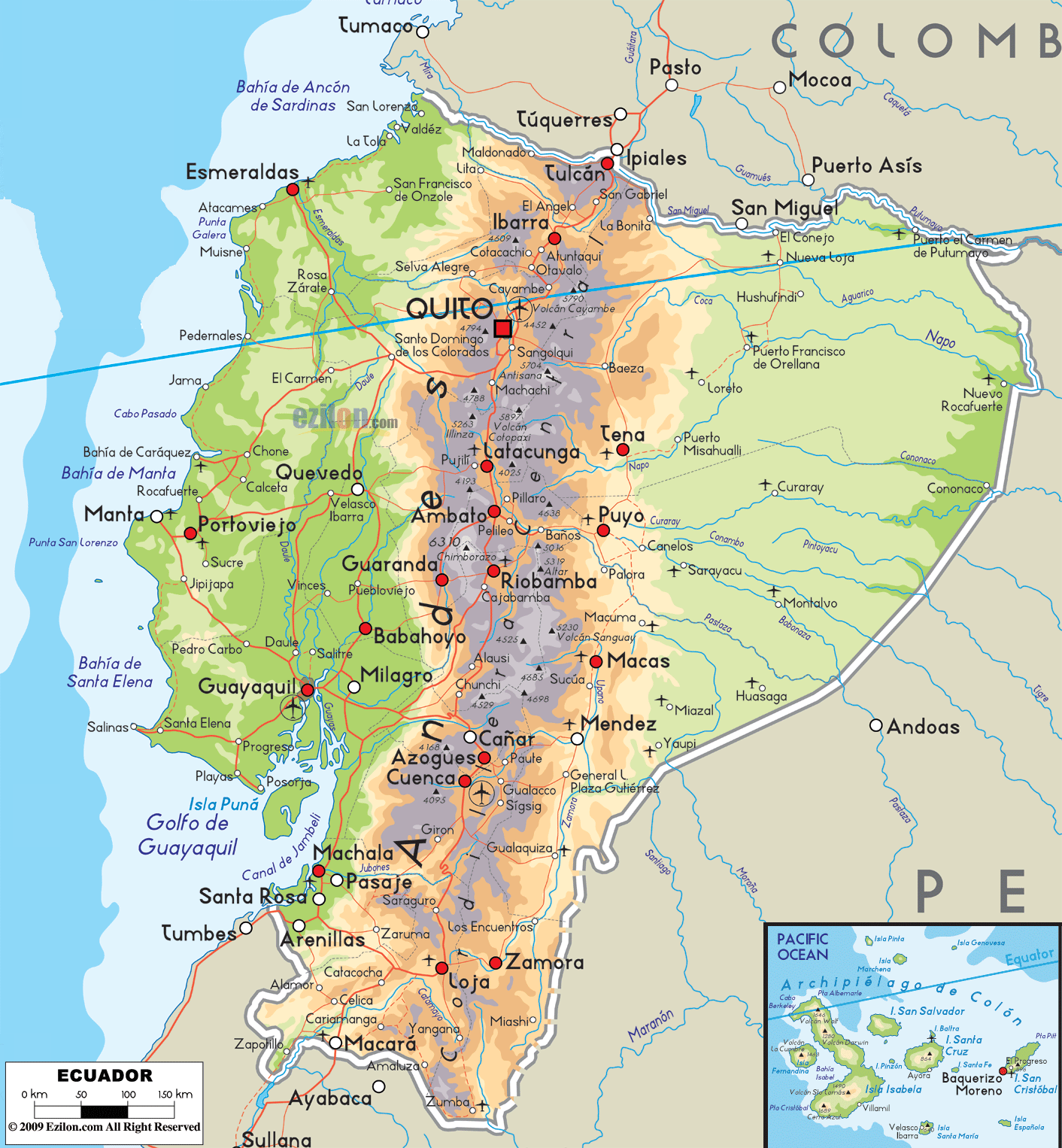
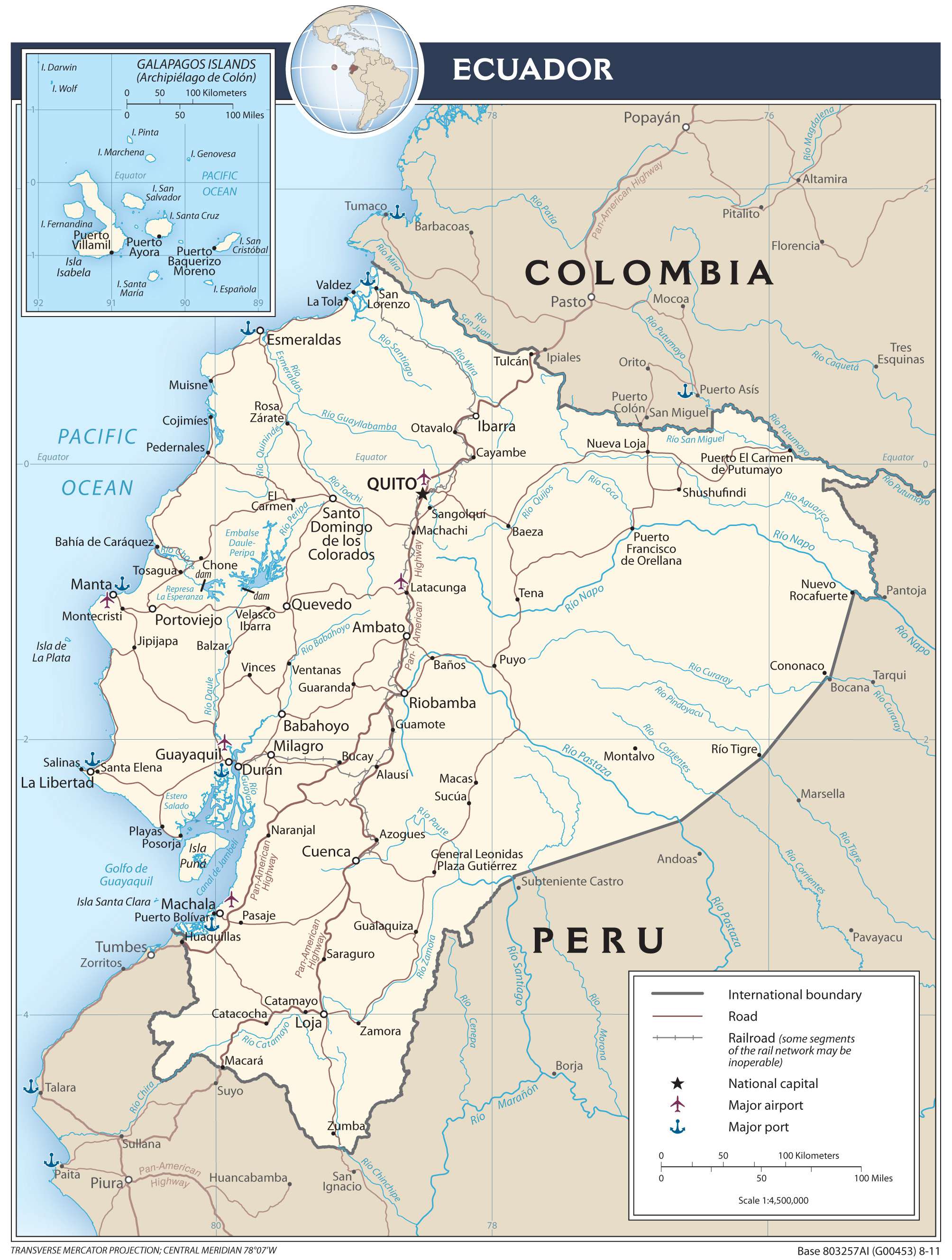
Discover Ecuador, a country located on the equator, with this collection of maps. The reference map showcases the country’s main cities, highways, islands, lakes and rivers, while satellite imagery provides an aerial view of the country’s landscape. A physical map is also included, with features such as mountains, valleys and more.
Online Interactive Political Map
Click on ![]() to view map in "full screen" mode.
to view map in "full screen" mode.
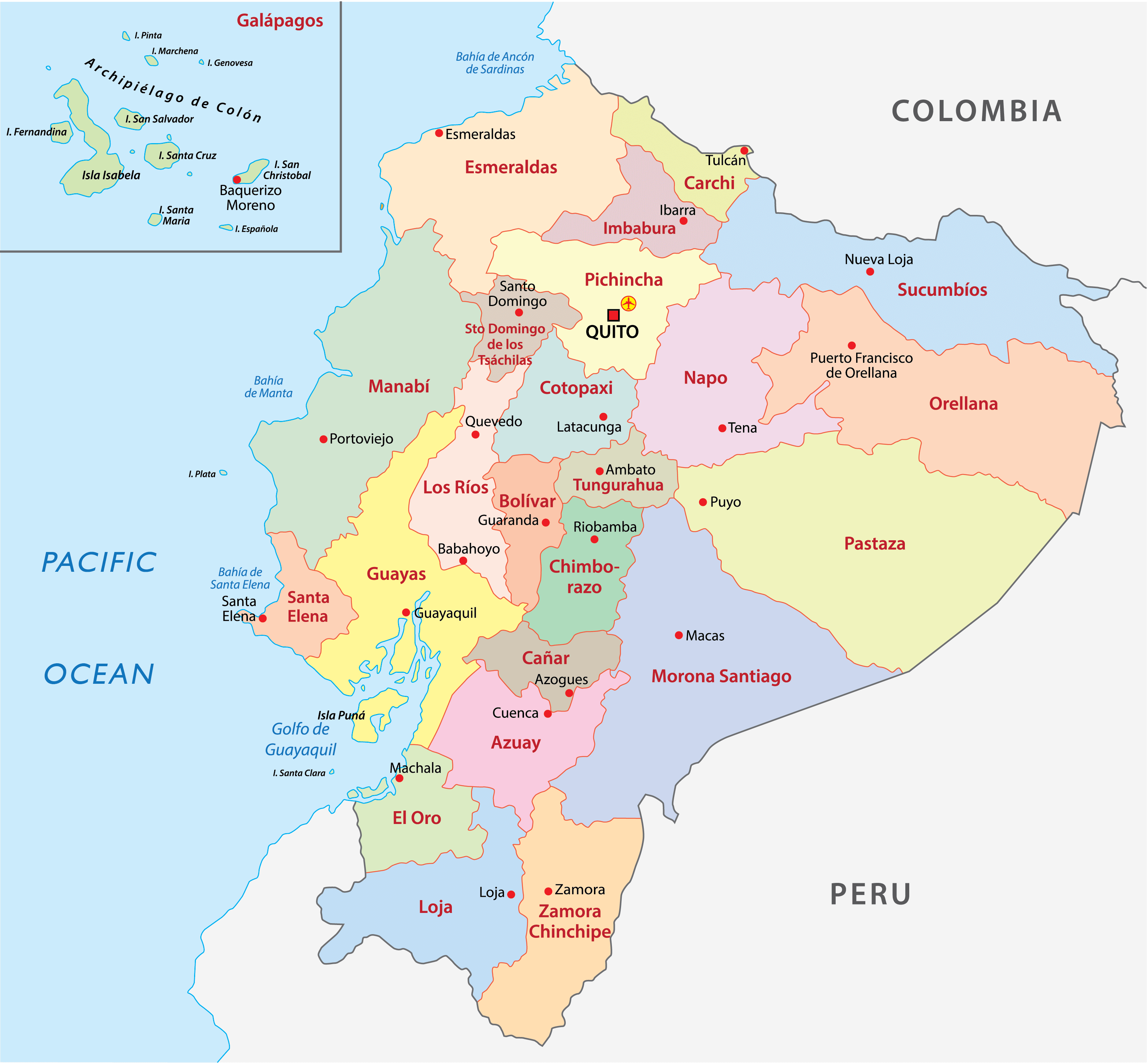
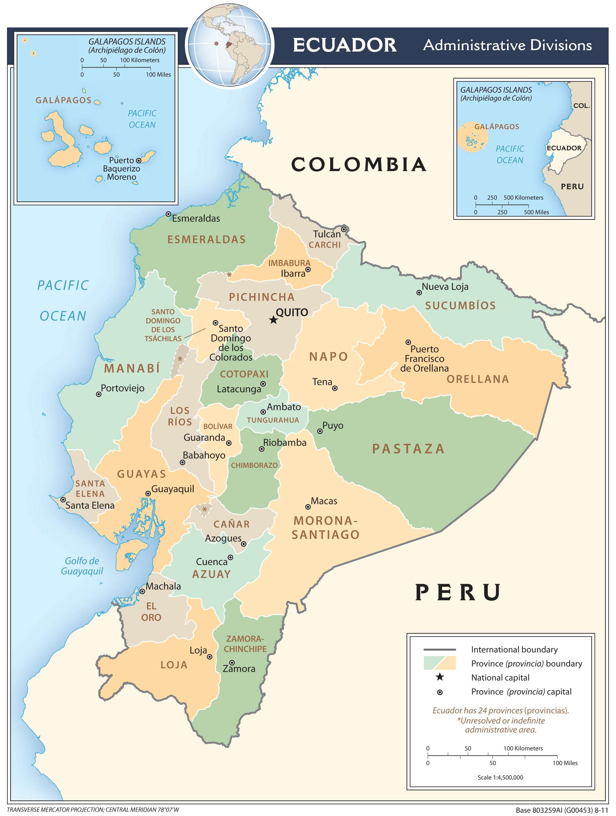
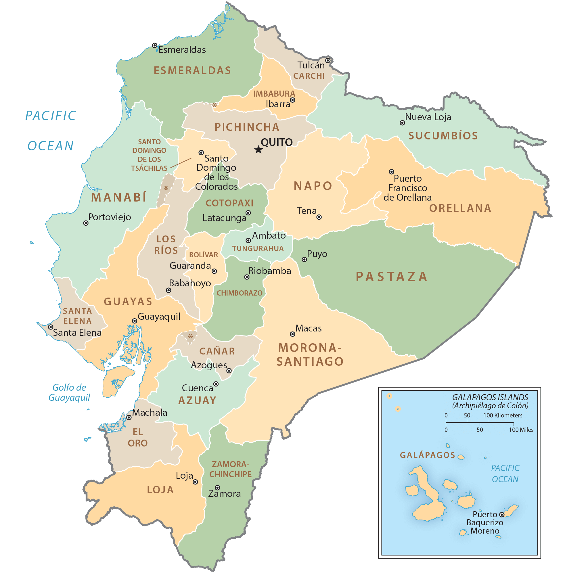
Ecuador (officially, the Republic of Ecuador) is divided into 24 administrative provinces(provincias, singular – provincia). In alphabetical order, these provinces are: Azuay, Bolivar, Canar, Carchi, Chimborazo, Cotopaxi, El Oro, Esmeraldas, Galapagos, Guayas, Imbabura, Loja, Los Rios, Manabi, Morona-Santiago, Napo, Orellana, Pastaza, Pichincha, Santa Elena, Santo Domingo de los Tsachilas, Sucumbios, Tungurahua and Zamora-Chinchipe. The provinces are subdivided into a total of 221 cantons. These cantons are further subdivided into parishes (parroquias).
Ecuador occupies a total area of 283,561 sq.km, which also includes the Galapagos Islands. Located in the north-central part of the country in the Andean highlands is, Quito – the national capital and the second most populous city of Ecuador. Situated at an elevation of 9,350ft, it is the world’s second highest capital city and the oldest among all the South American capitals. It is the administrative and cultural center of Ecuador. Guayaquil is the largest and the most populous city in Ecuador. It is also a major commercial hub and a port city, where most of the economic trade is conducted through the Gulf of Guayaquil.
Location Maps
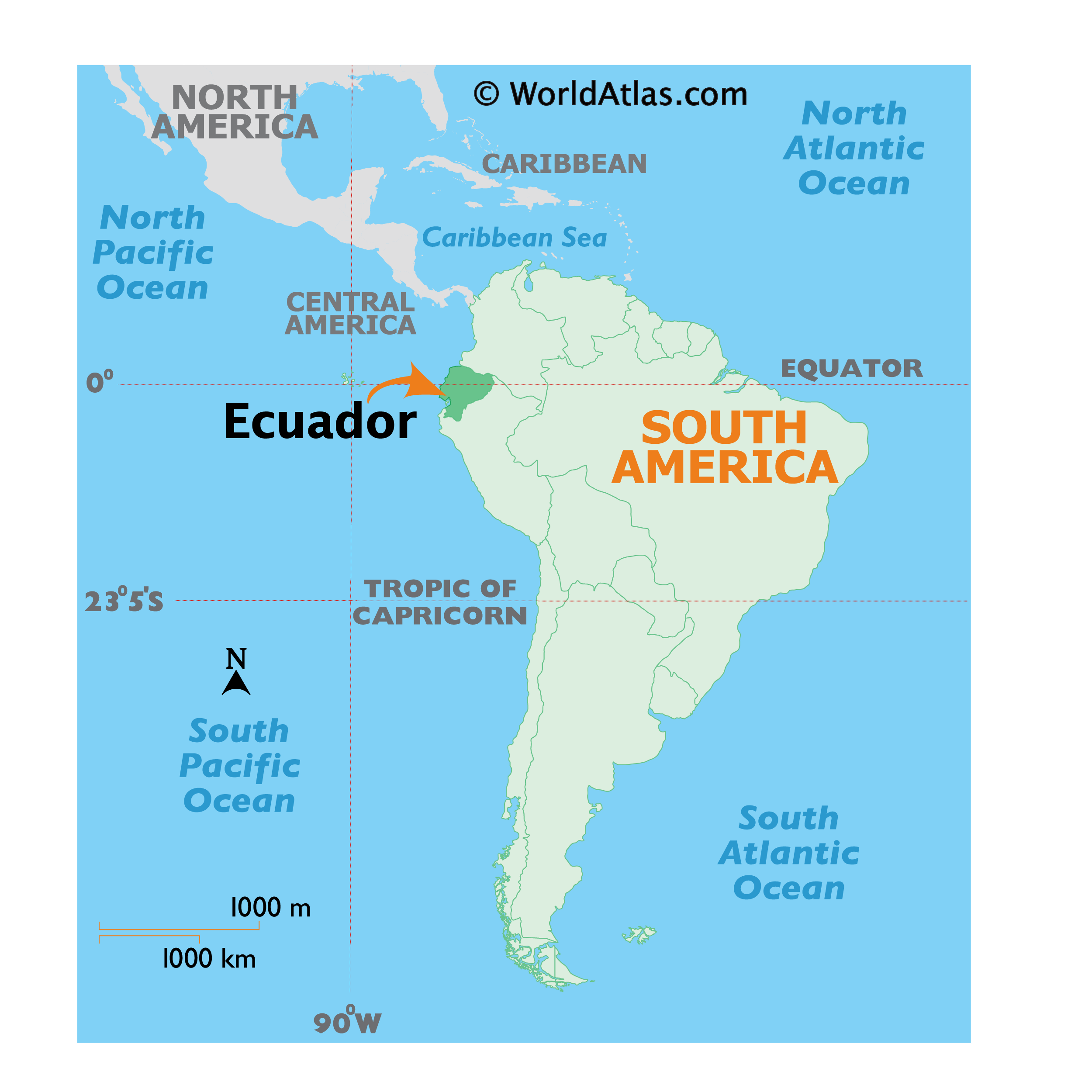
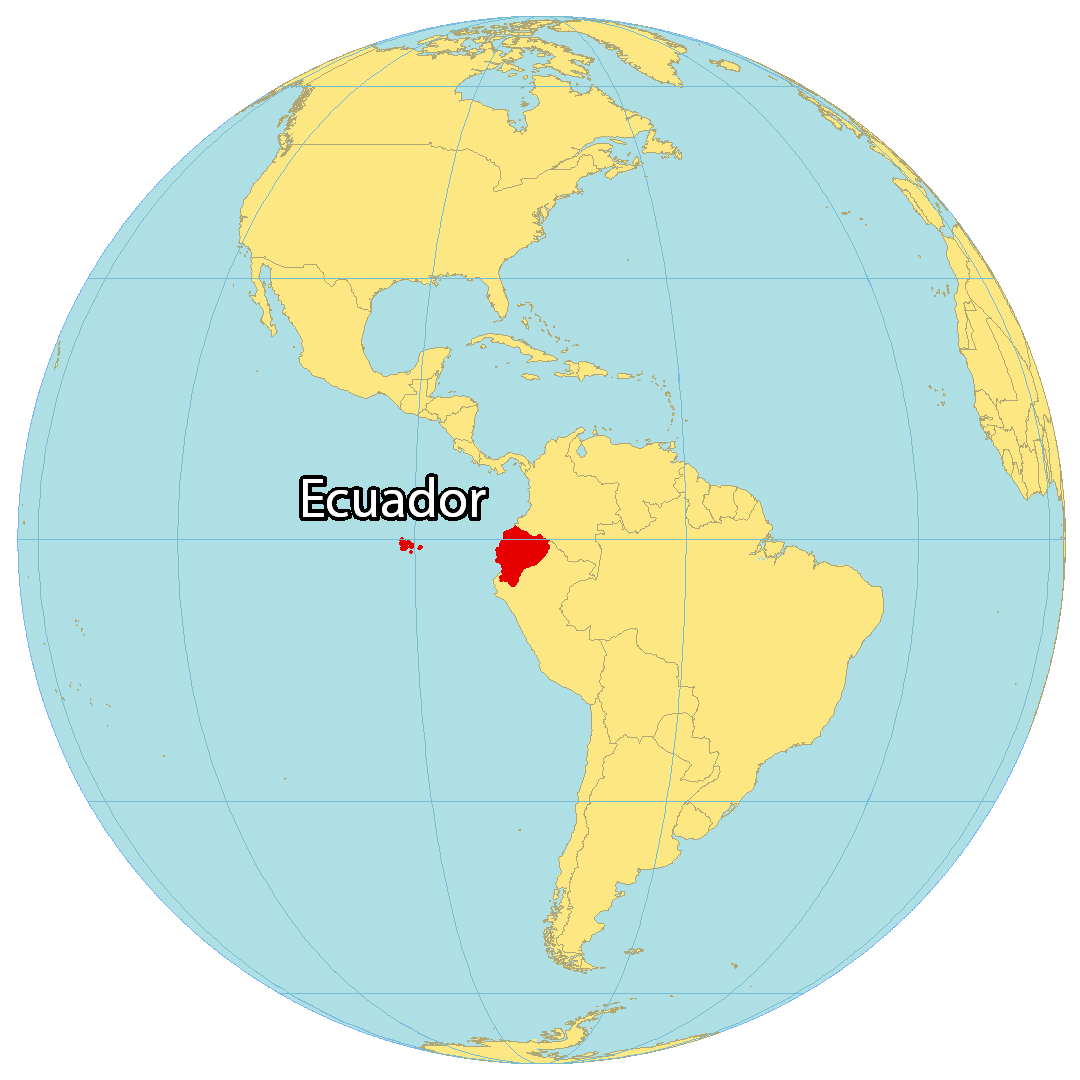
Where is Ecuador?
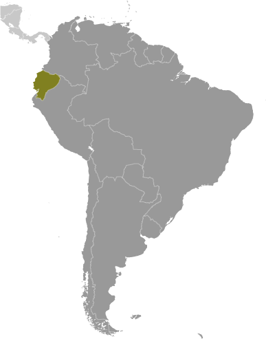
Ecuador is located in western South America, along the Pacific Ocean coastline of 2,237 kilometers (1,380 mi). It lies on the equator, hence its name. Ecuador borders two other South American countries, Peru to the south and Colombia to the north. About 950 kilometers (585 mi) off the west coast is the Galapagos Islands, where Charles Darwin theorized the Theory of Evolution. Quito is the capital of Ecuador, while Guayaquil is its largest city.
The geography of Ecuador is varied and includes an array of landscapes, from the Amazon rainforest to the Andes mountains to the Pacific coast. The country is home to a variety of plant and animal species, as well as a number of indigenous peoples.
High Definition Political Map of Ecuador

Ecuador Administrative Map
Physical Map of Ecuador
Transportation Map of Ecuador
Ecuador Satellite Map