Staples is a city in northeastern Guadalupe County, Texas, United States. In an election held on May 10, 2008, its residents voted to incorporate the community as a city. A total of 125 votes were cast, with 87 (69.6%) in favor of incorporation and 38 (30.4%) against. The population is approximately 220 and it is part of the San Antonio Metropolitan Statistical Area.
The city held its first municipal election on November 4, 2008. Eddie Daffern, an organizer of the incorporation effort, was elected unopposed as Mayor. A total of seven candidates ran for the five Alderman positions. Those elected include Carol Wester, who received 70 votes, followed by Ronnie Clark with 67 votes, Bert “Bubba” Reinke and William A. York—both winning 52 votes, and Shaun Seale with 40.
As of the 2010 census, Staples had a population of 267, along with a barber shop, two beauty shops, and a cafe.
| Name: | Staples city |
|---|---|
| LSAD Code: | 25 |
| LSAD Description: | city (suffix) |
| State: | Texas |
| County: | Guadalupe County |
| Incorporated: | 2008 |
| Total Area: | 1.50 sq mi (3.89 km²) |
| Land Area: | 1.50 sq mi (3.88 km²) |
| Water Area: | 0.00 sq mi (0.01 km²) |
| Total Population: | 267 |
| Population Density: | 185.16/sq mi (71.47/km²) |
| ZIP code: | 78670 |
| Area code: | 210, 726 (planned) |
| FIPS code: | 4870052 |
| GNISfeature ID: | 1369103 |
| Website: | www.cityofstaples.com |
Online Interactive Map
Click on ![]() to view map in "full screen" mode.
to view map in "full screen" mode.
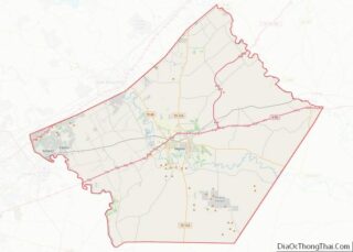
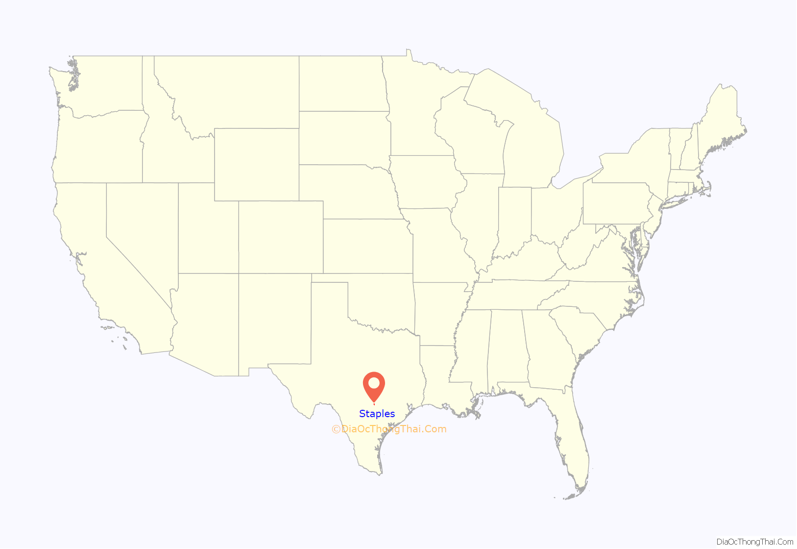
Staples location map. Where is Staples city?
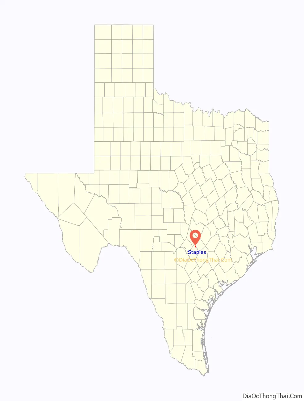
Staples Road Map
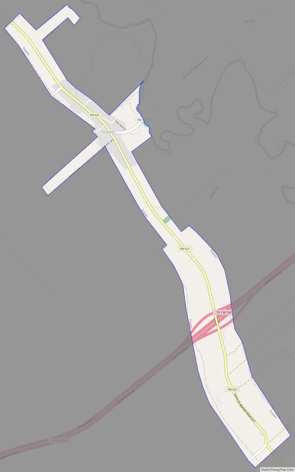
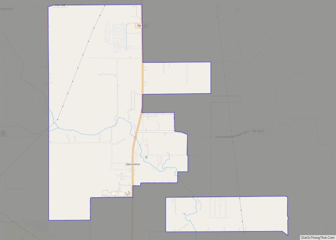
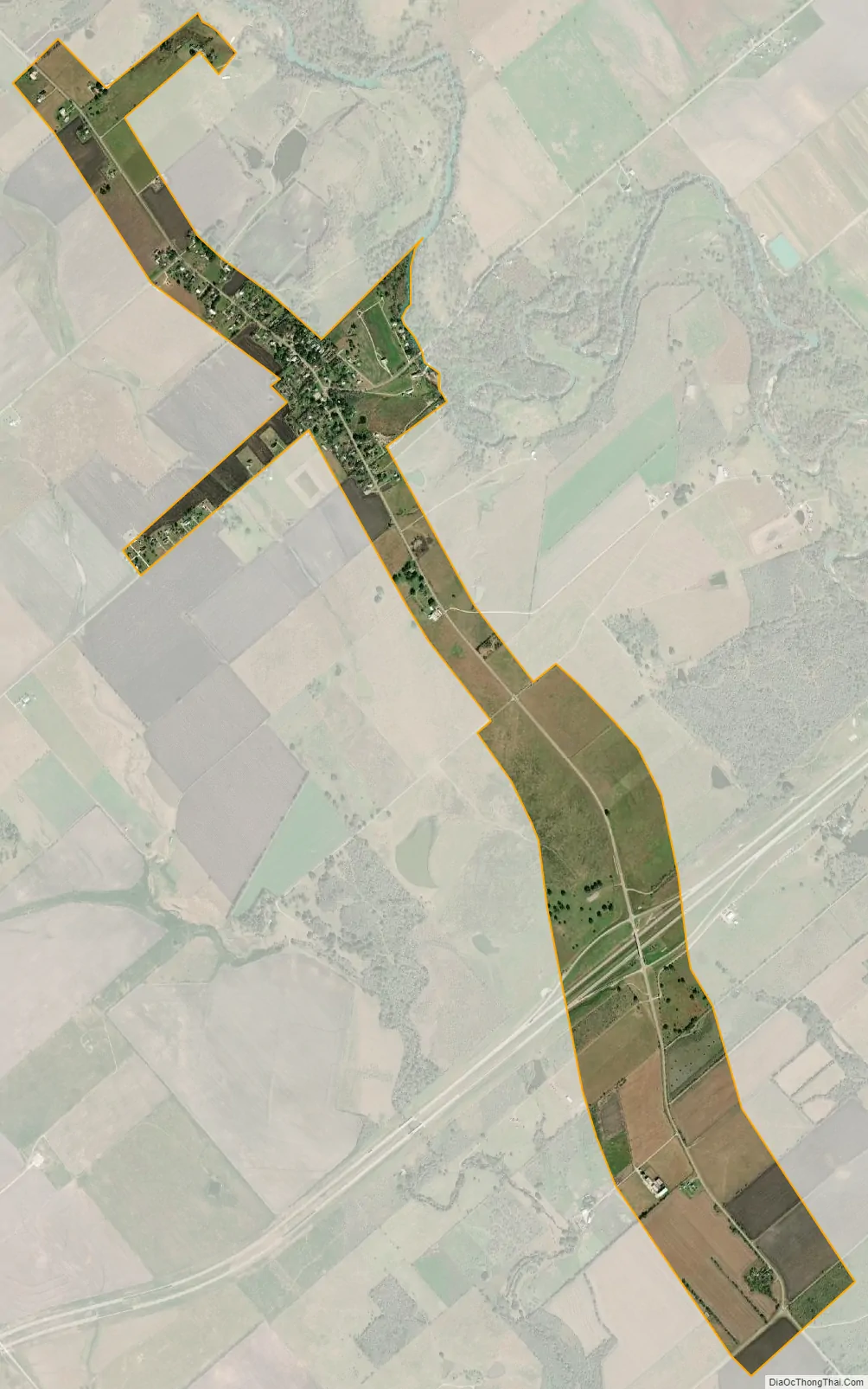
Staples city Satellite Map
Geography
Staples is located in northeastern Guadalupe County, just west of the San Marcos River, which forms the border with Caldwell County. It is 11 miles (18 km) southeast of San Marcos, 21 miles (34 km) northeast of Seguin, the Guadalupe County seat, 16 miles (26 km) northwest of Luling, and 16 miles southwest of Lockhart. Texas State Highway 130 runs through the southern part of Staples, providing a new freeway route between Austin, 41 miles (66 km) to the north, and San Antonio, 56 miles (90 km) to the southwest.
According to the U.S. Census Bureau, the city of Staples has a total area of 1.5 square miles (3.9 km), of which 0.004 square miles (0.01 km), or 0.30%, are water.
See also
Map of Texas State and its subdivision:- Anderson
- Andrews
- Angelina
- Aransas
- Archer
- Armstrong
- Atascosa
- Austin
- Bailey
- Bandera
- Bastrop
- Baylor
- Bee
- Bell
- Bexar
- Blanco
- Borden
- Bosque
- Bowie
- Brazoria
- Brazos
- Brewster
- Briscoe
- Brooks
- Brown
- Burleson
- Burnet
- Caldwell
- Calhoun
- Callahan
- Cameron
- Camp
- Carson
- Cass
- Castro
- Chambers
- Cherokee
- Childress
- Clay
- Cochran
- Coke
- Coleman
- Collin
- Collingsworth
- Colorado
- Comal
- Comanche
- Concho
- Cooke
- Coryell
- Cottle
- Crane
- Crockett
- Crosby
- Culberson
- Dallam
- Dallas
- Dawson
- Deaf Smith
- Delta
- Denton
- Dewitt
- Dickens
- Dimmit
- Donley
- Duval
- Eastland
- Ector
- Edwards
- El Paso
- Ellis
- Erath
- Falls
- Fannin
- Fayette
- Fisher
- Floyd
- Foard
- Fort Bend
- Franklin
- Freestone
- Frio
- Gaines
- Galveston
- Garza
- Gillespie
- Glasscock
- Goliad
- Gonzales
- Gray
- Grayson
- Gregg
- Grimes
- Guadalupe
- Hale
- Hall
- Hamilton
- Hansford
- Hardeman
- Hardin
- Harris
- Harrison
- Hartley
- Haskell
- Hays
- Hemphill
- Henderson
- Hidalgo
- Hill
- Hockley
- Hood
- Hopkins
- Houston
- Howard
- Hudspeth
- Hunt
- Hutchinson
- Irion
- Jack
- Jackson
- Jasper
- Jeff Davis
- Jefferson
- Jim Hogg
- Jim Wells
- Johnson
- Jones
- Karnes
- Kaufman
- Kendall
- Kenedy
- Kent
- Kerr
- Kimble
- King
- Kinney
- Kleberg
- Knox
- La Salle
- Lamar
- Lamb
- Lampasas
- Lavaca
- Lee
- Leon
- Liberty
- Limestone
- Lipscomb
- Live Oak
- Llano
- Loving
- Lubbock
- Lynn
- Madison
- Marion
- Martin
- Mason
- Matagorda
- Maverick
- McCulloch
- McLennan
- McMullen
- Medina
- Menard
- Midland
- Milam
- Mills
- Mitchell
- Montague
- Montgomery
- Moore
- Morris
- Motley
- Nacogdoches
- Navarro
- Newton
- Nolan
- Nueces
- Ochiltree
- Oldham
- Orange
- Palo Pinto
- Panola
- Parker
- Parmer
- Pecos
- Polk
- Potter
- Presidio
- Rains
- Randall
- Reagan
- Real
- Red River
- Reeves
- Refugio
- Roberts
- Robertson
- Rockwall
- Runnels
- Rusk
- Sabine
- San Augustine
- San Jacinto
- San Patricio
- San Saba
- Schleicher
- Scurry
- Shackelford
- Shelby
- Sherman
- Smith
- Somervell
- Starr
- Stephens
- Sterling
- Stonewall
- Sutton
- Swisher
- Tarrant
- Taylor
- Terrell
- Terry
- Throckmorton
- Titus
- Tom Green
- Travis
- Trinity
- Tyler
- Upshur
- Upton
- Uvalde
- Val Verde
- Van Zandt
- Victoria
- Walker
- Waller
- Ward
- Washington
- Webb
- Wharton
- Wheeler
- Wichita
- Wilbarger
- Willacy
- Williamson
- Wilson
- Winkler
- Wise
- Wood
- Yoakum
- Young
- Zapata
- Zavala
- Alabama
- Alaska
- Arizona
- Arkansas
- California
- Colorado
- Connecticut
- Delaware
- District of Columbia
- Florida
- Georgia
- Hawaii
- Idaho
- Illinois
- Indiana
- Iowa
- Kansas
- Kentucky
- Louisiana
- Maine
- Maryland
- Massachusetts
- Michigan
- Minnesota
- Mississippi
- Missouri
- Montana
- Nebraska
- Nevada
- New Hampshire
- New Jersey
- New Mexico
- New York
- North Carolina
- North Dakota
- Ohio
- Oklahoma
- Oregon
- Pennsylvania
- Rhode Island
- South Carolina
- South Dakota
- Tennessee
- Texas
- Utah
- Vermont
- Virginia
- Washington
- West Virginia
- Wisconsin
- Wyoming