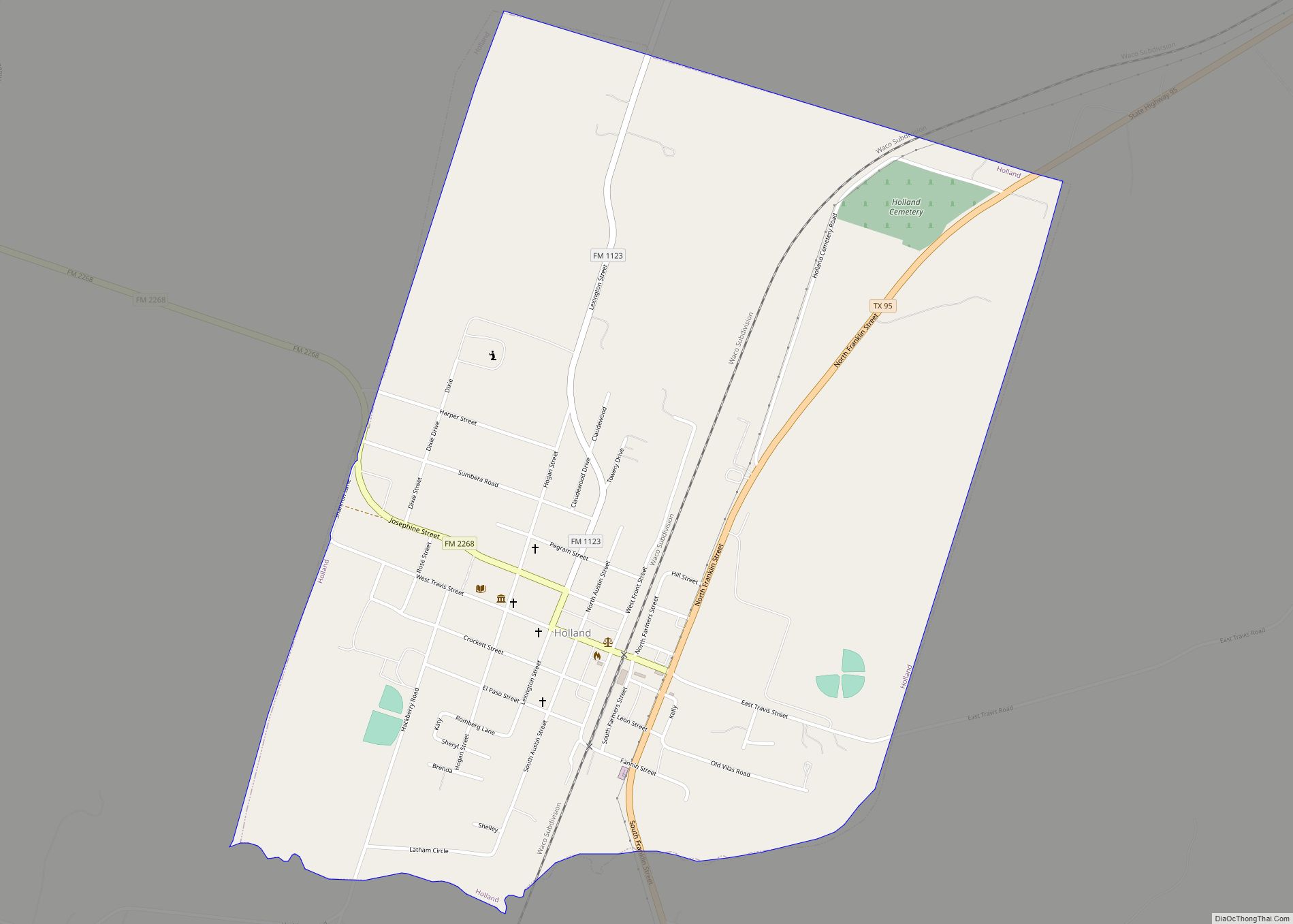
Holland is a city in Bell County, Texas, United States. The population was 1,075 at the 2020 census. The center of population of Texas is located in Holland. It is part of the Killeen–Temple–Fort Hood metropolitan statistical area.
| Name: | Holland town |
|---|---|
| LSAD Code: | 43 |
| LSAD Description: | town (suffix) |
| State: | Texas |
| County: | Bell County |
| Incorporated: | 1891 |
| Elevation: | 525 ft (160 m) |
| Total Area: | 1.66 sq mi (4.31 km²) |
| Land Area: | 1.65 sq mi (4.26 km²) |
| Water Area: | 0.02 sq mi (0.05 km²) |
| Total Population: | 1,075 |
| Population Density: | 711.85/sq mi (274.93/km²) |
| ZIP code: | 76534 |
| Area code: | 254 |
| FIPS code: | 4834508 |
| GNISfeature ID: | 1359404 |
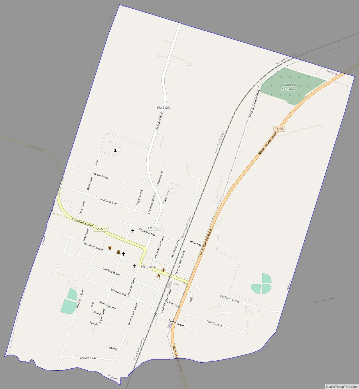
Online Interactive Map
Click on ![]() to view map in "full screen" mode.
to view map in "full screen" mode.
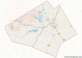
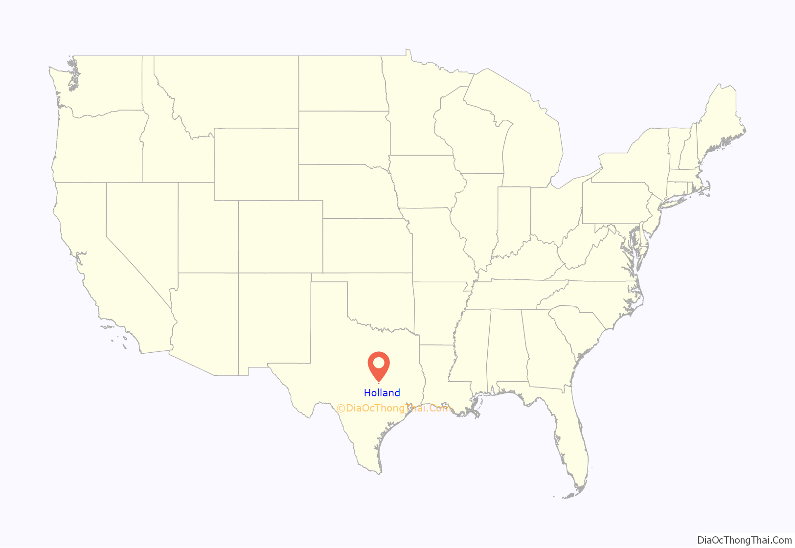
Holland location map. Where is Holland town?
History
Holland’s history reaches back to a time before the Civil War, when a community known as Mountain Home began to grow up near Gotcher’s Mountain, a hill south of town. A post office was established on August 22, 1870, under the name Mountain Home, with James Shaw as postmaster. On November 6, 1871, the Mountain Home post office was officially closed.
In 1881, an extension of the Missouri–Kansas–Texas Railroad was laid out from Denison to Taylor, and the tracks were constructed through Bell County in 1881 and 1882, from north to south, passing through the Holland community. This brought about the town of Holland as it is known today.
James Reuben Holland was born in 1847 in Claiborne County, Tennessee. Holland arrived in Belton, Texas, on October 26, 1874, with a wagon and horses, his wife and four children, and six dollars cash.
A. Moss made an application for the Mountain Home community to have a new post office again, but by that time, the name “Mountain Home” had already been claimed by another community. Without Holland’s knowledge, Moss submitted the name “Holland”. The Holland post office was officially approved April 10, 1879, with the appointment of Alfred Evans as postmaster.
Holland married a young widow in 1867. The widow, Mary Tabitha Hutchens Moore, had one daughter, Macie, from her first marriage. Together, Holland and Mary had five children: Ellis, Alice, Claude, Mary, and another child that did not live. In 1877, Holland bought 105 acres (42 ha) of land along Darr’s Creek for $5.00 an acre. The following year, Holland bought an additional 145 acres (59 ha) and built a steam-powered cotton gin.
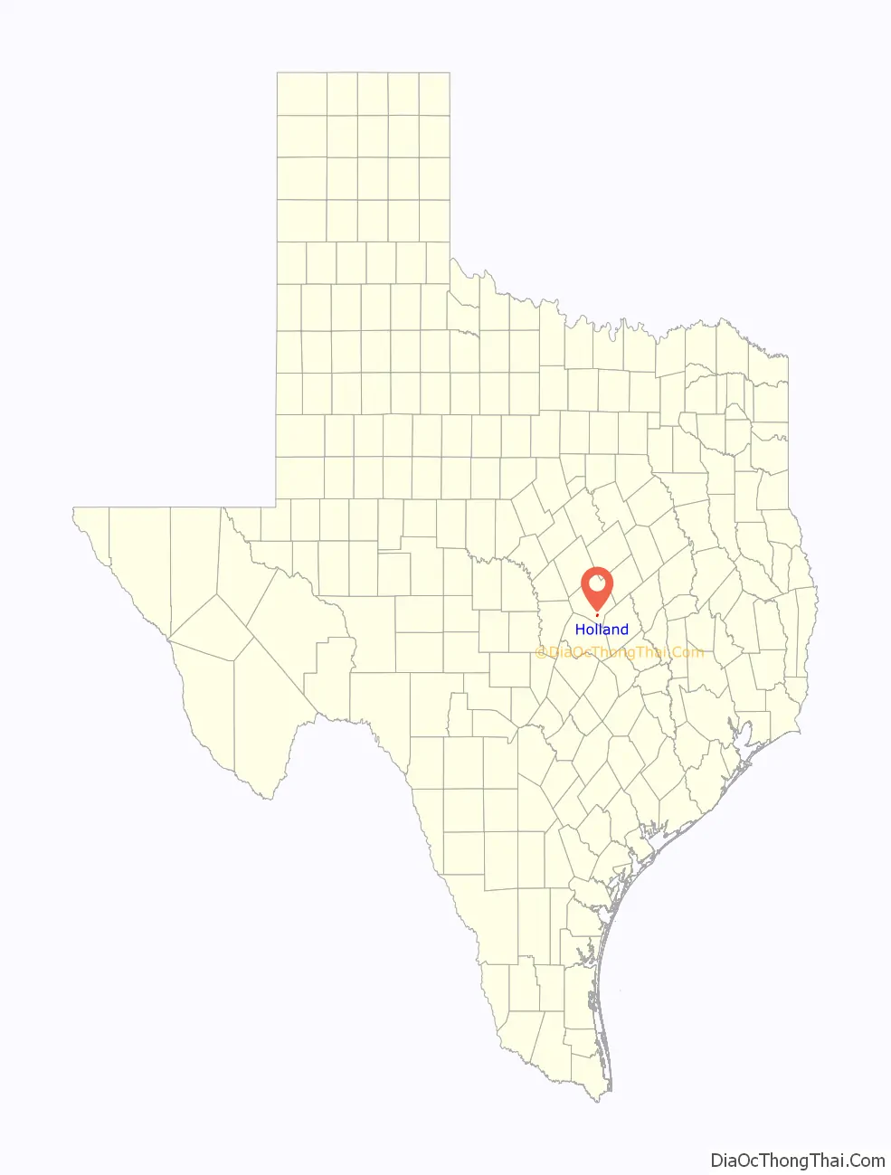
Holland Road Map
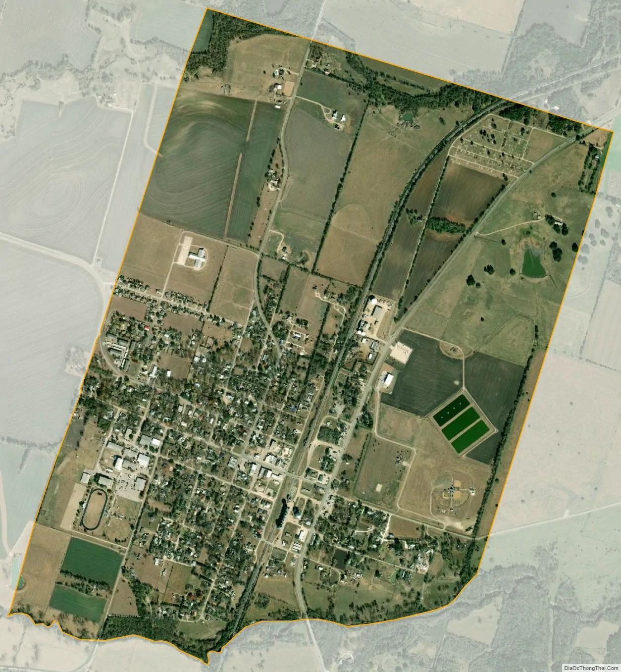
Holland city Satellite Map
Geography
Holland is located in southeastern Bell County at 30°52′51″N 97°24′16″W / 30.88083°N 97.40444°W / 30.88083; -97.40444 (30.880710, –97.404408). Texas State Highway 95 passes through the town, leading north 17 miles (27 km) to Temple and south 22 miles (35 km) to Taylor.
According to the United States Census Bureau, the town has a total area of 1.8 square miles (4.6 km), of which 0.019 square miles (0.05 km), or 1.12%, is covered by water.
See also
Map of Texas State and its subdivision:- Anderson
- Andrews
- Angelina
- Aransas
- Archer
- Armstrong
- Atascosa
- Austin
- Bailey
- Bandera
- Bastrop
- Baylor
- Bee
- Bell
- Bexar
- Blanco
- Borden
- Bosque
- Bowie
- Brazoria
- Brazos
- Brewster
- Briscoe
- Brooks
- Brown
- Burleson
- Burnet
- Caldwell
- Calhoun
- Callahan
- Cameron
- Camp
- Carson
- Cass
- Castro
- Chambers
- Cherokee
- Childress
- Clay
- Cochran
- Coke
- Coleman
- Collin
- Collingsworth
- Colorado
- Comal
- Comanche
- Concho
- Cooke
- Coryell
- Cottle
- Crane
- Crockett
- Crosby
- Culberson
- Dallam
- Dallas
- Dawson
- Deaf Smith
- Delta
- Denton
- Dewitt
- Dickens
- Dimmit
- Donley
- Duval
- Eastland
- Ector
- Edwards
- El Paso
- Ellis
- Erath
- Falls
- Fannin
- Fayette
- Fisher
- Floyd
- Foard
- Fort Bend
- Franklin
- Freestone
- Frio
- Gaines
- Galveston
- Garza
- Gillespie
- Glasscock
- Goliad
- Gonzales
- Gray
- Grayson
- Gregg
- Grimes
- Guadalupe
- Hale
- Hall
- Hamilton
- Hansford
- Hardeman
- Hardin
- Harris
- Harrison
- Hartley
- Haskell
- Hays
- Hemphill
- Henderson
- Hidalgo
- Hill
- Hockley
- Hood
- Hopkins
- Houston
- Howard
- Hudspeth
- Hunt
- Hutchinson
- Irion
- Jack
- Jackson
- Jasper
- Jeff Davis
- Jefferson
- Jim Hogg
- Jim Wells
- Johnson
- Jones
- Karnes
- Kaufman
- Kendall
- Kenedy
- Kent
- Kerr
- Kimble
- King
- Kinney
- Kleberg
- Knox
- La Salle
- Lamar
- Lamb
- Lampasas
- Lavaca
- Lee
- Leon
- Liberty
- Limestone
- Lipscomb
- Live Oak
- Llano
- Loving
- Lubbock
- Lynn
- Madison
- Marion
- Martin
- Mason
- Matagorda
- Maverick
- McCulloch
- McLennan
- McMullen
- Medina
- Menard
- Midland
- Milam
- Mills
- Mitchell
- Montague
- Montgomery
- Moore
- Morris
- Motley
- Nacogdoches
- Navarro
- Newton
- Nolan
- Nueces
- Ochiltree
- Oldham
- Orange
- Palo Pinto
- Panola
- Parker
- Parmer
- Pecos
- Polk
- Potter
- Presidio
- Rains
- Randall
- Reagan
- Real
- Red River
- Reeves
- Refugio
- Roberts
- Robertson
- Rockwall
- Runnels
- Rusk
- Sabine
- San Augustine
- San Jacinto
- San Patricio
- San Saba
- Schleicher
- Scurry
- Shackelford
- Shelby
- Sherman
- Smith
- Somervell
- Starr
- Stephens
- Sterling
- Stonewall
- Sutton
- Swisher
- Tarrant
- Taylor
- Terrell
- Terry
- Throckmorton
- Titus
- Tom Green
- Travis
- Trinity
- Tyler
- Upshur
- Upton
- Uvalde
- Val Verde
- Van Zandt
- Victoria
- Walker
- Waller
- Ward
- Washington
- Webb
- Wharton
- Wheeler
- Wichita
- Wilbarger
- Willacy
- Williamson
- Wilson
- Winkler
- Wise
- Wood
- Yoakum
- Young
- Zapata
- Zavala
- Alabama
- Alaska
- Arizona
- Arkansas
- California
- Colorado
- Connecticut
- Delaware
- District of Columbia
- Florida
- Georgia
- Hawaii
- Idaho
- Illinois
- Indiana
- Iowa
- Kansas
- Kentucky
- Louisiana
- Maine
- Maryland
- Massachusetts
- Michigan
- Minnesota
- Mississippi
- Missouri
- Montana
- Nebraska
- Nevada
- New Hampshire
- New Jersey
- New Mexico
- New York
- North Carolina
- North Dakota
- Ohio
- Oklahoma
- Oregon
- Pennsylvania
- Rhode Island
- South Carolina
- South Dakota
- Tennessee
- Texas
- Utah
- Vermont
- Virginia
- Washington
- West Virginia
- Wisconsin
- Wyoming