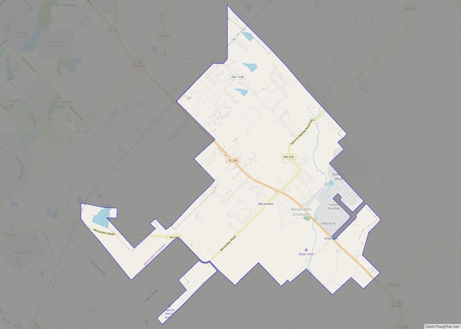
McLendon-Chisholm is a city in Rockwall County, Texas, United States. The population was 1,373 at the 2010 census.
| Name: | McLendon-Chisholm city |
|---|---|
| LSAD Code: | 25 |
| LSAD Description: | city (suffix) |
| State: | Texas |
| County: | Rockwall County |
| Elevation: | 502 ft (153 m) |
| Total Area: | 12.81 sq mi (33.18 km²) |
| Land Area: | 12.50 sq mi (32.38 km²) |
| Water Area: | 0.31 sq mi (0.80 km²) 0.90% |
| Total Population: | 3,562 |
| Population Density: | 280/sq mi (110/km²) |
| Area code: | 214, 469, 972 |
| FIPS code: | 4845804 |
| GNISfeature ID: | 1388560 |
| Website: | http://www.mclendon-chisholm.com/ |
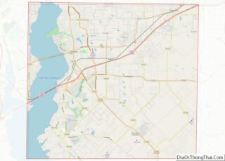
Online Interactive Map
Click on ![]() to view map in "full screen" mode.
to view map in "full screen" mode.
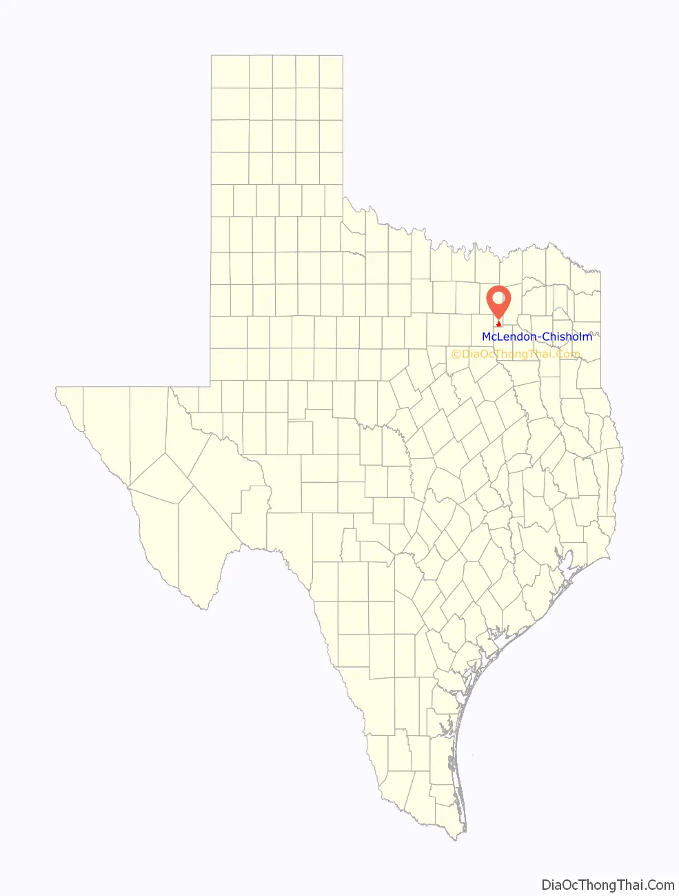
McLendon-Chisholm location map. Where is McLendon-Chisholm city?

History
The community of McLendon-Chisholm began as two separate settlements: McLendon and Chisholm.
McLendon
Named for landowner P.A. McLendon, the community of McLendon was settled around 1870. He built a combination store, cotton gin, and blacksmith shop that remained in operation until 1975. A post office opened in 1880, and by 1896, McLendon was home to an estimated 150 residents. The post office closed in 1905. Throughout the early 20th century, the population hovered around 50.
Chisholm
The land that eventually became the site of Chisholm was given to Mexican War veteran King Latham in 1847. Enoch Parson Chisholm and his brother B. Frank Chisholm, from whom the community’s name was derived, purchased 200 acres (0.81 km) from Latham in 1856. A few years later, Enoch purchased an additional 600 acres (2.4 km) for $2.00/acre. He organized the Chisholm Methodist Church in 1871 and the community of Chisholm was officially platted in 1886. In that same year, Berry Creek Academy was formed through the merger of two local schools. Chisholm’s first store opened in 1890 and a post office was established in 1891. By 1898, Berry Creek Academy was the second-largest school in Rockwall County, boasting a total enrollment of 301 students. The Chisholm post office closed in 1905, but the community continued to grow. The population was estimated at 102 in 1904 and peaked around 200 in 1940. By the 1960s, that figure had dropped to around 167.
Incorporation
On October 18, 1969, the two communities incorporated as McLendon-Chisholm. Residents seeking zoning protection and the preservation of their rural lifestyles was the main reason behind the incorporation effort. By the mid-1970s, the city had approximately 170 residents. That number rapidly grew to 480 in the 1980s and 646 by the 1990 census. By 2000, the population had increased to 914, a 41 percent increase over the 1990 figure.
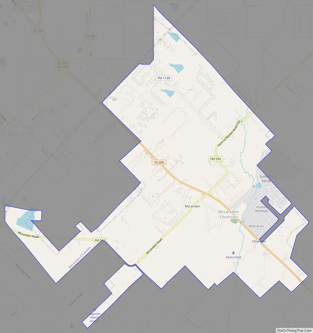
McLendon-Chisholm Road Map
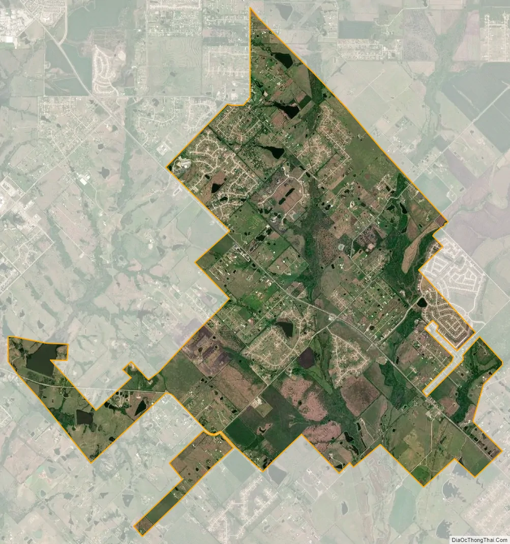
McLendon-Chisholm city Satellite Map
Geography
McLendon-Chisholm is located at 32°50′46″N 96°23′24″W / 32.84611°N 96.39000°W / 32.84611; -96.39000 (32.846035, –96.390123). It is situated along State Highway 205 in south central Rockwall County, about 6 miles southeast of Rockwall.
According to the United States Census Bureau, the city has a total area of 9.9 square miles (26 km), of which 9.9 square miles (26 km) are land and 0.1 square miles (0.26 km) (0.90%) is covered by water.
See also
Map of Texas State and its subdivision:- Anderson
- Andrews
- Angelina
- Aransas
- Archer
- Armstrong
- Atascosa
- Austin
- Bailey
- Bandera
- Bastrop
- Baylor
- Bee
- Bell
- Bexar
- Blanco
- Borden
- Bosque
- Bowie
- Brazoria
- Brazos
- Brewster
- Briscoe
- Brooks
- Brown
- Burleson
- Burnet
- Caldwell
- Calhoun
- Callahan
- Cameron
- Camp
- Carson
- Cass
- Castro
- Chambers
- Cherokee
- Childress
- Clay
- Cochran
- Coke
- Coleman
- Collin
- Collingsworth
- Colorado
- Comal
- Comanche
- Concho
- Cooke
- Coryell
- Cottle
- Crane
- Crockett
- Crosby
- Culberson
- Dallam
- Dallas
- Dawson
- Deaf Smith
- Delta
- Denton
- Dewitt
- Dickens
- Dimmit
- Donley
- Duval
- Eastland
- Ector
- Edwards
- El Paso
- Ellis
- Erath
- Falls
- Fannin
- Fayette
- Fisher
- Floyd
- Foard
- Fort Bend
- Franklin
- Freestone
- Frio
- Gaines
- Galveston
- Garza
- Gillespie
- Glasscock
- Goliad
- Gonzales
- Gray
- Grayson
- Gregg
- Grimes
- Guadalupe
- Hale
- Hall
- Hamilton
- Hansford
- Hardeman
- Hardin
- Harris
- Harrison
- Hartley
- Haskell
- Hays
- Hemphill
- Henderson
- Hidalgo
- Hill
- Hockley
- Hood
- Hopkins
- Houston
- Howard
- Hudspeth
- Hunt
- Hutchinson
- Irion
- Jack
- Jackson
- Jasper
- Jeff Davis
- Jefferson
- Jim Hogg
- Jim Wells
- Johnson
- Jones
- Karnes
- Kaufman
- Kendall
- Kenedy
- Kent
- Kerr
- Kimble
- King
- Kinney
- Kleberg
- Knox
- La Salle
- Lamar
- Lamb
- Lampasas
- Lavaca
- Lee
- Leon
- Liberty
- Limestone
- Lipscomb
- Live Oak
- Llano
- Loving
- Lubbock
- Lynn
- Madison
- Marion
- Martin
- Mason
- Matagorda
- Maverick
- McCulloch
- McLennan
- McMullen
- Medina
- Menard
- Midland
- Milam
- Mills
- Mitchell
- Montague
- Montgomery
- Moore
- Morris
- Motley
- Nacogdoches
- Navarro
- Newton
- Nolan
- Nueces
- Ochiltree
- Oldham
- Orange
- Palo Pinto
- Panola
- Parker
- Parmer
- Pecos
- Polk
- Potter
- Presidio
- Rains
- Randall
- Reagan
- Real
- Red River
- Reeves
- Refugio
- Roberts
- Robertson
- Rockwall
- Runnels
- Rusk
- Sabine
- San Augustine
- San Jacinto
- San Patricio
- San Saba
- Schleicher
- Scurry
- Shackelford
- Shelby
- Sherman
- Smith
- Somervell
- Starr
- Stephens
- Sterling
- Stonewall
- Sutton
- Swisher
- Tarrant
- Taylor
- Terrell
- Terry
- Throckmorton
- Titus
- Tom Green
- Travis
- Trinity
- Tyler
- Upshur
- Upton
- Uvalde
- Val Verde
- Van Zandt
- Victoria
- Walker
- Waller
- Ward
- Washington
- Webb
- Wharton
- Wheeler
- Wichita
- Wilbarger
- Willacy
- Williamson
- Wilson
- Winkler
- Wise
- Wood
- Yoakum
- Young
- Zapata
- Zavala
- Alabama
- Alaska
- Arizona
- Arkansas
- California
- Colorado
- Connecticut
- Delaware
- District of Columbia
- Florida
- Georgia
- Hawaii
- Idaho
- Illinois
- Indiana
- Iowa
- Kansas
- Kentucky
- Louisiana
- Maine
- Maryland
- Massachusetts
- Michigan
- Minnesota
- Mississippi
- Missouri
- Montana
- Nebraska
- Nevada
- New Hampshire
- New Jersey
- New Mexico
- New York
- North Carolina
- North Dakota
- Ohio
- Oklahoma
- Oregon
- Pennsylvania
- Rhode Island
- South Carolina
- South Dakota
- Tennessee
- Texas
- Utah
- Vermont
- Virginia
- Washington
- West Virginia
- Wisconsin
- Wyoming